Integrated disaster risk reduction in flood-affected areas by local communities [ຕາຈິກິສະຕານ]
- ການສ້າງ:
- ປັບປູງ:
- ຜູ້ສັງລວມຂໍ້ມູນ: Stefan Michel
- ບັນນາທິການ: –
- ຜູ້ທົບທວນຄືນ: Umed Vahobov
Интегрированный подход к снижению риска стихийных бедствий местными сообществами, в местностях подверженным селевым потокам
approaches_4319 - ຕາຈິກິສະຕານ
ເບິ່ງພາກສ່ວນ
ຂະຫຍາຍທັງໝົດ ຍຸບທັງໝົດ1. ຂໍ້ມູນທົ່ວໄປ
1.2 ລາຍລະອຽດ ການຕິດຕໍ່ ຂອງບຸກຄົນທີ່ຊັບພະຍາກອນ ແລະ ສະຖາບັນ ການມີສ່ວນຮ່ວມ ໃນການປະເມີນຜົນ ແລະ ເອກະສານ ຂອງວິທີທາງ
ບຸກຄົນສຳຄັນ (ຫຼາຍຄົນ)
ຜູ້ຊ່ຽວຊານ ດ້ານການຄຸ້ມຄອງ ທີ່ດິນແບບຍືນຍົງ:
Muhidinov Nodir
nodir.sfl@gmail.com
Deutsche Gesellschaft für Internationale Zusammenarbeit (GIZ)
ຕາຈິກິສະຕານ
ຊື່ຂອງໂຄງການ ທີ່ອໍານວຍຄວາມສະດວກ ໃນການສ້າງເອກກະສານ ຫຼື ປະເມີນດ້ານແນວທາງ (ຖ້າກ່ຽວຂ້ອງ)
Strengthening of Livelihoods through Climate Change Adaptation in Kyrgyzstan and Tajikistanຊື່ຂອງ ສະຖາບັນການຈັດຕັ້ງ ທີ່ອໍານວຍຄວາມສະດວກ ໃນການສ້າງເອກກະສານ ຫຼື ປະເມີນແນວທາງ (ຖ້າກ່ຽວຂ້ອງ)
GIZ Tajikistan (GIZ Tajikistan) - ຕາຈິກິສະຕານ1.3 ເງື່ອນໄຂ ຂອງການນໍາໃຊ້ເອກກະສານຂໍ້ມູນ ຂອງ WOCAT
ຜູ້ສັງລວມ ແລະ ບັນດາຜູ້ຕອບແບບສອບຖາມ ຍອມຮັບໃນເງື່ອນໄຂ ການນໍາໃຊ້ຂໍ້ມູນເອກະສານ ທີ່ສ້າງຂື້ນ ໂດຍຜ່ານ ອົງການ WOCAT:
ແມ່ນ
1.4 ເອກະສານອ້າງອີງ (ຫຼາຍ) ກັບແບບສອບຖາມ (ຫຼາຍ) ເຕັກໂນໂລຢີ ຂອງດ້ານການຄຸ້ມຄອງ ດິນແບບຍືນຍົງ
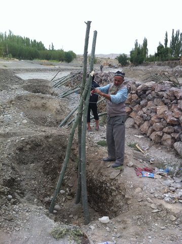
Prevention of riverbank erosion by combination of green … [ຕາຈິກິສະຕານ]
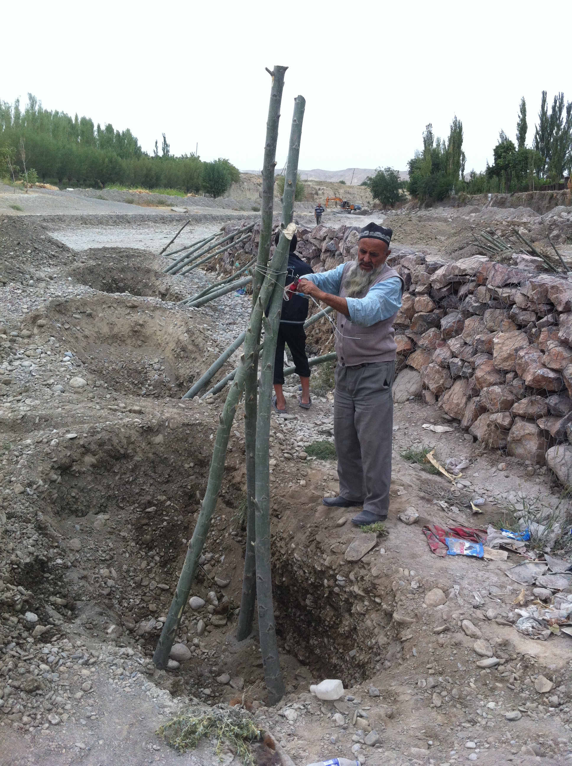
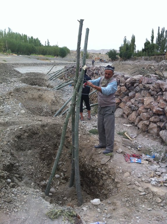
Flashfloods in riverbeds cause intensive riverbank erosion, which threatens villages, infrastructure and productive lands. Preventive measures combining "grey" (physical structures) and "green" (living trees) elements are more effective, sustainable and cost efficient than constructive measures only.
- ຜູ້ສັງລວມຂໍ້ມູນ: Stefan Michel
2. ພັນລະນາ ແນວທາງການຄຸ້ມຄອງນໍາໃຊ້ດິນແບບຍືນຍົງ
2.1 ການອະທິບາຍ ໂດຍຫຍໍ້ ຂອງວິທີທາງ
Climate change and land degradation in upper catchment areas cause an increasing frequency and intensity of flash flood and debris flows affecting settlements and productive areas. GIZ in collaboration with the Committee on Emergency Situations assisted local communities in the implementation of integrated preventive measures.
2.2 ການອະທິບາຍ ລາຍລະອຽດ ຂອງວິທີທາງ
ການອະທິບາຍ ລາຍລະອຽດ ຂອງວິທີທາງ:
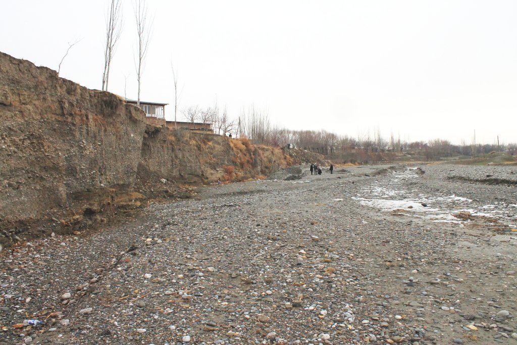
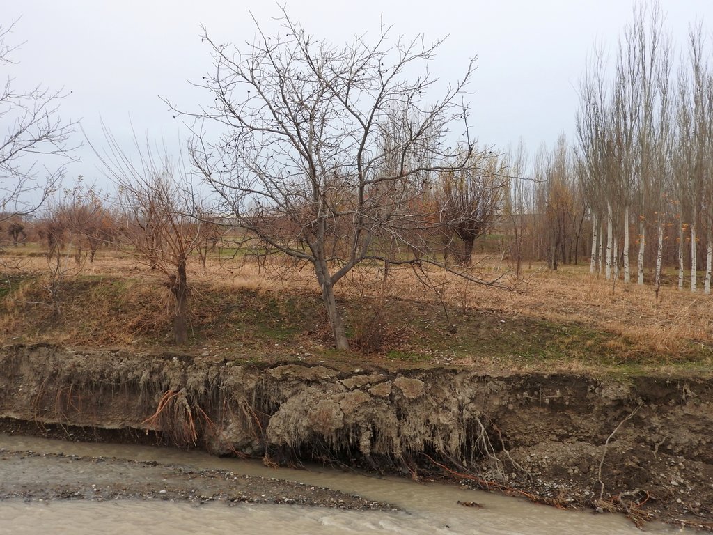
Villages and associated productive lands like orchards, gardens and arable fields in the lower parts of the northern main slope of the Turkestan mountain range are typically located in the valleys of rivers and streams. Water discharge in these rivers and streams is seasonally highly variable. During the wet season water flow is very high, while during the dry summer and fall months almost no water is visible at the surface and the limited discharge takes place in the gravel of the riverbed. After rainfall and during snowmelt extreme flow events happen with discharges several times exceeding the average of the wet season. Flashfloods with high speed and energy typically cause the transportation of large amounts of debris. These debris flows can be much more destructive than ordinary high water events. The resulting riverbank erosion is in some extent a natural element of the morphological dynamic of rivers and streams.
Land-use related factors have increased the vulnerability of communities to these flashfloods and debris flows as well as their destructiveness. Population growth, the expansion of settlements and the reclamation of more lands for irrigated orchards, gardens and arable fields have brought more people and values into potentially risky areas. The degradation of the vegetation in upper catchments has contributed to reduced infiltration of water and high and fast surface runoff. The riparian forests and woodlands which in some extent slow down flashfloods and keep sediment have been largely destroyed by clearing, livestock grazing and by the increasing intensity of flashflood events.
These problems are increasingly exacerbated by the impact of climate change. The already visible trends and predictions show higher levels of aridity, higher temperatures during the vegetation season, reduced overall precipitation in catchment areas – all affecting the retention potential of upper catchment areas – and more irregular rainfall patterns, reduced snow packs and accelerated snow melt as well as the loss of glaciers as buffers of water flow. These factors all contribute to a higher frequency and intensity of flashflood and debris flows.
These events threaten settlements, infrastructure and human lives, but they also pose substantial risks to the stability and functioning of irrigation canals, cause irreversibly losses of productive lands and thus threaten livelihoods of farmers and food security.
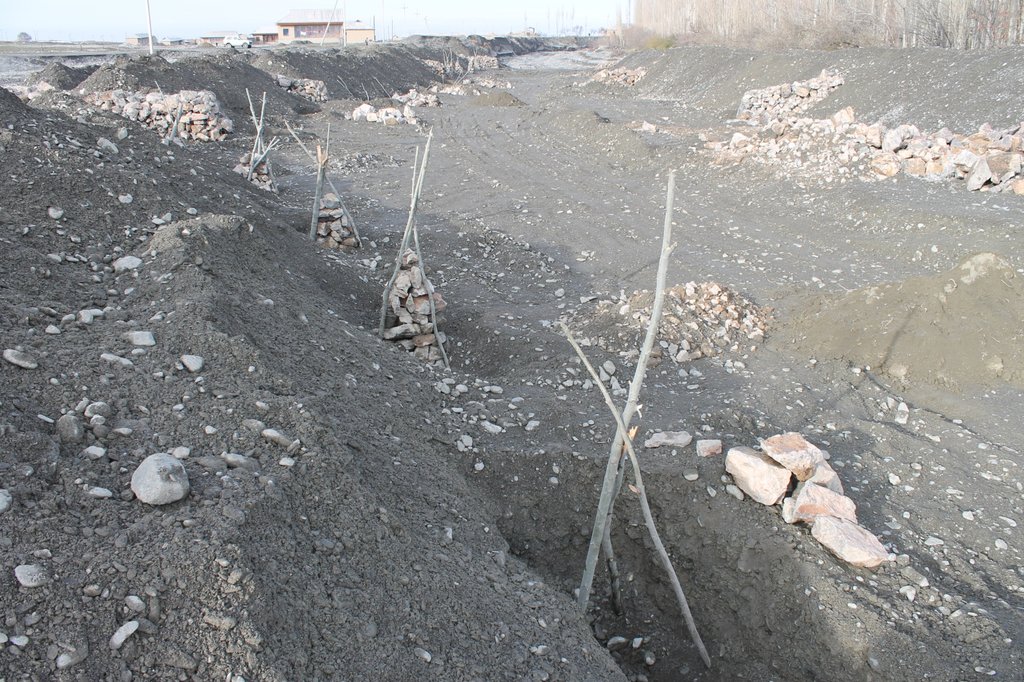
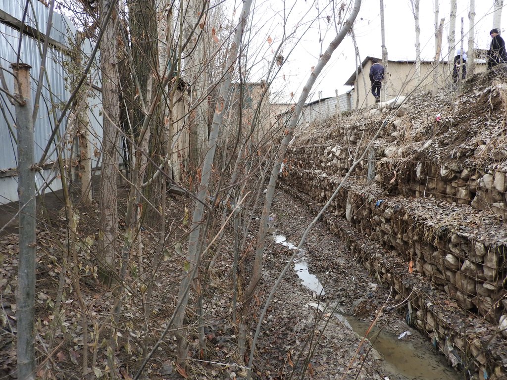
The approach brought together the Committee of Emergency Situations, affected local people and the administrative communities, the mahalla committees, which represent the inhabitants of one village or a section of a larger village. These institutions are called communal self-governance structures, but are subordinated to the government as they are reporting to the sub-district or jamoat. Assisted by experts provided by the project, the situation was jointly analyzed; risks identified and integrated intervention planned. Typically the interventions consisted of a combination of “grey” (i.e. constructive structures) and “green” (i.e. protective vegetation) measures. Most of the upper catchment areas belong to different communities, often to different districts and substantial parts are located in neighboring Kyrgyzstan. Therefore addressing the degradation of these areas and a reduction of disaster risk through integrated watershed management in the entire catchments was rarely possible.
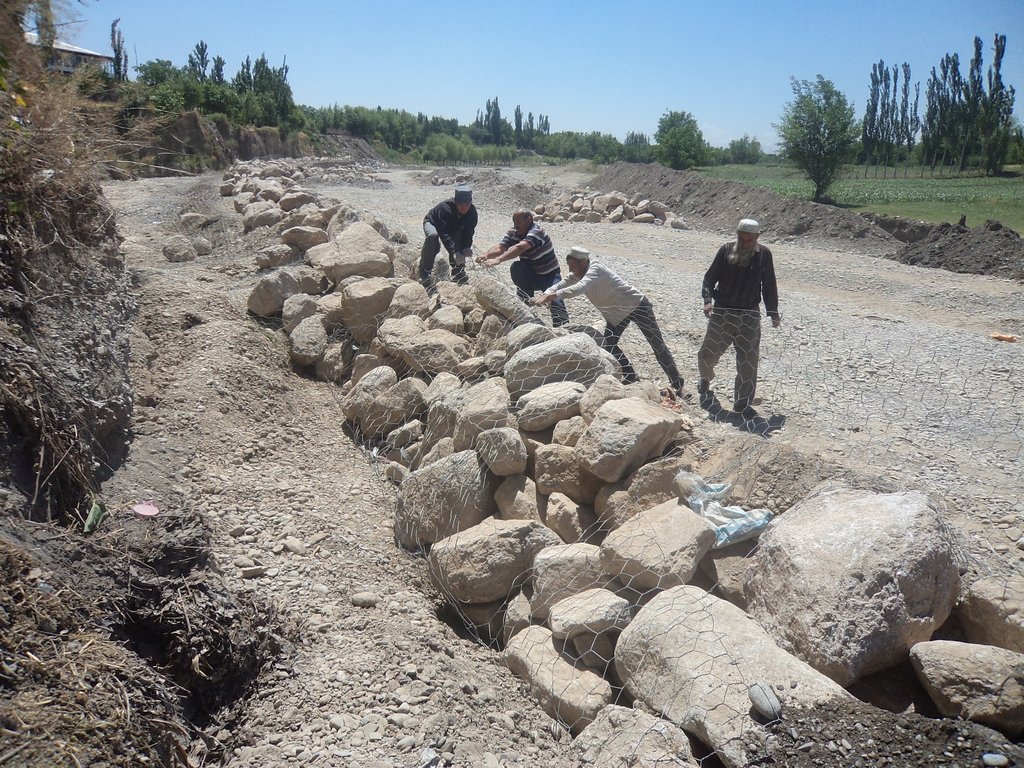
The project assisted with technical planning, construction supervision, purchase and transportation of construction materials. The communities would contribute about 30% of the overall costs, mainly in form of voluntary communal work, the so called hashar, as well as in form of locally available construction materials. The community is also in charge of future operation and maintenance of the riverbank protection structures.
2.3 ຮູບພາບຂອງແນວທາງ
2.5 ປະເທດ / ເຂດ / ສະຖານທີ່ບ່ອນທີ່ແນວທາງໄດ້ຖືກນໍາໃຊ້
ປະເທດ:
ຕາຈິກິສະຕານ
ພາກພື້ນ / ລັດ / ແຂວງ:
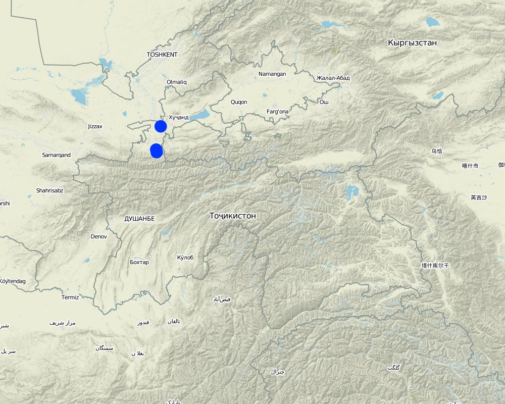
Sughd region
ຂໍ້ມູນເພີ່ມເຕີມຂອງສະຖານທີ່:
Spitamen district, Devashtich district
Map
×2.6 ວັນທີເລີ່ມຕົ້ນ ແລະ ສິ້ນສຸດ ການຈັດຕັ້ງປະຕີບັດ ວິທີທາງ
ສະແດງປີຂອງການເລີ່ມຕົ້ນ:
2014
ຖ້າຫາກບໍ່ຮູ້ຈັກປີທີ່ແນ່ນອນ, ໃຫ້ປະມານຄາດຄະເນ ເອົາມື້ທີ່ໄດ້ເລີ່ມຈັດຕັ້ງປະຕິບັດ ວິທີທາງ:
ຕໍ່າກວ່າ 10 ປີ ຜ່ານມາ (ມາເຖິງປະຈຸບັນ)
2.7 ປະເພດຂອງແນວທາງ
- ພາຍໃຕ້ໂຄງການ / ແຜນງານ
2.8 ເປົ້າໝາຍ / ຈຸດປະສົງຫຼັກ ຂອງການຈັດຕັ້ງປະຕິບັດ ວິທີທາງ
Prevention of disasters caused by flashfloods and debris flows
2.9 ເງື່ອນໄຂອໍານວຍ ຫຼື ຂັດຂວາງການປະຕິບັດຂອງເຕັກໂນໂລຢີ / ເຕັກໂນໂລຢີການນໍາໃຊ້ຕາມແນວທາງ
ມີຄວາມສາມາດ / ເຂັ້າເຖິງຊັບພະຍາກອນດ້ານການເງິນ ແລະ ການບໍລິການ
- ເຊື່ອງຊ້ອນ
Communities and Committee of Emergency Situations without external assistance not able to implement effective integrated measures.
ການກໍ່ຕັ້ງສະຖາບັນ
- ອໍານວຍ
Good collaboration between communities and Committee of Emergency Situations.
ການຮ່ວມມື / ການປະສານງານຂອງຜູ້ກ່ຽວຂ້ອງ
- ອໍານວຍ
Good collaboration between communities and Committee of Emergency Situations.
ຄວາມຮູ້ກ່ຽວກັບການຄຸ້ມຄອງ ທີ່ດິນແບບຍືນຍົງ, ການເຂົ້າເຖິງການສະໜັບສະໜູນ ທາງດ້ານວິຊາການ
- ເຊື່ອງຊ້ອນ
Insufficient knowledge in communities about effective technololgy.
ວຽກ, ມີກໍາລັງຄົນ
- ອໍານວຍ
Traditional joint volunteer work in communities for addressing common problems (hashar).
3. ການມີສ່ວນຮ່ວມ ແລະ ບົດບາດຂອງພາກສ່ວນທີ່ກ່ຽວຂ້ອງທີ່ໄດ້ມີສ່ວນຮ່ວມ
3.1 ຜູ້ມີສ່ວນຮ່ວມ ໃນວິທີທາງ ແລະ ພາລະບົດບາດ ຂອງເຂົາເຈົ້າ
- ຜູ້ນໍາໃຊ້ດິນໃນທ້ອງຖິ່ນ / ຊຸມຊົນທ້ອງຖິ່ນ
Inhabitants of village
Participation in identification of risk sites;
Volunteer work
- ຜູ້ຊ່ຽວຊານ ການນຄຸ້ມຄອງ ທີ່ດິນແບບຍືນຍົງ / ທີ່ປຶກສາດ້ານກະສິກໍາ
Engineers provided by GIZ
Identification of risk sites;
Design, planning and supervision of interventions.
- ອໍານາດ ການປົກຄອງທ້ອງຖິ່ນ
District branches of Committee for Emergency Situations
Participation in identification of risk sites;
Agreement of plans for interventions
3.2 ການມີສ່ວນຮ່ວມຂອງຜູ້ນໍາໃຊ້ທີ່ດິນໃນທ້ອງຖິ່ນ / ຊຸມຊົນທ້ອງຖິ່ນໃນໄລຍະທີ່ແຕກຕ່າງກັນຂອງແນວທາງ
| ການລວບລວມ ເອົາຜູ້ນໍາໃຊ້ດິນ ໃນທ້ອງຖິ່ນ / ຊຸມຊົນທ້ອງຖິ່ນ | ໃຫ້ລະບຸ ຜູ້ໃດທີ່ມີສ່ວນຮ່ວມ ໃນແຕ່ລະກິດຈະກໍາ? | |
|---|---|---|
| ການເລີ່ມຕົ້ນ / ແຮງຈູງໃຈ | ການຮ່ວມມື | Participation in identification of risk sites; |
| ການວາງແຜນ | ການຮ່ວມມື | Participation in discussion of interventions; |
| ການປະຕິບັດ | ການຮ່ວມມື | Volunteer work |
| ຕິດຕາມກວດກາ / ການປະເມີນຜົນ | ການຮ່ວມມື | Control of conditions and functioning of protective structures |
3.4 ການຕັດສິນໃຈກ່ຽວກັບການຄັດເລືອກເຕັກໂນໂລຢີຂອງການຄຸ້ມຄອງທີ່ດິນແບບຍືນຍົງ / ເຕັກໂນໂລຢີ
ລະບຸ ຄົນທີ່ຕັດສິນໃຈ ກ່ຽວກັບການຄັດເລືອກຂອງ ເຕັກໂນໂລຢີ / ເຕັກໂນໂລຢີ ຈະໄດ້ຮັບການປະຕິບັດ:
- ພາກສ່ວນກ່ຽວຂ້ອງທັງໝົດ, ເປັນສ່ວນໜຶ່ງ ຂອງວິທີທາງແບບມີສ່ວນຮ່ວມ
4. ການສະໜັບສະໜູນທາງດ້ານວິຊາການ, ການສ້າງຄວາມສາມາດ, ແລະ ການຈັດການຄວາມຮູ້.
4.1 ການສ້າງຄວາມສາມາດ / ການຝຶກອົບຮົມ
ຜູ້ນໍາໃຊ້ທີ່ດິນ ຫຼື ພາກສ່ວນກ່ຽວຂ້ອງອື່ນໆ ໄດ້ຮັບການຝຶກອົບຮົມບໍ່?
ບໍ່ແມ່ນ
4.2 ການບໍລິການໃຫ້ຄໍາປຶກສາ
ເຮັດຜູ້ໃຊ້ທີ່ດິນມີການເຂົ້າເຖິງການບໍລິການໃຫ້ຄໍາປຶກສາ?
ແມ່ນ
ອະທິບາຍ / ຄວາມຄິດເຫັນ:
Not involved in this approach
4.3 ສະຖາບັນການສ້າງຄວາມເຂັ້ມແຂງ (ການພັດທະນາອົງການຈັດຕັ້ງ)
ສະຖາບັນ ໄດ້ຮັບການສ້າງຕັ້ງຂື້ນ ຫຼື ໄດ້ຮັບການສ້າງຄວາມເຂັ້ມແຂງ ໂດຍການຈັດຕັ້ງປະຕິບັດ ວິທີທາງບໍ່?
- ມີ, ໜ້ອຍໜຶ່ງ
ລະບຸ ທາງສະຖາບັນ ໄດ້ສ້າງຄວາມເຂັ້ມແຂງ ໃນລະດັບໃດ (ຫຼາຍ):
- ທ້ອງຖິ່ນ
ອະທິບາຍ ສະຖາບັນການຈັດຕັ້ງ, ພາລະບົດບາດ ແລະ ໜ້າທີ່ຮັບຜິດຊອບ, ສະມາຊິກ ແລະ ອື່ນໆ.
Strengthening of community institutions in addressing issues of common concern.
ລະບຸ ປະເພດ ຂອງສະໜັບສະໜູນ:
- ການສ້າງຄວາມອາດສາມາດ / ການຝຶກອົບຮົມ
4.4 ຕິດຕາມກວດກາ ແລະ ປະເມີນຜົນ
ການຈັດຕັ້ງປະຕິບັດ ວິທີທາງ ໄດ້ມີການປະເມີນຜົນ ແລະ ຕິດຕາມບໍ?
ແມ່ນ
ຖ້າແມ່ນ, ເອກກະສານສະບັບນີ້ ແມ່ນໄດ້ນໍາໃຊ້ເຂົ້າໃນການຕິດຕາມ ແລະ ປະເມີນຜົນບໍ່?
ບໍ່ແມ່ນ
4.5 ການຄົ້ນຄວ້າ
ນີ້້ແມ່ນສ່ວນໜຶ່ງ ການຄົ້ນຄວ້າ ຂອງວິທີທາງບໍ່?
ບໍ່ແມ່ນ
5. ການສະໜັບສະໜູນທາງດ້ານການເງິນ ແລະ ອຸປະກອນຈາກພາຍນອກ
5.1 ງົບປະມານປະຈໍາປີ ສໍາລັບວິທີທາງ ຂອງການຄຸ້ມຄອງ ທີ່ດິນແບບຍືນຍົງ
ຖ້າຫາກບໍ່ຮູ້ຈັດງົບປະມານທີ່ແນ່ນອນ ແມ່ນໃຫ້ປະມານເອົາ:
- 10,000-100,000
ຄໍາເຫັນ (ຕົວຢ່າງ: ແຫຼ່ງຂໍ້ມູນຫຼັກ ຂອງການສະໜອງທຶນ / ຜູ້ໃຫ້ທຶນທີ່ສໍາຄັນ):
Government of Germany, implemented via Deutsche Gesellschaft für Internationale Zusammenarbeit (GIZ). The approach has been implemented in the frame of a much larger program and the specific budget for the SLM component of the Approach cannot be determined.
5.2 ການສະໜັບສະໜູນ ທາງດ້ານການເງິນ / ອຸປະກອນ ສະໜອງໃຫ້ແກ່ຜູ້ນໍາທີ່ດິນ
ຜູ້ນໍາໃຊ້ດິນ ໄດ້ຮັບການສະໜັບສະໜູນ ທາງດ້ານ ການເງິນ / ອຸປະກອນ ໃນການຈັດຕັ້ງປະຕິບັດ ເຕັກໂນໂລຢີບໍ?
ແມ່ນ
ຖ້າແມ່ນ, ໃຫ້ລະບຸປະເພດ (ຫຼາຍ) ຂອງການສະໜັບສະໜູນ, ເງື່ອນໄຂ ແລະ ຜູູ້ສະໜອງ (ຫຼາຍ):
Costs of planning, design and supervision, costs of materials, transportation and machinery covered by GIZ.
5.3 ເງິນສົມທົບສໍາລັບການນໍາໃຊ້ສະເພາະປັດໃຈຂາເຂົ້າໃນການຜະລີດກະສິກໍາ (ລວມທັງແຮງງານ)
- ອຸປະກອນ
| ໃຫ້ລະບຸໄດ້ຮັບການສະໜັບສະໜູນປັດໃຈຂາເຂົ້າຫຍັງແດ່ | ທີ່ຂອບເຂດ | ລະບຸ ການອຸດໜູນ |
|---|---|---|
| ເຄື່ອງກົນຈັກ | ງົບປະມານເຕັມສ່ວນ | |
- ການກໍ່ສ້າງ
| ໃຫ້ລະບຸໄດ້ຮັບການສະໜັບສະໜູນປັດໃຈຂາເຂົ້າຫຍັງແດ່ | ທີ່ຂອບເຂດ | ລະບຸ ການອຸດໜູນ |
|---|---|---|
| ຫີນ | ງົບປະມານບາງສ່ວນ | |
| Gabion nets | ງົບປະມານເຕັມສ່ວນ | |
ຖ້າແຮງງານ ຂອງຜູ້ນໍາໃຊ້ດິນ ໄດ້ຮັບການສະໜັບສະໜູນ ປັດໃຈຂາເຂົ້າ, ແມ່ນບໍ່:
- ການອາສາ
5.4 ສິນເຊື່ອ
ໄດ້ປ່ອຍສິນເຊື່ອ ສະໜອງໃຫ້ພາຍໃຕ້ ວິທີການສໍາລັບກິດຈະກໍາ ການຄຸ້ມຄອງ ທີ່ດິນແບບຍືນນຍົງບໍ່?
ບໍ່ແມ່ນ
5.5 ສິ່ງຈູງໃຈ ຫຼື ເຄື່ອງມືອື່ນໆ
ການສົ່ງເສີມ ຈັດຕັ້ງປະຕິບັດ ເຕັກໂນໂລຢີ ໃນການຄຸ້ມຄອງ ດິນແບບຍືນຍົງ ໄດ້ສະໜອງສິ່ງກະຕຸກຊຸກຍູ້ບໍ່?
ບໍ່ແມ່ນ
6. ວິເຄາະຜົນກະທົບ ແລະ ສັງລວມບັນຫາ
6.1 ຜົນກະທົບຂອງແນວທາງ
ວິທີທາງ ຊ່ວຍຊຸກຍູ້ ຜູ້ນຳໃຊ້ທີ່ດິນທ້ອງຖີ່ນ, ໃນການປັບປຸງ ການມີສ່ວນຮ່ວມ ຂອງຜູ້ທີ່ກ່ຽວຂ້ອງ ບໍ່?
- ບໍ່
- ມີ, ໜ້ອຍໜຶ່ງ
- ມີ, ພໍສົມຄວນ
- ມີ, ຫຼາຍ
People mobilized to address common issues.
ການຈັດຕັ້ງປະຕິບັດ ວິທີທາງ ສາມາດຊ່ວຍຜູ້ນໍາໃຊ້ທີ່ດິນ ໃນການຈັດຕັ້ງປະຕິບັດ ແລະ ບໍາລຸງຮັກສາ ເຕັກໂນໂລຢີ ການຄຸ້ມຄອງ ທີ່ດິນແບບຍືນຍົງໄດ້ບໍ?
- ບໍ່
- ມີ, ໜ້ອຍໜຶ່ງ
- ມີ, ພໍສົມຄວນ
- ມີ, ຫຼາຍ
Grey and geeen measures for prevention of riverbank erosion
ການນໍາໃຊ້ ວິທີທາງ ສາມາດປັບປຸງ ການປະສານງານ ແລະ ຄ່າໃຊ້ຈ່າຍ ການຈັດຕັ້ງປະຕິບັດ ທີ່ມີປະສິດທິພາບ ຂອງການຄຸ້ມຄອງ ທີ່ດິນແບບຍືດຍົງໄດ້ບໍ່?
- ບໍ່
- ມີ, ໜ້ອຍໜຶ່ງ
- ມີ, ພໍສົມຄວນ
- ມີ, ຫຼາຍ
ການນໍາໃຊ້ ວິທີທາງ ສາມາດລະດົມ ຫຼື ປັບປຸງ ການເຂົ້າເຖິງຊັບພະຍາກອນ ການເງິນ ສໍາລັບການຈັດຕັ້ງປະຕິບັດ ການຄຸ້ມຄອງ ທີ່ດິນແບບຍືດຍົງໄດ້ບໍ່?
- ບໍ່
- ມີ, ໜ້ອຍໜຶ່ງ
- ມີ, ພໍສົມຄວນ
- ມີ, ຫຼາຍ
Combination of financial and technical support by GIZ and contributions in form of work and locally available materials by community members.
ການນໍາໃຊ້ ວິທີທາງ ສາມາດປັບປຸງຄວາມຮູ້ ແລະ ຄວາມສາມາດຂອງຜູ້ນໍາໃຊ້ທີ່ດິນ ໃນການປະຕິບັດ ການຄຸ້ມຄອງ ທີ່ດິນແບບຍືດຍົງໄດ້ບໍ່?
- ບໍ່
- ມີ, ໜ້ອຍໜຶ່ງ
- ມີ, ພໍສົມຄວນ
- ມີ, ຫຼາຍ
Community members capable of replicating the technologies.
ການນໍາໃຊ້ ວິທີທາງ ສາມາດປັບປຸງຄວາມຮູ້ ແລະ ຄວາມສາມາດ ຂອງພາກສ່ວນທີ່ກ່ຽວຂ້ອງໄດ້ບໍ່?
- ບໍ່
- ມີ, ໜ້ອຍໜຶ່ງ
- ມີ, ພໍສົມຄວນ
- ມີ, ຫຼາຍ
Committee of Emergency Situations capable of replicating the technologies.
Improved collaboration between Committe of Emergency Situations, communal self-governance and community members.
ການຈັດຕັ້ງປະຕິບັດ ວິທີທາງ ສາມາດຊຸກຍູ້ ຜູ້ນໍາໃຊ້ທີ່ດິນທີ່ເປັນຊາວໜຸ່ມ / ຄົນລຸ້ນໃໝ່ ໃນການຄຸ້ມຄອງ ທີ່ດິນແບບຍືນຍົງໄດ້ບໍ?
- ບໍ່
- ມີ, ໜ້ອຍໜຶ່ງ
- ມີ, ພໍສົມຄວນ
- ມີ, ຫຼາຍ
Involvement of young people in joint work
ການນໍາໃຊ້ ວິທີທາງ ໄດ້ປັບປຸງ ການຄໍ້າປະກັນສະບຽງອາຫານ ຫຼື ປັບປຸງໂຄສະນາການໄດ້ບໍ່?
- ບໍ່
- ມີ, ໜ້ອຍໜຶ່ງ
- ມີ, ພໍສົມຄວນ
- ມີ, ຫຼາຍ
Reduced risk of destruction of irrigation infrastructure and of loss of productive lands.
ການຈັດຕັ້ງປະຕິບັດ ວິທີທາງ ສາມາດສ້າງຄວາມອາດສາມາດໃຫ້ຜູ້ນໍາໃຊ້ດິນ ໃນການປັບຕົວ ຕໍ່ການປ່ຽນແປງດິນຟ້າອາກາດ / ຫຼດຜ່ອນຄວາມສ່ຽງທາງໄພພິບັດໄດ້ບໍ? :
- ບໍ່
- ມີ, ໜ້ອຍໜຶ່ງ
- ມີ, ພໍສົມຄວນ
- ມີ, ຫຼາຍ
Reduced risk of destructive impacts of flashfloods and debris flows, which due to climate change are increasing in frequency and intensity.
6.2 ແຮງຈູງໃຈຫຼັກຂອງຜູ້ນໍາໃຊ້ທີ່ດິນໃນການປະຕິບັດການຄຸ້ມຄອງທີ່ດິນແບບຍືນຍົງ
- ຫຼຸດຜ່ອນຄວາມສ່ຽງຂອງໄພພິບັດ
6.3 ຄວາມຍືນຍົງຂອງກິດຈະກໍາວິທີທາງ
ຜູ້ນໍາໃຊ້ ທີ່ດິນ ສາມາດສືບຕໍ່ ການຈັດຕັ້ງປະຕິບັດ ຜ່ານວິທີທາງໄດ້ບໍ່ (ໂດຍປາດສະຈາກ ການຊ່ວຍເຫຼືອ ຈາກພາກສ່ວນພາຍນອກ)?
- ແມ່ນ
6.4 ຈຸດແຂງ / ຂໍ້ດີ ຂອງວິທີທາງ
| ຈຸດແຂງ / ຂໍ້ດີ / ໂອກາດໃນການນໍາໃຊ້ທີ່ດິນ |
|---|
| Reduced disaster risk |
| Availability of wood from green measures |
| ຈຸດແຂງ / ຈຸດດີ / ໂອກາດ ຈາກທັດສະນະຂອງຜູ້ປ້ອນຂໍ້ມູນ ຫຼື ບຸກຄົນສຳຄັນ |
|---|
| Same as land-users |
| Improved collaboration at local level and strengthened institutions |
| Ownership feeling among community members |
6.5 ຈຸດອ່ອນ / ຂໍ້ເສຍຂອງແນວທາງ ແລະ ວິທີການແກ້ໄຂໃຫ້ເຂົາເຈົ້າ
| ຈຸດອ່ອນ / ຂໍ້ເສຍ / ຄວາມສ່ຽງໃນມູມມອງຂອງຜູ້ນໍາໃຊ້ທີ່ດິນ | ມີວິທີການແກ້ໄຂຄືແນວໃດ? |
|---|---|
| None |
| ຈຸດອ່ອນ ຫຼື ຂໍ້ເສຍ ຫຼື ຄວາມສ່ຽງ ໃນມຸມມອງຂອງ ຜູ້ສັງລວມຂໍ້ມູນ ຫຼື ບັນດາຜູ້ຕອບແບບສອບຖາມ | ມີວິທີການແກ້ໄຂຄືແນວໃດ? |
|---|---|
| None |
7. ເອກກະສານອ້າງອີງ ແລະ ຂໍ້ມູນການເຊື່ອມໂຍງ
7.1 ວິທີການ / ແຫຼ່ງຂໍ້ມູນ
- ການໄປຢ້ຽມຢາມພາກສະໜາມ, ການສໍາຫຼວດພາກສະໜາມ
- ການສໍາພາດ ຜູ້ນໍາໃຊ້ທີ່ດິນ
- ສໍາພາດ ຊ່ຽວຊານ ການຄຸ້ມຄອງ ດິນແບບຍືນຍົງ
- ການລວບລວມ ບົດລາຍງານ ແລະ ເອກະສານອື່ນໆ ທີ່ມີຢູ່ແລ້ວ
ຂໍ້ມູນການເຊື່ອມຕໍ່ ແລະ ເນື້ອໃນ
ຂະຫຍາຍທັງໝົດ ຍຸບທັງໝົດການເຊື່ອມຕໍ່

Prevention of riverbank erosion by combination of green … [ຕາຈິກິສະຕານ]
Flashfloods in riverbeds cause intensive riverbank erosion, which threatens villages, infrastructure and productive lands. Preventive measures combining "grey" (physical structures) and "green" (living trees) elements are more effective, sustainable and cost efficient than constructive measures only.
- ຜູ້ສັງລວມຂໍ້ມູນ: Stefan Michel
ເນື້ອໃນ
ບໍ່ມີເນື້ອໃນ


