Stone-faced Soil Bund Stablized with Grass [ອີທິໂອເປຍ]
- ການສ້າງ:
- ປັບປູງ:
- ຜູ້ສັງລວມຂໍ້ມູນ: Daniel Danano
- ບັນນາທິການ: –
- ຜູ້ທົບທວນຄືນ: Fabian Ottiger, Alexandra Gavilano
Dhaga (oromifa)
technologies_1077 - ອີທິໂອເປຍ
ເບິ່ງພາກສ່ວນ
ຂະຫຍາຍທັງໝົດ ຍຸບທັງໝົດ1. ຂໍ້ມູນທົ່ວໄປ
1.2 ຂໍ້ມູນ ການຕິດຕໍ່ພົວພັນ ຂອງບຸກຄົນທີ່ສໍາຄັນ ແລະ ສະຖາບັນ ທີ່ມີສ່ວນຮ່ວມ ໃນການປະເມີນເອກກະສານ ເຕັກໂນໂລຢີ
ຊື່ສະຖາບັນ (ຫຼາຍສະຖາບັນ) ທີ່ອໍານວຍຄວາມສະດວກ ໃນການສ້າງເອກກະສານ / ປະເມີນ ເຕັກໂນໂລຢີ (ຖ້າກ່ຽວຂ້ອງ)
FAO Food and Agriculture Organization (FAO Food and Agriculture Organization) - ອີຕາລີ1.3 ເງື່ອນໄຂ ກ່ຽວກັບ ການນໍາໃຊ້ຂໍ້ມູນເອກະສານ ທີ່ສ້າງຂື້ນ ໂດຍຜ່ານ ອົງການພາບລວມຂອງໂລກ ທາງດ້ານແນວທາງ ແລະ ເຕັກໂນໂລຢີ ຂອງການອານຸລັກ ທໍາມະຊາດ (WOCAT)
ຜູ້ປ້ອນຂໍ້ມູນ ແລະ ບຸກຄົນສຳຄັນ ທີ່ໃຫ້ຂໍ້ມູນ (ຫຼາຍ) ຍິນຍອມ ຕາມເງື່ອນໄຂ ໃນການນຳໃຊ້ຂໍ້ມູນ ເພື່ອສ້າງເປັນເອກກະສານຂອງ WOCAT:
ແມ່ນ
2. ການອະທິບາຍ ເຕັກໂນໂລຢີ ຂອງການຄຸ້ມຄອງ ທີ່ດິນແບບຍືນຍົງ
2.1 ຄໍາອະທິບາຍສັ້ນຂອງ ເຕັກໂນໂລຢີ
ການກຳໜົດຄວາມໝາຍ ຂອງເຕັກໂນໂລຢີ:
Stone faced terraces are commonly constructed on cultivated lands. These are structural measural measures placed along the contour to control soil erosion and trap runoff.
2.2 ການອະທິບາຍ ລາຍລະອຽດ ຂອງເຕັກໂນໂລຢີ
ການພັນລະນາ:
Stone-faced soil bund is constructed during the dry period when the field is free from crops (after crop harvest). Soils in the woreda are light and are easily eroded. A contour line is marked on the ground first and a foundation placing stones is dug. The stone wall is placed in the foundation and the wall is raised until it attains a height of 0.50m at minimum. Then earth is dug on the upslope side by removing soil from it and make an embankment of soil on the upper side to support the stone wall. In the same way the stone is supported by the soil from the upper side. The embanked soil is lightly compacted to avoid collapse. The objective is to control concentrated runoff from causing soil erosion and to retain as much rainwater as possible in the soil for mazimizing crop production. Livestock are not let on the terraced land. Most land users feed their animals tethered. The bund is then stablized by planting grass. The most commonly used grasses for stablizing bunds in the area are phalaris and elephant grass. The purpose is to control runoff and soil erosion from cultivated lands. Grass is planted to stablize the bund and also help in providing fodder for animals. Some land users stablize the stone-faced bunds by planting fruit trees. Fruit trees are often planted at the homesteads for better management and protection. The income obtaoned from fruit trees is high. Sorghum fields are predominantly treated by stone-faced bunds while chat and coffee fields are treated by ridges and basins. Frequent maintenance and upgrading is required until bench is formed. Currently most of the fields in the woreda have a properly stablized terraces and as a result loss of soil and water by erosion is decreasing. Maintenance is done continuously until the structure stablizes well and inparticular after heavy rains, every time after tillage and cropping. The technology is suitable in areas where stones are avialable and soils are light.
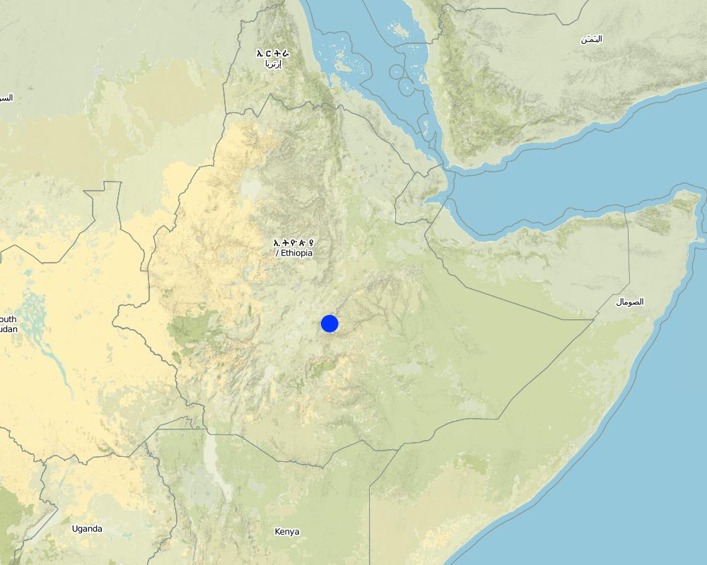
2.5 ປະເທດ / ເຂດ / ສະຖານທີ່ບ່ອນທີ່ ເຕັກໂນໂລຢີ ໄດ້ຮັບການນໍາໃຊ້ ແລະ ທີ່ຖືກປົກຄຸມດ້ວຍການປະເມີນຜົນ
ປະເທດ:
ອີທິໂອເປຍ
ພາກພື້ນ / ລັດ / ແຂວງ:
Oromia National Regional State
ຂໍ້ມູນເພີ່ມເຕີມຂອງສະຖານທີ່:
Tullo
ໃຫ້ລະບຸ ການແຜ່ຂະຫຍາຍ ເຕັກໂນໂລຢີ:
- ແຜ່ຂະຫຍາຍຢ່າງໄວວາໃນພື້ນທີ່
ຖ້າຫາກບໍ່ຮູ້ເນື້ອທີ່ທີ່ແນ່ນອນ, ໃຫ້ລະບຸ ເນື້ອທີ່ໂດຍປະມານ ທີ່ໃກ້ຄຽງ:
- 100-1,000 ກມ 2
ຄວາມຄິດເຫັນ:
Total area covered by the SLM Technology is 80 km2.
Information obtaned from annual activities and achievements reports. But at present the total technology area is more than the amount shown here and estimate is indicated as follows:
Map
×2.6 ວັນທີໃນການຈັດຕັ້ງປະຕິບັດ
ຖ້າຫາກວ່າ ບໍ່ຮູ້ຈັກ ປີທີ່ຊັດເຈນ ແມ່ນໃຫ້ປະມານ ວັນທີເອົາ:
- ຕໍ່າກວ່າ 10 ປີ ຜ່ານມາ (ມາເຖິງປະຈຸບັນ)
2.7 ການນໍາສະເໜີ ເຕັກໂນໂລຢີ
ໃຫ້ລະບຸ ເຕັກໂນໂລຢີ ໄດ້ຖືກຈັດຕັ້ງປະຕິບັດຄືແນວໃດ?
- ໂດຍຜ່ານໂຄງການ / ການຊ່ວຍເຫຼືອຈາກພາຍນອກ
ຄວາມຄິດເຫັນ (ປະເພດ ໂຄງການ ແລະ ອື່ນໆ):
The technology was initially introduced by the extension implementation project of the Ministry of Agriculture and modified in the process of implementing the National Soil and Water Conservation Program in the country in the various phases of the land rehabilitation and afforestation project of the MERETproject (MOARD/WFP)
3. ການໃຈ້ແຍກ ເຕັກໂນໂລຢີ ໃນການຄຸ້ມຄອງ ດິນແບບຍືນຍົງ
3.1 ຈຸດປະສົງຫຼັກ (ຫຼາຍ) ຂອງເຕັກໂນໂລຢີ
- ປັບປຸງ ການຜະລິດ
- ຫຼຸດຜ່ອນ, ປ້ອງກັນ, ຟື້ນຟູ ການເຊື່ອມໂຊມຂອງດິນ
3.2 ປະເພດການນໍາໃຊ້ທີ່ດິນ ໃນປະຈຸບັນ() ທີ່ເຕັກໂນໂລຢີ ໄດ້ຖືກນໍາໃຊ້

ດິນທີ່ປູກພືດ
- ການປູກພືດປະຈໍາປີ
- ພືດຢືນຕົ້ນ (ບໍ່ແມ່ນໄມ້)
- ເປັນໄມ້ຢືນຕົ້ນ ແລະ ໄມ້ພຸ່ມ ຈາກການປູກພືດ
ການປູກພືດປະຈຳປີ - ລະບຸປະເພດພືດ:
- ທັນຍາພືດ-ສາລີ
- ທັນຍາພືດ-ເຂົ້າຟາງ
- ພືດຕະກູນຖົ່ວ ແລະ ຖົ່ວປະເພດອື່ນໆ
- teff
- chat, elephant grass, phalaris
ການປູກພືດທີ່ເປັນຕົ້ນໄມ້ ແລະ ໄມ້ພຸ່ມ - ລະບຸປະເພດພືດ:
- ໝາກອາໂວກາໂດ
- ກາເຟ, ປູກຢູ່ພື້ນທີ່ເປີດ
- ໝາກໄມ້, ອື່ນໆ
- ໝາກມ່ວງ, ໝາກມັງຄຸດ, ໝາກສີດາ
- grevillea, cordia
ຈໍານວນ ລະດູການ ປູກໃນປີໜຶ່ງ:
- 2
ລະບຸ ຊະນິດ:
Longest growing period in days: 240 Longest growing period from month to month: Apr - NovSecond longest growing period in days: 150Second longest growing period from month to month: Feb - Jun
ມີການເຝືກປູກພືດແບບສັບຫວ່າງບໍ່?
ແມ່ນ
ຖ້າມີ, ໃຫ້ລະບຸວ່າປູກພືດຊະນິດໃດທີ່ປູກສັບຫວ່າງ:
maize-haricot beans, chat-beans

ທົ່ງຫຍ້າລ້ຽງສັດ
ທົ່ງຫຍ້າລ້ຽງສັດແບບສຸມ / ການຜະລິດອາຫານສັດ:
- ຕັດຫຍ້າ ແລະ ຂົນຫຍ້າ / ບໍ່ມີທົ່ງຫຍ້າທໍາມະຊາດ
ຄວາມຄິດເຫັນ:
Major land use problems (compiler’s opinion): Land use problem is the result mainly of high population growth, improper land use and poor farming practices. Land not suitable for cultivation is put under use. Steepslopes on hillsides and mountain escarpments are cultivated. These have resulted in high runoff and sediment movment from the upper catchments which are dominantly devoid of vegetation and no conservation measures practiced.
Major land use problems (land users’ perception): land shortage, loss of fertility and soil erosion on lands with no conservation measures.
Cut-and-carry/ zero grazing: grazing land is seriously shriniking owing
Type of cropping system and major crops comments: sorghum-beans or chat - sorghum, maize-beans
3.4 ການສະໜອງນ້ຳ
ການສະໜອງນໍ້າ ໃນພື້ນທີ່ ທີ່ໄດ້ນໍາໃຊ້ ເຕັກໂນໂລຢີ:
- ນໍ້າຝົນ
3.5 ການນໍາໃຊ້ເຕັກໂນໂລຢີ ທີ່ຢູ່ໃນກຸ່ມການຄຸ້ມຄອງ ທີ່ດິນແບບຍືນຍົງ
- ມາດຕະການ ຕັດຂວາງ ກັບຄວາມຄ້ອຍຊັນ
3.6 ມາດຕະການ ການຄຸ້ມຄອງ ທີ່ດິນແບບຍືນຍົງ ປະກອບດ້ວຍ ເຕັກໂນໂລຢີ
3.7 ປະເພດດິນເຊື່ອມໂຊມ ຫຼັກທີ່ໄດ້ນໍາໃຊ້ ເຕັກໂນໂລຢີ

ດິນເຊາະເຈື່ອນ ໂດຍນໍ້າ
- Wt: ການສູນເສຍຊັ້ນໜ້າດິນ / ການເຊາະເຈື່ອນຜິວໜ້າດິນ

ການເຊື່ອມໂຊມ ຂອງດິນ ທາງເຄມີ
- Cn: ຄວາມອຸດົມສົມບູນ ລົດໜ້ອຍຖອຍລົງ ແລະ ສານອິນຊີວັດຖຸລົດລົງ (ບໍ່ແມ່ນສາເຫດມາຈາກການເຊາະເຈື່ອນ)
ຄວາມຄິດເຫັນ:
Main type of degradation addressed: Wt: loss of topsoil / surface erosion
Secondary types of degradation addressed: Cn: fertility decline and reduced organic matter content
3.8 ການປ້ອງກັນ, ການຫຼຸດຜ່ອນ, ຫຼືການຟື້ນຟູຂອງການເຊື່ອມໂຊມຂອງດິນ
ໃຫ້ລະບຸ ເປົ້າໝາຍ ເຕັກໂນໂລຢີ ທີ່ພົວພັນ ກັບຄວາມເຊື່ອມໂຊມຂອງດິນ:
- ປ້ອງກັນການເຊື່ອມໂຊມຂອງດິນ
- ຫຼຸດຜ່ອນການເຊື່ອມໂຊມຂອງດິນ
ຄວາມຄິດເຫັນ:
Main goals: mitigation / reduction of land degradation
Secondary goals: prevention of land degradation
4. ຂໍ້ກໍາໜົດ, ກິດຈະກໍາການປະຕິບັດ, ວັດຖຸດິບ, ແລະຄ່າໃຊ້ຈ່າຍ
4.1 ເຕັກນິກ ໃນການແຕ້ມແຜນວາດ ເຕັກໂນໂລຢີ
ຄຸນລັກສະນະ ຂອງເຕັກນິກ (ທີ່ກ່ຽວຂ້ອງ ກັບການແຕ້ມແຜນວາດ ທາງດ້ານເຕັກນີກ):
Technical knowledge required for field staff / advisors: moderate
Technical knowledge required for land users: moderate
Main technical functions: reduction of slope length
Secondary technical functions: control of concentrated runoff: retain / trap, reduction of slope angle, increase of infiltration, increase / maintain water stored in soil
Early planting
Material/ species: sorghum, maize, chat
Remarks: on contour and row planting
Mixed cropping / intercropping
Material/ species: maize-haricot beans, chat-beans
Remarks: row planting and broadcasting
Contour planting / strip cropping
Material/ species: land tillage and cultivation
Remarks: contour cultivation
Legume inter-planting
Remarks: contour
Manure / compost / residues
Material/ species: animal dung and crop residue farming
Quantity/ density: 30-40 t/ha
Remarks: applied in between rows
Mineral (inorganic) fertilizers
Material/ species: chemical fertilizers (DAP and Urea)
Remarks: broadcasting
Contour tillage
Remarks: along the contour and made by oxen plough
Aligned: -contour
Vegetative material: T : trees / shrubs, F : fruit trees / shrubs
Number of plants per (ha): 400-500
Vertical interval between rows / strips / blocks (m): 1
Spacing between rows / strips / blocks (m): 10 m
Width within rows / strips / blocks (m): 3 x 3
Vegetative measure: aligned: contour
Vegetative material: G : grass
Number of plants per (ha): 5000
Vertical interval between rows / strips / blocks (m): 1
Spacing between rows / strips / blocks (m): 110 m
Width within rows / strips / blocks (m): 0.3 x 0.3
Vegetative measure: Vegetative material: G : grass
Vegetative measure: Vegetative material: G : grass
Vegetative measure: Vegetative material: G : grass
Trees/ shrubs species: grevillea, cordia
Fruit trees / shrubs species: guava, avocado
Grass species: elephant, phalaris
Slope (which determines the spacing indicated above): 10.00%
If the original slope has changed as a result of the Technology, the slope today is (see figure below): 3.00%
Gradient along the rows / strips: 0.00%
4.3 ການສ້າງຕັ້ງກິດຈະກໍາ
| ກິດຈະກໍາ | Timing (season) | |
|---|---|---|
| 1. | seed collection | dry season |
| 2. | seedling production | dry season |
| 3. | seedling planting | during rains |
| 4. | weeding and cultivation | during rains |
4.4 ຕົ້ນທຶນ ແລະ ປັດໄຈຂາເຂົ້າທີ່ຈໍາເປັນໃນຈັດຕັ້ງປະຕິບັດ
| ລະບຸ ປັດໃຈ ນໍາເຂົ້າ ໃນການຜະລີດ | ຫົວໜ່ວຍ | ປະລິມານ | ຕົ້ນທຶນ ຕໍ່ຫົວໜ່ວຍ | ຕົ້ນທຶນທັງໝົດ ຂອງປັດໃຈຂາເຂົ້າ ໃນການຜະລິດ | % ຂອງຕົ້ນທຶນທັງໝົດ ທີ່ຜູ້ນໍາໃຊ້ທີ່ດິນ ໃຊ້ຈ່າຍເອງ | |
|---|---|---|---|---|---|---|
| ແຮງງານ | Labour | ha | 1.0 | 125.0 | 125.0 | |
| ອຸປະກອນ | Animal traction | ha | 1.0 | 46.6 | 46.6 | |
| ອຸປະກອນ | Tools | ha | 1.0 | 5.5 | 5.5 | |
| ວັດສະດຸໃນການປູກ | Seeds | ha | 1.0 | 2.8 | 2.8 | |
| ວັດສະດຸໃນການປູກ | Seedlings | ha | 1.0 | 30.0 | 30.0 | |
| ຝຸ່ນ ແລະ ຢາຊີວະພາບ | Fetilizer | ha | 1.0 | 33.3 | 33.3 | |
| ຕົ້ນທຶນທັງໝົດ ໃນການຈັດຕັ້ງປະຕິບັດ ເຕັກໂນໂລຢີ | 243.2 | |||||
| ຄ່າໃຊ້ຈ່າຍທັງໝົດ ສຳລັບການສ້າງຕັ້ງເຕັກໂນໂລຢີ ເປັນສະກຸນເງີນໂດລາ | 243.2 | |||||
ຄວາມຄິດເຫັນ:
Duration of establishment phase: 60 month(s)
4.5 ບໍາລຸງຮັກສາ / ແຜນຈັດຕັ້ງປະຕິບັດ ກິດຈະກໍາ
| ກິດຈະກໍາ | ໄລຍະເວລາ / ຄວາມຖີ່ | |
|---|---|---|
| 1. | primary tillage | onset of rains |
| 2. | secondary tillage and seed bed preparation | in the middle of early rains and main rains |
| 3. | weeding and cultivation | after germination |
| 4. | thinning | after rains |
4.6 ຄ່າໃຊ້ຈ່າຍ ແລະ ປັດໄຈນໍາເຂົ້າທີ່ຈໍາເປັນສໍາລັບການບໍາລຸງຮັກສາກິດຈະກໍາ / ແຜນປະຕິບັດ (ຕໍ່ປີ)
| ລະບຸ ປັດໃຈ ນໍາເຂົ້າ ໃນການຜະລີດ | ຫົວໜ່ວຍ | ປະລິມານ | ຕົ້ນທຶນ ຕໍ່ຫົວໜ່ວຍ | ຕົ້ນທຶນທັງໝົດ ຂອງປັດໃຈຂາເຂົ້າ ໃນການຜະລິດ | % ຂອງຕົ້ນທຶນທັງໝົດ ທີ່ຜູ້ນໍາໃຊ້ທີ່ດິນ ໃຊ້ຈ່າຍເອງ | |
|---|---|---|---|---|---|---|
| ແຮງງານ | Labour | ha | 1.0 | 12.5 | 12.5 | |
| ອຸປະກອນ | Tools | ha | 1.0 | 0.5 | 0.5 | |
| ວັດສະດຸໃນການປູກ | Seedlings | ha | 1.0 | 3.0 | 3.0 | |
| ຝຸ່ນ ແລະ ຢາຊີວະພາບ | Fertilizer | ha | 1.0 | 33.3 | 33.3 | |
| ຕົ້ນທຶນທັງໝົດ ທີ່ໃຊ້ໃນການບໍາລຸງຮັກສາ ເຕັກໂນໂລຢີ | 49.3 | |||||
| ຄ່າໃຊ້ຈ່າຍທັງໝົດ ສຳລັບການບົວລະບັດຮກສາເຕັກໂນໂລຢີ ເປັນສະກຸນເງີນໂດລາ | 49.3 | |||||
ຄວາມຄິດເຫັນ:
length of stone faced bunds and the number of trees planted
4.7 ປັດໄຈ ທີ່ສໍາຄັນ ທີ່ສົ່ງຜົນກະທົບ ຕໍ່ຄ່າໃຊ້ຈ່າຍ
ໃຫ້ອະທິບາຍ ປັດໃຈ ທີ່ສົ່ງຜົນກະທົບ ຕໍ່ຕົ້ນທຶນ ໃນການຈັດຕັ້ງປະຕິບັດ:
Slope: In steep slopes terraces get closer and the length of terrace per unit area /hectar/ increases and this increases the cost of construction. On soils of shallow soils digging becomes tough and this leads to increased costs
5. ສະພາບແວດລ້ອມທໍາມະຊາດ ແລະ ມະນຸດ
5.1 ອາກາດ
ປະລິມານນໍ້າຝົນປະຈໍາປີ
- < 250 ມີລິແມັດ
- 251-500 ມີລິແມັດ
- 501-750 ມີລິແມັດ
- 751-1,000 ມີລິແມັດ
- 1,001-1,500 ມີລິແມັດ
- 1,501-2,000 ມີລິແມັດ
- 2,001-3,000 ມີລິແມັດ
- 3,001-4,000 ມີລິແມັດ
- > 4,000 ມີລິແມັດ
ເຂດສະພາບອາກາດກະສິກໍາ
- ເຄີ່ງຄວາມຊຸ່ມ
Almost over 65% of the SWC area
5.2 ພູມິປະເທດ
ຄ່າສະເລ່ຍ ຄວາມຄ້ອຍຊັນ:
- ພື້ນທີ່ຮາບພຽງ (0-2%)
- ອ່ອນ (3-5 %)
- ປານກາງ (6-10 %)
- ມ້ວນ (11-15 %)
- ເນີນ(16-30%)
- ໍຊັນ (31-60%)
- ຊັນຫຼາຍ (>60%)
ຮູບແບບຂອງດິນ:
- ພູພຽງ / ທົ່ງພຽງ
- ສັນພູ
- ເປີ້ນພູ
- ເນີນພູ
- ຕີນພູ
- ຮ່ອມພູ
ເຂດລະດັບສູງ:
- 0-100 ແມັດ a.s.l.
- 101-500 ແມັດ a.s.l.
- 501-1,000 ແມັດ a.s.l.
- 1,001-1,500 ແມັດ a.s.l.
- 1,501-2,000 ແມັດ a.s.l.
- 2,001-2,500 ແມັດ a.s.l.
- 2,501-3,000 ແມັດ a.s.l.
- 3,001-4,000 ແມັດ a.s.l.
- > 4,000 ແມັດ a.s.l.
ຄຳເຫັນ ແລະ ຂໍ້ມູນສະເພາະ ເພີ່ມເຕີມ ກ່ຽວກັບ ພູມີປະເທດ:
Altitudinal zone: 1501-2000 m a.s.l. (dominant elevation, ranked 1) and 1,001-1,500 m a.s.l. (very small area, ranked 2)
Landforms: Mountain slopes (the dominant landform, ranked 1), foot slopes (dominanatly cultivated lands, ranked 2) and valley floor (mostly cultivated, ranked 2)
Slopes on average: Hilly (planted forestsand shrublands with degraded natural forests, ranekd 1), Rolling ( cultivated lands with perennial crops, ranked 2), moderate (cultivated lands with cereals (sorghum and maize) ranked 3), getnle (cultivated with teff and sweet potato, ranked 3)
5.3 ດິນ
ຄວາມເລິກ ຂອງດິນສະເລ່ຍ:
- ຕື້ນຫຼາຍ (0-20 ຊັງຕີແມັດ)
- ຕື້ນ (21-50 ຊຕມ)
- ເລີກປານກາງ (51-80 ຊຕມ)
- ເລິກ (81-120 ຊມ)
- ເລິກຫຼາຍ (> 120 cm)
ເນື້ອດິນ (ໜ້າດິນ):
- ຫຍາບ / ເບົາ (ດິນຊາຍ)
ຊັ້ນອິນຊີວັດຖຸ ເທິງໜ້າດິນ:
- ປານກາງ (1-3 %)
- ຕໍາ່ (<1 %)
ຖ້າເປັນໄປໄດ້ ແມ່ນໃຫ້ຕິດຄັດ ການພັນລະນາດິນ ຫຼື ຂໍ້ມູນສະເພາະຂອງດິນ, ຕົວຢ່າງ, ຄຸນລັກສະນະ ປະເພດຂອງດິນ, ຄ່າຄວາມເປັນກົດ / ເປັນດ່າງຂອງດິນ, ສານອາຫານ, ດິນເຄັມ ແລະ ອື່ນໆ.
Soil depth on average: Shallow (soils on mountain slopes , ranked 1), moderately deep (soils on foot slopes, ranked 2), deep ( soils on valley floors, ranked 3) and very deep (soils around homesteads, ranked 3)
Soil texture: Coarse/light (mountain slopes and foot slopes, ranked 1), medium (foot slopes, ranked 2) and fine/heavy (valley floor, ranked 3)
Soil fertility is low (mountain slopes, ranked 1), medium (foot slopes, ranked 2) and high (valley floor, ranked 3)
Topsoil organic matter is medium (impressions: on valley floors of cultivated lands, ranked 1) and low ( impressions:mountain slopes, ranked 2)
Soil drainage/infiltration is good (most of the mountain slopes and foot slopes, ranked 1) and medium (on valley floors, ranked 2)
Soil water storage capacity is low (on mountain slopes because of shallow soils, ranked 1) and medium (on foot slopes and valley floors, ranked 2)
5.6 ຄຸນລັກສະນະ ຂອງຜູ້ນໍາໃຊ້ທີ່ດິນ ທີ່ໄດ້ນໍາໃຊ້ເຕັກໂນໂລຢີ
ລະບົບ ການຕະຫຼາດ ແລະ ຜົນຜະລິດ:
- ກຸ້ມຕົນເອງ (ພໍພຽງ)
ລາຍຮັບ ທີ່ບໍ່ໄດ້ມາຈາກ ການຜະລິດ ກະສິກໍາ:
- > 50 % ຂອງລາຍຮັບທັງໝົດ
ລະດັບຄວາມຮັ່ງມີ:
- ສະເລ່ຍ
- ຮັ່ງມີ
ລະດັບ ການຫັນເປັນກົນຈັກ:
- ການໃຊ້ແຮງງານຄົນ
- ສັດລາກແກ່
ໃຫ້ລະບຸ ຄຸນລັກສະນະ ຂອງຜູ້ນໍາໃຊ້ທີ່ດິນ:
Population density: 200-500 persons/km2
Annual population growth: 2% - 3%
(The rich hire labour).
(could get orgainzed in groups for labour sahring).
Off-farm income specification: The rich and average land users get engaged in other non farm activities because they have financial means
Level of mechanization: Animal traction (cereal crop fields are ploughed and cultivated by oxen plough, ranked 1) and manual work (chat and coffee plants are manually cultivated by hoe, ranked 2)
Market orientation of grazing land: Subsistence (self-supply). Animals are predominanatly kept for draft power requiremen and milk production.
5.7 ເນື້ອທີ່ສະເລ່ຍຂອງດິນ ທີ່ຜູ້ນຳໃຊ້ທີ່ດິນ ໃຊ້ເຮັດເຕັກໂນໂລຢີ
- <0.5 ເຮັກຕາ
- 0.5-1 ເຮັກຕາ
- 1-2 ເຮັກຕາ
- 2-5 ເຮັກຕາ
- 5-15 ເຮັກຕາ
- 15-50 ເຮັກຕາ
- 50-100 ເຮັກຕາ
- 100-500 ເຮັກຕາ
- 500-1,000 ເຮັກຕາ
- 1,000-10,000 ເຮັກຕາ
- > 10,000 ເຮັກຕາ
ຄວາມຄິດເຫັນ:
0.5-1 ha (The poor are many and they have a very small holdings, ranked 1)
1-2 ha (The average land users)
5.8 ເຈົ້າຂອງທີ່ດິນ, ສິດໃຊ້ທີ່ດິນ, ແລະ ສິດທິການນໍາໃຊ້ນໍ້າ
ເຈົ້າຂອງດິນ:
- ລັດ
ສິດທິ ໃນການນໍາໃຊ້ທີ່ດິນ:
- ເປີດກວ້າງ (ບໍ່ມີການຈັດຕັ້ງ)
- ບຸກຄົນ
6. ຜົນກະທົບ ແລະ ລາຍງານສະຫຼຸບ
6.1 ການສະແດງຜົນກະທົບ ພາຍໃນພື້ນທີ່ ທີ່ໄດ້ຈັດຕັ້ງປະຕິບັດ ເຕັກໂນໂລຢີ
ຜົນກະທົບທາງເສດຖະກິດສັງຄົມ
ການຜະລິດ
ການຜະລິດພືດ
ຄວາມຄິດເຫັນ / ລະບຸແຈ້ງ:
due to increase in soil misture and erosion control due to measures
ການຜະລິດອາຫານສັດ
ຄວາມຄິດເຫັນ / ລະບຸແຈ້ງ:
planataion on the hillsides and on bunds
ຄຸນນະພາບຂອງອາຫານສັດ
ຄວາມຄິດເຫັນ / ລະບຸແຈ້ງ:
planataion on the hillsides and on bunds
ຜົນຜະລິດໄມ້
ຄວາມຄິດເຫັນ / ລະບຸແຈ້ງ:
area closures and hillside planataions
ລາຍໄດ້ ແລະ ຄ່າໃຊ້ຈ່າຍ
ລາຍຮັບ ຈາກການຜະລີດ
ຄວາມຄິດເຫັນ / ລະບຸແຈ້ງ:
crop production increased
ຜົນກະທົບດ້ານວັດທະນາທໍາສັງຄົມ
ສະຖາບັນ ການຈັດຕັ້ງຊຸມຊົນ
ຄວາມຄິດເຫັນ / ລະບຸແຈ້ງ:
farmers get organized in groups for conservation activities
ຄວາມຮູ້ກ່ຽວກັບ ການຄຸ້ມຄອງ ທີ່ດິນແບບຍືນຍົງ / ການເຊື່ອມໂຊມຂອງດິນ
ຄວາມຄິດເຫັນ / ລະບຸແຈ້ງ:
land users appreciating conservation interventions increasing
ຜົນກະທົບຕໍ່ລະບົບນິເວດ
ວົງຈອນນໍ້າ / ນໍ້າ
ການໄຫຼ ຂອງນໍ້າໜ້າດິນ
ປະລິມານ ກ່ອນການຈັດຕັ້ງປະຕິບັດ ການຄຸ້ມຄອງ ທີ່ດິນແບບຍືນຍົງ:
50
ປະລີມານ ຫຼັງການຈັດຕັ້ງປະຕິບັດ ການຄຸ້ມຄອງ ທີ່ດິນແບບຍືນຍົງ:
0
ດິນ
ຄວາມຊຸ່ມຂອງດິນ
ຄວາມຄິດເຫັນ / ລະບຸແຈ້ງ:
ruinoff trapped
ການສູນເສຍດິນ
ປະລິມານ ກ່ອນການຈັດຕັ້ງປະຕິບັດ ການຄຸ້ມຄອງ ທີ່ດິນແບບຍືນຍົງ:
60
ປະລີມານ ຫຼັງການຈັດຕັ້ງປະຕິບັດ ການຄຸ້ມຄອງ ທີ່ດິນແບບຍືນຍົງ:
4
ຄວາມຄິດເຫັນ / ລະບຸແຈ້ງ:
because of measures
6.4 ການວິເຄາະຕົ້ນທຶນ ແລະ ຜົນປະໂຫຍດ
ຈະເຮັດປະໂຫຍດເພື່ອປຽບທຽບກັບຄ່າໃຊ້ຈ່າຍກັບສິ່ງກໍ່ສ້າງ (ຈາກທັດສະນະຂອງຜູ້ນຳໃຊ້ທີ່ດິນ) ໄດ້ແນວໃດ?
ຜົນຕອບແທນ ໃນໄລຍະສັ້ນ:
ປານກາງ
ຜົນຕອບແທນ ໃນໄລຍະຍາວ:
ຜົນກະທົບທາງບວກ
ຈະໄດ້ຮັບຜົນປະໂຫຍດເມື່ອປຽບທຽບກັບ / ຄ່າໃຊ້ຈ່າຍໃນການບຳລຸງຮັກສາທີເ່ກີດຂື້ນອິກ (ຈາກທັດສະນະຄະຕິຂອງຜູ້ນຳໃຊ້ທີ່ດິນ) ໄດ້ແນວໃດ?
ຜົນຕອບແທນ ໃນໄລຍະສັ້ນ:
ຜົນກະທົບທາງບວກເລັກນ້ອຍ
ຜົນຕອບແທນ ໃນໄລຍະຍາວ:
ຜົນກະທົບທາງບວກ
6.5 ການປັບຕົວຮັບເອົາເຕັກໂນໂລຢີ
ຄວາມຄິດເຫັນ:
90 % of land user families have adopted the Technology with external material support
1150 land user families have adopted the Technology with external material support
Comments on acceptance with external material support: estimates
10% of land user families have adopted the Technology without any external material support
Comments on spontaneous adoption: estimates
7. ເອກະສານອ້າງອີງ ແລະ ການເຊື່ອມຕໍ່
7.1 ວິທີການ / ແຫຼ່ງຂໍ້ມູນ
ຂໍ້ມູນການເຊື່ອມຕໍ່ ແລະ ເນື້ອໃນ
ຂະຫຍາຍທັງໝົດ ຍຸບທັງໝົດການເຊື່ອມຕໍ່
ບໍ່ມີຂໍ້ມູນການເຊື່ອມຕໍ່
ເນື້ອໃນ
ບໍ່ມີເນື້ອໃນ