Bench terraces on loess soil [Хятад]
- Шинийг нээх:
- Шинэчлэх:
- Эмхэтгэгч: Fei WANG
- Хянан тохиолдуулагч: –
- Хянагчид: David Streiff, Alexandra Gavilano
土坎梯田,梯地
technologies_1445 - Хятад
Бүлгүүдийг үзэх
Бүгдийг дэлгэх Бүгдийг хаах1. Ерөнхий мэдээлэл
1.2 Технологийг үнэлэх, баримтжуулах ажилд хамаарах мэдээлэл өгсөн хүмүүс, байгууллагуудын холбоо барих мэдээлэл
ГТМ мэргэжилтэн:
1.3 ВОКАТ-аар баримтжуулсан өгөгдлийг ашиглахтай холбоотой нөхцөл
Эмхэтгэгч болон гол мэдээлэгч хүн(хүмүүс) WOCAT аргачлалаар баримтжуулсан мэдээллийг ашиглахтай холбоотой нөхцлийг хүлээн зөвшөөрсөн:
Тийм
2. ГТМ Технологийн тодорхойлолт
2.1 Технологийн товч тодорхойлолт
Технологийн тодорхойлолт:
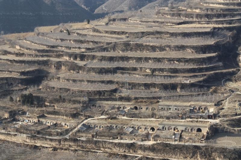
A Terrace is a structural SLM practice with a raised flat platform built on the slope to reduce soil loss and runoff on the slope, increase the rainfall infiltration and yield.
2.2 Технологийн дэлгэрэнгүй тодорхойлолт
Тодорхойлолт:
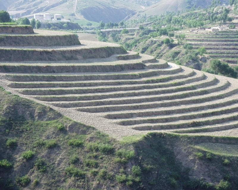
A terrace is a leveled section of a hilly cultivated area, designed as a method of soil conservation to slow or prevent the rapid surface runoff and erosion of topsoil. Often such land is formed into multiple terraces, giving a stepped appearance.
Purpose of the Technology: To change the landform for better agricultural condition of operation of tillage and harvasting, reduction of soil erosion and water loss and finally for higher production.
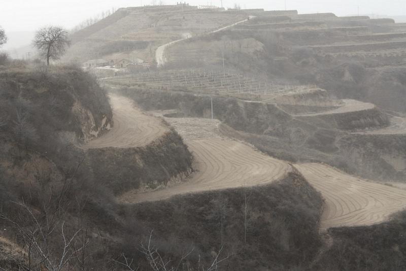
Establishment / maintenance activities and inputs: The building of a terrace in the loess plateau takes long because loess is very soft and deep and the severe soil erosion and shortage of water in agriculture hinders the process, as well. Previously, terraces were constructed by hand. These terraces weres narrow and damaged by the great storms. Now, the machinery is used to build wide terrace with high bank size in the loess plateau. The establishment of terrace needs a lot of money but it is a long-term investment. The maintenance of terrace is considerable economic because the major efforts are the annually improvment of terrace bunds.
Natural / human environment: The soil erosion is very severe because of the cohesionless loess soil and very intensive rainfall storms in the summer and autumn that would destroy the land surface into broken hilly area. Terrace is a kind of measure to resolve it combining with crops. The human activities here is very intensive because they must plant on the slopes that would make the soil erosion greater.
2.3 Технологийн гэрэл зураг
Медиа галерей
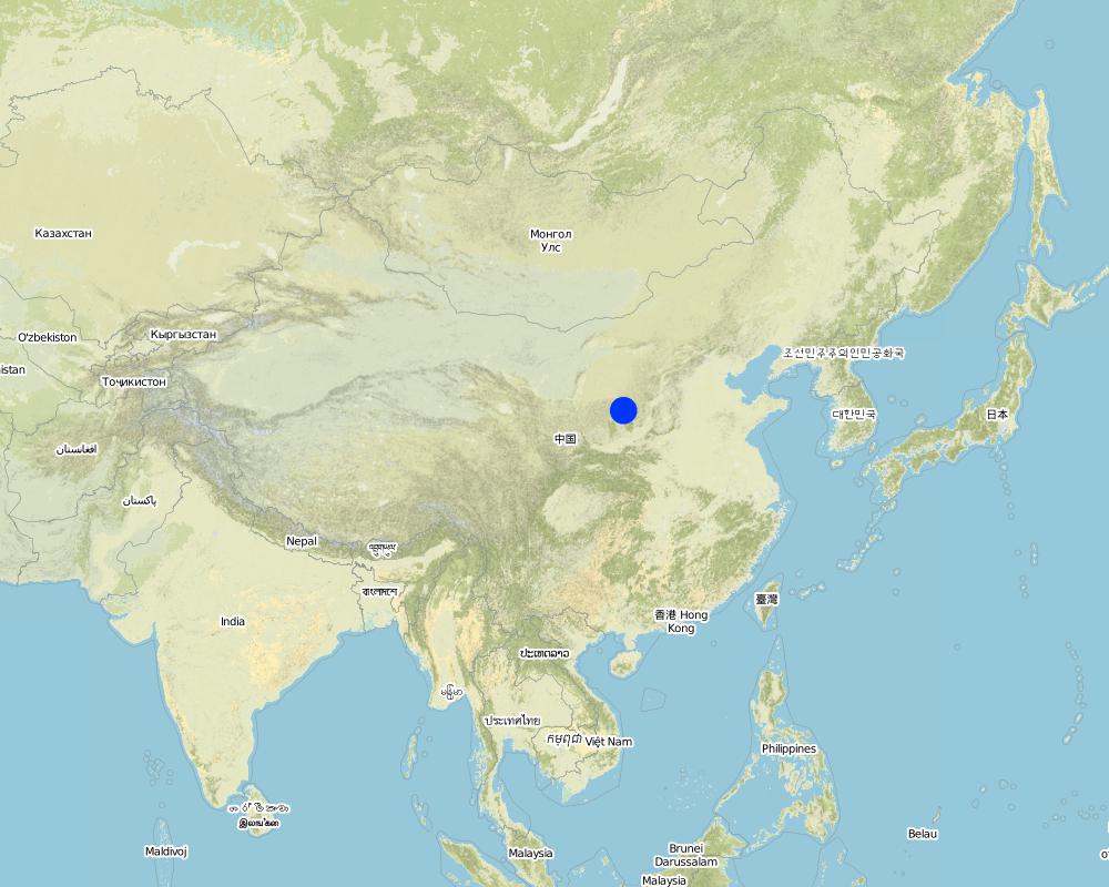
2.5 Энэ үнэлгээнд хамрагдсан технологийг хэрэгжүүлсэн улс орон/ бүс нутаг/ байршил
Улс:
Хятад
Улс/аймаг/сум:
Shaanxi Province
Байршлын дэлгэрэнгүй тодорхойлолт:
Yanhe River Basin
Технологи өргөн дэлгэрсэн эсхийг тодорхойл:
- газар дээр жигд тархсан
Технологи газар нутгийн хэмжээнд жигд тархсан бол түүний эзлэх талбайг тодорхойлно уу (км2-аар):
253.3
Тайлбар:
Total area covered by the SLM Technology is 253.3 km2.
The total area with different measures is till to 2000. Yanhe River is a first class branch of Yellow River, China. The average channel slope is 3.26‰, and the area of whole basin is 7,687 km2. It is in the semi-arid North Temperate Zone with an average annual precipitation varying from 500 to 550 mm, and an average annual air temperature ranging from 8.5 to 11.4℃. It is in hilly gully area of the Loess Plateau covered by loess. The landform is seriously broken by cutting gullies induced by water erosion. The gully density (the length of channel in one km2) is amount to 2.1 to 4.6 km•km-2. The soil loss is severe all along.
The Ganguyi Hydrology Station (109°48′E, 36°42′N) located in the Ganguyi Town, Baota Country, Yan’an City, Shaanxi Province. The area up Ganguyi Hydrology Station is 5,891 km2, including of Jingbian County(256km2), Zhidan County(708km2), Ansai County(2,699km2) and Baota County(2,228km2). The average annual runoff is 0.22 billion m3, and the runoff modulus accounting for 4,776.36 m3•km-2•yr-1. The average annual sediment flow is 4.776
Map
×2.6 Хэрэгжсэн хугацаа
Байгуулсан тодорхой оныг мэдэхгүй бол баримжаа хугацааг тодорхойл:
- >50 жилийн өмнө (уламжлалт)
2.7 Технологийн танилцуулга
Технологийг хэрхэн нэвтрүүлснийг тодорхойл:
- Уламжлалт системийн хэсэг (> 50 жил)
Тайлбар (төслийн төрөл г.м.):
The terrace in this site has been formed since 1994 with machinery. The land is quite wide and large enough for agriculture in the hilly loess region,
3. ГТМ технологийн ангилал
3.1 Технологийн үндсэн зорилго (ууд)
- газрын доройтлыг бууруулах, сэргийлэх, нөхөн сэргээх
3.2 Технологи нэвтрүүлсэн газрын одоогийн газар ашиглалтын хэлбэр(үүд)
Нэг газр нутгийн хэмжээнд хэрэгжих холимог газар ашиглалт:
Тийм
Газар ашиглалтын холимог тогтолцоог (тарилан/бэлчээр/ой мод) тодорхойл:
- ХАА-н ойжуулалт

Тариалангийн талбай
- Нэг наст үр тариа
- Олон наст (модлог биш) үр тариа
- Мод, сөөг тарих
Нэг наст үр тариа - Таримлыг тодорхойлно уу:
- үр тариа - эрдэнэ шиш
- үр тариа - шар будаа
- цэцэгс
- тэжээлийн ургамал - царгас
- буурцагт ургамал - шош
- тосны ургамал - наран цэцэг, рапс ба бусад
- үндэст/булцуут ургамал– төмс
- хүнсний ногоо - бусад
Мод, бут тариалах - Таримлыг тодорхойлно уу:
- хасарваань
- жимс (алим, лийр г.м.)
Жилд ургамал ургах улирлын тоо:
- 1
Тодорхойлно уу:
Longest growing period in days: 300Longest growing period from month to month: March to NovemberSecond longest growing period in days: 200Second longest growing period from month to month: April to October
Тайлбар:
Main cash crops: Beans, sunflower, apple, Chinese date, alfalfa
Main food crops: Potato, millets, maize, buckwheat
other crops: vegetable
Major land use problems (compiler’s opinion): Soil and water losses are alarming in this region. The loose loess, steep slopes, and intensive storms in the summer and autumn, accelerates this process. Aditionally, the lack of rainfall negatively impacts agriculture and vegatation. Sediment deposition could increase the river bed and diminish capacity of reservoirs. On one hand side floods occur frequently because of fast and large runoff and on other hand side sedimentation in rivers reduce their water carring capacity.
Major land use problems (land users’ perception): The low yield of crops and the low income from land is more important for the local people. It is necessary to improve the agricultural conditions. The land, especially the tableland and gentle slope land could be convert into terrace.
Future (final) land use (after implementation of SLM Technology): Cropland: Ca: Annual cropping
Type of cropping system and major crops comments: The composation of agriculture is very simple here.
Livestock is grazing on crop residues
3.3 Технологи хэрэгжүүлснээр газар ашиглалтад өөрчлөлт гарсан уу?
Технологи хэрэгжүүлснээр газар ашиглалтад өөрчлөлт гарсан уу?
- Тийм (Технологи хэрэгжүүлэхээс өмнөх үеийн газар ашиглалтын талаархи асуулгыг бөглөнө үү)

Бэлчээрийн газар
- Intensive grazing/ fodder production
3.4 Усан хангамж
Технологи хэрэгжүүлсэн газрын усан хангамж:
- Байгалийн усалгаатай
3.5 Технологи ГТМ-ийн аль бүлэгт хамаарах вэ
- Налуугийн арга хэмжээ
3.6 Технологийг бүрдүүлэх ГТМ арга хэмжээ

Ургамлын арга хэмжээ
- V2: Өвс ба олон наст өвслөг ургамал

Барилга байгууламжийн арга хэмжээ
- S1: Террас

Менежментийн арга хэмжээ
- М1: Газар ашиглалтын хэлбэрийг өөрчлөх
Тайлбар:
Main measures: structural measures
Secondary measures: vegetative measures, management measures
Type of vegetative measures: aligned: -along boundary
3.7 Технологид харгалзах газрын доройтлын төрөл

хөрс усаар эвдрэх
- Wt: Хөрсний гадаргын угаагдал

усны доройтол
- Hs: Гадаргын усны хэмжээ багасах
- Hw: Ус намгархаг газрын буферлэх буюу хаах чадвар багасах
Тайлбар:
Main type of degradation addressed: Wt: loss of topsoil / surface erosion
Secondary types of degradation addressed: Hs: change in quantity of surface water, Hw: reduction of the buffering capacity of wetland areas
Main causes of degradation: deforestation / removal of natural vegetation (incl. forest fires) (The natural vegetation in this region is grass on theslope and trees on the gully and alluvial land. After the destroy of natural, the soil loss increases greatly.), Heavy / extreme rainfall (intensity/amounts) (About 70% of annual rainfall is in the summer and autumn. The storm is very intensive.), population pressure (The population density account for 71 capita per square km.)
Secondary causes of degradation: droughts (The rainfall varies greatly in different year and different seasons. The drought happened frenquently.)
3.8 Газрын доройтлоос урьдчилан сэргийлэх, сааруулах ба нөхөн сэргээх
Газрын доройтолтой холбоотойгоор Технологи ямар зорилго тавьсан болохыг тодорхойл:
- Газрын доройтлыг бууруулах
Тайлбар:
Main goals: mitigation / reduction of land degradation
4. Техникийн нөхцөл, хэрэгжүүлсэн үйл ажиллагаа, материал ба зардал
4.1 Технологийн техник зураг
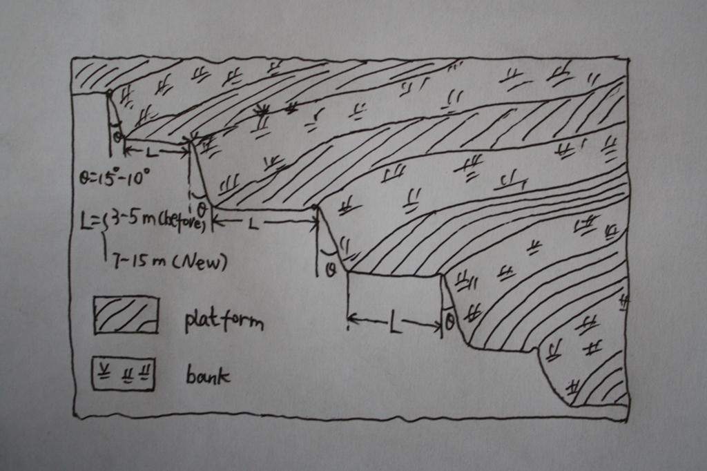
Техник тодорхойлолт (техник зургийн тайлбар):
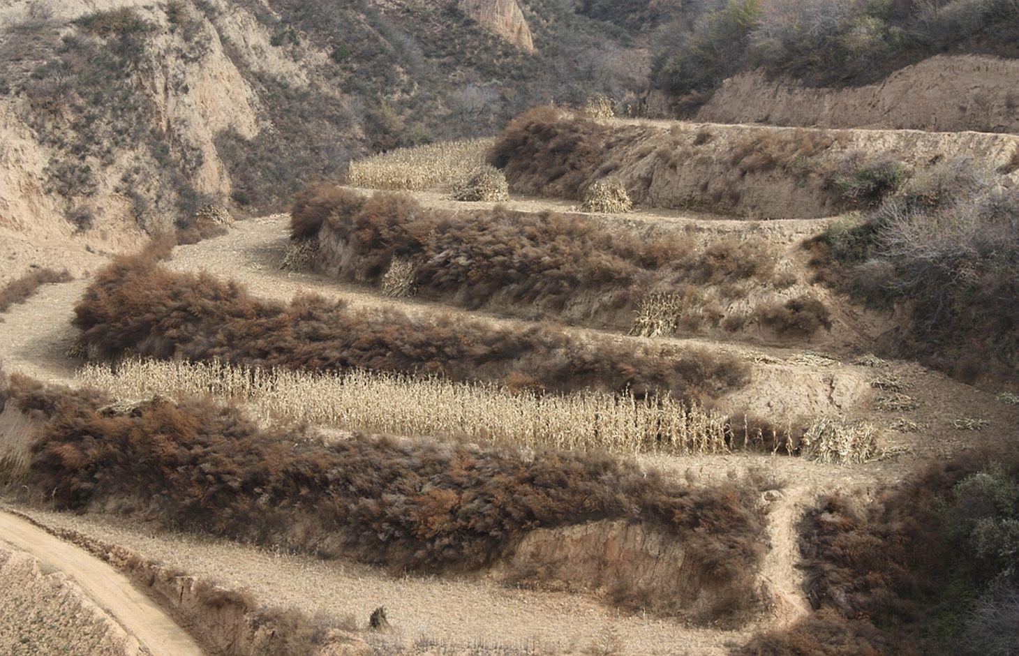
The brief structure of terrace in the Yanhe River Basin.
Location: Zhifanggou Watershed. Ansai County, Shaanxi, China
Date: 2008-12-15
Technical knowledge required for field staff / advisors: low (The location selection and how to build a good terrace need special knowledge on soil engineering.)
Technical knowledge required for land users: moderate (It is easy to know the benefit for all the local farmers.)
Main technical functions: control of concentrated runoff: retain / trap, reduction of slope angle, increase of infiltration
Secondary technical functions: increase / maintain water stored in soil, improvement of water quality, buffering / filtering water, increase of biomass (quantity)
Aligned: -along boundary
Vegetative material: G : grass
Number of plants per (ha): 50000
Vertical interval between rows / strips / blocks (m): 2.5
Spacing between rows / strips / blocks (m): 0.5
Grass species: Natural grass to protect the bank of terrace.
Slope (which determines the spacing indicated above): 20.00%
If the original slope has changed as a result of the Technology, the slope today is (see figure below): 2.00%
Gradient along the rows / strips: 1.00%
Terrace: bench level
Vertical interval between structures (m): 2.5
Spacing between structures (m): 8
Height of bunds/banks/others (m): 2.5
Width of bunds/banks/others (m): 8
Length of bunds/banks/others (m): 50-100
Construction material (earth): The terrace in the Loess Plateau are used local soil/earth directly.
Slope (which determines the spacing indicated above): 30%
If the original slope has changed as a result of the Technology, the slope today is: 30-60%
Lateral gradient along the structure: 2%
Vegetation is used for stabilisation of structures.
Change of land use type: Wild grassland or range land before mostly. Some time the cropland on the slope.
Change of land use practices / intensity level: The labor is less intensive on the plain platform.
Зохиогч:
Wang Fei, Yangling, Shaanxi, China
4.2 Материал болон зардалд хамаарах ерөнхий мэдээлэл
Үнэ өртөгийг тооцоход ашигласан мөнгөн нэгж:
- Ам.доллар
Хэрэв боломжтой бол үндэсний валютын Америк доллартай харьцах харьцааг бичнэ үү (тухайлбал, 1 ам.дол. = 79,9 Бразил реал): 1 ам.дол. =:
0.83
Хөлсний ажилчны нэг өдрийн цалингийн хэмжээг тодорхойлно уу:
8.8
4.3 Бий болгох үйл ажиллагаа
| Үйл ажиллагаа | Хугацаа (улирал) | |
|---|---|---|
| 1. | Survey and design | Before construction |
| 2. | Move the topsoil to other place | 1st step of construction |
| 3. | Built the platform and bank with soil digged | 2nd step of construction |
| 4. | Backcover the topsoil on the surface of platform | 3rd step of construction |
| 5. | Check and accept the terrace | After the terrace finished |
4.4 Бий болгоход шаардагдсан зардал, хөрөнгийн өртөг
| Зардлын нэр, төрөл | Хэмжих нэгж | Тоо хэмжээ | Нэгжийн үнэ | Зардал бүрийн нийт өртөг | Нийт дүнгээс газар ашиглагчийн төлсөн % | |
|---|---|---|---|---|---|---|
| Хөдөлмөр эрхлэлт | Survey and design | Person/day | 45.0 | 8.8 | 396.0 | 100.0 |
| Хөдөлмөр эрхлэлт | Building terraces (machine price included) | Person/day | 75.0 | 19.0 | 1425.0 | 100.0 |
| Технологи бий болгох нийт үнэ өртөг | 1821.0 | |||||
| Технологи бий болгох нийт үнэ өртөг, ам.доллар | 2193.98 | |||||
Тайлбар:
Duration of establishment phase: 0.5 month(s)
4.5 Арчилгаа/ урсгал үйл ажиллагаа
| Үйл ажиллагаа | Хугацаа/ давтамж | |
|---|---|---|
| 1. | Reinforce the bank | annually |
| 2. | Fill the erosion hole of the landform | annually |
| 3. | Build the edge in some terraces | annually |
| 4. | Reinforce the bank | annually |
| 5. | Fill the erosion hole of the landform | annually |
| 6. | Build the edge in some terraces | annually |
4.6 Арчилгаа/урсгал ажилд шаардагдсан зардал, хөрөнгийн өртөг (нэг жилд)
| Зардлын нэр, төрөл | Хэмжих нэгж | Тоо хэмжээ | Нэгжийн үнэ | Зардал бүрийн нийт өртөг | Нийт дүнгээс газар ашиглагчийн төлсөн % | |
|---|---|---|---|---|---|---|
| Хөдөлмөр эрхлэлт | Keep Terraces in shape | Person/day | 30.0 | 8.8 | 264.0 | 100.0 |
| Технологийн арчилгаа/урсгал үйл ажиллагаанд шаардагдах нийт үнэ өртөг | 264.0 | |||||
| Технологи арчилах ба урсгал ажлын нийт үнэ өртөг, ам.доллар | 318.07 | |||||
Тайлбар:
Machinery/ tools: Crawl dozer and small traditional hand tool., crawler tractor, spade
In general condition, slope and soil, in the middle reaches of Yan River Basin. The prices of labour-day and Machine-hour are around 2005.
4.7 Зардалд нөлөөлж байгаа хамгийн чухал хүчин зүйл
Өртөг, зардалд нөлөөлөх гол хүчин зүйл:
The terrace on the steep slope need more input for more soil and earth should be moved. It is the most important factor.The soil depth is not so important for the deep soil layer here.The cost of labour increases greatly in the last several years and the cost of construction of terrace increased.
5. Байгаль ба нийгмийн нөхцөл
5.1 Уур амьсгал
Жилийн нийлбэр хур тундас
- < 250 мм
- 251-500 мм
- 501-750 мм
- 751-1,000 мм
- 1,001-1,500 мм
- 1,501-2,000 мм
- 2,001-3,000 мм
- 3,001-4,000 мм
- > 4,000 мм
Хур тунадасны талаархи тодорхойлолт/ тайлбар:
The mean annual rainfall in the basin is 515.2 mm in the duration from 1952 to 2000. The rainfall from May to Oct accounts for 446.8 mm, up to 86.7%; and that from Jun to Sep accounts for 367.6 mm, up
Агро-уур амьсгалын бүс
- хагас хуурай
Thermal climate class: temperate. The accumulating time that temperature above 0 ℃ about 3800 hours, and that above 10 ℃ is more than 3200 hours.
5.2 Гадаргын хэлбэр
Дундаж налуу:
- хавтгай (0-2 %)
- бага зэрэг налуу (3-5 %)
- дунд зэрэг налуу (6-10 % )
- хэвгий (11-15 %)
- налуу (16-30 %)
- их налуу (31-60 % )
- эгц налуу (>60 %)
Гадаргын хэлбэр:
- тэгш өндөрлөг / тал
- нуруу
- уулын энгэр
- дов толгод
- бэл
- хөндий
Өндрийн бүслүүр:
- 0-100 д.т.д. м.
- 101-500 д.т.д. м.
- 501-1,000 д.т.д м.
- 1,001-1,500 д.т.д м.
- 1,501-2,000 д.т.д м.
- 2,001-2,500 д.т.д. м.
- 2,501-3,000 д.т.д. м.
- 3,001-4,000 д.т.д м.
- > 4,000 д.т.д. м.
Технологи дараах асуудалд хандсан эсэхийг тодорхойл:
- гүдгэр нөхцөл
Гадаргын талаархи тодорхойлолт ба бусад тайлбар:
Landforms also: mountain slopes and hill slopes
Slopes on average also very steep
5.3 Хөрс
Хөрсний дундаж зузаан:
- маш нимгэн (0-20 см)
- нимгэн (21-50 см)
- дунд зэрэг зузаан (51-80 см)
- зузаан (81-120 cм)
- маш зузаан (>120 cм)
Хөрсний бүтэц (өнгөн хөрс):
- дундаж (элсэнцэр, шавранцар)
Өнгөн хөрсөнд агуулагдах ялзмаг:
- бага (<1 % )
Боломжтой бол хөрсний бүрэн тодорхойлолт, боломжит мэдээллийг өгнө үү, жишээ нь хөрсний төрөл, хөрсний урвалын орчин/хүчиллэг байдал, катион солилцох чадавхи, азотын хэмжээ, давсжилт г.м.
Soil texture: There are more than 50% soil particle are fine sand with size between 0.05 and 0.1 mm.
Soil fertility very low: Lack of N, P and SOM.
Topsoil organic matter: The average Top-SOM of cropland is about 0.05%
Soil drainage / infiltration good: The inflitration of Loess is very fast, but it is prone to sealing when flashing.
Soil water storage capacity low: It is easy to evaporation and drainage.
5.4 Усны хүртээмж ба чанар
Гүний усны түвшин:
5-50 м
Гадаргын усны хүртээмж:
дунд зэрэг
Усны чанар (цэвэршүүлээгүй):
муу чанарын ундны ус (цэвэршүүлэх шаардлагатай)
Усны чанар, нөөцийн талаархи тайлбар ба бусад тодорхойлолт:
Availability of surface water medium: It is very stable in this region.
Availability of surface water also poor/none: Nearly all the branches of Yanhe are seasonal river.
Ground water table: It depends on the landform. In valley and alluvial land, it is shallow.
Water quality: Good quality for there are few pollution sources.
5.5 Биологийн олон янз байдал
Зүйлийн олон янз байдал:
- дунд зэрэг
Биологийн олон янз байдлын талаархи тайлбар ба бусад тодорхойлолт:
It is very stable in this region.
5.6 Технологи нэвтрүүлсэн газар ашиглагчдын тухай мэдээлэл
Үйлдвэрлэлийн системийн зах зээлийн чиг баримжаа:
- холимог (амьжиргаа ба худалдаанд)
- худалдаа наймааны/ зах зээлийн
Бусад эх үүсвэрээс олох орлого:
- Нийт орлогын 10-50 %
Чинээлэг байдлын түвшин:
- дундаж
Хувь хүн эсвэл бүлэг:
- Хувь хүн / өрх
Механикжилтын түвшин:
- гар ажил
- ердийн хөсөг
Хүйс:
- эмэгтэй
- эрэгтэй
Газар ашиглагчдын бусад шинж чанарыг тодорхойл:
Land users applying the Technology are mainly common / average land users
Difference in the involvement of women and men: No clear difference.
Population density: 50-100 persons/km2
Annual population growth: < 0.5%
80% of the land users are average wealthy (The terrace are build together in some villages for all the people funded by national subsidy.).
Off-farm income specification: The yield of terrace is much high and stable.
Level of mechanization manual work: The harvesting and other management are by hand, even the tillage on the nerrow terrace
Level of mechanization animal traction: Tillage with animal power mostly in the wider terrace.
Market orientation mixed subsistence/ commercial: Some production for themselves, but most of production is exchanged on the market.
5.7 Газар ашиглагчийн технологи нэвтрүүлсэн газрын дундаж талбайн хэмжээ
- < 0.5 га
- 0.5-1 га
- 1-2 га
- 2-5 га
- 5-15 га
- 15-50 га
- 50-100 га
- 100-500 га
- 500-1,000 га
- 1,000-10,000 га
- > 10,000 га
Энэ талбай том, жижиг, дунд алинд хамаарах вэ (орон нутгийн нөхцөлд харгалзуулна уу)?
- бага-хэмжээний
Тайлбар:
According to 0.054 ha per capita.
5.8 Газар эзэмшил, газар ашиглах эрх, ус ашиглах эрх
Газар өмчлөл:
- төрийн
- нэгдлийн/ тосгон
Газар ашиглах эрх:
- хувь хүн
Ус ашиглах эрх:
- нээлттэй хүртэх (зохион байгуулалтгүй)
Тайлбар:
Like other rural area in China.
5.9 Дэд бүтэц, үйлчилгээний хүртээмж
эрүүл мэнд:
- ядуу
- дунд зэргийн
- сайн
боловсрол:
- ядуу
- дунд зэргийн
- сайн
хөдөлмөр эрхлэлт (жишээ нь, ХАА-аас өөр):
- ядуу
- дунд зэргийн
- сайн
зам тээвэр:
- ядуу
- дунд зэргийн
- сайн
усан хангамж ба ариутгал:
- ядуу
- дунд зэргийн
- сайн
санхүүгийн үйлчилгээ:
- ядуу
- дунд зэргийн
- сайн
6. Үр нөлөө ба дүгнэлт
6.1 Технологийн талбайд үзүүлсэн нөлөө
Нийгэм-эдийн засгийн үр нөлөө
Үйлдвэрлэл
газар тариалангийн үйлдвэрлэл
ГТМ хэрэгжихээс өмнөх тоо хэмжээ:
600
ГТМ хэрэгжиснээс хойшхи тоо хэмжээ:
2200
малын бүтээмж
модлогийн бүтээмж
бүтээмж буурах эрсдэл
бүтээгдэхүүний олон янз хэлбэр
үйлдвэрлэлийн газар
Усны хүртээмж ба чанар
ундны усны хүрэлцээ
ундны усны чанар
Орлого, зарлага
тухайн аж ахуйн орлого
ГТМ хэрэгжихээс өмнөх тоо хэмжээ:
43.9
ГТМ хэрэгжиснээс хойшхи тоо хэмжээ:
120
орлогын олон янз эх үүсвэр
ажлын хэмжээ
Нийгэм-соёлын үр нөлөө
хүнсний аюулгүй байдал/ өөрийн хэрэгцээг хангах
маргааныг шийдвэрлэх
Livelihoods and human well-being
Экологийн үр нөлөө
Усны эргэлт/ илүүдэл
ус хураах / цуглуулах
гадаргын урсац
ууршилт
Тайлбар/ тодорхой дурьдах:
Evaporation form the wall of terrace, Especially for the narrow terrace
Хөрс
хөрсний чийг
Тайлбар/ тодорхой дурьдах:
More inflitration of rainfall, but the evaporation near to the wall increases
хөрсөн бүрхэвч
хөрс алдагдах
ГТМ хэрэгжихээс өмнөх тоо хэмжээ:
10000t/km^
ГТМ хэрэгжиснээс хойшхи тоо хэмжээ:
2000t/km^2
Биологийн олон янз байдал: ургамал, амьтан
газрын дээрхи / доорхи карбон
ургамлын төрөл, зүйл
Экологийн бусад үр нөлөө
Hazards towards adverse events
6.2 Технологийн талбайн гадна үзүүлсэн үр нөлөө
хуурай улиралд ашиглах найдвартай, тогтвортой урсац
голын адагт үерлэх
голын адагт лаг шавар хуримтлагдах
буферлэх / шүүлтүүрийн багтаамж
салхиар тээвэрлэгдэх хурдас
хөрш зэргэлдээ газарт учирах хохирол
нийтийн/хувийн хэвшлийн дэд бүтцэд учрах хохирол
6.3 Технологийн уур амьсгалын өөрчлөлт, цаг агаарын гамшигт үзэгдэлд өртөх байдал ба эмзэг байдал (газар ашиглагчийн бодлоор)
Уур амьсгалын аажим өөрчлөлт
Уур амьсгалын аажим өөрчлөлт
| Улирал | Өсөх эсвэл буурах | Технологи түүний нөлөөг хэрхэн бууруулж байна? | |
|---|---|---|---|
| жилийн дундаж температур | Өсөлт | сайн |
Уур амьсгалаас хамаарах аюул (гамшиг)
Цаг уурын гамшигт үзэгдэл
| Технологи түүний нөлөөг хэрхэн бууруулж байна? | |
|---|---|
| орон нутгийн аадар бороо | муу |
| орон нутгийн салхин шуурга | сайн |
Уур амьсгалын гамшиг
| Технологи түүний нөлөөг хэрхэн бууруулж байна? | |
|---|---|
| ган гачиг | мэдэхгүй |
Усзүйн гамшиг
| Технологи түүний нөлөөг хэрхэн бууруулж байна? | |
|---|---|
| усны үер (гол) | сайн |
Уур амьсгалд хамаарах бусад үр дагавар
Уур амьсгалд хамаарах бусад үр дагавар
| Технологи түүний нөлөөг хэрхэн бууруулж байна? | |
|---|---|
| цргалтын хугацаа багасах | мэдэхгүй |
Тайлбар:
Loess is very prone to erosion and extreme storms would destory the bank of terrace. In the study site sesonal rainfall increased and the loess terrace could retain more soil water and reduce the runoff.
6.4 Өртөг ба ашгийн шинжилгээ
Бий болгох зардалтай харьцуулахад ямар ашиг өгсөн бэ (газар ашиглагчийн бодлоор)?
Богино хугацаанд эргэн төлөгдөх байдал:
бага зэрэг эерэг
Урт хугацаанд эргэн төлөгдөх байдал:
эерэг
Арчилгаа/урсгал зардалтай харьцуулахад ямар ашиг өгсөн бэ (газар ашиглагчийн бодлоор)?
Богино хугацаанд эргэн төлөгдөх байдал:
бага зэрэг эерэг
Урт хугацаанд эргэн төлөгдөх байдал:
маш эерэг
Тайлбар:
The yield of terrace is stable and relative higher. The income from terrace is high and the maintain cost is low.
6.5 Технологи нэвтрүүлэлт
- 1-10 %
Боломжтой бол, тоогоор илэрхийл (өрхийн тоо эсвэл бүрхэх талбай):
100 households
Технологи нэвтрүүлсэн хүмүүсээс хэд нь өөрийн хүчээр технологийг хэрэгжүүлсэн бэ, өөрөөр хэлбэл гадны тусламж дэмжлэг авалгүйгээр?
- 0-10%
Тайлбар:
90% of land user families have adopted the Technology with external material support
95 land user families have adopted the Technology with external material support
Comments on acceptance with external material support: Most land farmers have some terrace. I do not know the exact number of land user families who adopted the technology.
10% of land user families have adopted the Technology without any external material support
5 land user families have adopted the Technology without any external material support
Comments on spontaneous adoption: the old narrow terraces, now a very small area left, are build voluntarily.
There is a strong trend towards spontaneous adoption of the Technology
Comments on adoption trend: Nearly all the people know the benefit of terrace. the benefits of terraces are very good for crops and orchards are high enough in this region.
6.7 Технологийн давуу тал/боломжууд
| Газар ашиглагчдын тодорхойлсон давуу тал/боломжууд |
|---|
|
Increase yield and income. How can they be sustained / enhanced? If the terrace is maintained well, the water condition would be better than that on the slope land even in dry year with low precipitation. |
|
Convenient to till and harvest How can they be sustained / enhanced? Tillage and harvesting is much easier on the plain flat land than on the slope. The maintainance of terrace is important. |
| Эмхэтгэгч, бусад мэдээлэл өгсөн хүмүүсийн өнцгөөс тодорхойлсон давуу тал/боломжууд |
|---|
|
Reduce soil erosion on the slope. How can they be sustained / enhanced? The loess soil is prone to erosion because of its loose character induced by fine sand content and low soil organic matter. The plain flat makes the dispersion and transportation of soil particls difficult. |
|
Reduce runoff and increase the soil moisture How can they be sustained / enhanced? The runoff generation is smaller on the plain than on the slope. Slow movement of surface water lead to more soil infiltration. |
|
Increase yield. How can they be sustained / enhanced? Water is the limit factor in the loess plateau. The yield would increase if there is enough water available. |
|
Decrease flood risk. How can they be sustained / enhanced? It is a kind of off-site benefits because less runoff generation and gentle process of runoff decrease flooding. Reduction of sediment also diminish flood risk because the drainage capacity of channel and adjusting capacity of reservior increase when sedimentation decrease. |
6.8 Технологийн дутагдалтай/сул тал/аюул болон тэдгээрийг хэрхэн даван туулах арга зам
| Газар ашиглагч нарын тодорхойлсон сул тал/ дутагдал/ эрсдэл | Тэдгээрийг хэрхэн даван туулах вэ? |
|---|---|
| The output is also low in contrast with other industries. | No way to overcome it. The total and net income is too low because the area of terrace per capita is very small. |
| The income is relative compared with other industries. | No way to overcome it. The net income is low because the labour costs are increasing, and the total income because labour cost and very small area of terrace per capita. |
| Эмхэтгэгч, бусад мэдээлэл өгсөн хүмүүсийн өнцгөөс тодорхойлсон сул тал/ дутагдал/ эрсдэл | Тэдгээрийг хэрхэн даван туулах вэ? |
|---|---|
| There is possible damage of terraces because the loess is very loosen and prone to collapse. | Keep upmaintaining the bank and land well. |
| Decrease runoff of lower stream. | No way to overcome it, but it also could decrease the risk of floods. |
7. Ном зүй ба холбоосууд
7.1 Мэдээлэл цуглуулсан арга/эх үүсвэр
7.2 Ном, хэвлэлийн ишлэл
Гарчиг, зохиогч, он, ISBN:
Soil and water conservation records of Shaanxi Province. 2000. Shaanxi People's Press, Xi'an City, China
Хаанаас авч болох вэ? Зардал?
Library of ISWC, CAS
Гарчиг, зохиогч, он, ISBN:
The soil and agriculture of the Loess Plateau. 1989. Zhu Xianmo, Agriculture Press, Beijing City, China
Хаанаас авч болох вэ? Зардал?
Library of ISWC, CAS
Гарчиг, зохиогч, он, ISBN:
Statistical tearbook of Yan'an. 2003. Compiled by Editorial Board of Statistical tearbook of Yan'an
Хаанаас авч болох вэ? Зардал?
Library of ISWC, CAS
Гарчиг, зохиогч, он, ISBN:
Impact of human activities on runoff and sediment change of Yanhe River based on the periods divided by sediment concentration. 2008. WANG Fei , MU Xing-min ,JIAO Ju-ying, LI Rui. Journal of Sediment Research
Хаанаас авч болох вэ? Зардал?
http://159.226.100.28/asp/Detail.asp
Гарчиг, зохиогч, он, ISBN:
Changes of soil erosion intensity due to conversion of farmland to forest and grassland in Yanhe River. 2007. BasinWang Bangwen, yang Qinke, Liu Zhihong, Meng Qingxiang, Science of Soil and Water Conservation
Хаанаас авч болох вэ? Зардал?
http://159.226.100.28/asp/Detail.asp
Холбоос ба модулууд
Бүгдийг дэлгэх Бүгдийг хаахХолбоосууд
Холбоос байхгүй байна
Модулууд
Модуль байхгүй байна