High-quality inner urban development [Alemanha]
- Criação:
- Atualização:
- Compilador/a: Johanna Fick
- Editor: –
- Revisores: Fabian Ottiger, David Streiff, Alexandra Gavilano
Qualitätsvolle Innenentwicklung (German)
technologies_1698 - Alemanha
Veja as seções
Expandir tudo Recolher tudo1. Informação geral
1.2 Detalhes do contato das pessoas capacitadas e instituições envolvidas na avaliação e documentação da tecnologia
Especialista em GST:
Hoymann Jana
Federal Institute for Research on Building, Urban Affairs and Spatial Development (BBSR)
Alemanha
Especialista em GST:
Goetzke Roland
Federal Institute for Research on Building, Urban Affairs and Spatial Development (BBSR)
Alemanha
Nome do projeto que facilitou a documentação/avaliação da Tecnologia (se relevante)
Book project: Making sense of research for sustainable land management (GLUES)Nome do projeto que facilitou a documentação/avaliação da Tecnologia (se relevante)
Climate Change - Land Use Strategies (CC-LandStraD / GLUES)Nome da(s) instituição(ões) que facilitou(ram) a documentação/ avaliação da Tecnologia (se relevante)
Thünen Institute (Thünen Institute) - AlemanhaNome da(s) instituição(ões) que facilitou(ram) a documentação/ avaliação da Tecnologia (se relevante)
Federal Institute for Research on Building, Urban Affairs and Spatial Development (BBSR) - Alemanha1.3 Condições em relação ao uso da informação documentada através de WOCAT
O compilador e a(s) pessoa(s) capacitada(s) aceitam as condições relativas ao uso de dados documentados através do WOCAT:
Sim
1.5 Referência ao(s) questionário(s) sobre abordagens GST (documentado(s) usando WOCAT)
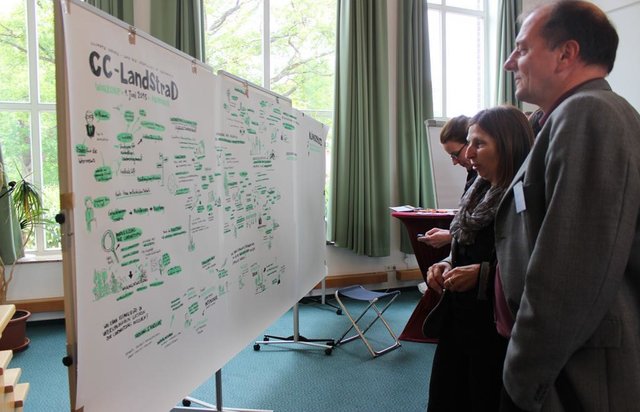
Open dialogue platform on sustainable land management [Alemanha]
Establishing a dialogue platform on sustainable land management which is open to all stakeholders
- Compilador/a: Johanna Fick
2. Descrição da tecnologia de GST
2.1 Descrição curta da tecnologia
Definição da tecnologia:
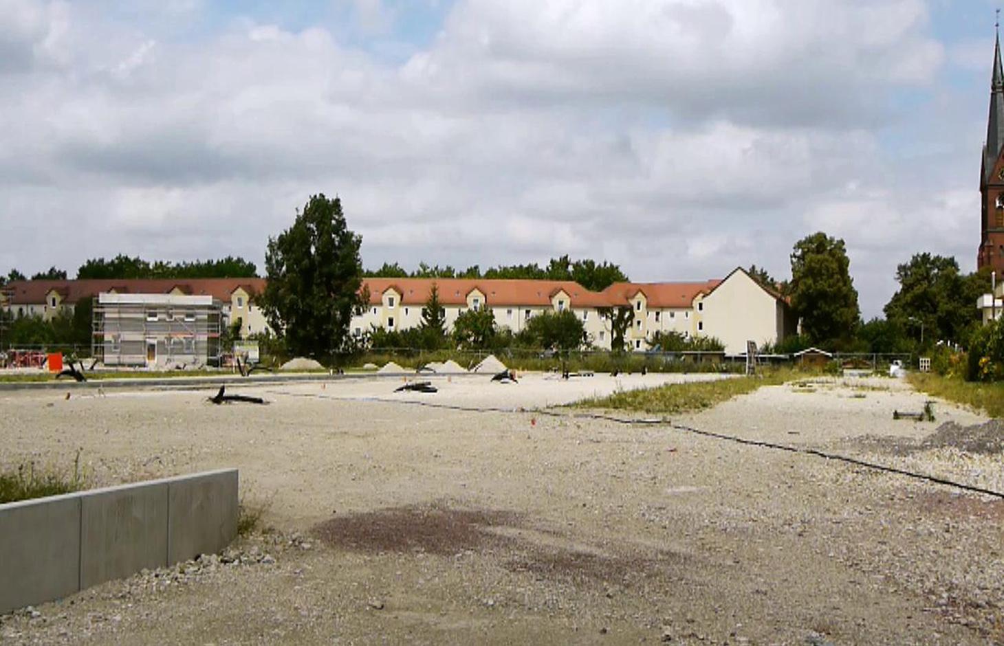
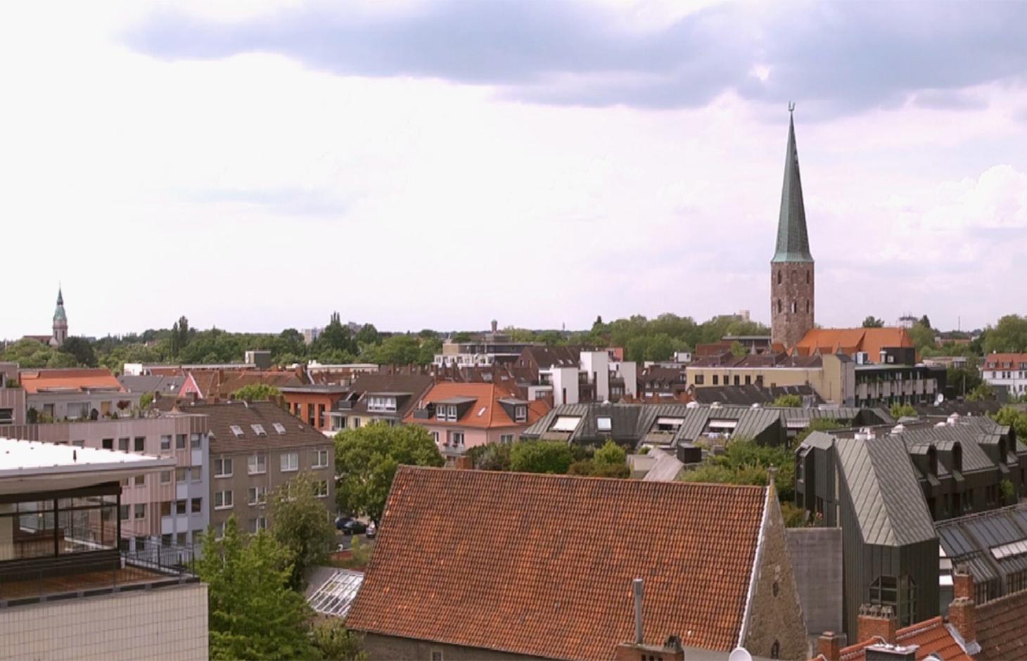
A scenario simulation of land use change where high-quality inner urban development is promoted, including the rehabilitation of brownfields, reuse of vacant lots, use of gaps between buildings and the improvement of existing structures.
2.2 Descrição detalhada da tecnologia
Descrição:
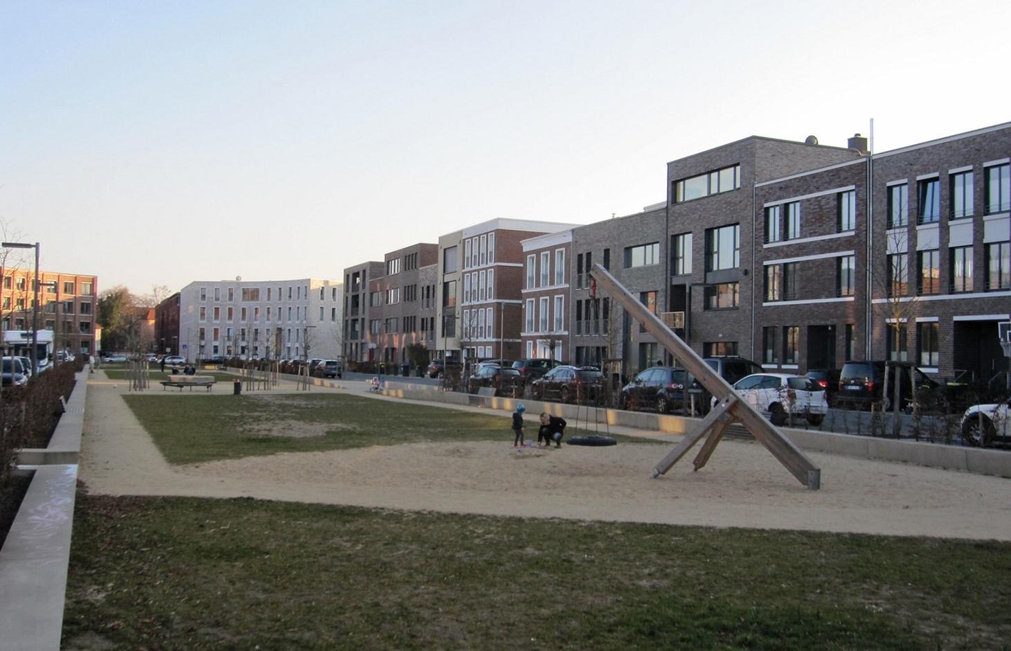
The best means of reducing land loss by settlement and infrastructure development is through fulfilling inner urban development potential. This “compact settlement development” makes the most efficient use of space. Simultaneously it contributes to the reduction of greenhouse gas emissions by the maintenance of farmland or forest areas on the outskirts of urban areas. One example is the rehabilitation and utilization of “brownfields”, including previous industrial areas. Another example is redevelopment of transportation infrastructure within settlements or on the urban fringe. However, the revitalization and utilization of brownfields is often expensive. Other aspects of inner urban development are the reuse of vacant lots, the use of spaces between buildings and the improvement of existing building structures by adding extra floors.
Purpose of the Technology: Through these developments, the rate of daily land consumption by settlement and transportation can be reduced. In Germany, such land loss reached 73 ha/day in 2010. According to a survey commissioned by the Federal Office for Building and Regional Planning, 20% of existing brownfields and vacant lots can be brought into use in the short term and another 50% of the total in the long term: 30% cannot be developed for various reasons including disputed tenure. The ambitious aim of the sustainability strategy of the German federal government is to reduce today’s daily land consumption for settlement and transport from the current 73 ha/day to 30 ha/day by 2020. However this appears unrealistic: nevertheless with high-quality inner urban development technology, this could be achieved by 2030. If the technology is planned and implemented through scenario simulation of sectoral land use changes in Germany (agriculture, forest and settlements), then calculations show that the daily land loss by settlement and transport could be reduced from 45 ha/day in a “business as usual” scenario (with some improvements assumed) to 30 ha/per day in 2030 by using high-quality inner urban development measures.
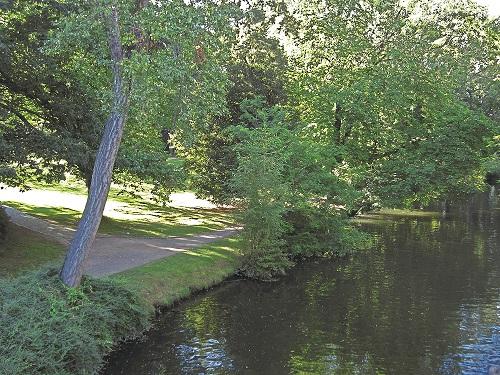
Establishment / maintenance activities and inputs: During re-densification of urban areas sufficient green spaces must be protected to address climate change considerations such as higher temperatures and more runoff. High urban densities lead to an increase in the “heat island effect” (a combination of extensive urban/ suburban landscapes with reduced air circulation, little cloud cover and long periods of high temperature). Thus, the rehabilitation of brownfields has to go along with the transformation of impervious surfaces into permeable ones, and planning of corridors for air exchange by “green and blue climate corridors” (public parks, ponds and rivers). There are several initiatives to establish high quality inner urban development in Germany. These include: 1) “Inner before external” urban development within the Federal Building Law; 2) Many communities operating a brownfields and vacant lots cadastre; 3) General management of urban areas. Nevertheless, the reuse of inner city brownfields often requires considerable and costly remediation of contaminated sites. Due to the ownership issues of vacant lots, many are not easily accessible through municipalities, and this complicates their development. In other cases, available construction areas or buildings are not appropriate to the needs of investors.
2.3 Fotos da tecnologia
Galeria de Mídias

2.5 País/região/locais onde a tecnologia foi aplicada e que estão cobertos nesta avaliação
País:
Alemanha
Região/Estado/Província:
Germany, North Rhine-Westphalia
Especificação adicional de localização:
Rheinisch-Bergischer Kreis and Rhein-Sieg-Kreis
Comentários:
Boundary points of the Technology area: 51.075063; 7.335960
51.164380; 7.251345
51.107561; 6.988673
50.816401; 7.674266
50.585640; 6.892780
50.793044; 6.867394
Total area covered by the SLM Technology is 1590 km2.
Technology is the result of a scenario simulation fow whole Germany but is mapped in the Rhine region as an example.The technology does not document a specific inner urban development project and the region mapped is an example. In some German cities inner urban development is a common land management measure but the amount of current inner-urban development cannot be quantified. The potential is estimated as 120000 to 165000 ha.
2.6 Data da implementação
Caso o ano exato seja desconhecido, indique a data aproximada:
- menos de 10 anos atrás (recentemente)
2.7 Introdução da tecnologia
Especifique como a tecnologia foi introduzida:
- através de projetos/intervenções externas
Comentários (tipos de projeto, etc.):
The technology documented here is a scenario simulation of land use change and not the realisation of a specific inner urban development project.
3. Classificação da tecnologia de GST
3.2 Tipo(s) atualizado(s) de uso da terra onde a tecnologia foi aplicada

Assentamentos, infraestrutura
Comentários:
Major land use problems (compiler’s opinion): Land use for settlement and transport leads to imperviousness, and a reduction of high quality agricultural areas. Sealed surfaces increase runoff during heavy rain events, and high building densities promote the development of urban heat islands.
Major land use problems (land users’ perception): In fast-growing regions, high demand requires the supply of additional land for construction.
Future (final) land use (after implementation of SLM Technology): Other: Oo: Other: wastelands, deserts, glaciers, swamps, recreation areas, etc
Type of cropping system and major crops comments: not applicable
Constraints of settlement / urban: Data availability for locations of brownfields, vacant lots and vacancies
Constraints of infrastructure network (roads, railways, pipe lines, power lines): Data availability for locations of brownfields, vacant lots and vacancies
Constraints of recreation: Data availability for locations of brownfields, vacant lots and vacancies
Constraints of brownfields: Data availability for locations of brownfields, vacant lots and vacancies
Number of growing seasons per year: 1
3.3 O uso do solo mudou devido à implementação da Tecnologia?
O uso do solo mudou devido à implementação da Tecnologia?
- Não (Continuar com a pergunta 3.4)
Assentamentos, infraestrutura
- Assentamentos, edificações
- Tráfego: estradas, ferrovias
Comentários:
Other: Os: Settlements, infrastructure networks
3.5 Grupo de GST ao qual pertence a tecnologia
- Compact settlement development
3.6 Medidas de GST contendo a tecnologia

Medidas de gestão
- M1: Mudança no tipo de uso da terra
- M2: Mudança de gestão/nível de intensidade
Comentários:
Main measures: management measures
3.7 Principais tipos de degradação da terra abordados pela tecnologia

Deteriorização física do solo
- Pk: quebra e ressecamento
- Pu: perda da função bioprodutiva devido a outras atividades

Degradação biológica
- Bh: perda dos habitats
- Bq: quantidade/ declínio da biomassa
Comentários:
Main type of degradation addressed: Pu: loss of bio-productive function due to other activities
Secondary types of degradation addressed: Pk: sealing and crusting, Bh: loss of habitats, Bq: quantity / biomass decline
Main causes of degradation: urbanisation and infrastructure development
Secondary causes of degradation: population pressure, inputs and infrastructure: (roads, markets, distribution of water points, other, …), governance / institutional
3.8 Redução, prevenção ou recuperação da degradação do solo
Especifique o objetivo da tecnologia em relação a degradação da terra:
- Reduzir a degradação do solo
Comentários:
Main goals: mitigation / reduction of land degradation
4. Especificações técnicas, implementação de atividades, entradas e custos
4.1 Desenho técnico da tecnologia
Especificações técnicas (relacionada ao desenho técnico):
Green and blue structure like parks, trees, alleys (green) and water areas like rivers, canals, ponds and lakes (blue) are relevant issues especially with respect to the climate adaptation
Technical knowledge required for scientific staff: high
Main technical functions: spatial arrangement and diversification of land use, reduces the loss of agricultural land and forests
Change of land use type: Brownfields are converted to settlement area. Agricultural area is conserved.
Change of land use practices / intensity level: Settlement density may increase with inner urban development.
Autor:
Johanna Fick
4.3 Atividades de implantação
| Atividade | Periodicidade (estação do ano) | |
|---|---|---|
| 1. | Data collection | Half a year |
| 2. | Implementation into the model and model calibration | Half a year |
| 3. | Model runs | one month |
| 4. | Evaluation | one month |
| 5. | Scenario development |
4.7 Fatores mais importantes que afetam os custos
Descreva os fatores mais determinantes que afetam os custos:
Measures can be very different in terms of inputs and costs, and depend on the specific situation eg contaminated area of a former petrol station can have very high rehabilitation costs due to the need to detoxify the soil before new use. However other measures cost (effectively) no money at all eg legislation governing the reduction of the distance permitted between two new buildings by the local authorities.
5. Ambiente natural e humano
5.1 Clima
Precipitação pluviométrica anual
- <250 mm
- 251-500 mm
- 501-750 mm
- 751-1.000 mm
- 1.001-1.500 mm
- 1.501-2.000 mm
- 2.001-3.000 mm
- 3.001-4.000 mm
- > 4.000 mm
Especificações/comentários sobre a pluviosidade:
Annual rainfall: 250-500 mm, 500-750 mm, 750-1000 mm, 1000-1500 mm
Zona agroclimática
- úmido
Thermal climate class: temperate
5.2 Topografia
Declividade média:
- Plano (0-2%)
- Suave ondulado (3-5%)
- Ondulado (6-10%)
- Moderadamente ondulado (11-15%)
- Forte ondulado (16-30%)
- Montanhoso (31-60%)
- Escarpado (>60%)
Formas de relevo:
- Planalto/planície
- Cumes
- Encosta de serra
- Encosta de morro
- Sopés
- Fundos de vale
Zona de altitude:
- 0-100 m s.n.m.
- 101-500 m s.n.m.
- 501-1.000 m s.n.m.
- 1.001-1.500 m s.n.m.
- 1.501-2.000 m s.n.m.
- 2.001-2.500 m s.n.m.
- 2.501-3.000 m s.n.m.
- 3.001-4.000 m s.n.m.
- > 4.000 m s.n.m.
Comentários e outras especificações sobre a topografia:
Landforms: plateau / plains, hill slopes, valley floors (Not relevant for technology inner urban development)
5.6 Características dos usuários da terra que utilizam a tecnologia
Indivíduos ou grupos:
- Empregado (empresa, governo)
Indique outras características relevantes dos usuários da terra:
Difference in the involvement of women and men: Technology is not applied by land users. The technology is a scenario simulation, not a specific project of inner urban development.
Population density: 200-500 persons/km2
Annual population growth: < 0.5%
(Technology, which is a scenario simulation is not applied by land users.).
Off-farm income specification: not applicable
5.8 Propriedade de terra, direitos de uso da terra e de uso da água
Direitos do uso da terra:
- Comunitário (organizado)
- Indivíduo
Comentários:
Land ownership: state, company, individual, not titled
6. Impactos e declarações finais
6.1 Impactos no local mostrados pela tecnologia
Impactos socioculturais
Estado de saúde
Comentários/especificar:
Due to increase of urban heat island effect. Effect cannot be quantified.
Oportunidades de lazer
Return on sales after revitalisation of brownfields
Cost for public transport and public infrastructure
Compact urban infrasture
Impactos ecológicos
Ciclo hídrico/escoamento
Escoamento superficial
Comentários/especificar:
Estimation, source is another study
Solo
Ressecamento/ selagem do solo
Comentários/especificar:
Increased soil sealing, amount depends on the number of inner urban development projects
Biodiversidade: vegetação, animais
Diversidade vegetal
Clima e redução de riscos de desastre
Emissão de carbono e gases de efeito estufa
Comentários/especificar:
Increased carbon sequestration
Outros impactos ecológicos
Reduced hazard towards adverse events
Comentários/especificar:
If established green and blue corridors
6.2 Impactos externos mostrados pela tecnologia
Capacidade de tamponamento/filtragem
Danos na infraestrutura pública/privada
Ways for infrastructure (e.g. water/sewage pipeline)
Comentários/especificar:
Through the compact settlement structure
6.3 Exposição e sensibilidade da tecnologia às mudanças climáticas graduais e extremos/desastres relacionados ao clima (conforme o ponto de vista dos usuários da terra)
Mudança climática gradual
Mudança climática gradual
| Estação do ano | aumento ou diminuição | Como a tecnologia lida com isso? | |
|---|---|---|---|
| Temperatura anual | aumento | não bem |
Extremos (desastres) relacionados ao clima
Desastres meteorológicos
| Como a tecnologia lida com isso? | |
|---|---|
| Temporal local | não bem |
| Tempestade de vento local | não conhecido |
Desastres climatológicos
| Como a tecnologia lida com isso? | |
|---|---|
| Seca | não conhecido |
Desastres hidrológicos
| Como a tecnologia lida com isso? | |
|---|---|
| Inundação geral (rio) | não conhecido |
Outras consequências relacionadas ao clima
Outras consequências relacionadas ao clima
| Como a tecnologia lida com isso? | |
|---|---|
| Período de crescimento reduzido | bem |
| não conhecido |
Comentários:
A more intensive use of urban area through inner urban development leads also to an increase of impervious areas. These can addressed by urban blue and green corridors.
6.5 Adoção da tecnologia
Comentários:
No answer possible, since technology is a scenario simulation.
There is no trend towards spontaneous adoption of the Technology
6.7 Pontos fortes/vantagens/oportunidades da tecnologia
| Pontos fortes/vantagens/oportunidades na visão do compilador ou de outra pessoa capacitada |
|---|
|
Scenario simulations help to identify hot spots and can indicate regions where inner urban development should be pushed by public institutions. How can they be sustained / enhanced? Inner urban development is profitable if pressure on land is high but needs to be pushed also in regions with less pressure to protect soils, nature and climate. |
|
Inner urban development can have positive impacts on climate adaptation How can they be sustained / enhanced? To reach positive impacts on climate adaptation issues it is necessary to establish green and blue climate corridors (e.g. network of urban greens established or optimized by re-vitalization of brownfields). |
|
Inner urban development can rise the attractiveness of town (greater inner city mobility, compact town) How can they be sustained / enhanced? The technology improves inner-urban area development. For improvements to existing settlement areas, additional building activities (e.g. making buildings taller; concentrating housing) are possible. Side effects are a very concentrated settlement structure but with the advantage of reducing the sprawling out of settlements into agricultural land or wooded areas (i.e. outer development) and this saves GHG emissions and other ecosystem services ESS. |
6.8 Pontos fracos, desvantagens/riscos da tecnologia e formas de superá-los
| Pontos fracos/vantagens/riscos na visão do compilador ou de outra pessoa capacitada | Como eles podem ser superados? |
|---|---|
| Nationwide simulation cannot indicate concrete lots where inner urban development should be pushed. | The technology has shown the potential for Germany as a whole, but implementation depends on local authorities. |
7. Referências e links
7.1 Métodos/fontes de informação
7.2 Referências às publicações disponíveis
Título, autor, ano, ISBN:
www.cc-landstrad.de
Título, autor, ano, ISBN:
www.bbsr.bund.de
7.3 Links para informações on-line relevantes
Título/ descrição:
www.cc-landstrad.de
Título/ descrição:
www.bbsr.bund.de
Links e módulos
Expandir tudo Recolher tudoLinks
Open dialogue platform on sustainable land management [Alemanha]
Establishing a dialogue platform on sustainable land management which is open to all stakeholders
- Compilador/a: Johanna Fick
Módulos
Não há módulos