High-quality inner urban development [Германия]
- Создание:
- Обновить:
- Составитель: Johanna Fick
- Редактор: –
- Рецензенты: Fabian Ottiger, David Streiff, Alexandra Gavilano
Qualitätsvolle Innenentwicklung (German)
technologies_1698 - Германия
Просмотреть разделы
Развернуть все Свернуть все1. Общая информация
1.2 Контактные данные специалистов и организаций, участвующих в описании и оценке Технологии
Специалист по УЗП:
Hoymann Jana
Federal Institute for Research on Building, Urban Affairs and Spatial Development (BBSR)
Германия
Специалист по УЗП:
Goetzke Roland
Federal Institute for Research on Building, Urban Affairs and Spatial Development (BBSR)
Германия
Название проекта, содействовавшего документированию/оценке Технологии (если применимо)
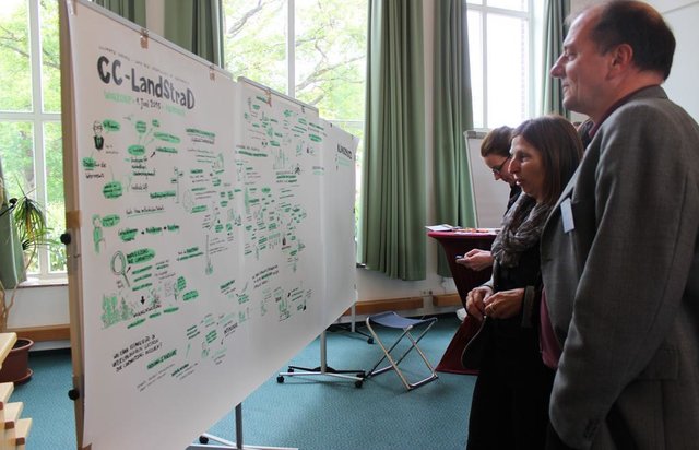
Book project: Making sense of research for sustainable land management (GLUES)Название проекта, содействовавшего документированию/оценке Технологии (если применимо)
Climate Change - Land Use Strategies (CC-LandStraD / GLUES)Название организации (-ий), содействовавших документированию/оценке Технологии (если применимо)
Thünen Institute (Thünen Institute) - ГерманияНазвание организации (-ий), содействовавших документированию/оценке Технологии (если применимо)
Federal Institute for Research on Building, Urban Affairs and Spatial Development (BBSR) - Германия1.3 Условия, регламентирующие использование данных, собранных ВОКАТ
Составитель и ответственный(-ые) специалист(-ы) согласны с условиями, регламентирующими использование собранных ВОКАТ данных:
Да
1.5 Ссылка на Анкету (ы) по Подходам УЗП (документируется с использованием ВОКАТ)
Open dialogue platform on sustainable land management [Германия]
Establishing a dialogue platform on sustainable land management which is open to all stakeholders
- Составитель: Johanna Fick
2. Описание Технологии УЗП
2.1 Краткое описание Технологии
Определение Технологии:
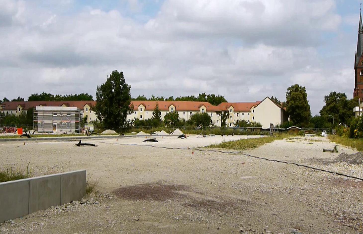
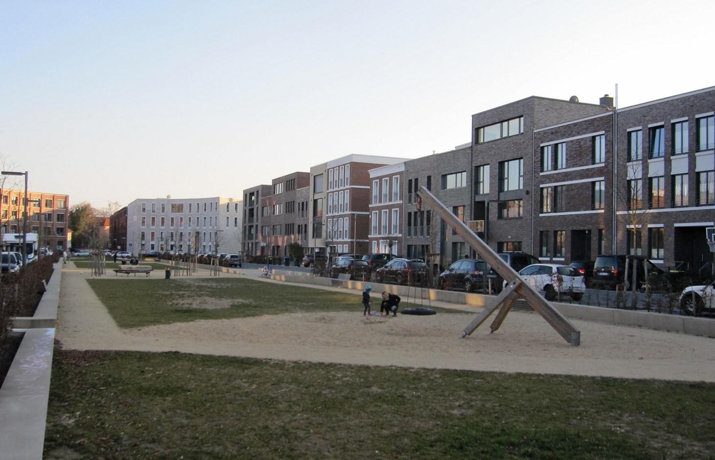
A scenario simulation of land use change where high-quality inner urban development is promoted, including the rehabilitation of brownfields, reuse of vacant lots, use of gaps between buildings and the improvement of existing structures.
2.2 Подробное описание Технологии
Описание:
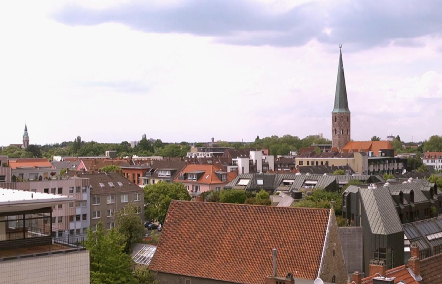
The best means of reducing land loss by settlement and infrastructure development is through fulfilling inner urban development potential. This “compact settlement development” makes the most efficient use of space. Simultaneously it contributes to the reduction of greenhouse gas emissions by the maintenance of farmland or forest areas on the outskirts of urban areas. One example is the rehabilitation and utilization of “brownfields”, including previous industrial areas. Another example is redevelopment of transportation infrastructure within settlements or on the urban fringe. However, the revitalization and utilization of brownfields is often expensive. Other aspects of inner urban development are the reuse of vacant lots, the use of spaces between buildings and the improvement of existing building structures by adding extra floors.
Purpose of the Technology: Through these developments, the rate of daily land consumption by settlement and transportation can be reduced. In Germany, such land loss reached 73 ha/day in 2010. According to a survey commissioned by the Federal Office for Building and Regional Planning, 20% of existing brownfields and vacant lots can be brought into use in the short term and another 50% of the total in the long term: 30% cannot be developed for various reasons including disputed tenure. The ambitious aim of the sustainability strategy of the German federal government is to reduce today’s daily land consumption for settlement and transport from the current 73 ha/day to 30 ha/day by 2020. However this appears unrealistic: nevertheless with high-quality inner urban development technology, this could be achieved by 2030. If the technology is planned and implemented through scenario simulation of sectoral land use changes in Germany (agriculture, forest and settlements), then calculations show that the daily land loss by settlement and transport could be reduced from 45 ha/day in a “business as usual” scenario (with some improvements assumed) to 30 ha/per day in 2030 by using high-quality inner urban development measures.
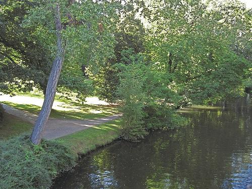
Establishment / maintenance activities and inputs: During re-densification of urban areas sufficient green spaces must be protected to address climate change considerations such as higher temperatures and more runoff. High urban densities lead to an increase in the “heat island effect” (a combination of extensive urban/ suburban landscapes with reduced air circulation, little cloud cover and long periods of high temperature). Thus, the rehabilitation of brownfields has to go along with the transformation of impervious surfaces into permeable ones, and planning of corridors for air exchange by “green and blue climate corridors” (public parks, ponds and rivers). There are several initiatives to establish high quality inner urban development in Germany. These include: 1) “Inner before external” urban development within the Federal Building Law; 2) Many communities operating a brownfields and vacant lots cadastre; 3) General management of urban areas. Nevertheless, the reuse of inner city brownfields often requires considerable and costly remediation of contaminated sites. Due to the ownership issues of vacant lots, many are not easily accessible through municipalities, and this complicates their development. In other cases, available construction areas or buildings are not appropriate to the needs of investors.
2.3 Фотографии, иллюстрирующие Технологию
Медиа-галерея

2.5 Страна/ регион/ места, где применяется Технология, информация о которых собрана в данной Анкете
Страна:
Германия
Административная единица (Район/Область):
Germany, North Rhine-Westphalia
Более точная привязка места:
Rheinisch-Bergischer Kreis and Rhein-Sieg-Kreis
Пояснения:
Boundary points of the Technology area: 51.075063; 7.335960
51.164380; 7.251345
51.107561; 6.988673
50.816401; 7.674266
50.585640; 6.892780
50.793044; 6.867394
Total area covered by the SLM Technology is 1590 km2.
Technology is the result of a scenario simulation fow whole Germany but is mapped in the Rhine region as an example.The technology does not document a specific inner urban development project and the region mapped is an example. In some German cities inner urban development is a common land management measure but the amount of current inner-urban development cannot be quantified. The potential is estimated as 120000 to 165000 ha.
2.6 Сколько лет применяется данная Технология
Если год начала применения Технологии достоверно неизвестен, дайте примерную оценку:
- менее 10 лет назад (недавняя)
2.7 Внедрение Технологии
Укажите, как именно Технология УЗП была внедрена:
- через проекты/ внешнее вмешательство
Пояснения (тип проекта и т.д.):
The technology documented here is a scenario simulation of land use change and not the realisation of a specific inner urban development project.
3. Классификация Технологии УЗП
3.2 Текущий(-ие) тип(-ы) землепользования на территории, где применяется Технология

Населенные пункты, инфраструктура
Пояснения:
Major land use problems (compiler’s opinion): Land use for settlement and transport leads to imperviousness, and a reduction of high quality agricultural areas. Sealed surfaces increase runoff during heavy rain events, and high building densities promote the development of urban heat islands.
Major land use problems (land users’ perception): In fast-growing regions, high demand requires the supply of additional land for construction.
Future (final) land use (after implementation of SLM Technology): Other: Oo: Other: wastelands, deserts, glaciers, swamps, recreation areas, etc
Type of cropping system and major crops comments: not applicable
Constraints of settlement / urban: Data availability for locations of brownfields, vacant lots and vacancies
Constraints of infrastructure network (roads, railways, pipe lines, power lines): Data availability for locations of brownfields, vacant lots and vacancies
Constraints of recreation: Data availability for locations of brownfields, vacant lots and vacancies
Constraints of brownfields: Data availability for locations of brownfields, vacant lots and vacancies
Number of growing seasons per year: 1
3.3 Изменилось ли использование земель в связи с внедрением Технологии?
Изменилось ли использование земель в связи с внедрением Технологии?
- Нет (см. пункт 3.4)
Населенные пункты, инфраструктура
- Жилищная застройка, другие здания
- Транспорт: автомобильные и железные дороги
Пояснения:
Other: Os: Settlements, infrastructure networks
3.5 Категория УЗП, к которой относится Технология
- Compact settlement development
3.6 Мероприятия УЗП, выполняемые в рамках Технологии

управленческие мероприятия
- У1: Смена типа землепользования
- У2: Изменение формы/ интенсивности хозяйствования
Пояснения:
Main measures: management measures
3.7 Основные проблемы деградации земель, на решение которых направлена Технология

ухудшение физических свойств почв
- Фк: растрескивание и коркообразование
- Фд: утрата био-продуктивных функций по другим причинам

биологическая деградация
- Бм: утрата местообитаний
- Бк: сокращение количества биомассы
Пояснения:
Main type of degradation addressed: Pu: loss of bio-productive function due to other activities
Secondary types of degradation addressed: Pk: sealing and crusting, Bh: loss of habitats, Bq: quantity / biomass decline
Main causes of degradation: urbanisation and infrastructure development
Secondary causes of degradation: population pressure, inputs and infrastructure: (roads, markets, distribution of water points, other, …), governance / institutional
3.8 Предотвращение и снижение деградации земель, или восстановление нарушенных земель
Укажите цель Технологии по отношению к деградации земель :
- снижение деградации земель
Пояснения:
Main goals: mitigation / reduction of land degradation
4. Технические характеристики, мероприятия по практической реализации, вложения и стоимость
4.1 Технический рисунок, иллюстрирующий Технологию
Спецификация (пояснения к техническому рисунку):
Green and blue structure like parks, trees, alleys (green) and water areas like rivers, canals, ponds and lakes (blue) are relevant issues especially with respect to the climate adaptation
Technical knowledge required for scientific staff: high
Main technical functions: spatial arrangement and diversification of land use, reduces the loss of agricultural land and forests
Change of land use type: Brownfields are converted to settlement area. Agricultural area is conserved.
Change of land use practices / intensity level: Settlement density may increase with inner urban development.
Автор:
Johanna Fick
4.3 Мероприятия, необходимые для начала реализации
| Деятельность | Время (сессия) | |
|---|---|---|
| 1. | Data collection | Half a year |
| 2. | Implementation into the model and model calibration | Half a year |
| 3. | Model runs | one month |
| 4. | Evaluation | one month |
| 5. | Scenario development |
4.7 Наиболее значимые факторы, влияющие на стоимость затрат
Опишите наиболее значимые факторы, влияющие на стоимость затрат:
Measures can be very different in terms of inputs and costs, and depend on the specific situation eg contaminated area of a former petrol station can have very high rehabilitation costs due to the need to detoxify the soil before new use. However other measures cost (effectively) no money at all eg legislation governing the reduction of the distance permitted between two new buildings by the local authorities.
5. Природные и социально-экономические условия
5.1 Климат
Среднегодовое количество осадков
- < 250 мм
- 251-500 мм
- 501-750 мм
- 751-1000 мм
- 1001-1500 мм
- 1501-2000 мм
- 2001-3000 мм
- 3001-4000 мм
- > 4000 мм
Пояснения/ комментарии по осадкам:
Annual rainfall: 250-500 mm, 500-750 mm, 750-1000 mm, 1000-1500 mm
Агроклиматическая зона
- влажная
Thermal climate class: temperate
5.2 Рельеф
Склоны (преобладающие):
- пологие (0-2%)
- покатые (3-5%)
- покато-крутые (6-10%)
- крутые (11-15%)
- очень крутые (16-30%)
- чрезвычайно крутые (31-60%)
- обрывистые (>60%)
Формы рельефа:
- плато/ равнины
- гребни хребтов/холмов
- склоны гор
- склоны холмов
- подножья
- днища долин
Зона высотной поясности:
- 0-100 м над уровнем моря
- 101-500 м н.у.м.
- 501-1000 м н.у.м.
- 1001-1500 м н.у.м.
- 1501-2000 м н.у.м.
- 2001-2500 м н.у.м.
- 2501-3000 м н.у.м.
- 3001-4000 м н.у.м.
- > 4 тыс. м н.у.м.
Комментарии и дополнительные сведения по условиям рельефа/ топографии :
Landforms: plateau / plains, hill slopes, valley floors (Not relevant for technology inner urban development)
5.6 Характеристика землепользователей, применяющих Технологию
Индивидуальное или коллективное хозяйство:
- использующее наемных работников (компания, государство)
Укажите другие важные характеристики землепользователей:
Difference in the involvement of women and men: Technology is not applied by land users. The technology is a scenario simulation, not a specific project of inner urban development.
Population density: 200-500 persons/km2
Annual population growth: < 0.5%
(Technology, which is a scenario simulation is not applied by land users.).
Off-farm income specification: not applicable
5.8 Собственность на землю, права на земле- и водопользование
Право землепользования:
- общинное (контролируемое)
- индивидуальное
Пояснения:
Land ownership: state, company, individual, not titled
6. Воздействия и заключительные положения
6.1 Влияние Технологии УЗП в пределах территории ее применения
Социальное и культурное воздействие
состояние здоровья
Комментарий/ пояснения:
Due to increase of urban heat island effect. Effect cannot be quantified.
возможности отдыха и рекреации
Return on sales after revitalisation of brownfields
Cost for public transport and public infrastructure
Compact urban infrasture
Экологическое воздействие
Водный цикл/ поверхностный сток
поверхностный сток
Комментарий/ пояснения:
Estimation, source is another study
Почвы
образование корки на поверхности почв/ запечатывание
Комментарий/ пояснения:
Increased soil sealing, amount depends on the number of inner urban development projects
Биоразнообразие: растительность, животный мир
разнообразие флоры
Климат и снижение риска стихийных бедствий
выбросы углекислого газа и парниковых газов
Комментарий/ пояснения:
Increased carbon sequestration
Другие экологические последствия
Reduced hazard towards adverse events
Комментарий/ пояснения:
If established green and blue corridors
6.2 Влияние Технологии за пределами территории ее применения
буферная/ фильтрационная способность
ущерб объектам инфраструктуры общего/ частного пользования
Ways for infrastructure (e.g. water/sewage pipeline)
Комментарий/ пояснения:
Through the compact settlement structure
6.3 Подверженность и чувствительность Технологии УЗП к постепенным изменениям климата и экстремальным погодным явлениям/ стихийным бедствиям, связанным с изменением климата (в понимании землепользователей)
Постепенное изменение климата
Постепенное изменение климата
| Сезон | увеличение или уменьшение | Насколько успешно Технология справляется с этим? | |
|---|---|---|---|
| среднегодовые температуры | увеличилось | плохо |
Экстремальные явления, связанные с изменением климата (стихийные бедствия)
Погодные стихийные бедствия
| Насколько успешно Технология справляется с этим? | |
|---|---|
| местные ливневые дожди | плохо |
| местные ураганы | не известно |
Стихийные бедствия климатического характера
| Насколько успешно Технология справляется с этим? | |
|---|---|
| засухи | не известно |
Гидрологические стихийные бедствия
| Насколько успешно Технология справляется с этим? | |
|---|---|
| регулярные наводнения (выход рек из берегов) | не известно |
Другие воздействия, связанные с изменением климата
Другие воздействия, связанные с изменением климата
| Насколько успешно Технология справляется с этим? | |
|---|---|
| сокращение вегетационного периода | хорошо |
| не известно |
Пояснения:
A more intensive use of urban area through inner urban development leads also to an increase of impervious areas. These can addressed by urban blue and green corridors.
6.5 Внедрение Технологии
Пояснения:
No answer possible, since technology is a scenario simulation.
There is no trend towards spontaneous adoption of the Technology
6.7 Сильные стороны/ преимущества/ возможности Технологии
| Сильные стороны/ преимущества/ возможности по мнению составителя или других ключевых специалистов |
|---|
|
Scenario simulations help to identify hot spots and can indicate regions where inner urban development should be pushed by public institutions. How can they be sustained / enhanced? Inner urban development is profitable if pressure on land is high but needs to be pushed also in regions with less pressure to protect soils, nature and climate. |
|
Inner urban development can have positive impacts on climate adaptation How can they be sustained / enhanced? To reach positive impacts on climate adaptation issues it is necessary to establish green and blue climate corridors (e.g. network of urban greens established or optimized by re-vitalization of brownfields). |
|
Inner urban development can rise the attractiveness of town (greater inner city mobility, compact town) How can they be sustained / enhanced? The technology improves inner-urban area development. For improvements to existing settlement areas, additional building activities (e.g. making buildings taller; concentrating housing) are possible. Side effects are a very concentrated settlement structure but with the advantage of reducing the sprawling out of settlements into agricultural land or wooded areas (i.e. outer development) and this saves GHG emissions and other ecosystem services ESS. |
6.8 Слабые стороны/ недостатки/ риски Технологии и пути их преодоления
| Слабые стороны/ недостатки/ риски по мнению составителя или ответственных специалистов | Возможные пути их преодоления/снижения? |
|---|---|
| Nationwide simulation cannot indicate concrete lots where inner urban development should be pushed. | The technology has shown the potential for Germany as a whole, but implementation depends on local authorities. |
7. Справочные материалы и ссылки
7.1 Методы сбора/ источники информации
7.2 Ссылки на опубликованные материалы
Название, автор, год публикации, ISBN:
www.cc-landstrad.de
Название, автор, год публикации, ISBN:
www.bbsr.bund.de
7.3 Ссылки на соответствующую онлайн-информацию
Название/ описание:
www.cc-landstrad.de
Название/ описание:
www.bbsr.bund.de
Ссылки и модули
Развернуть все Свернуть всеСсылки
Open dialogue platform on sustainable land management [Германия]
Establishing a dialogue platform on sustainable land management which is open to all stakeholders
- Составитель: Johanna Fick
Модули
Нет модулей