High-quality inner urban development [เยอรมนี]
- ผู้สร้างสรรค์:
- การอัพเดท:
- ผู้รวบรวม: Johanna Fick
- ผู้เรียบเรียง: –
- ผู้ตรวจสอบ: Fabian Ottiger, David Streiff, Alexandra Gavilano
Qualitätsvolle Innenentwicklung (German)
technologies_1698 - เยอรมนี
ดูส่วนย่อย
ขยายทั้งหมด ย่อทั้งหมด1. ข้อมูลทั่วไป
1.2 รายละเอียดที่ติดต่อได้ของผู้รวบรวมและองค์กรที่เกี่ยวข้องในการประเมินและการจัดเตรียมทำเอกสารของเทคโนโลยี
ผู้เชี่ยวชาญ SLM:
Hoymann Jana
Federal Institute for Research on Building, Urban Affairs and Spatial Development (BBSR)
เยอรมนี
ผู้เชี่ยวชาญ SLM:
Goetzke Roland
Federal Institute for Research on Building, Urban Affairs and Spatial Development (BBSR)
เยอรมนี
ชื่อของโครงการซึ่งอำนวยความสะดวกในการทำเอกสารหรือการประเมินเทคโนโลยี (ถ้าเกี่ยวข้อง)
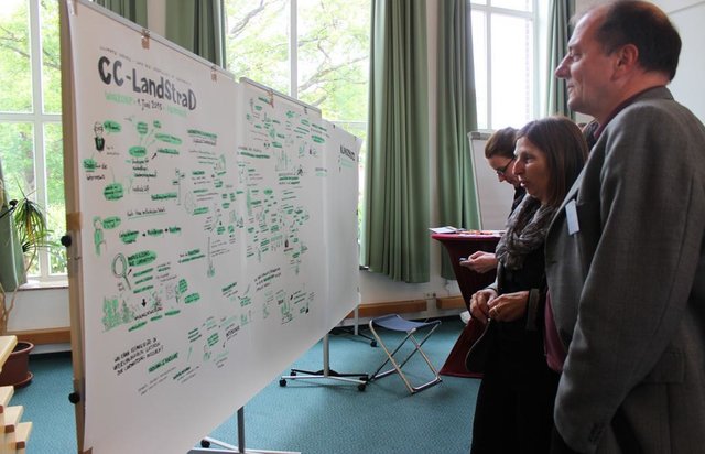
Book project: Making sense of research for sustainable land management (GLUES)ชื่อของโครงการซึ่งอำนวยความสะดวกในการทำเอกสารหรือการประเมินเทคโนโลยี (ถ้าเกี่ยวข้อง)
Climate Change - Land Use Strategies (CC-LandStraD / GLUES)ชื่อขององค์กรซึ่งอำนวยความสะดวกในการทำเอกสารหรือการประเมินเทคโนโลยี (ถ้าเกี่ยวข้อง)
Thünen Institute (Thünen Institute) - เยอรมนีชื่อขององค์กรซึ่งอำนวยความสะดวกในการทำเอกสารหรือการประเมินเทคโนโลยี (ถ้าเกี่ยวข้อง)
Federal Institute for Research on Building, Urban Affairs and Spatial Development (BBSR) - เยอรมนี1.3 เงื่อนไขการใช้ข้อมูลที่ได้บันทึกผ่านทาง WOCAT
ผู้รวบรวมและวิทยากรหลักยอมรับเงื่อนไขเกี่ยวกับการใช้ข้อมูลที่ถูกบันทึกผ่านทาง WOCAT:
ใช่
1.5 Reference to Questionnaire(s) on SLM Approaches (documented using WOCAT)
Open dialogue platform on sustainable land management [เยอรมนี]
Establishing a dialogue platform on sustainable land management which is open to all stakeholders
- ผู้รวบรวม: Johanna Fick
2. การอธิบายลักษณะของเทคโนโลยี SLM
2.1 การอธิบายแบบสั้น ๆ ของเทคโนโลยี
คำจำกัดความของเทคโนโลยี:
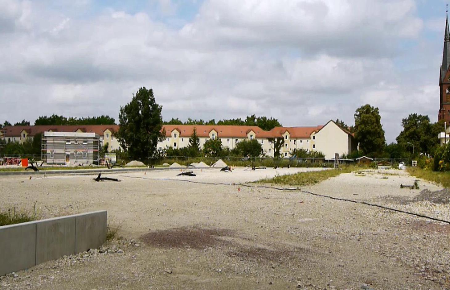
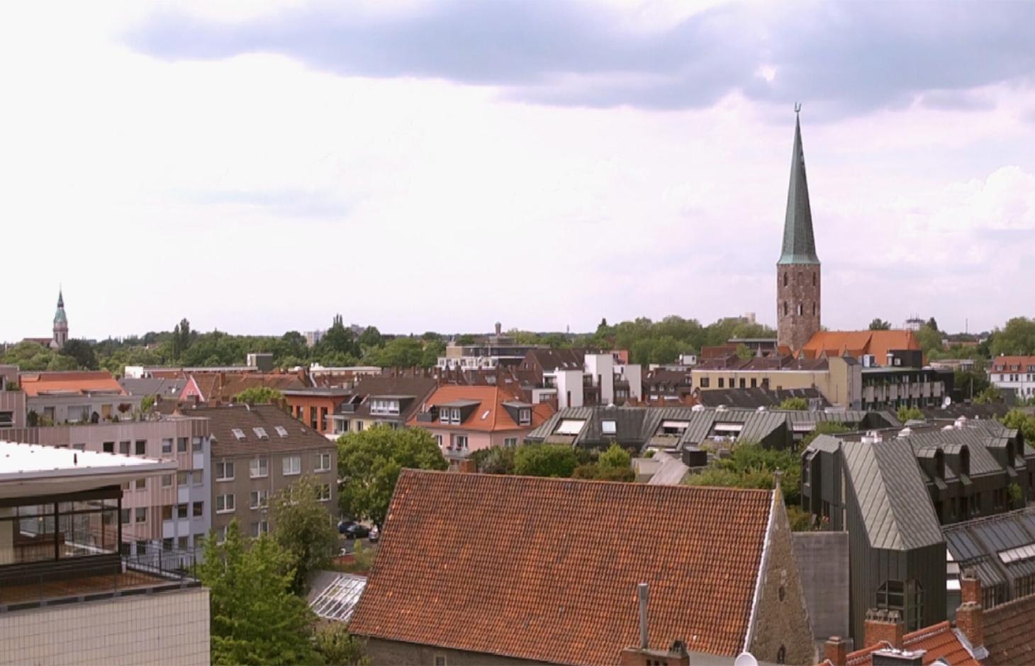
A scenario simulation of land use change where high-quality inner urban development is promoted, including the rehabilitation of brownfields, reuse of vacant lots, use of gaps between buildings and the improvement of existing structures.
2.2 การอธิบายแบบละเอียดของเทคโนโลยี
คำอธิบาย:
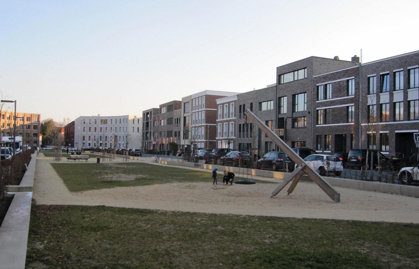
The best means of reducing land loss by settlement and infrastructure development is through fulfilling inner urban development potential. This “compact settlement development” makes the most efficient use of space. Simultaneously it contributes to the reduction of greenhouse gas emissions by the maintenance of farmland or forest areas on the outskirts of urban areas. One example is the rehabilitation and utilization of “brownfields”, including previous industrial areas. Another example is redevelopment of transportation infrastructure within settlements or on the urban fringe. However, the revitalization and utilization of brownfields is often expensive. Other aspects of inner urban development are the reuse of vacant lots, the use of spaces between buildings and the improvement of existing building structures by adding extra floors.
Purpose of the Technology: Through these developments, the rate of daily land consumption by settlement and transportation can be reduced. In Germany, such land loss reached 73 ha/day in 2010. According to a survey commissioned by the Federal Office for Building and Regional Planning, 20% of existing brownfields and vacant lots can be brought into use in the short term and another 50% of the total in the long term: 30% cannot be developed for various reasons including disputed tenure. The ambitious aim of the sustainability strategy of the German federal government is to reduce today’s daily land consumption for settlement and transport from the current 73 ha/day to 30 ha/day by 2020. However this appears unrealistic: nevertheless with high-quality inner urban development technology, this could be achieved by 2030. If the technology is planned and implemented through scenario simulation of sectoral land use changes in Germany (agriculture, forest and settlements), then calculations show that the daily land loss by settlement and transport could be reduced from 45 ha/day in a “business as usual” scenario (with some improvements assumed) to 30 ha/per day in 2030 by using high-quality inner urban development measures.
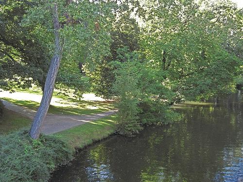
Establishment / maintenance activities and inputs: During re-densification of urban areas sufficient green spaces must be protected to address climate change considerations such as higher temperatures and more runoff. High urban densities lead to an increase in the “heat island effect” (a combination of extensive urban/ suburban landscapes with reduced air circulation, little cloud cover and long periods of high temperature). Thus, the rehabilitation of brownfields has to go along with the transformation of impervious surfaces into permeable ones, and planning of corridors for air exchange by “green and blue climate corridors” (public parks, ponds and rivers). There are several initiatives to establish high quality inner urban development in Germany. These include: 1) “Inner before external” urban development within the Federal Building Law; 2) Many communities operating a brownfields and vacant lots cadastre; 3) General management of urban areas. Nevertheless, the reuse of inner city brownfields often requires considerable and costly remediation of contaminated sites. Due to the ownership issues of vacant lots, many are not easily accessible through municipalities, and this complicates their development. In other cases, available construction areas or buildings are not appropriate to the needs of investors.
2.3 รูปภาพของเทคโนโลยี
อัลบั้มสื่อบันทึก

2.5 ประเทศภูมิภาค หรือสถานที่ตั้งที่เทคโนโลยีได้นำไปใช้และได้รับการครอบคลุมโดยการประเมินนี้
ประเทศ:
เยอรมนี
ภูมิภาค/รัฐ/จังหวัด:
Germany, North Rhine-Westphalia
ข้อมูลจำเพาะเพิ่มเติมของสถานที่ตั้ง :
Rheinisch-Bergischer Kreis and Rhein-Sieg-Kreis
แสดงความคิดเห็น:
Boundary points of the Technology area: 51.075063; 7.335960
51.164380; 7.251345
51.107561; 6.988673
50.816401; 7.674266
50.585640; 6.892780
50.793044; 6.867394
Total area covered by the SLM Technology is 1590 km2.
Technology is the result of a scenario simulation fow whole Germany but is mapped in the Rhine region as an example.The technology does not document a specific inner urban development project and the region mapped is an example. In some German cities inner urban development is a common land management measure but the amount of current inner-urban development cannot be quantified. The potential is estimated as 120000 to 165000 ha.
2.6 วันที่การดำเนินการ
ถ้าไม่รู้ปีที่แน่นอน ให้ระบุวันที่โดยประมาณ:
- น้อยกว่า 10 ปี (ไม่นานนี้)
2.7 คำแนะนำของเทคโนโลยี
ให้ระบุว่าเทคโนโลยีถูกแนะนำเข้ามาอย่างไร:
- ทางโครงการหรือจากภายนอก
ความคิดเห็น (ประเภทของโครงการ เป็นต้น) :
The technology documented here is a scenario simulation of land use change and not the realisation of a specific inner urban development project.
3. การจัดประเภทของเทคโนโลยี SLM
3.2 ประเภทของการใช้ที่ดินในปัจจุบันที่ได้นำเทคโนโลยีไปใช้

การตั้งถิ่นฐาน โครงสร้างพื้นฐาน
แสดงความคิดเห็น:
Major land use problems (compiler’s opinion): Land use for settlement and transport leads to imperviousness, and a reduction of high quality agricultural areas. Sealed surfaces increase runoff during heavy rain events, and high building densities promote the development of urban heat islands.
Major land use problems (land users’ perception): In fast-growing regions, high demand requires the supply of additional land for construction.
Future (final) land use (after implementation of SLM Technology): Other: Oo: Other: wastelands, deserts, glaciers, swamps, recreation areas, etc
Type of cropping system and major crops comments: not applicable
Constraints of settlement / urban: Data availability for locations of brownfields, vacant lots and vacancies
Constraints of infrastructure network (roads, railways, pipe lines, power lines): Data availability for locations of brownfields, vacant lots and vacancies
Constraints of recreation: Data availability for locations of brownfields, vacant lots and vacancies
Constraints of brownfields: Data availability for locations of brownfields, vacant lots and vacancies
Number of growing seasons per year: 1
3.3 Has land use changed due to the implementation of the Technology?
Has land use changed due to the implementation of the Technology?
- No (Continue with question 3.4)
การตั้งถิ่นฐาน โครงสร้างพื้นฐาน
- การตั้งถิ่นฐาน ตึกอาคาร
- การจราจร ทางถนน รถไฟ
แสดงความคิดเห็น:
Other: Os: Settlements, infrastructure networks
3.5 กลุ่ม SLM ที่ตรงกับเทคโนโลยีนี้
- Compact settlement development
3.6 มาตรการ SLM ที่ประกอบกันเป็นเทคโนโลยี

มาตรการอนุรักษ์ด้วยการจัดการ
- M1: การเปลี่ยนรูปแบบของการใช้ประโยชน์ที่ดิน
- M2: การเปลี่ยนแปลงของการจัดการหรือระดับความเข้มข้น
แสดงความคิดเห็น:
Main measures: management measures
3.7 รูปแบบหลักของการเสื่อมโทรมของที่ดินที่ได้รับการแก้ไขโดยเทคโนโลยี

การเสื่อมโทรมของดินทางด้านกายภาพ
- Pk (Slaking and crusting): การอุดตันของช่องว่างในดินหรือรูพรุน
- Pu (Loss of bio-productive function): การสูญเสียหน้าที่การผลิตทางชีวภาพอันเนื่องมาจากกิจกรรม อื่นๆ

การเสื่อมโทรมของดินทางด้านชีวภาพ
- Bh (Loss of habitat): การสูญเสียแหล่งที่อยู่
- Bq (Quantity/biomass decline): การลดลงของปริมาณหรือมวลชีวภาพ
แสดงความคิดเห็น:
Main type of degradation addressed: Pu: loss of bio-productive function due to other activities
Secondary types of degradation addressed: Pk: sealing and crusting, Bh: loss of habitats, Bq: quantity / biomass decline
Main causes of degradation: urbanisation and infrastructure development
Secondary causes of degradation: population pressure, inputs and infrastructure: (roads, markets, distribution of water points, other, …), governance / institutional
3.8 การป้องกัน การลดลง หรือการฟื้นฟูความเสื่อมโทรมของที่ดิน
ระบุเป้าหมายของเทคโนโลยีกับความเสื่อมโทรมของที่ดิน:
- ลดความเสื่อมโทรมของดิน
แสดงความคิดเห็น:
Main goals: mitigation / reduction of land degradation
4. ข้อมูลจำเพาะด้านเทคนิค กิจกรรมการนำไปปฏิบัติใช้ ปัจจัยนำเข้า และค่าใช้จ่าย
4.1 แบบแปลนทางเทคนิคของเทคโนโลยี
ข้อมูลจำเพาะด้านเทคนิค (แบบแปลนทางเทคนิคของเทคโนโลยี):
Green and blue structure like parks, trees, alleys (green) and water areas like rivers, canals, ponds and lakes (blue) are relevant issues especially with respect to the climate adaptation
Technical knowledge required for scientific staff: high
Main technical functions: spatial arrangement and diversification of land use, reduces the loss of agricultural land and forests
Change of land use type: Brownfields are converted to settlement area. Agricultural area is conserved.
Change of land use practices / intensity level: Settlement density may increase with inner urban development.
ผู้เขียน:
Johanna Fick
4.3 กิจกรรมเพื่อการจัดตั้ง
| กิจกรรม | Timing (season) | |
|---|---|---|
| 1. | Data collection | Half a year |
| 2. | Implementation into the model and model calibration | Half a year |
| 3. | Model runs | one month |
| 4. | Evaluation | one month |
| 5. | Scenario development |
4.7 ปัจจัยสำคัญที่สุดที่มีผลกระทบต่อค่าใช้จ่าย
ปัจจัยสำคัญที่สุดที่มีผลกระทบต่อค่าใช้จ่ายต่างๆ:
Measures can be very different in terms of inputs and costs, and depend on the specific situation eg contaminated area of a former petrol station can have very high rehabilitation costs due to the need to detoxify the soil before new use. However other measures cost (effectively) no money at all eg legislation governing the reduction of the distance permitted between two new buildings by the local authorities.
5. สิ่งแวดล้อมทางธรรมชาติและของมนุษย์
5.1 ภูมิอากาศ
ฝนประจำปี
- < 250 ม.ม.
- 251-500 ม.ม.
- 501-750 ม.ม.
- 751-1,000 ม.ม.
- 1,001-1,500 ม.ม.
- 1,501-2,000 ม.ม.
- 2,001-3,000 ม.ม.
- 3,001-4,000 ม.ม.
- > 4,000 ม.ม.
ข้อมูลจำเพาะ/ความคิดเห็นเรื่องปริมาณน้ำฝน:
Annual rainfall: 250-500 mm, 500-750 mm, 750-1000 mm, 1000-1500 mm
เขตภูมิอากาศเกษตร
- ชื้น
Thermal climate class: temperate
5.2 สภาพภูมิประเทศ
ค่าเฉลี่ยความลาดชัน:
- ราบเรียบ (0-2%)
- ลาดที่ไม่ชัน (3-5%)
- ปานกลาง (6-10%)
- เป็นลูกคลื่น (11-15%)
- เป็นเนิน (16-30%)
- ชัน (31-60%)
- ชันมาก (>60%)
ธรณีสัณฐาน:
- ที่ราบสูง/ที่ราบ
- สันเขา
- ไหล่เขา
- ไหล่เนินเขา
- ตีนเนิน
- หุบเขา
ระดับความสูง:
- 0-100 เมตร
- 101-500 เมตร
- 501-1,000 เมตร
- 1,001-1,500 เมตร
- 1,501-2,000 เมตร
- 2,001-2,500 เมตร
- 2,501-3,000 เมตร
- 3,001-4,000 เมตร
- > 4,000 เมตร
ความคิดเห็นและข้อมูลจำเพาะเพิ่มเติมเรื่องสภาพภูมิประเทศ:
Landforms: plateau / plains, hill slopes, valley floors (Not relevant for technology inner urban development)
5.6 ลักษณะของผู้ใช้ที่ดินที่นำเทคโนโลยีไปปฏิบัติใช้
เป็นรายบุคคล/ครัวเรือน:
- ลูกจ้าง (บริษัท รัฐบาล)
ระบุลักษณะอื่นๆที่เกี่ยวข้องของผู้ใช้ที่ดิน:
Difference in the involvement of women and men: Technology is not applied by land users. The technology is a scenario simulation, not a specific project of inner urban development.
Population density: 200-500 persons/km2
Annual population growth: < 0.5%
(Technology, which is a scenario simulation is not applied by land users.).
Off-farm income specification: not applicable
5.8 กรรมสิทธิ์ในที่ดิน สิทธิในการใช้ที่ดินและสิทธิในการใช้น้ำ
สิทธิในการใช้ที่ดิน:
- เกี่ยวกับชุมชน (ถูกจัดระเบียบ)
- รายบุคคล
แสดงความคิดเห็น:
Land ownership: state, company, individual, not titled
6. ผลกระทบและสรุปคำบอกกล่าว
6.1 ผลกระทบในพื้นที่ดำเนินการ (On-site) จากการใช้เทคโนโลยี
ผลกระทบด้านสังคมวัฒนธรรมอื่น ๆ
สถานการณ์ด้านสุขภาพ
แสดงความคิดเห็น/ระบุ:
Due to increase of urban heat island effect. Effect cannot be quantified.
โอกาสทางด้านสันทนาการ
Return on sales after revitalisation of brownfields
Cost for public transport and public infrastructure
Compact urban infrasture
ผลกระทบด้านนิเวศวิทยา
วัฐจักรน้ำหรือน้ำบ่า
น้ำไหลบ่าที่ผิวดิน
แสดงความคิดเห็น/ระบุ:
Estimation, source is another study
ดิน
การเกิดแผ่นแข็งที่ผิวดิน /การเกิดชั้นดาน
แสดงความคิดเห็น/ระบุ:
Increased soil sealing, amount depends on the number of inner urban development projects
ความหลากหลายทางชีวภาพของพืชและสัตว์
ความหลากหลายทางชีวภาพของพืช
ลดความเสี่ยงของภัยพิบัติ
การปล่อยคาร์บอนและก๊าซเรือนกระจก
แสดงความคิดเห็น/ระบุ:
Increased carbon sequestration
ผลกระทบด้านนิเวศวิทยาอื่น ๆ
Reduced hazard towards adverse events
แสดงความคิดเห็น/ระบุ:
If established green and blue corridors
6.2 ผลกระทบนอกพื้นที่ดำเนินการ (Off-site) จากการใช้เทคโนโลยี
ความสามารถต้านทานการเปลี่ยนแปลง / ความสามารถในการคัดกรอง
ความเสียหายต่อโครงสร้างพื้นฐานของรัฐหรือของเอกชน
Ways for infrastructure (e.g. water/sewage pipeline)
แสดงความคิดเห็น/ระบุ:
Through the compact settlement structure
6.3 การเผชิญและความตอบสนองของเทคโนโลยีต่อการเปลี่ยนแปลงสภาพภูมิอากาศที่ค่อยเป็นค่อยไป และสภาพรุนแรงของภูมิอากาศ / ภัยพิบัติ (ที่รับรู้ได้โดยผู้ใช้ที่ดิน)
การเปลี่ยนแปลงสภาพภูมิอากาศที่ค่อยเป็นค่อยไป
การเปลี่ยนแปลงสภาพภูมิอากาศที่ค่อยเป็นค่อยไป
| ฤดู | increase or decrease | เทคโนโลยีมีวิธีการรับมืออย่างไร | |
|---|---|---|---|
| อุณหภูมิประจำปี | เพิ่มขึ้น | ไม่ค่อยดี |
สภาพรุนแรงของภูมิอากาศ (ภัยพิบัติ)
ภัยพิบัติทางอุตุนิยมวิทยา
| เทคโนโลยีมีวิธีการรับมืออย่างไร | |
|---|---|
| พายุฝนประจำท้องถิ่น | ไม่ค่อยดี |
| พายุลมประจำท้องถิ่น | ไม่ทราบ |
ภัยพิบัติจากสภาพภูมิอากาศ
| เทคโนโลยีมีวิธีการรับมืออย่างไร | |
|---|---|
| ภัยจากฝนแล้ง | ไม่ทราบ |
ภัยพิบัติจากน้ำ
| เทคโนโลยีมีวิธีการรับมืออย่างไร | |
|---|---|
| น้ำท่วมตามปกติ (แม่น้ำ) | ไม่ทราบ |
ผลลัพธ์ตามมาที่เกี่ยวข้องกับภูมิอากาศอื่น ๆ
ผลลัพธ์ตามมาที่เกี่ยวข้องกับภูมิอากาศอื่น ๆ
| เทคโนโลยีมีวิธีการรับมืออย่างไร | |
|---|---|
| ช่วงการปลูกพืชที่ลดลงมา | ดี |
| ไม่ทราบ |
แสดงความคิดเห็น:
A more intensive use of urban area through inner urban development leads also to an increase of impervious areas. These can addressed by urban blue and green corridors.
6.5 การปรับตัวของเทคโนโลยี
แสดงความคิดเห็น:
No answer possible, since technology is a scenario simulation.
There is no trend towards spontaneous adoption of the Technology
6.7 จุดแข็ง / ข้อได้เปรียบ / โอกาสของเทคโนโลยี
| จุดแข็ง / ข้อได้เปรียบ / โอกาสในทัศนคติของผู้รวบรวมหรือวิทยากรหลัก |
|---|
|
Scenario simulations help to identify hot spots and can indicate regions where inner urban development should be pushed by public institutions. How can they be sustained / enhanced? Inner urban development is profitable if pressure on land is high but needs to be pushed also in regions with less pressure to protect soils, nature and climate. |
|
Inner urban development can have positive impacts on climate adaptation How can they be sustained / enhanced? To reach positive impacts on climate adaptation issues it is necessary to establish green and blue climate corridors (e.g. network of urban greens established or optimized by re-vitalization of brownfields). |
|
Inner urban development can rise the attractiveness of town (greater inner city mobility, compact town) How can they be sustained / enhanced? The technology improves inner-urban area development. For improvements to existing settlement areas, additional building activities (e.g. making buildings taller; concentrating housing) are possible. Side effects are a very concentrated settlement structure but with the advantage of reducing the sprawling out of settlements into agricultural land or wooded areas (i.e. outer development) and this saves GHG emissions and other ecosystem services ESS. |
6.8 จุดอ่อน / ข้อเสียเปรียบ / ความเสี่ยงของเทคโนโลยีและวิธีการแก้ไข
| จุดอ่อน / ข้อเสียเปรียบ / ความเสี่ยงในทัศนคติของผู้รวบรวมหรือวิทยากรหลัก | มีวิธีการแก้ไขได้อย่างไร |
|---|---|
| Nationwide simulation cannot indicate concrete lots where inner urban development should be pushed. | The technology has shown the potential for Germany as a whole, but implementation depends on local authorities. |
7. การอ้างอิงและการเชื่อมต่อ
7.1 วิธีการและแหล่งข้อมูล
7.2 การอ้างอิงถึงสิ่งตีพิมพ์
หัวข้อ, ผู้เขียน, ปี, หมายเลข ISBN:
www.cc-landstrad.de
หัวข้อ, ผู้เขียน, ปี, หมายเลข ISBN:
www.bbsr.bund.de
7.3 Links to relevant online information
ชื่อเรื่องหรือคำอธิบาย:
www.cc-landstrad.de
ชื่อเรื่องหรือคำอธิบาย:
www.bbsr.bund.de
ลิงก์และโมดูล
ขยายทั้งหมด ย่อทั้งหมดลิงก์
Open dialogue platform on sustainable land management [เยอรมนี]
Establishing a dialogue platform on sustainable land management which is open to all stakeholders
- ผู้รวบรวม: Johanna Fick
โมดูล
ไม่มีโมดูล