High-quality inner urban development [ເຢຍລະມັນ]
- ການສ້າງ:
- ປັບປູງ:
- ຜູ້ສັງລວມຂໍ້ມູນ: Johanna Fick
- ບັນນາທິການ: –
- ຜູ້ທົບທວນຄືນ: Fabian Ottiger, David Streiff, Alexandra Gavilano
Qualitätsvolle Innenentwicklung (German)
technologies_1698 - ເຢຍລະມັນ
ເບິ່ງພາກສ່ວນ
ຂະຫຍາຍທັງໝົດ ຍຸບທັງໝົດ1. ຂໍ້ມູນທົ່ວໄປ
1.2 ຂໍ້ມູນ ການຕິດຕໍ່ພົວພັນ ຂອງບຸກຄົນທີ່ສໍາຄັນ ແລະ ສະຖາບັນ ທີ່ມີສ່ວນຮ່ວມ ໃນການປະເມີນເອກກະສານ ເຕັກໂນໂລຢີ
ຜຸ້ຊ່ຽວຊານ ດ້ານການຄຸ້ມຄອງ ທີ່ດິນແບບຍືນຍົງ:
Hoymann Jana
Federal Institute for Research on Building, Urban Affairs and Spatial Development (BBSR)
ເຢຍລະມັນ
ຜຸ້ຊ່ຽວຊານ ດ້ານການຄຸ້ມຄອງ ທີ່ດິນແບບຍືນຍົງ:
Goetzke Roland
Federal Institute for Research on Building, Urban Affairs and Spatial Development (BBSR)
ເຢຍລະມັນ
ຊື່ໂຄງການ ທີ່ອໍານວຍຄວາມສະດວກ ໃນການສ້າງເອກກະສານ/ປະເມີນ ເຕັກໂນໂລຢີ (ຖ້າກ່ຽວຂ້ອງ)
Book project: Making sense of research for sustainable land management (GLUES)ຊື່ໂຄງການ ທີ່ອໍານວຍຄວາມສະດວກ ໃນການສ້າງເອກກະສານ/ປະເມີນ ເຕັກໂນໂລຢີ (ຖ້າກ່ຽວຂ້ອງ)
Climate Change - Land Use Strategies (CC-LandStraD / GLUES)ຊື່ສະຖາບັນ (ຫຼາຍສະຖາບັນ) ທີ່ອໍານວຍຄວາມສະດວກ ໃນການສ້າງເອກກະສານ / ປະເມີນ ເຕັກໂນໂລຢີ (ຖ້າກ່ຽວຂ້ອງ)
Thünen Institute (Thünen Institute) - ເຢຍລະມັນຊື່ສະຖາບັນ (ຫຼາຍສະຖາບັນ) ທີ່ອໍານວຍຄວາມສະດວກ ໃນການສ້າງເອກກະສານ / ປະເມີນ ເຕັກໂນໂລຢີ (ຖ້າກ່ຽວຂ້ອງ)
Federal Institute for Research on Building, Urban Affairs and Spatial Development (BBSR) - ເຢຍລະມັນ1.3 ເງື່ອນໄຂ ກ່ຽວກັບ ການນໍາໃຊ້ຂໍ້ມູນເອກະສານ ທີ່ສ້າງຂື້ນ ໂດຍຜ່ານ ອົງການພາບລວມຂອງໂລກ ທາງດ້ານແນວທາງ ແລະ ເຕັກໂນໂລຢີ ຂອງການອານຸລັກ ທໍາມະຊາດ (WOCAT)
ຜູ້ປ້ອນຂໍ້ມູນ ແລະ ບຸກຄົນສຳຄັນ ທີ່ໃຫ້ຂໍ້ມູນ (ຫຼາຍ) ຍິນຍອມ ຕາມເງື່ອນໄຂ ໃນການນຳໃຊ້ຂໍ້ມູນ ເພື່ອສ້າງເປັນເອກກະສານຂອງ WOCAT:
ແມ່ນ
1.5 ແບບສອບຖາມທີ່ອ້າງອີງເຖີງແນວທາງ ການຄຸ້ມຄອງທີ່ດິນແບບຍືນຍົງ (ໄດ້ເຮັດເປັນເອກະສານທີ່ໃຊ້ WOCAT)
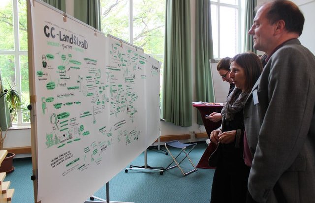
Open dialogue platform on sustainable land management [ເຢຍລະມັນ]
Establishing a dialogue platform on sustainable land management which is open to all stakeholders
- ຜູ້ສັງລວມຂໍ້ມູນ: Johanna Fick
2. ການອະທິບາຍ ເຕັກໂນໂລຢີ ຂອງການຄຸ້ມຄອງ ທີ່ດິນແບບຍືນຍົງ
2.1 ຄໍາອະທິບາຍສັ້ນຂອງ ເຕັກໂນໂລຢີ
ການກຳໜົດຄວາມໝາຍ ຂອງເຕັກໂນໂລຢີ:
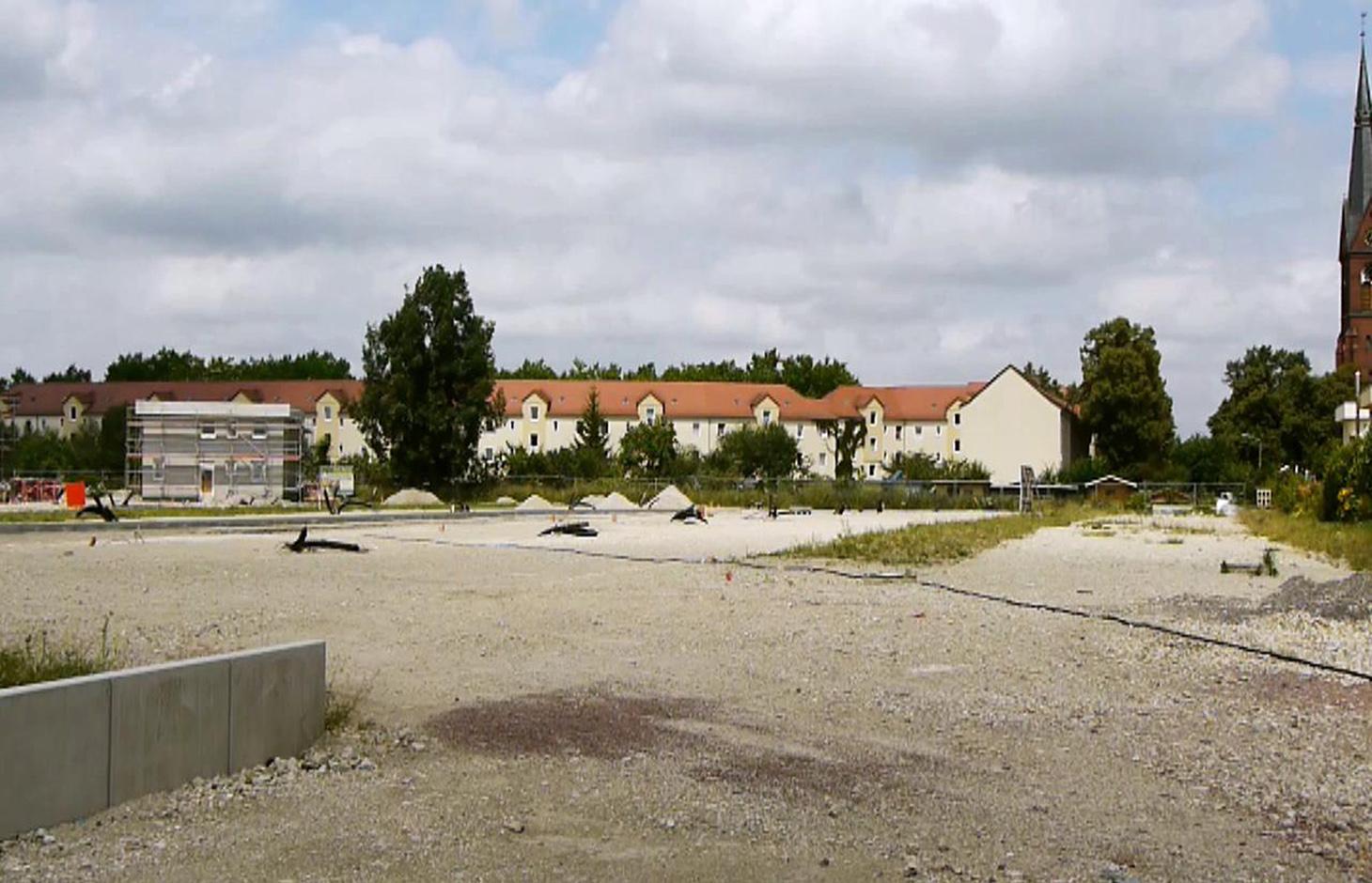
A scenario simulation of land use change where high-quality inner urban development is promoted, including the rehabilitation of brownfields, reuse of vacant lots, use of gaps between buildings and the improvement of existing structures.
2.2 ການອະທິບາຍ ລາຍລະອຽດ ຂອງເຕັກໂນໂລຢີ
ການພັນລະນາ:
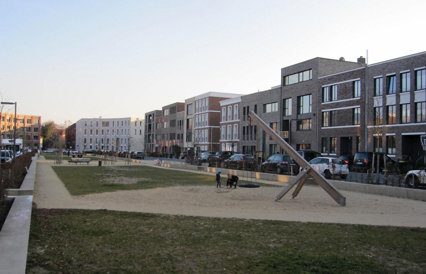
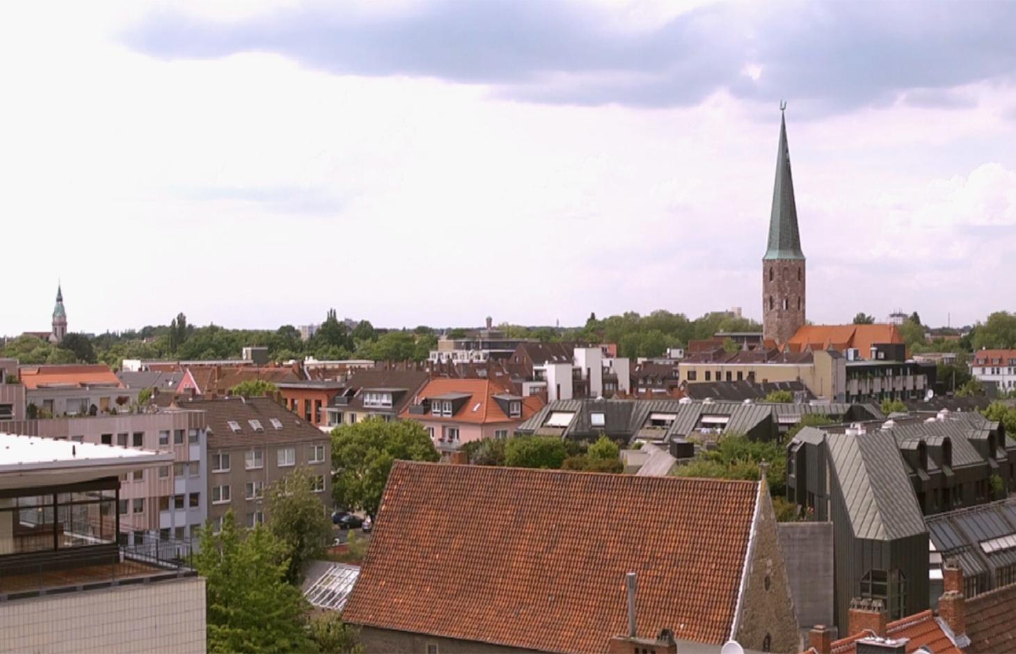
The best means of reducing land loss by settlement and infrastructure development is through fulfilling inner urban development potential. This “compact settlement development” makes the most efficient use of space. Simultaneously it contributes to the reduction of greenhouse gas emissions by the maintenance of farmland or forest areas on the outskirts of urban areas. One example is the rehabilitation and utilization of “brownfields”, including previous industrial areas. Another example is redevelopment of transportation infrastructure within settlements or on the urban fringe. However, the revitalization and utilization of brownfields is often expensive. Other aspects of inner urban development are the reuse of vacant lots, the use of spaces between buildings and the improvement of existing building structures by adding extra floors.
Purpose of the Technology: Through these developments, the rate of daily land consumption by settlement and transportation can be reduced. In Germany, such land loss reached 73 ha/day in 2010. According to a survey commissioned by the Federal Office for Building and Regional Planning, 20% of existing brownfields and vacant lots can be brought into use in the short term and another 50% of the total in the long term: 30% cannot be developed for various reasons including disputed tenure. The ambitious aim of the sustainability strategy of the German federal government is to reduce today’s daily land consumption for settlement and transport from the current 73 ha/day to 30 ha/day by 2020. However this appears unrealistic: nevertheless with high-quality inner urban development technology, this could be achieved by 2030. If the technology is planned and implemented through scenario simulation of sectoral land use changes in Germany (agriculture, forest and settlements), then calculations show that the daily land loss by settlement and transport could be reduced from 45 ha/day in a “business as usual” scenario (with some improvements assumed) to 30 ha/per day in 2030 by using high-quality inner urban development measures.
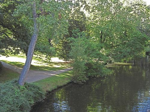
Establishment / maintenance activities and inputs: During re-densification of urban areas sufficient green spaces must be protected to address climate change considerations such as higher temperatures and more runoff. High urban densities lead to an increase in the “heat island effect” (a combination of extensive urban/ suburban landscapes with reduced air circulation, little cloud cover and long periods of high temperature). Thus, the rehabilitation of brownfields has to go along with the transformation of impervious surfaces into permeable ones, and planning of corridors for air exchange by “green and blue climate corridors” (public parks, ponds and rivers). There are several initiatives to establish high quality inner urban development in Germany. These include: 1) “Inner before external” urban development within the Federal Building Law; 2) Many communities operating a brownfields and vacant lots cadastre; 3) General management of urban areas. Nevertheless, the reuse of inner city brownfields often requires considerable and costly remediation of contaminated sites. Due to the ownership issues of vacant lots, many are not easily accessible through municipalities, and this complicates their development. In other cases, available construction areas or buildings are not appropriate to the needs of investors.
2.3 ຮູບພາບຂອງເຕັກໂນໂລຢີ
ສື່ຮູບພາບ

2.5 ປະເທດ / ເຂດ / ສະຖານທີ່ບ່ອນທີ່ ເຕັກໂນໂລຢີ ໄດ້ຮັບການນໍາໃຊ້ ແລະ ທີ່ຖືກປົກຄຸມດ້ວຍການປະເມີນຜົນ
ປະເທດ:
ເຢຍລະມັນ
ພາກພື້ນ / ລັດ / ແຂວງ:
Germany, North Rhine-Westphalia
ຂໍ້ມູນເພີ່ມເຕີມຂອງສະຖານທີ່:
Rheinisch-Bergischer Kreis and Rhein-Sieg-Kreis
ຄວາມຄິດເຫັນ:
Boundary points of the Technology area: 51.075063; 7.335960
51.164380; 7.251345
51.107561; 6.988673
50.816401; 7.674266
50.585640; 6.892780
50.793044; 6.867394
Total area covered by the SLM Technology is 1590 km2.
Technology is the result of a scenario simulation fow whole Germany but is mapped in the Rhine region as an example.The technology does not document a specific inner urban development project and the region mapped is an example. In some German cities inner urban development is a common land management measure but the amount of current inner-urban development cannot be quantified. The potential is estimated as 120000 to 165000 ha.
2.6 ວັນທີໃນການຈັດຕັ້ງປະຕິບັດ
ຖ້າຫາກວ່າ ບໍ່ຮູ້ຈັກ ປີທີ່ຊັດເຈນ ແມ່ນໃຫ້ປະມານ ວັນທີເອົາ:
- ຕໍ່າກວ່າ 10 ປີ ຜ່ານມາ (ມາເຖິງປະຈຸບັນ)
2.7 ການນໍາສະເໜີ ເຕັກໂນໂລຢີ
ໃຫ້ລະບຸ ເຕັກໂນໂລຢີ ໄດ້ຖືກຈັດຕັ້ງປະຕິບັດຄືແນວໃດ?
- ໂດຍຜ່ານໂຄງການ / ການຊ່ວຍເຫຼືອຈາກພາຍນອກ
ຄວາມຄິດເຫັນ (ປະເພດ ໂຄງການ ແລະ ອື່ນໆ):
The technology documented here is a scenario simulation of land use change and not the realisation of a specific inner urban development project.
3. ການໃຈ້ແຍກ ເຕັກໂນໂລຢີ ໃນການຄຸ້ມຄອງ ດິນແບບຍືນຍົງ
3.2 ປະເພດການນໍາໃຊ້ທີ່ດິນ ໃນປະຈຸບັນ() ທີ່ເຕັກໂນໂລຢີ ໄດ້ຖືກນໍາໃຊ້

ການຕັ້ງຖິ່ນຖານ, ພື້ນຖານໂຄງລ່າງ
ຄວາມຄິດເຫັນ:
Major land use problems (compiler’s opinion): Land use for settlement and transport leads to imperviousness, and a reduction of high quality agricultural areas. Sealed surfaces increase runoff during heavy rain events, and high building densities promote the development of urban heat islands.
Major land use problems (land users’ perception): In fast-growing regions, high demand requires the supply of additional land for construction.
Future (final) land use (after implementation of SLM Technology): Other: Oo: Other: wastelands, deserts, glaciers, swamps, recreation areas, etc
Type of cropping system and major crops comments: not applicable
Constraints of settlement / urban: Data availability for locations of brownfields, vacant lots and vacancies
Constraints of infrastructure network (roads, railways, pipe lines, power lines): Data availability for locations of brownfields, vacant lots and vacancies
Constraints of recreation: Data availability for locations of brownfields, vacant lots and vacancies
Constraints of brownfields: Data availability for locations of brownfields, vacant lots and vacancies
Number of growing seasons per year: 1
3.3 ການນຳໃຊ້ທີ່ດິນ ມີການປ່ຽນແປງຍ້ອນການຈັດຕັ້ງທົດລອງເຕັກໂນໂລຢີ ແມ່ນບໍ່?
ການນຳໃຊ້ທີ່ດິນ ມີການປ່ຽນແປງຍ້ອນການຈັດຕັ້ງທົດລອງເຕັກໂນໂລຢີ ແມ່ນບໍ່?
- ບໍ່ (ຕໍ່ເໜືອງກັບ ຄຳຖາມ 3.4)
ການຕັ້ງຖິ່ນຖານ, ພື້ນຖານໂຄງລ່າງ
- ການຕັ້ງຖິ່ນຖານ, ອາຄານ
- ການຈາລະຈອນ: ຫົນທາງ, ທາງລົດໄຟ
ຄວາມຄິດເຫັນ:
Other: Os: Settlements, infrastructure networks
3.5 ການນໍາໃຊ້ເຕັກໂນໂລຢີ ທີ່ຢູ່ໃນກຸ່ມການຄຸ້ມຄອງ ທີ່ດິນແບບຍືນຍົງ
- Compact settlement development
3.6 ມາດຕະການ ການຄຸ້ມຄອງ ທີ່ດິນແບບຍືນຍົງ ປະກອບດ້ວຍ ເຕັກໂນໂລຢີ

ມາດຕະການ ທາງດ້ານການຄຸ້ມຄອງ
- M1: ການປ່ຽນແປງ ປະເພດ ການນໍາໃຊ້ທີ່ດິນ
- M2: ການປ່ຽນແປງ ການຈັດການຄຸ້ມຄອງ / ລະດັບຄວາມໜາແໜ້ນ
ຄວາມຄິດເຫັນ:
Main measures: management measures
3.7 ປະເພດດິນເຊື່ອມໂຊມ ຫຼັກທີ່ໄດ້ນໍາໃຊ້ ເຕັກໂນໂລຢີ

ການເຊື່ອມໂຊມ ຂອງດິນ ທາງກາຍະພາບ
- Pk: ການບັນເທົາ ແລະ ການປົກຄຸມຂອງເປືອກໂລກ
- Pu: ການສູນເສຍ ການທໍາງານ ຂອງຊີວະພາບຜົນຜະລິດ ເນື່ອງຈາກການກິດຈະກໍາອື່ນໆ

ການເຊື່ອມໂຊມ ທາງຊີວະພາບ
- Bh: ການສູນເສຍ ທີ່ຢູ່ອາໃສ ຂອງສິ່ງທີ່ມີຊິວິດ
- Bq: ປະລິມານ / ອິນຊີວັດຖຸຫຼຸດລົງ
ຄວາມຄິດເຫັນ:
Main type of degradation addressed: Pu: loss of bio-productive function due to other activities
Secondary types of degradation addressed: Pk: sealing and crusting, Bh: loss of habitats, Bq: quantity / biomass decline
Main causes of degradation: urbanisation and infrastructure development
Secondary causes of degradation: population pressure, inputs and infrastructure: (roads, markets, distribution of water points, other, …), governance / institutional
3.8 ການປ້ອງກັນ, ການຫຼຸດຜ່ອນ, ຫຼືການຟື້ນຟູຂອງການເຊື່ອມໂຊມຂອງດິນ
ໃຫ້ລະບຸ ເປົ້າໝາຍ ເຕັກໂນໂລຢີ ທີ່ພົວພັນ ກັບຄວາມເຊື່ອມໂຊມຂອງດິນ:
- ຫຼຸດຜ່ອນການເຊື່ອມໂຊມຂອງດິນ
ຄວາມຄິດເຫັນ:
Main goals: mitigation / reduction of land degradation
4. ຂໍ້ກໍາໜົດ, ກິດຈະກໍາການປະຕິບັດ, ວັດຖຸດິບ, ແລະຄ່າໃຊ້ຈ່າຍ
4.1 ເຕັກນິກ ໃນການແຕ້ມແຜນວາດ ເຕັກໂນໂລຢີ
ຄຸນລັກສະນະ ຂອງເຕັກນິກ (ທີ່ກ່ຽວຂ້ອງ ກັບການແຕ້ມແຜນວາດ ທາງດ້ານເຕັກນີກ):
Green and blue structure like parks, trees, alleys (green) and water areas like rivers, canals, ponds and lakes (blue) are relevant issues especially with respect to the climate adaptation
Technical knowledge required for scientific staff: high
Main technical functions: spatial arrangement and diversification of land use, reduces the loss of agricultural land and forests
Change of land use type: Brownfields are converted to settlement area. Agricultural area is conserved.
Change of land use practices / intensity level: Settlement density may increase with inner urban development.
ຜູ້ຂຽນ:
Johanna Fick
4.3 ການສ້າງຕັ້ງກິດຈະກໍາ
| ກິດຈະກໍາ | Timing (season) | |
|---|---|---|
| 1. | Data collection | Half a year |
| 2. | Implementation into the model and model calibration | Half a year |
| 3. | Model runs | one month |
| 4. | Evaluation | one month |
| 5. | Scenario development |
4.7 ປັດໄຈ ທີ່ສໍາຄັນ ທີ່ສົ່ງຜົນກະທົບ ຕໍ່ຄ່າໃຊ້ຈ່າຍ
ໃຫ້ອະທິບາຍ ປັດໃຈ ທີ່ສົ່ງຜົນກະທົບ ຕໍ່ຕົ້ນທຶນ ໃນການຈັດຕັ້ງປະຕິບັດ:
Measures can be very different in terms of inputs and costs, and depend on the specific situation eg contaminated area of a former petrol station can have very high rehabilitation costs due to the need to detoxify the soil before new use. However other measures cost (effectively) no money at all eg legislation governing the reduction of the distance permitted between two new buildings by the local authorities.
5. ສະພາບແວດລ້ອມທໍາມະຊາດ ແລະ ມະນຸດ
5.1 ອາກາດ
ປະລິມານນໍ້າຝົນປະຈໍາປີ
- < 250 ມີລິແມັດ
- 251-500 ມີລິແມັດ
- 501-750 ມີລິແມັດ
- 751-1,000 ມີລິແມັດ
- 1,001-1,500 ມີລິແມັດ
- 1,501-2,000 ມີລິແມັດ
- 2,001-3,000 ມີລິແມັດ
- 3,001-4,000 ມີລິແມັດ
- > 4,000 ມີລິແມັດ
ຂໍ້ມູນສະເພາະ / ຄວາມເຫັນກ່ຽວກັບ ປະລິມານນໍ້າຝົນ:
Annual rainfall: 250-500 mm, 500-750 mm, 750-1000 mm, 1000-1500 mm
ເຂດສະພາບອາກາດກະສິກໍາ
- ຄວາມຊຸ່ມ
Thermal climate class: temperate
5.2 ພູມິປະເທດ
ຄ່າສະເລ່ຍ ຄວາມຄ້ອຍຊັນ:
- ພື້ນທີ່ຮາບພຽງ (0-2%)
- ອ່ອນ (3-5 %)
- ປານກາງ (6-10 %)
- ມ້ວນ (11-15 %)
- ເນີນ(16-30%)
- ໍຊັນ (31-60%)
- ຊັນຫຼາຍ (>60%)
ຮູບແບບຂອງດິນ:
- ພູພຽງ / ທົ່ງພຽງ
- ສັນພູ
- ເປີ້ນພູ
- ເນີນພູ
- ຕີນພູ
- ຮ່ອມພູ
ເຂດລະດັບສູງ:
- 0-100 ແມັດ a.s.l.
- 101-500 ແມັດ a.s.l.
- 501-1,000 ແມັດ a.s.l.
- 1,001-1,500 ແມັດ a.s.l.
- 1,501-2,000 ແມັດ a.s.l.
- 2,001-2,500 ແມັດ a.s.l.
- 2,501-3,000 ແມັດ a.s.l.
- 3,001-4,000 ແມັດ a.s.l.
- > 4,000 ແມັດ a.s.l.
ຄຳເຫັນ ແລະ ຂໍ້ມູນສະເພາະ ເພີ່ມເຕີມ ກ່ຽວກັບ ພູມີປະເທດ:
Landforms: plateau / plains, hill slopes, valley floors (Not relevant for technology inner urban development)
5.6 ຄຸນລັກສະນະ ຂອງຜູ້ນໍາໃຊ້ທີ່ດິນ ທີ່ໄດ້ນໍາໃຊ້ເຕັກໂນໂລຢີ
ບຸກຄົນ ຫຼື ກຸ່ມ:
- ການຈ້າງງານ (ບໍລິສັດ, ອົງການ ລັດຖະບານ)
ໃຫ້ລະບຸ ຄຸນລັກສະນະ ຂອງຜູ້ນໍາໃຊ້ທີ່ດິນ:
Difference in the involvement of women and men: Technology is not applied by land users. The technology is a scenario simulation, not a specific project of inner urban development.
Population density: 200-500 persons/km2
Annual population growth: < 0.5%
(Technology, which is a scenario simulation is not applied by land users.).
Off-farm income specification: not applicable
5.8 ເຈົ້າຂອງທີ່ດິນ, ສິດໃຊ້ທີ່ດິນ, ແລະ ສິດທິການນໍາໃຊ້ນໍ້າ
ສິດທິ ໃນການນໍາໃຊ້ທີ່ດິນ:
- ຊຸມຊົນ (ທີ່ມີການຈັດຕັ້ງ)
- ບຸກຄົນ
ຄວາມຄິດເຫັນ:
Land ownership: state, company, individual, not titled
6. ຜົນກະທົບ ແລະ ລາຍງານສະຫຼຸບ
6.1 ການສະແດງຜົນກະທົບ ພາຍໃນພື້ນທີ່ ທີ່ໄດ້ຈັດຕັ້ງປະຕິບັດ ເຕັກໂນໂລຢີ
ຜົນກະທົບດ້ານວັດທະນາທໍາສັງຄົມ
ສະພາບທາງດ້ານສຸຂະພາບ
ຄວາມຄິດເຫັນ / ລະບຸແຈ້ງ:
Due to increase of urban heat island effect. Effect cannot be quantified.
ໂອກາດ ໃນການພັກຜ່ອນຢ່ອນໃຈ
Return on sales after revitalisation of brownfields
Cost for public transport and public infrastructure
Compact urban infrasture
ຜົນກະທົບຕໍ່ລະບົບນິເວດ
ວົງຈອນນໍ້າ / ນໍ້າ
ການໄຫຼ ຂອງນໍ້າໜ້າດິນ
ຄວາມຄິດເຫັນ / ລະບຸແຈ້ງ:
Estimation, source is another study
ດິນ
ດິນເປັນຜົງ / ການຈັບໂຕຂອງດິນ ທີ່ມີຂະໜາດນ້ອຍຫຼາຍ ທີ່ມີການຈັບໂຕກັນເປັນກ້ອນ
ຄວາມຄິດເຫັນ / ລະບຸແຈ້ງ:
Increased soil sealing, amount depends on the number of inner urban development projects
ຊີວະນານາພັນ: ສັດ, ພືດ
ຄວາມຫຼາກຫຼາຍຂອງພືດ
ການຫຼຸດຜ່ອນ ຄວາມສ່ຽງ ຈາກໄພພິບັດ ແລະ ອາກາດປ່ຽນແປງ
ການລະເຫີຍອາຍກາກບອນ ແລະ ອາຍຜິດເຮືອນແກ້ວ
ຄວາມຄິດເຫັນ / ລະບຸແຈ້ງ:
Increased carbon sequestration
ຜົນກະທົບຕໍ່ລະບົບນິເວດອື່ນໆ
Reduced hazard towards adverse events
ຄວາມຄິດເຫັນ / ລະບຸແຈ້ງ:
If established green and blue corridors
6.2 ຜົນກະທົບທາງອ້ອມ ຈາກການນໍາໃຊ້ເຕັກໂນໂລຢີ
ການປ້ອງກັນ / ຄວາມອາດສາມາດ ການກັ່ນຕອງ
ຄວາມເສຍຫາຍ ກ່ຽວກັບພື້ນຖານໂຄງລ່າງ ສາທາລະນະ / ເອກກະຊົນ
Ways for infrastructure (e.g. water/sewage pipeline)
ຄວາມຄິດເຫັນ / ລະບຸແຈ້ງ:
Through the compact settlement structure
6.3 ການປ້ອງກັນ ແລະ ຄວາມບອບບາງ ຂອງເຕັກໂນໂລຢິ ໃນການປ່ຽນແປງສະພາບດິນຟ້າອາກາດ ແລະ ກ່ຽວຂ້ອງກັບອາກາດທີ່ມີການປ່ຽນແປງທີ່ຮຸນແຮງ / ໄພພິບັດທາງທໍາມະຊາດ (ຮັບຮູ້ໄດ້ໂດຍຜູ້ນໍາໃຊ້ທີ່ດິນ)
ການປ່ຽນແປງດິນຟ້າອາກາດ ເທື່ອລະກ້າວ
ການປ່ຽນແປງດິນຟ້າອາກາດ ເທື່ອລະກ້າວ
| ລະດູການ | ເພີ່ມຂື້ນ ຫຼື ຫຼຸດລົງ | ການນໍາໃຊ້ ເຕັກໂນໂລຢີ ສາມາດ ຮັບມື ໄດ້ຄືແນວໃດ? | |
|---|---|---|---|
| ອຸນຫະພູມປະຈໍາປີ | ເພີ່ມຂື້ນ | ບໍ່ດີ |
ອາກາດ ທີ່ກ່ຽວພັນກັບຄວາມຮຸນແຮງ (ໄພພິບັດທາງທໍາມະຊາດ)
ໄພພິບັດທາງອຸຕຸນິຍົມ
| ການນໍາໃຊ້ ເຕັກໂນໂລຢີ ສາມາດ ຮັບມື ໄດ້ຄືແນວໃດ? | |
|---|---|
| ພະຍຸຝົນ | ບໍ່ດີ |
| ພາຍຸລົມທ້ອງຖິ່ນ | ບໍ່ຮູ້ |
ໄພພິບັດທາງພູມອາກາດ
| ການນໍາໃຊ້ ເຕັກໂນໂລຢີ ສາມາດ ຮັບມື ໄດ້ຄືແນວໃດ? | |
|---|---|
| ແຫ້ງແລ້ງ | ບໍ່ຮູ້ |
ໄພພິບັດທາງອຸທົກກະສາກ
| ການນໍາໃຊ້ ເຕັກໂນໂລຢີ ສາມາດ ຮັບມື ໄດ້ຄືແນວໃດ? | |
|---|---|
| ໂດຍທົ່ວໄປ (ແມ່ນໍ້າ) ນໍ້າຖ້ວມ | ບໍ່ຮູ້ |
ຜົນສະທ້ອນສະພາບອາກາດອື່ນໆທີ່ກ່ຽວຂ້ອງ
ຜົນສະທ້ອນສະພາບອາກາດອື່ນໆທີ່ກ່ຽວຂ້ອງ
| ການນໍາໃຊ້ ເຕັກໂນໂລຢີ ສາມາດ ຮັບມື ໄດ້ຄືແນວໃດ? | |
|---|---|
| ໄລຍະເວລາການຂະຫຍາຍຕົວຫຼຸດລົງ | ດີ |
| ບໍ່ຮູ້ |
ຄວາມຄິດເຫັນ:
A more intensive use of urban area through inner urban development leads also to an increase of impervious areas. These can addressed by urban blue and green corridors.
6.5 ການປັບຕົວຮັບເອົາເຕັກໂນໂລຢີ
ຄວາມຄິດເຫັນ:
No answer possible, since technology is a scenario simulation.
There is no trend towards spontaneous adoption of the Technology
6.7 ຈຸດແຂງ / ຂໍ້ດີ / ໂອກາດ ໃນການນໍາໃຊ້ ເຕັກໂນໂລຢີ
| ຈຸດແຂງ / ຈຸດດີ / ໂອກາດ ຈາກທັດສະນະຂອງຜູ້ປ້ອນຂໍ້ມູນ ຫຼື ບຸກຄົນສຳຄັນ |
|---|
|
Scenario simulations help to identify hot spots and can indicate regions where inner urban development should be pushed by public institutions. How can they be sustained / enhanced? Inner urban development is profitable if pressure on land is high but needs to be pushed also in regions with less pressure to protect soils, nature and climate. |
|
Inner urban development can have positive impacts on climate adaptation How can they be sustained / enhanced? To reach positive impacts on climate adaptation issues it is necessary to establish green and blue climate corridors (e.g. network of urban greens established or optimized by re-vitalization of brownfields). |
|
Inner urban development can rise the attractiveness of town (greater inner city mobility, compact town) How can they be sustained / enhanced? The technology improves inner-urban area development. For improvements to existing settlement areas, additional building activities (e.g. making buildings taller; concentrating housing) are possible. Side effects are a very concentrated settlement structure but with the advantage of reducing the sprawling out of settlements into agricultural land or wooded areas (i.e. outer development) and this saves GHG emissions and other ecosystem services ESS. |
6.8 ຈຸດອ່ອນ / ຂໍ້ເສຍ / ຄວາມສ່ຽງ ໃນການນໍາໃຊ້ ເຕັກໂນໂລຢີ ແລະ ວິທີການແກ້ໄຂບັນຫາ
| ຈຸດອ່ອນ/ຂໍ້ບົກຜ່ອງ/ຄວາມສ່ຽງ ຈາກທັດສະນະຂອງຜູ້ປ້ອນຂໍ້ມູນ ຫຼື ບຸກຄົນສຳຄັນ | ມີວິທີການແກ້ໄຂຄືແນວໃດ? |
|---|---|
| Nationwide simulation cannot indicate concrete lots where inner urban development should be pushed. | The technology has shown the potential for Germany as a whole, but implementation depends on local authorities. |
7. ເອກະສານອ້າງອີງ ແລະ ການເຊື່ອມຕໍ່
7.1 ວິທີການ / ແຫຼ່ງຂໍ້ມູນ
7.2 ເອກກະສານອ້າງອີງທີ່ເປັນບົດລາຍງານ
ຫົວຂໍ້, ຜູ້ຂຽນ, ປີ, ISBN:
www.cc-landstrad.de
ຫົວຂໍ້, ຜູ້ຂຽນ, ປີ, ISBN:
www.bbsr.bund.de
7.3 ເຊື່ອມຕໍ່ກັບຂໍ້ມູນທີ່ກ່ຽວຂ້ອງໂດຍກົງ
ຫົວຂໍ້ / ພັນລະນາ:
www.cc-landstrad.de
ຫົວຂໍ້ / ພັນລະນາ:
www.bbsr.bund.de
ຂໍ້ມູນການເຊື່ອມຕໍ່ ແລະ ເນື້ອໃນ
ຂະຫຍາຍທັງໝົດ ຍຸບທັງໝົດການເຊື່ອມຕໍ່
Open dialogue platform on sustainable land management [ເຢຍລະມັນ]
Establishing a dialogue platform on sustainable land management which is open to all stakeholders
- ຜູ້ສັງລວມຂໍ້ມູນ: Johanna Fick
ເນື້ອໃນ
ບໍ່ມີເນື້ອໃນ