Social Tenure Domain Model (STDM) [Кения]
- Создание:
- Обновить:
- Составитель: Ken Otieno
- Редактор: –
- Рецензенты: Donia Mühlematter, Hanspeter Liniger, Barbara *, Alexandra Gavilano
STDM
technologies_3318 - Кения
- Полная аннотация в формате PDF
- Полная аннотация в формате PDF для вывода на печать
- Полная аннотация в формате интернет-страницы
- Полная аннотация (неотформатированно)
- Social Tenure Domain Model (STDM): 5 июля 2018 г. (inactive)
- Social Tenure Domain Model (STDM): 7 мая 2019 г. (public)
- Social Tenure Domain Model (STDM): 28 июня 2018 г. (inactive)
- Social Tenure Domain Model (STDM): 4 июня 2018 г. (inactive)
- Social Tenure Domain Model (STDM): 19 мая 2018 г. (inactive)
- Social Tenure Domain Model (STDM): 5 марта 2018 г. (inactive)
Просмотреть разделы
Развернуть все Свернуть все1. Общая информация
1.2 Контактные данные специалистов и организаций, участвующих в описании и оценке Технологии
Название проекта, содействовавшего документированию/оценке Технологии (если применимо)
Book project: Guidelines to Rangeland Management in Sub-Saharan Africa (Rangeland Management)1.3 Условия, регламентирующие использование данных, собранных ВОКАТ
Составитель и ответственный(-ые) специалист(-ы) согласны с условиями, регламентирующими использование собранных ВОКАТ данных:
Да
1.4 Декларация по устойчивости описываемой Технологии
Вызывает ли описанная здесь Технология проблемы деградации земель настолько, что ее нельзя назвать природосберегающей?
Нет
Пояснения:
The technology has demonstrated SLM.
2. Описание Технологии УЗП
2.1 Краткое описание Технологии
Определение Технологии:
The Social Tenure Domain Model (STDM) is about people and their relationships with land. The tool as applied secures tenure through the recognition of tenure diversity and social contexts. In the management of land and resources use, STDM facilitates proper land use and management to minimize practices that lead to degradation.
2.2 Подробное описание Технологии
Описание:
Technology application: The Social Tenure Domain Model is applied in order to relate natural and human environments. It is a social tool that defines the relationship of persons to natural resources such as land, their utilization of it, and sharing - for sustainable development. To realize optimal resource utilization, the tool enables the direct engagement of the resource users in a collective and participatory way. The technology allows communities to be part of a guided data collection and data entry into an STDM platform. The data includes social and economic data based on what is needed. The platform also can enable storage of information and documents such as title deeds. Names, gender, properties where the community members needs to have such information. These details can be updated and can inform planning and resource allocation by government and development partners. Main characteristics of the technology: STDM is a relational database built on an open source GIS platform called Quontum GIS (QGIS), running on Postgres SQL. This tool was built by Global Tools Land Network (GLTN). The tool captures both spatial information related to locations of land parcels, natural resources captured in points and defined in maps. Secondly, the technology captures socio-economic aspects of a resource, and allows definition of the type of relationship that exists between the resource and the person, as well as an indication of the percentage particular tenure regime in the areas including the existing rights and how they play out. The system recognizes the different level of rights thus appreciating that they are multiple and overlaid resulting to multiple uses. Therefore the technology enables the capture of bundles of rights that people have/should enjoy in a resource. The technology allows generation of reports and performs the desired analysis by the proponents and the beneficiaries of the information stored within the databases. It is open source, thus available free -hence its sustainability.The purposes/ functions of the STDM: The functions of the technology as have been piloted by RECONCILE and partners has focused around land tenure. It addresses security of tenure for vulnerable poor communities living within informal settlements, through participatory common resource identification, mapping and documentation, key resources including cattle dips, salt lick areas/fields and water points management has improved. This is due to the recognition of boundaries anticipatorily defined leading to revival of and establishment of community resources management committees especially around water and grazing lands. This in return has improved /increased production of both plants and animals. However, the technology can be customized to serve other purposes of information storage and management. The major activities/ inputs needed to establish/ maintain the technology: Major inputs are needed in empowerment of local communities through building their capacity to apply the technology through their own initiative. Building community-based resource centres and equipping them with computers installed with the software ensures that the technology is centred on the day-to-day activities of the communities and institutions. Benefits/ impacts: The technology has left better organised communities in terms of managing land and other resources. The technology has assisted local governments to manage issues of land ownership, especially within the context of customary land tenure and ownership. The county governments of Kenya, for instance, have spatial data and information that can help in planning and resources allocation. In areas where the technology has been used in the context of RECONCILE's work, better services and resources can be acquired given accurate information of Mapping land tenure, boundaries, water points and the water rights, infrastructure, different grazing lands and plans for the utilization of the grazing land and the rights of different users. It can result in improved and sustainable use of natural resources which in turn have a direct impact on production. Small-scale dairy farmers have been able to manage grazing lands, water and salt licks to improve production of animal products. Information captured and managed by the technology has enabled communities within informal settlements to negotiate with government authorities to enable land allocation and thus security of tenure and improved livelihoods.What do land users like / dislike about the technology?Likes: The technology is flexible, it can be customized to capture information in any form desired. It is based on a GIS platform which is easy to manipulate and is open source.Dislikes: Users sometimes encounter errors that are a result of incorrect information entered, and these errors are written with the programming format: thus it requires good knowledge of the technology to remedy this.
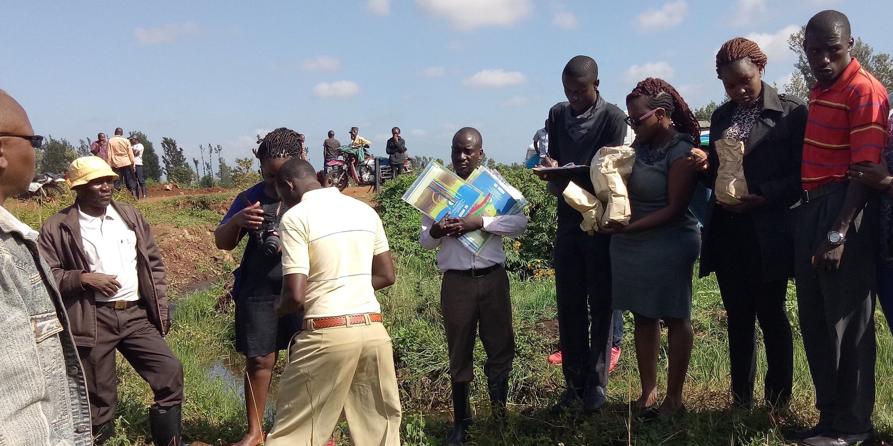
2.3 Фотографии, иллюстрирующие Технологию
Медиа-галерея
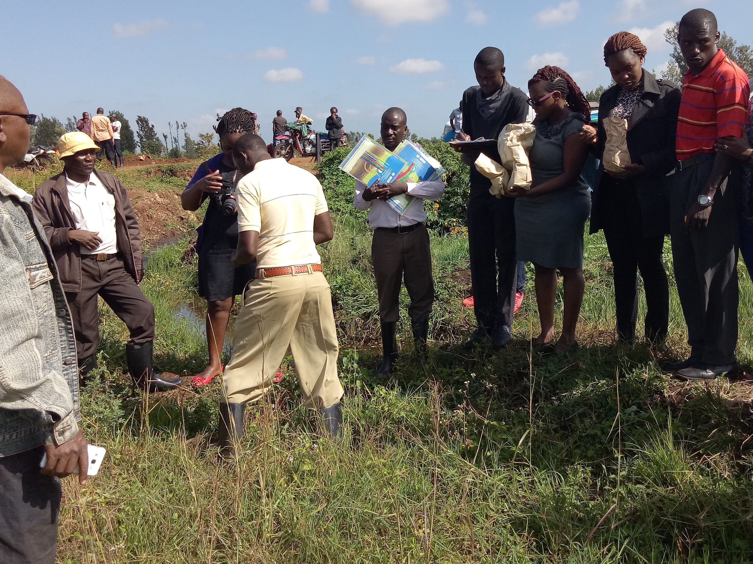
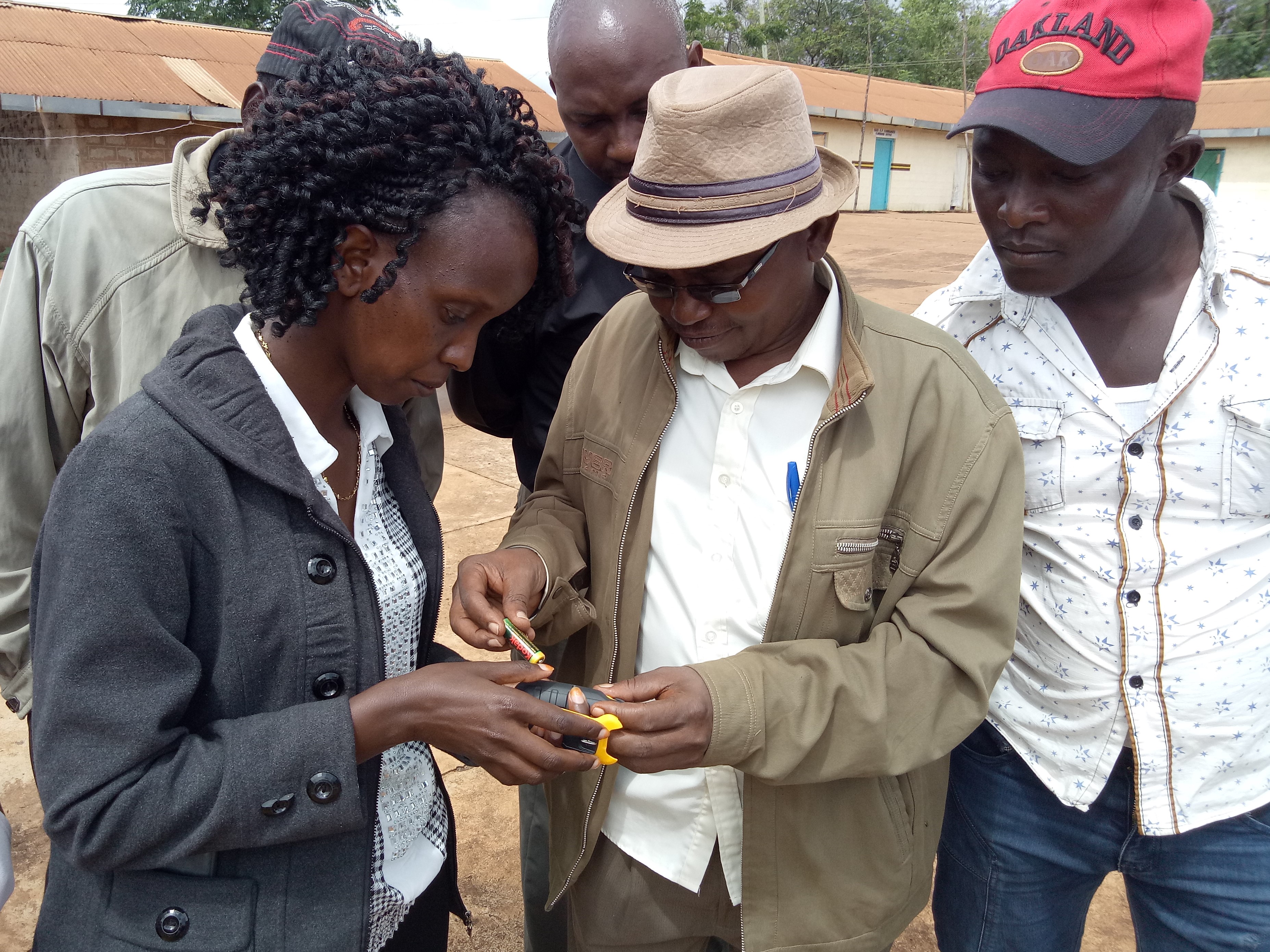
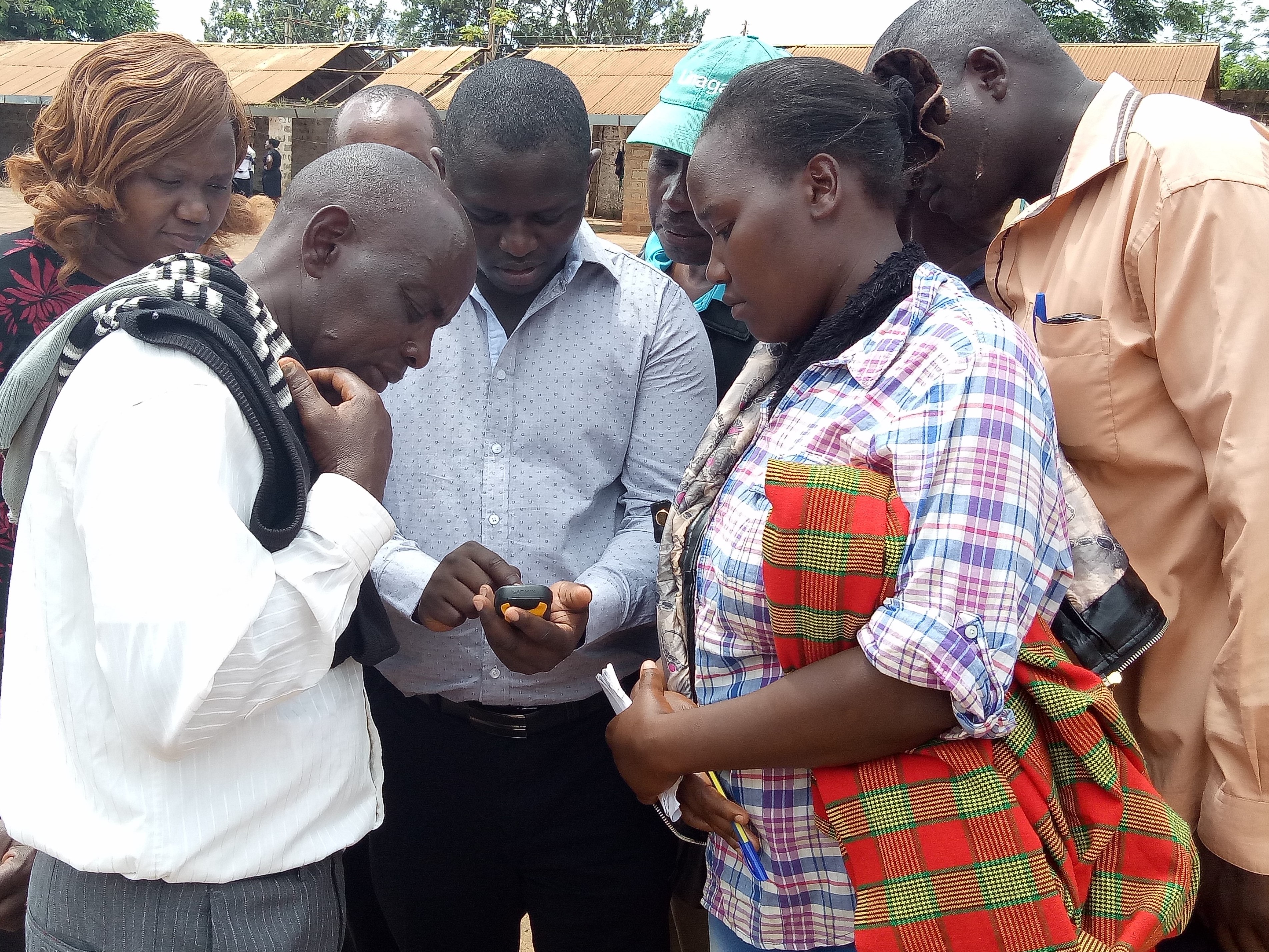
Комментарии к фотографиям:
This activity was done to complement the social economic data collected and create the ability to understand the social tenure relationship between farmers and the common resources.
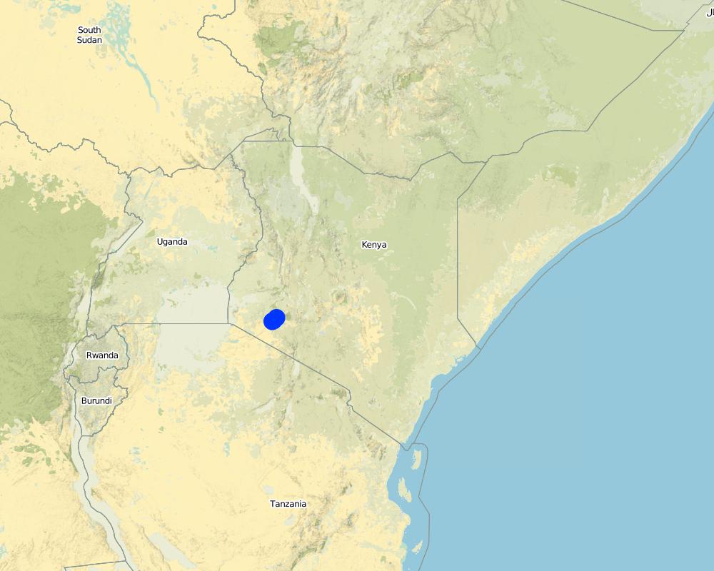
2.5 Страна/ регион/ места, где применяется Технология, информация о которых собрана в данной Анкете
Страна:
Кения
Административная единица (Район/Область):
Bomet county
Более точная привязка места:
Kembu sub-county
Охарактеризуйте пространственное распространение Технологии :
- равномерно-однородное применение на определенной площади
Если точная область неизвестна, укажите приблизительную площадь:
- 10-100 км2
Пояснения:
The technology is applicable in both. It can be customized to fit any use. The best outcome though is total area social enumeration and spatial mapping.
Map
×2.6 Сколько лет применяется данная Технология
Год начала реализации:
2016
2.7 Внедрение Технологии
Укажите, как именно Технология УЗП была внедрена:
- через проекты/ внешнее вмешательство
3. Классификация Технологии УЗП
3.1 Основные цели и задачи реализации Технологии
- повышение производства
- снижение или предотвращение деградации земель, восстановление нарушенных земель
- сохранение экосистем
- защита бассейнов рек (приводораздельной части/ нижнего течения) – в сочетании с другими Технологиями
3.2 Текущий(-ие) тип(-ы) землепользования на территории, где применяется Технология
Комбинированное землепользование в пределах одной и той же земельной единицы:
Да
Укажите сочетания типов землепользования (посевы / пастбища / деревья):
- Агро-пастбищное хозяйство ( включая растениеводство-животноводство)

Пахотные угодья и плантации
Число урожаев за год:
- 2
Поясните:
April to October and November through March

Пастбищные угодья
Экстенсивный выпас:
- Полукочевое скотоводство
Интенсивный выпас/ выращивание кормов:
- Стойловое содержание/ нулевой выпас
Вид животных:
- крупный рогатый скот - немолочная говядина
- крупный рогатый скот - молочный
Продукты и услуги:
- молоко
- кожа / шкуры
- мясо
Пояснения:
Main animal species and products: The cattle kept in Ndaraweta are mainly cross-breeds between local animals and Friesian or Ayrshire cattle. The communities are currently in an advance stage of upgrading, but they still keep some short-horned local zebu cows as well. The cattle are kept for multiple uses including milk, meat, and hides. The communities grow hay for local use and sale within.
The technology did therefore help the communities to appreciate the common resources that support the livestock keeping.
3.3 Изменилось ли использование земель в связи с внедрением Технологии?
Пояснения:
Before the mapping exercise, the management of most common resources were not given much attention. After participatory mapping and documenting these resources and the establishment of information on encroachment, degradation and the neglected water points, communities took up the management of the resources more seriously and therefore improved knowledge and clarity around the land tenure rights for the communities and the need for tenure security and protection of rangelands and the resources therein.
3.4 Водоснабжение
Обеспеченность водой участков, где реализуется Технология :
- богарные земли
3.5 Категория УЗП, к которой относится Технология
- лесное хозяйство в естественных и измененных лесах
- Кочевое животноводство и пастбищное хозяйство
- Комлексное земледельческо-животноводческое хозяйство
3.6 Мероприятия УЗП, выполняемые в рамках Технологии

управленческие мероприятия
- У1: Смена типа землепользования
- У2: Изменение формы/ интенсивности хозяйствования
- У3: Размещение с учетом природных и социально-экономических условий
3.7 Основные проблемы деградации земель, на решение которых направлена Технология

деградация водных ресурсов
- Вуп: изменение объема поверхностного стока
- Вб: снижение буферной способности водно-болотных угодий

другое
Пояснения:
Land degradation in rangelands is a problem that is being experienced and other challenges especially in the areas where agro-pastoralism is practiced include sustainable land use and management. The mapping process while not having direct response to these issues, it demonstrated that the communities can use sustainable means in land use through land use planning.
3.8 Предотвращение и снижение деградации земель, или восстановление нарушенных земель
Укажите цель Технологии по отношению к деградации земель :
- снижение деградации земель
- адаптация к деградации земель
4. Технические характеристики, мероприятия по практической реализации, вложения и стоимость
4.1 Технический рисунок, иллюстрирующий Технологию
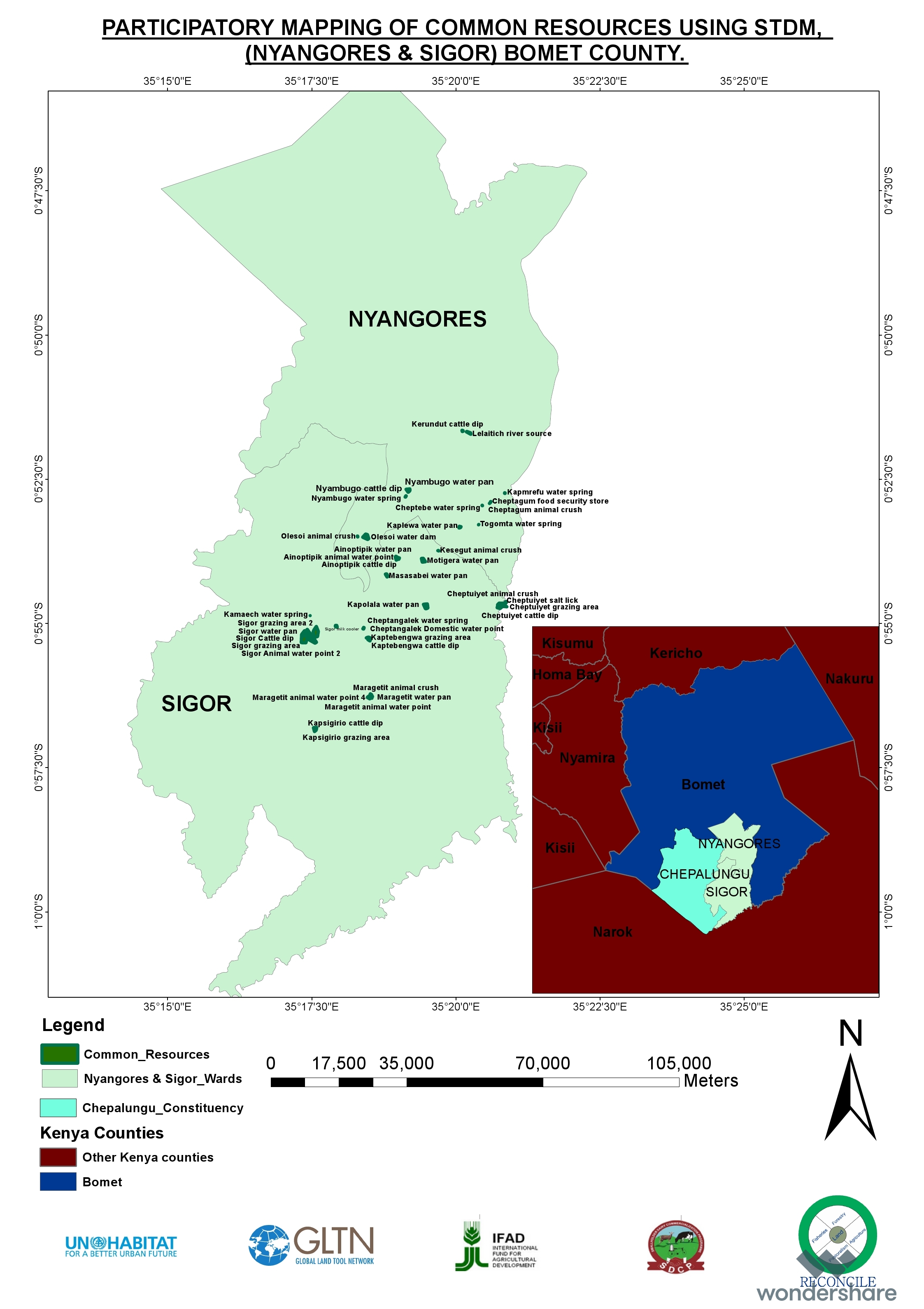
Спецификация (пояснения к техническому рисунку):
The overall space or measurements for the project areas were within the range of 25 to 75 square kilometres.
Автор:
RECONCILE
Дата:
15/06/2016
4.2 Общая информация по необходимым вложениям и стоимости
Уточните, как рассчитывались затраты и вложения:
- на площадь, где применяется Технология
Укажите размер и единицу площади:
Each project area 25 km2 (Project areas of three Sub-Counties 75 km2)
Укажите денежные единицы, использованные для подсчета затрат:
- Доллары США
Если это необходимо, укажите обменный курс от доллара США к местной валюте (например, 1 доллар США = 79,9 бразильского реала): 1 доллар США =:
101,0
Укажите среднюю дневную заработную плату наемных работников:
between Ksh. 2000 to 3000 depending on the kind of labour required and can go down to a compromised rate of ksh. 1000.
4.3 Мероприятия, необходимые для начала реализации
| Деятельность | Время (сессия) | |
|---|---|---|
| 1. | Enumeration of at least 1000 farmers | 9 months |
| 2. | Mapping of communal resources water points, salt lick areas, cattle dips etc | 9 months |
| 3. | Mapping of private resources water points within the private areas | 9 months |
| 4. | Data Management | 3 months |
| 5. | Preparation of data collection including testing of the tools | 1 month |
| 6. | Dialogue sessions with community leaders | 2 months |
| 7. | Negotiations on the methodology for data collection and the kind of information to be collected/asked | 1 month |
| 8. | Technical reviews and reflection with project team and partners | 1 month |
Пояснения:
The kind of tasks undertaken in this process is more project oriented combined with advocacy and policy processes.
4.4 Вложения и затраты, необходимые для начала реализации
| Опишите затраты | Единица | Количество | Затраты на единицу | Общая стоимость на единицу | % затрат, оплаченных землепользователями | |
|---|---|---|---|---|---|---|
| Оплата труда | Enumerators | persons | 90,0 | 50,0 | 4500,0 | |
| Оплата труда | Consultants | Persons | 6,0 | 1000,0 | 6000,0 | |
| Оплата труда | Technical Staff contribution and time | persons | 5,0 | 750,0 | 3750,0 | |
| Оплата труда | Data processing and management | persons | 24,0 | 60,0 | 1440,0 | |
| Оборудование | Data entry and analysis | persons | 20,0 | 40,0 | 800,0 | |
| Оборудование | GPS hiring | 120,0 | 55,0 | 6600,0 | ||
| Оборудование | GPS purchase | 5,0 | 320,0 | 1600,0 | ||
| Оборудование | Computers | 4,0 | 750,0 | 3000,0 | ||
| Оборудование | Conferences | 9,0 | 1500,0 | 13500,0 | ||
| Другие | Administrative costs | 9 months | 9,0 | 1400,0 | 12600,0 | |
| Другие | Logistical support | 36,0 | 600,0 | 21600,0 | ||
| Другие | Preliminary activities including targeted dialogue etc | Travels and associated costs | 5,0 | 300,0 | 1500,0 | |
| Другие | Documentation of the project (to be finalized) | Video documentary | 2,0 | 3000,0 | 6000,0 | |
| Общая стоимость запуска Технологии | 82890,0 | |||||
| Общие затраты на создание Технологии в долларах США | 820,69 | |||||
Если землепользователем оплачено менее 100% затрат, укажите, кем покрывались остальные затраты:
UNHABITAT, RECONCILE, Smallholder Dairy Commercialization Programme (SDCP)
Пояснения:
The project was supported by the UNHABITAT with contributions from RECONCILE and partners. the community contribution in kind is not included since it has not been tabulated in terms of cash.
4.5 Поддержание/ текущее обслуживание
| Деятельность | Сроки/ повторяемость проведения | |
|---|---|---|
| 1. | NA | |
| 2. | NA | |
| 3. | NA |
Пояснения:
The project did not have physical structures developed. However, as a result of the work structures like cattle dips have been rehabilitated and are currently being maintained by the the communities themselves. This does not need recurrent costs for maintenance or otherwise by the project.
4.7 Наиболее значимые факторы, влияющие на стоимость затрат
Опишите наиболее значимые факторы, влияющие на стоимость затрат:
The technology costs are dependent on the size and number of resources targeted by the process. It will therefore define the costs accordingly.
5. Природные и социально-экономические условия
5.1 Климат
Среднегодовое количество осадков
- < 250 мм
- 251-500 мм
- 501-750 мм
- 751-1000 мм
- 1001-1500 мм
- 1501-2000 мм
- 2001-3000 мм
- 3001-4000 мм
- > 4000 мм
Пояснения/ комментарии по осадкам:
The area is sub-humid.
Укажите название соответствующей метеостанции:
Kenya Meteorological department
Агроклиматическая зона
- влажная
- Умеренно-влажная
The average temperature in Bomet is 17.5 °C. Precipitation averages 1247 mm.
5.2 Рельеф
Склоны (преобладающие):
- пологие (0-2%)
- покатые (3-5%)
- покато-крутые (6-10%)
- крутые (11-15%)
- очень крутые (16-30%)
- чрезвычайно крутые (31-60%)
- обрывистые (>60%)
Формы рельефа:
- плато/ равнины
- гребни хребтов/холмов
- склоны гор
- склоны холмов
- подножья
- днища долин
Зона высотной поясности:
- 0-100 м над уровнем моря
- 101-500 м н.у.м.
- 501-1000 м н.у.м.
- 1001-1500 м н.у.м.
- 1501-2000 м н.у.м.
- 2001-2500 м н.у.м.
- 2501-3000 м н.у.м.
- 3001-4000 м н.у.м.
- > 4 тыс. м н.у.м.
Укажите, приурочено ли применение Технологии к специфическим условиям:
- не имеет значения
5.3 Почвы
Средняя мощность почв:
- поверхностные (0-20 см)
- неглубокие (21-50 см)
- умеренно глубокие (51-80 см)
- глубокие (81-120 см)
- очень глубокие (> 120 см)
Гранулометрический состав (верхнего горизонта):
- грубый крупнозернистый/ лёгкий (песчаный)
Гранулометрический состав (на глубине более 20 см):
- грубый крупнозернистый/ лёгкий (песчаный)
5.4 Доступность и качество воды
Уровень грунтовых вод:
5-50 м
Доступность поверхностных вод:
средняя
5.5 Биоразнообразие
Видовое разнообразие:
- средняя
Разнообразие местообитаний:
- низкое
5.6 Характеристика землепользователей, применяющих Технологию
Осёдлый или кочевой:
- Осёдлый
- Полукочевой
Рыночная ориентация производства:
- смешанный (натуральный / коммерческий)
Доходы из других источников:
- 10-50% всех доходов
Относительный уровень достатка:
- средний
Индивидуальное или коллективное хозяйство:
- группа/ община
- кооператив
Уровень механизации:
- ручной труд
- тягловая сила
Пол:
- женщины
- мужчины
Возраст землепользователей:
- молодёжь
- средний возраст
5.7 Средняя площадь земель, используемых землепользователями с применением Технологии
- < 0,5 га
- 0,5-1 га
- 1-2 га
- 2-5 га
- 5-15 га
- 15-50 га
- 50-100 га
- 100-500 га
- 500-1000 га
- 1000-10000 га
- > 10000 га
Считается ли это мелким, средним или крупным хозяйством (по местным масштабам)?
- мелкое
5.8 Собственность на землю, права на земле- и водопользование
Землевладелец:
- общинная/ поселковая
- индивидуальная, оформленная в собственность
Право землепользования:
- общинное (контролируемое)
- индивидуальное
Право водопользования:
- неограниченное (неконтролируемое)
- общинное (контролируемое)
5.9 Доступ к базовым услугам и инфраструктуре
медицинское обслуживание:
- плохой
- средний
- хорошая
образование:
- плохой
- средний
- хорошая
технические консультации:
- плохой
- средний
- хорошая
занятость (вне хозяйства):
- плохой
- средний
- хорошая
рынки:
- плохой
- средний
- хорошая
электроснабжение:
- плохой
- средний
- хорошая
транспорт и дорожная сеть:
- плохой
- средний
- хорошая
водоснабжение и канализация:
- плохой
- средний
- хорошая
финансовые услуги:
- плохой
- средний
- хорошая
6. Воздействия и заключительные положения
6.1 Влияние Технологии УЗП в пределах территории ее применения
Социально-экономическое воздействие
Продуктивность
производство кормов
Комментарий/ пояснения:
The production in the farms increased for milk
качество кормов
Комментарий/ пояснения:
The size of fodder producers also increased. the production trend is stable based on the number of farmers involved.
производство продуктов животноводства
Доходы и затраты
доходы хозяйства
Комментарий/ пояснения:
Resulting from the proper land use and increased milk production based on more pasture, costs increased.
Экологическое воздействие
Климат и снижение риска стихийных бедствий
влияние засух
6.2 Влияние Технологии за пределами территории ее применения
доступность воды
надежность и постоянство водотоков
буферная/ фильтрационная способность
воздействие парниковых газов
6.3 Подверженность и чувствительность Технологии УЗП к постепенным изменениям климата и экстремальным погодным явлениям/ стихийным бедствиям, связанным с изменением климата (в понимании землепользователей)
Постепенное изменение климата
Постепенное изменение климата
| Сезон | увеличение или уменьшение | Насколько успешно Технология справляется с этим? | |
|---|---|---|---|
| среднегодовое количество осадков | снизилось | умеренно |
Другие воздействия, связанные с изменением климата
Другие воздействия, связанные с изменением климата
| Насколько успешно Технология справляется с этим? | |
|---|---|
| сокращение вегетационного периода | умеренно |
6.4 Анализ эффективности затрат
Насколько получаемый результат сопоставим с первоначальными вложениями (с точки зрения землепользователей)?
Эффективность затрат в краткосрочной перспективе:
позитивное
Эффективность затрат в долгосрочной перспективе:
очень позитивное
Насколько получаемый результат сопоставим с текущими расходами по поддержанию технологии (с точки зрения землепользователей)?
Эффективность затрат в краткосрочной перспективе:
влияние незаметно
Эффективность затрат в долгосрочной перспективе:
позитивное
6.5 Внедрение Технологии
- > 50%
Если возможно, дайте количественную характеристику (число домохозяйств и/или площадь применения):
The technology covered around 500 individual farmers.
Среди применяющих Технологию землепользователей, какова доля лиц, применяющих её по собственной инициативе, т.е. без какого-либо материального стимулирования со стороны?
- 11-50%
Пояснения:
The technology application did not attract any material gains or incentives but, the process was community centered thus the adoption.
6.6 Адаптация
Была ли Технология УЗП изменена в недавнее время с целью адаптации к меняющимся условиям среды?
Да
Укажите, что именно изменилось в Технологии (дизайн, используемые материалы или виды растений/животных и т.д.):
The technology was more of the urban oriented tool but had to be modified to adopt to the local demands.
6.7 Сильные стороны/ преимущества/ возможности Технологии
| Сильные стороны/ преимущества/ возможности по мнению землепользователей |
|---|
| Ability to define spatial space and common and private resources including those resources associated with milk production such as milk coolers, water points, cattle dips, food stores, grazing areas, salt licks, crushes, animal corridors, forest etc.Establishes the carrying capacity of communal shared resources. |
| Establishment of the land tenure system of shared communal resources and issues arising.Status (management) of private resources within the rangelands.Production and income generated against household size. |
| Сильные стороны/ преимущества/ возможности по мнению составителя или других ключевых специалистов |
|---|
| The nature of the problem required innovative use in the mapping of the land and natural resources.The technology addressed immediate needs and provided a foundation for future updates and demands.The technology benefited from the existing data and improved delivery of output without any impediments. |
| The technology bridged the gap through skills transfer and capacity building and in facilitating dialogue on issues affecting the community (Maps, reports). Ability to adapt the technology in a simple manner that the users can relate to, and find value in their use contributed immensely to successIntroduced even a more user-friendly use of mobile and smart-phones. The “quick win” could be seen in the transformation of mobile phones into data collection tools and the data can be seen, verified and shared, replacing the tedious manual process which many were struggling with. |
| STDM databases accommodate the inclusion of social, economic and spatial data that can be maintained, accessed and updated by the communities anytime.Provided visual representation of available resources and their distribution and people can relate to spatial information on the map. |
| Ownership of technology by local people who are now leading on data collection, customizing the template, developing reports and innovating on its use. |
6.8 Слабые стороны/ недостатки/ риски Технологии и пути их преодоления
| Слабые стороны/ недостатки/ риски по мнению землепользователей | Возможные пути их преодоления/снижения? |
|---|---|
| The design of the tool was more urban oriented and it took time to be adapted for rural use especially where land is communal and customary rights are key. | Created more awareness. |
| Слабые стороны/ недостатки/ риски по мнению составителя или ответственных специалистов | Возможные пути их преодоления/снижения? |
|---|---|
| Difficult to set-up the server environment where no internet is available.Engaging other service providers may be difficult and takes time (Internet service provider need to authorize setting up additional server).Appropriate devices for capturing data may require an additional budget. | The internet component remains a challenge Technology is evolving and needs systematic information channels between the community members.The process requires proper funding in order not to have a break in between. |
7. Справочные материалы и ссылки
7.1 Методы сбора/ источники информации
- выезды на места, полевые обследования
900
- опросы землепользователей
900
- опросы специалистов/экспертов по УЗП
2
- данные, собранные из отчетов и достоверных документов
Когда были собраны данные (на местах)?
11/12/2017
7.3 Ссылки на соответствующую онлайн-информацию
Название/ описание:
RECONCILE end of project report and other progress reports are available for sharing
Название/ описание:
Food security in Bomet county
Адрес в сети Интернет:
awsc.uonbi.ac.ke/sites/default/files/chss/arts/.../Bomet-final.doc
Ссылки и модули
Развернуть все Свернуть всеСсылки
Нет ссылок
Модули
Нет модулей