Social Tenure Domain Model (STDM) [肯尼亚]
- 创建:
- 更新:
- 编制者: Ken Otieno
- 编辑者: –
- 审查者: Donia Mühlematter, Hanspeter Liniger, Barbara *, Alexandra Gavilano
STDM
technologies_3318 - 肯尼亚
- Social Tenure Domain Model (STDM): July 5, 2018 (inactive)
- Social Tenure Domain Model (STDM): May 7, 2019 (public)
- Social Tenure Domain Model (STDM): June 28, 2018 (inactive)
- Social Tenure Domain Model (STDM): June 4, 2018 (inactive)
- Social Tenure Domain Model (STDM): May 19, 2018 (inactive)
- Social Tenure Domain Model (STDM): March 5, 2018 (inactive)
查看章节
全部展开 全部收起1. 一般信息
1.2 参与该技术评估和文件编制的资源人员和机构的联系方式
有助于对技术进行记录/评估的项目名称(如相关)
Book project: Guidelines to Rangeland Management in Sub-Saharan Africa (Rangeland Management)1.3 关于使用通过WOCAT记录的数据的条件
编制者和关键资源人员接受有关使用通过WOCAT记录数据的条件。:
是
1.4 所述技术的可持续性声明
这里所描述的技术在土地退化方面是否存在问题,导致无法被认为是一种可持续的土地管理技术?:
否
注释:
The technology has demonstrated SLM.
2. SLM技术的说明
2.1 技术简介
技术定义:
The Social Tenure Domain Model (STDM) is about people and their relationships with land. The tool as applied secures tenure through the recognition of tenure diversity and social contexts. In the management of land and resources use, STDM facilitates proper land use and management to minimize practices that lead to degradation.
2.2 技术的详细说明
说明:
Technology application: The Social Tenure Domain Model is applied in order to relate natural and human environments. It is a social tool that defines the relationship of persons to natural resources such as land, their utilization of it, and sharing - for sustainable development. To realize optimal resource utilization, the tool enables the direct engagement of the resource users in a collective and participatory way. The technology allows communities to be part of a guided data collection and data entry into an STDM platform. The data includes social and economic data based on what is needed. The platform also can enable storage of information and documents such as title deeds. Names, gender, properties where the community members needs to have such information. These details can be updated and can inform planning and resource allocation by government and development partners. Main characteristics of the technology: STDM is a relational database built on an open source GIS platform called Quontum GIS (QGIS), running on Postgres SQL. This tool was built by Global Tools Land Network (GLTN). The tool captures both spatial information related to locations of land parcels, natural resources captured in points and defined in maps. Secondly, the technology captures socio-economic aspects of a resource, and allows definition of the type of relationship that exists between the resource and the person, as well as an indication of the percentage particular tenure regime in the areas including the existing rights and how they play out. The system recognizes the different level of rights thus appreciating that they are multiple and overlaid resulting to multiple uses. Therefore the technology enables the capture of bundles of rights that people have/should enjoy in a resource. The technology allows generation of reports and performs the desired analysis by the proponents and the beneficiaries of the information stored within the databases. It is open source, thus available free -hence its sustainability.The purposes/ functions of the STDM: The functions of the technology as have been piloted by RECONCILE and partners has focused around land tenure. It addresses security of tenure for vulnerable poor communities living within informal settlements, through participatory common resource identification, mapping and documentation, key resources including cattle dips, salt lick areas/fields and water points management has improved. This is due to the recognition of boundaries anticipatorily defined leading to revival of and establishment of community resources management committees especially around water and grazing lands. This in return has improved /increased production of both plants and animals. However, the technology can be customized to serve other purposes of information storage and management. The major activities/ inputs needed to establish/ maintain the technology: Major inputs are needed in empowerment of local communities through building their capacity to apply the technology through their own initiative. Building community-based resource centres and equipping them with computers installed with the software ensures that the technology is centred on the day-to-day activities of the communities and institutions. Benefits/ impacts: The technology has left better organised communities in terms of managing land and other resources. The technology has assisted local governments to manage issues of land ownership, especially within the context of customary land tenure and ownership. The county governments of Kenya, for instance, have spatial data and information that can help in planning and resources allocation. In areas where the technology has been used in the context of RECONCILE's work, better services and resources can be acquired given accurate information of Mapping land tenure, boundaries, water points and the water rights, infrastructure, different grazing lands and plans for the utilization of the grazing land and the rights of different users. It can result in improved and sustainable use of natural resources which in turn have a direct impact on production. Small-scale dairy farmers have been able to manage grazing lands, water and salt licks to improve production of animal products. Information captured and managed by the technology has enabled communities within informal settlements to negotiate with government authorities to enable land allocation and thus security of tenure and improved livelihoods.What do land users like / dislike about the technology?Likes: The technology is flexible, it can be customized to capture information in any form desired. It is based on a GIS platform which is easy to manipulate and is open source.Dislikes: Users sometimes encounter errors that are a result of incorrect information entered, and these errors are written with the programming format: thus it requires good knowledge of the technology to remedy this.
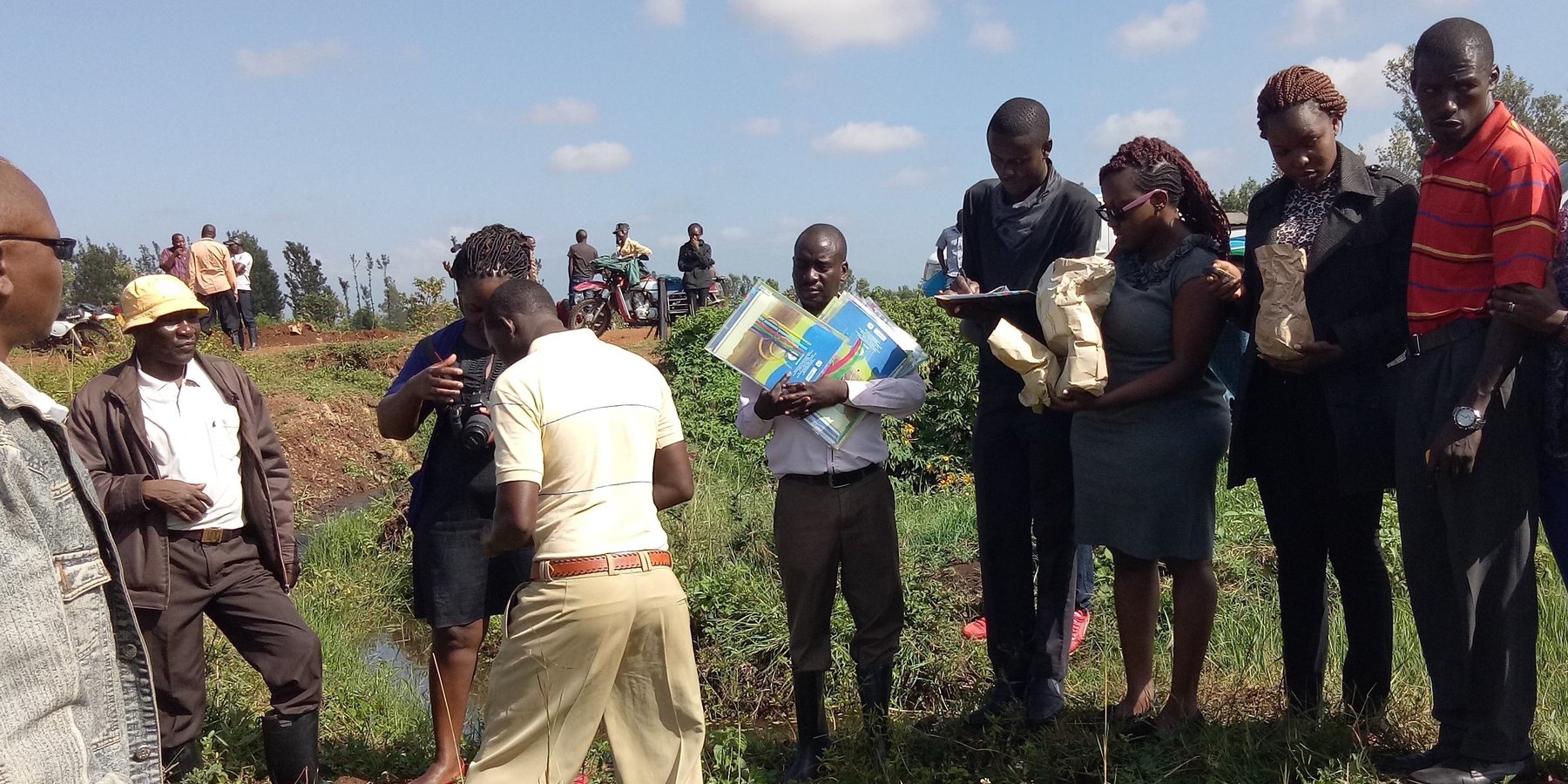
2.3 技术照片
媒体库
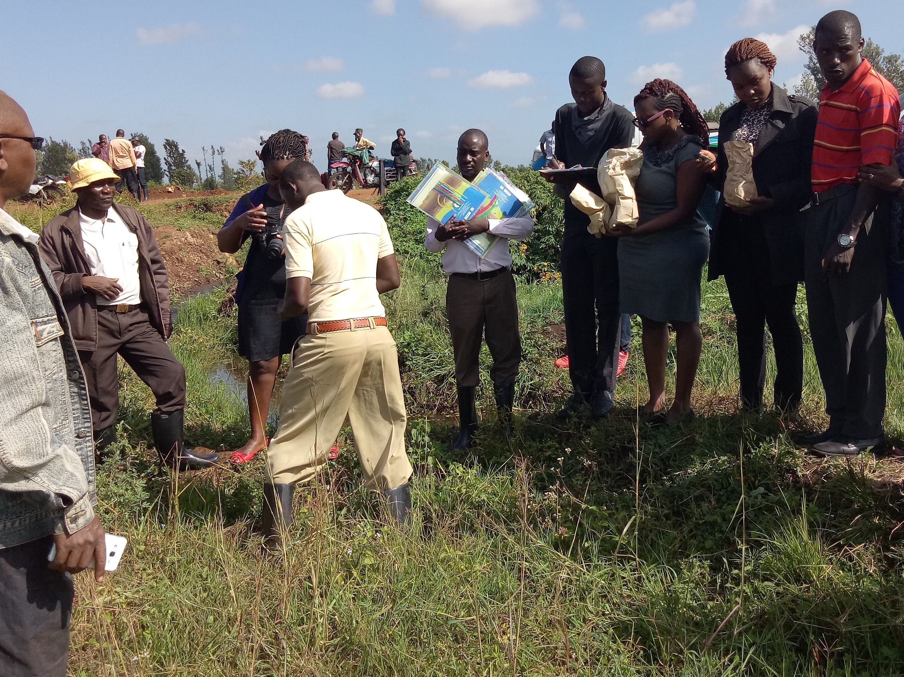
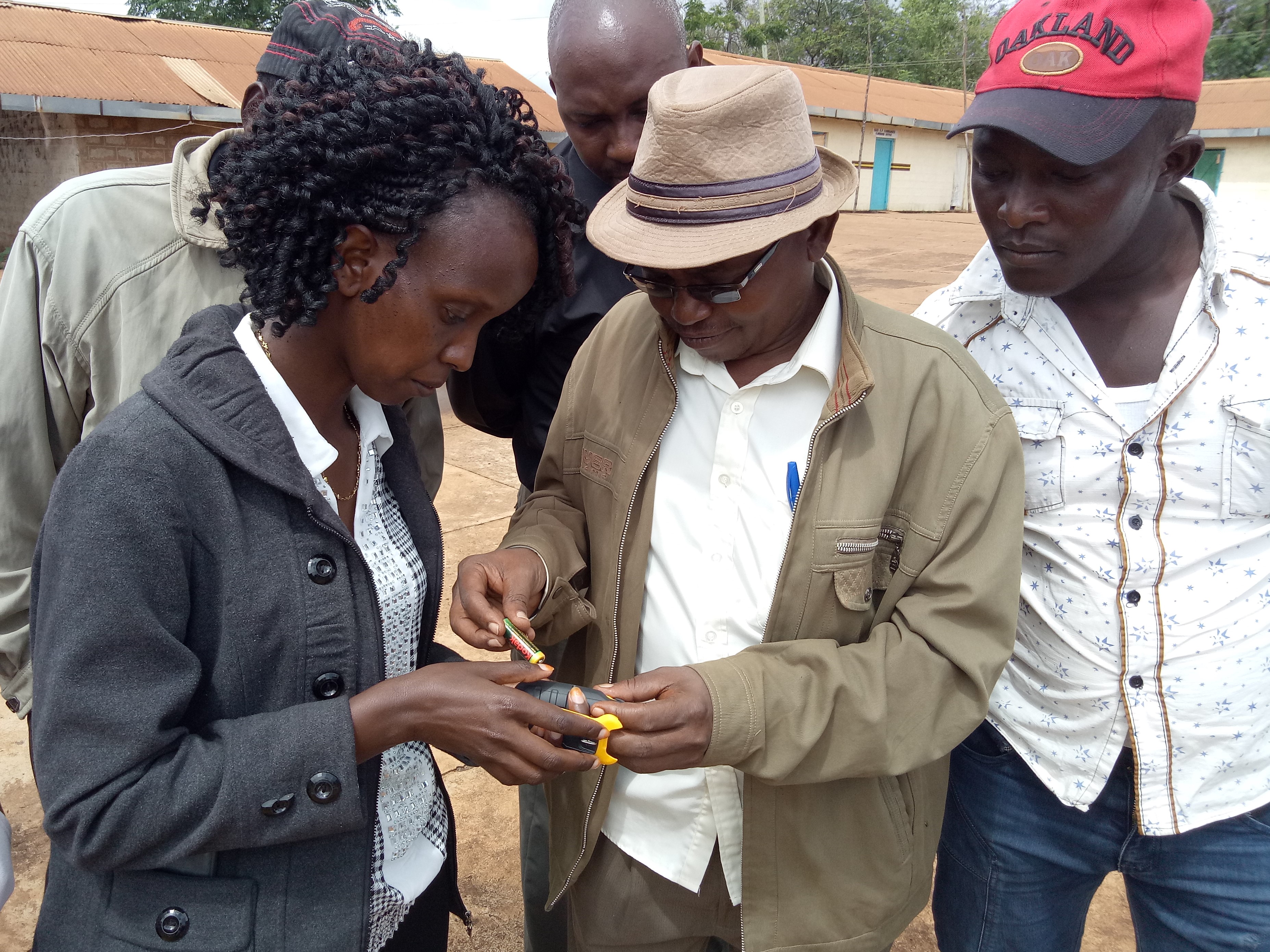
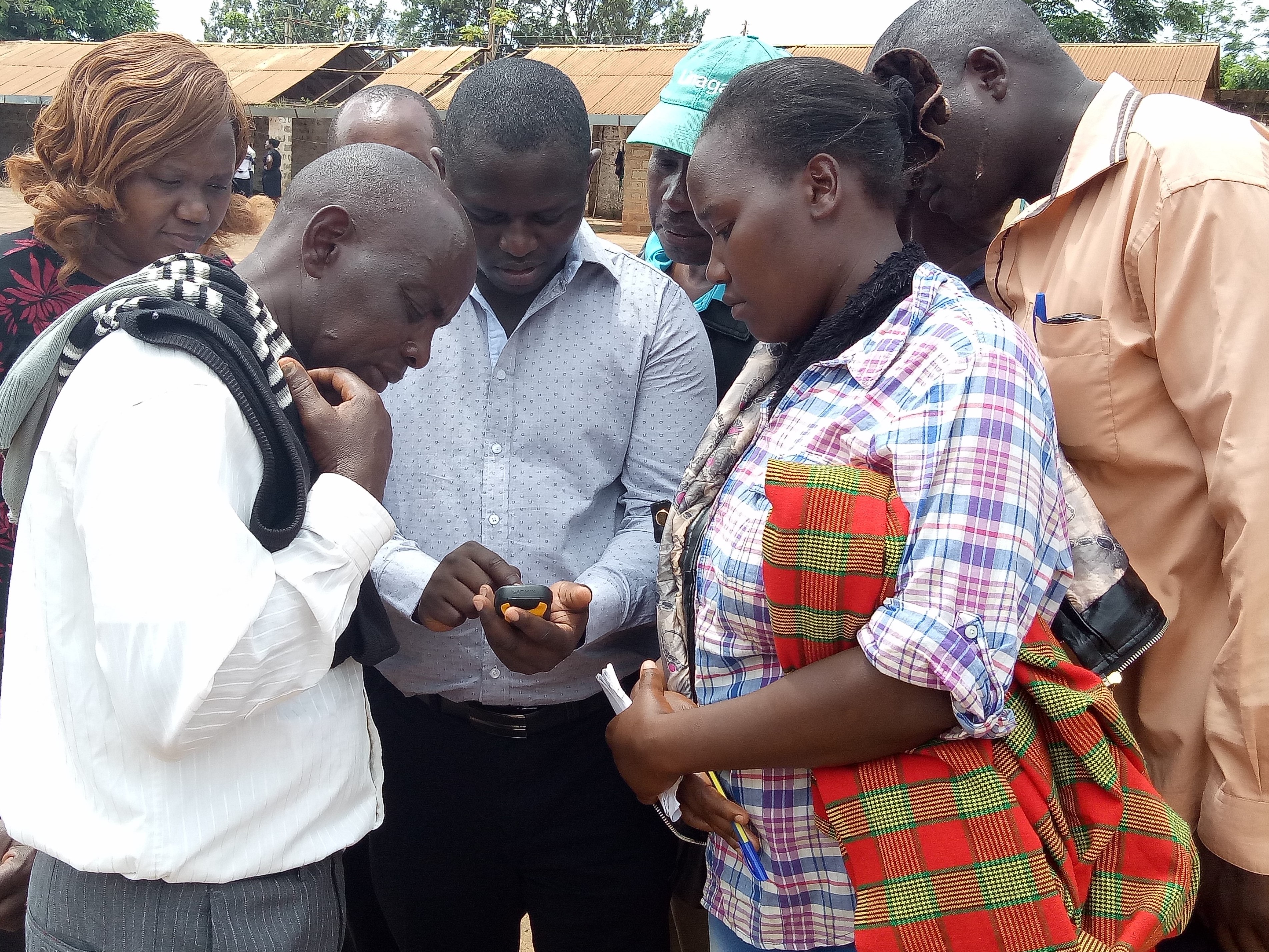
关于照片的一般说明:
This activity was done to complement the social economic data collected and create the ability to understand the social tenure relationship between farmers and the common resources.
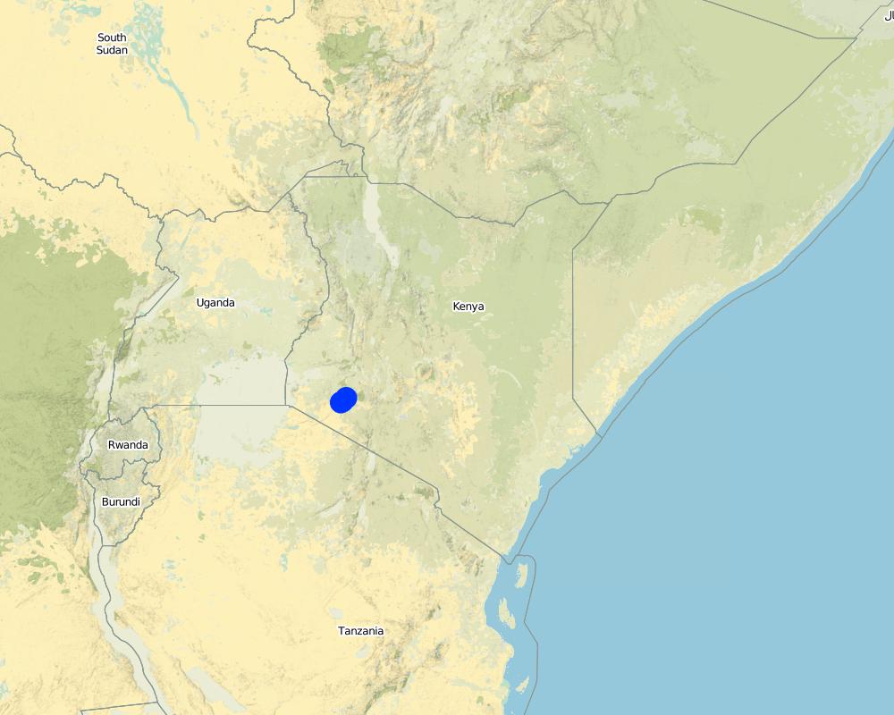
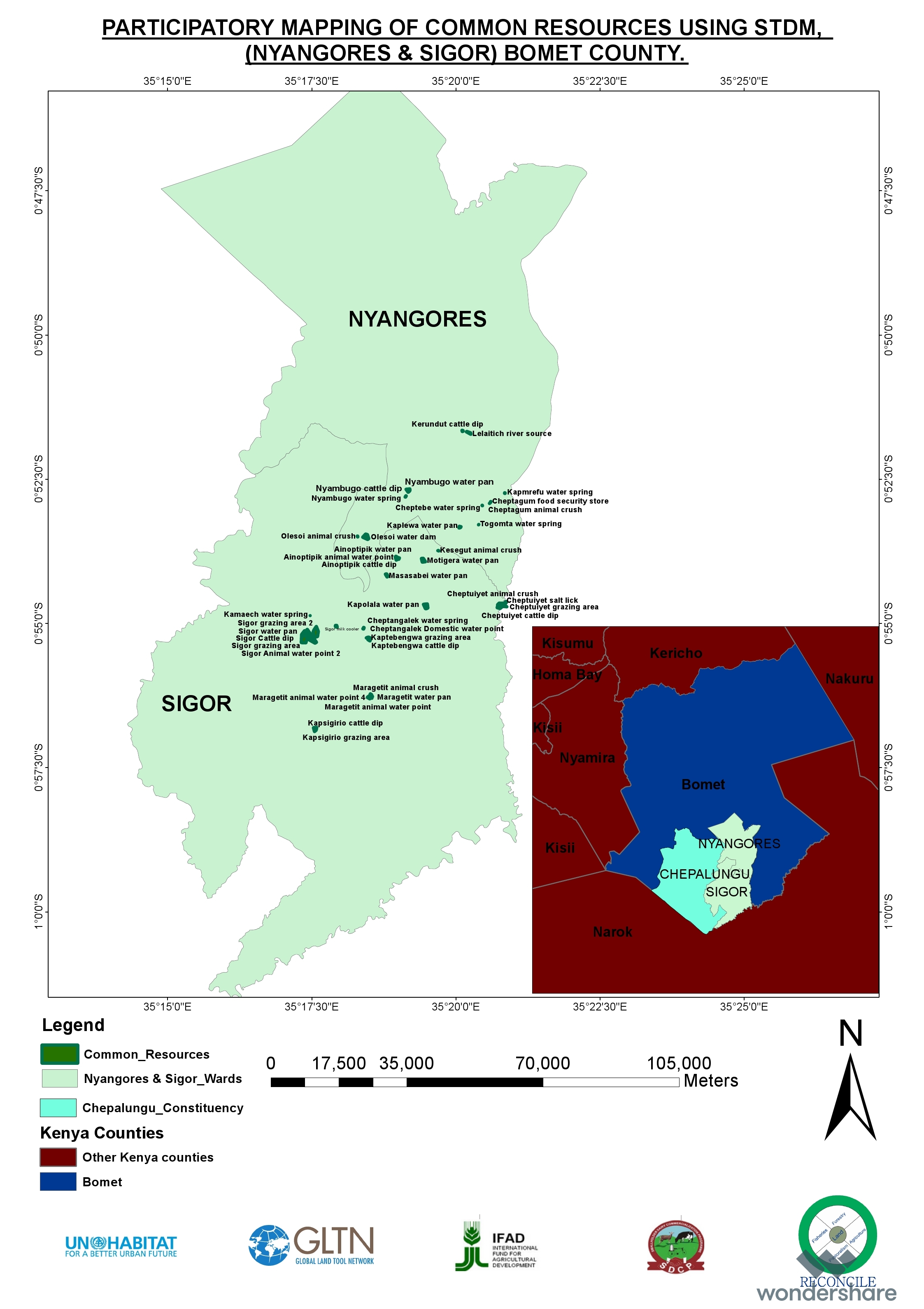
2.5 已应用该技术的、本评估所涵盖的国家/地区/地点
国家:
肯尼亚
区域/州/省:
Bomet county
有关地点的进一步说明:
Kembu sub-county
具体说明该技术的分布:
- 均匀地分布在一个区域
如果不知道精确的区域,请注明大致覆盖的区域:
- 10-100 平方千米
注释:
The technology is applicable in both. It can be customized to fit any use. The best outcome though is total area social enumeration and spatial mapping.
Map
×2.6 实施日期
注明实施年份:
2016
2.7 技术介绍
详细说明该技术是如何引入的:
- 通过项目/外部干预
3. SLM技术的分类
3.1 该技术的主要目的
- 改良生产
- 减少、预防、恢复土地退化
- 保护生态系统
- 结合其他技术保护流域/下游区域
3.2 应用该技术的当前土地利用类型
同一土地单元内混合使用的土地::
是
具体说明混合土地使用(作物/放牧/树木):
- 农牧业(包括农牧结合)

农田
每年的生长季节数:
- 2
具体说明:
April to October and November through March

牧场
粗放式放牧:
- 半游牧畜牧业
集约放牧/饲料生产:
- 收割和携带/零放牧
动物类型:
- 牛 - 非奶牛牛肉
- 牛 - 奶制品
产品和服务:
- 奶类
- 外皮/兽皮
- 肉类
注释:
Main animal species and products: The cattle kept in Ndaraweta are mainly cross-breeds between local animals and Friesian or Ayrshire cattle. The communities are currently in an advance stage of upgrading, but they still keep some short-horned local zebu cows as well. The cattle are kept for multiple uses including milk, meat, and hides. The communities grow hay for local use and sale within.
The technology did therefore help the communities to appreciate the common resources that support the livestock keeping.
3.3 由于技术的实施,土地使用是否发生了变化?
注释:
Before the mapping exercise, the management of most common resources were not given much attention. After participatory mapping and documenting these resources and the establishment of information on encroachment, degradation and the neglected water points, communities took up the management of the resources more seriously and therefore improved knowledge and clarity around the land tenure rights for the communities and the need for tenure security and protection of rangelands and the resources therein.
3.4 供水
该技术所应用土地的供水:
- 雨养
3.5 该技术所属的SLM组
- 天然和半天然森林管理
- 畜牧业和牧场管理
- 农畜综合管理
3.6 包含该技术的可持续土地管理措施

管理措施
- M1:改变土地使用类型
- M2:改变管理/强度级别
- M3:根据自然和人文环境进行布局
3.7 该技术强调的主要土地退化类型

水质恶化
- Hs:地表水良变化
- Hw:湿地缓冲能力下降
其它
注释:
Land degradation in rangelands is a problem that is being experienced and other challenges especially in the areas where agro-pastoralism is practiced include sustainable land use and management. The mapping process while not having direct response to these issues, it demonstrated that the communities can use sustainable means in land use through land use planning.
3.8 防止、减少或恢复土地退化
具体数量名该技术与土地退化有关的目标:
- 减少土地退化
- 适应土地退化
4. 技术规范、实施活动、投入和成本
4.1 该技术的技术图纸
技术规范(与技术图纸相关):
The overall space or measurements for the project areas were within the range of 25 to 75 square kilometres.
作者:
RECONCILE
日期:
15/06/2016
4.2 有关投入和成本计算的一般信息
具体说明成本和投入是如何计算的:
- 每个技术区域
注明尺寸和面积单位:
Each project area 25 km2 (Project areas of three Sub-Counties 75 km2)
具体说明成本计算所用货币:
- 美元
如相关,注明美元与当地货币的汇率(例如1美元=79.9巴西雷亚尔):1美元=:
101.0
注明雇用劳工的每日平均工资成本:
between Ksh. 2000 to 3000 depending on the kind of labour required and can go down to a compromised rate of ksh. 1000.
4.3 技术建立活动
| 活动 | 时间(季度) | |
|---|---|---|
| 1. | Enumeration of at least 1000 farmers | 9 months |
| 2. | Mapping of communal resources water points, salt lick areas, cattle dips etc | 9 months |
| 3. | Mapping of private resources water points within the private areas | 9 months |
| 4. | Data Management | 3 months |
| 5. | Preparation of data collection including testing of the tools | 1 month |
| 6. | Dialogue sessions with community leaders | 2 months |
| 7. | Negotiations on the methodology for data collection and the kind of information to be collected/asked | 1 month |
| 8. | Technical reviews and reflection with project team and partners | 1 month |
注释:
The kind of tasks undertaken in this process is more project oriented combined with advocacy and policy processes.
4.4 技术建立所需要的费用和投入
| 对投入进行具体说明 | 单位 | 数量 | 单位成本 | 每项投入的总成本 | 土地使用者承担的成本% | |
|---|---|---|---|---|---|---|
| 劳动力 | Enumerators | persons | 90.0 | 50.0 | 4500.0 | |
| 劳动力 | Consultants | Persons | 6.0 | 1000.0 | 6000.0 | |
| 劳动力 | Technical Staff contribution and time | persons | 5.0 | 750.0 | 3750.0 | |
| 劳动力 | Data processing and management | persons | 24.0 | 60.0 | 1440.0 | |
| 设备 | Data entry and analysis | persons | 20.0 | 40.0 | 800.0 | |
| 设备 | GPS hiring | 120.0 | 55.0 | 6600.0 | ||
| 设备 | GPS purchase | 5.0 | 320.0 | 1600.0 | ||
| 设备 | Computers | 4.0 | 750.0 | 3000.0 | ||
| 设备 | Conferences | 9.0 | 1500.0 | 13500.0 | ||
| 其它 | Administrative costs | 9 months | 9.0 | 1400.0 | 12600.0 | |
| 其它 | Logistical support | 36.0 | 600.0 | 21600.0 | ||
| 其它 | Preliminary activities including targeted dialogue etc | Travels and associated costs | 5.0 | 300.0 | 1500.0 | |
| 其它 | Documentation of the project (to be finalized) | Video documentary | 2.0 | 3000.0 | 6000.0 | |
| 技术建立所需总成本 | 82890.0 | |||||
| 技术建立总成本,美元 | 820.69 | |||||
如果土地使用者负担的费用少于100%,请注明由谁负担其余费用:
UNHABITAT, RECONCILE, Smallholder Dairy Commercialization Programme (SDCP)
注释:
The project was supported by the UNHABITAT with contributions from RECONCILE and partners. the community contribution in kind is not included since it has not been tabulated in terms of cash.
4.5 维护/经常性活动
| 活动 | 时间/频率 | |
|---|---|---|
| 1. | NA | |
| 2. | NA | |
| 3. | NA |
注释:
The project did not have physical structures developed. However, as a result of the work structures like cattle dips have been rehabilitated and are currently being maintained by the the communities themselves. This does not need recurrent costs for maintenance or otherwise by the project.
4.7 影响成本的最重要因素
描述影响成本的最决定性因素:
The technology costs are dependent on the size and number of resources targeted by the process. It will therefore define the costs accordingly.
5. 自然和人文环境
5.1 气候
年降雨量
- < 250毫米
- 251-500毫米
- 501-750毫米
- 751-1,000毫米
- 1,001-1,500毫米
- 1,501-2,000毫米
- 2,001-3,000毫米
- 3,001-4,000毫米
- > 4,000毫米
有关降雨的规范/注释:
The area is sub-humid.
注明所考虑的参考气象站名称:
Kenya Meteorological department
农业气候带
- 潮湿的
- 半湿润
The average temperature in Bomet is 17.5 °C. Precipitation averages 1247 mm.
5.2 地形
平均坡度:
- 水平(0-2%)
- 缓降(3-5%)
- 平缓(6-10%)
- 滚坡(11-15%)
- 崎岖(16-30%)
- 陡峭(31-60%)
- 非常陡峭(>60%)
地形:
- 高原/平原
- 山脊
- 山坡
- 山地斜坡
- 麓坡
- 谷底
垂直分布带:
- 0-100 m a.s.l.
- 101-500 m a.s.l.
- 501-1,000 m a.s.l.
- 1,001-1,500 m a.s.l.
- 1,501-2,000 m a.s.l.
- 2,001-2,500 m a.s.l.
- 2,501-3,000 m a.s.l.
- 3,001-4,000 m a.s.l.
- > 4,000 m a.s.l.
说明该技术是否专门应用于:
- 不相关
5.3 土壤
平均土层深度:
- 非常浅(0-20厘米)
- 浅(21-50厘米)
- 中等深度(51-80厘米)
- 深(81-120厘米)
- 非常深(> 120厘米)
土壤质地(表土):
- 粗粒/轻(砂质)
土壤质地(地表以下> 20厘米):
- 粗粒/轻(砂质)
5.4 水资源可用性和质量
地下水位表:
5-50米
地表水的可用性:
中等
5.5 生物多样性
物种多样性:
- 中等
栖息地多样性:
- 低
5.6 应用该技术的土地使用者的特征
定栖或游牧:
- 定栖的
- 半游牧的
生产系统的市场定位:
- 混合(生计/商业)
非农收入:
- 收入的10-50%
相对财富水平:
- 平均水平
个人或集体:
- 团体/社区
- 合作社
机械化水平:
- 手工作业
- 畜力牵引
性别:
- 女人
- 男人
土地使用者的年龄:
- 青年人
- 中年人
5.7 应用该技术的土地使用者使用的平均土地面积
- < 0.5 公顷
- 0.5-1 公顷
- 1-2 公顷
- 2-5公顷
- 5-15公顷
- 15-50公顷
- 50-100公顷
- 100-500公顷
- 500-1,000公顷
- 1,000-10,000公顷
- > 10,000公顷
这被认为是小规模、中规模还是大规模的(参照当地实际情况)?:
- 小规模的
5.8 土地所有权、土地使用权和水使用权
土地所有权:
- 社区/村庄
- 个人,有命名
土地使用权:
- 社区(有组织)
- 个人
用水权:
- 自由进入(无组织)
- 社区(有组织)
5.9 进入服务和基础设施的通道
健康:
- 贫瘠
- 适度的
- 好
教育:
- 贫瘠
- 适度的
- 好
技术援助:
- 贫瘠
- 适度的
- 好
就业(例如非农):
- 贫瘠
- 适度的
- 好
市场:
- 贫瘠
- 适度的
- 好
能源:
- 贫瘠
- 适度的
- 好
道路和交通:
- 贫瘠
- 适度的
- 好
饮用水和卫生设施:
- 贫瘠
- 适度的
- 好
金融服务:
- 贫瘠
- 适度的
- 好
6. 影响和结论性说明
6.1 该技术的现场影响
社会经济效应
生产
饲料生产
注释/具体说明:
The production in the farms increased for milk
饲料质量
注释/具体说明:
The size of fodder producers also increased. the production trend is stable based on the number of farmers involved.
畜牧生产
收入和成本
农业收入
注释/具体说明:
Resulting from the proper land use and increased milk production based on more pasture, costs increased.
生态影响
减少气候和灾害风险
干旱影响
6.2 该技术的场外影响已经显现
水资源可用性
旱季稳定可靠的水流
缓冲/过滤能力
温室气体的影响
6.3 技术对渐变气候以及与气候相关的极端情况/灾害的暴露和敏感性(土地使用者认为的极端情况/灾害)
渐变气候
渐变气候
| 季节 | 增加或减少 | 该技术是如何应对的? | |
|---|---|---|---|
| 年降雨量 | 减少 | 适度 |
其他气候相关的后果
其他气候相关的后果
| 该技术是如何应对的? | |
|---|---|
| 缩短生长期 | 适度 |
6.4 成本效益分析
技术收益与技术建立成本相比如何(从土地使用者的角度看)?
短期回报:
积极
长期回报:
非常积极
技术收益与技术维护成本/经常性成本相比如何(从土地使用者的角度看)?
短期回报:
中性/平衡
长期回报:
积极
6.5 技术采用
- > 50%
如若可行,进行量化(住户数量和/或覆盖面积):
The technology covered around 500 individual farmers.
在所有采用这项技术的人当中,有多少人是自发的,即未获得任何物质奖励/付款?:
- 11-50%
注释:
The technology application did not attract any material gains or incentives but, the process was community centered thus the adoption.
6.6 适应
最近是否对该技术进行了修改以适应不断变化的条件?:
是
具体说明技术的适应性(设计、材料/品种等):
The technology was more of the urban oriented tool but had to be modified to adopt to the local demands.
6.7 该技术的优点/长处/机会
| 土地使用者眼中的长处/优势/机会 |
|---|
| Ability to define spatial space and common and private resources including those resources associated with milk production such as milk coolers, water points, cattle dips, food stores, grazing areas, salt licks, crushes, animal corridors, forest etc.Establishes the carrying capacity of communal shared resources. |
| Establishment of the land tenure system of shared communal resources and issues arising.Status (management) of private resources within the rangelands.Production and income generated against household size. |
| 编制者或其他关键资源人员认为的长处/优势/机会 |
|---|
| The nature of the problem required innovative use in the mapping of the land and natural resources.The technology addressed immediate needs and provided a foundation for future updates and demands.The technology benefited from the existing data and improved delivery of output without any impediments. |
| The technology bridged the gap through skills transfer and capacity building and in facilitating dialogue on issues affecting the community (Maps, reports). Ability to adapt the technology in a simple manner that the users can relate to, and find value in their use contributed immensely to successIntroduced even a more user-friendly use of mobile and smart-phones. The “quick win” could be seen in the transformation of mobile phones into data collection tools and the data can be seen, verified and shared, replacing the tedious manual process which many were struggling with. |
| STDM databases accommodate the inclusion of social, economic and spatial data that can be maintained, accessed and updated by the communities anytime.Provided visual representation of available resources and their distribution and people can relate to spatial information on the map. |
| Ownership of technology by local people who are now leading on data collection, customizing the template, developing reports and innovating on its use. |
6.8 技术的弱点/缺点/风险及其克服方法
| 土地使用者认为的弱点/缺点/风险 | 如何克服它们? |
|---|---|
| The design of the tool was more urban oriented and it took time to be adapted for rural use especially where land is communal and customary rights are key. | Created more awareness. |
| 编制者或其他关键资源人员认为的弱点/缺点/风险 | 如何克服它们? |
|---|---|
| Difficult to set-up the server environment where no internet is available.Engaging other service providers may be difficult and takes time (Internet service provider need to authorize setting up additional server).Appropriate devices for capturing data may require an additional budget. | The internet component remains a challenge Technology is evolving and needs systematic information channels between the community members.The process requires proper funding in order not to have a break in between. |
7. 参考和链接
7.1 信息的方法/来源
- 实地考察、实地调查
900
- 与土地使用者的访谈
900
- 与SLM专业人员/专家的访谈
2
- 根据报告和其他现有文档进行编译
(现场)数据是什么时候汇编的?:
11/12/2017
7.3 链接到网络上的相关信息
标题/说明:
RECONCILE end of project report and other progress reports are available for sharing
标题/说明:
Food security in Bomet county
URL:
awsc.uonbi.ac.ke/sites/default/files/chss/arts/.../Bomet-final.doc
链接和模块
全部展开 全部收起链接
无链接
模块
无模块