Lake Revival: Towards Environmental Conservation [ภูฏาน]
- ผู้สร้างสรรค์:
- การอัพเดท:
- ผู้รวบรวม: Tshering Yangzom
- ผู้เรียบเรียง: Tashi Wangdi
- ผู้ตรวจสอบ: William Critchley, Rima Mekdaschi Studer, Joana Eichenberger
Tsho Nyam Soong Baedhi Rang Zhin Thakor Dhakzin Thabni (མཚོ་ཉམས་སྲུང་འབད་དེ་རང་བཞིན་མཐའ་སྐོར་བདག་འཛིན་འཐབ་ནི།)
technologies_6857 - ภูฏาน
ดูส่วนย่อย
ขยายทั้งหมด ย่อทั้งหมด1. ข้อมูลทั่วไป
1.2 รายละเอียดที่ติดต่อได้ของผู้รวบรวมและองค์กรที่เกี่ยวข้องในการประเมินและการจัดเตรียมทำเอกสารของเทคโนโลยี
วิทยากรหลัก
ผู้ใช้ที่ดิน:
La Tshultrim
NA
ภูฏาน
ผู้ใช้ที่ดิน:
Thinley Kinzang
NA
ภูฏาน
ผู้ใช้ที่ดิน:
Wangmo Dorji
NA
ภูฏาน
ผู้ใช้ที่ดิน:
Wangdi Yeshi
NA
ภูฏาน
ชื่อของโครงการซึ่งอำนวยความสะดวกในการทำเอกสารหรือการประเมินเทคโนโลยี (ถ้าเกี่ยวข้อง)
Strengthening national-level institutional and professional capacities of country Parties towards enhanced UNCCD monitoring and reporting – GEF 7 EA Umbrella II (GEF 7 UNCCD Enabling Activities_Umbrella II)ชื่อขององค์กรซึ่งอำนวยความสะดวกในการทำเอกสารหรือการประเมินเทคโนโลยี (ถ้าเกี่ยวข้อง)
National Soil Services Center, Department of Agric (National Soil Services Center, Department of Agric) - ภูฏาน1.3 เงื่อนไขการใช้ข้อมูลที่ได้บันทึกผ่านทาง WOCAT
ผู้รวบรวมและวิทยากรหลักยอมรับเงื่อนไขเกี่ยวกับการใช้ข้อมูลที่ถูกบันทึกผ่านทาง WOCAT:
ใช่
1.4 การเปิดเผยเรื่องความยั่งยืนของเทคโนโลยีที่ได้อธิบายไว้
เทคโนโลยีที่ได้อธิบายไว้นี้เป็นปัญหาของความเสื่อมโทรมโทรมของที่ดินหรือไม่ จึงไม่ได้รับการยอมรับว่าเป็นเทคโนโลยีเพื่อการจัดการที่ดินอย่างยั่งยืน:
ไม่ใช่
แสดงความคิดเห็น:
Technology is not problematic with regard to land degradation as lake revival plays an important role in sustained water source and environmental conservation.
2. การอธิบายลักษณะของเทคโนโลยี SLM
2.1 การอธิบายแบบสั้น ๆ ของเทคโนโลยี
คำจำกัดความของเทคโนโลยี:
The lake conservation initiative at Tali was conceived with the vision of protecting the lake and transforming the surrounding area into a community eco-tourism hub. The initiative is a testament to how science and spirituality, and culture and the environment can coexist and benefit from one another.
2.2 การอธิบายแบบละเอียดของเทคโนโลยี
คำอธิบาย:
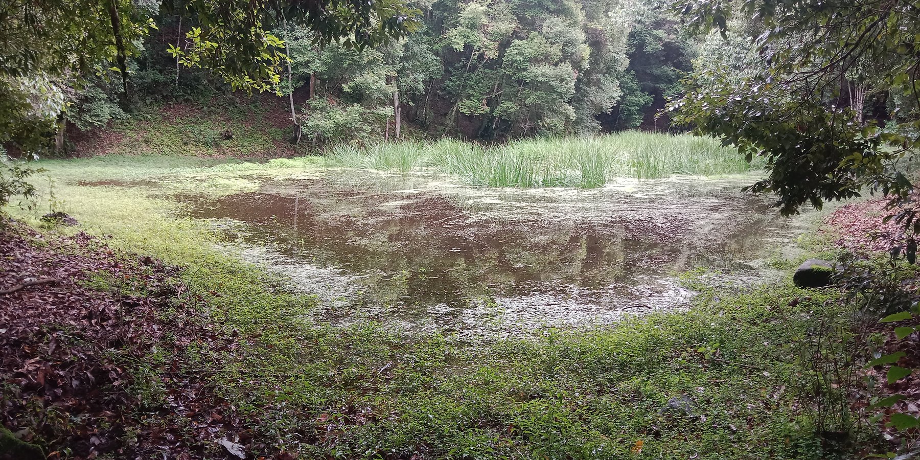
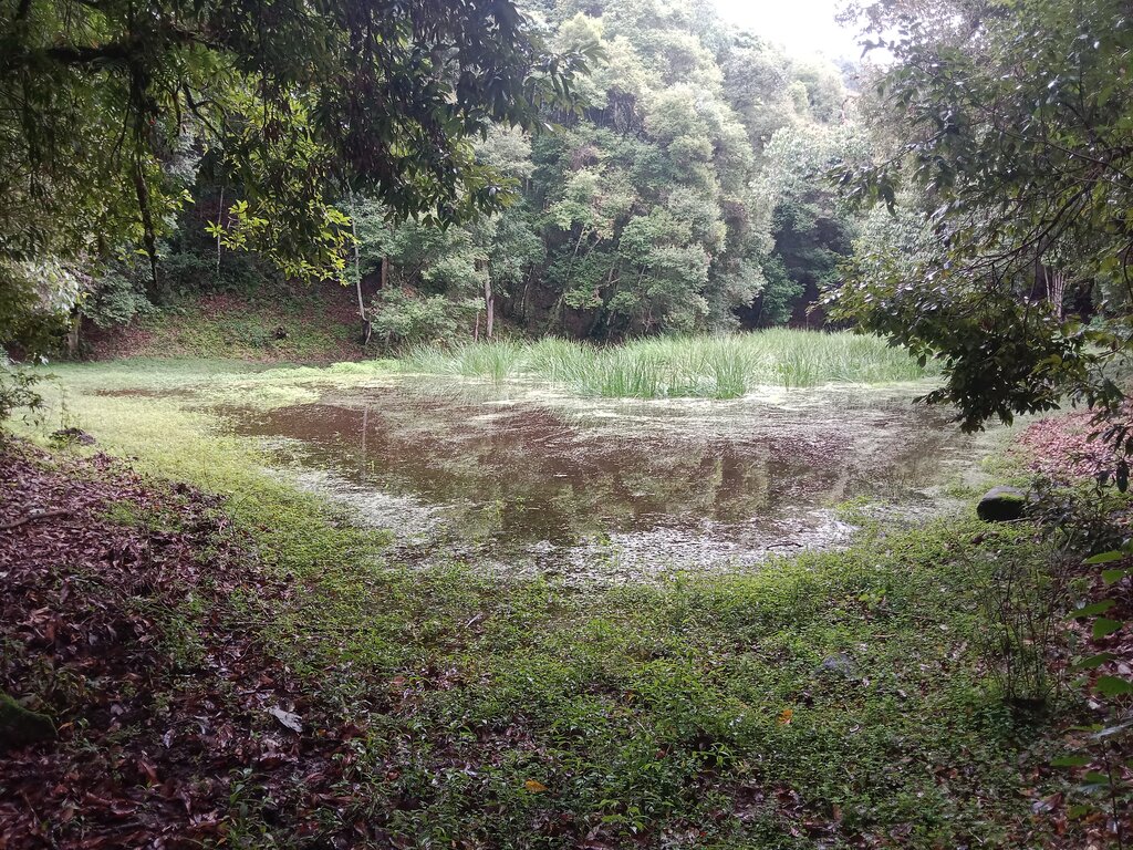
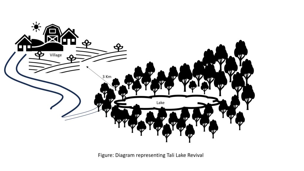
The lake conservation initiative at Tali was conceived with the vision of protecting the lake and transforming the surrounding area into a community eco-tourism hub. The initiative is a testament to how science and spirituality, and culture and the environment can coexist and benefit from one another. The Tali Lake is a major water source (both irrigation and drinking) for the community and both livestock and wild animals.
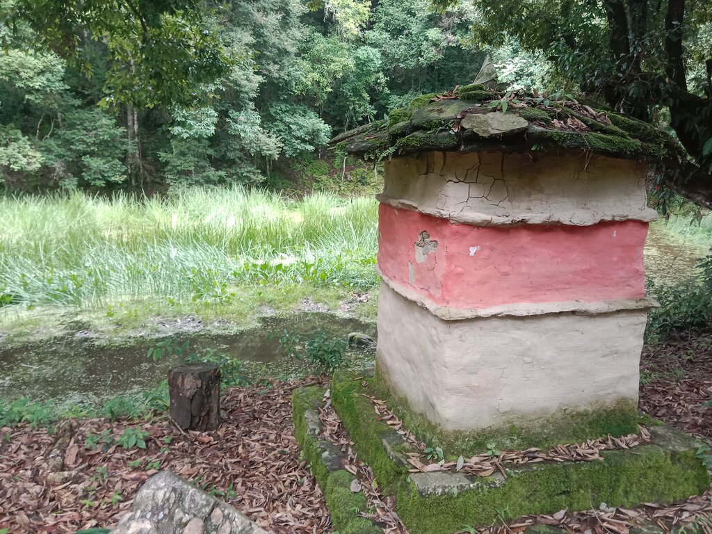
Bhutanese believe lakes to be sacred and religiously significant. Buli Lake and Tali Lake (Tangsibi Tsho) epitomise how nature and culture come together. Tali village under Nangkor gewog in Zhemgang Dzongkhag lies on the shoulder of mountains at an elevation of 1880 m.a.s.l. with broad-leaved forests. It comprises 25 households with around 280 residents. According to local legend, Tangsibi Tsho in Tali is the “Jewellery basket of Buli Tsho which was left behind when Buli Tsho moved from Tali to Buli”. Tali Lake is spread over an area of 0.40 ha. The 18.2 ha forest around the lake is dominated by species of oak. The forest around the lake harbours a very rich variety of mammals (22 species) that are ecologically important and visit the lake for water and predation. Also, 70 species of birds have been recorded in the forest around the lake.
The community, along with the Loden Foundation and the monastic body, has been engaged in reviving the lake as 90% of the surface was covered with waterweeds and grasses. The aim was to clean, beautify, and sustain the ecosystem through an integrated and holistic management project by combining scientific, social, and spiritual approaches. There was support of USD 33,550 from the United Nations Development Programme Global Environment Facility (UNDP GEF) Small Grants Programme (SGP) and USD 12,650 from the Loden Foundation and the Community.
Tangsibi Tsho in Tali has significant cultural importance which includes water for irrigation and drinking purposes both for people as well as livestock and wild animals. Thus, the initiative was aimed at conserving the lake and transforming the lake area into a community eco-tourism hub. According to the villagers and senior citizens of the community, the revival of the lake would help in mitigating water shortage problems for irrigation which they require for rice and wheat - as well as preserving the sacred location. The District Forest Division, Zhemgang under the Department of Forests and Park Services (DoFPS) conducted a survey and recorded 21 plant species (trees and shrubs) and 22 orchid species.
To commence the revival activities, meetings were held with the institutions and conservation groups, by-laws were developed, and extensive mapping and demarcation of the area around the lake were done. Then, during the site development phase of Tali Lake area management, there was development of footpaths and eco-cultural trails, identification of plants and trees and name tagging, installation of waste bins and procurement of materials, installation of signboards at the site, and access roads were completed. Research and documentation on the lake and the village were carried out, and audio-video recordings and interviews were done. Advocacy and awareness of output were also accomplished. Through community engagement and religious ceremonies, the lake was successfully cleared after consulting with the National Biodiversity Centre, advice from concerned authorities and local experts as well as recommendations contained in the biodiversity assessment report from Zhemgang Forest Division under DoFPS. Men and women from the village joined together to construct a bamboo raft to transport the weeds across the lake and over three truckloads of weeds and tree stumps were cleared to revive the lake. The National Environment Commission tested the water quality and the result showed that the pH of the water is slightly acidic (6.49), 0.95mg/L of dissolved oxygen, and chemical oxygen demand of 10.4mg/L.
The revival of Tali Tangsibi Lake has benefitted downstream water supplies for irrigation and has prevented the sacred local lake from drying up.
2.3 รูปภาพของเทคโนโลยี
2.5 ประเทศภูมิภาค หรือสถานที่ตั้งที่เทคโนโลยีได้นำไปใช้และได้รับการครอบคลุมโดยการประเมินนี้
ประเทศ:
ภูฏาน
ภูมิภาค/รัฐ/จังหวัด:
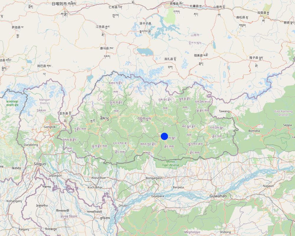
Tali Community
ข้อมูลจำเพาะเพิ่มเติมของสถานที่ตั้ง :
Nangkhor Gewog, Zhemgang Dzongkhag
ระบุการกระจายตัวของเทคโนโลยี:
- ใช้ ณ จุดที่เฉพาะเจาะจงหรือเน้นไปยังบริเวณพื้นที่ขนาดเล็ก
Is/are the technology site(s) located in a permanently protected area?
ใช่
ถ้าใช่ ระบุ:
The lake falls under the protected area 'Biological Corridor'.
Map
×2.6 วันที่การดำเนินการ
ระบุปีที่ใช้:
2020
2.7 คำแนะนำของเทคโนโลยี
ให้ระบุว่าเทคโนโลยีถูกแนะนำเข้ามาอย่างไร:
- ทางโครงการหรือจากภายนอก
ความคิดเห็น (ประเภทของโครงการ เป็นต้น) :
The lake revival activities were funded by UNDP GEF SGP (US$33550 ) and the Loden Foundation (US$12650) and they were all completed in 2020.
3. การจัดประเภทของเทคโนโลยี SLM
3.1 วัตถุประสงค์หลักของเทคโนโลยี
- ลด ป้องกัน ฟื้นฟู การเสื่อมโทรมของที่ดิน
- อนุรักษ์ระบบนิเวศน์
- รักษาสภาพหรือปรับปรุงความหลากหลายทางชีวภาพ
- สร้างผลกระทบทางด้านเศรษฐกิจที่เป็นประโยชน์
- สร้างผลกระทบทางด้านสังคมที่เป็นประโยชน์
3.2 ประเภทของการใช้ที่ดินในปัจจุบันที่ได้นำเทคโนโลยีไปใช้
Land use mixed within the same land unit:
ไม่ใช่

ป่า/พื้นที่ทำไม้
- ป่ากึ่งธรรมชาติ / พื้นที่ทำไม้
(Semi-)natural forests/ woodlands: Specify management type:
- การตัดไม้ที่มีคัดเลือก (Selective felling)
- การใช้ประโยชน์จากป่า ยกเว้นไม้
Are the trees specified above deciduous or evergreen?
- mixed deciduous/ evergreen
ผลิตภัณฑ์และบริการ:
- ไม้ซุง
- ไม้ที่นำมาทำเป็นเชื้อเพลิง
- การอนุรักษ์ / ป้องกันธรรมชาติ
- นันทนาการ / การท่องเที่ยว

ทางน้ำ แหล่งน้ำ พื้นที่ชุ่มน้ำ
ผลิตภัณฑ์หลักหรือบริการ:
Lake
3.3 Has land use changed due to the implementation of the Technology?
Has land use changed due to the implementation of the Technology?
- No (Continue with question 3.4)
3.4 การใช้น้ำ
การใช้น้ำของที่ดินที่มีการใช้เทคโนโลยีอยู่:
- น้ำฝนร่วมกับการชลประทาน
แสดงความคิดเห็น:
The community benefits from five irrigation sources viz. Bangleng Chhu, Budigang Chhu, Khatoed Chhu, Dungmangla Chhu, and Kokaling Chhu. The latter three irrigation channels are equipped with cement and pipelines.
3.5 กลุ่ม SLM ที่ตรงกับเทคโนโลยีนี้
- การจัดการน้ำผิวดิน (น้ำพุ แม่น้ำทะเลสาบ ทะเล)
- การลดความเสี่ยงจากภัยพิบัติบนพื้นฐานของระบบนิเวศ
3.6 มาตรการ SLM ที่ประกอบกันเป็นเทคโนโลยี

มาตรการอื่น ๆ
ระบุ:
Lake revival
3.7 รูปแบบหลักของการเสื่อมโทรมของที่ดินที่ได้รับการแก้ไขโดยเทคโนโลยี

การเสื่อมโทรมของดินทางด้านชีวภาพ
- Bh (Loss of habitat): การสูญเสียแหล่งที่อยู่
- Bs (Quality and species composition): องค์ประกอบหรือความหลากหลายทางคุณภาพและชนิดพันธุ์ลดลง

การเสื่อมโทรมของน้ำ
- Hs (Change in quantity of surface water): การเปลี่ยนแปลงปริมาณของน้ำที่ผิวดิน
3.8 การป้องกัน การลดลง หรือการฟื้นฟูความเสื่อมโทรมของที่ดิน
ระบุเป้าหมายของเทคโนโลยีกับความเสื่อมโทรมของที่ดิน:
- ไม่สามารถใช้ได้
4. ข้อมูลจำเพาะด้านเทคนิค กิจกรรมการนำไปปฏิบัติใช้ ปัจจัยนำเข้า และค่าใช้จ่าย
4.1 แบบแปลนทางเทคนิคของเทคโนโลยี
4.2 ข้อมูลทั่วไปเกี่ยวกับการคำนวณปัจจัยนำเข้าและค่าใช้จ่าย
ให้ระบุว่าค่าใช้จ่ายและปัจจัยนำเข้าได้รับการคำนวณอย่างไร:
- ต่อหน่วยเทคโนโลยี
ระบุสกุลเงินที่ใช้คำนวณค่าใช้จ่าย:
- USD
If relevant, indicate exchange rate from USD to local currency (e.g. 1 USD = 79.9 Brazilian Real): 1 USD =:
80.0
4.3 กิจกรรมเพื่อการจัดตั้ง
| กิจกรรม | Timing (season) | |
|---|---|---|
| 1. | Project inception and area mapping. | |
| 2. | Lake management and eco-cultural trail development. | After crop harvest (November and December, 2020) |
| 3. | Research and documentation phase. | |
| 4. | Output dissemination. |
4.4 ค่าใช้จ่ายของปัจจัยนำเข้าที่จำเป็นสำหรับการจัดตั้ง
If you are unable to break down the costs in the table above, give an estimation of the total costs of establishing the Technology:
46200.0
ถ้าผู้ใช้ที่ดินรับภาระน้อยกว่า 100% ของค่าใช้จ่าย ให้ระบุว่าใครเป็นผู้รับผิดชอบส่วนที่เหลือ:
The whole of expenditures were borne by UNDP GEF SGP (US$33550) and the Loden Foundation (US$12650).
แสดงความคิดเห็น:
The unit cost breakdown was impossible due to the unavailability of the expenditure statements.
4.5 การบำรุงรักษาสภาพหรือกิจกรรมที่เกิดขึ้นเป็นประจำ
แสดงความคิดเห็น:
Since the completion of the activity in 2020, no maintenance activities have been conducted so far. However, the physical monitoring is done by the chairman, secretary, and treasurer of the community forest management group of Tali.
5. สิ่งแวดล้อมทางธรรมชาติและของมนุษย์
5.1 ภูมิอากาศ
ฝนประจำปี
- < 250 ม.ม.
- 251-500 ม.ม.
- 501-750 ม.ม.
- 751-1,000 ม.ม.
- 1,001-1,500 ม.ม.
- 1,501-2,000 ม.ม.
- 2,001-3,000 ม.ม.
- 3,001-4,000 ม.ม.
- > 4,000 ม.ม.
ข้อมูลจำเพาะ/ความคิดเห็นเรื่องปริมาณน้ำฝน:
Average annual rainfall: 1200-1800 mm
The rain estimate has been derived based on the agro-ecological zone (AEZ) the area falls under.
Bhutan is divided into six AEZs (source: https://www.fao.org/3/ad103e/AD103E02.htm).
Bhutan has six AEZs. The wet sub-tropical zone is from 150 to 600 m, followed by the humid sub-tropical zone from 600 to 1,200 m. The dry sub-tropical zone starts at 1,200 m and extends to 1,800 m, followed by the warm temperate zone, which reaches 2,600 m. The cool temperate zone lies between 2,600 and 3,600 m and, finally, the alpine zone between 3,600 m and 4,600 m.
เขตภูมิอากาศเกษตร
The lake area falls under the Dry Subtropical Zone in Bhutan.
5.2 สภาพภูมิประเทศ
ค่าเฉลี่ยความลาดชัน:
- ราบเรียบ (0-2%)
- ลาดที่ไม่ชัน (3-5%)
- ปานกลาง (6-10%)
- เป็นลูกคลื่น (11-15%)
- เป็นเนิน (16-30%)
- ชัน (31-60%)
- ชันมาก (>60%)
ธรณีสัณฐาน:
- ที่ราบสูง/ที่ราบ
- สันเขา
- ไหล่เขา
- ไหล่เนินเขา
- ตีนเนิน
- หุบเขา
ระดับความสูง:
- 0-100 เมตร
- 101-500 เมตร
- 501-1,000 เมตร
- 1,001-1,500 เมตร
- 1,501-2,000 เมตร
- 2,001-2,500 เมตร
- 2,501-3,000 เมตร
- 3,001-4,000 เมตร
- > 4,000 เมตร
ให้ระบุถ้าเทคโนโลยีได้ถูกนำไปใช้:
- บริเวณแอ่งบนที่ราบ (concave situations)
ความคิดเห็นและข้อมูลจำเพาะเพิ่มเติมเรื่องสภาพภูมิประเทศ:
1742 m a.s.l
5.3 ดิน
ค่าเฉลี่ยความลึกของดิน:
- ตื้นมาก (0-20 ซ.ม.)
- ตื้น (21-50 ซ.ม.)
- ลึกปานกลาง (51-80 ซ.ม.)
- ลึก (81-120 ซ.ม.)
- ลึกมาก (>120 ซ.ม.)
เนื้อดิน (ดินชั้นบน):
- ปานกลาง (ดินร่วน ทรายแป้ง)
- ละเอียด/หนัก (ดินเหนียว)
เนื้อดินล่าง (> 20 ซ.ม.ต่ำจากผิวดิน):
- ปานกลาง (ดินร่วน ทรายแป้ง)
- ละเอียด/หนัก (ดินเหนียว)
อินทรียวัตถุในดิน:
- สูง (>3%)
(ถ้ามี) ให้แนบคำอธิบายเรื่องดินแบบเต็มหรือระบุข้อมูลที่มีอยู่ เช่น ชนิดของดิน ค่า pH ของดินหรือความเป็นกรดของดิน ความสามารถในการแลกเปลี่ยนประจุบวก ไนโตรเจน ความเค็ม เป็นต้น:
Moisture content-2.95%
Organic matter-3.77%
Organic carbon-2.19%
pH-6.45
Electrical conductivity-36.27 µs/cm
Nitrogen-0.11
Phosphorus-0.95
Potassium-98.40 mg/100ml
Soil texture-Clay Loam
5.4 ความเป็นประโยชน์และคุณภาพของน้ำ
ระดับน้ำใต้ดิน:
5-50 เมตร
น้ำไหลบ่าที่ผิวดิน:
ดี
คุณภาพน้ำ (ที่ยังไม่ได้บำบัด):
เป็นน้ำเพื่อการดื่มที่ดี
Water quality refers to:
surface water
ความเค็มของน้ำเป็นปัญหาหรือไม่:
ไม่ใช่
กำลังเกิดน้ำท่วมในพื้นที่หรือไม่:
ไม่ใช่
5.5 ความหลากหลายทางชีวภาพ
ความหลากหลายทางชนิดพันธุ์:
- สูง
ความหลากหลายของแหล่งที่อยู่:
- สูง
ความคิดเห็นและข้อมูลจำเพาะเพิ่มเติมของความหลากหลายทางชีวภาพ:
Some 21 plant species (trees and shrubs) and 22 orchid species were identified and documented by Zhemgang Forest Division during the biodiversity survey conducted in and around the lake area.
5.6 ลักษณะของผู้ใช้ที่ดินที่นำเทคโนโลยีไปปฏิบัติใช้
อยู่กับที่หรือเร่ร่อน:
- อยู่กับที่
แนวทางการตลาดของระบบการผลิต:
- mixed (subsistence/ commercial)
รายได้ที่มาจากนอกฟาร์ม:
- 10-50% ของรายได้ทั้งหมด
ระดับของความมั่งคั่งโดยเปรียบเทียบ:
- พอมีพอกิน
เป็นรายบุคคล/ครัวเรือน:
- กลุ่ม/ชุมชน
ระดับของการใช้เครื่องจักรกล:
- การใช้เครื่องจักรหรือเครื่องยนต์
เพศ:
- หญิง
- ชาย
อายุของผู้ใช้ที่ดิน:
- ผู้เยาว์
- วัยกลางคน
5.7 Average area of land used by land users applying the Technology
- < 0.5 เฮกตาร์
- 0.5-1 เฮกตาร์
- 1-2 เฮกตาร์
- 2-5 เฮกตาร์
- 5-15 เฮกตาร์
- 15-50 เฮกตาร์
- 50-100 เฮกตาร์
- 100-500 เฮกตาร์
- 500-1,000 เฮกตาร์
- 1,000-10,000 เฮกตาร์
- >10,000 เฮกตาร์
พิจารณาว่าเป็นขนาดเล็ก กลาง หรือขนาดใหญ่ (ซึ่งอ้างอิงถึงบริบทระดับท้องถิ่น):
- ขนาดใหญ่
แสดงความคิดเห็น:
The average handholding of the community ranges from 7 to 8 acres, falling under the large scale based on local context. In general, the average household land holding in Bhutan is 3 acres.
In the local context:
3 acres (1.2 ha) = medium scale
> 3 acres = large-scale
<3 acres = small-scale
5.8 กรรมสิทธิ์ในที่ดิน สิทธิในการใช้ที่ดินและสิทธิในการใช้น้ำ
- Family land
สิทธิในการใช้ที่ดิน:
- รายบุคคล
สิทธิในการใช้น้ำ:
- เกี่ยวกับชุมชน (ถูกจัดระเบียบ)
Are land use rights based on a traditional legal system?
ใช่
ระบุ:
The land use rights in Bhutan is based on a traditional legal system guided by formal land act and land rules and regulations.
5.9 การเข้าถึงบริการและโครงสร้างพื้นฐาน
สุขภาพ:
- จน
- ปานกลาง
- ดี
การศึกษา:
- จน
- ปานกลาง
- ดี
ความช่วยเหลือทางด้านเทคนิค:
- จน
- ปานกลาง
- ดี
การจ้างงาน (เช่น ภายนอกฟาร์ม):
- จน
- ปานกลาง
- ดี
ตลาด:
- จน
- ปานกลาง
- ดี
พลังงาน:
- จน
- ปานกลาง
- ดี
ถนนและการขนส่ง:
- จน
- ปานกลาง
- ดี
น้ำดื่มและการสุขาภิบาล:
- จน
- ปานกลาง
- ดี
บริการด้านการเงิน:
- จน
- ปานกลาง
- ดี
6. ผลกระทบและสรุปคำบอกกล่าว
6.1 ผลกระทบในพื้นที่ดำเนินการ (On-site) จากการใช้เทคโนโลยี
ผลกระทบทางด้านเศรษฐกิจและสังคม
การผลิต
การผลิตพืชผล
แสดงความคิดเห็น/ระบุ:
The lake is a critical source of irrigation water. The lake revival has aided in crop production via water availability.
การผลิตสัตว์
แสดงความคิดเห็น/ระบุ:
The lake is a critical source of drinking water for domestic animals. The lake revival has aided in animal production via water availability.
การเสี่ยงต่อความล้มเหลวในการผลิต
แสดงความคิดเห็น/ระบุ:
The risk of production failure has decreased as there are enhanced crop and animal productions due to water availability from the lake.
ความเป็นประโยชน์และคุณภาพของน้ำ
การมีน้ำดื่มไว้ให้ใช้
แสดงความคิดเห็น/ระบุ:
The lake is a source of drinking water for the Tali community and because the lake is cleaned and managed the water availability and quality have improved.
คุณภาพน้ำดื่ม
แสดงความคิดเห็น/ระบุ:
The lake is a source of drinking water for the Tali community and because the lake is cleaned and managed the water availability and quality have improved.
การมีน้ำไว้ให้ปศุสัตว์
แสดงความคิดเห็น/ระบุ:
The lake is a source of drinking water for domestic animals so the water availability for livestock has increased.
คุณภาพน้ำสำหรับปศุสัตว์
แสดงความคิดเห็น/ระบุ:
The lake is a source of drinking water for domestic animals and because the lake is cleaned and managed the water quality for livestock has improved.
การมีน้ำไว้ให้สำหรับการชลประทาน
แสดงความคิดเห็น/ระบุ:
The lake is a source of irrigation water and because the lake is cleaned, managed, and conserved the availability of irrigation has increased.
คุณภาพน้ำสำหรับการชลประทาน
แสดงความคิดเห็น/ระบุ:
The lake is a source of irrigation water and because the lake is cleaned, managed, and conserved the quality of irrigation water has improved.
ผลกระทบด้านสังคมวัฒนธรรมอื่น ๆ
SLM หรือความรู้เรื่องความเสื่อมโทรมของที่ดิน
แสดงความคิดเห็น/ระบุ:
The lake revival has created awareness among the Tali community against the irresponsible exploitation of forests. It has thrown light on the importance of water conservation.
ผลกระทบด้านนิเวศวิทยา
ความหลากหลายทางชีวภาพของพืชและสัตว์
ความหลากหลายทางชีวภาพของสัตว์
แสดงความคิดเห็น/ระบุ:
The quantity is not known. However, the beneficiaries believe that the lake revival along with eco-tourism area demarcation followed by enhanced area protection could have improved the animal diversity.
ความหลากหลายของสัตว์
แสดงความคิดเห็น/ระบุ:
The dedicated area (lake and the nearby forest) identified and protected is assumed to have diversified the habitats.
6.2 ผลกระทบนอกพื้นที่ดำเนินการ (Off-site) จากการใช้เทคโนโลยี
น้ำที่ใช้ประโยชน์ได้
แสดงความคิดเห็น/ระบุ:
Increased water availability for drinking and irrigation.
6.3 การเผชิญและความตอบสนองของเทคโนโลยีต่อการเปลี่ยนแปลงสภาพภูมิอากาศที่ค่อยเป็นค่อยไป และสภาพรุนแรงของภูมิอากาศ / ภัยพิบัติ (ที่รับรู้ได้โดยผู้ใช้ที่ดิน)
การเปลี่ยนแปลงสภาพภูมิอากาศที่ค่อยเป็นค่อยไป
การเปลี่ยนแปลงสภาพภูมิอากาศที่ค่อยเป็นค่อยไป
| ฤดู | increase or decrease | เทคโนโลยีมีวิธีการรับมืออย่างไร | |
|---|---|---|---|
| อุณหภูมิประจำปี | เพิ่มขึ้น | ดีมาก |
สภาพรุนแรงของภูมิอากาศ (ภัยพิบัติ)
ภัยพิบัติทางอุตุนิยมวิทยา
| เทคโนโลยีมีวิธีการรับมืออย่างไร | |
|---|---|
| พายุฝนประจำท้องถิ่น | ดีมาก |
| พายุฝนฟ้าคะนองประจำท้องถิ่น | ดีมาก |
| พายุลูกเห็บประจำท้องถิ่น | ดีมาก |
| พายุลมประจำท้องถิ่น | ดีมาก |
แสดงความคิดเห็น:
About the annual rainfall, the land users shared that the quantity over the years has remained the same. But the rainfall pattern has changed. In the earlier years (past 10 - 15 years) there used to be gentle and steady rainfall. However, in recent years, some sudden heavy rain has been following some prolonged dry spells.
6.4 การวิเคราะห์ค่าใช้จ่ายและผลประโยชน์ที่ได้รับ
ผลประโยชน์ที่ได้รับเปรียบเทียบกับค่าใช้จ่ายในการจัดตั้งเป็นอย่างไร (จากมุมมองของผู้ใช้ที่ดิน)
ผลตอบแทนระยะสั้น:
ด้านลบเล็กน้อย
ผลตอบแทนระยะยาว:
ด้านลบ
แสดงความคิดเห็น:
No maintenance was carried out until now.
6.5 การปรับตัวของเทคโนโลยี
- > 50%
ถ้ามีข้อมูลให้บอกปริมาณด้วย (จำนวนของครัวเรือนหรือครอบคลุมพื้นที่):
25 households of Tali
Of all those who have adopted the Technology, how many did so spontaneously, i.e. without receiving any material incentives/ payments?
- 0-10%
6.6 การปรับตัว
เทคโนโลยีได้รับการปรับเปลี่ยนเมื่อเร็วๆนี้ เพื่อให้ปรับตัวเข้ากับสภาพที่กำลังเปลี่ยนแปลงหรือไม่:
ไม่ใช่
6.7 จุดแข็ง / ข้อได้เปรียบ / โอกาสของเทคโนโลยี
| จุดแข็ง / ข้อได้เปรียบ / โอกาสในทัศนคติของผู้ใช้ที่ดิน |
|---|
| Enhance the understanding of scientific, cultural, and spiritual ecology for environmental conservation. |
| Enhance livelihood through the promotion of community-based ecotourism activities. |
| Retaine or increase water volume of the lake. |
| Continued transmission of local cultural knowledge and spiritual and scientific practices beneficial for environmental conservation. |
| Promote community stewardship of the lake and the environment. |
| Revive and conserve lake and the surrounding ecosystem. |
| Create awareness against the irresponsible exploitation of forests. |
| Increased awareness to sustain watersheds and sources for irrigation. |
6.8 จุดอ่อน / ข้อเสียเปรียบ / ความเสี่ยงของเทคโนโลยีและวิธีการแก้ไข
| จุดอ่อน / ข้อเสียเปรียบ / ความเสี่ยงในทัศนคติของผู้ใช้ที่ดิน | มีวิธีการแก้ไขได้อย่างไร |
|---|---|
| Internal conflicts and misunderstandings are common during group labor contribution. | Regular group meetings, guidance from District Forest Division |
| จุดอ่อน / ข้อเสียเปรียบ / ความเสี่ยงในทัศนคติของผู้รวบรวมหรือวิทยากรหลัก | มีวิธีการแก้ไขได้อย่างไร |
|---|---|
| Weeds cover the lake periodically. | Cleaning the lake surface by identifying certain routine time. |
| The trails and monuments near the lake are kept unmanaged. | Regular clearing of these trails and management of monuments. |
| Unmanaged water hole present above the lake. | A small water hole present above the lake can be improved and maintained, so that the pressure on the lake will be reduced and can serve as a water reservoir for the lake. |
7. การอ้างอิงและการเชื่อมต่อ
7.1 วิธีการและแหล่งข้อมูล
- ไปเยี่ยมชมภาคสนาม การสำรวจพื้นที่ภาคสนาม
Four
- การสัมภาษณ์กับผู้ใช้ที่ดิน
Four
วันที่เก็บรวบรวมข้อมูล(ภาคสนาม) :
15/07/2023
7.2 การอ้างอิงถึงสิ่งตีพิมพ์
หัวข้อ, ผู้เขียน, ปี, หมายเลข ISBN:
REVIVAL: LEVERAGING CULTURAL & SCIENTIFIC KNOWLEDGE AND PRACTICES FOR ENVIRONMENTAL CONSERVATION IN TALI, The Loden Foundation, 2022
ชื่อเรื่อง ผู้เขียน ปี ISBN:
https://www.undp.org/bhutan/publications/revival-leveraging-cultural-scientific-knowledge-and-practices-environmental-conservation-tali
7.3 Links to relevant online information
ชื่อเรื่องหรือคำอธิบาย:
The Loden Foundation
URL:
https://loden.org/
ชื่อเรื่องหรือคำอธิบาย:
Revival: Leveraging cultural, scientific knowledge and practices for environmental conservation in Tali
URL:
https://www.undp.org/bhutan
ชื่อเรื่องหรือคำอธิบาย:
Leveraging Cultural and Scientific Knowledge and Practices for Environmental Conservation in Tali
URL:
http://3.14.34.174/spacial-itemid-projects-landing-page/spacial-itemid-project-search-results/spacial-itemid-project-detailpage.html?view=projectdetail&id=28078
ชื่อเรื่องหรือคำอธิบาย:
Jewel basket of Tali
URL:
https://kuenselonline.com/jewel-basket-of-tali/
ลิงก์และโมดูล
ขยายทั้งหมด ย่อทั้งหมดลิงก์
ไม่มีลิงก์
โมดูล
ไม่มีโมดูล


