Trenches combined with living hedges or grass lines [Rwanda]
- Creation:
- Update:
- Compiler: Desire Kagabo
- Editor: –
- Reviewer: David Streiff
Imiringoti
technologies_1550 - Rwanda
View sections
Expand all Collapse all1. General information
1.2 Contact details of resource persons and institutions involved in the assessment and documentation of the Technology
SLM specialist:
SLM specialist:
Name of project which facilitated the documentation/ evaluation of the Technology (if relevant)
The Transboundary Agro-ecosystem Management Project for the Kagera River Basin (GEF-FAO / Kagera TAMP )Name of the institution(s) which facilitated the documentation/ evaluation of the Technology (if relevant)
FAO Food and Agriculture Organization (FAO Food and Agriculture Organization) - ItalyName of the institution(s) which facilitated the documentation/ evaluation of the Technology (if relevant)
Rwanda Agriculture Board (Rwanda Agriculture Board) - Rwanda1.3 Conditions regarding the use of data documented through WOCAT
The compiler and key resource person(s) accept the conditions regarding the use of data documented through WOCAT:
Yes
2. Description of the SLM Technology
2.1 Short description of the Technology
Definition of the Technology:
Trenches combined with living hedges or grass lines are slow-forming terraces to control soil erosion by changing the length of the slope and progressively reducing the slope gradient; he slope steepness decreases progressively by hydric and tillage erosion.
2.2 Detailed description of the Technology
Description:
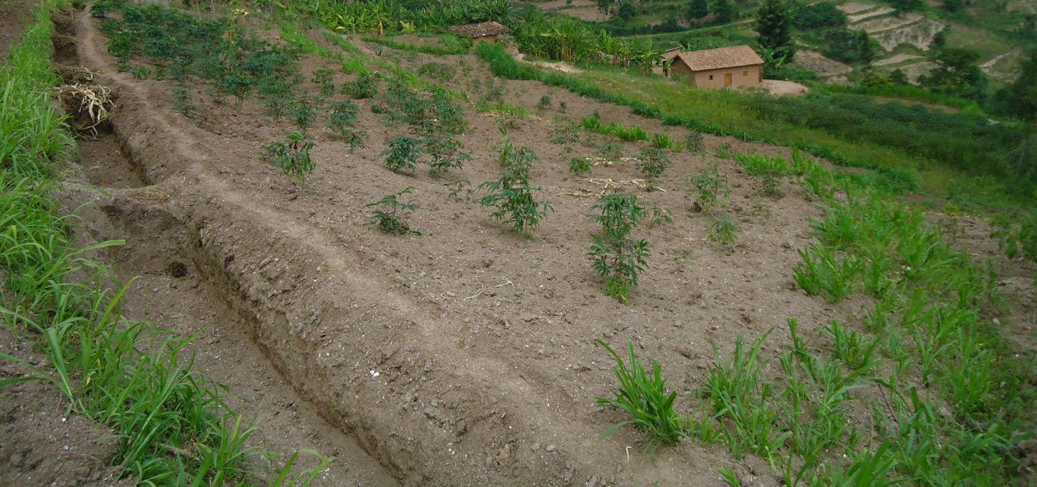
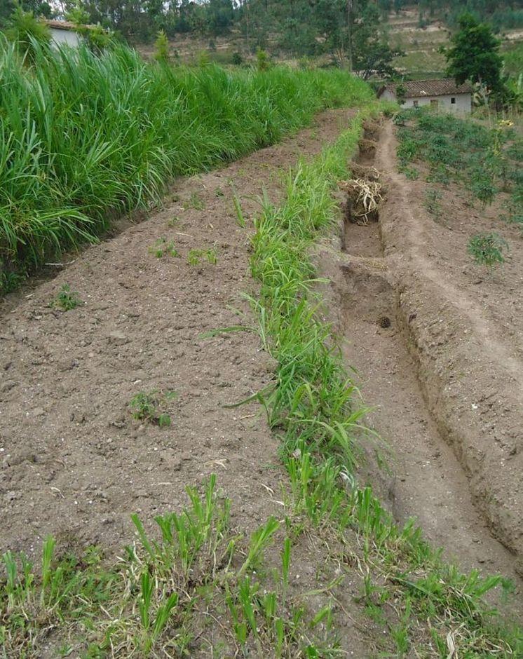
Trenches combined with living hedges or grassed lines are less labour-intensive method that is practiced in the highlands of Rwanda. The method involves digging trenches which have grass-stabilized banks, or simply planting grass strips and vegetative barriers across the slope to reduce runoff. This method, locally referred to as ‘progressive terracing’, is more adaptable by individual farmers across the country. In the study conducted by Kagabo et al. (2013) in the highlands of Buberuka Region of Rwanda, it was noted that net increment in yields and returns on investment increased with the age of terraces, since the capital costs of terracing were easily recovered. These terraces also showed more resilience, some being over 30 years old and still effective. Along the contour band, soil from the upper parts of the slope is removed and deposited above by creating a series of discontinuous trenches in order to extend the flat terrain. Over 5-10 years, the terraces become enlarged and form a terrace along the contour, such that the slopes are transformed over time into level bench terraces (but never %).
Purpose of the Technology: The main purpose of this technology is to reduce runoff and soil erosion on the slope and to improve soil quality and soil moisture retention. Grass strips or living hedgerows are intended to both trap sediments and facilitate the slow formation of terraces.
Establishment / maintenance activities and inputs: The establishment of trenches combined with living hedges or grassed lines is less labor intensive and requires less skilled labor. Regular maintenance banks on which living hedges are planted, to seasonally stream living hedges to minimize the competition of nutrients and water with plants. To efficiently use these terraces it is advisable to introduce intensive and rentable cropping systems or agroforestry with fruits and forage trees.
Natural / human environment: This technology was reported to be very resilient as trenches combined with living hedges or grassed lines of 20+ year old are still effective in controlling soil erosion. However, the soil quality on these formed terraces between alleys does not homogenize 100% over the course of time. Large soil fertility gradients with marked spatial difference in both soil quality and crop yield from their upper parts downwards of the terraces is observed. The soil in the lower parts of the terraces showed as much as 57% more organic carbon content and 31% more available phosphorous than the soil in the upper parts of the terraces (Kagabo et al. 2013).
2.3 Photos of the Technology
Media Gallery
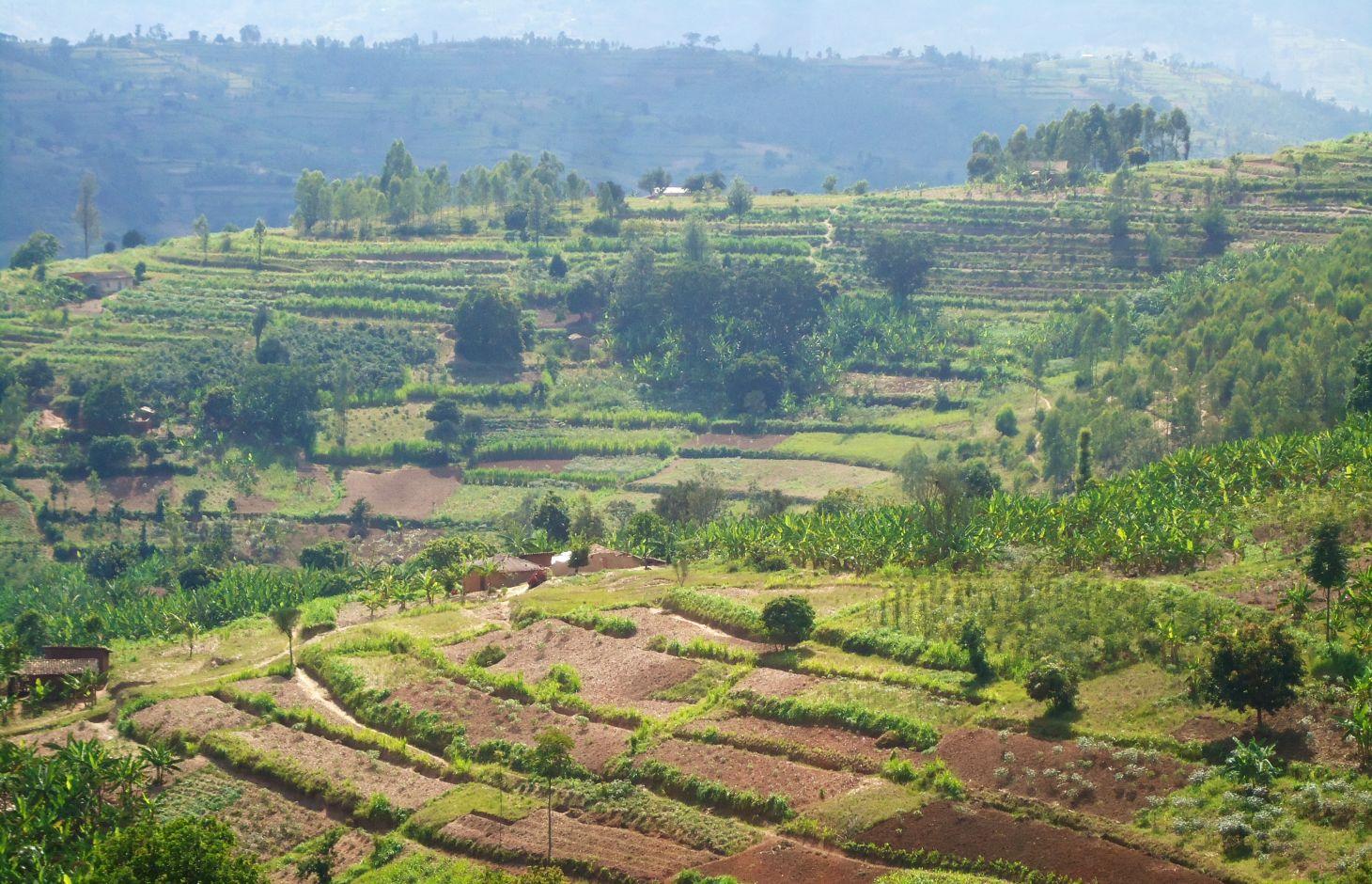
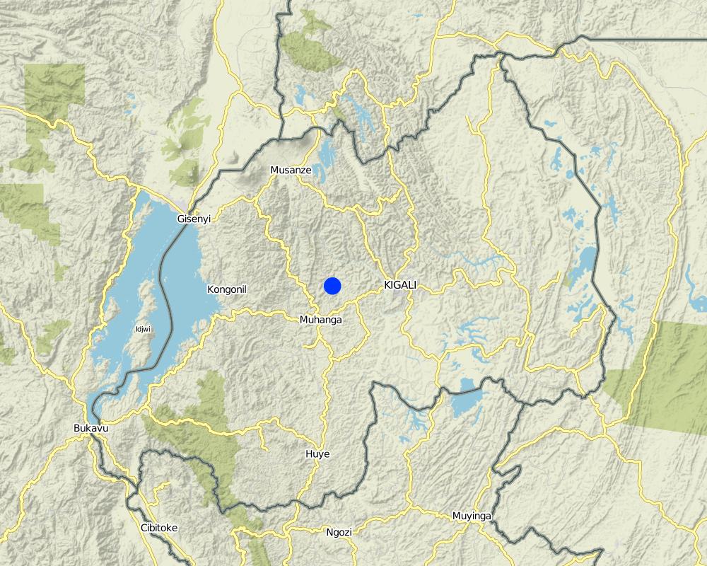
2.5 Country/ region/ locations where the Technology has been applied and which are covered by this assessment
Country:
Rwanda
Region/ State/ Province:
Rwanda
Further specification of location:
Kamonyi District (Southern Province)
Map
×2.6 Date of implementation
If precise year is not known, indicate approximate date:
- 10-50 years ago
2.7 Introduction of the Technology
- Government
3. Classification of the SLM Technology
3.1 Main purpose(s) of the Technology
- reduce, prevent, restore land degradation
3.2 Current land use type(s) where the Technology is applied

Cropland
- Annual cropping
- Tree and shrub cropping
Main crops (cash and food crops):
major cash crop: Coffee and cassava
major food crop: Banana and beans
other: Maize
Comments:
Major land use problems (compiler’s opinion): Soil erosion, water contamination due to sediment loads, decrease of soil fertility and soil depth, loss of vegetation cover
Major land use problems (land users’ perception): Soil erosion, contamination of water (the turbidity of water is high) therefore the domestic use of water is a problem.
Future (final) land use (after implementation of SLM Technology): Cropland: Ca: Annual cropping
If land use has changed due to the implementation of the Technology, indicate land use before implementation of the Technology:
Grazing land: Ge: Extensive grazing land
3.3 Further information about land use
Water supply for the land on which the Technology is applied:
- rainfed
Specify:
Longest growing period in days: 150; Longest growing period from month to month: September – February; Second longest growing period in days: 120; Second longest growing period from month to month: March – July
Livestock density (if relevant):
10-25 LU /km2
3.4 SLM group to which the Technology belongs
- improved ground/ vegetation cover
- cross-slope measure
3.5 Spread of the Technology
Specify the spread of the Technology:
- evenly spread over an area
If the Technology is evenly spread over an area, indicate approximate area covered:
- 10-100 km2
Comments:
The area covered by this technology has been estimated
3.6 SLM measures comprising the Technology

vegetative measures
- V1: Tree and shrub cover
- V2: Grasses and perennial herbaceous plants

structural measures
- S3: Graded ditches, channels, waterways
Comments:
Type of vegetative measures: aligned: -contour, aligned: -along boundary
3.7 Main types of land degradation addressed by the Technology

soil erosion by water
- Wt: loss of topsoil/ surface erosion
- Wg: gully erosion/ gullying
- Wo: offsite degradation effects
Comments:
Secondary types of degradation addressed: Wg: gully erosion / gullying, Wo: offsite degradation effects
Main causes of degradation: deforestation / removal of natural vegetation (incl. forest fires) (Used as energy (fire wood)), other natural causes (avalanches, volcanic eruptions, mud flows, highly susceptible natural resources, extreme topography, etc.) specify (Steep slopes in many cases are over 60%), population pressure (High density (in rural area over 400 inhabitant per ha))
Secondary causes of degradation: soil management (Less use of organic manure), crop management (annual, perennial, tree/shrub) (No proper crop rotation and all crop residues are exported), over-exploitation of vegetation for domestic use (Fodder), poverty / wealth (Farmers have low income and have less access to off farm income or remittances), education, access to knowledge and support services (High rate of irriteracy)
3.8 Prevention, reduction, or restoration of land degradation
Specify the goal of the Technology with regard to land degradation:
- prevent land degradation
- reduce land degradation
Comments:
Secondary goals: prevention of land degradation
4. Technical specifications, implementation activities, inputs, and costs
4.1 Technical drawing of the Technology
Author:
Kagabo Desire and Guy Ngenzi, RAB, 5016 Kigali
4.2 Technical specifications/ explanations of technical drawing
Trenches are dug in trapezoidal shape with 40 cm of height, 30 cm of base length and 50 cm of top lengths. An empty space of 40 cm is left between two consecutive trenches along a contour line.
Location: Kamonyi/Giko. Southern province
Date: 2012
Technical knowledge required for field staff / advisors: high (Special training should be provided to field staff to be able to make an adequate design and teach land users)
Technical knowledge required for land users: low (Land users are required to only implement the technology under the supervision of field staff)
Technical knowledge required for Farmer representive: high (These farmers need to be trained so that the can easily supervise the work)
Main technical functions: control of concentrated runoff: retain / trap, reduction of slope length, improvement of topsoil structure (compaction), increase of infiltration, sediment retention / trapping, sediment harvesting
Secondary technical functions: control of concentrated runoff: impede / retard, reduction of slope angle
Aligned: -contour
Vegetative material: G : grass
Number of plants per (ha): 11114
Vertical interval between rows / strips / blocks (m): 1
Spacing between rows / strips / blocks (m): 6
Vertical interval within rows / strips / blocks (m): 0.3
Width within rows / strips / blocks (m): 0.2
Aligned: -along boundary
Vegetative material: T : trees / shrubs, F : fruit trees / shrubs, G : grass
Number of plants per (ha): 84
Vertical interval between rows / strips / blocks (m): NA
Spacing between rows / strips / blocks (m): NA
Vertical interval within rows / strips / blocks (m): 20
Width within rows / strips / blocks (m): NA
Trees/ shrubs species: Grevelea/planted
Fruit trees / shrubs species: Avocado/Planted
Grass species: Napier grass/planted
Slope (which determines the spacing indicated above): 20%
If the original slope has changed as a result of the Technology, the slope today is (see figure below): 45%
Gradient along the rows / strips: 0%
Bund/ bank: level
Vertical interval between structures (m): 1.2
Spacing between structures (m): 6
Depth of ditches/pits/dams (m): 0.4
Width of ditches/pits/dams (m): 0.5
Length of ditches/pits/dams (m): 5
Height of bunds/banks/others (m): 0.4
Width of bunds/banks/others (m): 0.4
Length of bunds/banks/others (m): 5
Bund/ bank: graded
Vertical interval between structures (m): 1.2
Spacing between structures (m): 6
Depth of ditches/pits/dams (m): 0.4
Width of ditches/pits/dams (m): 0.5
Length of ditches/pits/dams (m): 5
Height of bunds/banks/others (m): 0.4
Width of bunds/banks/others (m): 0.4
Length of bunds/banks/others (m): 5
Construction material (earth): Soil excavation in farmers land along the contour
Slope (which determines the spacing indicated above): 30%
If the original slope has changed as a result of the Technology, the slope today is: 10%
Lateral gradient along the structure: 0%
Vegetation is used for stabilisation of structures.
4.3 General information regarding the calculation of inputs and costs
other/ national currency (specify):
Rwandan Francs
Indicate exchange rate from USD to local currency (if relevant): 1 USD =:
640.0
Indicate average wage cost of hired labour per day:
1000
4.4 Establishment activities
| Activity | Type of measure | Timing | |
|---|---|---|---|
| 1. | Cuttings | Vegetative | Rainy season |
| 2. | Transport | Vegetative | Rainy season |
| 3. | Planting | Vegetative | Rainy season |
| 4. | Identification of contour lines, digging of trenches and grass planting on risers | Structural | dry season |
4.5 Costs and inputs needed for establishment
| Specify input | Unit | Quantity | Costs per Unit | Total costs per input | % of costs borne by land users | |
|---|---|---|---|---|---|---|
| Labour | Planting | persons/day/ha | 20.0 | 1000.0 | 20000.0 | 100.0 |
| Labour | Identification of contour lines, digging and planting | persons/day/ha | 100.0 | 1000.0 | 100000.0 | 100.0 |
| Equipment | Transport | ha | 10.0 | 1000.0 | 10000.0 | 100.0 |
| Equipment | Tools | pieces/ha | 100.0 | 1200.0 | 120000.0 | 100.0 |
| Plant material | Cuttings | ha | 2.0 | 1000.0 | 2000.0 | 100.0 |
| Total costs for establishment of the Technology | 252000.0 | |||||
Comments:
Duration of establishment phase: 1 month(s)
4.6 Maintenance/ recurrent activities
| Activity | Type of measure | Timing/ frequency | |
|---|---|---|---|
| 1. | Weeding | Vegetative | Before crop planting/each cropping season |
| 2. | Manure application and transportation | Vegetative | Before crop planting/annually |
| 3. | Grass streaming | Vegetative | Throughout the year |
| 4. | Clearing the ditches by removing piled up sediments. | Structural | Rainy season |
4.7 Costs and inputs needed for maintenance/ recurrent activities (per year)
| Specify input | Unit | Quantity | Costs per Unit | Total costs per input | % of costs borne by land users | |
|---|---|---|---|---|---|---|
| Labour | Weeding | persons/day/ha | 5.0 | 1000.0 | 5000.0 | 100.0 |
| Labour | Manure application and transportation | persons/day/ha | 10.0 | 1000.0 | 10000.0 | 100.0 |
| Labour | Grass streaming | persons/day/ha | 2.0 | 1000.0 | 2000.0 | 100.0 |
| Labour | Clearing the ditches | persons/day/ha | 30.0 | 1000.0 | 30000.0 | 100.0 |
| Equipment | Tools | pieces/ha | 30.0 | 800.0 | 24000.0 | 100.0 |
| Total costs for maintenance of the Technology | 71000.0 | |||||
Comments:
Machinery/ tools: Not applicable
The cost of labor is estimated based on land steepness, soil structure (deep, gravel or shallow soils). Land steepness defines the spacing between anti-erosion ditches hence affecting the cost of labor. Similarly, the soil structure (deep, gravel or shallow soils) defines the size of labor to be used per hectare.
4.8 Most important factors affecting the costs
Describe the most determinate factors affecting the costs:
The most determining factor affecting the cost is labor (the cost of labor increases with the nature of the soil structure as well as with the land steepness.
5. Natural and human environment
5.1 Climate
Annual rainfall
- < 250 mm
- 251-500 mm
- 501-750 mm
- 751-1,000 mm
- 1,001-1,500 mm
- 1,501-2,000 mm
- 2,001-3,000 mm
- 3,001-4,000 mm
- > 4,000 mm
Agro-climatic zone
- sub-humid
Thermal climate class: tropics
5.2 Topography
Slopes on average:
- flat (0-2%)
- gentle (3-5%)
- moderate (6-10%)
- rolling (11-15%)
- hilly (16-30%)
- steep (31-60%)
- very steep (>60%)
Landforms:
- plateau/plains
- ridges
- mountain slopes
- hill slopes
- footslopes
- valley floors
Altitudinal zone:
- 0-100 m a.s.l.
- 101-500 m a.s.l.
- 501-1,000 m a.s.l.
- 1,001-1,500 m a.s.l.
- 1,501-2,000 m a.s.l.
- 2,001-2,500 m a.s.l.
- 2,501-3,000 m a.s.l.
- 3,001-4,000 m a.s.l.
- > 4,000 m a.s.l.
5.3 Soils
Soil depth on average:
- very shallow (0-20 cm)
- shallow (21-50 cm)
- moderately deep (51-80 cm)
- deep (81-120 cm)
- very deep (> 120 cm)
Soil texture (topsoil):
- medium (loamy, silty)
- fine/ heavy (clay)
Topsoil organic matter:
- medium (1-3%)
- low (<1%)
If available, attach full soil description or specify the available information, e.g. soil type, soil PH/ acidity, Cation Exchange Capacity, nitrogen, salinity etc.
Soil fertility is medium
Soil drainage / infiltration is good
Soil water storage capacity is medium
5.4 Water availability and quality
Ground water table:
5-50 m
Availability of surface water:
poor/ none
Water quality (untreated):
poor drinking water (treatment required)
5.5 Biodiversity
Species diversity:
- medium
5.6 Characteristics of land users applying the Technology
Market orientation of production system:
- subsistence (self-supply)
Off-farm income:
- less than 10% of all income
Relative level of wealth:
- very poor
- poor
Individuals or groups:
- individual/ household
Level of mechanization:
- manual work
Gender:
- women
- men
Indicate other relevant characteristics of the land users:
Land users applying the Technology are mainly common / average land users
Population density: 50-100 persons/km2
Annual population growth: 2% - 3%; 3%
75% of the land users are poor and own 75% of the land.
30% of the land users are poor and own 25% of the land.
5.7 Average area of land owned or leased by land users applying the Technology
- < 0.5 ha
- 0.5-1 ha
- 1-2 ha
- 2-5 ha
- 5-15 ha
- 15-50 ha
- 50-100 ha
- 100-500 ha
- 500-1,000 ha
- 1,000-10,000 ha
- > 10,000 ha
Is this considered small-, medium- or large-scale (referring to local context)?
- small-scale
5.8 Land ownership, land use rights, and water use rights
Land ownership:
- individual, titled
Land use rights:
- individual
Water use rights:
- open access (unorganized)
5.9 Access to services and infrastructure
health:
- poor
- moderate
- good
education:
- poor
- moderate
- good
technical assistance:
- poor
- moderate
- good
employment (e.g. off-farm):
- poor
- moderate
- good
markets:
- poor
- moderate
- good
energy:
- poor
- moderate
- good
roads and transport:
- poor
- moderate
- good
drinking water and sanitation:
- poor
- moderate
- good
financial services:
- poor
- moderate
- good
6. Impacts and concluding statements
6.1 On-site impacts the Technology has shown
Socio-economic impacts
Production
crop production
Quantity before SLM:
3472
Quantity after SLM:
10416
Comments/ specify:
Yield of beans increased
fodder production
Quantity before SLM:
40
Quantity after SLM:
160
Comments/ specify:
Grasses availability increases because grasses are growing along the contours
production area
Income and costs
workload
Socio-cultural impacts
SLM/ land degradation knowledge
Quantity before SLM:
1
Quantity after SLM:
30
Comments/ specify:
The technology improved awareness regarding soil erosion control
conflict mitigation
Quantity before SLM:
20
Quantity after SLM:
80
Comments/ specify:
Production per unit area increased considerably thus theft between farmers have been reduced
livelihood and human well-being
Comments/ specify:
Increase in agricultural production has contributed to income generation and provide needed school fees
Ecological impacts
Water cycle/ runoff
harvesting/ collection of water
surface runoff
Soil
soil moisture
soil cover
soil loss
Other ecological impacts
hazard towards adverse events
6.2 Off-site impacts the Technology has shown
downstream siltation
damage on neighbours' fields
Comments/ specify:
Each farmer use his land without causing damage in the down neighbor's land
6.3 Exposure and sensitivity of the Technology to gradual climate change and climate-related extremes/ disasters (as perceived by land users)
Gradual climate change
Gradual climate change
| Season | Type of climatic change/ extreme | How does the Technology cope with it? | |
|---|---|---|---|
| annual temperature | increase | well |
Climate-related extremes (disasters)
Meteorological disasters
| How does the Technology cope with it? | |
|---|---|
| local rainstorm | not well |
| local windstorm | well |
Climatological disasters
| How does the Technology cope with it? | |
|---|---|
| drought | well |
Hydrological disasters
| How does the Technology cope with it? | |
|---|---|
| general (river) flood | not well |
Other climate-related consequences
Other climate-related consequences
| How does the Technology cope with it? | |
|---|---|
| reduced growing period | well |
6.4 Cost-benefit analysis
How do the benefits compare with the establishment costs (from land users’ perspective)?
Short-term returns:
neutral/ balanced
Long-term returns:
very positive
How do the benefits compare with the maintenance/ recurrent costs (from land users' perspective)?
Short-term returns:
slightly negative
Long-term returns:
very positive
6.5 Adoption of the Technology
- more than 50%
If available, quantify (no. of households and/ or area covered):
207 households covering 100 percent of the stated area
Of all those who have adopted the Technology, how many have did so spontaneously, i.e. without receiving any material incentives/ payments?
- 90-100%
Comments:
207 land user families have adopted the Technology without any external material support
There is a strong trend towards spontaneous adoption of the Technology
Comments on adoption trend: 100% of farmers has adopted the technology
6.7 Strengths/ advantages/ opportunities of the Technology
| Strengths/ advantages/ opportunities in the land user’s view |
|---|
|
To prevent soil erosion How can they be sustained / enhanced? Maintenance of contour lines |
|
Grasses provide mulching How can they be sustained / enhanced? Proper maintenance of grasses on contour lines |
| Strengths/ advantages/ opportunities in the compiler’s or other key resource person’s view |
|---|
|
Mitigation of land degradation due to soil erosion How can they be sustained / enhanced? Continuous sensitization and enforcement by government to land users to stabilize the technology. |
|
Increased crop productivity How can they be sustained / enhanced? Continuous training from government and give all basic necessary support services to land users |
|
Increased fodder production How can they be sustained / enhanced? Proper maintenance of the technology by land users |
6.8 Weaknesses/ disadvantages/ risks of the Technology and ways of overcoming them
| Weaknesses/ disadvantages/ risks in the land user’s view | How can they be overcome? |
|---|---|
| It is hard to implement mainly by older and poor land users | It is required to offer communal support or financial support from development partners |
| Weaknesses/ disadvantages/ risks in the compiler’s or other key resource person’s view | How can they be overcome? |
|---|---|
| It requires a lot of physical energy, elderly people can't afford | Help each other through communal work (umuganda) |
| Labor costs | Land users with less financial means should join their efforts by working together |
7. References and links
7.2 References to available publications
Title, author, year, ISBN:
Kagera TAMP project website
Available from where? Costs?
http://www.fao.org/nr/kagera/en/
Title, author, year, ISBN:
Participatory Integrated Watershed Managementin the north-western highlands of RwandaMbarushimana Désiré2013
Available from where? Costs?
http://www.wageningenur.nl/nl/show/Desire-Kagabo-Participatory-Integrated-Watershed-Management-in-the-northwestern-highlands-of-Rwanda.htm
Links and modules
Expand all Collapse allLinks
No links
Modules
No modules