Retention ponds [Slovenia]
- Creation:
- Update:
- Compiler: Gregor Kramberger
- Editor: –
- Reviewers: William Critchley, Rima Mekdaschi Studer
Mokri zadrževalniki vode
technologies_5933 - Slovenia
View sections
Expand all Collapse all1. General information
1.2 Contact details of resource persons and institutions involved in the assessment and documentation of the Technology
SLM specialist:
SLM specialist:
Istenič Darja
Faculty of Civil and Geodetic Engineering, University of Ljubljana
Slovenia
SLM specialist:
Škerjanec Mateja
Faculty of Civil and Geodetic Engineering, University of Ljubljana
Slovenia
SLM specialist:
Banovec Primož
Faculty of Civil and Geodetic Engineering, University of Ljubljana
Slovenia
SLM specialist:
Curk Miha
Biotechnical Faculty, University of Ljubljana
Slovenia
SLM specialist:
Cvejić Rozalija
Biotechnical Faculty, University of Ljubljana
Slovenia
land user:
Purgaj Donik Biserka
Fruit center Maribor (demonstrartion plantation centre), Institute of Agriculture and Forestry Maribor
Slovenia
Name of project which facilitated the documentation/ evaluation of the Technology (if relevant)
OPtimal strategies to retAIN and re-use water and nutrients in small agricultural catchments across different soil-climatic regions in Europe (OPTAIN)Name of the institution(s) which facilitated the documentation/ evaluation of the Technology (if relevant)
Chamber of Agriculture and Forestry of Slovenia – Institute of Agriculture and Forestry Maribor (KGZS) - SloveniaName of the institution(s) which facilitated the documentation/ evaluation of the Technology (if relevant)
University of Ljubljana (UL) - Slovenia1.3 Conditions regarding the use of data documented through WOCAT
The compiler and key resource person(s) accept the conditions regarding the use of data documented through WOCAT:
Yes
1.4 Declaration on sustainability of the described Technology
Is the Technology described here problematic with regard to land degradation, so that it cannot be declared a sustainable land management technology?
No
Comments:
With improper implementation and intended use, it can have a negative effect on sustainability in the environment. It can be sustainable if properly anticipated/planned. The construction of the pond is usually subject to an environmental impact assessment where these matters are resolved as to whether it is sustainable or not.
2. Description of the SLM Technology
2.1 Short description of the Technology
Definition of the Technology:
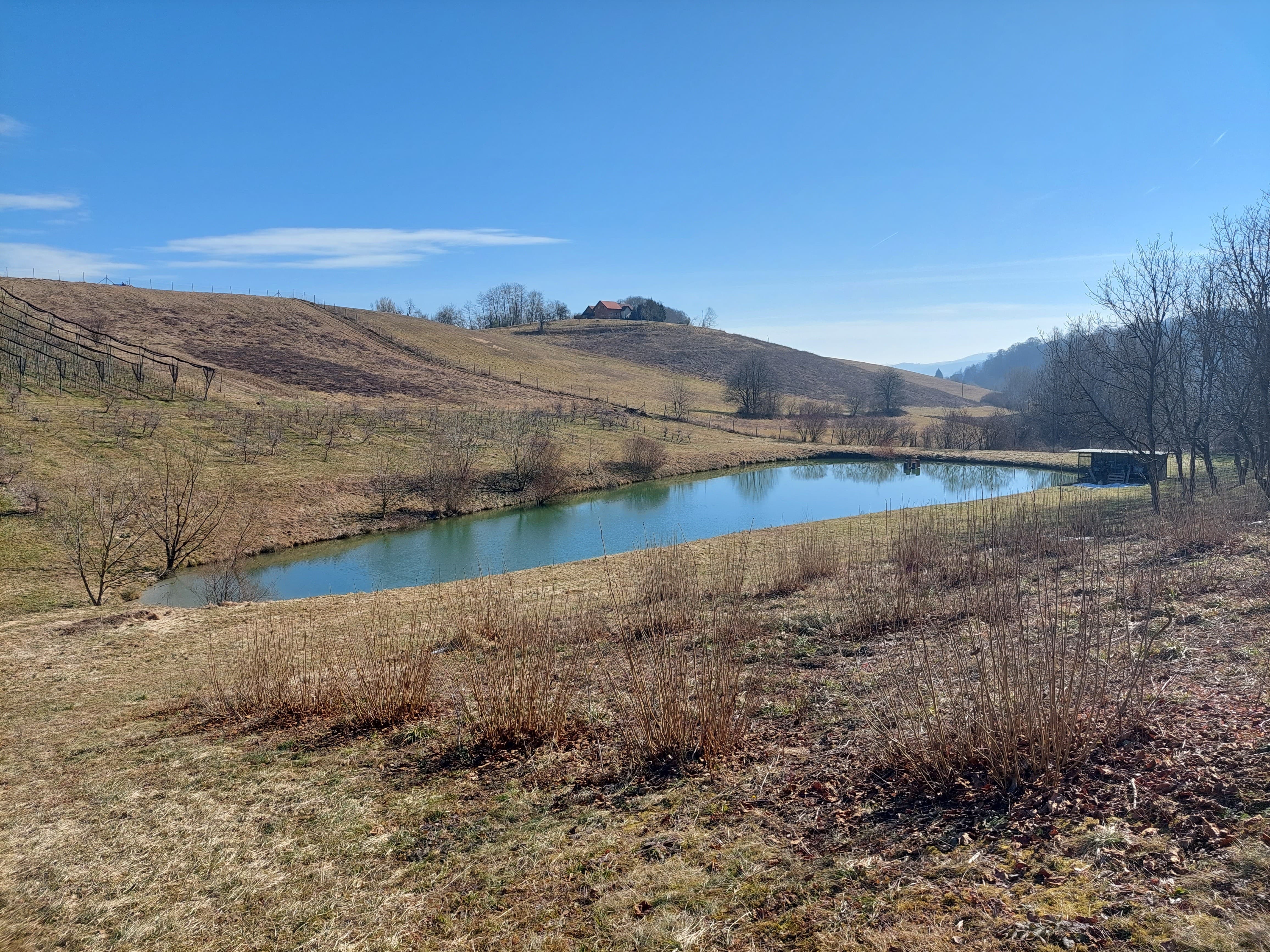
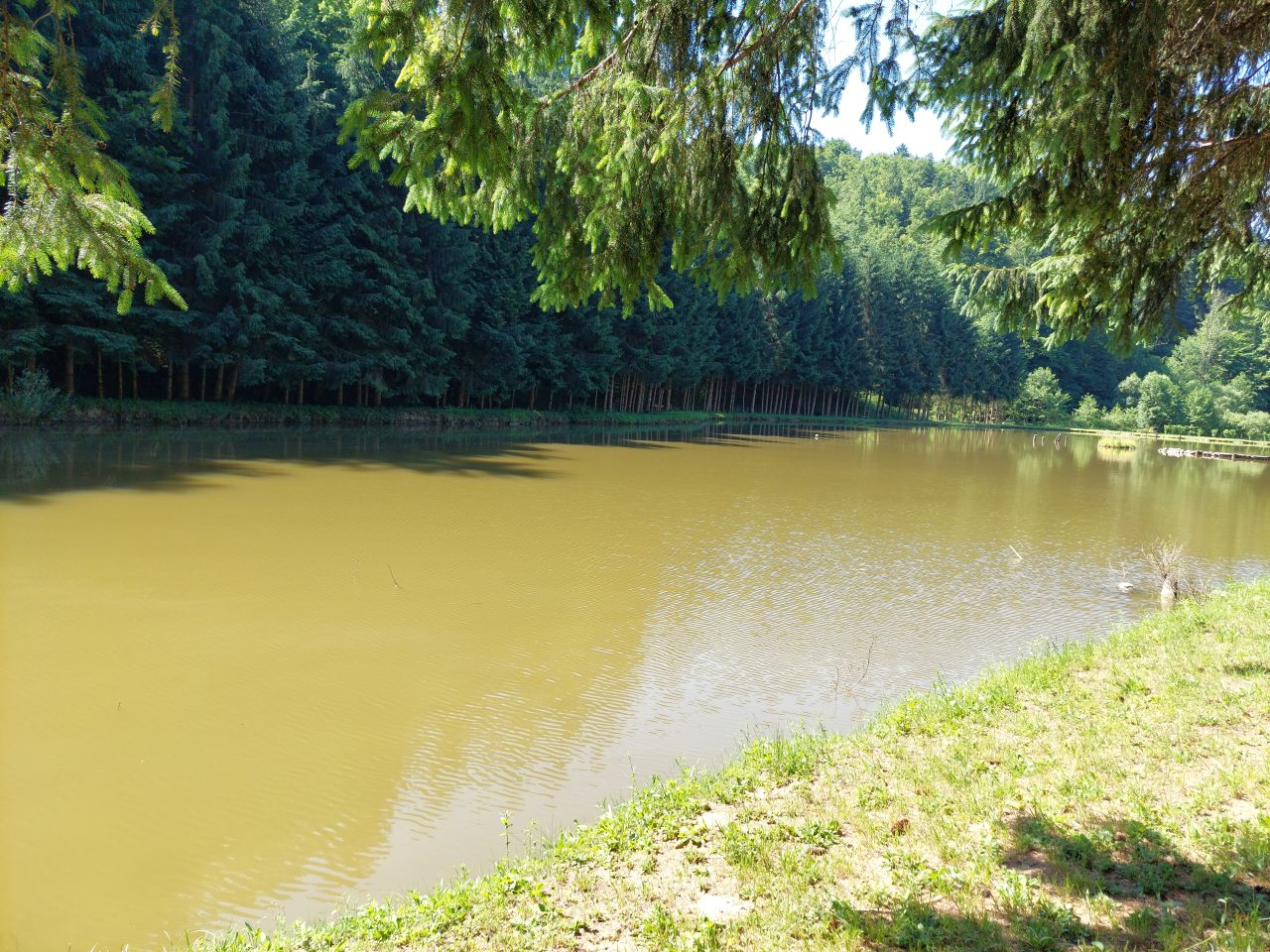
Retention ponds (e.g. flood storage reservoirs, shallow impoundments) are water bodies, storing water to attenuate surface runoff during rainfall events. They provide storage as well as improving water quality. Retention ponds may also be used for irrigation of farmland.
2.2 Detailed description of the Technology
Description:
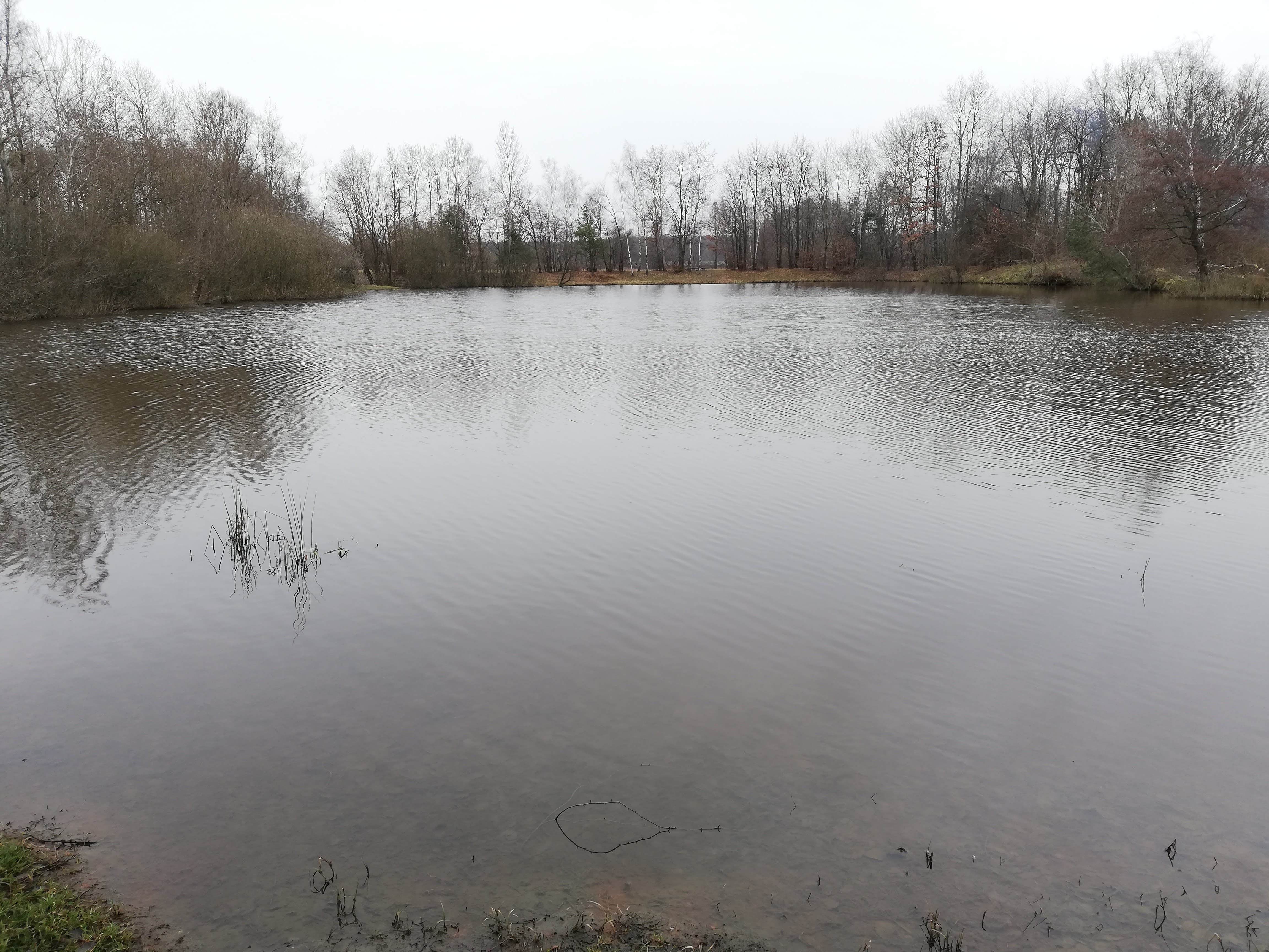
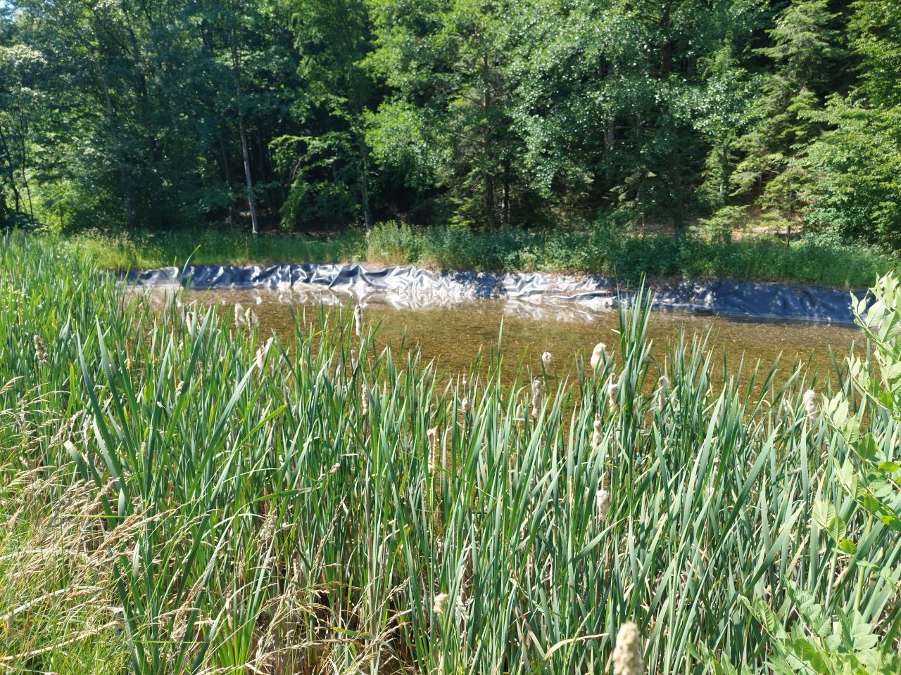
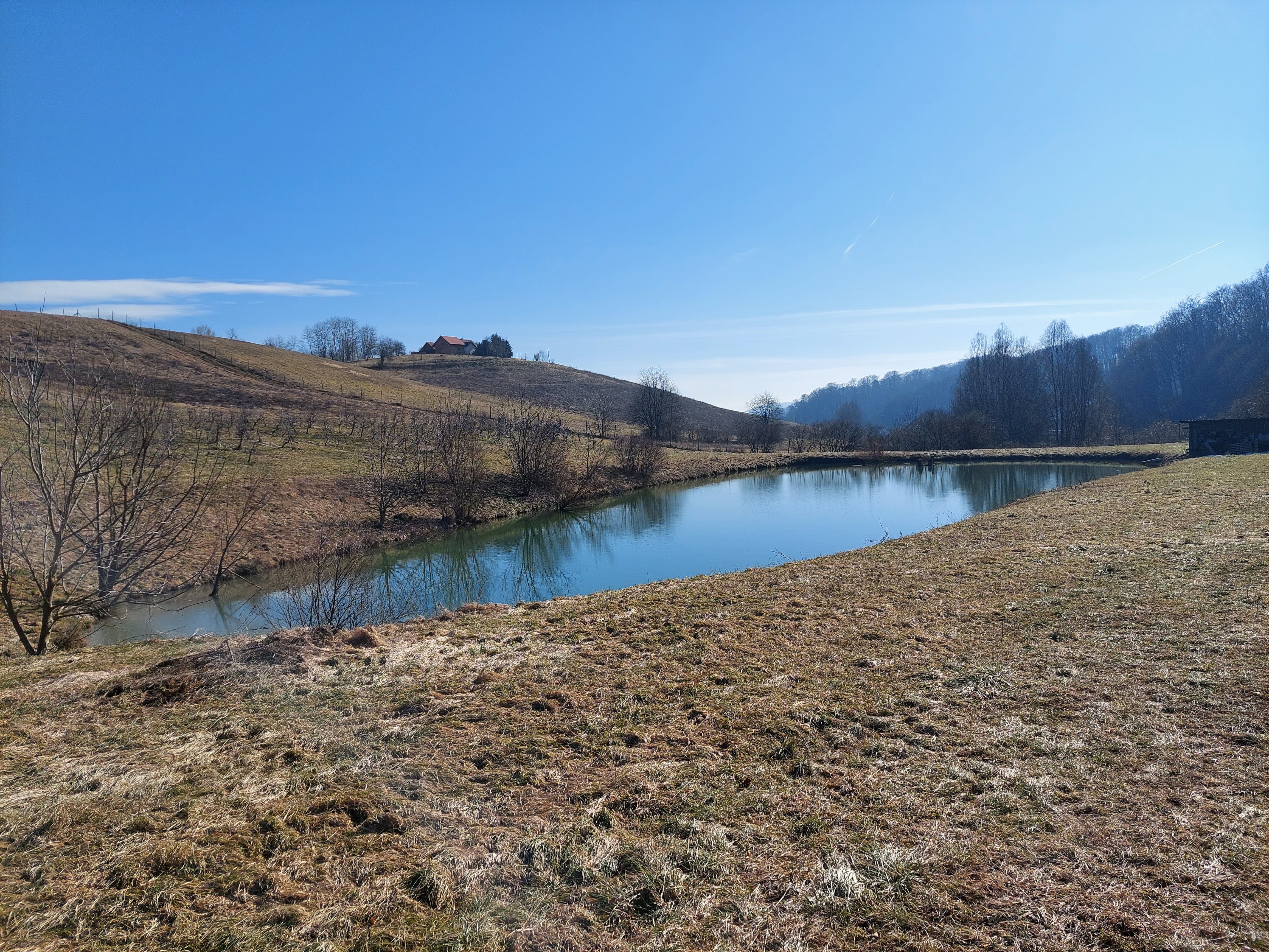
“Retention ponds” comprise both simple, small ponds (up to 2000 m3, up to 4 m deep) and larger, more complex reservoirs (greater than 2000 m3). Retention ponds are designed to provide storage capacity to attenuate surface runoff during rainfall events. Each consists of a permanent ponded area with landscaped banks. Retention ponds achieve both storm water attenuation and water quality treatment through supplementary storage capacity of runoff. Water is then released at a controlled rate once the risk of flooding has passed. The technology can be applied in a natural or human environment. Before construction of a pond it is essential to follow legislation, which covers conditions and restrictions for the given location. Once a site is selected, technical documentation is prepared: first the conceptual design, then documentation for obtaining opinion, consent and a building permit. Later there is also project documentation for implementation. If the water is to be used for other purposes as well (e.g. for irrigation), it is necessary to plan for usage and environmental impact. Retention and still water promotes pollutant removal through sedimentation, while aquatic vegetation and biological uptake mechanisms offer additional treatment. Retention ponds are effective in removing urban pollutants and improving water quality.
They are created either by using an existing natural depression, or by excavating a new depression, or by constructing embankments. Existing natural water bodies should not be used however, due to the risk that pollution events and poorer water quality might disturb/damage the natural ecology of the system. A great benefit of retention ponds is that they hold water when there is an excess of it, which can be used later when water is not available (e.g. for irrigation). Irrigation users are farmers, so they see the advantage of using a retention system. In addition to irrigation, water has also been needed in recent years for anti-frost systems (sprinkling a consistent layer of water on the crop during an entire frost event until temperatures are back to safe levels). Disadvantages are mainly restrictions in some areas (e.g. protected areas), preparation of demanding documentation and bureaucracy, and lengthy procedures for obtaining permits.
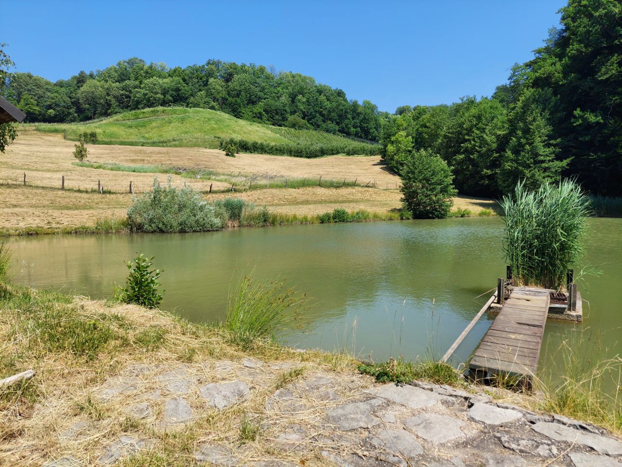
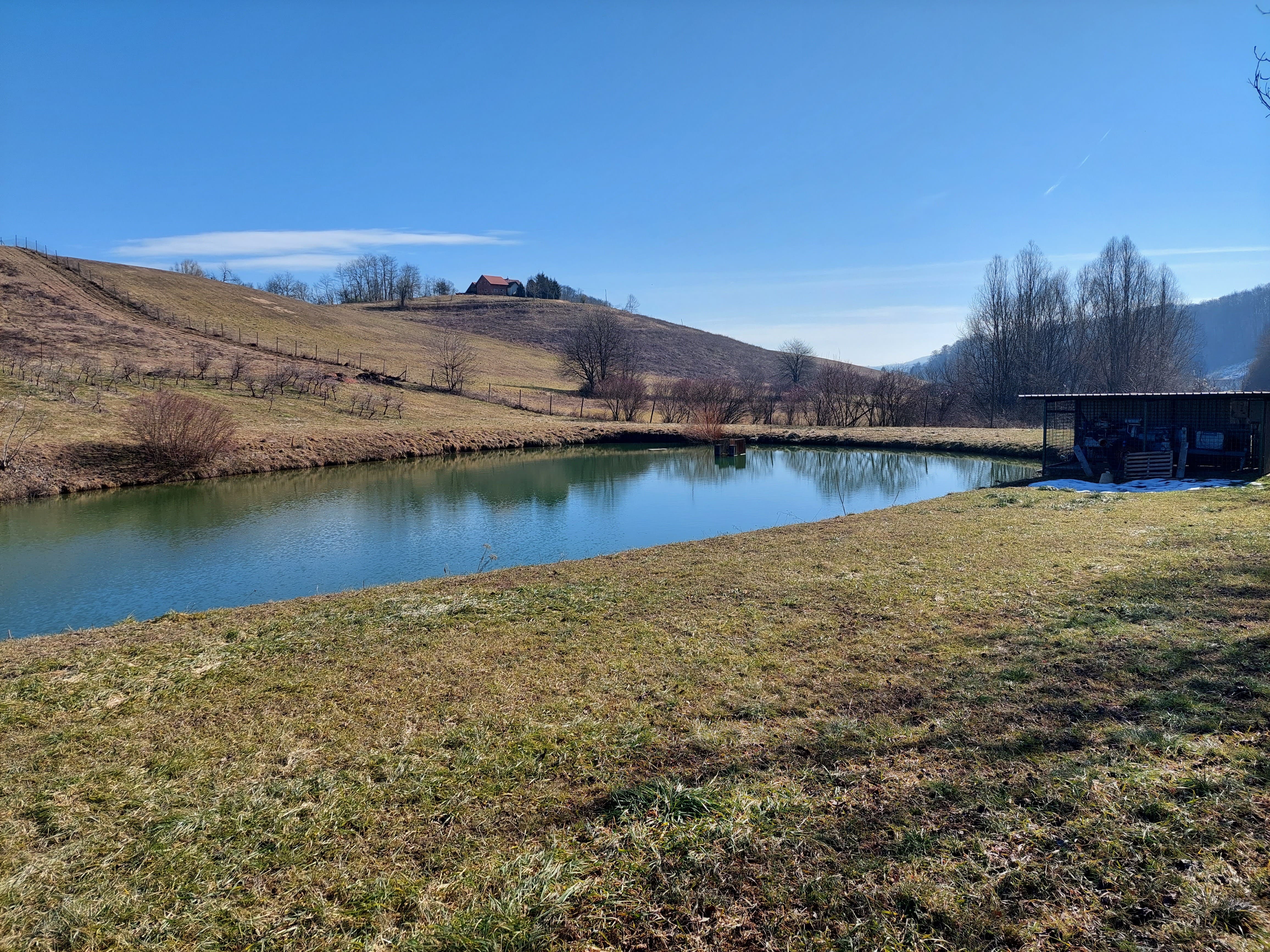
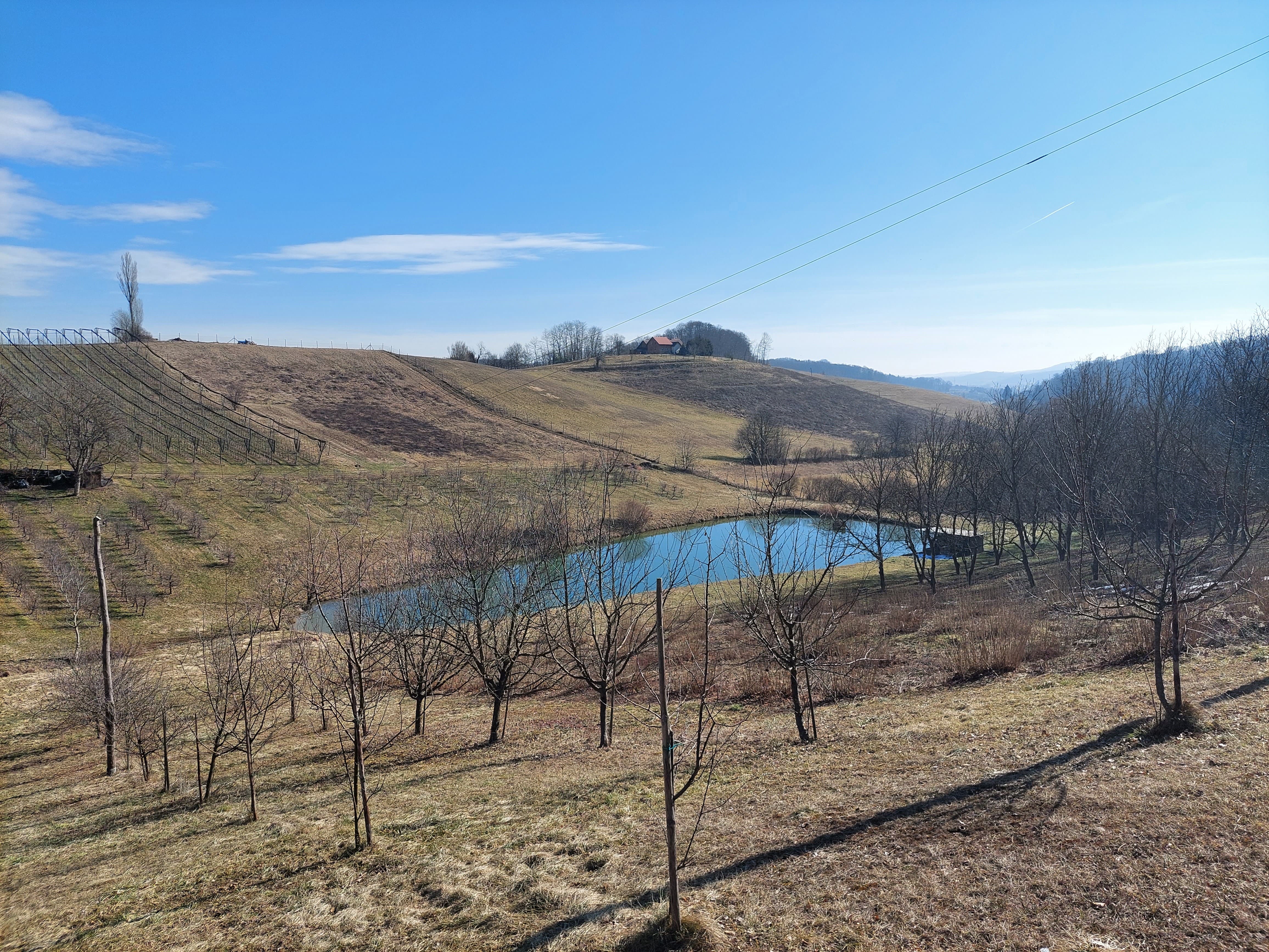
2.3 Photos of the Technology
Media Gallery
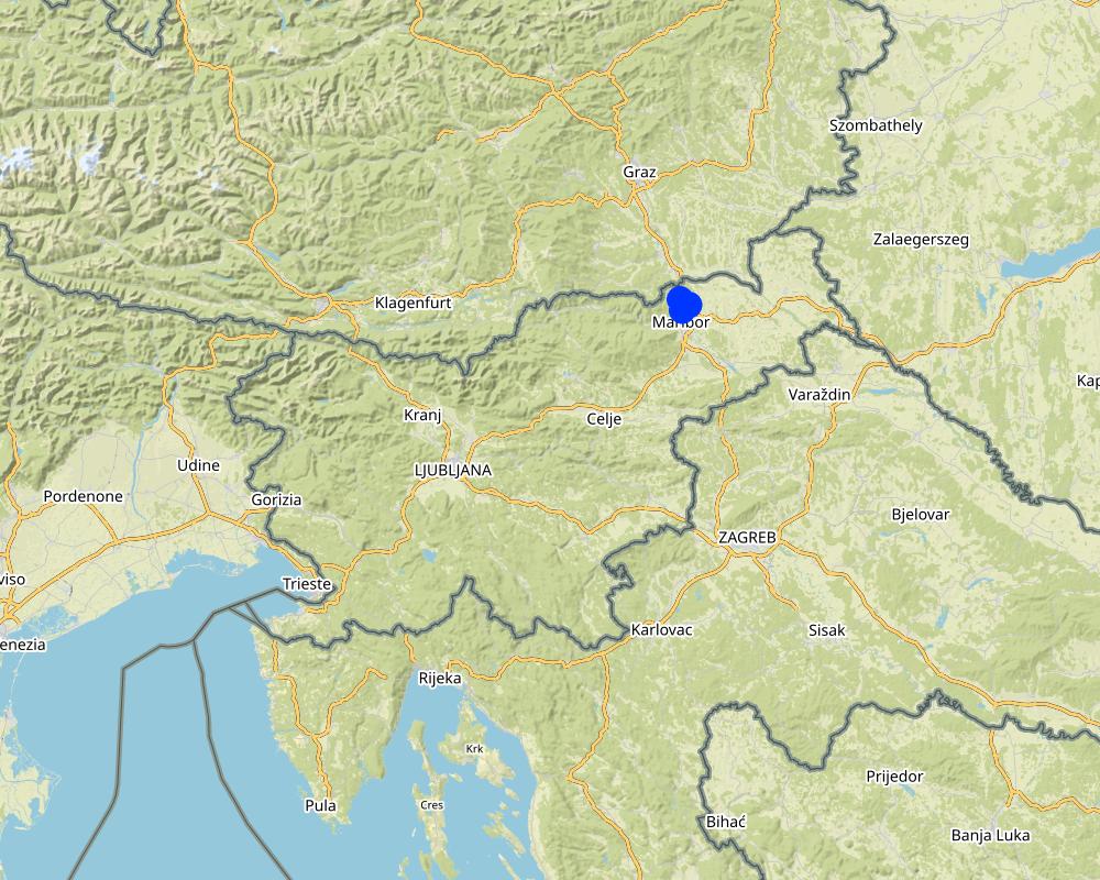
2.5 Country/ region/ locations where the Technology has been applied and which are covered by this assessment
Country:
Slovenia
Region/ State/ Province:
Podravska region, Slovenia
Further specification of location:
Pesnica
Specify the spread of the Technology:
- applied at specific points/ concentrated on a small area
Is/are the technology site(s) located in a permanently protected area?
No
Comments:
Setting up a measure in a protected area is limited and very difficult due to construction restrictions in such an environment.
Map
×2.6 Date of implementation
If precise year is not known, indicate approximate date:
- 10-50 years ago
2.7 Introduction of the Technology
Specify how the Technology was introduced:
- as part of a traditional system (> 50 years)
- through projects/ external interventions
Comments (type of project, etc.):
In the 1990s, the state financed the construction of several water reservoirs in the area.
3. Classification of the SLM Technology
3.1 Main purpose(s) of the Technology
- improve production
- protect a watershed/ downstream areas – in combination with other Technologies
- reduce risk of disasters
- adapt to climate change/ extremes and its impacts
- create beneficial economic impact
3.2 Current land use type(s) where the Technology is applied
Land use mixed within the same land unit:
No

Waterways, waterbodies, wetlands
- Ponds, dams
Main products/ services:
Retention of water, collection of water. Retention ponds are ponds or basins designed with additional storage capacity to attenuate surface runoff during rainfall events. In dry years, the water can be used for agriculture, e.g. for irrigation.
3.3 Has land use changed due to the implementation of the Technology?
Has land use changed due to the implementation of the Technology?
- Yes (Please fill out the questions below with regard to the land use before implementation of the Technology)
Land use mixed within the same land unit:
No
Waterways, waterbodies, wetlands
- Drainage lines, waterways
- Swamps, wetlands
3.4 Water supply
Water supply for the land on which the Technology is applied:
- rainfed
3.5 SLM group to which the Technology belongs
- water harvesting
- irrigation management (incl. water supply, drainage)
- surface water management (spring, river, lakes, sea)
3.6 SLM measures comprising the Technology

structural measures
- S5: Dams, pans, ponds
3.7 Main types of land degradation addressed by the Technology

soil erosion by water
- Wt: loss of topsoil/ surface erosion
- Wg: gully erosion/ gullying
- Wo: offsite degradation effects

biological degradation
- Bc: reduction of vegetation cover
- Bh: loss of habitats
- Bq: quantity/ biomass decline
- Bs: quality and species composition/ diversity decline
- Bp: increase of pests/ diseases, loss of predators

water degradation
- Ha: aridification
- Hs: change in quantity of surface water
- Hg: change in groundwater/aquifer level
- Hp: decline of surface water quality
- Hq: decline of groundwater quality
3.8 Prevention, reduction, or restoration of land degradation
Specify the goal of the Technology with regard to land degradation:
- prevent land degradation
Comments:
To prevent erosion.
4. Technical specifications, implementation activities, inputs, and costs
4.1 Technical drawing of the Technology
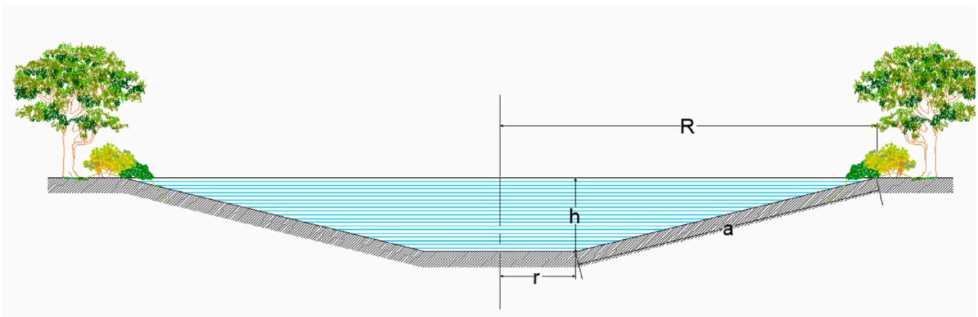
Technical specifications (related to technical drawing):
Water retention pond – excavation scheme. R is the top radius of pond, while r is the base radius; h is the height and a refers to the bank slope. Storage volume is estimated by radius r and height h (Figure). We consider potential storage volumes of 5,000 m3 to 10,000 m3.
Prior to start of construction, detention/retention ponds should be designed by a registered design professional. Plans and specifications should be referred to by field personnel throughout the construction process. When placing a detention/retention pond in a space in the first phase it is necessary to produce a conceptual design of the intended construction of a pond, which must show the purpose and goals of the retaining wall, the size of the pond, the location, a list of plots that are encroached upon, distances from neighboring land and neighboring buildings, anticipated activities in the impoundment area, impoundment volume, barrier size data, including stability assessment, and geotechnical data (Hočuršćak 2017). When planning construction of the pond, attention should be paid primarily to the impact on the actual use of space from the point of view of water management regulations, which defines the area of use and activity restrictions, due to the possible negative impact on water and coastal lands, aquatic habitats and the ecosystem created by the construction of the reservoir. After talking with the designer, in order to obtain a water permit and consent from the authorities, it is necessary to prepare technical documentation for the installation and construction, which must also include the basis for monitoring operation and maintenance (Hočuršćak 2017). The technical documentation (dimensioning of the reservoir) may differ from the microlocation and purpose or use of the measure, e.g. if pool is intended only to contain high water, sediment or debris laoding, will it be inhabited by aquatic animals, will water be used for irrigation, drinking, etc. We also consider the shape and size of the area to identify those better suited for allocating ponds also in terms of space availability. For example, it is necessary to exclude locations with a greater slope and distance from the river considering higher slope and distance is more difficult and costly to construct. We also exclude locations where the construction of a pond is not possible because they are too narrow or too small. We should consider water retention ponds as elements of a green infrastructure network together with other natural elements (e.g. vegetated riparian zones) and protected areas (e.g. Natura, 2000 sites) with a pond design that embeds features that enhance their ecological functionality. These include mild-sloped sides with vegetated buffers along the shorelines and vegetated floating islands that facilitate the nesting of birds. We refer to excavated ponds, with no weirs or dams, since inline ponds are more costly and may have negative ecological impacts (A. Staccione et al. 2021).
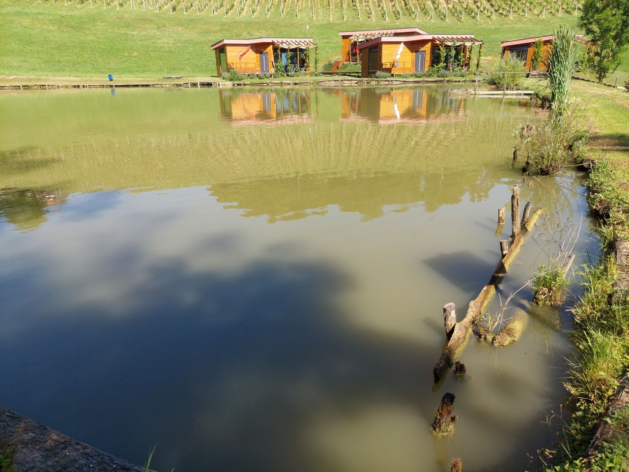
Presentation of the water reservoir at the Sadjarski Center Maribor (translated: Fruit Growing Center Maribor):
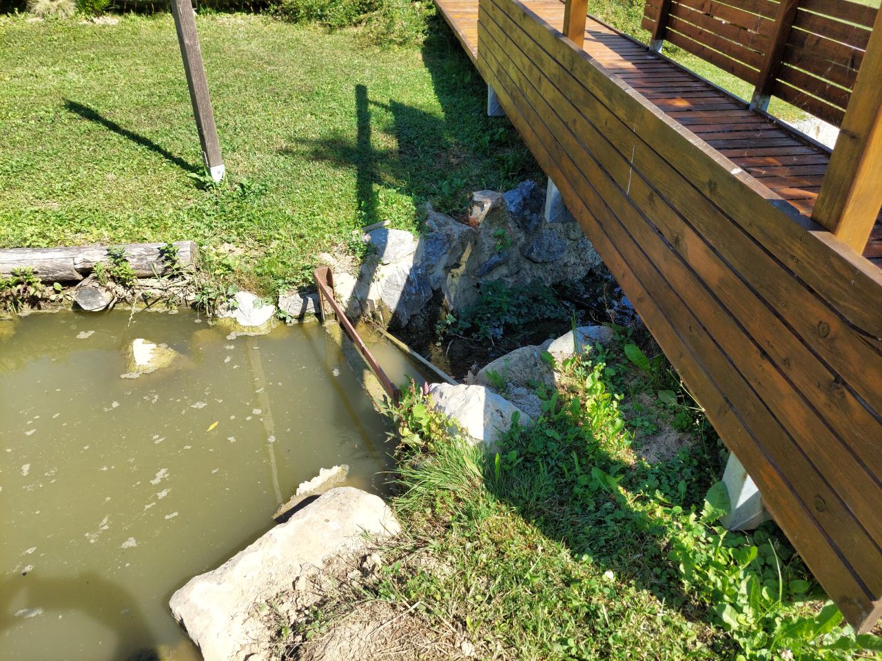
The Sadjarski Center Maribor is located on a sloping terrain, which is pedologically and configuratively quite diverse, with slopes ranging from 5-15%. The soil structure is clayey loam with a basaltic substrate. In the lower, flatter part, the soil was waterlogged, which was resolved through drainage systems. These drains are directed towards a drainage ditch, which serves as the foundation for the pond and is fed by two smaller springs. The intake point is located at the lowest point and at the southernmost part of the complex. It covers an area of 3000 m2 and has a depth of up to 3.8 m. Its capacity is 5500 m3 of water when fully filled. At its southern part, there is a concrete overflow structure (spillway) with a height of 3.8 m, which is used to drain excess water and regulate the water level. A concrete pipe, 20 m in length and 80 cm in diameter, is connected to it for the discharge of excess water. On the western side, a concrete pumping platform with a canopy and an oil trap has been constructed. It houses a 185 kW (252 HP) DAF diesel generator and a Capprari flow pump with a capacity of 300 l/min (18.0 m3/h). The pumping unit is used for filling the reservoir of the irrigation fertigation system.
Author:
A. Staccione et al.
Date:
2021
Technical specifications (related to technical drawing):
Ponds should contain the following zones (NWRM.eu, retention ponds):
- a sediment forebay or other form of upstream pre-treatment system (i.e. as part of an upstream management train of sustainable drainage components),
- a permanent pool which will remain wet throughout the year and is the main treatment zone,
- a temporary storage volume for flood attenuation, created through landscaped banks to the permanent pool,
- a shallow zone or aquatic bench which is a shallow area along the edge of the permanent pool to support wetland planting, providing ecology, amenity and safety benefits.
Additional pond design features should include an emergency spillway for safe overflow when storage capacity is exceeded, maintenance access, a safety bench, and appropriate landscaping (NWRM.eu, retention ponds).
NWRM.eu, retention ponds suggest;
- The ratio of flow path length to width in the pond should be between 3:1 and 5:1. Inlets and outlets should be placed to maximise the flow path length through the pond.
- Ponds should be wedge-shaped in plan so flow enters the pond and gradually spreads out, improving the sedimentation process and potential improvement in water quality.
- The depth of the permanent pool should be between 1.2 m and 2.0 m. Deeper pools may be subject to stratification and anoxic conditions. Shallower pools may be prone to algal blooms and high biological activity during summer months.
- Side slopes should not be steeper than 1:3 to ensure public safety and maintenance access.
- Residence time of permanent pond should be at least 20 days to allow for biological treatment of dissolved pollutants where this is required.
- Additional storage volume drained in 24-72 hours after the rainfall event depending on the intensity and duration of the storm and the design specifications of the pond
- Outfall design should be such that at least 50% of the maximum storage volume is discharged within 24 hours to allow for multiple events
- Retention ponds should ideally be combined with upstream sustainable drainage components, such as smaller detention basins and swales, which offer primary treatment and sediment management.
- Regular inspection and maintenance is important for the effective operation of ponds as designed.
Regular maintenance activities include litter and debris removal; vegetation maintenance (including cutting of bank and aquatic vegetation and removal of nuisance plants); inlet/outlet inspection and maintenance; and sediment removal from forebay (where applicable). Less frequent maintenance may include sediment removal from permanent pond; repairs; ongoing inspections and monitoring.
Appropriate signage to warn of water depth must be included for public safety.
4.2 General information regarding the calculation of inputs and costs
Specify how costs and inputs were calculated:
- per Technology unit
Specify unit:
pond
Specify dimensions of unit (if relevant):
5500
other/ national currency (specify):
EUR
If relevant, indicate exchange rate from USD to local currency (e.g. 1 USD = 79.9 Brazilian Real): 1 USD =:
0.97
Indicate average wage cost of hired labour per day:
90.90
4.3 Establishment activities
| Activity | Timing (season) | |
|---|---|---|
| 1. | Costs of obtaining construction, technical and project documentation | 1-2 years before before starting construction |
| 2. | Construction of a pond | 1st year |
| 3. | Costs of supervision of construction and craftsmanship | 1st year |
4.4 Costs and inputs needed for establishment
If you are unable to break down the costs in the table above, give an estimation of the total costs of establishing the Technology:
73600.0
If land user bore less than 100% of costs, indicate who covered the remaining costs:
The construction of a water reservoir can be subsidized from various sources (EU, state, municipalities, etc.). The largest share of support can be obtained through the Rural Development Program, where an investment can receive support ranging from 30% to 50% of eligible project cost (establishment cost).
Comments:
The costs include excavation costs and bottom waterproofing costs. Determining the exact establishment costs for the entire project was challenging due to variations in location, topography, size, shape, dimensions, materials, soil permeability, and other factors. The specific establishment cost for the retention pond at the case study location is not available or relevant, as it would be significantly lower than the cost of constructing such a pond today (due to inflation). Therefore, we decided to use projected values based on the maximum eligible costs set by the Ministry of Agriculture for grant applications, which amount to 13.38 €/m3 (2016). This value represents the justified project cost for constructing the retention pond. In this scenario, the estimated establishment cost for a typical 5000 m3 pond would be 66,900.00 €.
4.5 Maintenance/ recurrent activities
| Activity | Timing/ frequency | |
|---|---|---|
| 1. | Energy for pumping | annually |
| 2. | water fee | annually |
| 3. | Maintenance costs (vegetation management, inspections, infrastructure maintenance, mulching, invasive species removal, pumping the entire pond for cleaning and sediment removal, sludge cleaning, monitoring, bank stabilization, replacement of damaged parts, and sealing, etc.) | annually |
4.6 Costs and inputs needed for maintenance/ recurrent activities (per year)
If you are unable to break down the costs in the table above, give an estimation of the total costs of maintaining the Technology:
3000.0
Comments:
Obtaining precise costs for maintaining the pond and its surroundings is challenging, as it involves various factors. The costs can include anything from labor hours and manual mowing around the pond to considering professionals for inspections, infrastructure maintenance, mulching, invasive species removal, pumping the entire reservoir for cleaning and sediment removal, sludge cleaning, monitoring, bank stabilization, replacement of damaged parts, sealing, and more. The exact costs are difficult to determine due to the highly diverse infrastructure present in different locations. We have estimated the costs per square meter of the area under maintenance, which includes both the surrounding land and the water surface. If it's only about cleaning the surroundings of the reservoir, we consider only the land area. However, if it involves cleaning within the reservoir, we also take into account the water surface area. The best rough estimates we have range from 1 to 5 € per square meter.
4.7 Most important factors affecting the costs
Describe the most determinate factors affecting the costs:
Construction costs are affected by the shape, size, depth and microlocation of the pond layout. In addition, the cost is also influenced by the purpose of use (e.g. if pool is intended only to contain high water, sediment or debris laoding, will it be inhabited by aquatic animals, will water be used for irrigation, drinking, etc.). Geomechanically conditions are also important, because ponds and reservoirs can affect slope stability and induce landslides. The value of the investment can vary greatly depending on the design of the pond, location, water content of the area, soil structure, climate conditions,... so it is impossible to determine the exact values for pond construction, but we can only give an estimation.
5. Natural and human environment
5.1 Climate
Annual rainfall
- < 250 mm
- 251-500 mm
- 501-750 mm
- 751-1,000 mm
- 1,001-1,500 mm
- 1,501-2,000 mm
- 2,001-3,000 mm
- 3,001-4,000 mm
- > 4,000 mm
Specify average annual rainfall (if known), in mm:
1080.00
Specifications/ comments on rainfall:
The most precipitation falls in summer, the months with the highest average precipitation are June and August, the least precipitation falls in winter, in January and February at least, and in principle more precipitation falls in autumn than in spring.
Indicate the name of the reference meteorological station considered:
Jareninski vrh (1981 – 2010)
Agro-climatic zone
- sub-humid
Mean annual temperature in year 2014 Jareninski vrh is 11,9°C.
5.2 Topography
Slopes on average:
- flat (0-2%)
- gentle (3-5%)
- moderate (6-10%)
- rolling (11-15%)
- hilly (16-30%)
- steep (31-60%)
- very steep (>60%)
Landforms:
- plateau/plains
- ridges
- mountain slopes
- hill slopes
- footslopes
- valley floors
Altitudinal zone:
- 0-100 m a.s.l.
- 101-500 m a.s.l.
- 501-1,000 m a.s.l.
- 1,001-1,500 m a.s.l.
- 1,501-2,000 m a.s.l.
- 2,001-2,500 m a.s.l.
- 2,501-3,000 m a.s.l.
- 3,001-4,000 m a.s.l.
- > 4,000 m a.s.l.
Indicate if the Technology is specifically applied in:
- concave situations
Comments and further specifications on topography:
There are depressions, settlements are in the valley, concave type.
5.3 Soils
Soil depth on average:
- very shallow (0-20 cm)
- shallow (21-50 cm)
- moderately deep (51-80 cm)
- deep (81-120 cm)
- very deep (> 120 cm)
Soil texture (topsoil):
- medium (loamy, silty)
- fine/ heavy (clay)
Soil texture (> 20 cm below surface):
- medium (loamy, silty)
- fine/ heavy (clay)
Topsoil organic matter:
- medium (1-3%)
5.4 Water availability and quality
Ground water table:
5-50 m
Availability of surface water:
good
Water quality (untreated):
for agricultural use only (irrigation)
Water quality refers to:
surface water
Is water salinity a problem?
No
Is flooding of the area occurring?
Yes
Regularity:
episodically
Comments and further specifications on water quality and quantity:
Hydro melioration was carried out in the area, a drainage system and water retention systems (e.g. ponds and basins) were arranged.
5.5 Biodiversity
Species diversity:
- medium
Habitat diversity:
- medium
5.6 Characteristics of land users applying the Technology
Sedentary or nomadic:
- Sedentary
Market orientation of production system:
- commercial/ market
Off-farm income:
- 10-50% of all income
Relative level of wealth:
- average
Individuals or groups:
- individual/ household
- employee (company, government)
Level of mechanization:
- mechanized/ motorized
Gender:
- women
- men
Age of land users:
- middle-aged
Indicate other relevant characteristics of the land users:
Manager of an agricultural company - fruit center - poblic demonstration plantation.
5.7 Average area of land used by land users applying the Technology
- < 0.5 ha
- 0.5-1 ha
- 1-2 ha
- 2-5 ha
- 5-15 ha
- 15-50 ha
- 50-100 ha
- 100-500 ha
- 500-1,000 ha
- 1,000-10,000 ha
- > 10,000 ha
Is this considered small-, medium- or large-scale (referring to local context)?
- medium-scale
5.8 Land ownership, land use rights, and water use rights
Land ownership:
- company
Land use rights:
- individual
Water use rights:
- communal (organized)
Are land use rights based on a traditional legal system?
No
Specify:
They are based on national legal system
5.9 Access to services and infrastructure
health:
- poor
- moderate
- good
education:
- poor
- moderate
- good
technical assistance:
- poor
- moderate
- good
employment (e.g. off-farm):
- poor
- moderate
- good
markets:
- poor
- moderate
- good
energy:
- poor
- moderate
- good
roads and transport:
- poor
- moderate
- good
drinking water and sanitation:
- poor
- moderate
- good
financial services:
- poor
- moderate
- good
6. Impacts and concluding statements
6.1 On-site impacts the Technology has shown
Socio-economic impacts
Production
crop production
Comments/ specify:
Irrigation has avoided reduction in production due to drought and frost
crop quality
Comments/ specify:
Improved fruit health (protection against drought and frost)
risk of production failure
Comments/ specify:
Protection against drought and frost
production area
Comments/ specify:
Change of land use (from agricultural land to water body).
land management
Comments/ specify:
Increased the complexity of management.
Water availability and quality
irrigation water quality
demand for irrigation water
Income and costs
farm income
Comments/ specify:
Production and income stability.
diversity of income sources
Comments/ specify:
Possible diversification on farm (tourism and recreation).
workload
Comments/ specify:
Demanding maintenance and increased complexity of management.
Socio-cultural impacts
food security/ self-sufficiency
Comments/ specify:
Lower risk of production failure, stability in business, motivation to do business in agriculture
recreational opportunities
Comments/ specify:
Possible additional activities on farm.
community institutions
Comments/ specify:
An example of good practice for the community.
SLM/ land degradation knowledge
Comments/ specify:
With positive effects more interest of the farmer in sustainable production.
Ecological impacts
Water cycle/ runoff
water quantity
Comments/ specify:
Water available in dry months.
harvesting/ collection of water
surface runoff
excess water drainage
evaporation
Soil
soil moisture
Comments/ specify:
Increased in case of irrigation
soil loss
nutrient cycling/ recharge
Biodiversity: vegetation, animals
Vegetation cover
plant diversity
Comments/ specify:
Planting species near/around the pond.
invasive alien species
Comments/ specify:
Danger in case of improper maintenance.
animal diversity
Comments/ specify:
For a green reservoir, a lot of green infrastructure is placed next to it, which serves as protection for animals and plants (beneficial).
beneficial species
habitat diversity
Climate and disaster risk reduction
flood impacts
landslides/ debris flows
drought impacts
fire risk
Comments/ specify:
Proximity to water.
micro-climate
Comments/ specify:
It affects the microclimate, more humidity, slower temperature fluctuations
6.2 Off-site impacts the Technology has shown
water availability
Comments/ specify:
It is slightly increased as the ponds provide water during dry periods.
reliable and stable stream flows in dry season
Comments/ specify:
Improved mainly due to water retention during wet seasons for use in dry periods.
downstream flooding
Comments/ specify:
Reduced due to the capacity of ponds to retain excess water during times when rivers may flood.
downstream siltation
Comments/ specify:
The reservoir also enables sediment retention, preventing sediment from reaching downstream watercourses.
groundwater/ river pollution
Comments/ specify:
Many studies indicate that ponds can trap harmful substances, causing them to settle or undergo processes (acting as natural purification systems, especially when appropriate plant species are involved). This helps maintain cleaner downstream flows in terms of pollutants.
buffering/ filtering capacity
Comments/ specify:
The pond's ability to retain pollutants also contributes to its buffering and filtering capacity.
6.3 Exposure and sensitivity of the Technology to gradual climate change and climate-related extremes/ disasters (as perceived by land users)
Gradual climate change
Gradual climate change
| Season | increase or decrease | How does the Technology cope with it? | |
|---|---|---|---|
| seasonal temperature | summer | increase | well |
| annual rainfall | decrease | very well | |
| seasonal rainfall | spring | increase | very well |
Climate-related extremes (disasters)
Meteorological disasters
| How does the Technology cope with it? | |
|---|---|
| local rainstorm | well |
Climatological disasters
| How does the Technology cope with it? | |
|---|---|
| heatwave | not well |
| drought | very well |
Hydrological disasters
| How does the Technology cope with it? | |
|---|---|
| general (river) flood | well |
Other climate-related consequences
Other climate-related consequences
| How does the Technology cope with it? | |
|---|---|
| extended growing period | well |
6.4 Cost-benefit analysis
How do the benefits compare with the establishment costs (from land users’ perspective)?
Short-term returns:
neutral/ balanced
Long-term returns:
positive
How do the benefits compare with the maintenance/ recurrent costs (from land users' perspective)?
Short-term returns:
positive
Long-term returns:
positive
Comments:
The costs of establishing a retention pond are indeed very high, and it is a substantial investment. However, especially in the case of agricultural land irrigation, the benefits can be quite favorable, particularly in terms of drought protection or frost prevention. In the long run, the investment yields significant advantages, as it enables resilience to climate change. Farmers can also receive support through rural development programs, which provide 30-50% project funding. Although the maintenance costs can be considerable, they are necessary and offer substantial benefits to farmers who irrigate their crops or protect them from frost. From land users' perspective it's positive, if they have improved production results.
6.5 Adoption of the Technology
- 1-10%
Of all those who have adopted the Technology, how many did so spontaneously, i.e. without receiving any material incentives/ payments?
- 0-10%
Comments:
It is worth noting that the availability and extent of government subsidies can vary depending on the location, specific program, and eligibility criteria. In this research area, the majority of projects received partial funding from the government.
6.6 Adaptation
Has the Technology been modified recently to adapt to changing conditions?
No
6.7 Strengths/ advantages/ opportunities of the Technology
| Strengths/ advantages/ opportunities in the land user’s view |
|---|
| Retention ponds are simple if space is provided. |
| They collect water for use in drought conditions. |
| Retention ponds manage storm water quantity and quality, lessening the transfer of pollutants and chemicals into nearby water bodies. |
| Improved storm water collection and flood control. |
| Retention ponds provide habitats for animals, organisms, and insects (biodiversity). |
| Strengths/ advantages/ opportunities in the compiler’s or other key resource person’s view |
|---|
| Local farm water retention systems allow for the detainment of water captured during spring runoff as well as during precipitation events, either directly or due to transport by surface runoff. This provides water storage that can be drawn on when groundwater supplies become depleted. |
| Retention ponds are designed to hold excess storm water runoff and release it slowly to avoid flooding downstream areas. They also serve to reduce downstream peak flow and aid in retaining flood waters which reduces associated flood risks downstream. If water is released from the reservoir, they serve to replenish groundwater stores downstream. |
| Surface water retention systems have shown success in reducing nutrient and sediment loading in various locations worldwide. |
| Under drought conditions these systems enable farmers to draw water from the reservoirs to support crop irrigation. The main value of water retention ponds is related to agricultural water demand in the dry season. They are considered the only effective way to preserve agricultural productivity. The ponds can increase the monetary value of agricultural land that can cope with water needs. |
| In addition to the primary function of retaining high waters, they often also serve a multipurpose use, such as: supply of drinking water, irrigation of agricultural land, protection against erosion, aquaculture, fishing, energy source, preservation of landscape and biodiversity, tourism, recreation and others. |
| Biomass production is another benefit of multi-purpose surface water retention system – cattails bioproduction and nutrient management. |
| In the case of construction of the so-called of a "green" water reservoir, green infrastructure solutions can provide protection for various species of animals and plants, which promotes biodiversity. |
6.8 Weaknesses/ disadvantages/ risks of the Technology and ways of overcoming them
| Weaknesses/ disadvantages/ risks in the land user’s view | How can they be overcome? |
|---|---|
| Anaerobic conditions can occur without regular inflow. | Proper planning and dimensioning of the pond, location and water level are necessary. It is necessary to ensure adequate flow and depth of the pond. |
| May not be suitable for steep sites, due to requirement for high embankments. | The construction of the pond is planned at a suitable location. |
| Colonisation by invasive species could increase maintenance and pose a danger to cultivated areas. | Regular maintenance and cleaning of the pond bank is necessary. |
| Safety risk in case of slipping and falling into the pond. | It is necessary to fence and isolate the access to the pond. |
| Weaknesses/ disadvantages/ risks in the compiler’s or other key resource person’s view | How can they be overcome? |
|---|---|
| Large investments in the irrigation system and access to funds for irrigation infrastructure can be difficult to attain. | The size and holding capacity of retention systems also need to be considered to maximize benefits while limiting the initial costs of building a surface water retention system. |
| The construction requires a lot of technical preparation, planning, documentation and there are many bureaucratic obstacles to comply with the spatial acts of the municipality and to fulfil the requirements of the spatial planning authorities, which also includes large initial costs. | The preparation and management of the project should be entrusted to a professional service. Check the conditions ahead of time and plan strategically several years ahead. |
| While irrigation provides an economic gain during drought years, it also increases operational costs for water supplies. | Strategies need to provide drought proofing of crops as well as limiting damages caused by floods in non-drought years to reduce risk to farmers and the region. |
| Experts identified some barriers for greener pond implementation, especially related to reduced efficiency. The higher surface required can cause loss of water stored during summer from the higher rate of evaporation. Another risk is associated with vegetation close to the pond banks which can reduce impermeabilization and increase water infiltration due to root growth in the soil. | Good technical plan with solutions and compromises for best results with natural (green) benefits. Considering the benefits brought by green systems. |
| Unregulated relations between active/potential users, both in the delimitation of water rights, especially in times of water shortage, and in cases of regulating obligations for the proper operation and maintenance. | Collective investments with a good long-term plan for operation and maintenance. Organized management of users from the organization (e.g. municipality, etc.). |
7. References and links
7.1 Methods/ sources of information
- field visits, field surveys
Field visit and conducted interview with the farm manager at the Fruit Growing Center Maribor. A working group was established, where we met 2 times to review and respond to the questionnaire.
- interviews with land users
Purgaj Donik Biserka is a farm manager of agriculture company "Fruit growing center Maribor" (land user).
- interviews with SLM specialists/ experts
Matjaz Glavan, Istenič Darja, Škerjanec Mateja, Banovec Primož, Curk Miha and Cvejić Rozalija representatives from University of Ljubljana.
- compilation from reports and other existing documentation
As for the literature, we utilized the following documents:
- Vodnogospodarske podlage za nadzor obratovanja in vzdrževanja manjših zadrževalnikov (translated: Hydraulic basis for monitoring the operation and maintenance of small reservoirs). Miljenko Hočuršćak. Aktualni projekti s področja upravljanja z vodami in urejanje voda. 28. Mišičev vodarski dan 2017.
- Natural water retention ponds for water management in agriculture: A potential scenario in Northern Italy; Andrea Staccione, Davide Broccoli, Paolo Mazzoli, Stefano Bagli, Jaroslav Mysiak; Journal of Environmental Management 292 (2021) 112849.
When were the data compiled (in the field)?
10/02/2023
7.2 References to available publications
Title, author, year, ISBN:
An economic assessment of local farm multi-purpose surface water retention systems in a Canadian Prairie setting; Pamela Berry, Fuad Yassin, Kenneth Belcher, Karl-Erich Lindenschmidt, Appl Water Sci (2017) 7:4461–4478.
Available from where? Costs?
Web
Title, author, year, ISBN:
Natural water retention ponds for water management in agriculture: A potential scenario in Northern Italy; Andrea Staccione, Davide Broccoli, Paolo Mazzoli, Stefano Bagli, Jaroslav Mysiak; Journal of Environmental Management 292 (2021) 112849.
Available from where? Costs?
Web
Title, author, year, ISBN:
Natural Water Retention Measures; Report: Individual NWRM - Retention ponds.
Available from where? Costs?
Web
Title, author, year, ISBN:
Vodnogospodarske podlage za nadzor obratovanja in vzdrževanja manjših zadrževalnikov. Miljenko Hočuršćak. Aktualni projekti s področja upravljanja z vodami in urejanje voda. 28. Mišičev vodarski dan 2017.
Available from where? Costs?
Web
Links and modules
Expand all Collapse allLinks
No links
Modules
No modules