Wetland in the Stabė River [Lithuania]
- Creation:
- Update:
- Compiler: Jovita Mėžinė
- Editor: Egle Baltranaite
- Reviewers: William Critchley, Rima Mekdaschi Studer, Joana Eichenberger
Šlapynė at Stabės Terespolis
technologies_5996 - Lithuania
View sections
Expand all Collapse all1. General information
1.2 Contact details of resource persons and institutions involved in the assessment and documentation of the Technology
Key resource person(s)
co-compiler:
co-compiler:
Name of project which facilitated the documentation/ evaluation of the Technology (if relevant)
OPtimal strategies to retAIN and re-use water and nutrients in small agricultural catchments across different soil-climatic regions in Europe (OPTAIN) {'additional_translations': {}, 'value': 6286, 'label': 'Name of the institution(s) which facilitated the documentation/ evaluation of the Technology (if relevant)', 'text': 'Klaipeda University (KU) - Lithuania', 'template': 'raw'}1.3 Conditions regarding the use of data documented through WOCAT
The compiler and key resource person(s) accept the conditions regarding the use of data documented through WOCAT:
Yes
1.4 Declaration on sustainability of the described Technology
Is the Technology described here problematic with regard to land degradation, so that it cannot be declared a sustainable land management technology?
No
2. Description of the SLM Technology
2.1 Short description of the Technology
Definition of the Technology:
The installation of this wetland contributes to reducing the ecological debt to nature by restoring natural complexes, reaching a balance between environmental and economic interests, and promoting sustainable farming conditions in one of the most important and valuable natural areas of central Lithuania.
2.2 Detailed description of the Technology
Description:
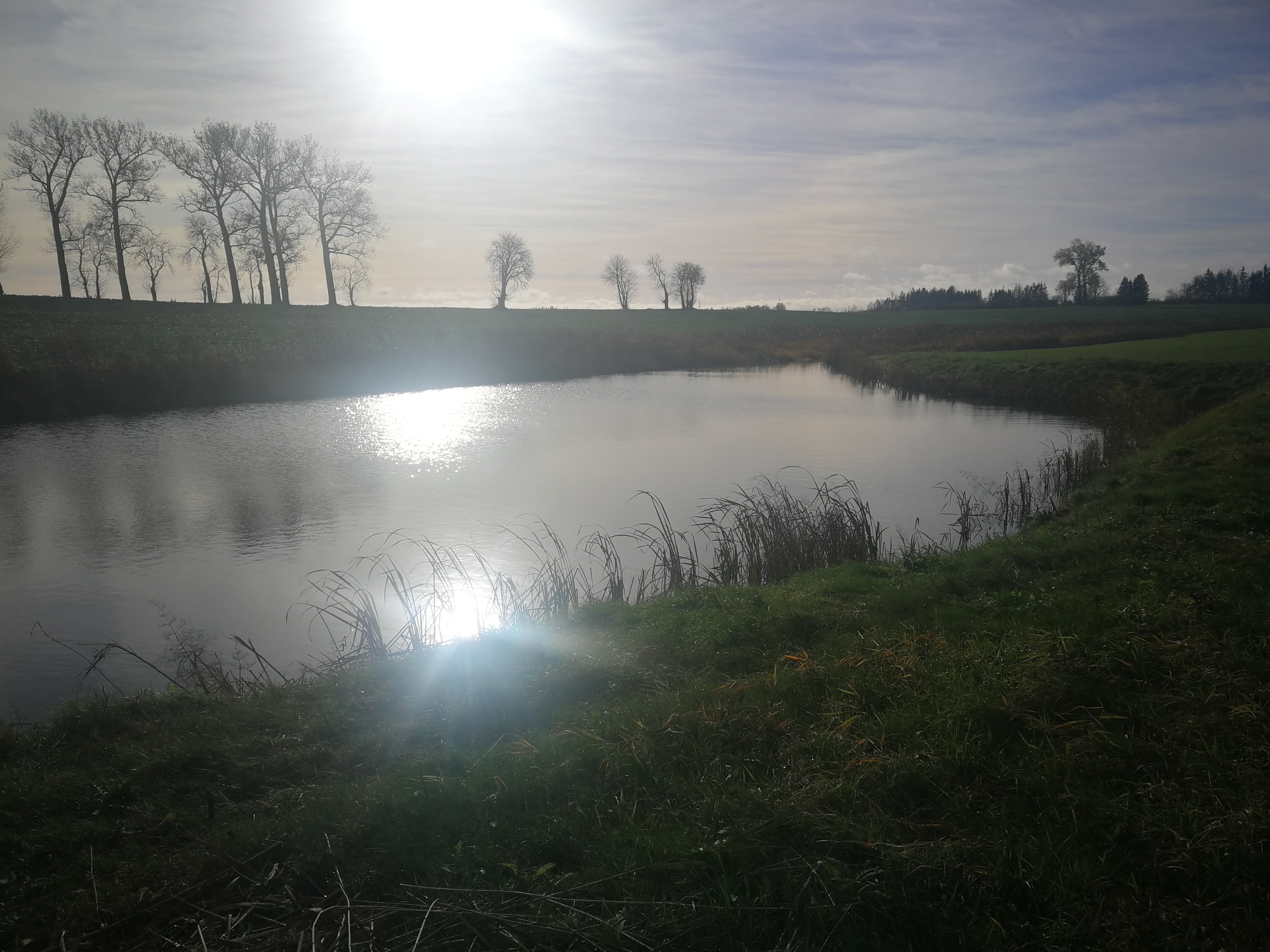
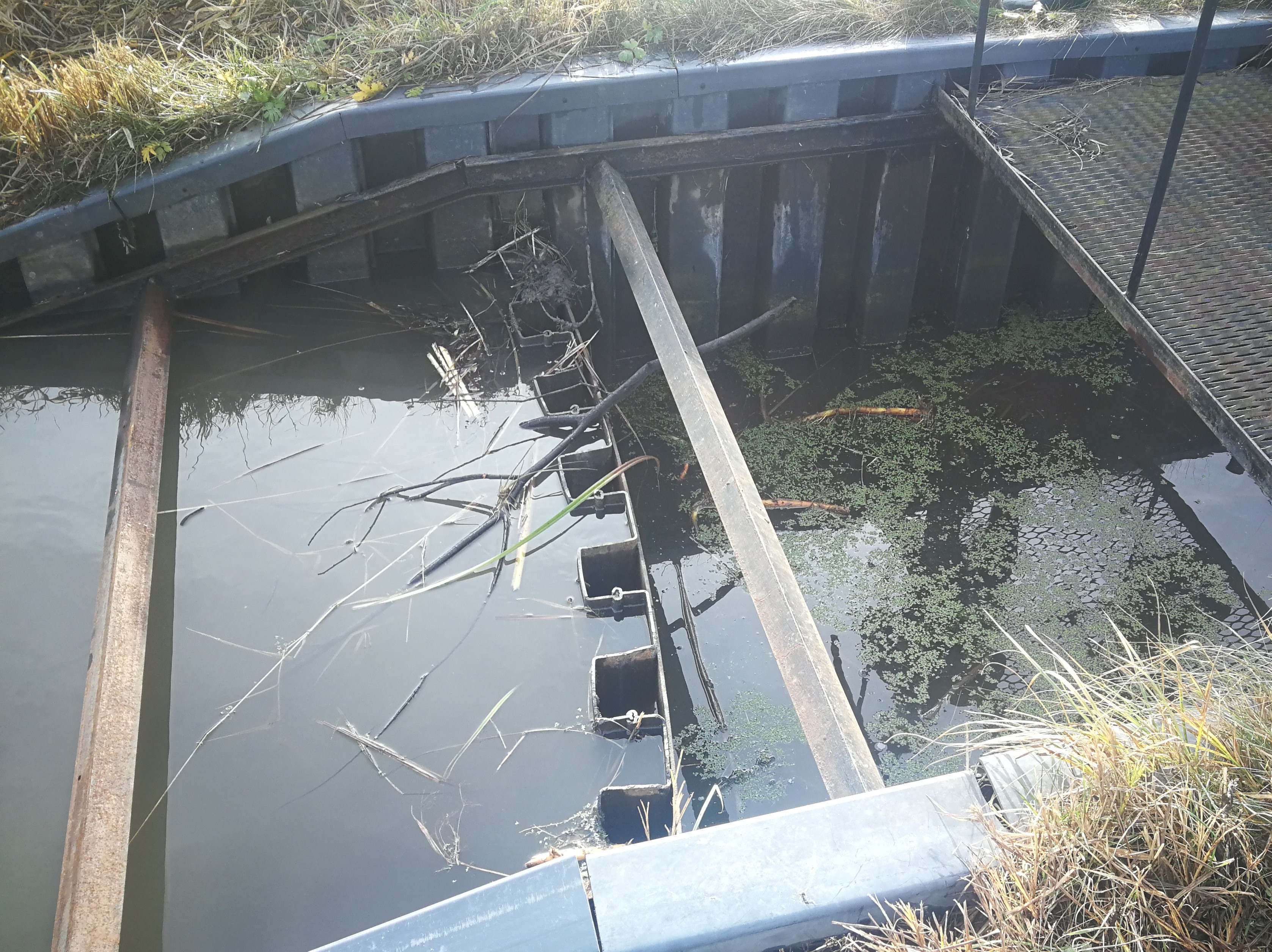
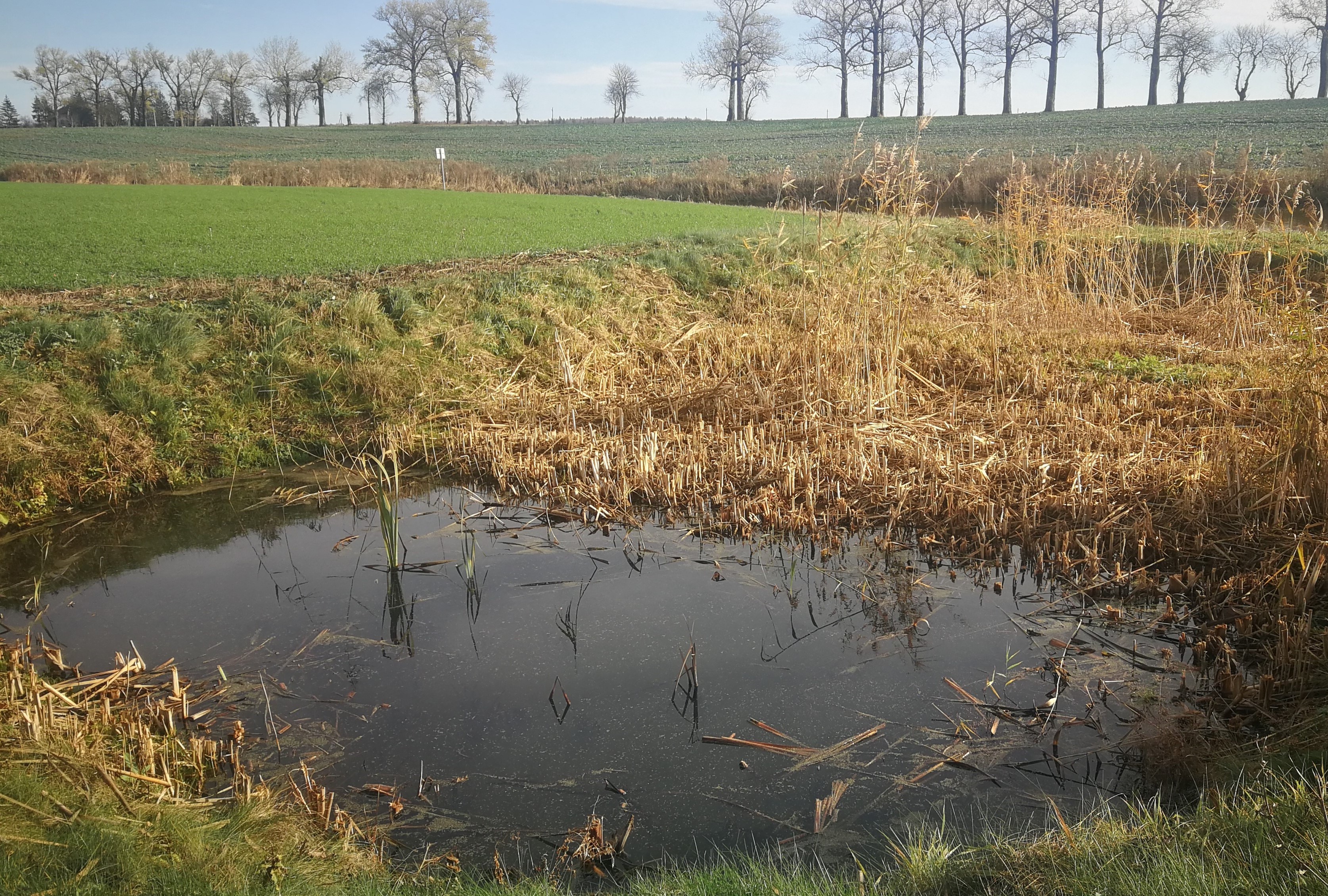
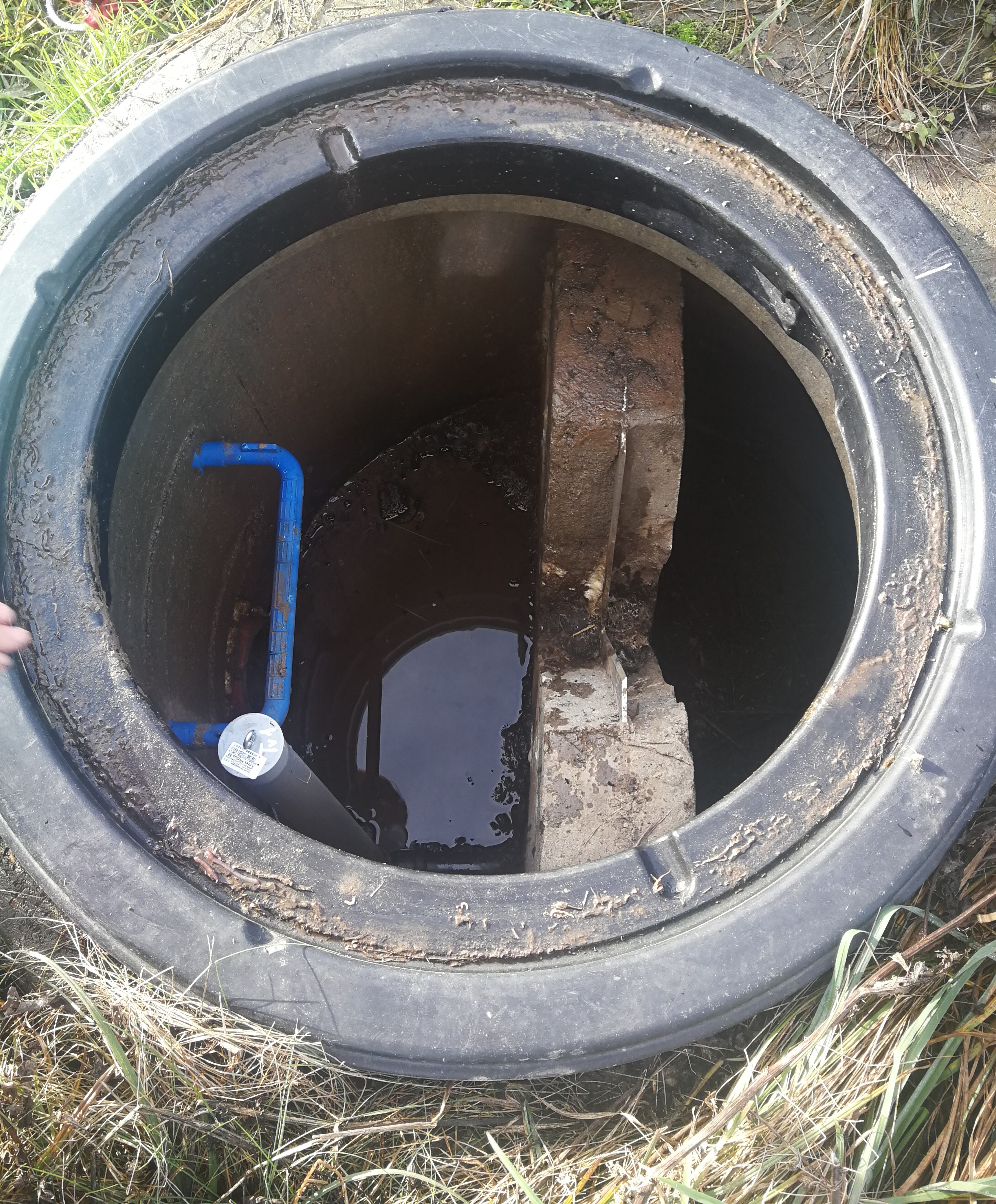
In the lower part of the river Stabė, 1.8 km from its mouth, a wetland of 2.38 ha has been installed. The wetland was constructed by artificially flooding the valley. Corrugated metal plating was used at the inlet and outlet of the wetland to protect the stream banks. While most Lithuanian wetlands are peaty, this one is not. Over time, the surface layer of the wetland has been altered by the hydrophytic wetland-specific plants, their species composition, and the degree of decomposition of these plants. Sediments washed down from the fields accumulate here. The organic matter in these sediments creates the typical habitats of saturated organic soils, which are effective in terms of nitrogen - and especially phosphorus - retention.
The wetland has four main sections. The deepest part covers 0.21 ha and is up to 2.0 m deep. Sediments are deposited here. When there is a decrease in flow, these sediments can then be removed mechanically and transported to fertilize the adjacent fields. The next section covers 0.94 ha and its depth is less than 0.5 m. It is covered with wetland vegetation. The third section works as a filter and the water is aerated. It is protected by a dyke, 6 metres in length, perpendicular to the direction of flow. The dyke is formed from soil and pitched with stone and gravel. The maximum depth of the water in this section is 0.1 metres. The fourth and final section is where the surface water is treated by macropytic vegetation. It covers 1.2 ha and is from 0.2 to 0.5 m deep. Barriers help prolong the period that the water is held.
The wetland was designed to retain nutrients in the spring and reduce their concentrations downstream. Through an ongoing research programme, the impact of the wetland has been monitored from the start. In the first year, vegetation had not become established so there were no impacts. However in 2020 and 2021 there were very positive results in terms of nutrient capture.
2.3 Photos of the Technology
Media Gallery
2.5 Country/ region/ locations where the Technology has been applied and which are covered by this assessment
Country:
Lithuania
Region/ State/ Province:
Kėdainiai district
Further specification of location:
Terespolis village
Specify the spread of the Technology:
- applied at specific points/ concentrated on a small area
Is/are the technology site(s) located in a permanently protected area?
No
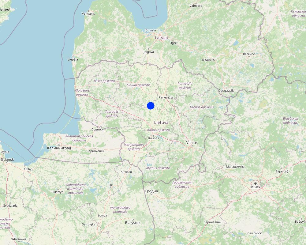
Map
×2.6 Date of implementation
Indicate year of implementation:
2015
If precise year is not known, indicate approximate date:
- less than 10 years ago (recently)
2.7 Introduction of the Technology
Specify how the Technology was introduced:
- through projects/ external interventions
Comments (type of project, etc.):
EEE Grants. Project implemented by the Environmental Protection Agency at the Ministry of Environment
3. Classification of the SLM Technology
3.1 Main purpose(s) of the Technology
- reduce, prevent, restore land degradation
- conserve ecosystem
- preserve/ improve biodiversity
- adapt to climate change/ extremes and its impacts
- create beneficial economic impact
3.2 Current land use type(s) where the Technology is applied
Land use mixed within the same land unit:
No

Waterways, waterbodies, wetlands
- Swamps, wetlands

Other
Specify:
Land not used for agricultural purposes for a long time
Comments:
land use has changed to agriculture because the wetland has helped to drain the farmland area
3.3 Has land use changed due to the implementation of the Technology?
Has land use changed due to the implementation of the Technology?
- Yes (Please fill out the questions below with regard to the land use before implementation of the Technology)
Land use mixed within the same land unit:
No

Unproductive land
Comments:
Note: the wetland has enabled the surrounding area to become farmland through drainage and fertilization with excavated silt.
3.4 Water supply
Water supply for the land on which the Technology is applied:
- mixed rainfed-irrigated
3.5 SLM group to which the Technology belongs
- wetland protection/ management
- New wetlands establishment
3.6 SLM measures comprising the Technology

structural measures
- S3: Graded ditches, channels, waterways
- S5: Dams, pans, ponds
3.7 Main types of land degradation addressed by the Technology

biological degradation
- Bh: loss of habitats

water degradation
- Hs: change in quantity of surface water
3.8 Prevention, reduction, or restoration of land degradation
Specify the goal of the Technology with regard to land degradation:
- adapt to land degradation
Comments:
Land owner started using the field for agriculture after the establishment of this wetland.
4. Technical specifications, implementation activities, inputs, and costs
4.1 Technical drawing of the Technology
Technical specifications (related to technical drawing):
The wetland is designed from four main parts. The deep part is where sediments are deposited in the event of a sudden decrease in water flow rates. These sediments can then be removed mechanically and transported to appropriate locations.
The shallow part with barriers increases the residence time of surface water in the wetland. In this part, only the artificially induced water level and the loaded strips of field stones that direct the flow of water is loaded, thus increasing the residence time of the surface water.
Completely shallow part up to a depth of 0.1 m. It is a 6.0 m wide underwater embankment with an anti-erosion coating and fieldstone layer, through which the water is aerated and cleared.
The fourth shallow part is where the surface water is treated by macrophyte vegetation.
More technical pictures and detailed description of the technology can be found in the report "Šlapynės įrengimas Terespolio k., Kėdainių rajone (Implementation of wetland in Terespolis village, Kedainiai district) " on https://old.gamta.lt/files/%C5%A1lapyn%C4%97s%20projektas1550671582565.pdf
Author:
E. Nacevičiaus firma "Edmeta" and UAB "Aplinkos inžinierių grupė"
Date:
2015
4.2 General information regarding the calculation of inputs and costs
Specify how costs and inputs were calculated:
- per Technology unit
Specify unit:
wetland
Specify dimensions of unit (if relevant):
2.38 ha
other/ national currency (specify):
EURO
4.3 Establishment activities
| Activity | Timing (season) | |
|---|---|---|
| 1. | Preparation of the river part | autumn |
| 2. | Bank establishment | autumn |
| 3. | Construction of the deep part | autumn |
| 4. | Construction of the shallow parts | autumn |
| 5. | Lower barrier works | autumn |
4.4 Costs and inputs needed for establishment
| Specify input | Unit | Quantity | Costs per Unit | Total costs per input | % of costs borne by land users | |
|---|---|---|---|---|---|---|
| Labour | Preparation of the river part | total costs | 1.0 | 2038.0 | 2038.0 | |
| Labour | Bank establishment | total costs | 1.0 | 2340.0 | 2340.0 | |
| Labour | Construction of the deep part | total costs | 1.0 | 2776.0 | 2776.0 | |
| Labour | Construction of the shallow parts | total costs | 1.0 | 9135.0 | 9135.0 | |
| Equipment | Lower barrier works | total costs | 1.0 | 1053.0 | 1053.0 | |
| Equipment | Preparation of the river part | total costs | 1.0 | 2300.0 | 2300.0 | |
| Equipment | Bank establishment | total costs | 1.0 | 3228.0 | 3228.0 | |
| Equipment | Construction of the deep part | total costs | 1.0 | 11833.0 | 11833.0 | |
| Equipment | Construction of the shallow parts | total costs | 1.0 | 3750.0 | 3750.0 | |
| Plant material | Lower barrier works | total costs | 1.0 | 3655.0 | 3655.0 | |
| Construction material | Preparation of the river part | total costs | 1.0 | 258.0 | 258.0 | |
| Construction material | Bank establishment | total costs | 1.0 | 7336.0 | 7336.0 | |
| Construction material | Construction of the deep part | total costs | 1.0 | 44.0 | 44.0 | |
| Construction material | Construction of the shallow parts | total costs | 1.0 | 34363.0 | 34363.0 | |
| Other | Lower barrier works | total costs | 1.0 | 5482.0 | 5482.0 | |
| Total costs for establishment of the Technology | 89591.0 | |||||
| Total costs for establishment of the Technology in USD | 89591.0 | |||||
If land user bore less than 100% of costs, indicate who covered the remaining costs:
Total cost covered by the project.
Comments:
The price is calculated for the whole wetland (89591.00 EUR). The establishment costs indicate the actual expenses that occurred in 2015.
Project preparation 9,09 %, Labour 43,36 %, Construction materials 31,25 %, Equipment 16,30 %.
4.5 Maintenance/ recurrent activities
| Activity | Timing/ frequency | |
|---|---|---|
| 1. | Vegetation observations and removal of excess vegetation | once a year |
| 2. | Measurements of sediments and their removal | once a year |
| 3. | N and P measurements and removal of priming | depending on the measurements after fertilization |
| 4. | Animal regulation and removal of damage | depending on the needs and season |
| 5. | Other activities (after floods, vandalism) | after events |
Comments:
The maintenance activities depend and differ on the year. Not every year there is a need to remove sediments or excessed plants. Sometimes were is a need of reintegration or replacement of plant material, especially after winter.
4.6 Costs and inputs needed for maintenance/ recurrent activities (per year)
If you are unable to break down the costs in the table above, give an estimation of the total costs of maintaining the Technology:
5000.0
If land user bore less than 100% of costs, indicate who covered the remaining costs:
Since the wetland was established form the project funds, the project team UAB "Aplinkos inžinierių grupė" is responsible for the maintenance of the wetland until the end of the project. After the end of the contract - the successor or authorized person of its results, local farmers or members of rural communities will be responsible for the maintenance of wetland.
Comments:
The estimated costs are based on the report "Pasklidosios vandens taršos mažinimo priemonių įrengimo pilotiniame baseine darbai [Establisment of measures to reduce diffuse water pollution in the pilot basin]" presented in 2016.
4.7 Most important factors affecting the costs
Describe the most determinate factors affecting the costs:
Inflation is one of the most affecting factors. The real costs of the last years are not publicly available.
5. Natural and human environment
5.1 Climate
Annual rainfall
- < 250 mm
- 251-500 mm
- 501-750 mm
- 751-1,000 mm
- 1,001-1,500 mm
- 1,501-2,000 mm
- 2,001-3,000 mm
- 3,001-4,000 mm
- > 4,000 mm
Agro-climatic zone
- sub-humid
5.2 Topography
Slopes on average:
- flat (0-2%)
- gentle (3-5%)
- moderate (6-10%)
- rolling (11-15%)
- hilly (16-30%)
- steep (31-60%)
- very steep (>60%)
Landforms:
- plateau/plains
- ridges
- mountain slopes
- hill slopes
- footslopes
- valley floors
Altitudinal zone:
- 0-100 m a.s.l.
- 101-500 m a.s.l.
- 501-1,000 m a.s.l.
- 1,001-1,500 m a.s.l.
- 1,501-2,000 m a.s.l.
- 2,001-2,500 m a.s.l.
- 2,501-3,000 m a.s.l.
- 3,001-4,000 m a.s.l.
- > 4,000 m a.s.l.
Indicate if the Technology is specifically applied in:
- not relevant
5.3 Soils
Soil depth on average:
- very shallow (0-20 cm)
- shallow (21-50 cm)
- moderately deep (51-80 cm)
- deep (81-120 cm)
- very deep (> 120 cm)
Soil texture (topsoil):
- medium (loamy, silty)
Soil texture (> 20 cm below surface):
- medium (loamy, silty)
If available, attach full soil description or specify the available information, e.g. soil type, soil PH/ acidity, Cation Exchange Capacity, nitrogen, salinity etc.
Sandy loam with high organic carbon
5.4 Water availability and quality
Availability of surface water:
good
Water quality (untreated):
for agricultural use only (irrigation)
Water quality refers to:
both ground and surface water
Is water salinity a problem?
No
Is flooding of the area occurring?
No
5.5 Biodiversity
Species diversity:
- medium
Habitat diversity:
- medium
5.6 Characteristics of land users applying the Technology
Sedentary or nomadic:
- Sedentary
Market orientation of production system:
- mixed (subsistence/ commercial)
Off-farm income:
- 10-50% of all income
Relative level of wealth:
- average
Individuals or groups:
- individual/ household
Level of mechanization:
- mechanized/ motorized
Gender:
- men
Age of land users:
- middle-aged
5.7 Average area of land used by land users applying the Technology
- < 0.5 ha
- 0.5-1 ha
- 1-2 ha
- 2-5 ha
- 5-15 ha
- 15-50 ha
- 50-100 ha
- 100-500 ha
- 500-1,000 ha
- 1,000-10,000 ha
- > 10,000 ha
Is this considered small-, medium- or large-scale (referring to local context)?
- medium-scale
5.8 Land ownership, land use rights, and water use rights
Land ownership:
- individual, titled
Land use rights:
- individual
Water use rights:
- open access (unorganized)
Are land use rights based on a traditional legal system?
Yes
5.9 Access to services and infrastructure
health:
- poor
- moderate
- good
education:
- poor
- moderate
- good
technical assistance:
- poor
- moderate
- good
employment (e.g. off-farm):
- poor
- moderate
- good
markets:
- poor
- moderate
- good
energy:
- poor
- moderate
- good
roads and transport:
- poor
- moderate
- good
drinking water and sanitation:
- poor
- moderate
- good
financial services:
- poor
- moderate
- good
- poor
- moderate
- good
6. Impacts and concluding statements
6.1 On-site impacts the Technology has shown
Socio-economic impacts
Production
crop production
Comments/ specify:
Production increased by drainage and return of sediment to the cropland.
Water availability and quality
irrigation water quality
Ecological impacts
Biodiversity: vegetation, animals
plant diversity
habitat diversity
6.2 Off-site impacts the Technology has shown
water availability
reliable and stable stream flows in dry season
Specify assessment of off-site impacts (measurements):
These are observed impacts by the land owner
6.3 Exposure and sensitivity of the Technology to gradual climate change and climate-related extremes/ disasters (as perceived by land users)
Gradual climate change
Gradual climate change
| Season | increase or decrease | How does the Technology cope with it? | |
|---|---|---|---|
| annual temperature | increase | well | |
| seasonal temperature | summer | increase | well |
| annual rainfall | increase | well |
Climate-related extremes (disasters)
Meteorological disasters
| How does the Technology cope with it? | |
|---|---|
| local rainstorm | well |
| local thunderstorm | well |
6.4 Cost-benefit analysis
How do the benefits compare with the establishment costs (from land users’ perspective)?
Short-term returns:
positive
Long-term returns:
positive
How do the benefits compare with the maintenance/ recurrent costs (from land users' perspective)?
Short-term returns:
very positive
Long-term returns:
very positive
Comments:
Land user has no maintenance costs and had no establishment costs.
6.5 Adoption of the Technology
- single cases/ experimental
If available, quantify (no. of households and/ or area covered):
1
Of all those who have adopted the Technology, how many did so spontaneously, i.e. without receiving any material incentives/ payments?
- 0-10%
Comments:
No adoption
6.6 Adaptation
Has the Technology been modified recently to adapt to changing conditions?
No
6.7 Strengths/ advantages/ opportunities of the Technology
| Strengths/ advantages/ opportunities in the land user’s view |
|---|
| More even seasonality, land more suitable for agriculture. |
| Strengths/ advantages/ opportunities in the compiler’s or other key resource person’s view |
|---|
| Biodiversity supported/ sediment capture/ nature-based sustainable solution. |
6.8 Weaknesses/ disadvantages/ risks of the Technology and ways of overcoming them
| Weaknesses/ disadvantages/ risks in the land user’s view | How can they be overcome? |
|---|---|
| More nutrients come out of the exit point of the wetland than enter in the entry point. | Accurate details of impact still under assessment |
7. References and links
7.1 Methods/ sources of information
- interviews with land users
Land user and maintenance authority (UAB „Aplinkos inžinierių grupė“).
- compilation from reports and other existing documentation
Project material: application, costs tables, monitoring material.
When were the data compiled (in the field)?
2022
7.2 References to available publications
Title, author, year, ISBN:
Report about installation of the technology - UAB "Aplinkos inžinierių grupė", 2015. Šlapynės įrengimas Terespolio k., Kėdainių rajone [Installation of wetland in Terespolis village, Kedainiai district], Kaunas
Available from where? Costs?
https://old.gamta.lt/files/%C5%A1lapyn%C4%97s%20projektas1550671582565.pdf
Title, author, year, ISBN:
Report about implementation of the technology - UAB "Aplinkos inžinierių grupė", 2016. Pasklidosios vandens taršos mažinimo priemonių įrengimo pilotiniame baseine darbai [The installation of diffuse water pollution abatement measures in pilot river basins], Kaunas
Available from where? Costs?
https://old.gamta.lt/files/Galutine%20ataskaita%20pakoreguota.pdf
7.3 Links to relevant online information
Title/ description:
Report about installation of the sedimentation points close to wetland
URL:
https://old.gamta.lt/files/sedimentacijos%20tvenkin%C4%97li%C5%B3%20projektas1550671609855.pdf
Title/ description:
Report of wetland monitoring in 2021
URL:
https://aaa.lrv.lt/uploads/aaa/documents/files/II%20kasmetin%C4%97%20ataskaita.pdf
Title/ description:
Report of wetland monitoring in 2022
URL:
https://aaa.lrv.lt/uploads/aaa/documents/files/III%20kasmetine%20%2Bgalutine%20ataskaita(2).pdf
7.4 General comments
The questionnaire is well designed, clear and concise with nice explanations and examples that makes it easy to understand what needs to written. However it was difficult to find some material to give a detail answers, especially with the maintenance costs.
Links and modules
Expand all Collapse allLinks
No links
Modules
No modules