Wetland in the Stabė River [ប្រទេសលីទុយអានី]
- ការបង្កើត៖
- បច្ចុប្បន្នភាព
- អ្នកចងក្រង៖ Jovita Mėžinė
- អ្នកកែសម្រួល៖ Egle Baltranaite
- អ្នកត្រួតពិនិត្យច្រើនទៀត៖ William Critchley, Rima Mekdaschi Studer, Joana Eichenberger
Šlapynė at Stabės Terespolis
technologies_5996 - ប្រទេសលីទុយអានី
ពិនិត្យមើលគ្រប់ផ្នែក
ពង្រីកមើលទាំងអស់ បង្រួមទាំងអស់1. ព័ត៌មានទូទៅ
1.2 ព័ត៌មានលម្អិតពីបុគ្គលសំខាន់ៗ និងស្ថាប័នដែលចូលរួមក្នុងការវាយតម្លៃ និងចងក្រងឯកសារនៃបច្ចេកទេស
co-compiler:
ឈ្មោះគម្រោងដែលបានចងក្រងឯកសារ/ វាយតម្លៃលើបច្ចេកទេស (បើទាក់ទង)
OPtimal strategies to retAIN and re-use water and nutrients in small agricultural catchments across different soil-climatic regions in Europe (OPTAIN)ឈ្មោះអង្គភាពមួយ (ច្រើន) ដែលបានចងក្រងឯកសារ/ វាយតម្លៃបច្ចេកទេស (បើទាក់ទង)
Klaipeda University (KU) - ប្រទេសលីទុយអានី1.3 លក្ខខណ្ឌទាក់ទងទៅនឹងការប្រើប្រាស់ទិន្នន័យដែលបានចងក្រងតាមរយៈ វ៉ូខេត
អ្នកចងក្រង និង(បុគ្គលសំខាន់ៗ)យល់ព្រមទទួលយកនូវលក្ខខណ្ឌនានាទាក់ទងទៅនឹងការប្រើប្រាស់ទិន្នន័យដែលបានចងក្រងតាមរយៈវ៉ូខេត:
បាទ/ចា៎
1.4 សេចក្តីប្រកាសស្តីពីចីរភាពនៃការពណ៌នាពីបច្ចេកទេស
តើបច្ចេកទេសដែលបានពណ៌នានេះមានបញ្ហាដែលផ្តោតលើការធ្លាក់ចុះគុណភាពដី, បើដូច្នេះវាមិនអាចត្រូវបានប្រកាសថាជាបច្ចេកទេសនៃការគ្រប់គ្រងប្រកបដោយចីរភាពទេ?
ទេ
2. ការពណ៌នាពីបច្ចេកទេស SLM
2.1 ការពណ៌នាដោយសង្ខេបពីបច្ចេកទេស
និយមន័យបច្ចេកទេស:
The installation of this wetland contributes to reducing the ecological debt to nature by restoring natural complexes, reaching a balance between environmental and economic interests, and promoting sustainable farming conditions in one of the most important and valuable natural areas of central Lithuania.
2.2 ការពណ៌នាលម្អិតពីបច្ចេកទេស
ការពណ៌នា:
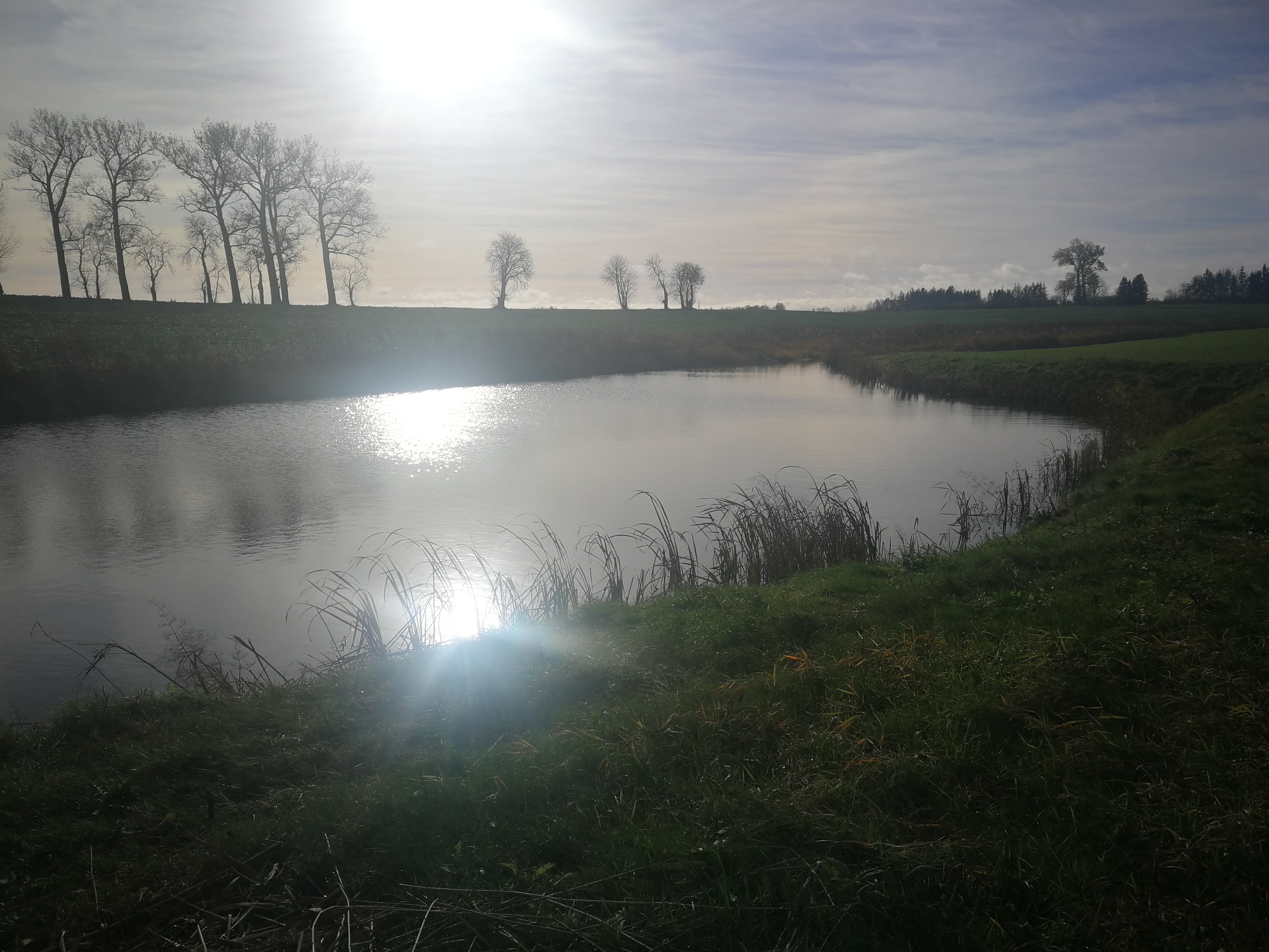
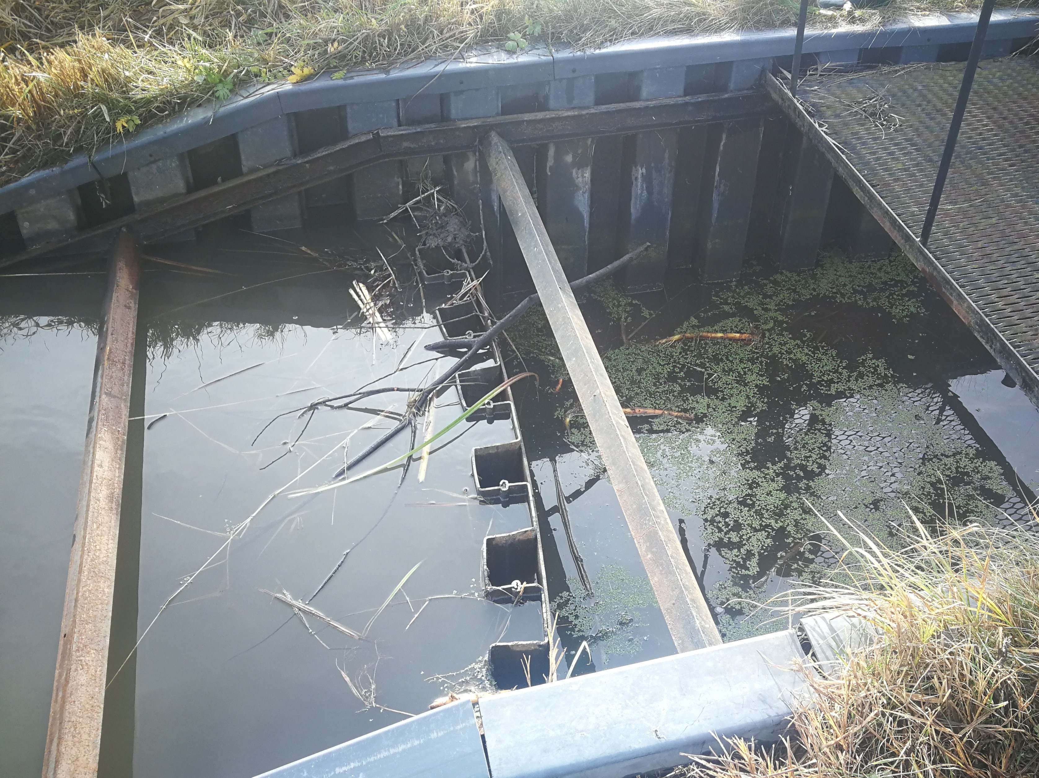
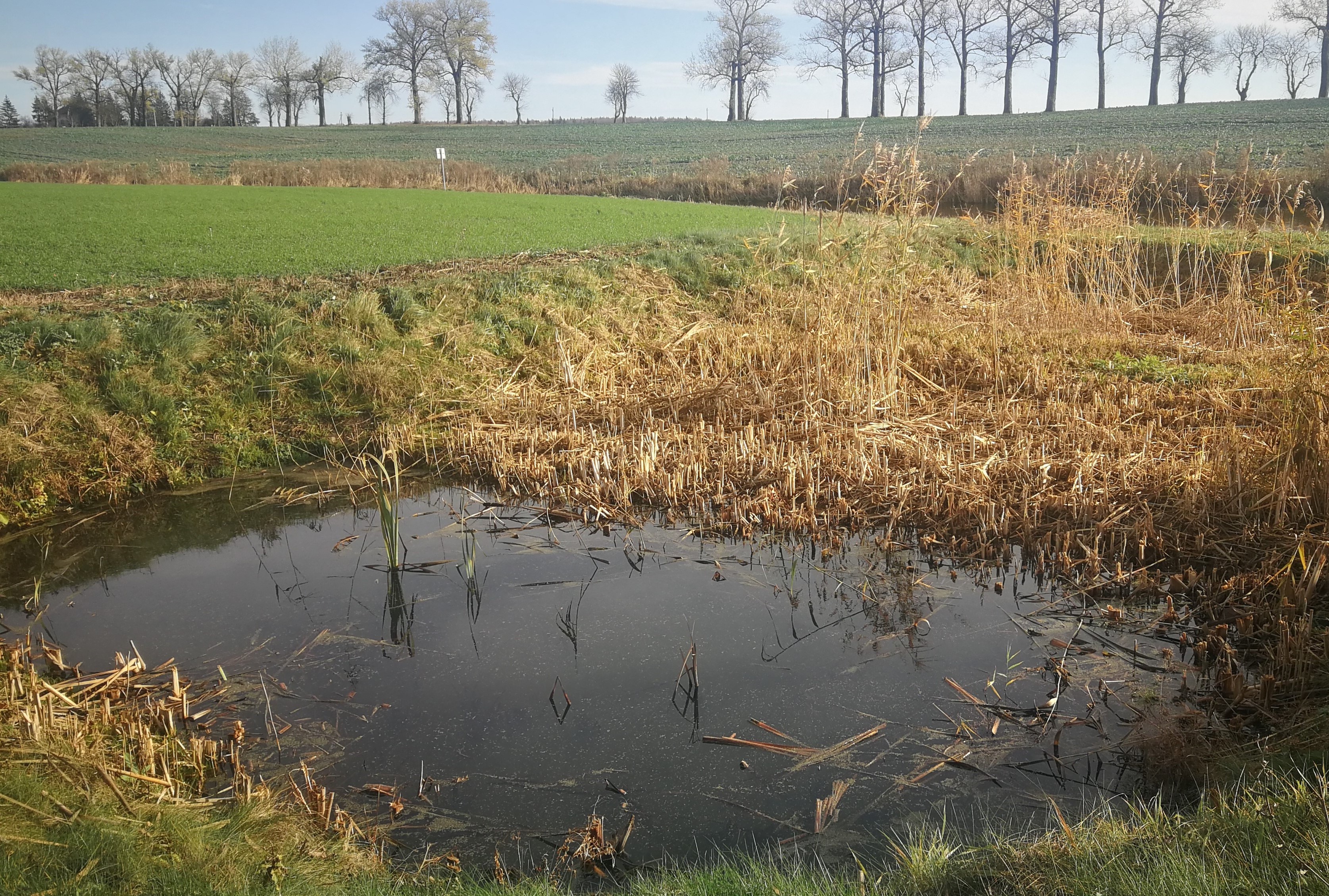
In the lower part of the river Stabė, 1.8 km from its mouth, a wetland of 2.38 ha has been installed. The wetland was constructed by artificially flooding the valley. Corrugated metal plating was used at the inlet and outlet of the wetland to protect the stream banks. While most Lithuanian wetlands are peaty, this one is not. Over time, the surface layer of the wetland has been altered by the hydrophytic wetland-specific plants, their species composition, and the degree of decomposition of these plants. Sediments washed down from the fields accumulate here. The organic matter in these sediments creates the typical habitats of saturated organic soils, which are effective in terms of nitrogen - and especially phosphorus - retention.
The wetland has four main sections. The deepest part covers 0.21 ha and is up to 2.0 m deep. Sediments are deposited here. When there is a decrease in flow, these sediments can then be removed mechanically and transported to fertilize the adjacent fields. The next section covers 0.94 ha and its depth is less than 0.5 m. It is covered with wetland vegetation. The third section works as a filter and the water is aerated. It is protected by a dyke, 6 metres in length, perpendicular to the direction of flow. The dyke is formed from soil and pitched with stone and gravel. The maximum depth of the water in this section is 0.1 metres. The fourth and final section is where the surface water is treated by macropytic vegetation. It covers 1.2 ha and is from 0.2 to 0.5 m deep. Barriers help prolong the period that the water is held.
The wetland was designed to retain nutrients in the spring and reduce their concentrations downstream. Through an ongoing research programme, the impact of the wetland has been monitored from the start. In the first year, vegetation had not become established so there were no impacts. However in 2020 and 2021 there were very positive results in terms of nutrient capture.
2.3 រូបភាពនៃបច្ចេកទេស
វិចិត្រសាលប្រព័ន្ធផ្សព្វផ្សាយ
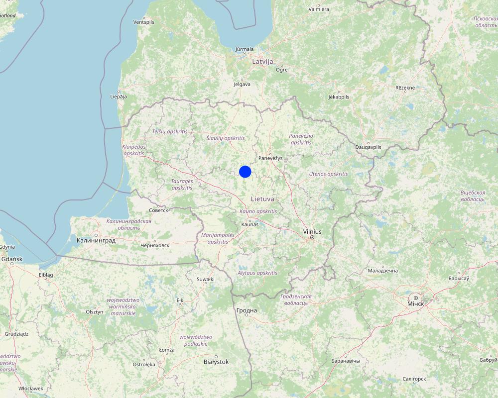
2.5 ប្រទេស/តំបន់/ទីតាំងកន្លែង ដែលបច្ចេកទេសត្រូវបានអនុវត្ត និងបានគ្រប់ដណ្តប់ដោយការវាយតម្លៃនេះ
ប្រទេស:
ប្រទេសលីទុយអានី
តំបន់/រដ្ឋ/ខេត្ត:
Kėdainiai district
បញ្ជាក់បន្ថែមពីលក្ខណៈនៃទីតាំង:
Terespolis village
បញ្ជាក់ពីការសាយភាយនៃបច្ចេកទេស:
- អនុវត្តនៅកន្លែងជាក់លាក់មួយ/ ប្រមូលផ្តុំនៅតំបន់តូចៗ
តើបច្ចេកទេស (មួយ ឬច្រើន) ទាំងនោះស្ថិតនៅក្នុងតំបន់ការពារជាអចិន្ត្រៃយ៍ណាមួយដែរឬទេ?
ទេ
Map
×2.6 កាលបរិច្ឆេទនៃការអនុវត្ត
បង្ហាញឆ្នាំនៃការចុះអនុវត្ត:
2015
ប្រសិនបើមិនច្បាស់ឆ្នាំ សូមបញ្ជាក់កាលបរិច្ឆេទដែលប្រហាក់ប្រហែល:
- តិចជាង 10ឆ្នាំមុន (ថ្មី)
2.7 ការណែនាំពីបច្ចេកទេស
សូមបញ្ជាក់តើបច្ចេកទេសត្រូវបានណែនាំឱ្យអនុវត្តដោយរបៀបណា:
- តាមរយៈគម្រោង / អន្តរាគមន៍ពីខាងក្រៅ
មតិយោបល់ (ប្រភេទនៃគម្រោង ។ល។):
EEE Grants. Project implemented by the Environmental Protection Agency at the Ministry of Environment
3. ចំណាត់ថ្នាក់នៃបច្ចេកទេស SLM
3.1 គោលបំណងចម្បង (១ ឬច្រើន) នៃបច្ចេកទេសនេះ
- កាត់បន្ថយ, បង្ការ, ស្តារឡើងវិញនូវការធ្លាក់ចុះគុណភាពដី
- អភិរក្សប្រព័ន្ធអេកូឡូស៊ី
- អភិរក្ស/ធ្វើឱ្យប្រសើរឡើងជីវចម្រុះ
- បន្ស៊ាំទៅនឹងការប្រែប្រួលអាកាសធាតុ/គ្រោះមហន្តរាយ និងផលប៉ះពាល់របស់វា
- បង្កើតផលប្រយោជន៍សេដ្ឋកិច្ច
3.2 ប្រភេទដីប្រើប្រាស់មួយប្រភេទ (ច្រើនប្រភេទ) ដែលបានអនុវត្តបច្ចេកទេស
ដីប្រើប្រាស់ចម្រុះនៅលើដីតែមួយ:
ទេ

ផ្លូវទឹក ផ្ទៃទឹក ដីសើម
- វាលភក់ ដីសើម

ផ្សេងៗ
សូមបញ្ជាក់:
Land not used for agricultural purposes for a long time
មតិយោបល់:
land use has changed to agriculture because the wetland has helped to drain the farmland area
3.3 បន្ទាប់ពីអនុវត្តបច្ចេកទេស តើដីប្រើប្រាស់មានការប្រែប្រួលដែររឺទេ?
បន្ទាប់ពីអនុវត្តបច្ចេកទេស តើដីប្រើប្រាស់មានការប្រែប្រួលដែររឺទេ?
- បាទ/ច៎ា (សូមបំពេញសំណួរខាងក្រោមពីស្ថានភាពដីប្រើប្រាស់មុនពេលអនុវត្តបច្ចេកទេស)
ដីប្រើប្រាស់ចម្រុះនៅលើដីតែមួយ:
ទេ

ដីខ្សោះជីជាតិ
មតិយោបល់:
Note: the wetland has enabled the surrounding area to become farmland through drainage and fertilization with excavated silt.
3.4 ការផ្គត់ផ្គង់ទឹក
ការផ្គត់ផ្គង់ទឹកនៅកន្លែងអនុវត្តបច្ចេកទេស:
- ទឹកភ្លៀង និងប្រព័ន្ធស្រោចស្រព
3.5 ក្រុម SLM ដែលបច្ចេកទេសស្ថិតនៅក្នុង
- ការគ្រប់គ្រង/ ការការពារតំបន់ដីសើម
- New wetlands establishment
3.6 វិធានការ SLM ដែលបញ្ចូលនូវបច្ចេកទេស

វិធានការរចនាស័ម្ពន្ធ
- S3: កម្ពស់ភ្លឺ ប្រឡាយ ផ្លូវទឹក
- S5: ទំនប់ ថ្លុក ស្រះ
3.7 កំណត់ប្រភេទនៃការធ្លាក់ចុះគុណភាពដីសំខាន់ៗដែលបច្ចេកទេសនេះបានដោះស្រាយ

ការធ្លាក់ចុះជីវសាស្ត្រនៃដី
- Bh: ការបាត់បង់ទីជំរក

ការបាត់បង់ទឹក
- Hs: ការប្រែប្រួលបរិមាណទឹកនៅលើផ្ទៃដី
3.8 ការពារ កាត់បន្ថយ ឬស្តារឡើងវិញនៃការធ្លាក់ចុះគុណភាពដី
បញ្ជាក់ពីគោលដៅរបស់បច្ចេកទេស ដែលផ្តោតទៅការធ្លាក់ចុះគុណភាពដី:
- ការបន្ស៊ាំទៅនឹងការធ្លាក់ចុះគុណភាពដី
មតិយោបល់:
Land owner started using the field for agriculture after the establishment of this wetland.
4. បច្ចេកទេសជាក់លាក់ សកម្មភាពអនុវត្ត ធាតុចូល និងថ្លៃដើម
4.1 គំនូសបច្ចេកទេសនៃបច្ចេកទេសនេះ
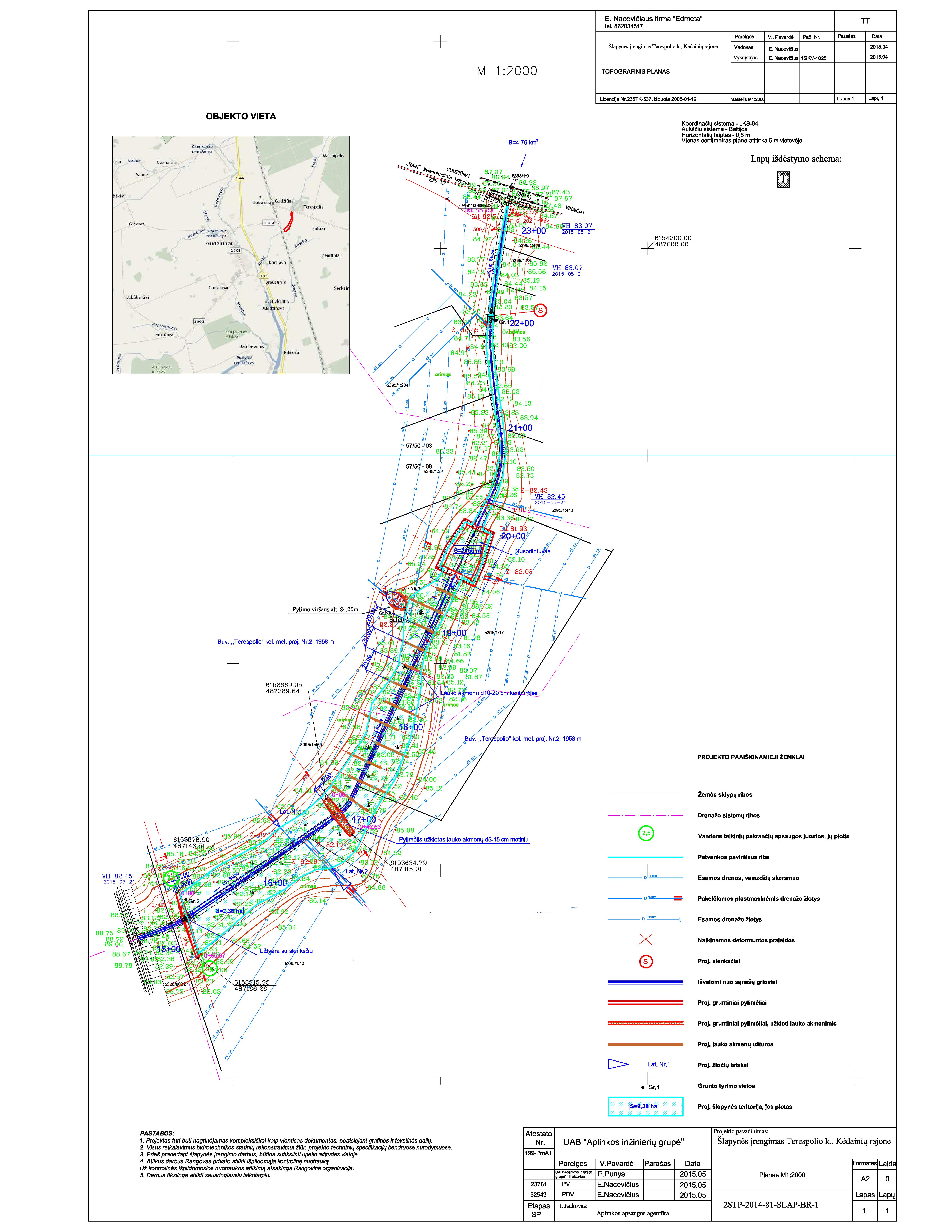
លក្ខណៈពិសេសនៃបច្ចេកទេស (ទាក់ទងនឺងគំនូរបច្ចេកទេស):
The wetland is designed from four main parts. The deep part is where sediments are deposited in the event of a sudden decrease in water flow rates. These sediments can then be removed mechanically and transported to appropriate locations.
The shallow part with barriers increases the residence time of surface water in the wetland. In this part, only the artificially induced water level and the loaded strips of field stones that direct the flow of water is loaded, thus increasing the residence time of the surface water.
Completely shallow part up to a depth of 0.1 m. It is a 6.0 m wide underwater embankment with an anti-erosion coating and fieldstone layer, through which the water is aerated and cleared.
The fourth shallow part is where the surface water is treated by macrophyte vegetation.
More technical pictures and detailed description of the technology can be found in the report "Šlapynės įrengimas Terespolio k., Kėdainių rajone (Implementation of wetland in Terespolis village, Kedainiai district) " on https://old.gamta.lt/files/%C5%A1lapyn%C4%97s%20projektas1550671582565.pdf
ឈ្មោះអ្នកនិពន្ធ:
E. Nacevičiaus firma "Edmeta" and UAB "Aplinkos inžinierių grupė"
កាលបរិច្ឆេទ:
2015
4.2 ព័ត៌មានទូទៅដែលពាក់ព័ន្ធនឹងការគណនាធាតុចូល និងថ្លៃដើម
កំណត់របៀបនៃការគណនាថ្លៃដើម និងធាតុចូល:
- ក្នុងឯកតាបច្ចេកទេស
បញ្ជាក់ឯកតា:
wetland
បញ្ជាក់ពីទំហំនៃឯកតា (បើពាក់ព័ន្ធ):
2.38 ha
ផ្សេងៗ/ រូបិយប័ណ្ណជាតិ (បញ្ជាក់):
EURO
4.3 សកម្មភាពបង្កើត
| សកម្មភាព | រយៈពេល (រដូវកាល) | |
|---|---|---|
| 1. | Preparation of the river part | autumn |
| 2. | Bank establishment | autumn |
| 3. | Construction of the deep part | autumn |
| 4. | Construction of the shallow parts | autumn |
| 5. | Lower barrier works | autumn |
4.4 ថ្លៃដើម និងធាតុចូលដែលត្រូវការសម្រាប់ការបង្កើតបច្ចេកទេស
| បញ្ជាក់ពីធាតុចូល | ឯកតា | បរិមាណ | ថ្លៃដើមក្នុងមួយឯកតា | ថ្លៃធាតុចូលសរុប | % នៃថ្លៃដើមដែលចំណាយដោយអ្នកប្រើប្រាស់ដី | |
|---|---|---|---|---|---|---|
| កម្លាំងពលកម្ម | Preparation of the river part | total costs | 1,0 | 2038,0 | 2038,0 | |
| កម្លាំងពលកម្ម | Bank establishment | total costs | 1,0 | 2340,0 | 2340,0 | |
| កម្លាំងពលកម្ម | Construction of the deep part | total costs | 1,0 | 2776,0 | 2776,0 | |
| កម្លាំងពលកម្ម | Construction of the shallow parts | total costs | 1,0 | 9135,0 | 9135,0 | |
| សម្ភារៈ | Lower barrier works | total costs | 1,0 | 1053,0 | 1053,0 | |
| សម្ភារៈ | Preparation of the river part | total costs | 1,0 | 2300,0 | 2300,0 | |
| សម្ភារៈ | Bank establishment | total costs | 1,0 | 3228,0 | 3228,0 | |
| សម្ភារៈ | Construction of the deep part | total costs | 1,0 | 11833,0 | 11833,0 | |
| សម្ភារៈ | Construction of the shallow parts | total costs | 1,0 | 3750,0 | 3750,0 | |
| សម្ភារៈដាំដុះ | Lower barrier works | total costs | 1,0 | 3655,0 | 3655,0 | |
| សម្ភារៈសាងសង់ | Preparation of the river part | total costs | 1,0 | 258,0 | 258,0 | |
| សម្ភារៈសាងសង់ | Bank establishment | total costs | 1,0 | 7336,0 | 7336,0 | |
| សម្ភារៈសាងសង់ | Construction of the deep part | total costs | 1,0 | 44,0 | 44,0 | |
| សម្ភារៈសាងសង់ | Construction of the shallow parts | total costs | 1,0 | 34363,0 | 34363,0 | |
| ផ្សេងៗ | Lower barrier works | total costs | 1,0 | 5482,0 | 5482,0 | |
| ថ្លៃដើមសរុបក្នុងការបង្កើតបច្ចេកទេស | 89591,0 | |||||
| ថ្លៃដើមសរុបក្នុងការបង្កើតបច្ចេកទេសគិតជាដុល្លារ | 89591,0 | |||||
ប្រសិនបើអ្នកប្រើប្រាស់ដីមិនមានថ្លៃដើម 100% សូមបញ្ជាក់ថានរណាដែលចំណាយថ្លៃដើមដែលនៅសល់:
Total cost covered by the project.
មតិយោបល់:
The price is calculated for the whole wetland (89591.00 EUR). The establishment costs indicate the actual expenses that occurred in 2015.
Project preparation 9,09 %, Labour 43,36 %, Construction materials 31,25 %, Equipment 16,30 %.
4.5 សកម្មភាពថែទាំ
| សកម្មភាព | ពេលវេលា/ ភាពញឹកញាប់ | |
|---|---|---|
| 1. | Vegetation observations and removal of excess vegetation | once a year |
| 2. | Measurements of sediments and their removal | once a year |
| 3. | N and P measurements and removal of priming | depending on the measurements after fertilization |
| 4. | Animal regulation and removal of damage | depending on the needs and season |
| 5. | Other activities (after floods, vandalism) | after events |
មតិយោបល់:
The maintenance activities depend and differ on the year. Not every year there is a need to remove sediments or excessed plants. Sometimes were is a need of reintegration or replacement of plant material, especially after winter.
4.6 កំណត់ថ្លៃដើមសម្រាប់ការថែទាំ/ សកម្មភាពរបស់បច្ចេកទេស (ក្នុងរយៈពេលមួយឆ្នាំ)
ប្រសិនបើមិនអាចបំបែកតម្លៃដើមក្នុងតារាងខាងក្រោមទេ សូមផ្តល់នូវតម្លៃប៉ាន់ស្មានសរុបក្នុងការថែទាំបច្ចេកទេសនោះ:
5000,0
ប្រសិនបើអ្នកប្រើប្រាស់ដីមិនមានថ្លៃដើម 100% សូមបញ្ជាក់ថានរណាដែលចំណាយថ្លៃដើមដែលនៅសល់:
Since the wetland was established form the project funds, the project team UAB "Aplinkos inžinierių grupė" is responsible for the maintenance of the wetland until the end of the project. After the end of the contract - the successor or authorized person of its results, local farmers or members of rural communities will be responsible for the maintenance of wetland.
មតិយោបល់:
The estimated costs are based on the report "Pasklidosios vandens taršos mažinimo priemonių įrengimo pilotiniame baseine darbai [Establisment of measures to reduce diffuse water pollution in the pilot basin]" presented in 2016.
4.7 កត្តាសំខាន់បំផុតដែលមានឥទ្ធិពលដល់ការចំណាយ
ពណ៌នាពីកត្តាប៉ះពាល់ចម្បងៗទៅលើថ្លៃដើម:
Inflation is one of the most affecting factors. The real costs of the last years are not publicly available.
5. លក្ខណៈបរិស្ថានធម្មជាតិ និងមនុស្ស
5.1 អាកាសធាតុ
បរិមាណទឹកភ្លៀងប្រចាំឆ្នាំ
- < 250 មម
- 251-500 មម
- 501-750 មម
- 751-1,000 មម
- 1,001-1,500 មម
- 1,501-2,000 មម
- 2,001-3,000 មម
- 3,001-4,000 មម
- > 4,000 មម
តំបន់កសិអាកាសធាតុ
- មានភ្លៀងមធ្យម
5.2 សណ្ឋានដី
ជម្រាលជាមធ្យម:
- រាបស្មើ (0-2%)
- ជម្រាលតិចតួច (3-5%)
- មធ្យម (6-10%)
- ជម្រាលខ្ពស់បន្តិច (11-15%)
- ទីទួល (16-30%)
- ទីទួលចោត (31-60%)
- ទីទួលចោតខ្លាំង (>60%)
ទម្រង់ដី:
- ខ្ពង់រាប
- កំពូលភ្នំ
- ជម្រាលភ្នំ
- ជម្រាលទួល
- ជម្រាលជើងភ្នំ
- បាតជ្រលងភ្នំ
តំបន់តាមរយៈកម្ពស់ :
- 0-100 ម
- 101-500 ម
- 501-1,000 ម
- 1,001-1,500 ម
- 1,501-2,000 ម
- 2,001-2,500 ម
- 2,501-3,000 ម
- 3,001-4,000 ម
- > 4,000 ម
បញ្ជាក់ថាតើបច្ចេកទេសនេះត្រូវបានអនុវត្តន៍នៅក្នុង:
- មិនពាក់ព័ន្ធទាំងអស់
5.3 ដី
ជម្រៅដីជាមធ្យម:
- រាក់ខ្លាំង (0-20 សម)
- រាក់ (21-50 សម)
- មធ្យម (51-80 សម)
- ជ្រៅ (81-120 សម)
- ជ្រៅខ្លាំង (> 120 សម)
វាយនភាពដី (ស្រទាប់លើ):
- មធ្យម (ល្បាយ, ល្បាប់)
វាយនភាពដី (> 20 សម ស្រទាប់ក្នុង):
- មធ្យម (ល្បាយ, ល្បាប់)
បើអាចសូមភ្ជាប់ការពណ៌នាពីដីឱ្យបានច្បាស់ ឬព័ត៌មានដែលអាចទទួលបាន ឧ. ប្រភេទដី, pH ដី/ ជាតិអាស៊ីត, សមត្ថភាពផ្លាស់ប្តូរកាចុង, វត្តមាននីត្រូសែន, ភាពប្រៃ ។ល។:
Sandy loam with high organic carbon
5.4 ទឹកដែលអាចទាញមកប្រើប្រាស់បាន និងគុណភាពទឹក
ទឹកលើដីដែលអាចទាញយកប្រើប្រាស់បាន:
ល្អ
គុណភាពទឹក (មិនបានធ្វើប្រត្តិកម្ម):
ទឹកសម្រាប់តែការធ្វើកសិកម្ម (ស្រោចស្រព)
គុណភាពទឹក គឺផ្តោតទៅលើ៖:
ទាំងទឹកក្រោមដី និងលើផ្ទៃដី
តើមានបញ្ហាភាពទឹកប្រៃហូរចូលមកដែរឬទេ?
ទេ
តើទឹកជំនន់កំពុងកើតមាននៅតំបន់នេះដែររឺទេ?
ទេ
5.5 ជីវៈចម្រុះ
ភាពសម្បូរបែបនៃប្រភេទ:
- កម្រិតមធ្យម
ភាពសម្បូរបែបនៃទីជម្រក:
- កម្រិតមធ្យម
5.6 លក្ខណៈនៃអ្នកប្រើប្រាស់ដីដែលអនុវត្តបច្ចេកទេស
នៅមួយកន្លែង ឬពនេចរ :
- នៅមួយកន្លែង
ទីផ្សារនៃប្រព័ន្ធផលិតកម្ម:
- ពាក់កណ្តាលពាណិជ្ជកម្ម (ផ្គត់ផ្គង់ខ្លួនឯង/ ពាណិជ្ជកម្ម)
ចំណូលក្រៅកសិកម្ម:
- 10-50% នៃចំណូល
កម្រិតជីវភាព:
- មធ្យម
ឯកជន ឬក្រុម:
- ធ្វើខ្លួនឯង/ គ្រួសារ
កម្រិតប្រើប្រាស់គ្រឿងយន្ត:
- គ្រឿងយន្ត/ ម៉ាស៊ីន
យេនឌ័រ:
- បុរស
អាយុរបស់អ្នកប្រើប្រាស់ដី:
- វ័យកណ្តាល
5.7 ទំហំផ្ទៃដីជាមធ្យមនៃដីប្រើប្រាស់ដោយអ្នកប្រើប្រាស់ដី ក្នុងការអនុវត្តបច្ចេកទេស
- < 0.5 ហិកតា
- 0.5-1 ហិកតា
- 1-2 ហិកតា
- 2-5 ហិកតា
- 5-15 ហិកតា
- 15-50 ហិកតា
- 50-100 ហិកតា
- 100-500 ហិកតា
- 500-1,000 ហិកតា
- 1,000-10,000 ហិកតា
- > 10,000 ហិកតា
តើផ្ទៃដីនេះចាត់ទុកជាទំហំកម្រិតណាដែរ ខ្នាតតូច មធ្យម ឬខ្នាតធំ (ធៀបនឹងបរិបទតំបន់)?
- ខ្នាតមធ្យម
5.8 ភាពជាម្ចាស់ដី កម្មសិទ្ធប្រើប្រាស់ដី និងកម្មសិទ្ធប្រើប្រាស់ទឹក
ភាពជាម្ចាស់ដី:
- ឯកជន មានកម្មសិទ្ធ
កម្មសិទ្ធិប្រើប្រាស់ដី:
- ឯកជន
កម្មសិទ្ធប្រើប្រាស់ទឹក:
- អាស្រ័យផលសេរី (មិនមានការកំណត់)
តើកម្មសិទ្ធប្រើប្រាស់ដី គឺផ្អែកលើប្រព័ន្ធច្បាប់បែបបុរាណ?
បាទ/ចា៎
5.9 ការប្រើប្រាស់សេវាកម្ម និងហេដ្ឋារចនាសម្ព័ន្ធ
សុខភាព:
- មិនល្អ
- មធ្យម
- ល្អ
ការអប់រំ:
- មិនល្អ
- មធ្យម
- ល្អ
ជំនួយបច្ចេកទេស:
- មិនល្អ
- មធ្យម
- ល្អ
ការងារ (ឧ. ការងារក្រៅកសិដ្ឋាន):
- មិនល្អ
- មធ្យម
- ល្អ
ទីផ្សារ:
- មិនល្អ
- មធ្យម
- ល្អ
ថាមពល:
- មិនល្អ
- មធ្យម
- ល្អ
ផ្លូវ និងការដឹកជញ្ជូន:
- មិនល្អ
- មធ្យម
- ល្អ
ទឹកផឹក និងអនាម័យ:
- មិនល្អ
- មធ្យម
- ល្អ
សេវាកម្មហិរញ្ញវត្ថុ:
- មិនល្អ
- មធ្យម
- ល្អ
- មិនល្អ
- មធ្យម
- ល្អ
6. ផលប៉ះពាល់ និងការសន្និដ្ឋាន
6.1 ផលប៉ះពាល់ក្នុងបរិវេណអនុវត្តបច្ចេកទេសដែលកើតមាន
ផលប៉ះពាល់លើសេដ្ឋកិច្ចសង្គម
ផលិតផល
ផលិតកម្មដំណាំ
មតិយោបល់/ ការបញ្ជាក់:
Production increased by drainage and return of sediment to the cropland.
ទឹកដែលអាចទាញមកប្រើប្រាស់បាន និងគុណភាពទឹក
គុណភាពទឹកស្រោចស្រព
ផលប៉ះពាល់ទៅលើអេកូឡូស៊ី
ជីវចម្រុះ៖ ដំណាំ, សត្វ
ភាពសម្បូរបែបនៃរុក្ខជាតិ
ភាពសម្បូរបែបនៃទីជំរក
6.2 ផលប៉ះពាល់ក្រៅបរិវេណអនុវត្តបច្ចេកទេសដែលកើតមាន
ទឹកដែលអាចទាញមកប្រើប្រាស់បាន
លំហូរទឹកដែលអាចប្រើប្រាស់បាននៅរដូវប្រាំង
វាយតម្លៃផលប៉ះពាល់ក្រៅបរិវេណអនុវត្តបច្ចេកទេស (វាស់វែង):
These are observed impacts by the land owner
6.3 ភាពប្រឈម និងភាពរួសនៃបច្ចេកទេសទៅនឹងការប្រែប្រួលអាកាសធាតុ និងគ្រោះអាកាសធាតុ/ គ្រោះមហន្តរាយ (ដែលដឹងដោយអ្នកប្រើប្រាស់ដី)
ការប្រែប្រួលអាកាសធាតុ
ការប្រែប្រួលអាកាសធាតុ
| រដូវកាល | កើនឡើង ឬថយចុះ | លក្ខណៈឆ្លើយតបនៃបច្ចេកទេសទៅនឹងការប្រែប្រួលអាកាសធាតុ | |
|---|---|---|---|
| សីតុណ្ហភាពប្រចាំឆ្នាំ | កើនឡើង | ល្អ | |
| សីតុណ្ហភាពប្រចាំរដូវកាល | រដូវក្តៅ | កើនឡើង | ល្អ |
| បរិមាណទឹកភ្លៀងប្រចាំឆ្នាំ | កើនឡើង | ល្អ |
គ្រោះអាកាសធាតុ (មហន្តរាយ)
គ្រោះមហន្តរាយធម្មជាតិ
| លក្ខណៈឆ្លើយតបនៃបច្ចេកទេសទៅនឹងការប្រែប្រួលអាកាសធាតុ | |
|---|---|
| ព្យុះភ្លៀងតាមតំបន់ | ល្អ |
| ព្យុះរន្ទះតាមតំបន់ | ល្អ |
6.4 ការវិភាគថ្លៃដើម និងអត្ថប្រយោជន៍
តើផលចំណេញ និងថ្លៃដើមត្រូវបានប្រៀបធៀបគ្នាយ៉ាងដូចម្តេច (ទស្សនៈរបស់អ្នកប្រើប្រាស់ដី)?
រយៈពេលខ្លី:
វិជ្ជមាន
រយៈពេលវែង:
វិជ្ជមាន
តើផលចំណេញ និងការថែទាំ/ ជួសជុលត្រូវបានប្រៀបធៀបគ្នាយ៉ាងដូចម្តេច (ទស្សនៈរបស់អ្នកប្រើប្រាស់ដី)?
រយៈពេលខ្លី:
វិជ្ជមានខ្លាំង
រយៈពេលវែង:
វិជ្ជមានខ្លាំង
មតិយោបល់:
Land user has no maintenance costs and had no establishment costs.
6.5 ការទទួលយកបច្ចេកទេស
- តែមួយករណី /ពិសោធន៍
បើអាច សូមបញ្ជាក់ពីបរិមាណ (ចំនួនគ្រួសារ និង/ ឬតំបន់គ្របដណ្តប់):
1
ក្នុងចំណោមគ្រួសារទាំងអស់ដែលបានអនុវត្តបច្ចេកទេស តើមានប៉ុន្មានគ្រួសារដែលចង់ធ្វើដោយខ្លួនឯង ដោយមិនទទួលបានសម្ភារៈលើកទឹកចិត្ត/ប្រាក់ឧបត្ថម្ភ?:
- 0-10%
មតិយោបល់:
No adoption
6.6 ការបន្សុំា
តើថ្មីៗនេះ បច្ចេកទេសនេះត្រូវបានកែតម្រូវដើម្បីបន្ស៊ាំទៅនឹងស្ថានភាពប្រែប្រួលដែរឬទេ?
ទេ
6.7 ភាពខ្លាំង/ គុណសម្បត្តិ/ ឱកាសនៃបច្ចេកទេស
| ភាពខ្លាំង/ គុណសម្បត្តិ/ ឱកាសនៅកន្លែងរបស់អ្នកប្រើប្រាស់ដី |
|---|
| More even seasonality, land more suitable for agriculture. |
| ភាពខ្លាំង/ គុណសម្បត្តិ/ ឱកាស ទស្សនៈរបស់បុគ្គលសំខាន់ៗ |
|---|
| Biodiversity supported/ sediment capture/ nature-based sustainable solution. |
6.8 ភាពខ្សោយ/ គុណវិបត្តិ/ ហានិភ័យនៃបច្ចេកទេស និងវិធីសាស្ត្រដោះស្រាយ
| ភាពខ្សោយ/ គុណវិបត្តិ/ ហានិភ័យ ទស្សនៈរបស់អ្នកប្រើប្រាស់ដី | តើបច្ចេកទេសទាំងនោះបានដោះស្រាយបញ្ហាដូចម្តេច? |
|---|---|
| More nutrients come out of the exit point of the wetland than enter in the entry point. | Accurate details of impact still under assessment |
7. ឯកសារយោង និងវេបសាយ
7.1 វិធីសាស្ត្រ/ ប្រភពនៃព័ត៌មាន
- ការសម្ភាសន៍ជាមួយអ្នកប្រើប្រាស់ដី
Land user and maintenance authority (UAB „Aplinkos inžinierių grupė“).
- ការចងក្រងពីរបាកការណ៍ និងឯកសារផ្សេងៗទៀតដែលមាន
Project material: application, costs tables, monitoring material.
តើពេលណាដែលទិន្នន័យបានចងក្រង (នៅទីវាល)?
2022
7.2 ឯកសារយោងដែលបានចេញផ្សាយ
ចំណងជើង អ្នកនិពន្ធ ឆ្នាំ ISBN:
Report about installation of the technology - UAB "Aplinkos inžinierių grupė", 2015. Šlapynės įrengimas Terespolio k., Kėdainių rajone [Installation of wetland in Terespolis village, Kedainiai district], Kaunas
មានប្រភពមកពីណា? ថ្លៃដើមប៉ុន្មាន?
https://old.gamta.lt/files/%C5%A1lapyn%C4%97s%20projektas1550671582565.pdf
ចំណងជើង អ្នកនិពន្ធ ឆ្នាំ ISBN:
Report about implementation of the technology - UAB "Aplinkos inžinierių grupė", 2016. Pasklidosios vandens taršos mažinimo priemonių įrengimo pilotiniame baseine darbai [The installation of diffuse water pollution abatement measures in pilot river basins], Kaunas
មានប្រភពមកពីណា? ថ្លៃដើមប៉ុន្មាន?
https://old.gamta.lt/files/Galutine%20ataskaita%20pakoreguota.pdf
7.3 ការភ្ជាប់ទៅកាន់ព័ត៌មានពាក់ព័ន្ធលើប្រព័ន្ធអនឡាញ
ចំណងជើង/ ពណ៌នា:
Report about installation of the sedimentation points close to wetland
វេបសាយ:
https://old.gamta.lt/files/sedimentacijos%20tvenkin%C4%97li%C5%B3%20projektas1550671609855.pdf
ចំណងជើង/ ពណ៌នា:
Report of wetland monitoring in 2021
វេបសាយ:
https://aaa.lrv.lt/uploads/aaa/documents/files/II%20kasmetin%C4%97%20ataskaita.pdf
ចំណងជើង/ ពណ៌នា:
Report of wetland monitoring in 2022
វេបសាយ:
https://aaa.lrv.lt/uploads/aaa/documents/files/III%20kasmetine%20%2Bgalutine%20ataskaita(2).pdf
7.4 មតិយោបល់ទូទៅ
The questionnaire is well designed, clear and concise with nice explanations and examples that makes it easy to understand what needs to written. However it was difficult to find some material to give a detail answers, especially with the maintenance costs.
ការតភ្ជាប់ និងម៉ូឌុល
ពង្រីកមើលទាំងអស់ បង្រួមទាំងអស់ការតភ្ជាប់
គ្មានការតភ្ជាប់
ម៉ូឌុល
គ្មានម៉ូឌុល