No-till with controlled traffic [Australia]
- Creation:
- Update:
- Compiler: Des McGarry
- Editor: –
- Reviewers: Alexandra Gavilano, Fabian Ottiger
no-till, permanent uncropped wheel tracks,eliminate soil compaction, judiciois spraying
technologies_945 - Australia
View sections
Expand all Collapse all1. General information
1.2 Contact details of resource persons and institutions involved in the assessment and documentation of the Technology
SLM specialist:
Griffith Noel
Name of project which facilitated the documentation/ evaluation of the Technology (if relevant)
Book project: where the land is greener - Case Studies and Analysis of Soil and Water Conservation Initiatives Worldwide (where the land is greener)1.3 Conditions regarding the use of data documented through WOCAT
The compiler and key resource person(s) accept the conditions regarding the use of data documented through WOCAT:
Yes
1.4 Declaration on sustainability of the described Technology
Is the Technology described here problematic with regard to land degradation, so that it cannot be declared a sustainable land management technology?
No
2. Description of the SLM Technology
2.1 Short description of the Technology
Definition of the Technology:
Large-scale no-till grain production with permanent wheel tracks
common to all on-farm equipment.
2.2 Detailed description of the Technology
Description:
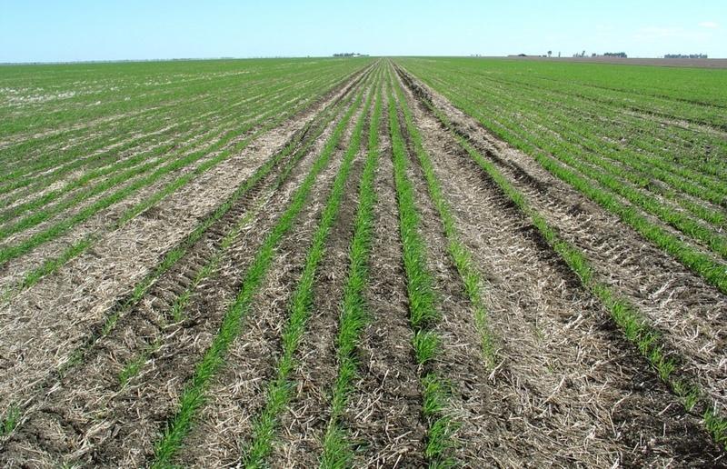
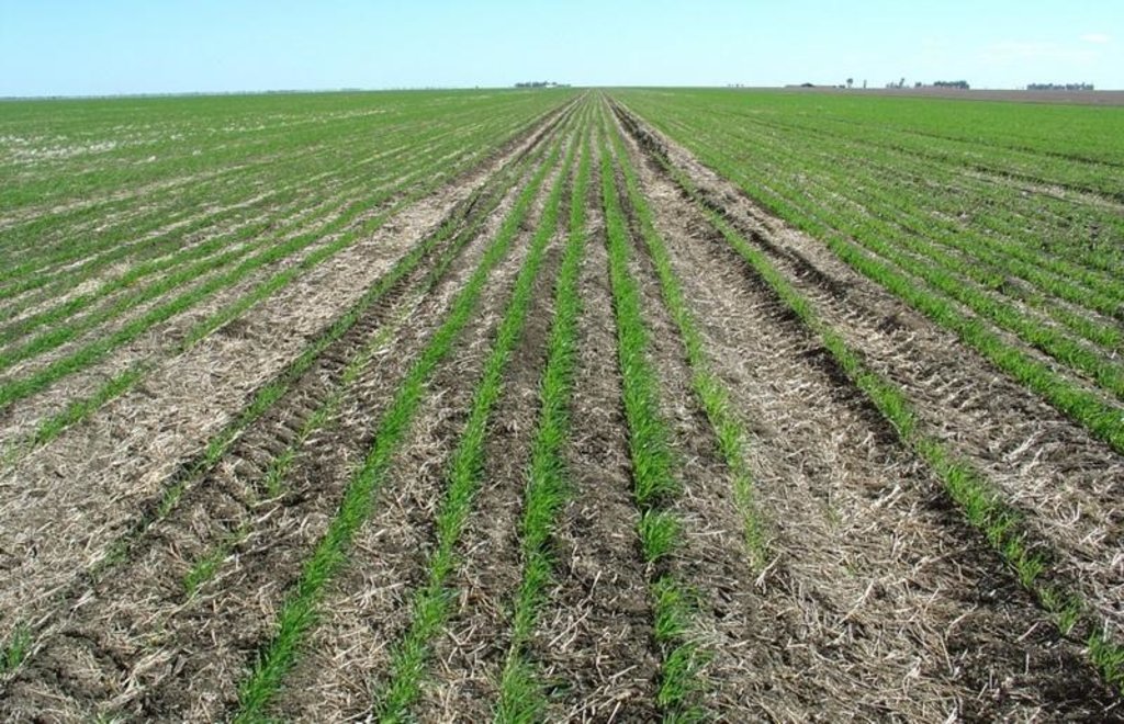
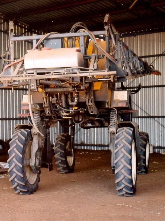
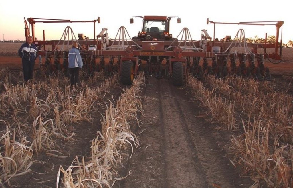
This controlled traffic, no-till farming system (CT/NT) is practiced on a 1,900 ha farm on the broad, almost flat Jandowae Plains in semi-arid Queensland, Australia. Principal soil types are vertisols, with some poorer areas where the sand content is greater, and these have a tendency to hard-set and crust. Over the past five years, the farm owner has changed the farming system completely from conventional farming to no-till with controlled traffic. Controlled traffic means permanent uncropped wheel tracks or ‘tramlines’: all equipment has 2 metre axles. The total farm machinery comprises a tractor, a spray rig and two 11 meter zero-till planter/fertilizer units; one each for wheat and sorghum sowing. The tramlines were laid out two years ago by a contractor using Geographical Positioning System (GPS).
The main technical objective was to eliminate soil compaction. The CT/NT combination ensures the land -between the tramlines - remains in excellent condition. There has been no ploughing or tillage at all in those 5 years. He practices a three year rotation between winter wheat, summer sorghum and fallow, but the system is not fixed: it depends very much on soil moisture status and thus on the rainfall (opportunity cropping). Generally in summer about one third is in summer sorghum and in winter about one third in winter wheat, the rest of the land is
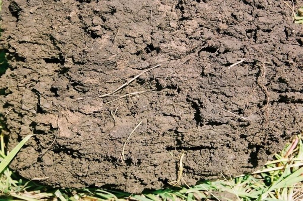
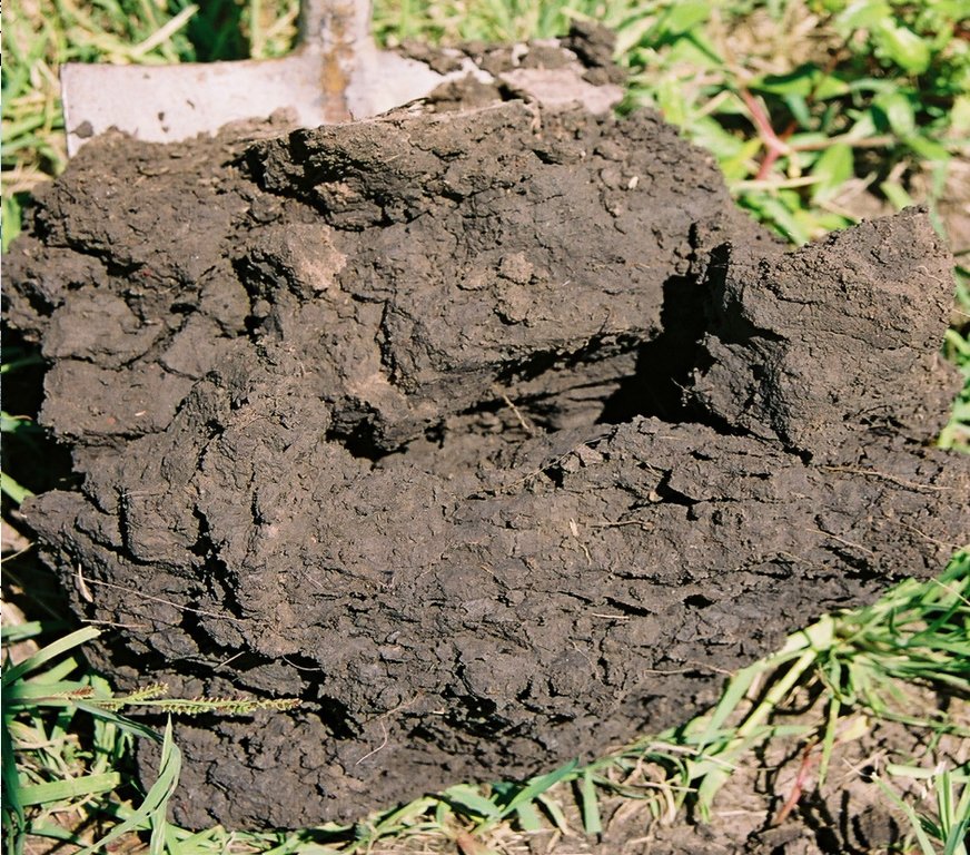
under fallow. The one-year fallow is maintained through the use of herbicides sprayed onto the undisturbed residue from the previous crop. The system is designed for rain capture - to build up soil moisture stores in the fallow periods for subsequent crops - and for disease control (to ‘spell’ the land). During the cropping cycle, the key to his effective weed control system is ‘to get in early’ and ‘actively chase weeds’ through judicious spraying. The farm is now free of the locally common persistent weed Erigeron annuus. In the five years his sorghum yields have risen from 3 to 7 tons per hectares. Over the last three years the soil has improved, becoming soft, friable and moist between his plant lines. Infiltration has improved a lot and soil structure is now excellent.
Tractor use and overall fuel consumption has decreased to less than one quarter of that under conventional tillage. Correspondingly the workload is hugely reduced: from four men required under the conventional system for an equivalent area, the farmer is the sole operator, very occasionally assisted by his son, and a paid contractor for harvesting. He is so satisfied with the CT/NT system that he is attempting to purchase a nearby property to extend the area that he can farm using his current machinery.
2.3 Photos of the Technology
2.5 Country/ region/ locations where the Technology has been applied and which are covered by this assessment
Country:
Australia
Region/ State/ Province:
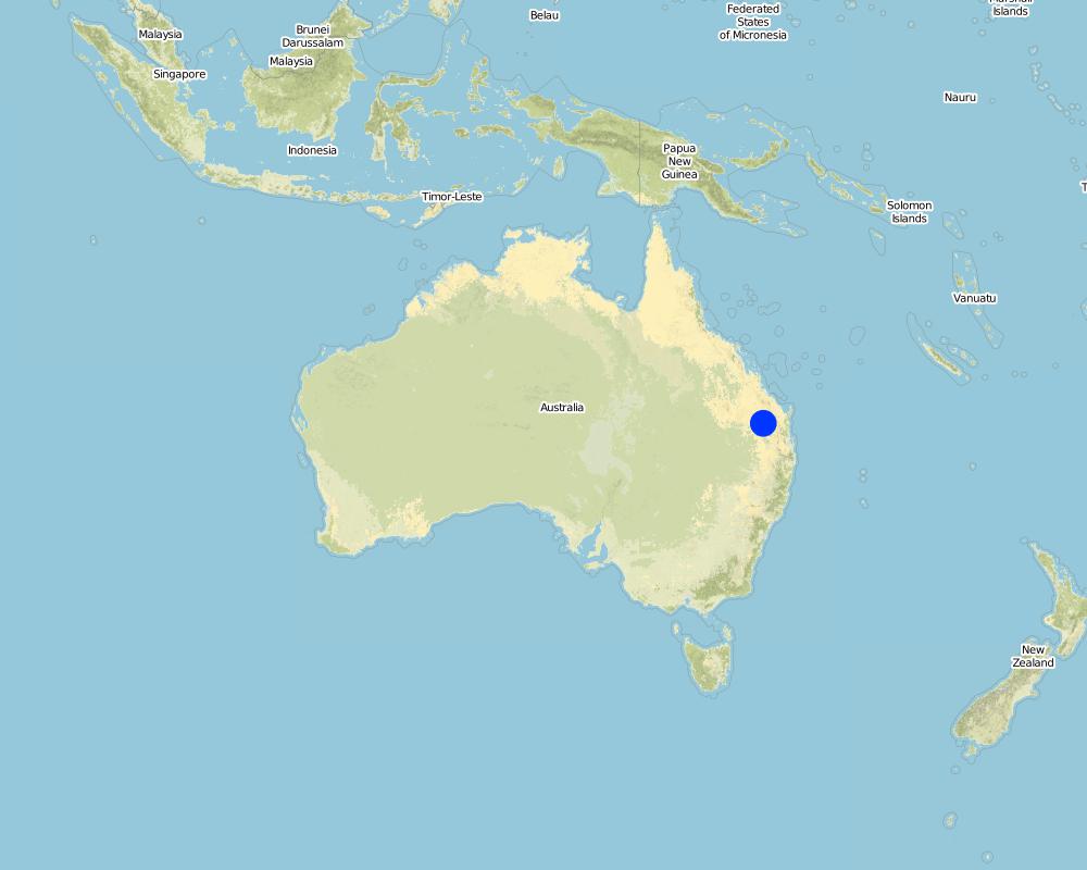
Jimbour (north of Dalby), Queensland
Specify the spread of the Technology:
- evenly spread over an area
If the Technology is evenly spread over an area, specify area covered (in km2):
19.0
If precise area is not known, indicate approximate area covered:
- 10-100 km2
Map
×2.7 Introduction of the Technology
Specify how the Technology was introduced:
- during experiments/ research
3. Classification of the SLM Technology
3.1 Main purpose(s) of the Technology
- improve production
- reduce, prevent, restore land degradation
- create beneficial economic impact
3.2 Current land use type(s) where the Technology is applied
Land use mixed within the same land unit:
No

Cropland
- Annual cropping
Annual cropping - Specify crops:
- cereals - sorghum
- cereals - wheat (winter)
Number of growing seasons per year:
- 2
Specify:
Longest growing period in days: 180 Longest growing period from month to month: Oct - AprS econd longest growing period in days: 180 Second longest growing period from month to month: Apr - Sep
Is intercropping practiced?
No
Is crop rotation practiced?
Yes
If yes, specify:
wheat-sorghum-fallow
Comments:
Major land use problems (compiler’s opinion): The farmer’s main reason for starting the combination of CT and NT was to rid himself of soil compaction, in order to achieve better utilisation of locally low and unpredictable rainfall amounts while minimising costs and reducing labour and machinery requirements.
3.3 Has land use changed due to the implementation of the Technology?
Has land use changed due to the implementation of the Technology?
- No (Continue with question 3.4)
3.4 Water supply
Water supply for the land on which the Technology is applied:
- rainfed
3.5 SLM group to which the Technology belongs
- minimal soil disturbance
3.6 SLM measures comprising the Technology

agronomic measures
- A3: Soil surface treatment
A3: Differentiate tillage systems:
A 3.1: No tillage
Comments:
Main measures: agronomic measures
3.7 Main types of land degradation addressed by the Technology

soil erosion by water
- Wt: loss of topsoil/ surface erosion
- Wg: gully erosion/ gullying

soil erosion by wind
- Et: loss of topsoil

physical soil deterioration
- Pc: compaction
Comments:
Main type of degradation addressed: Wt: loss of topsoil / surface erosion, Pc: compaction
Secondary types of degradation addressed: Wg: gully erosion / gullying, Et: loss of topsoil
3.8 Prevention, reduction, or restoration of land degradation
Specify the goal of the Technology with regard to land degradation:
- reduce land degradation
4. Technical specifications, implementation activities, inputs, and costs
4.1 Technical drawing of the Technology
Technical specifications (related to technical drawing):
Main technical functions: control of raindrop splash, control of dispersed runoff: retain / trap, improvement of ground cover, increase in organic matter, increase of infiltration, increase / maintain water stored in soil, improvement of soil structure, reduction of compaction by traffic, increase of soil fertility
Technical knowledge required for field staff / advisors: moderate; Technical knowledge required for land users: moderate
4.2 General information regarding the calculation of inputs and costs
Specify currency used for cost calculations:
- USD
Indicate average wage cost of hired labour per day:
160
4.3 Establishment activities
| Activity | Timing (season) | |
|---|---|---|
| 1. | layout of the controlled traffic lines (tramlines) using GPS mounted in a 4x4 vehicle. Two days were adequate for the whole farm. |
4.4 Costs and inputs needed for establishment
| Specify input | Unit | Quantity | Costs per Unit | Total costs per input | % of costs borne by land users | |
|---|---|---|---|---|---|---|
| Labour | Labour | ha | 1.0 | 5.0 | 5.0 | 100.0 |
| Total costs for establishment of the Technology | 5.0 | |||||
| Total costs for establishment of the Technology in USD | 5.0 | |||||
Comments:
Duration of establishment phase: 12 month(s)
4.5 Maintenance/ recurrent activities
| Activity | Timing/ frequency | |
|---|---|---|
| 1. | Layout of the controlled traffic lines (tramlines) | Two days were adequate for the establishment on the whole farm. |
| 2. | Weed control (spray-coupe) with roundup | Summer sorghum (650 ha, during 1 season or half a year) |
| 3. | Fertilizing | Summer sorghum (650 ha, during 1 season or half a year) |
| 4. | Sowing and simultaneous application of starter fertilizer | Mid October, Summer sorghum (650 ha, during 1 season or half a year) |
| 5. | Spraying pre-emergent herbicide to kill summer grasses | Summer sorghum (650 ha, during 1 season or half a year) |
| 6. | Harvest by contractors | early March, Summer sorghum (650 ha, during 1 season or half a year) |
| 7. | Weed control | Winter wheat (650 ha, during 1 season or half a year) |
| 8. | Fertilizing (Urea) | Winter wheat (650 ha, during 1 season or half a year) |
| 9. | Sowing and simultaneous application of starter fertilizer | Mid May, Winter wheat (650 ha, during 1 season or half a year) |
| 10. | In-crop weed spray | Winter wheat (650 ha, during 1 season or half a year) |
| 11. | Harvest by contractors | October |
| 12. | Fallow (1,250 ha) | During 2 seasons or totally 1 year |
| 13. | Weed control (combination of roundup mixed with broadleaf herbicide) | 5–6 times per fallow period |
| 14. | Determine the soil moisture (To determine soil moisture he uses an iron rod; if he can push it into the heavy clay soil, then the soil is moist. Additionally, he measures rainfall) |
4.6 Costs and inputs needed for maintenance/ recurrent activities (per year)
| Specify input | Unit | Quantity | Costs per Unit | Total costs per input | % of costs borne by land users | |
|---|---|---|---|---|---|---|
| Labour | Labour | ha | 1.0 | 5.0 | 5.0 | 100.0 |
| Equipment | Animal traction | ha | 1.0 | 6.0 | 6.0 | 100.0 |
| Equipment | Harvesting by contractor | ha | 1.0 | 17.0 | 17.0 | 100.0 |
| Plant material | Seeds | ha | 1.0 | 8.0 | 8.0 | 100.0 |
| Fertilizers and biocides | Fertilizer | ha | 1.0 | 53.0 | 53.0 | 100.0 |
| Fertilizers and biocides | Biocides | ha | 1.0 | 22.0 | 22.0 | 100.0 |
| Total costs for maintenance of the Technology | 111.0 | |||||
| Total costs for maintenance of the Technology in USD | 111.0 | |||||
Comments:
Machinery/ tools: tactor,spray rig, zero-till planter/fertilizer, iron rod
Comparison of costs between conventional tillage and no-till farming (CT/NT): (1) Labour costs are 4x less in CT/NT: 4 men used to work on the farm (conventional), now the farmer is alone – (plus contractors for harvesting). (2) Average annual diesel consumption: reduced from 108,333 litres (conventional) to 13,636 litres (no-till) which is 8 times less. (3) Costs of equipment to set up a CT/NT system (US$ 240,000) are 3 times less than that for conventional tillage equipment (US$ 700,000).
(4) For biocides he has to invest 5 times more in CT/NT. The conventional values are estimates.
4.7 Most important factors affecting the costs
Describe the most determinate factors affecting the costs:
In average one third of the farm area is in crop and two thirds are fallow. This means that overall farming costs per
ha are reduced, since during fallow period activities are limited to spraying herbicides. Labour costs approximately US$ 160 per day. Machinery costs average out at US$ 20 per hour (diesel costs US$ 0.9 per litre). All the data comes from this single farmer. Purchase of equipment is not included in the table above.
5. Natural and human environment
5.1 Climate
Annual rainfall
- < 250 mm
- 251-500 mm
- 501-750 mm
- 751-1,000 mm
- 1,001-1,500 mm
- 1,501-2,000 mm
- 2,001-3,000 mm
- 3,001-4,000 mm
- > 4,000 mm
Agro-climatic zone
- semi-arid
- arid
Thermal climate class: subtropics
5.2 Topography
Slopes on average:
- flat (0-2%)
- gentle (3-5%)
- moderate (6-10%)
- rolling (11-15%)
- hilly (16-30%)
- steep (31-60%)
- very steep (>60%)
Landforms:
- plateau/plains
- ridges
- mountain slopes
- hill slopes
- footslopes
- valley floors
Altitudinal zone:
- 0-100 m a.s.l.
- 101-500 m a.s.l.
- 501-1,000 m a.s.l.
- 1,001-1,500 m a.s.l.
- 1,501-2,000 m a.s.l.
- 2,001-2,500 m a.s.l.
- 2,501-3,000 m a.s.l.
- 3,001-4,000 m a.s.l.
- > 4,000 m a.s.l.
Comments and further specifications on topography:
Landforms: Also footslopes and valley floors (both ranked 2)
Slopes on average: Also moderate (ranked 2) and rolling (ranked 3)
5.3 Soils
Soil depth on average:
- very shallow (0-20 cm)
- shallow (21-50 cm)
- moderately deep (51-80 cm)
- deep (81-120 cm)
- very deep (> 120 cm)
Soil texture (topsoil):
- fine/ heavy (clay)
Topsoil organic matter:
- medium (1-3%)
- low (<1%)
If available, attach full soil description or specify the available information, e.g. soil type, soil PH/ acidity, Cation Exchange Capacity, nitrogen, salinity etc.
Soil depth on average: Also shallow and deep (both ranked 2)
Soil fertility: Medium (ranked 1) and high (ranked 2)
Soil drainage: Poor
5.6 Characteristics of land users applying the Technology
Market orientation of production system:
- commercial/ market
Off-farm income:
- less than 10% of all income
Relative level of wealth:
- average
Indicate other relevant characteristics of the land users:
and own 88% of the land.
5.7 Average area of land used by land users applying the Technology
- < 0.5 ha
- 0.5-1 ha
- 1-2 ha
- 2-5 ha
- 5-15 ha
- 15-50 ha
- 50-100 ha
- 100-500 ha
- 500-1,000 ha
- 1,000-10,000 ha
- > 10,000 ha
5.8 Land ownership, land use rights, and water use rights
Land ownership:
- individual, titled
Land use rights:
- individual
6. Impacts and concluding statements
6.1 On-site impacts the Technology has shown
Socio-economic impacts
Production
crop production
Income and costs
farm income
Socio-cultural impacts
SLM/ land degradation knowledge
Ecological impacts
Water cycle/ runoff
excess water drainage
Soil
soil moisture
soil cover
soil loss
soil compaction
soil organic matter/ below ground C
Biodiversity: vegetation, animals
plant diversity
animal diversity
habitat diversity
Other ecological impacts
Soil fertility
6.2 Off-site impacts the Technology has shown
reliable and stable stream flows in dry season
downstream flooding
downstream siltation
groundwater/ river pollution
Transported sediments
6.4 Cost-benefit analysis
How do the benefits compare with the establishment costs (from land users’ perspective)?
Short-term returns:
very positive
Long-term returns:
very positive
How do the benefits compare with the maintenance/ recurrent costs (from land users' perspective)?
Short-term returns:
very positive
Long-term returns:
very positive
6.5 Adoption of the Technology
If available, quantify (no. of households and/ or area covered):
200
Comments:
200 land user families have adopted the Technology without any external material support
There is no trend towards spontaneous adoption of the Technology
Comments on adoption trend: There isn’t a strong trend now towards growing spontaneous adoption: uptake has slowed dramatically as many conservative farmers prefer to continue their traditional tillage practices.
6.7 Strengths/ advantages/ opportunities of the Technology
| Strengths/ advantages/ opportunities in the compiler’s or other key resource person’s view |
|---|
|
Land that previously was un-farmable is now under crops. Site inspection shows initially poor land to be now in good condition (after only 5 years). The value of the land has increased How can they be sustained / enhanced? Farmers practising CT/NT can and are buying/leasing more land, which will improve the overall state of the land in Queensland. |
|
Farmers can manage much larger growing areas with less personnel and equipment. A single operator is well able to run a large arable farm on his own How can they be sustained / enhanced? Ditto. |
|
Cereal farming is now less prone to yield losses (and crop failure) in drought years – as there is better rainwater infiltration and water use efficiency with CT/NT How can they be sustained / enhanced? Continue with the system. |
| He has all weeds under control (without need for tillage). |
6.8 Weaknesses/ disadvantages/ risks of the Technology and ways of overcoming them
| Weaknesses/ disadvantages/ risks in the compiler’s or other key resource person’s view | How can they be overcome? |
|---|---|
| The contract harvester runs on 3 m wide axles, so the wheels run on the beds. However, there has only been one wet harvest in 5 years so the incidence of soil compaction from harvesting is negligible | This is not really seen as a problem. One solution would be to build a dedicated harvester (too expensive) or find a contractor with equipment that fitted the system. |
| A conservative mentality towards conservation agriculture is constraining the adoption of the system by other farmers | Continue demonstrating and disseminating knowledge about benefits. |
7. References and links
7.1 Methods/ sources of information
7.2 References to available publications
Title, author, year, ISBN:
Blackwell P (1998) Customised controlled traffic farming systems, instead of standard recommendations or ‘tramlines ain’t tramlines’.In Second national controlled farming conference, pp. 23–26. Eds JN Tullberg and DF Yule.
Available from where? Costs?
Gatton College: University of Queensland
Title, author, year, ISBN:
Hulme PJ, McKenzie DC, MacLeod DA and Anthony DTW (1996) An evaluation of controlled traffic with reduced tillage for irrigated cotton on a Vertisol.
Soil and Tillage Research 38:217–237
Title, author, year, ISBN:
McGarry D, Bridge BJ and Radford BJ (2000). Contrasting soil physical properties after zero and traditional tillage of an alluvial soil in the semi-arid tropics. Soil and Tillage Research 53:105–115
Links and modules
Expand all Collapse allLinks
No links
Modules
No modules


