Dugout Sunken Pond with Catchment Treatment [ប្រទេសឥណ្ឌា]
- ការបង្កើត៖
- បច្ចុប្បន្នភាព
- អ្នកចងក្រង៖ Unknown User
- អ្នកកែសម្រួល៖ –
- អ្នកត្រួតពិនិត្យច្រើនទៀត៖ Fabian Ottiger, Alexandra Gavilano
Bandha/ Pokhari (Oriya)
technologies_1475 - ប្រទេសឥណ្ឌា
ពិនិត្យមើលគ្រប់ផ្នែក
ពង្រីកមើលទាំងអស់ បង្រួមទាំងអស់1. ព័ត៌មានទូទៅ
1.2 ព័ត៌មានលម្អិតពីបុគ្គលសំខាន់ៗ និងស្ថាប័នដែលចូលរួមក្នុងការវាយតម្លៃ និងចងក្រងឯកសារនៃបច្ចេកទេស
បុគ្គលសំខាន់ម្នាក់ (ច្រើននាក់)
អ្នកជំនាញឯកទេស SLM:
Patnaik Kishore Chandra
ប្រទេសឥណ្ឌា
អ្នកជំនាញឯកទេស SLM:
Pradhan Gandhi
ប្រទេសឥណ្ឌា
អ្នកជំនាញឯកទេស SLM:
Tripathy Dasarathi
ប្រទេសឥណ្ឌា
អ្នកជំនាញឯកទេស SLM:
Panda R.K
Central Soil & Water Conservation Research & Training Institute
ប្រទេសឥណ្ឌា
អ្នកជំនាញឯកទេស SLM:
Mohanty K.C
Sahid Laxman Naik Development Society
ប្រទេសឥណ្ឌា
អ្នកជំនាញឯកទេស SLM:
Mishra BIJAYALAXMI
IDCWDP
ប្រទេសឥណ្ឌា
ឈ្មោះអង្គភាពមួយ (ច្រើន) ដែលបានចងក្រងឯកសារ/ វាយតម្លៃបច្ចេកទេស (បើទាក់ទង)
Central Soil & Water Conservation Research & Training Institute - ប្រទេសឥណ្ឌាឈ្មោះអង្គភាពមួយ (ច្រើន) ដែលបានចងក្រងឯកសារ/ វាយតម្លៃបច្ចេកទេស (បើទាក់ទង)
Sahid Laxman Naik Development Society - ប្រទេសឥណ្ឌាឈ្មោះអង្គភាពមួយ (ច្រើន) ដែលបានចងក្រងឯកសារ/ វាយតម្លៃបច្ចេកទេស (បើទាក់ទង)
IDCWDP (IDCWDP) - ប្រទេសឥណ្ឌា1.3 លក្ខខណ្ឌទាក់ទងទៅនឹងការប្រើប្រាស់ទិន្នន័យដែលបានចងក្រងតាមរយៈ វ៉ូខេត
អ្នកចងក្រង និង(បុគ្គលសំខាន់ៗ)យល់ព្រមទទួលយកនូវលក្ខខណ្ឌនានាទាក់ទងទៅនឹងការប្រើប្រាស់ទិន្នន័យដែលបានចងក្រងតាមរយៈវ៉ូខេត:
បាទ/ចា៎
1.5 ការយោងទៅលើកម្រងបញ្ជីសំណួរ (មួយ ឬច្រើន) នៃវិធីសាស្ត្រផ្សព្វផ្សាយ SLM (ដែលបានចងក្រងដោយទស្សនៈពិភពលោកស្តីពីវិធីសាស្ត្រ និងបច្ចេកទេសងអភិរក្ស WOCAT)
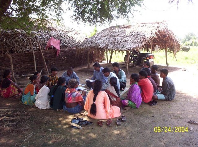
PARTICIPATORY APPROACH IN IDCWDP, DANIDA [ប្រទេសឥណ្ឌា]
Participatory approach for holistic and intigrated development of the defined area on watershed basis involving all level of stake holders.
- អ្នកចងក្រង៖ Srikanta Kumar Parida
2. ការពណ៌នាពីបច្ចេកទេស SLM
2.1 ការពណ៌នាដោយសង្ខេបពីបច្ចេកទេស
និយមន័យបច្ចេកទេស:
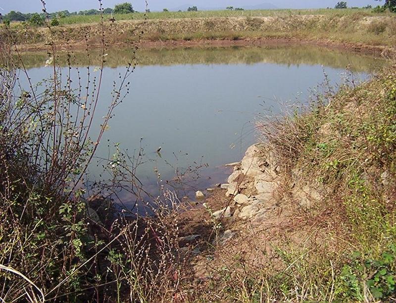
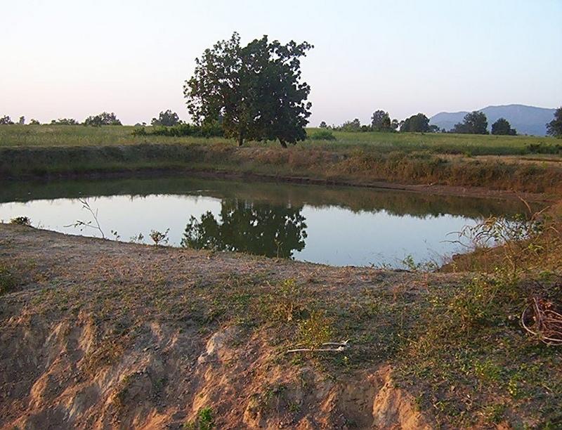
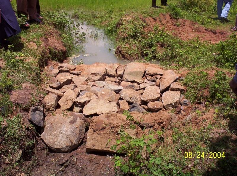
Dugout sunken pond with catchment treatment.
2.2 ការពណ៌នាលម្អិតពីបច្ចេកទេស
ការពណ៌នា:
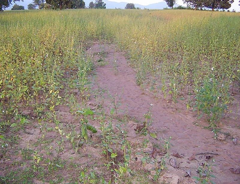
(1) Total size of the project area = 4.75 Ha.
(2) Different structures taken up in the project area are
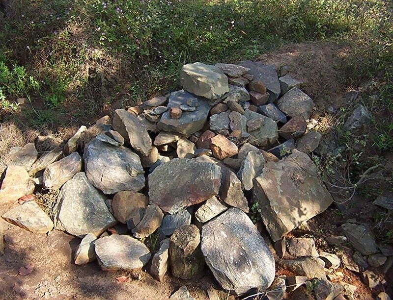
(i) Brushwood check dam- 6 Nos.
(ii) Drop structure- 8 Nos.
(iii) Dugout sunken pond - 1 No.
(3) All the above structures were positioned to ridge to valley treatment
(Ref.QT-6/2.1.2/a)
Purpose of the Technology: 1) Storage of runoff for cattle and human use.
2) Construction of structures to check soil erosion and sand casting.
3) Pisciculture.
Establishment / maintenance activities and inputs: Establishment :-
1) SWC specialist selected sites for dugout sunken pond, layout the design.
2) SWC specialist also selected sites for drop structures, brushwood check
dams in gullied portion of project area with reference to vertical interval
of slope gradient and space between structures.
3) The execution of work were done by concerned villagers on payment basis.
4) During execution, 20% of the total cost of the dugout sunken pond was
contributed by the villagers in shape of labour.
5) Training on technical know how imparted to the villagrs during execution
of pond, bund, drop structure and brush wood check dam.
Maintenance:-
1) The dugout sunken pond requires (a) Desiltation once in two years (b)
Repair of earthern bund around inlet and outlet every year.
2) The drop structure & brushwood check dams requires little maintenance when
ever requires.
3) One management group has formed in the same village & funds has been
raised by doing pisciculture in the pond.
4) The management group is taking major reponsibility for its maintenance.
Natural / human environment: (1) Drainage line stablilized (2) Adjuscant area cultivated (3) Users group
formed and pisciculture taken up for the Ist time in the village.
2.3 រូបភាពនៃបច្ចេកទេស
វិចិត្រសាលប្រព័ន្ធផ្សព្វផ្សាយ
2.5 ប្រទេស/តំបន់/ទីតាំងកន្លែង ដែលបច្ចេកទេសត្រូវបានអនុវត្ត និងបានគ្រប់ដណ្តប់ដោយការវាយតម្លៃនេះ
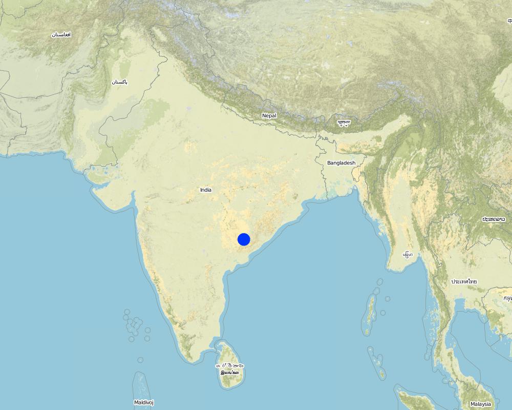
ប្រទេស:
ប្រទេសឥណ្ឌា
តំបន់/រដ្ឋ/ខេត្ត:
Orissa
បញ្ជាក់បន្ថែមពីលក្ខណៈនៃទីតាំង:
Orissa/ Malkangiri
បញ្ជាក់ពីការសាយភាយនៃបច្ចេកទេស:
- ត្រូវបានផ្សព្វផ្សាយត្រឹមតំបន់មួយ
ប្រសិនបើបច្ចេកទេសត្រូវបានសាយភាយពាសពេញតំបន់ណាមួយ បញ្ជាក់ទំហំផ្ទៃដីអនុវត្តន៍ (គិតជា គ.ម2):
0,0475
ប្រសិនបើមិនច្បាស់ពីទំហំផ្ទៃដី សូមធ្វើការប៉ាន់ប្រម៉ាណ:
- < 0.1 គម2 (10 ហិកតា)
មតិយោបល់:
Total area covered by the SLM Technology is 0.0475 km2.
A fellow, understanding, gullied piece ofland selected for the technology which suffers from sand casting and uncertainity of rain.
Map
×2.6 កាលបរិច្ឆេទនៃការអនុវត្ត
ប្រសិនបើមិនច្បាស់ឆ្នាំ សូមបញ្ជាក់កាលបរិច្ឆេទដែលប្រហាក់ប្រហែល:
- តិចជាង 10ឆ្នាំមុន (ថ្មី)
2.7 ការណែនាំពីបច្ចេកទេស
សូមបញ្ជាក់តើបច្ចេកទេសត្រូវបានណែនាំឱ្យអនុវត្តដោយរបៀបណា:
- តាមរយៈគម្រោង / អន្តរាគមន៍ពីខាងក្រៅ
មតិយោបល់ (ប្រភេទនៃគម្រោង ។ល។):
National Watershed Development Project for Rainfed Area (NWDPRA)
3. ចំណាត់ថ្នាក់នៃបច្ចេកទេស SLM
3.1 គោលបំណងចម្បង (១ ឬច្រើន) នៃបច្ចេកទេសនេះ
- ធ្វើឱ្យប្រសើរឡើងនូវផលិតកម្ម
3.2 ប្រភេទដីប្រើប្រាស់មួយប្រភេទ (ច្រើនប្រភេទ) ដែលបានអនុវត្តបច្ចេកទេស
ដីប្រើប្រាស់ចម្រុះនៅលើដីតែមួយ:
បាទ/ចា៎
បញ្ជាក់ពីប្រភេទដីច្រើនប្រភេទ (ដីដាំដំណាំ/ដីចិញ្ចឹមសត្វ/ដីព្រៃឈើ):
- Agro-pastoralism ( រួមបញ្ចូលទាំងដំណាំ និងចិញ្ចឹមសត្វ)

ដីដាំដំណាំ
- ដំណាំប្រចាំឆ្នាំ
- rice
ចំនួនសារដែលដាំដំណាំក្នុងមួយឆ្នាំ:
- 1
សូមបញ្ជាក់:
Longest growing period in days: 150 Longest growing period from month to month: Jul - Nov

ដីសម្រាប់ចិញ្ចឹមសត្វ
- cattle
មតិយោបល់:
Major land use problems (compiler’s opinion):
1) A fellow, undulating, gullied piece of land.
2) Acute sand casting at the down stream cropland.
3) About 40% of the project area were practicing local paddy which suffers from erratic rainfall.
Major land use problems (land users’ perception): A piece of land which depends upon the mercy of the Rain God for annual production.
3.4 ការផ្គត់ផ្គង់ទឹក
ការផ្គត់ផ្គង់ទឹកនៅកន្លែងអនុវត្តបច្ចេកទេស:
- ទឹកភ្លៀង
3.5 ក្រុម SLM ដែលបច្ចេកទេសស្ថិតនៅក្នុង
- ការស្តុកទុកទឹក
- ការចិញ្ចឹមឃ្មុំ, វារីវប្បកម្ម, ការចិញ្ចឹមបសុបក្សី, ទន្សាយ, ដង្កូវនាង ។ល។
3.6 វិធានការ SLM ដែលបញ្ចូលនូវបច្ចេកទេស

វិធានការរចនាស័ម្ពន្ធ
- S5: ទំនប់ ថ្លុក ស្រះ
មតិយោបល់:
Main measures: structural measures
Secondary measures: vegetative measures
Type of vegetative measures: aligned: -contour
3.7 កំណត់ប្រភេទនៃការធ្លាក់ចុះគុណភាពដីសំខាន់ៗដែលបច្ចេកទេសនេះបានដោះស្រាយ

ការហូរច្រោះដីដោយសារទឹក
- Wt: ការបាត់ដីស្រទាប់លើដោយការហូរច្រោះ
- Wg: ការកកើតឡើងនូវកំទេចកំទីដីស្រទាប់ក្រោម
មតិយោបល់:
Main type of degradation addressed: Wt: loss of topsoil / surface erosion
Secondary types of degradation addressed: Wg: gully erosion / gullying
Main causes of degradation: other human induced causes (specify) (agricultural causes - Coordination of traditional method of agricultural practices like along the slope, use of long term local varieity of seeds etc.), poverty / wealth (lack of captial)
Secondary causes of degradation: other natural causes (avalanches, volcanic eruptions, mud flows, highly susceptible natural resources, extreme topography, etc.) specify (Erosion problem), education, access to knowledge and support services (lack of knowledge), Common social practices
3.8 ការពារ កាត់បន្ថយ ឬស្តារឡើងវិញនៃការធ្លាក់ចុះគុណភាពដី
បញ្ជាក់ពីគោលដៅរបស់បច្ចេកទេស ដែលផ្តោតទៅការធ្លាក់ចុះគុណភាពដី:
- ការការពារការធ្លាក់ចុះគុណភាពដី
- ការកាត់បន្ថយការធ្លាក់ចុះគុណភាពដី
មតិយោបល់:
Main goals: mitigation / reduction of land degradation
Secondary goals: prevention of land degradation
4. បច្ចេកទេសជាក់លាក់ សកម្មភាពអនុវត្ត ធាតុចូល និងថ្លៃដើម
4.1 គំនូសបច្ចេកទេសនៃបច្ចេកទេសនេះ
លក្ខណៈពិសេសនៃបច្ចេកទេស (ទាក់ទងនឺងគំនូរបច្ចេកទេស):
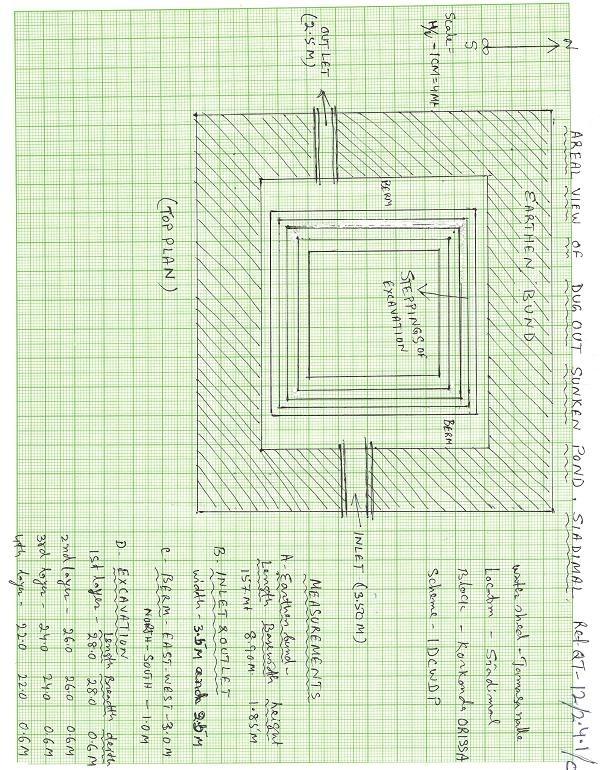
Aerial view of dugout sunken pond
Location: Siadimal, Korkonda. Malkangiri/Orissa/ India
Date: 15.3.2005
Technical knowledge required for field staff / advisors: moderate
Technical knowledge required for land users: moderate
Main technical functions: control of dispersed runoff: retain / trap
Secondary technical functions: reduction of slope angle, water harvesting / increase water supply, Control of sand casting
Aligned: -contour
Vegetative material: G : grass
Vertical interval within rows / strips / blocks (m): 0.15
Width within rows / strips / blocks (m): 0.45
Vegetative measure: In earthern bund slope
Vegetative material: G : grass
Vertical interval within rows / strips / blocks (m): Compact
Width within rows / strips / blocks (m): 3.7
Vegetative measure: Vegetative material: G : grass
Vegetative measure: Vegetative material: G : grass
Vegetative measure: Vegetative material: G : grass
Grass species: Vertivera and local grass slods
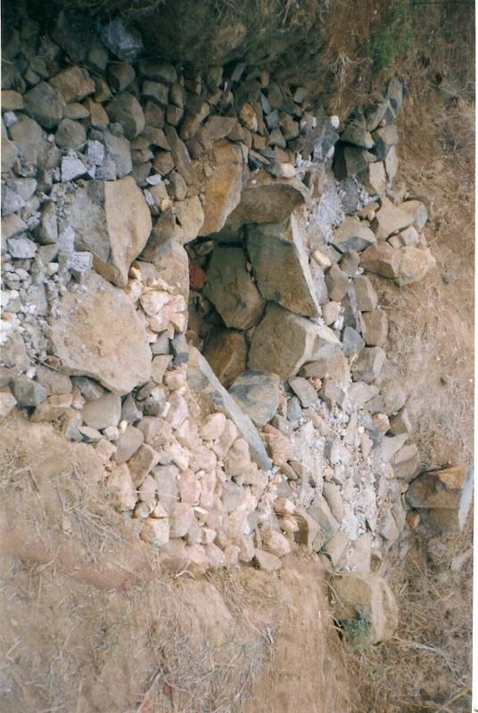
Structural measure: Sediment/Sand/Trap/brushwood check dam
Vertical interval between structures (m): 0.6
Spacing between structures (m): 10
Height of bunds/banks/others (m): 0.6
Width of bunds/banks/others (m): 1.5
Length of bunds/banks/others (m): 3
Structural measure: Sediment/Sand/Trap/ drop structure
Vertical interval between structures (m): 9
Spacing between structures (m): 15
Height of bunds/banks/others (m): 1.05
Width of bunds/banks/others (m): 5.3
Length of bunds/banks/others (m): 3
Structural measure: Dam/Pan/Dugout sunken pond
Depth of ditches/pits/dams (m): 0.6
Width of ditches/pits/dams (m): 28/26/24/22
Length of ditches/pits/dams (m): 28/26/24/22
Structural measure: Bund/Trapizoidal
Height of bunds/banks/others (m): 1.85
Width of bunds/banks/others (m): 1.50+8.9/2
Length of bunds/banks/others (m): 157
Construction material (earth): Soil excavated from pond is used to built bund around pond.
Construction material (stone): Inlet and outlet of pond and drop structure are made up of stone
Construction material (wood): Brush wood check dams are made up of wooden poles and bush wood.
Slope (which determines the spacing indicated above): 8%
If the original slope has changed as a result of the Technology, the slope today is: 3%
For water harvesting: the ratio between the area where the harvested water is applied and the total area from which water is collected is: 1:41
Vegetation is used for stabilisation of structures.
ឈ្មោះអ្នកនិពន្ធ:
Patnaik K.C, Malkangiri, Oriss
4.2 ព័ត៌មានទូទៅដែលពាក់ព័ន្ធនឹងការគណនាធាតុចូល និងថ្លៃដើម
ផ្សេងៗ/ រូបិយប័ណ្ណជាតិ (បញ្ជាក់):
Rupee
បើពាក់ព័ន្ធសូមកំណត់អត្រាប្តូរប្រាក់ពីដុល្លាទៅរូបិយប័ណ្ណតំបន់ (ឧ. 1 ដុល្លារ = 79.9 រៀលនៃរូបិយប័ណ្ណប្រេស៊ីល) ៖ 1 ដុល្លារ =:
45,0
កំណត់ថ្លៃឈ្នួលជាមធ្យមនៃការជួលកម្លាំងពលកម្មក្នុងមួយថ្ងៃ:
0.89
4.3 សកម្មភាពបង្កើត
| សកម្មភាព | រយៈពេល (រដូវកាល) | |
|---|---|---|
| 1. | Collection grass sods and vertivera slips | beginning of rainy season |
| 2. | Transporting grass sods on established banks | beginning of rainy season |
| 3. | Watering | When dry in Ist. Season |
| 4. | Dugout sunken pond-Surveying | Summer season |
| 5. | Dugout sunken pond- soil excavated from pondage area used in trapizodical bund around leaving inlet & outlet portion. | Summer season |
| 6. | Dugout sunken pond- Collection and transporting stone to inlet & outlet site | Summer season |
| 7. | Dugout sunken pond- construction of inlet & outlet with stone | Summer season |
| 8. | Dugout sunken pond- collection of local grass sods & vertiver slops | Onset of rain |
| 9. | Dugout sunken pond- turfing the bund slopes and planting of vertiver slips in rows at up stream and down steam side of inlet and outlet | On set of rain |
| 10. | Brushwood check dam- surveying | Summer season |
| 11. | Brushwood check dam- collection of wooden poles and brush wood | Summer season |
| 12. | Brushwood check dam- collection of picked up stones | Summer season |
| 13. | Brushwood check dam- fixing of wooden pole, weiving with brush wood, filling up the gaps with picked up stones | Summer season |
| 14. | Brushwood check dam- collection of vertiver slips and planting in upstream and downstream of each structure | On set of rain |
| 15. | Drop structure- surveying | Summer season |
| 16. | Drop structure- collection & transportation of stones to work spot | Summer season |
| 17. | Drop structure- construction of drop structure with stones | Summer season |
| 18. | Drop structure- collection of vertiver slips and planting at up stream and down stream of structure | On set of rain |
4.4 ថ្លៃដើម និងធាតុចូលដែលត្រូវការសម្រាប់ការបង្កើតបច្ចេកទេស
| បញ្ជាក់ពីធាតុចូល | ឯកតា | បរិមាណ | ថ្លៃដើមក្នុងមួយឯកតា | ថ្លៃធាតុចូលសរុប | % នៃថ្លៃដើមដែលចំណាយដោយអ្នកប្រើប្រាស់ដី | |
|---|---|---|---|---|---|---|
| កម្លាំងពលកម្ម | Labour | ha | 1,0 | 225,0 | 225,0 | 14,0 |
| សម្ភារៈ | Animal traction | ha | 1,0 | 49,0 | 49,0 | |
| សម្ភារៈ | Tools | ha | 1,0 | 4,0 | 4,0 | |
| ផ្សេងៗ | Royalty charges for stones | ha | 1,0 | 6,0 | 6,0 | |
| ផ្សេងៗ | Fishery and feed | ha | 1,0 | 9,0 | 9,0 | |
| ផ្សេងៗ | Field bunding | ha | 1,0 | 73,0 | 73,0 | 100,0 |
| ផ្សេងៗ | Water way | ha | 1,0 | 6,0 | 6,0 | 100,0 |
| ថ្លៃដើមសរុបក្នុងការបង្កើតបច្ចេកទេស | 372,0 | |||||
| ថ្លៃដើមសរុបក្នុងការបង្កើតបច្ចេកទេសគិតជាដុល្លារ | 8,27 | |||||
4.5 សកម្មភាពថែទាំ
| សកម្មភាព | ពេលវេលា/ ភាពញឹកញាប់ | |
|---|---|---|
| 1. | Collecting vertiver slips & grass sods for gap filling | Onset of rain /annual |
| 2. | Collection of grass sods and gap fillling to bund layers | On set of rain/Annualy |
| 3. | Desiltation | Before on set of rain/Biannualy |
4.6 កំណត់ថ្លៃដើមសម្រាប់ការថែទាំ/ សកម្មភាពរបស់បច្ចេកទេស (ក្នុងរយៈពេលមួយឆ្នាំ)
| បញ្ជាក់ពីធាតុចូល | ឯកតា | បរិមាណ | ថ្លៃដើមក្នុងមួយឯកតា | ថ្លៃធាតុចូលសរុប | % នៃថ្លៃដើមដែលចំណាយដោយអ្នកប្រើប្រាស់ដី | |
|---|---|---|---|---|---|---|
| កម្លាំងពលកម្ម | Labour | ha | 1,0 | 18,0 | 18,0 | 100,0 |
| ផ្សេងៗ | Field bunding | ha | 1,0 | 2,0 | 2,0 | 100,0 |
| ផ្សេងៗ | Water way | ha | 1,0 | 1,0 | 1,0 | 100,0 |
| ថ្លៃដើមសរុបសម្រាប់ការថែទាំដំណាំតាមបច្ចេកទេស | 21,0 | |||||
| ថ្លៃដើមសរុបសម្រាប់ការថែទាំដំណាំតាមបច្ចេកទេសគិតជាដុល្លារ | 0,47 | |||||
មតិយោបល់:
The above calculation is based on the total establishment/ recurring cost both born by the project and land users is devided by the total project area i.e 4.75 ha. To get average hect. cost.
4.7 កត្តាសំខាន់បំផុតដែលមានឥទ្ធិពលដល់ការចំណាយ
ពណ៌នាពីកត្តាប៉ះពាល់ចម្បងៗទៅលើថ្លៃដើម:
Availability of stone affects the cost from implementing SWC
5. លក្ខណៈបរិស្ថានធម្មជាតិ និងមនុស្ស
5.1 អាកាសធាតុ
បរិមាណទឹកភ្លៀងប្រចាំឆ្នាំ
- < 250 មម
- 251-500 មម
- 501-750 មម
- 751-1,000 មម
- 1,001-1,500 មម
- 1,501-2,000 មម
- 2,001-3,000 មម
- 3,001-4,000 មម
- > 4,000 មម
កំណត់បរិមាណទឹកភ្លៀង (បើដឹង) ជា មីលីម៉ែត្រ:
1760,00
តំបន់កសិអាកាសធាតុ
- មានភ្លៀងមធ្យម
South Eastern Ghat Agro Climatic Zone
5.2 សណ្ឋានដី
ជម្រាលជាមធ្យម:
- រាបស្មើ (0-2%)
- ជម្រាលតិចតួច (3-5%)
- មធ្យម (6-10%)
- ជម្រាលខ្ពស់បន្តិច (11-15%)
- ទីទួល (16-30%)
- ទីទួលចោត (31-60%)
- ទីទួលចោតខ្លាំង (>60%)
ទម្រង់ដី:
- ខ្ពង់រាប
- កំពូលភ្នំ
- ជម្រាលភ្នំ
- ជម្រាលទួល
- ជម្រាលជើងភ្នំ
- បាតជ្រលងភ្នំ
តំបន់តាមរយៈកម្ពស់ :
- 0-100 ម
- 101-500 ម
- 501-1,000 ម
- 1,001-1,500 ម
- 1,501-2,000 ម
- 2,001-2,500 ម
- 2,501-3,000 ម
- 3,001-4,000 ម
- > 4,000 ម
មតិយោបល់ និងបញ្ចាក់បន្ថែមអំពីសណ្ឋានដី :
Altitudinal zone: 101-500 m a.s.l. (423 m a.s.l.)
Landforms: Plateau/plains (2-7% slope)
5.3 ដី
ជម្រៅដីជាមធ្យម:
- រាក់ខ្លាំង (0-20 សម)
- រាក់ (21-50 សម)
- មធ្យម (51-80 សម)
- ជ្រៅ (81-120 សម)
- ជ្រៅខ្លាំង (> 120 សម)
វាយនភាពដី (ស្រទាប់លើ):
- មធ្យម (ល្បាយ, ល្បាប់)
សារធាតុសរីរាង្គនៅស្រទាប់ដីខាងលើ:
- មធ្យម (1-3%)
បើអាចសូមភ្ជាប់ការពណ៌នាពីដីឱ្យបានច្បាស់ ឬព័ត៌មានដែលអាចទទួលបាន ឧ. ប្រភេទដី, pH ដី/ ជាតិអាស៊ីត, សមត្ថភាពផ្លាស់ប្តូរកាចុង, វត្តមាននីត្រូសែន, ភាពប្រៃ ។ល។:
Soil fertility: Medium
Soil drainage/infiltration: Good
Soil water storage capacity: Medium
5.6 លក្ខណៈនៃអ្នកប្រើប្រាស់ដីដែលអនុវត្តបច្ចេកទេស
ចំណូលក្រៅកសិកម្ម:
- 10-50% នៃចំណូល
កម្រិតជីវភាព:
- មិនល្អ
- មធ្យម
កម្រិតប្រើប្រាស់គ្រឿងយន្ត:
- ប្រើកម្លាំងពលកម្ម
- ប្រើកម្លាំងសត្វ
សូមបញ្ជាក់ពីលក្ខណៈពាក់ព័ន្ធផ្សេងទៀតអំពីអ្នកប្រើប្រាស់ដី:
Population density: < 10 persons/km2
Annual population growth: < 0.5%
30% of the land users are average wealthy and own 60% of the land.
70% of the land users are poor and own 40% of the land.
Off-farm income specification: Land users from SWC technology area proctise contour plough, line sowing and using HYV paddy have increased their income significantly.
Level of mechanization: Manual labour and aniaml traction (bullock plough, both ranked 1)
Market orientation of production system: Pisciculture (Selling at village level)
5.7 ទំហំផ្ទៃដីជាមធ្យមនៃដីប្រើប្រាស់ដោយអ្នកប្រើប្រាស់ដី ក្នុងការអនុវត្តបច្ចេកទេស
- < 0.5 ហិកតា
- 0.5-1 ហិកតា
- 1-2 ហិកតា
- 2-5 ហិកតា
- 5-15 ហិកតា
- 15-50 ហិកតា
- 50-100 ហិកតា
- 100-500 ហិកតា
- 500-1,000 ហិកតា
- 1,000-10,000 ហិកតា
- > 10,000 ហិកតា
5.8 ភាពជាម្ចាស់ដី កម្មសិទ្ធប្រើប្រាស់ដី និងកម្មសិទ្ធប្រើប្រាស់ទឹក
ភាពជាម្ចាស់ដី:
- ភូមិ
កម្មសិទ្ធិប្រើប្រាស់ដី:
- អាស្រ័យផលសេរី (មិនមានការកំណត់)
6. ផលប៉ះពាល់ និងការសន្និដ្ឋាន
6.1 ផលប៉ះពាល់ក្នុងបរិវេណអនុវត្តបច្ចេកទេសដែលកើតមាន
ផលប៉ះពាល់លើសេដ្ឋកិច្ចសង្គម
ផលិតផល
ផលិតកម្មដំណាំ
ភាពសម្បូរបែបនៃផលិតផល
មតិយោបល់/ ការបញ្ជាក់:
Fish add to their income
ផ្ទៃដីផលិតកម្ម
មតិយោបល់/ ការបញ្ជាក់:
Closure of land by pondage area
ទឹកដែលអាចទាញមកប្រើប្រាស់បាន និងគុណភាពទឹក
ទឹកដែលអាចប្រើប្រាស់បានសម្រាប់ការចិញ្ចឹមសត្វ
មតិយោបល់/ ការបញ្ជាក់:
Pisciculture support to live stock, dirnking water for cattle
ផលប៉ះពាល់ទៅលើវប្បធម៌សង្គម
ស្ថាប័នសហគមន៍
មតិយោបល់/ ការបញ្ជាក់:
Management group formed and strengthened due to continurous income from pisciculture.
ចំណេះដឹង SLM / ការធ្លាក់ចុះគុណភាពដី
មតិយោបល់/ ការបញ្ជាក់:
Training conducted
Linkage with other institutions
មតិយោបល់/ ការបញ្ជាក់:
Due to different activities in the pond linkage to other institution has increased like Horticulture, Fishery etc.
ផលប៉ះពាល់ទៅលើអេកូឡូស៊ី
វដ្តទឹក/លំហូរ
លំហូរទឹកលើផ្ទៃដី
គុណភាពមុន SLM:
90
គុណភាពក្រោយ SLM:
40
ប្រព័ន្ធបង្ហូរទឹក
ដី
សំណើមដី
មតិយោបល់/ ការបញ្ជាក់:
Due to water storage
ការបាត់បង់ដី
គុណភាពមុន SLM:
87
គុណភាពក្រោយ SLM:
45
ផលប៉ះពាល់ទៅលើអេកូឡូស៊ីផ្សេងៗ
Biodiversity
6.2 ផលប៉ះពាល់ក្រៅបរិវេណអនុវត្តបច្ចេកទេសដែលកើតមាន
កំណកល្បាប់ខ្សែទឹកខាងក្រោម
Soil moisture regime
6.4 ការវិភាគថ្លៃដើម និងអត្ថប្រយោជន៍
តើផលចំណេញ និងថ្លៃដើមត្រូវបានប្រៀបធៀបគ្នាយ៉ាងដូចម្តេច (ទស្សនៈរបស់អ្នកប្រើប្រាស់ដី)?
រយៈពេលខ្លី:
វិជ្ជមានតិចតួច
រយៈពេលវែង:
វិជ្ជមាន
តើផលចំណេញ និងការថែទាំ/ ជួសជុលត្រូវបានប្រៀបធៀបគ្នាយ៉ាងដូចម្តេច (ទស្សនៈរបស់អ្នកប្រើប្រាស់ដី)?
រយៈពេលខ្លី:
ប៉ះពាល់តិចតួចបំផុត
រយៈពេលវែង:
ប៉ះពាល់តិចតួចបំផុត
6.5 ការទទួលយកបច្ចេកទេស
ក្នុងចំណោមគ្រួសារទាំងអស់ដែលបានអនុវត្តបច្ចេកទេស តើមានប៉ុន្មានគ្រួសារដែលចង់ធ្វើដោយខ្លួនឯង ដោយមិនទទួលបានសម្ភារៈលើកទឹកចិត្ត/ប្រាក់ឧបត្ថម្ភ?:
- 91-100%
មតិយោបល់:
100% of land user families have adopted the Technology without any external material support
19 land user families have adopted the Technology without any external material support
Comments on spontaneous adoption: survey results
There is a moderate trend towards spontaneous adoption of the Technology
Comments on adoption trend: If the community find the technology is low cost to teke up and gets eye catching benefits, then the treand of adoption is good.
6.7 ភាពខ្លាំង/ គុណសម្បត្តិ/ ឱកាសនៃបច្ចេកទេស
| ភាពខ្លាំង/ គុណសម្បត្តិ/ ឱកាសនៅកន្លែងរបស់អ្នកប្រើប្រាស់ដី |
|---|
|
Water problem for human and cattle solved How can they be sustained / enhanced? Regular maintenance of pond needed |
|
Damage of crops reduced by construction of series of structures How can they be sustained / enhanced? More field bunding, vegetative cover should be imparted. |
|
Users group brings villagers closure How can they be sustained / enhanced? Manageent group to be reorganised annuly |
| ភាពខ្លាំង/ គុណសម្បត្តិ/ ឱកាស ទស្សនៈរបស់បុគ្គលសំខាន់ៗ |
|---|
|
Water scarcity of the area partly solved How can they be sustained / enhanced? Regular desilting shound be done. |
|
Heavy sand casting and soil loss controled How can they be sustained / enhanced? More vegetative cover required for catchement area |
|
Crop production increased in the project area How can they be sustained / enhanced? Should be replicated by the people. |
|
Pisciculture added extra income to the villagers How can they be sustained / enhanced? Hybrid fingerlings to be adopted |
6.8 ភាពខ្សោយ/ គុណវិបត្តិ/ ហានិភ័យនៃបច្ចេកទេស និងវិធីសាស្ត្រដោះស្រាយ
| ភាពខ្សោយ/ គុណវិបត្តិ/ ហានិភ័យ ទស្សនៈរបស់អ្នកចងក្រងឬបុគ្គលសំខាន់ៗ | តើបច្ចេកទេសទាំងនោះបានដោះស្រាយបញ្ហាដូចម្តេច? |
|---|---|
| Sand casting could not be checked fully | By full vegetative cover and more structural measures it can be checked. |
| Sediment deposit in down stream area decreased | The loss can be over come by increasing crop yield. |
7. ឯកសារយោង និងវេបសាយ
7.1 វិធីសាស្ត្រ/ ប្រភពនៃព័ត៌មាន
7.2 ឯកសារយោងដែលបានចេញផ្សាយ
ចំណងជើង អ្នកនិពន្ធ ឆ្នាំ ISBN:
Watershed Survey Report
មានប្រភពមកពីណា? ថ្លៃដើមប៉ុន្មាន?
Director of Soil Conservation, Orissa, Bhubaneswar
ចំណងជើង អ្នកនិពន្ធ ឆ្នាំ ISBN:
Plan and Estimate
មានប្រភពមកពីណា? ថ្លៃដើមប៉ុន្មាន?
-do-
ការតភ្ជាប់ និងម៉ូឌុល
ពង្រីកមើលទាំងអស់ បង្រួមទាំងអស់ការតភ្ជាប់
PARTICIPATORY APPROACH IN IDCWDP, DANIDA [ប្រទេសឥណ្ឌា]
Participatory approach for holistic and intigrated development of the defined area on watershed basis involving all level of stake holders.
- អ្នកចងក្រង៖ Srikanta Kumar Parida
ម៉ូឌុល
គ្មានម៉ូឌុល