Gully plug [ប្រទេសហ្ស៊កដានី]
- ការបង្កើត៖
- បច្ចុប្បន្នភាព
- អ្នកចងក្រង៖ Mira Haddad
- អ្នកកែសម្រួល៖ –
- អ្នកត្រួតពិនិត្យច្រើនទៀត៖ William Critchley, Rima Mekdaschi Studer
السدات
technologies_5862 - ប្រទេសហ្ស៊កដានី
ពិនិត្យមើលគ្រប់ផ្នែក
ពង្រីកមើលទាំងអស់ បង្រួមទាំងអស់1. ព័ត៌មានទូទៅ
1.2 ព័ត៌មានលម្អិតពីបុគ្គលសំខាន់ៗ និងស្ថាប័នដែលចូលរួមក្នុងការវាយតម្លៃ និងចងក្រងឯកសារនៃបច្ចេកទេស
អ្នកជំនាញឯកទេស SLM:
Strohmeier Stefan
International Center of Agriculture Research in the Dry Areas (ICARDA)
ប្រទេសហ្ស៊កដានី
អ្នកជំនាញឯកទេស SLM:
អ្នកជំនាញឯកទេស SLM:
Evett Steve
USDA Agricultural Research Service
សហរដ្ឋអាមេរិក
ឈ្មោះអង្គភាពមួយ (ច្រើន) ដែលបានចងក្រងឯកសារ/ វាយតម្លៃបច្ចេកទេស (បើទាក់ទង)
International Center for Agricultural Research in the Dry Areas (ICARDA) - ប្រទេសលីបង់1.3 លក្ខខណ្ឌទាក់ទងទៅនឹងការប្រើប្រាស់ទិន្នន័យដែលបានចងក្រងតាមរយៈ វ៉ូខេត
អ្នកចងក្រង និង(បុគ្គលសំខាន់ៗ)យល់ព្រមទទួលយកនូវលក្ខខណ្ឌនានាទាក់ទងទៅនឹងការប្រើប្រាស់ទិន្នន័យដែលបានចងក្រងតាមរយៈវ៉ូខេត:
បាទ/ចា៎
1.4 សេចក្តីប្រកាសស្តីពីចីរភាពនៃការពណ៌នាពីបច្ចេកទេស
តើបច្ចេកទេសដែលបានពណ៌នានេះមានបញ្ហាដែលផ្តោតលើការធ្លាក់ចុះគុណភាពដី, បើដូច្នេះវាមិនអាចត្រូវបានប្រកាសថាជាបច្ចេកទេសនៃការគ្រប់គ្រងប្រកបដោយចីរភាពទេ?
ទេ
2. ការពណ៌នាពីបច្ចេកទេស SLM
2.1 ការពណ៌នាដោយសង្ខេបពីបច្ចេកទេស
និយមន័យបច្ចេកទេស:
Gully plugs aim at rehabilitating active gullies in dryland watersheds, which are prone to erosion through concentrated surface runoff. Multiple gullies plugged in succession dissipate runoff energy, foster local water retention and infiltration, encourage sedimentation, assist in the stabilization of gully bed and side banks, and stimulate revegetation of flow paths; the channel measures must be combined with proper SLM in the catchments upstream.
2.2 ការពណ៌នាលម្អិតពីបច្ចេកទេស
ការពណ៌នា:
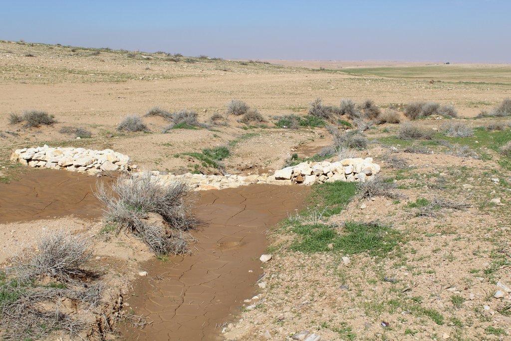
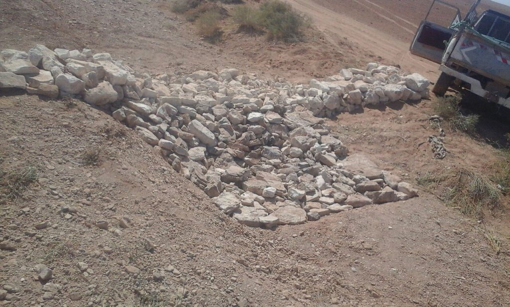
Characteristics: Multiple gully plugs positioned sequentially within a gully system interrupt concentrated surface runoff and reduce its erosive power. The plugs are each made of multiple cobbles/stones mostly ranging between 10 and 30 cm diameter and constructed to ensure a stable structure. The plugs started at the head of the gully (upstream) and ranges from 1.5 - 3.7 m in width with an average of 2.5 m. For heavily eroded and very unstable sections, gabions can be used also. The structures are around 1.0 to 1.5-m high, anchored into the sidewalls, and around 0.20 to 0.35 m deep into the gully bed, built up to around 1/3 to max. 1/2 of the gully depth - ensuring the concentrated flow stays within the channel and does not overflow the side banks. The top of the plug is U-shaped, with the sides built higher than the centre. Upslope, the plugs are packed with soil to trap sediments (stopping it flowing through the structure), and downslope the plugs have an apron to dissipate the energy of overflowing water, into a micro stilling basin. The downslope side of the gully plug is sloped rather than vertical. The large stones add roughness to the slope, creating a rough spillway that dissipates erosive energy. In the direction of gully flow, several gully plugs are placed such that the upper gully apron is set at approximately the height of the following downstream gully crest.
Environment: The technology is used in a watershed close to Al Majeddyeh village, located in the Middle Badia zone, approximately 30 km south-east of Amman. The climate is arid and warm (Palmer, 2013). The average annual rainfall is around 130 mm. The natural environment is labelled as steppe, “BSh” in the köppen classification. The human environment is characterized by agropastoralists. They are semi-nomadic and live in villages around the watershed, for example, Al Majeddyeh village.
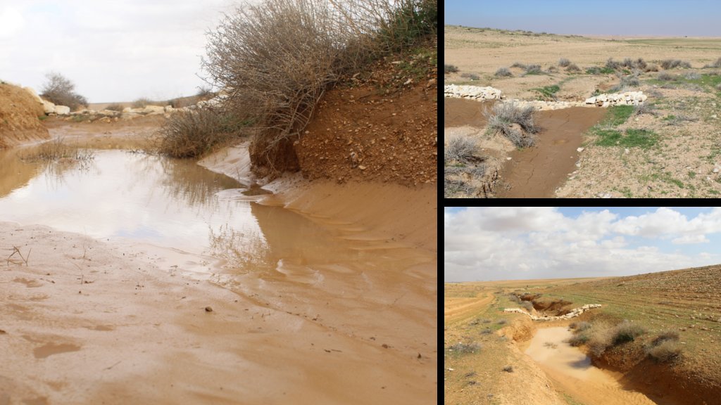
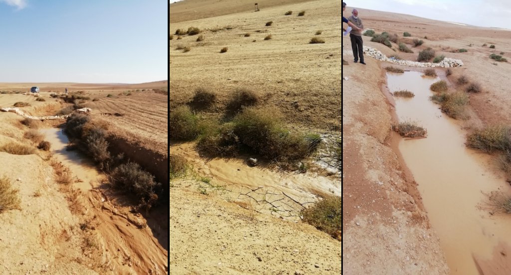
Purpose: The measure interrupts the concentrated flow, reduces velocity, and dissipates energy. Multiple structures along the gully decrease the erosive power of runoff, retaining a fraction of the runoff, inducing sedimentation (upstream of the plug), thus protecting the gully bed from further deep-scouring, and strengthening the gully side banks, especially when this is linked with re-vegetation. Over time, the establishing vegetation (roots and surface cover) stabilizes the soil and protects it from concentrated flow erosion. To be effective, gully plug emplacement requires SLM in upland areas. These measures then jointly mitigate peak runoff generation and accordingly reduce downstream flooding.
Major activities: Upland SLM is essential. In the specific watershed rehabilitation context, upland SLM was achieved through micro water harvesting and re-vegetation through native shrubs (the “VALLERANI” method). Gully morphology assessment is required for gully plug design, and positioning and earthwork excavation is necessary for foundation preparation in the gully bed and wall anchors. Proper layering of various size stones and shaping of gully plugs is necessary as is the addition of a packed soil pack upstream of the stone structure, to semi-seal the surface and to pond water. Then gully walls are revegetated through native seedlings: these benefit from the water ponding upstream prior to sedimentation upstream of the gully and enhanced soil water storage in the sediments once the gully is filled.
Benefits: Stops ongoing land degradation and gully deepening, and achieves a certain degree of rehabilitation; retains a fraction of runoff water and sediments in the watershed – water mainly infiltrates and provides moisture to the gully vegetation; gully vegetation serves various purposes including livestock fodder, reduction of flow velocities in the gully, and retention of further sediment.
Land user's opinion: Land users benefit from the vegetation (e.g. fruit trees can potentially be out-planted), as well as ponded water for livestock; however, the technology is labor-intensive, and therefore costly, and landowners (at the local target site) require incentives to carry out the work.
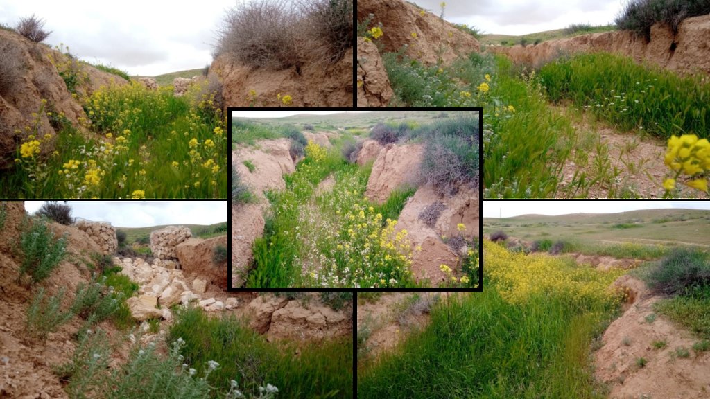
2.3 រូបភាពនៃបច្ចេកទេស
2.5 ប្រទេស/តំបន់/ទីតាំងកន្លែង ដែលបច្ចេកទេសត្រូវបានអនុវត្ត និងបានគ្រប់ដណ្តប់ដោយការវាយតម្លៃនេះ
ប្រទេស:
ប្រទេសហ្ស៊កដានី
តំបន់/រដ្ឋ/ខេត្ត:
Amman governorate/Al Jizza/Al Majeddyeh village
បញ្ជាក់ពីការសាយភាយនៃបច្ចេកទេស:
- អនុវត្តនៅកន្លែងជាក់លាក់មួយ/ ប្រមូលផ្តុំនៅតំបន់តូចៗ
តើបច្ចេកទេស (មួយ ឬច្រើន) ទាំងនោះស្ថិតនៅក្នុងតំបន់ការពារជាអចិន្ត្រៃយ៍ណាមួយដែរឬទេ?
ទេ
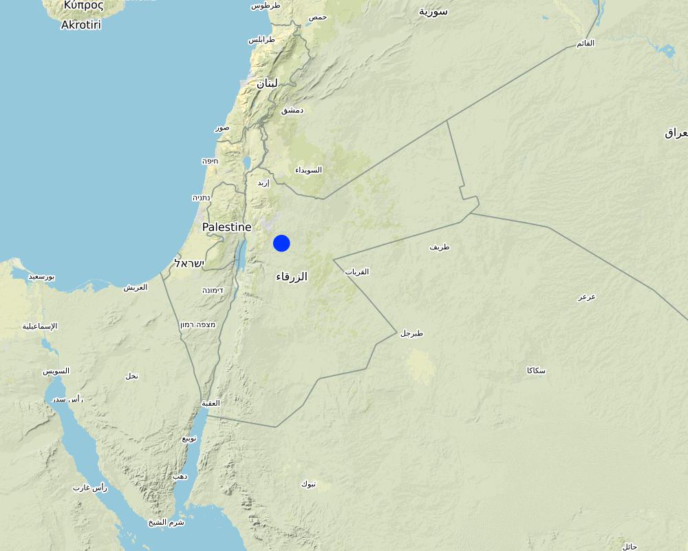
Map
×2.6 កាលបរិច្ឆេទនៃការអនុវត្ត
បង្ហាញឆ្នាំនៃការចុះអនុវត្ត:
2017
2.7 ការណែនាំពីបច្ចេកទេស
សូមបញ្ជាក់តើបច្ចេកទេសត្រូវបានណែនាំឱ្យអនុវត្តដោយរបៀបណា:
- ពេលកំពុងពិសោធន៍
- តាមរយៈគម្រោង / អន្តរាគមន៍ពីខាងក្រៅ
3. ចំណាត់ថ្នាក់នៃបច្ចេកទេស SLM
3.1 គោលបំណងចម្បង (១ ឬច្រើន) នៃបច្ចេកទេសនេះ
- កាត់បន្ថយ, បង្ការ, ស្តារឡើងវិញនូវការធ្លាក់ចុះគុណភាពដី
- អភិរក្ស/ធ្វើឱ្យប្រសើរឡើងជីវចម្រុះ
- កាត់បន្ថយហានិភ័យនៃគ្រោះមហន្តរាយ
3.2 ប្រភេទដីប្រើប្រាស់មួយប្រភេទ (ច្រើនប្រភេទ) ដែលបានអនុវត្តបច្ចេកទេស
ដីប្រើប្រាស់ចម្រុះនៅលើដីតែមួយ:
បាទ/ចា៎
បញ្ជាក់ពីប្រភេទដីច្រើនប្រភេទ (ដីដាំដំណាំ/ដីចិញ្ចឹមសត្វ/ដីព្រៃឈើ):
- Agro-pastoralism ( រួមបញ្ចូលទាំងដំណាំ និងចិញ្ចឹមសត្វ)

ដីសម្រាប់ចិញ្ចឹមសត្វ
វាលស្មៅធំៗ:
- ពាក់កណ្តាលពនេចរ

ផ្លូវទឹក ផ្ទៃទឹក ដីសើម
- ខ្សែទឹក ផ្លូវទឹក
ផលិតផល/សេវាកម្មចម្បង:
To convey and drain: Wd
3.3 បន្ទាប់ពីអនុវត្តបច្ចេកទេស តើដីប្រើប្រាស់មានការប្រែប្រួលដែររឺទេ?
បន្ទាប់ពីអនុវត្តបច្ចេកទេស តើដីប្រើប្រាស់មានការប្រែប្រួលដែររឺទេ?
- បាទ/ច៎ា (សូមបំពេញសំណួរខាងក្រោមពីស្ថានភាពដីប្រើប្រាស់មុនពេលអនុវត្តបច្ចេកទេស)
ដីប្រើប្រាស់ចម្រុះនៅលើដីតែមួយ:
ទេ

ដីសម្រាប់ចិញ្ចឹមសត្វ
វាលស្មៅធំៗ:
- ពនេចរ
- ពាក់កណ្តាលពនេចរ
ប្រភេទសត្វ:
- សត្វពពែ
- សត្វចៀម
តើជាការអនុវត្តការគ្រប់គ្រងដែលរួមបញ្ចូលការដាំដំណាំ និងចិញ្ចឹមសត្វដែរឬទេ?
ទេ
ផលិតផល និងសេវាកម្ម:
- សាច់
3.4 ការផ្គត់ផ្គង់ទឹក
ការផ្គត់ផ្គង់ទឹកនៅកន្លែងអនុវត្តបច្ចេកទេស:
- ទឹកភ្លៀង
មតិយោបល់:
The measure mitigates the effect of surface runoff in concentrated flow areas - as a consequence of heavy rainfall events
3.5 ក្រុម SLM ដែលបច្ចេកទេសស្ថិតនៅក្នុង
- ធ្វើឱ្យប្រសើរឡើងគម្របដី/ ដំណាំគម្របដី
- កាត់បន្ថយការរំខានដល់ដី
- វិធានការអនុវត្តកាត់ទទឹងទីជម្រាល
- water harvesting; surface water management (spring, river, lakes, sea, riparian zone, riverbanks, seashore, lakeshore, spring shed); ecosystem-based disaster risk reduction
3.6 វិធានការ SLM ដែលបញ្ចូលនូវបច្ចេកទេស

វិធានការរុក្ខជាតិ
- V2: ស្មៅនិងរុក្ខជាតិៗដែលដុះមានអាយុមិនលើសពី 2ឆ្នាំ

វិធានការរចនាស័ម្ពន្ធ
- S6: ជញ្ជាំង, របាំង, របងឈើខ្ពស់ៗ

វិធានការផ្សេងៗ
សូមបញ្ជាក់:
Specify tillage system: no tillage
Specify residue management: grazed and retained
3.7 កំណត់ប្រភេទនៃការធ្លាក់ចុះគុណភាពដីសំខាន់ៗដែលបច្ចេកទេសនេះបានដោះស្រាយ

ការហូរច្រោះដីដោយសារទឹក
- Wg: ការកកើតឡើងនូវកំទេចកំទីដីស្រទាប់ក្រោម
- Wo: ផលប៉ះពាល់នៃការធ្លាក់ចុះគុណភាពកន្លែងឆ្ងាយ

ការបាត់បង់រូបសាស្ត្រនៃដី
- Pk: ការបិទរន្ធដី
- Pu: បាត់បង់នូវផលិតភាពជីវៈដោយសារសកម្មភាពផ្សេងៗ

ការបាត់បង់ទឹក
- Hs: ការប្រែប្រួលបរិមាណទឹកនៅលើផ្ទៃដី
- Hw៖ ការថយចុះសមត្ថភាព buffering របស់តំបន់ដីសើមដែលដោះស្រាយជាមួយនឹងទឹកជំនន់ និងការបំពុល
3.8 ការពារ កាត់បន្ថយ ឬស្តារឡើងវិញនៃការធ្លាក់ចុះគុណភាពដី
បញ្ជាក់ពីគោលដៅរបស់បច្ចេកទេស ដែលផ្តោតទៅការធ្លាក់ចុះគុណភាពដី:
- ការកាត់បន្ថយការធ្លាក់ចុះគុណភាពដី
- ការជួសជុល/ ស្តារឡើងវិញនៃឱនភាពដីធ្ងន់ធ្ងរ
4. បច្ចេកទេសជាក់លាក់ សកម្មភាពអនុវត្ត ធាតុចូល និងថ្លៃដើម
4.1 គំនូសបច្ចេកទេសនៃបច្ចេកទេសនេះ
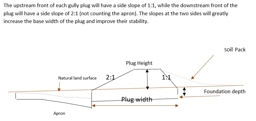
លក្ខណៈពិសេសនៃបច្ចេកទេស (ទាក់ទងនឺងគំនូរបច្ចេកទេស):
Emplacement in gully morphological system and watershed context: Determine the downstream starting point for the gully plugs and then extend upstream. The basic design is to keep the structure height maximum half the gully depth regardless of structure type. The spacing between structures is set as a gully depth function, structure crest height above the gully bed, and slope of the gully bed between structures. Additionally, the structure's final location will be shifted either upstream or downstream of the calculated gully bed level to place the structure in a more stable point if required. Following this methodology ensures variable spacing between structures to cope with both slope and depth of gully to ensure the sediment filling in between these structures occurs. In the case of distinct gully morphology and side banks that are very unstable, gabion structures can also be used/instead of a single stone pack.
Design of the Structure: Gully plugs must be anchored strong enough to resist water flow and prevent bypass from the side banks. A foundation is also required for all structures, depending on their dimensions and the bed's nature. At the specific site, the foundation depth for the planned structures ranges between 0.2 to 0.35 meters. The anchoring of gully plugs ranges between 1 and 1.5 meters. This depends on the existing condition of the banks at each structure location. Gully plugs have a downstream apron with a length of around 3 to 4 times the height of structures. The apron starts from below the bottom level of the foundation and gradually level halfway down. All gully plugs were designed to have a height maximum of 0.5 the depth of the gully. So each structure will pass water flow downward but keeping it inside the gully. Gabion structures have a sort of spillway from the top but at the same time protecting the banks. The configuration slightly differs from the normal stone structure, but the idea is to protect the sides and a spillway in the middle. The upstream front of each gully plug has a side slope of 1:1, while the downstream front of the plug has a side slope of 2:1 (not counting the apron). The slopes at the two sides greatly increase the base width of the plug and improve their stability. The gully plugs are provided with an amount of soil resulting from the foundation to form a triangle of soil fill against the structure at the upstream side; this improves the function of the gully plugin holding more water and trapping sediments. On the other side of each structure, the downstream side's slope is meant to tackle the overflow of water along the drop to safely return to the gully bed level without causing additional erosion. The rock-filled apron catches the flow and acts to dissipate erosive energy.
ឈ្មោះអ្នកនិពន្ធ:
Steve Evett
កាលបរិច្ឆេទ:
15/08/2017
4.2 ព័ត៌មានទូទៅដែលពាក់ព័ន្ធនឹងការគណនាធាតុចូល និងថ្លៃដើម
កំណត់របៀបនៃការគណនាថ្លៃដើម និងធាតុចូល:
- ក្នុងឯកតាបច្ចេកទេស
បញ្ជាក់ឯកតា:
Gully plug
កំណត់រូបិយប័ណ្ណសម្រាប់ថ្លៃដើម:
- ដុល្លារ
4.3 សកម្មភាពបង្កើត
| សកម្មភាព | រយៈពេល (រដូវកាល) | |
|---|---|---|
| 1. | Implement upland watershed SLM (reference VALLERANI) | |
| 2. | Gully system/morphological assessment | |
| 3. | Determine plug design and implementation in the watershed | |
| 4. | Excavation earthworks for anchors and foundation | At least 2 months prior rainy season onset |
| 5. | Stone made construction of gully plugs (occasionally with gabions) | At least 1 month prior rainy season onset |
| 6. | Soil pack at upstream front | At least 1 month prior rainy season onset |
| 7. | Revegetation of gully side banks | At the onset of the rainy season |
មតិយោបល់:
Gully plugs require proper SLM in the uplands. Revegetation of gully side banks is optional – depending on the recovery potential of the area.
4.4 ថ្លៃដើម និងធាតុចូលដែលត្រូវការសម្រាប់ការបង្កើតបច្ចេកទេស
| បញ្ជាក់ពីធាតុចូល | ឯកតា | បរិមាណ | ថ្លៃដើមក្នុងមួយឯកតា | ថ្លៃធាតុចូលសរុប | % នៃថ្លៃដើមដែលចំណាយដោយអ្នកប្រើប្រាស់ដី | |
|---|---|---|---|---|---|---|
| កម្លាំងពលកម្ម | Field technician (design and oversight) | Labour Day (LD) per structure | 0,2 | 50,0 | 10,0 | |
| កម្លាំងពលកម្ម | Workers (excavation/earthworks) | LD | 4,0 | 35,0 | 140,0 | |
| កម្លាំងពលកម្ម | Workers (stone layering/construction) | LD | 4,0 | 35,0 | 140,0 | |
| កម្លាំងពលកម្ម | Worker (out-planting of seedlings) | LD | 1,0 | 35,0 | 35,0 | |
| សម្ភារៈ | Shovel, Pickaxe, buckets, ruler | Lump sum | 1,0 | 10,0 | 10,0 | |
| សម្ភារៈដាំដុះ | Seedlings | per item | 10,0 | 0,5 | 5,0 | |
| សម្ភារៈសាងសង់ | Stones | m3 | 4,0 | 10,0 | 40,0 | |
| ផ្សេងៗ | Logistics (seedling transport, local stone transport) | lump sum | 1,0 | 10,0 | 10,0 | |
| ថ្លៃដើមសរុបក្នុងការបង្កើតបច្ចេកទេស | 390,0 | |||||
| ថ្លៃដើមសរុបក្នុងការបង្កើតបច្ចេកទេសគិតជាដុល្លារ | 390,0 | |||||
ប្រសិនបើអ្នកប្រើប្រាស់ដីមិនមានថ្លៃដើម 100% សូមបញ្ជាក់ថានរណាដែលចំណាយថ្លៃដើមដែលនៅសល់:
International research for the development project.
មតិយោបល់:
Design is tailored for implementation through local workers (rural agro-pastoral community) and local materials. The engagement of local community workers as part of the specific project; if a professional contractor is hired costs can be significantly reduced.
4.5 សកម្មភាពថែទាំ
| សកម្មភាព | ពេលវេលា/ ភាពញឹកញាប់ | |
|---|---|---|
| 1. | Inspect damage/status | After severe storms and runoff events |
| 2. | Maintain/repair/improve | After inspection |
មតិយោបល់:
If optimally designed and connected with proper upland SLM the gully plug technology would not require maintenance; the measure induces nature-based (vegetation) protection of vulnerable gully zones over time.
4.6 កំណត់ថ្លៃដើមសម្រាប់ការថែទាំ/ សកម្មភាពរបស់បច្ចេកទេស (ក្នុងរយៈពេលមួយឆ្នាំ)
| បញ្ជាក់ពីធាតុចូល | ឯកតា | បរិមាណ | ថ្លៃដើមក្នុងមួយឯកតា | ថ្លៃធាតុចូលសរុប | % នៃថ្លៃដើមដែលចំណាយដោយអ្នកប្រើប្រាស់ដី | |
|---|---|---|---|---|---|---|
| កម្លាំងពលកម្ម | Expert (investigation) | LD | 0,1 | 50,0 | 5,0 | |
| កម្លាំងពលកម្ម | LD | 0,5 | 35,0 | 17,5 | ||
| កម្លាំងពលកម្ម | LD | 1,0 | 35,0 | 35,0 | ||
| សម្ភារៈសាងសង់ | stones | m3 | 0,5 | 10,0 | 5,0 | |
| ថ្លៃដើមសរុបសម្រាប់ការថែទាំដំណាំតាមបច្ចេកទេស | 62,5 | |||||
| ថ្លៃដើមសរុបសម្រាប់ការថែទាំដំណាំតាមបច្ចេកទេសគិតជាដុល្លារ | 62,5 | |||||
ប្រសិនបើអ្នកប្រើប្រាស់ដីមិនមានថ្លៃដើម 100% សូមបញ្ជាក់ថានរណាដែលចំណាយថ្លៃដើមដែលនៅសល់:
It is 100% covered by the research project
មតិយោបល់:
Maintenance might be needed in case of improper implementation and/or extreme event occurrence. Maintenance should be minimal - mostly after initial 1-2 rainy seasons. Thereafter, revegetated and rehabilitated gully system – and most importantly, the rehabilitated uplands - would take on hydrological buffering functions and withstand the erosive force of surface runoff.
4.7 កត្តាសំខាន់បំផុតដែលមានឥទ្ធិពលដល់ការចំណាយ
ពណ៌នាពីកត្តាប៉ះពាល់ចម្បងៗទៅលើថ្លៃដើម:
The most distinct cost factor is labor – which is especially significant when using local (community) labor; some technical training is required.
5. លក្ខណៈបរិស្ថានធម្មជាតិ និងមនុស្ស
5.1 អាកាសធាតុ
បរិមាណទឹកភ្លៀងប្រចាំឆ្នាំ
- < 250 មម
- 251-500 មម
- 501-750 មម
- 751-1,000 មម
- 1,001-1,500 មម
- 1,501-2,000 មម
- 2,001-3,000 មម
- 3,001-4,000 មម
- > 4,000 មម
កំណត់បរិមាណទឹកភ្លៀង (បើដឹង) ជា មីលីម៉ែត្រ:
130,00
លក្ខណៈពិសេស/ មតិយោបល់លើរដូវភ្លៀង:
Jordan has a rainy season from September to May – but locally, the effective rainy season sets on later (November or December) and lasts until April.
បញ្ជាក់ឈ្មោះឯកសារយោងនៃស្ថានីយឧតុនិយម:
Queen Alia international airport reference station reports long term average annual rainfall of about 150 mm A rainfall tipping bucket installed in the site in 2016.
តំបន់កសិអាកាសធាតុ
- ស្ងួត
5.2 សណ្ឋានដី
ជម្រាលជាមធ្យម:
- រាបស្មើ (0-2%)
- ជម្រាលតិចតួច (3-5%)
- មធ្យម (6-10%)
- ជម្រាលខ្ពស់បន្តិច (11-15%)
- ទីទួល (16-30%)
- ទីទួលចោត (31-60%)
- ទីទួលចោតខ្លាំង (>60%)
ទម្រង់ដី:
- ខ្ពង់រាប
- កំពូលភ្នំ
- ជម្រាលភ្នំ
- ជម្រាលទួល
- ជម្រាលជើងភ្នំ
- បាតជ្រលងភ្នំ
តំបន់តាមរយៈកម្ពស់ :
- 0-100 ម
- 101-500 ម
- 501-1,000 ម
- 1,001-1,500 ម
- 1,501-2,000 ម
- 2,001-2,500 ម
- 2,501-3,000 ម
- 3,001-4,000 ម
- > 4,000 ម
បញ្ជាក់ថាតើបច្ចេកទេសនេះត្រូវបានអនុវត្តន៍នៅក្នុង:
- សណ្ឋានដីផត
មតិយោបល់ និងបញ្ចាក់បន្ថែមអំពីសណ្ឋានដី :
Gully slope is 3.4% on average.
5.3 ដី
ជម្រៅដីជាមធ្យម:
- រាក់ខ្លាំង (0-20 សម)
- រាក់ (21-50 សម)
- មធ្យម (51-80 សម)
- ជ្រៅ (81-120 សម)
- ជ្រៅខ្លាំង (> 120 សម)
វាយនភាពដី (ស្រទាប់លើ):
- មធ្យម (ល្បាយ, ល្បាប់)
- ម៉ត់/ ធ្ងន់ (ឥដ្ឋ)
វាយនភាពដី (> 20 សម ស្រទាប់ក្នុង):
- មធ្យម (ល្បាយ, ល្បាប់)
- ម៉ត់/ ធ្ងន់ (ឥដ្ឋ)
សារធាតុសរីរាង្គនៅស្រទាប់ដីខាងលើ:
- ទាប (<1%)
បើអាចសូមភ្ជាប់ការពណ៌នាពីដីឱ្យបានច្បាស់ ឬព័ត៌មានដែលអាចទទួលបាន ឧ. ប្រភេទដី, pH ដី/ ជាតិអាស៊ីត, សមត្ថភាពផ្លាស់ប្តូរកាចុង, វត្តមាននីត្រូសែន, ភាពប្រៃ ។ល។:
Soil depth is varying throughout the gully areas. At some points (mostly upstream) the gully bed reaches the bedrock
5.4 ទឹកដែលអាចទាញមកប្រើប្រាស់បាន និងគុណភាពទឹក
នីវ៉ូទឹកក្រោមដី:
> 50 ម
ទឹកលើដីដែលអាចទាញយកប្រើប្រាស់បាន:
កម្រិតមធ្យម
គុណភាពទឹក (មិនបានធ្វើប្រត្តិកម្ម):
ទឹកសម្រាប់តែការធ្វើកសិកម្ម (ស្រោចស្រព)
គុណភាពទឹក គឺផ្តោតទៅលើ៖:
ទឹកលើផ្ទៃដី
តើមានបញ្ហាភាពទឹកប្រៃហូរចូលមកដែរឬទេ?
ទេ
តើទឹកជំនន់កំពុងកើតមាននៅតំបន់នេះដែររឺទេ?
បាទ/ចា៎
ភាពទៀងទាត់:
ញឹកញាប់
5.5 ជីវៈចម្រុះ
ភាពសម្បូរបែបនៃប្រភេទ:
- ខ្ពស់
ភាពសម្បូរបែបនៃទីជម្រក:
- កម្រិតមធ្យម
មតិយោបល់ និងលក្ខណៈពិសេសផ្សេងទៀតលើជីវចម្រុះ:
Gully plugs with out-planted vegetation create micro-climates; after recruitment and emergence of seed material, biodiversity increases.
5.6 លក្ខណៈនៃអ្នកប្រើប្រាស់ដីដែលអនុវត្តបច្ចេកទេស
នៅមួយកន្លែង ឬពនេចរ :
- នៅមួយកន្លែង
- ពាក់កណ្តាលពនេចរ
ចំណូលក្រៅកសិកម្ម:
- តិចជាង 10% នៃចំណូល
កម្រិតជីវភាព:
- មិនល្អខ្លាំង
- មិនល្អ
ឯកជន ឬក្រុម:
- ធ្វើខ្លួនឯង/ គ្រួសារ
- ជាក្រុម/ សហគមន៍
កម្រិតប្រើប្រាស់គ្រឿងយន្ត:
- ប្រើកម្លាំងពលកម្ម
យេនឌ័រ:
- បុរស
អាយុរបស់អ្នកប្រើប្រាស់ដី:
- យុវវ័យ
- វ័យកណ្តាល
5.7 ទំហំផ្ទៃដីជាមធ្យមនៃដីប្រើប្រាស់ដោយអ្នកប្រើប្រាស់ដី ក្នុងការអនុវត្តបច្ចេកទេស
- < 0.5 ហិកតា
- 0.5-1 ហិកតា
- 1-2 ហិកតា
- 2-5 ហិកតា
- 5-15 ហិកតា
- 15-50 ហិកតា
- 50-100 ហិកតា
- 100-500 ហិកតា
- 500-1,000 ហិកតា
- 1,000-10,000 ហិកតា
- > 10,000 ហិកតា
តើផ្ទៃដីនេះចាត់ទុកជាទំហំកម្រិតណាដែរ ខ្នាតតូច មធ្យម ឬខ្នាតធំ (ធៀបនឹងបរិបទតំបន់)?
- ខ្នាតធំ
មតិយោបល់:
The entire watershed area affected by gully plugs is 160 hectares.
The total constructed plugs are 55.
5.8 ភាពជាម្ចាស់ដី កម្មសិទ្ធប្រើប្រាស់ដី និងកម្មសិទ្ធប្រើប្រាស់ទឹក
ភាពជាម្ចាស់ដី:
- ឯកជន មានកម្មសិទ្ធ
កម្មសិទ្ធិប្រើប្រាស់ដី:
- ឯកជន
តើកម្មសិទ្ធប្រើប្រាស់ដី គឺផ្អែកលើប្រព័ន្ធច្បាប់បែបបុរាណ?
បាទ/ចា៎
5.9 ការប្រើប្រាស់សេវាកម្ម និងហេដ្ឋារចនាសម្ព័ន្ធ
សុខភាព:
- មិនល្អ
- មធ្យម
- ល្អ
ការអប់រំ:
- មិនល្អ
- មធ្យម
- ល្អ
ជំនួយបច្ចេកទេស:
- មិនល្អ
- មធ្យម
- ល្អ
ការងារ (ឧ. ការងារក្រៅកសិដ្ឋាន):
- មិនល្អ
- មធ្យម
- ល្អ
ទីផ្សារ:
- មិនល្អ
- មធ្យម
- ល្អ
ថាមពល:
- មិនល្អ
- មធ្យម
- ល្អ
ផ្លូវ និងការដឹកជញ្ជូន:
- មិនល្អ
- មធ្យម
- ល្អ
ទឹកផឹក និងអនាម័យ:
- មិនល្អ
- មធ្យម
- ល្អ
សេវាកម្មហិរញ្ញវត្ថុ:
- មិនល្អ
- មធ្យម
- ល្អ
6. ផលប៉ះពាល់ និងការសន្និដ្ឋាន
6.1 ផលប៉ះពាល់ក្នុងបរិវេណអនុវត្តបច្ចេកទេសដែលកើតមាន
ផលប៉ះពាល់លើសេដ្ឋកិច្ចសង្គម
ផលិតផល
ផលិតកម្មចំណីសត្វ
គុណភាពចំណីសត្វ
ទឹកដែលអាចទាញមកប្រើប្រាស់បាន និងគុណភាពទឹក
ទឹកដែលអាចប្រើប្រាស់បានសម្រាប់ការចិញ្ចឹមសត្វ
ផលប៉ះពាល់ទៅលើវប្បធម៌សង្គម
សន្តិសុខស្បៀង/ ភាពគ្រប់គ្រាន់ខ្លួនឯង
មតិយោបល់/ ការបញ្ជាក់:
Some herbs (and fruits (trees) in the future)
ឱកាសនៃការបង្កើតថ្មី
មតិយោបល់/ ការបញ្ជាក់:
enhanced biodiversity, shade and shelter
ចំណេះដឹង SLM / ការធ្លាក់ចុះគុណភាពដី
មតិយោបល់/ ការបញ្ជាក់:
Through training/community participation
ផលប៉ះពាល់ទៅលើអេកូឡូស៊ី
វដ្តទឹក/លំហូរ
គុណភាពទឹក
មតិយោបល់/ ការបញ្ជាក់:
Certain degree purification through infiltration in the sediment accumulation zone
ការប្រមូលស្តុកទុកទឹក
លំហូរទឹកលើផ្ទៃដី
មតិយោបល់/ ការបញ្ជាក់:
Effect on hydrology (distinctness of runoff peak)
នីវ៉ូទឹកក្រោមដី/ ដង្ហើមទឹក
មតិយោបល់/ ការបញ្ជាក់:
Certain deep-infiltration
រំហួត
មតិយោបល់/ ការបញ្ជាក់:
more open water ponding – but also deep-infiltration and beneficial use for vegetation (transpiration)
ដី
សំណើមដី
គម្របដី
ការបាត់បង់ដី
មតិយោបល់/ ការបញ្ជាក់:
Side banks stabilized
ការកើនឡើងដី
មតិយោបល់/ ការបញ្ជាក់:
sediments trapped
ដីប្រេះ
មតិយោបល់/ ការបញ្ជាក់:
sediment crust increased in the ponding area – but better soil structure at the side banks (revegetation) – overall positive impact.
ជីវចម្រុះ៖ ដំណាំ, សត្វ
ដំណាំគម្រប
ជីវម៉ាស/ កាបូនលើដី
ភាពសម្បូរបែបនៃរុក្ខជាតិ
ភាពសម្បូរបែបនៃសត្វ
ប្រភេទសត្វមានប្រយោជន៍
ការកាត់បន្ថយហានិភ័យនៃគ្រោះមហន្តរាយ និងគ្រោះអាកាសធាតុ
ផលប៉ះពាល់នៃទឹកជំនន់
ដីបាក់/ លំហូរកំទិចកំទី
មតិយោបល់/ ការបញ្ជាក់:
Through side bank stabilization.
អាកាសធាតុ
6.2 ផលប៉ះពាល់ក្រៅបរិវេណអនុវត្តបច្ចេកទេសដែលកើតមាន
ទឹកជំនន់ខ្សែទឹកខាងក្រោម
កំណកល្បាប់ខ្សែទឹកខាងក្រោម
មតិយោបល់/ ការបញ្ជាក់:
especially when combined with upland measure: reference VALLERANI
ខូចខាតដល់ស្រែអ្នកជិតខាង
មតិយោបល់/ ការបញ្ជាក់:
Less tributary channel development (connectivity of upland areas); less downstream siltation
ខូចខាតដល់ហេដ្ឋារចនាសម្ព័ន្ធសាធារណៈ/ឯកជន
មតិយោបល់/ ការបញ្ជាក់:
less runoff peakiness and siltation
6.3 ភាពប្រឈម និងភាពរួសនៃបច្ចេកទេសទៅនឹងការប្រែប្រួលអាកាសធាតុ និងគ្រោះអាកាសធាតុ/ គ្រោះមហន្តរាយ (ដែលដឹងដោយអ្នកប្រើប្រាស់ដី)
ការប្រែប្រួលអាកាសធាតុ
ការប្រែប្រួលអាកាសធាតុ
| រដូវកាល | កើនឡើង ឬថយចុះ | លក្ខណៈឆ្លើយតបនៃបច្ចេកទេសទៅនឹងការប្រែប្រួលអាកាសធាតុ | |
|---|---|---|---|
| សីតុណ្ហភាពប្រចាំឆ្នាំ | កើនឡើង | មធ្យម | |
| បរិមាណទឹកភ្លៀងប្រចាំឆ្នាំ | ថយចុះ | ល្អ |
គ្រោះអាកាសធាតុ (មហន្តរាយ)
គ្រោះមហន្តរាយធម្មជាតិ
| លក្ខណៈឆ្លើយតបនៃបច្ចេកទេសទៅនឹងការប្រែប្រួលអាកាសធាតុ | |
|---|---|
| ព្យុះភ្លៀងតាមតំបន់ | ល្អ |
គ្រោះមហន្តរាយទឹក
| លក្ខណៈឆ្លើយតបនៃបច្ចេកទេសទៅនឹងការប្រែប្រួលអាកាសធាតុ | |
|---|---|
| ទឹកជំនន់ដោយទឹកភ្លៀង | ល្អណាស់ |
គ្រោះមហន្តរាយជីវៈសាស្ត្រ
| លក្ខណៈឆ្លើយតបនៃបច្ចេកទេសទៅនឹងការប្រែប្រួលអាកាសធាតុ | |
|---|---|
| ការរាតត្បាតនៃជំងឺ | ល្អ |
ផលវិបាកដែលទាក់ទងនឹងបរិយាកាសផ្សេងៗទៀត
ផលវិបាកដែលទាក់ទងនឹងបរិយាកាសផ្សេងៗទៀត
| លក្ខណៈឆ្លើយតបនៃបច្ចេកទេសទៅនឹងការប្រែប្រួលអាកាសធាតុ | |
|---|---|
| អូសបន្លាយពេលដាំដុះ | ល្អណាស់ |
6.4 ការវិភាគថ្លៃដើម និងអត្ថប្រយោជន៍
តើផលចំណេញ និងថ្លៃដើមត្រូវបានប្រៀបធៀបគ្នាយ៉ាងដូចម្តេច (ទស្សនៈរបស់អ្នកប្រើប្រាស់ដី)?
រយៈពេលខ្លី:
អវិជ្ជមាន
រយៈពេលវែង:
វិជ្ជមាន
តើផលចំណេញ និងការថែទាំ/ ជួសជុលត្រូវបានប្រៀបធៀបគ្នាយ៉ាងដូចម្តេច (ទស្សនៈរបស់អ្នកប្រើប្រាស់ដី)?
រយៈពេលខ្លី:
អវិជ្ជមាន
រយៈពេលវែង:
វិជ្ជមានតិចតួច
មតិយោបល់:
During the initial stage potential benefits through vegetation do not materialize; main effects are on water and sediment retention. Long-term, the technology fosters the rehabilitation nature-based retention functions (very limited long-term maintenance required).
6.5 ការទទួលយកបច្ចេកទេស
- តែមួយករណី /ពិសោធន៍
បើអាច សូមបញ្ជាក់ពីបរិមាណ (ចំនួនគ្រួសារ និង/ ឬតំបន់គ្របដណ្តប់):
1
ក្នុងចំណោមគ្រួសារទាំងអស់ដែលបានអនុវត្តបច្ចេកទេស តើមានប៉ុន្មានគ្រួសារដែលចង់ធ្វើដោយខ្លួនឯង ដោយមិនទទួលបានសម្ភារៈលើកទឹកចិត្ត/ប្រាក់ឧបត្ថម្ភ?:
- 0-10%
6.6 ការបន្សុំា
តើថ្មីៗនេះ បច្ចេកទេសនេះត្រូវបានកែតម្រូវដើម្បីបន្ស៊ាំទៅនឹងស្ថានភាពប្រែប្រួលដែរឬទេ?
ទេ
6.7 ភាពខ្លាំង/ គុណសម្បត្តិ/ ឱកាសនៃបច្ចេកទេស
| ភាពខ្លាំង/ គុណសម្បត្តិ/ ឱកាសនៅកន្លែងរបស់អ្នកប្រើប្រាស់ដី |
|---|
| Gully side bank vegetation useable as (livestock) fodder source; some herbs (later fruit tree benefits) for human consumption. |
| Gully is stable and does not expand e.g. tributaries. Uplands remain connected and productive. |
| Ponded water for livestock watering (during the rainy season). |
| Shelter and shade through vegetation. |
| ភាពខ្លាំង/ គុណសម្បត្តិ/ ឱកាស ទស្សនៈរបស់បុគ្គលសំខាន់ៗ |
|---|
| Sediments from the uplands are trapped; relatively fertile soil remains in the watershed. |
| Increased local soil moisture and consequential vegetation quantity and bio-diversity enhancement; increase carbon storage and other ecosystem services such as pollination. |
| Smoothened watershed hydrology is beneficial for downstream agriculture – especially when applied in a watershed context with downstream flood irrigation (MARAB) |
| Protection of downstream infrastructure (flooding and sediments). |
6.8 ភាពខ្សោយ/ គុណវិបត្តិ/ ហានិភ័យនៃបច្ចេកទេស និងវិធីសាស្ត្រដោះស្រាយ
| ភាពខ្សោយ/ គុណវិបត្តិ/ ហានិភ័យ ទស្សនៈរបស់អ្នកប្រើប្រាស់ដី | តើបច្ចេកទេសទាំងនោះបានដោះស្រាយបញ្ហាដូចម្តេច? |
|---|---|
| implementation costs | Incentives (e.g. governmental) for communities to implement SLM; regulations and enforcement on environmental management – especially connected with entitlements of natural resources facilitation |
| Tensions between upstream and downstream watershed users (watershed hydrology) – especially affected through wrong design and failure (e.g. gully breakage) | Community-based and holistic watershed management – the share of benefits and commitment for maintenance. |
| Additional fodder supply might attract other foreign herders (overgrazing) | Community-based and holistic watershed management – and protection. |
| Technical skills needed for implementation | Rural communities’ capacity building programs |
| ភាពខ្សោយ/ គុណវិបត្តិ/ ហានិភ័យ ទស្សនៈរបស់អ្នកចងក្រងឬបុគ្គលសំខាន់ៗ | តើបច្ចេកទេសទាំងនោះបានដោះស្រាយបញ្ហាដូចម្តេច? |
|---|---|
| Expert design and implementation support required | Governmental and environmental organizations in control of design and support to local communities (training). |
| Requires upland SLM | Integrated watershed management and empowerment of local communities to manage and facilitate – provision of support (e.g. government and/or international projects). |
| Increased vegetation in a fragile ecosystem can lead to local pressure | Integrated watershed management and empowerment of local communities – especially sustainable grazing plans |
| Risk of wrong lessons learned: large water harvesting in gully systems (dams) created by locals | Capacity development programs; regulations and enforcement on environmental management. |
7. ឯកសារយោង និងវេបសាយ
7.1 វិធីសាស្ត្រ/ ប្រភពនៃព័ត៌មាន
- តាមការចុះទីវាល ការស្រាវជ្រាវនៅទីវាល
The number of field visit is 5.
- ការសម្ភាសន៍ជាមួយអ្នកប្រើប្រាស់ដី
The number of land users that were interviewed is 10.
- ការសម្ភាសន៍ជាមួយអ្នកជំនាញ/ ឯកទេស
The number of SLM experts who were interviewed is 5.
តើពេលណាដែលទិន្នន័យបានចងក្រង (នៅទីវាល)?
09/08/2020
7.2 ឯកសារយោងដែលបានចេញផ្សាយ
ចំណងជើង អ្នកនិពន្ធ ឆ្នាំ ISBN:
Steven, E. (2017). Report on Majiddya Watershed Rehabilitation Project - Gully Plugs Plan /August 2017.
ចំណងជើង អ្នកនិពន្ធ ឆ្នាំ ISBN:
Strohmeier, S. (2017). Dimensioning of Marab in Majidyya.
ចំណងជើង អ្នកនិពន្ធ ឆ្នាំ ISBN:
SEA. 1974. Les ouvrages en gabions – techniques rurales en Afrique. Secretariat d’Etat aux Affaires Etrangeres, Republique Francaise, 20, rue Monsieur, 75007 Paris.
ចំណងជើង អ្នកនិពន្ធ ឆ្នាំ ISBN:
FAO. 1977. Guidelines for watershed management. FAO Conservation Guide 1. Food and Agriculture Organization of the United Nations. Rome, 1977
ការតភ្ជាប់ និងម៉ូឌុល
ពង្រីកមើលទាំងអស់ បង្រួមទាំងអស់ការតភ្ជាប់
គ្មានការតភ្ជាប់
ម៉ូឌុល
គ្មានម៉ូឌុល


