Community Land Use Planning in Arkhiloskalo [Грузия]
- Создание:
- Обновить:
- Составитель: Hanns Kirchmeir
- Редактор: Kety Tsereteli
- Рецензент: Rima Mekdaschi Studer
technologies_5762 - Грузия
Просмотреть разделы
Развернуть все Свернуть все1. Общая информация
1.2 Контактные данные специалистов и организаций, участвующих в описании и оценке Технологии
Специалист по УЗП:
Название проекта, содействовавшего документированию/оценке Технологии (если применимо)
Applying Landscape and Sustainable Land Management (L-SLM) for mitigating land degradation and contributing to poverty reduction in rural area (L-SLM Project)Название организации (-ий), содействовавших документированию/оценке Технологии (если применимо)
Regional Environmental Centre for the Caucasus (REC Caucasus) - Грузия1.3 Условия, регламентирующие использование данных, собранных ВОКАТ
Составитель и ответственный(-ые) специалист(-ы) согласны с условиями, регламентирующими использование собранных ВОКАТ данных:
Да
1.4 Декларация по устойчивости описываемой Технологии
Вызывает ли описанная здесь Технология проблемы деградации земель настолько, что ее нельзя назвать природосберегающей?
Нет
1.5 Ссылка на Анкету (ы) по Подходам УЗП (документируется с использованием ВОКАТ)
Land Degradation Neutrality Transformative Projects and Programmes (LDN-TPP) … [Грузия]
In the framework of the project ‘Generating Economic and Environmental Benefits from Sustainable Land Management for Vulnerable Rural Communities of Georgia’, Land Degradation Neutrality Transformative Projects and Programmes (LDN-TPP) were developed to implement the LDN targets at municipal level. The approach defines the process to break down global and international …
- Составитель: Daniel Zollner
2. Описание Технологии УЗП
2.1 Краткое описание Технологии
Определение Технологии:
Unsustainable land use practices, such as deforestation, overgrazing and improper agricultural management systems are triggering the loss and degradation of valuable land resources in Georgia. Land use planning is one of the measures among others to contribute to support the integration of good Landscape and Sustainable Land Management (L-SLM) principles and practices into national policy and institutional framework to ensure the adoption of economically viable practices by rural communities. This technology is demonstrated in an application in Arkhiloskalo community in Eastern Georgia.
2.2 Подробное описание Технологии
Описание:
The globally ongoing degradation of land resources is threatening our food security and functioning ecosystem services. Therefore, restoration of degraded land as defined by the Sustainable Development Goal (SDG 15.3) has become a strategic objective of the UNCCD. To achieve Land Degradation Neutrality (LDN), action on the national level is needed. Georgia is one of the 113 countries (as of Sept. 2017) willing to take part in the Target Setting Program (TSP).
One of the major problems which Georgia is facing today is an absence of a comprehensive and integrated approach in the land management sector. In addition, an irrelevant legal framework sometimes leads to additional “conflicts” with the evolved national strategy and policy packages.
The land-use planning in the village of Arkhiloskalo, Dedoplistskaro Municipality is one of the pilot activities linked to LDN (Land Degradation Neutrality). The project financed by Global Environment Facility (GEF) / UN Environment Programm (UNEP) was implemented by local partner REC Caucasus (The Regional Environmental Centre for the Caucasus) through E.C.O. Institute of Ecology (Austria).
The land-use plan documents the status quo of the current land use. It is a baseline that can be used to steer and monitor future developments. The land-use plan is based on field assessments made in summer 2019 and builds a baseline for future assessments/monitoring. The land-use plan on the village level helps to break down national LDN targets to the local level. The plan and the development of land-use scenarios help to anticipate the future gains and losses of land resources and reflect the national LDN-target on the local level. Local stakeholders can identify areas of degradation risk and areas which can be rehabilitated. The Arkhiloskalo land-use plan contributes to sustainable land use by recognizing the current situation of land use and its spatial distribution as well as identifying the strength and weaknesses of the current situation.
Methodology:
Mapping for Arkhiloskalo land use plan: The mapping result is a detailed documentation of size and spatial distribution of land cover categories. Change in land cover is an important indicator to monitor the loss and gains of land resources according to the LDN monitoring concept.
For the mapping of the settlements, arable land and gardens, maps from Google Earth and digital cadastre of parcels were used. In the field maps, each polygon has an assigned Map-ID number, which is unique for each village. Polygons with the same land use category and land-use intensity can have the same Map-ID. Next to the drawing of the polygon on the map, in a field form each polygon is described by:
- Map-ID;
- Current Land use category;
- Current Land-use intensity;
- Remark (a specification of the polygon if needed).
Classifications of land use categories: The land-use classification is based on the CLC - Corine Land Classification System (The CORINE Land Cover is a vector map with a scale of 1:10 000, a minimum cartographic unit (MCU) of 100 m². It maps homogeneous landscape patterns). The Corine Land Classification system classifies urban fabric, mine, dump and construction sites, arable land, permanent crops, pastures, forests, shrubs and herbaceous vegetation associations, Open spaces with little or no vegetation, inland wetlands and waters.
The pastureland was differentiated into different productivity classes. In the field three classes of vegetation cover and species composition: low, medium, and high productivity were assessed.
For the mapping in Arkhiloskalo the following land use categories were selected: Settlements and human infrastructure (Code from the Corine Land Classification system – e.g. SHR, name – e.g. Houses); Forests and shrub-land; Agricultural managed land; Natural and semi-natural habitats.
2.3 Фотографии, иллюстрирующие Технологию
Медиа-галерея
2.5 Страна/ регион/ места, где применяется Технология, информация о которых собрана в данной Анкете
Страна:
Грузия
Административная единица (Район/Область):
Kakheti
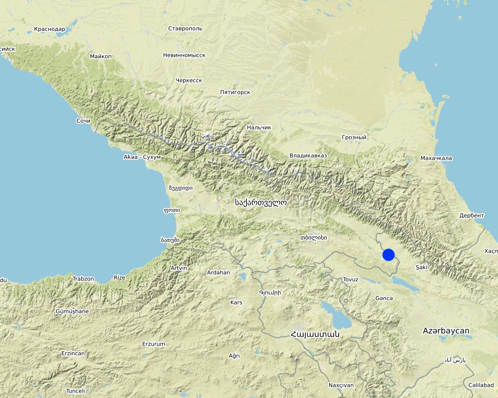
Более точная привязка места:
The Village of Arkhiloskalo is locted in the Municipality of Dedoplitskaro.
Охарактеризуйте пространственное распространение Технологии :
- равномерно-однородное применение на определенной площади
Если технология равномерно занимает территорию, укажите площадь покрытия (в км2):
49,7
Если точная область неизвестна, укажите приблизительную площадь:
- 10-100 км2
Пояснения:
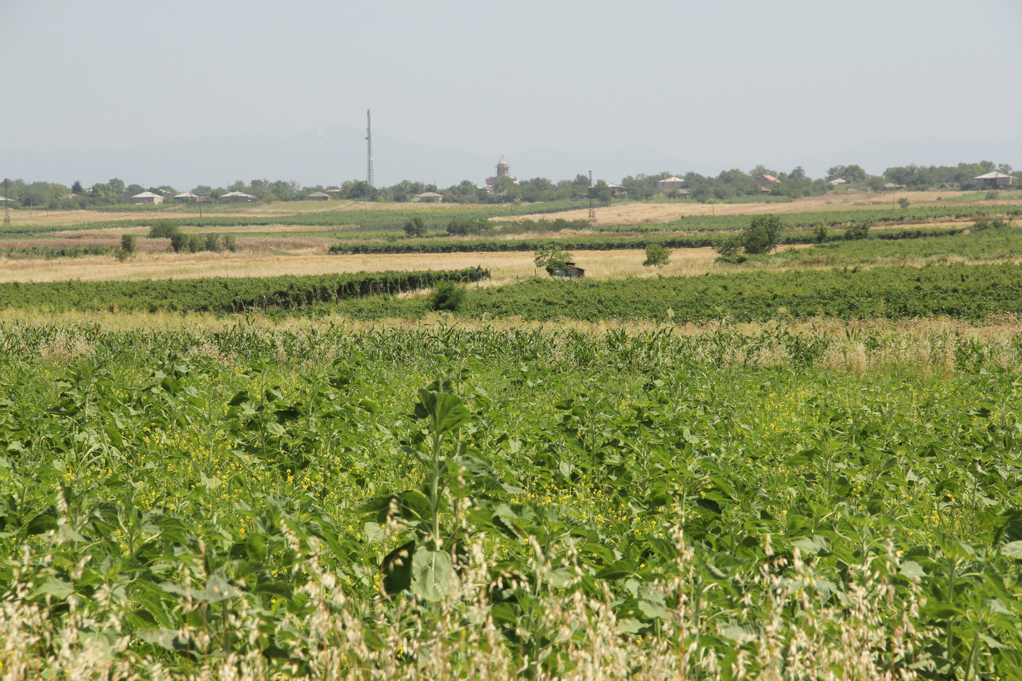
The village Arkhiloskalo covers an area of 4,970 ha. The area ranges from the lower section in the North 250 m (Alasani river valley) up to 730 m at the ridge and then falls again to the South in the Shiraki Valley to 600 m.
Map
×2.6 Сколько лет применяется данная Технология
Год начала реализации:
2018
2.7 Внедрение Технологии
Укажите, как именно Технология УЗП была внедрена:
- через проекты/ внешнее вмешательство
Пояснения (тип проекта и т.д.):
The land-use plan approach is one of the measures among others to contribute to support the integration of good Landscape and Sustainable Land Management (L-SLM) principles and practices into national policy and institutional framework to ensure the adoption of economically viable practices by rural communities. This was a GEF-funded project.
3. Классификация Технологии УЗП
3.1 Основные цели и задачи реализации Технологии
- повышение производства
- снижение или предотвращение деградации земель, восстановление нарушенных земель
- сохранение/ повышение биоразнообразия
- адаптация к изменению климата / экстремальным погодным явлениям и их последствиям
- создание благоприятных экономических условий
3.2 Текущий(-ие) тип(-ы) землепользования на территории, где применяется Технология
Комбинированное землепользование в пределах одной и той же земельной единицы:
Да
Укажите сочетания типов землепользования (посевы / пастбища / деревья):
- Агролесоводство

Пахотные угодья и плантации
- Однолетние культуры
- Древесные и кустарниковые культуры
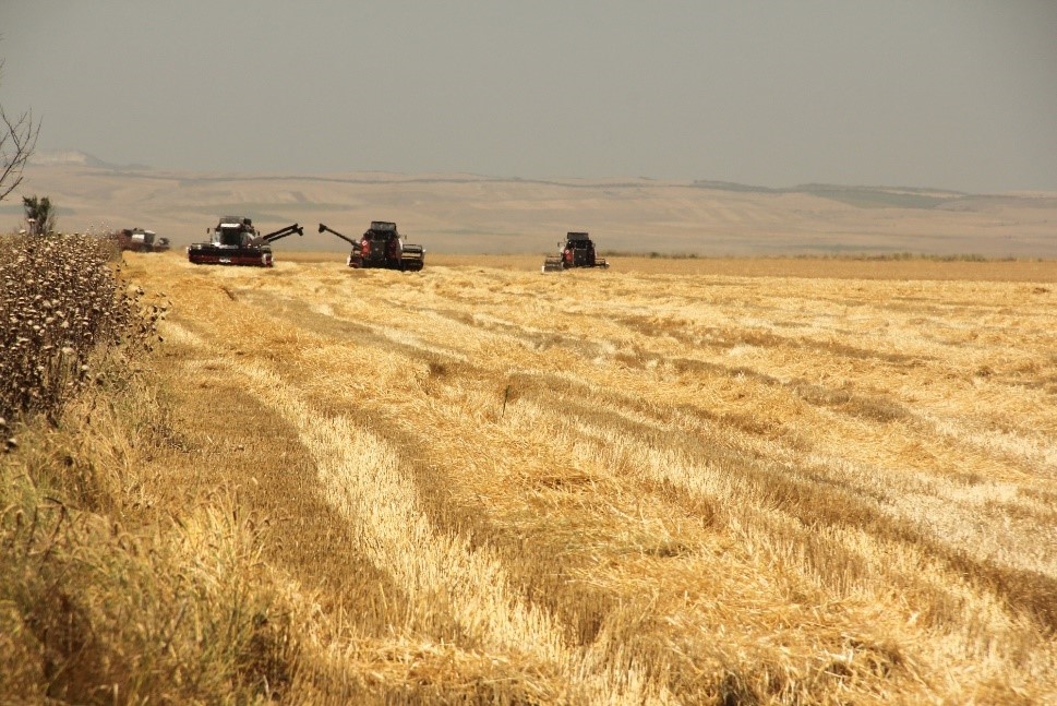
Ежегодный урожай - Уточните культуры:
- зерновые культуры - пшеница (яровая)
- зерновые культуры - пшеница (озимая)
- масличные культуры - подсолнечник, рапс, другие
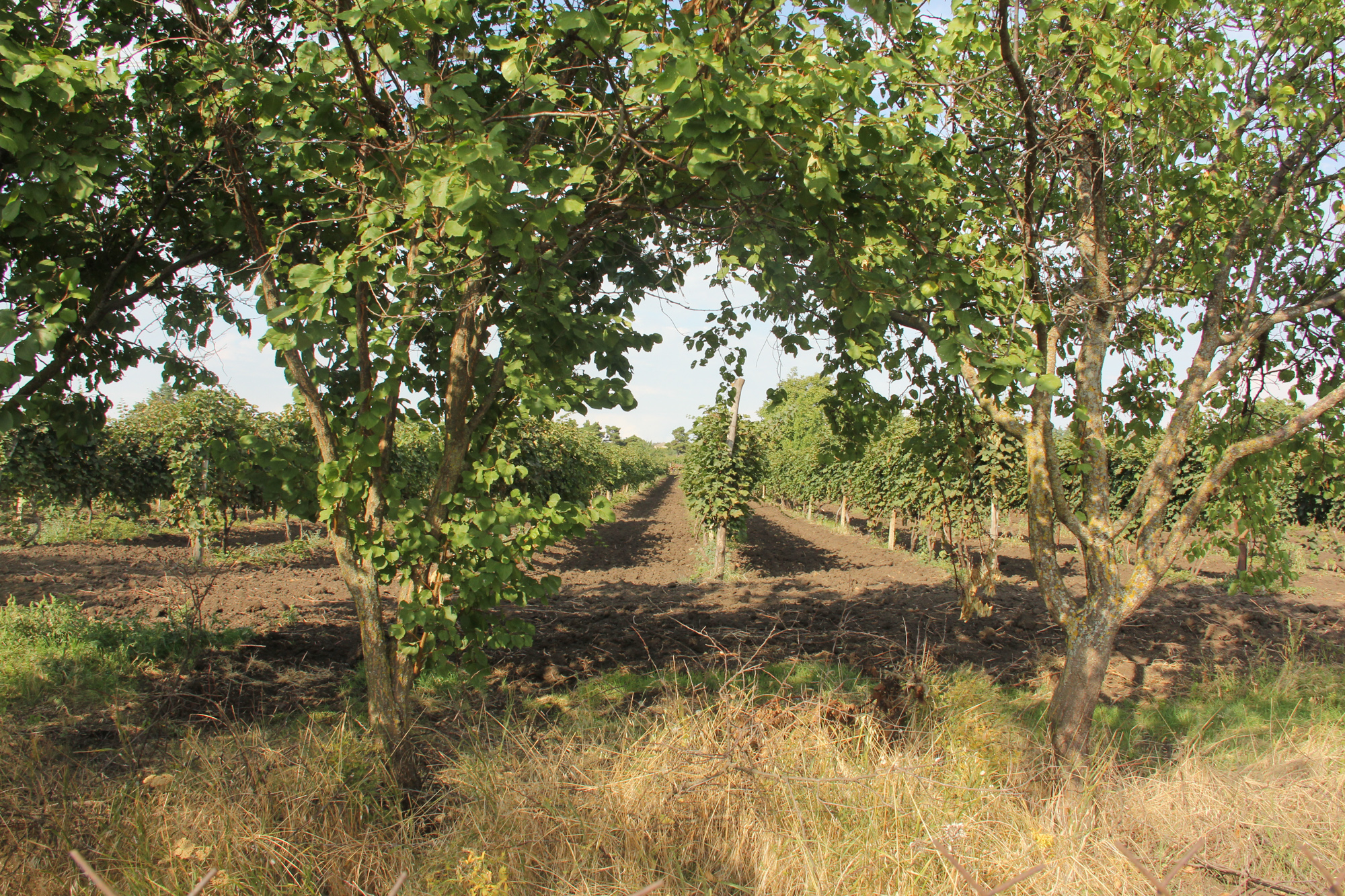
Древесные и кустарниковые культуры - Уточните культуры:
- другие фрукты
- виноград
Число урожаев за год:
- 1
Поясните:
summer
Применяются ли посевы в междурядьях?
Нет
Применяется ли севооборот?
Нет

Пастбищные угодья
Экстенсивный выпас:
- Загонно-порционное
Интенсивный выпас/ выращивание кормов:
- Стойловое содержание/ нулевой выпас
- Улучшенные пастбища
Вид животных:
- cattle - dairy and beef (e.g. zebu)
Используется ли комплексное земледельческо-животноводческое хозяйство?
Нет
Виды:
cattle - dairy and beef (e.g. zebu)
Счет:
982

Населенные пункты, инфраструктура
- Жилищная застройка, другие здания
- Транспорт: автомобильные и железные дороги
Пояснения:
All form of land cover and land use forms have been mapped.
3.3 Изменилось ли использование земель в связи с внедрением Технологии?
Изменилось ли использование земель в связи с внедрением Технологии?
- Нет (см. пункт 3.4)
3.4 Водоснабжение
Обеспеченность водой участков, где реализуется Технология :
- богарные земли
3.5 Категория УЗП, к которой относится Технология
- Защитные лесные насаждения
- ротационная система (севооборот, парование, переложное использование)
- Управление отходами/ сточными водами
- Land use planning
3.6 Мероприятия УЗП, выполняемые в рамках Технологии

управленческие мероприятия
- У2: Изменение формы/ интенсивности хозяйствования
- У7: Другие
Пояснения:
The land use planning started with mapping of current land use and included stakeholders input on strength and weaknesses. Based on this, development scenarios have been developed to change current land use approaches to a more sustainable way (e.g. restoration of windbreaks, crop rotation etc.)
3.7 Основные проблемы деградации земель, на решение которых направлена Технология

ветровая эрозия почв
- Эп: утрата плодородного слоя почвы
Пояснения:
The loss of windbreaks caused an increased exposure of topsoil to wind erosion on fields with annual crops. The land use plan helps to quantify the current state of the windbreaks and underlines their functional importance.
3.8 Предотвращение и снижение деградации земель, или восстановление нарушенных земель
Укажите цель Технологии по отношению к деградации земель :
- предотвращение деградации земель
4. Технические характеристики, мероприятия по практической реализации, вложения и стоимость
4.1 Технический рисунок, иллюстрирующий Технологию
Спецификация (пояснения к техническому рисунку):
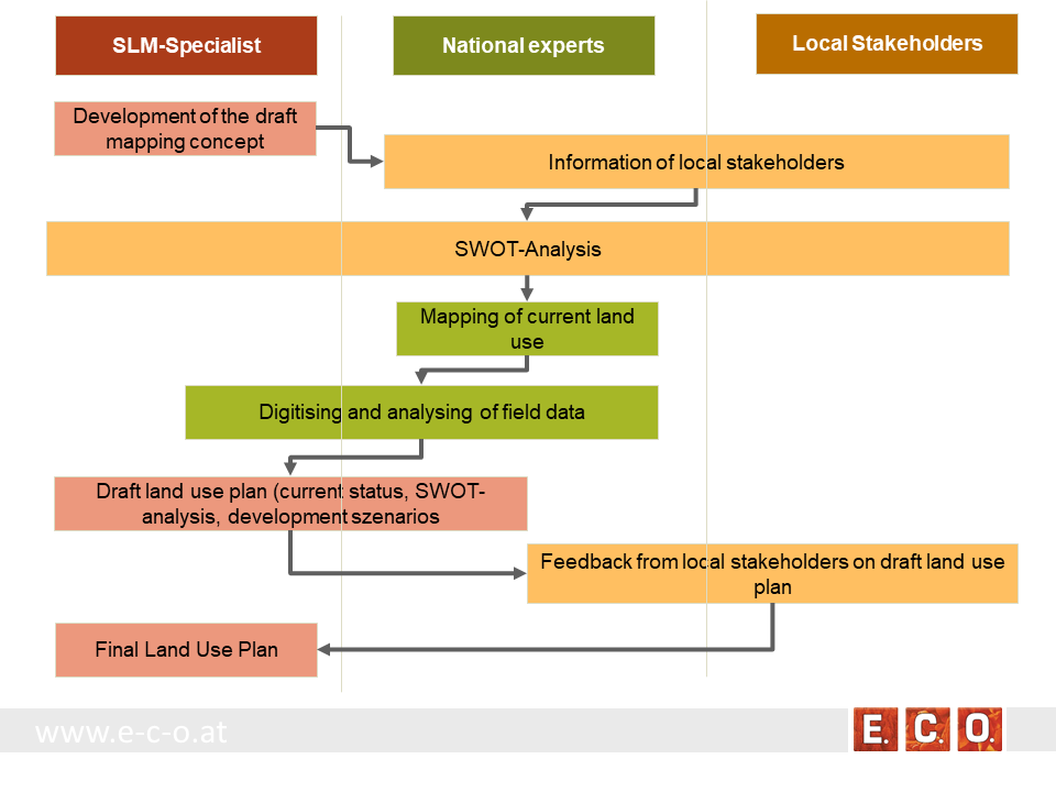
Key stages of implementation:
The land-use planning in the village of Arkhiloskalo, Dedoplistskaro Municipality is one of the pilot activities linked to LDN.
Together with the local stakeholders, a land-use plan has been worked out. The procedure of defining a spatial development plan for a municipality goes along three stages:
• Stage 1: Gather background information & implement pre-design studies and development of a mapping concept
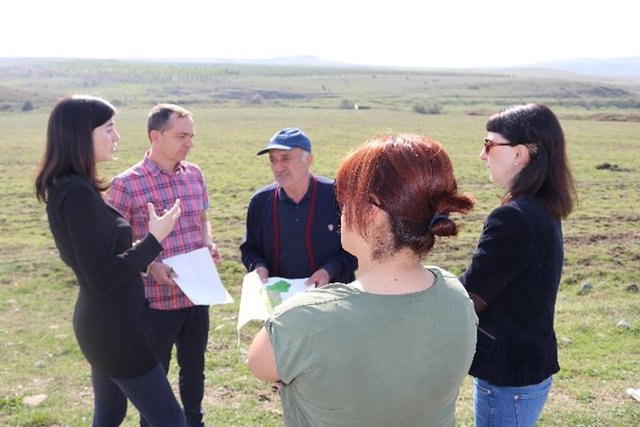
• Stage 2: Information of local stakeholders on this activity and implementation of an SWOT analysis (Strength, Weaknesses, Opportunities, Threats) related to the land use of the village
• Stage 3: Mapping and analyzing the current land use
• Stage 4: Preparation of a draft land use plan
• Stage 5: Reflection of the draft land use plan with local stakeholders
• Stage 6: Preparation of the final land use plan
Автор:
Hanns Kirchmeir
Дата:
16/01/2020
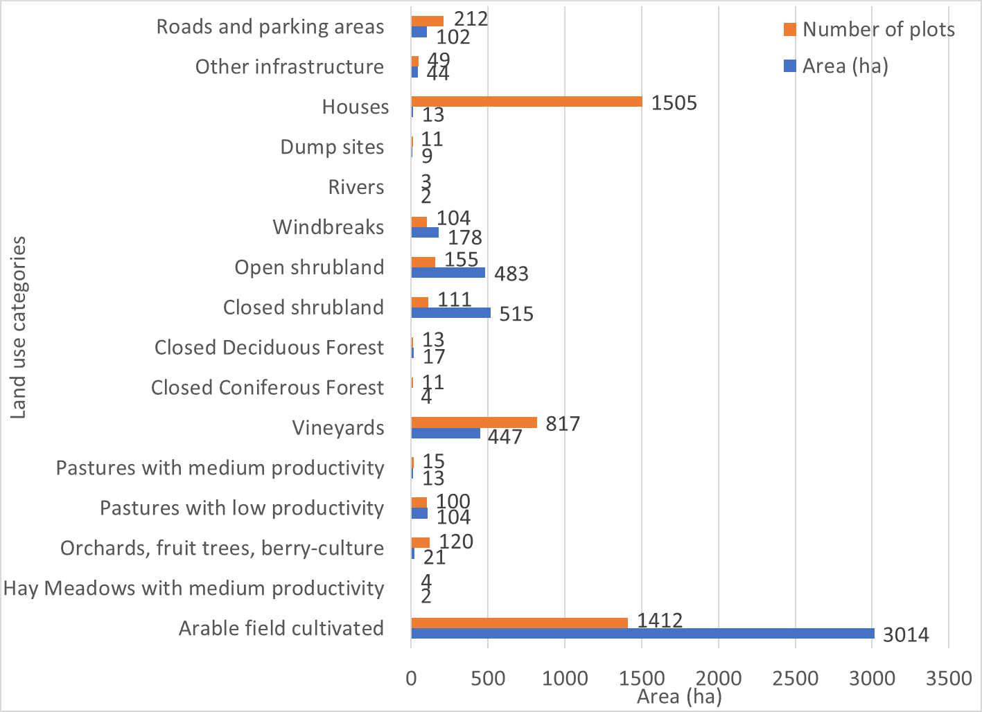
Спецификация (пояснения к техническому рисунку):
Absolute area sizes. The largest land use category is arable land (3,014 ha) followed by closed and open shrubland (515 ha and 483 ha, respectively). Vineyards cover a total of 447 ha whereas windbreaks cover 178 ha. Pastures with low productivity (104 ha) and roads and parking areas (102 ha) use almost the same amount of land. Other infrastructure covers 44 ha of land. Orchards, fruit trees and berry-culture use 21 ha of land. Closed deciduous forest (17 ha) covers only a few more hectares than pastures (13 ha). Houses are the most common plot category in Arkhiloskalo but use only around 13 ha of land which puts them on the same land-use level as pastures. Dumpsites (9 ha) use more than twice the area of closed coniferous forest (4 ha). Hay meadows and rivers cover around 2 ha of the area.
Автор:
Hanns Kirchmeir
Дата:
20/11/2019
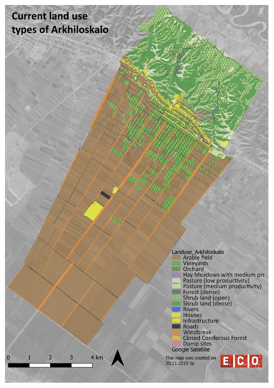
Спецификация (пояснения к техническому рисунку):
Map of current land-use categories in Arkhiloskalo. The land-use classification in this approach is based on the Corine Land Classification System. It was split into sub-categories where needed to meet the needs of local land use practices.
Автор:
Hanns Kirchmeir
Дата:
13/11/2019
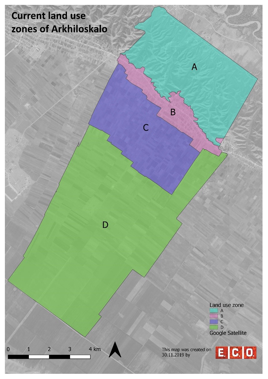
Спецификация (пояснения к техническому рисунку):
Based on the different land use, 4 different zones have been separated:
•Zone A: Steep North Slope
•Zone B. Settlement Area
•Zone C: Zone of perennial Crops
•Zone D: Zone of annual Crops
Автор:
Hanns Kirchmeir
4.2 Общая информация по необходимым вложениям и стоимости
Уточните, как рассчитывались затраты и вложения:
- на площадь, где применяется Технология
Укажите размер и единицу площади:
50 km²
Укажите денежные единицы, использованные для подсчета затрат:
- Доллары США
Укажите среднюю дневную заработную плату наемных работников:
national expert 100 USD
4.3 Мероприятия, необходимые для начала реализации
| Деятельность | Время (сессия) | |
|---|---|---|
| 1. | Gather background information & implement pre-design studies and development of a mapping concept | Winter/spring |
| 2. | Information of local stakeholders on this activity and implementation of an SWOT analysis (Strength, Weaknesses, Opportunities, Threats) related to the land use of the village | Spring |
| 3. | Mapping and analyzing the current land use | Summer |
| 4. | Preparation of a draft land use plan | Autumn/Winter |
| 5. | Reflection of the draft land use plan with local stakeholders | Autumn/Winter |
| 6. | Preparation of the final land use plan | Autumn/Winter |
4.4 Вложения и затраты, необходимые для начала реализации
Если Вы не можете указать расходы в приведенной выше таблице постатейно, дайте оценку общих затрат на создание Технологии:
15000,0
Если землепользователем оплачено менее 100% затрат, укажите, кем покрывались остальные затраты:
REC-Caucasus, GEF-funded Project
Пояснения:
The budget is $ 15 000 / per year. This amount includes the salaries of following expert, such as: National expert on SLM, National expert on LUP, International expert on SLM, International expert on LUP, Botanist, GIS expert. Also the above budget includes travels and missions in three municipalities, workshops in Akhmeta and Dedoplistskaro municipalities, workshops and public hearings in selected local communities (Arkhiloskalo and Shenako),
4.7 Наиболее значимые факторы, влияющие на стоимость затрат
Опишите наиболее значимые факторы, влияющие на стоимость затрат:
The field work of mapping and analysis of results took a lot of time as well as the stakeholder meetings.
5. Природные и социально-экономические условия
5.1 Климат
Среднегодовое количество осадков
- < 250 мм
- 251-500 мм
- 501-750 мм
- 751-1000 мм
- 1001-1500 мм
- 1501-2000 мм
- 2001-3000 мм
- 3001-4000 мм
- > 4000 мм
Пояснения/ комментарии по осадкам:
The driest month is January, with 25 mm of rainfall. The greatest amount of precipitation occurs in June, with an average of 108 mm. The difference in precipitation between the driest month and the wettest month is 83 mm.
Укажите название соответствующей метеостанции:
Dedoplistskaro Met. Station
Агроклиматическая зона
- полузасушливая
The climate is warm and temperate in Dedoplistskaro. The average annual temperature in Dedoplistskaro is 11.3 °C. The warmest month of the year is July, with an average temperature of 22.7 °C. The lowest average temperatures in the year occur in January, when it is around 0.1 °C.
5.2 Рельеф
Склоны (преобладающие):
- пологие (0-2%)
- покатые (3-5%)
- покато-крутые (6-10%)
- крутые (11-15%)
- очень крутые (16-30%)
- чрезвычайно крутые (31-60%)
- обрывистые (>60%)
Формы рельефа:
- плато/ равнины
- гребни хребтов/холмов
- склоны гор
- склоны холмов
- подножья
- днища долин
Зона высотной поясности:
- 0-100 м над уровнем моря
- 101-500 м н.у.м.
- 501-1000 м н.у.м.
- 1001-1500 м н.у.м.
- 1501-2000 м н.у.м.
- 2001-2500 м н.у.м.
- 2501-3000 м н.у.м.
- 3001-4000 м н.у.м.
- > 4 тыс. м н.у.м.
Укажите, приурочено ли применение Технологии к специфическим условиям:
- не имеет значения
Комментарии и дополнительные сведения по условиям рельефа/ топографии :
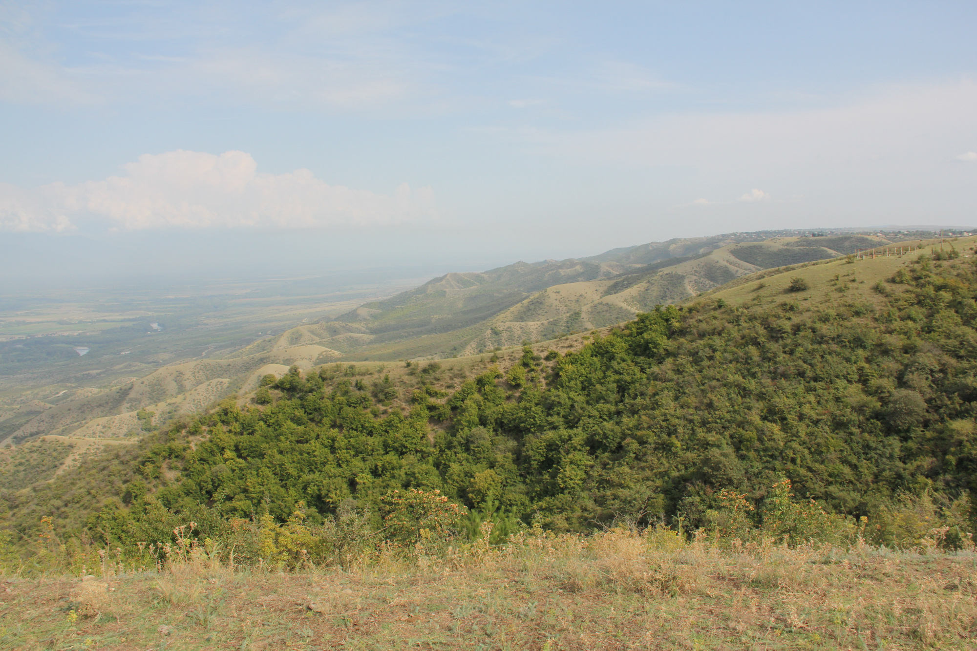
The pastures are located on steep hill slope to the north, while the village and arable lands are located on the gently south facing terrace.
5.3 Почвы
Средняя мощность почв:
- поверхностные (0-20 см)
- неглубокие (21-50 см)
- умеренно глубокие (51-80 см)
- глубокие (81-120 см)
- очень глубокие (> 120 см)
Гранулометрический состав (верхнего горизонта):
- средние фракции (суглинистый, супесчаный)
Гранулометрический состав (на глубине более 20 см):
- средние фракции (суглинистый, супесчаный)
Содержание органического вещества в верхнем горизонте:
- высокое (> 3%)
5.4 Доступность и качество воды
Уровень грунтовых вод:
5-50 м
Доступность поверхностных вод:
недостаточны/ отсутствуют
Качество воды (без обработки):
питьевая вода плохого качества (необходима обработка)
Качество воды относится к:
грунтовые воды
Является ли солёность воды проблемой?
Нет
Происходят ли периодические затопления территории?
Нет
5.5 Биоразнообразие
Видовое разнообразие:
- высокое
Разнообразие местообитаний:
- высокое
Комментарии и дополнительная информация по биоразнообразию:
Especially the semi-natural landscapes of the slopes to the north are of high habitat and species diversity.
5.6 Характеристика землепользователей, применяющих Технологию
Осёдлый или кочевой:
- Осёдлый
Рыночная ориентация производства:
- смешанный (натуральный / коммерческий)
Доходы из других источников:
- < 10% всех доходов
Относительный уровень достатка:
- плохой
Индивидуальное или коллективное хозяйство:
- частное/ домовладение
Уровень механизации:
- механизировано/ есть автотранспорт
Пол:
- мужчины
Возраст землепользователей:
- средний возраст
Укажите другие важные характеристики землепользователей:
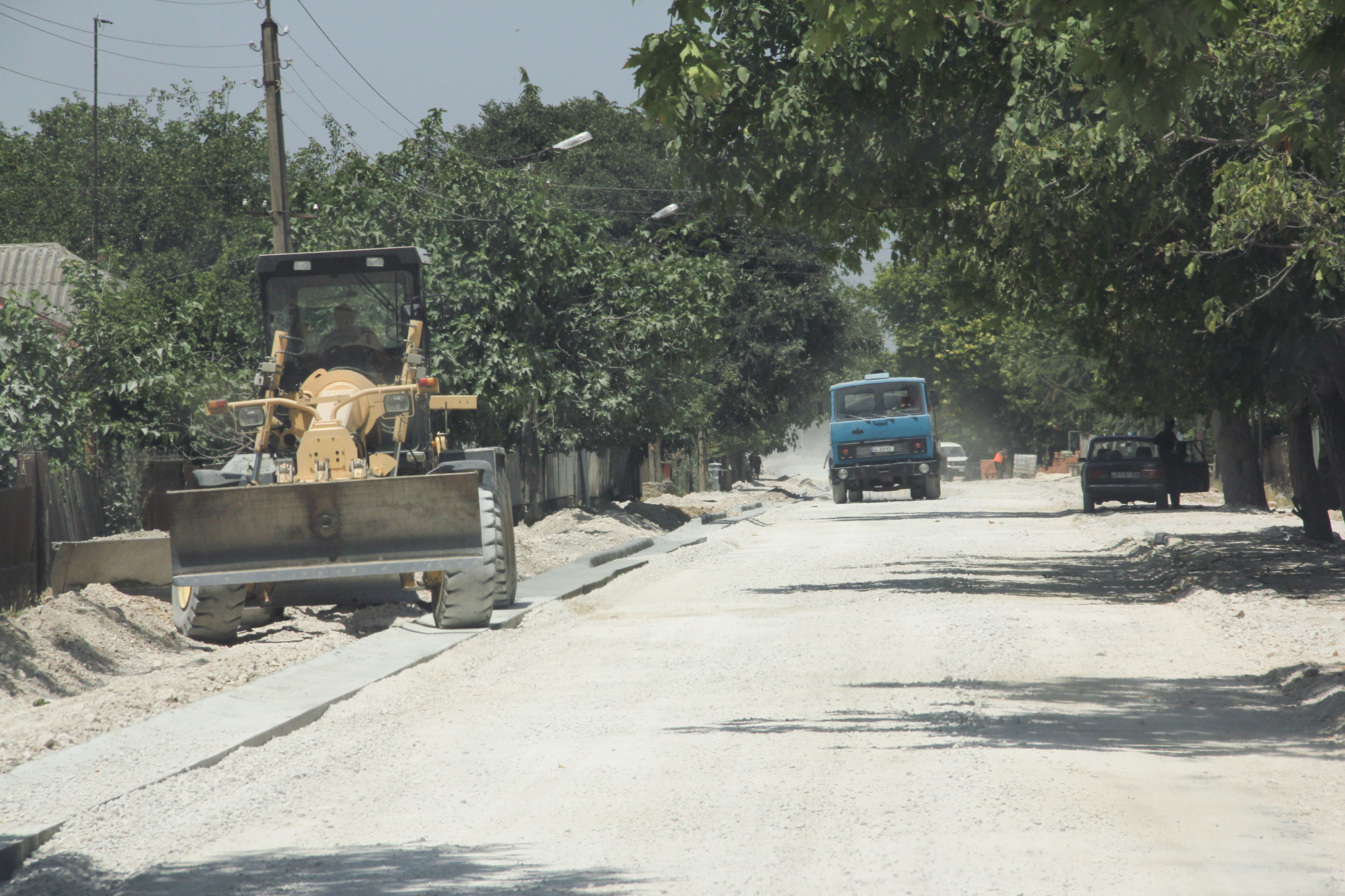
The village is very remote. Driving distance to the municipality is about 1h on bad roads.
5.7 Средняя площадь земель, используемых землепользователями с применением Технологии
- < 0,5 га
- 0,5-1 га
- 1-2 га
- 2-5 га
- 5-15 га
- 15-50 га
- 50-100 га
- 100-500 га
- 500-1000 га
- 1000-10000 га
- > 10000 га
Считается ли это мелким, средним или крупным хозяйством (по местным масштабам)?
- среднего размера
5.8 Собственность на землю, права на земле- и водопользование
Землевладелец:
- общинная/ поселковая
- индивидуальная, оформленная в собственность
Право землепользования:
- неограниченное (неконтролируемое)
- индивидуальное
Право водопользования:
- общинное (контролируемое)
Права на землепользование основаны на традиционной правовой системе?
Да
5.9 Доступ к базовым услугам и инфраструктуре
медицинское обслуживание:
- плохой
- средний
- хорошая
образование:
- плохой
- средний
- хорошая
технические консультации:
- плохой
- средний
- хорошая
рынки:
- плохой
- средний
- хорошая
электроснабжение:
- плохой
- средний
- хорошая
транспорт и дорожная сеть:
- плохой
- средний
- хорошая
водоснабжение и канализация:
- плохой
- средний
- хорошая
финансовые услуги:
- плохой
- средний
- хорошая
6. Воздействия и заключительные положения
6.1 Влияние Технологии УЗП в пределах территории ее применения
Социально-экономическое воздействие
Продуктивность
производство сельскозяйственных культур
Комментарий/ пояснения:
Effects will be visible based on the implementation of selected development scenario provided by Land use plan.
разнообразие продукции
Комментарий/ пояснения:
Effects will be visible based on the implementation of selected development scenario provided by Land use plan.
Доходы и затраты
разнообразие источников дохода
Комментарий/ пояснения:
Effects will be visible based on the implementation of selected development scenario provided by Land use plan.
Социальное и культурное воздействие
знания в области УЗП/ деградации земель
Комментарий/ пояснения:
Improvements by training and workshops, awareness raising.
Экологическое воздействие
Биоразнообразие: растительность, животный мир
Растительный покров
Комментарий/ пояснения:
Reduced grazing in zone A (north slope) will increase the vegetation cover. Effects will be visible based on the implementation of selected development scenario provided by Land use plan.
биомасса/ содержание углерода в надземной биомассе
Комментарий/ пояснения:
Reduced grazing in zone A (north slope) will increase the cover of shrubs and trees which will lead to increase of biomass. Effects will be visible based on the implementation of selected development scenario provided by Land use plan.
разнообразие фауны
Комментарий/ пояснения:
Effects will be visible based on the implementation of selected development scenario provided by Land use plan.
разнообразие местообитаний
Комментарий/ пояснения:
Diversification of land use and restoration of windbreaks will increase habitat diversity. Effects will be visible based on the implementation of selected development scenario provided by Land use plan.
Климат и снижение риска стихийных бедствий
скорость ветра
Комментарий/ пояснения:
Improvement of windbreaks will reduce wind speed and topoil erosion. Effects will be visible based on the implementation of selected development scenario provided by Land use plan.
6.2 Влияние Технологии за пределами территории ее применения
загрязнение подземных/ речных вод
Комментарий/ пояснения:
Removal of uncontrolled dump sites will reduce groundwater and river pollution especially in the Alasani floodplain north of the community.
отложения, переносимые ветром
Комментарий/ пояснения:
The rehabilitation of windbreaks will have a positive impact on neighboring fields.
6.3 Подверженность и чувствительность Технологии УЗП к постепенным изменениям климата и экстремальным погодным явлениям/ стихийным бедствиям, связанным с изменением климата (в понимании землепользователей)
Пояснения:
The technology of land use planning is not sensitive to climate change but is an appropriate technology to adapt land use to future anticipated climate changes.
6.4 Анализ эффективности затрат
Насколько получаемый результат сопоставим с первоначальными вложениями (с точки зрения землепользователей)?
Эффективность затрат в краткосрочной перспективе:
отрицательно
Эффективность затрат в долгосрочной перспективе:
позитивное
Насколько получаемый результат сопоставим с текущими расходами по поддержанию технологии (с точки зрения землепользователей)?
Эффективность затрат в краткосрочной перспективе:
влияние незаметно
Эффективность затрат в долгосрочной перспективе:
влияние незаметно
Пояснения:
The land use planning process is an investment in future developments. Return of investment can be expected in oncoming years. The mapping result is a detailed documentation of size and spatial distribution land cover categories. Change in land cover is an important indicator to monitor the loss and gains according to the LDN monitoring concept. The land-use plan is based on field assessments made in summer 2019 and built a baseline for future change assessments as it includes data on land-use intensity which will enable to consider change in time dynamics and to monitor changes on the ground.
6.5 Внедрение Технологии
- отдельные случаи/ эксперимент
Если возможно, дайте количественную характеристику (число домохозяйств и/или площадь применения):
It was implemented as show case for one community
Среди применяющих Технологию землепользователей, какова доля лиц, применяющих её по собственной инициативе, т.е. без какого-либо материального стимулирования со стороны?
- 0-10%
6.6 Адаптация
Была ли Технология УЗП изменена в недавнее время с целью адаптации к меняющимся условиям среды?
Нет
6.7 Сильные стороны/ преимущества/ возможности Технологии
| Сильные стороны/ преимущества/ возможности по мнению землепользователей |
|---|
| The majority of the land users in village Arkhiloskalo have been using the same land and natural resources through decades and have good understanding of the natural conditions and climate change perspectives of the target area. The land use plan, the scenario development and the knowledge exchange in the workshops are have been considered as advantage for awareness raising, joint decision making and to start a positive change in short-term period. |
| The successful land-use system with improved environment conditions and benefit to the local farmers can lead to be a perfect example for the whole municipality of Dedoplistskaro as most part of its territory is agricultural land in semi-arid environment facing some rapid and significant challenges caused by climate change. |
| Сильные стороны/ преимущества/ возможности по мнению составителя или других ключевых специалистов |
|---|
| The land use plan will help to optimize the management and to eliminate present challenges in the 4 separate zones and promote improved sustainable land- use, land-management practices like crop rotation and re-establishment of windbreaks. |
| The land-use plan helps to identify the strength, opportunities, weaknesses and threats and contribute to sustainable land-use and its management. E.g.: in the Zone A, Steep North Slope there is a high risk, that the waste in the dumpsites will be washed down in an uncontrolled manner into the natural and semi-natural habitats of the slope. The waste is partly burned and the wash out of toxic solute can harm nature and ground water. |
| Application of the technology helps to optimize management measures, which will reduce costs and labour forces, e.g., by increasing productivity of land and productivity of vineyards in the Zone C: zone of perennial crops. |
| The land-use map integrates climate mitigation. E.g. it helps to plan the re-establishment of the windbreaks, which significantly contributes to the reduction of wind erosion in the Zone D: Zone of annual crops. |
| The terrestrial evaluation of the current land use can also serve to evaluate remote sensing technologies for semi-automatic classification of land cover categories. |
6.8 Слабые стороны/ недостатки/ риски Технологии и пути их преодоления
| Слабые стороны/ недостатки/ риски по мнению землепользователей | Возможные пути их преодоления/снижения? |
|---|---|
| Lack of dialogue and trust could be one of the risks to succeed with the introduction of advanced methods of sustainable land management. | The proposed sustainable land-use practices and pilot activities should be planned in a way to have results on the ground in a short-term period to keep local farmers motivated. |
| Слабые стороны/ недостатки/ риски по мнению составителя или ответственных специалистов | Возможные пути их преодоления/снижения? |
|---|---|
| Risks: Land use plan Interest of farmers, guesthouse providers and local residents are conflicting. | This can be limited by good facilitation of focus group discussions between different stakeholder groups. |
| Local actors (farmers, guest house providers ...) are not interested in participating in the joint land-use planning process. | It will need a well-coordinated communication design to include all the local stakeholders in the process of practical and theoretical introduction to the principles of sustainable land-use. The communication should emphasize potential economic benefits to the local households together with advantages of the sustainability. This can be a key factor to get most of the local stakeholders engaged with the proposed sustainable land-use practices. |
7. Справочные материалы и ссылки
7.1 Методы сбора/ источники информации
- выезды на места, полевые обследования
2 days of joint field visit of the project team, 2 weeks of field-mapping of the national expert.
- опросы землепользователей
About 44 participants in workshops and 12 people interviewed.
- опросы специалистов/экспертов по УЗП
2 specialists
- данные, собранные из отчетов и достоверных документов
1 international expert and 3 national experts have been conducted for the feedback on the report.
Когда были собраны данные (на местах)?
12/08/2018
7.2 Ссылки на опубликованные материалы
Название, автор, год публикации, ISBN:
Pilot project on land degradation neutrality in Georgia: Final Report.2017.Huber, M., Joseph, A., Kirchmeir, H., Ghambashidze, G.
Где опубликовано? Стоимость?
https://e-c-o.at/files/publications/downloads/D00813_ECO_policy_brief_LDN_Georgia_171025.pdf
Название, автор, год публикации, ISBN:
Applying Landscape and Sustainable Land Management (L-SLM) for mitigating land degradation and contributing to poverty reduction in rural areas: Final report. 2017. Kirchmeir, H., Joseph, A., Huber, M.
Где опубликовано? Стоимость?
Request at RECC Caucasus
Название, автор, год публикации, ISBN:
limatologies at high resolution for the earth’s land surface areas. Sci. Data 4:170122 doi: 10.1038/sdata.2017. Karger, D. N. Conrad, O., Böhner, J., Kawohl, T., Kreft, H., Soria-Auza, R.W., Zimmermann, N.E., Linder H.P. & Kessler M.
Где опубликовано? Стоимость?
https://www.nature.com/articles/sdata2017122
7.4 Общие комментарии
It was not easy to consider the land use planning either to be a technology or an approach. Finally, we submitted as an approach.
Ссылки и модули
Развернуть все Свернуть всеСсылки
Land Degradation Neutrality Transformative Projects and Programmes (LDN-TPP) … [Грузия]
In the framework of the project ‘Generating Economic and Environmental Benefits from Sustainable Land Management for Vulnerable Rural Communities of Georgia’, Land Degradation Neutrality Transformative Projects and Programmes (LDN-TPP) were developed to implement the LDN targets at municipal level. The approach defines the process to break down global and international …
- Составитель: Daniel Zollner
Модули
Нет модулей