Tabia [ตูนิเซีย]
- ผู้สร้างสรรค์:
- การอัพเดท:
- ผู้รวบรวม: Mongi Ben Zaied
- ผู้เรียบเรียง: –
- ผู้ตรวจสอบ: Deborah Niggli, Alexandra Gavilano
technologies_1420 - ตูนิเซีย
ดูส่วนย่อย
ขยายทั้งหมด ย่อทั้งหมด1. ข้อมูลทั่วไป
1.2 รายละเอียดที่ติดต่อได้ของผู้รวบรวมและองค์กรที่เกี่ยวข้องในการประเมินและการจัดเตรียมทำเอกสารของเทคโนโลยี
วิทยากรหลัก
ผู้เชี่ยวชาญ SLM:
Sghaier Mongi
Institut des Régions Arides IRA
ตูนิเซีย
ผู้เชี่ยวชาญ SLM:
Chniter Mongi
Commissariats Régionaux au Développement Agricole CRDA
ตูนิเซีย
ผู้เชี่ยวชาญ SLM:
ชื่อของโครงการซึ่งอำนวยความสะดวกในการทำเอกสารหรือการประเมินเทคโนโลยี (ถ้าเกี่ยวข้อง)
DESIRE (EU-DES!RE)ชื่อของโครงการซึ่งอำนวยความสะดวกในการทำเอกสารหรือการประเมินเทคโนโลยี (ถ้าเกี่ยวข้อง)
Book project: Water Harvesting – Guidelines to Good Practice (Water Harvesting)ชื่อขององค์กรซึ่งอำนวยความสะดวกในการทำเอกสารหรือการประเมินเทคโนโลยี (ถ้าเกี่ยวข้อง)
Institut des Régions Arides de Médenine (Institut des Régions Arides de Médenine) - ตูนิเซียชื่อขององค์กรซึ่งอำนวยความสะดวกในการทำเอกสารหรือการประเมินเทคโนโลยี (ถ้าเกี่ยวข้อง)
Commissariats Régionaux au Développement Agricole (CRDA) - ตูนิเซีย1.3 เงื่อนไขการใช้ข้อมูลที่ได้บันทึกผ่านทาง WOCAT
ผู้รวบรวมและวิทยากรหลักยอมรับเงื่อนไขเกี่ยวกับการใช้ข้อมูลที่ถูกบันทึกผ่านทาง WOCAT:
ใช่
1.5 Reference to Questionnaire(s) on SLM Approaches (documented using WOCAT)
Observatoire Territorial de Gestion des Ressources Naturelles [ตูนิเซีย]
L’observatoire territorial de gestion des ressources naturelles est un dispositif scientifique, technique et institutionnel mis en place sur un territoire, pour assurer une fonction d’observation, de suivi, et d’amélioration de la connaissance.
- ผู้รวบรวม: Wafa Saidi
Projet d'Aménagement et de Développement Intégré du Territoire … [ตูนิเซีย]
Le Projet d'Aménagement et de Développement Intégré du Territoire (PADIT) est basé sur la sollicitation des populations locales et la collaboration avec tous les acteurs impliqués dans la gestion des ressources naturelles et du développement rural afin de valoriser les atouts d'un territoire donné et élaborer un plan d'action intégré …
- ผู้รวบรวม: Wafa Saidi
Collecte des eaux pluviales dans des citernes [ตูนิเซีย]
Les citernes sont construites soit par l’état dans les zones enclavées où l’approvisionnement en eaux potables et difficile voire impossible par le réseau de la Société Nationale d’Exploitation et de Distribution des Eaux (SONEDE) soit par des particuliers pour collecter les eaux de pluies. Ces ouvrages sont destinés à l’abreuvement …
- ผู้รวบรวม: Donia Mühlematter

Conservation des eaux et des sols suivant la … [ตูนิเซีย]
Les tabias sont développés dans les piedmonts des Djebels et les plaines à pente légère (n’excédant pas les 3 %) du centre et du sud tunisien où la pluviométrie annuelle est relativement faible. Les zones aménagées en tabias reçoivent annuellement un supplément d’eau de ruissellement permettant une agriculture pluviale très …
- ผู้รวบรวม: Donia Mühlematter
Dryland watershed management approach [ตูนิเซีย]
Integrated land and water management approach, including vegetative, management, and agronomic measure
- ผู้รวบรวม: Naceur Mahdi
2. การอธิบายลักษณะของเทคโนโลยี SLM
2.1 การอธิบายแบบสั้น ๆ ของเทคโนโลยี
คำจำกัดความของเทคโนโลยี:
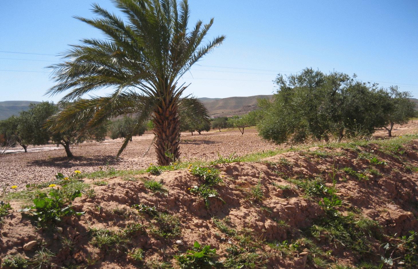
The tabia earthen dyke is a water harvesting technique used in the foothill and piedmont areas.
2.2 การอธิบายแบบละเอียดของเทคโนโลยี
คำอธิบาย:
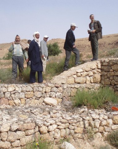
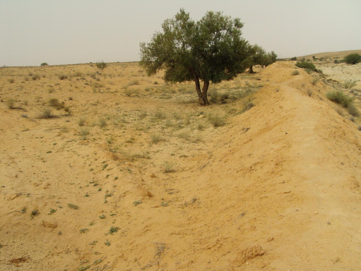
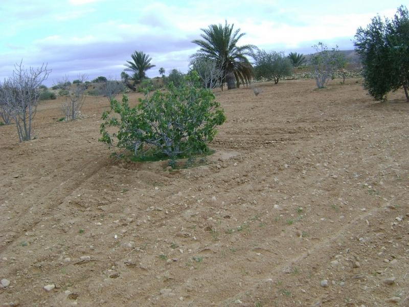
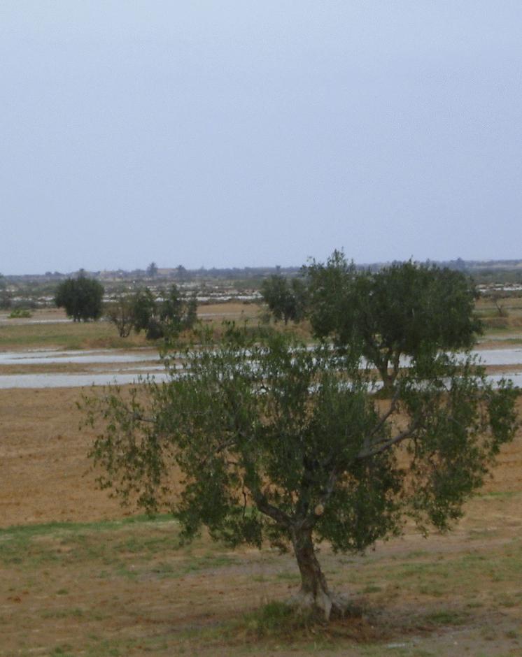
The tabia technology is similar to the jessour system but is used in the gently-sloping foothill and piedmont areas. It is considered to be a relatively new technique, developed by mountain dwellers who migrated to the plains. Tabias, like jessour, comprise an earthen dyke (50-150 m in length, 1-2 m in height), a spillway (central and/or lateral) and an associated water harvesting area. The ratio between the area where water is applied (cropped area) and the total area from which water is collected varies from 1:6 to 1:20. The differences between the tabia and the jessour systems are that the former contains two additional lateral bunds (up to 30 m long) and sometimes a small flood diversion dyke (mgoud). Small tabia are constructed manually using shovels, pickles and carts. Larger constructions are done mechanically using tractors and bulldozers.
Purpose of the Technology: Tree products and annual crops are commonly grown using tabia. Besides their water harvesting qualities, tabias also have a positive effect on soil erosion and groundwater recharge.
Natural / human environment: The tabia runoff-water harvesting technique is widely practised in central Tunisia. Tabias are usually installed on the piedmont, where the slope does not exceed 3% and where the soil is relatively deep. Ancient remnants of tabias have been found in the region of Gafsa (south west Tunisia). The system has been adopted by people living in the neighbouring foothills and plains of the central and southeastern regions (Jeffara) of the country, following the transformation of their pasture to cultivated fields.
2.3 รูปภาพของเทคโนโลยี
อัลบั้มสื่อบันทึก
2.5 ประเทศภูมิภาค หรือสถานที่ตั้งที่เทคโนโลยีได้นำไปใช้และได้รับการครอบคลุมโดยการประเมินนี้
ประเทศ:
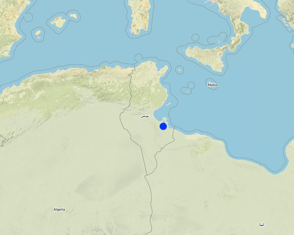
ตูนิเซีย
ภูมิภาค/รัฐ/จังหวัด:
Medenine
ข้อมูลจำเพาะเพิ่มเติมของสถานที่ตั้ง :
Medenine nord
ระบุการกระจายตัวของเทคโนโลยี:
- กระจายไปอย่างสม่ำเสมอในพื้นที่
If precise area is not known, indicate approximate area covered:
- 10-100 ตร.กม.
Map
×2.6 วันที่การดำเนินการ
ถ้าไม่รู้ปีที่แน่นอน ให้ระบุวันที่โดยประมาณ:
- 10-50 ปี
2.7 คำแนะนำของเทคโนโลยี
ให้ระบุว่าเทคโนโลยีถูกแนะนำเข้ามาอย่างไร:
- ทางโครงการหรือจากภายนอก
3. การจัดประเภทของเทคโนโลยี SLM
3.2 ประเภทของการใช้ที่ดินในปัจจุบันที่ได้นำเทคโนโลยีไปใช้

พื้นที่ปลูกพืช
- การปลูกไม้ยืนต้น ไม้พุ่ม
จำนวนของฤดูเพาะปลูกต่อปี:
- 1
ระบุ:
Période de croissance la plus longue en jour: 180,Période de croissance la plus longue d'un mois à l'autre: Octobre - Avril

ทุ่งหญ้าเลี้ยงสัตว์
แสดงความคิดเห็น:
Problèmes principaux d'utilisation des terres (avis du compilateur): érosion hydrique des sols, ruissellement et perte de terre, surpâturage
Major land use problems (land users’ perception): overgrazing
3.4 การใช้น้ำ
การใช้น้ำของที่ดินที่มีการใช้เทคโนโลยีอยู่:
- น้ำฝนร่วมกับการชลประทาน
3.5 กลุ่ม SLM ที่ตรงกับเทคโนโลยีนี้
- การเก็บเกี่ยวน้ำ
3.6 มาตรการ SLM ที่ประกอบกันเป็นเทคโนโลยี

มาตรการอนุรักษ์ด้วยโครงสร้าง
- S2: ทำนบ เขื่อนดิน
แสดงความคิดเห็น:
Main measures: structural measures
3.7 รูปแบบหลักของการเสื่อมโทรมของที่ดินที่ได้รับการแก้ไขโดยเทคโนโลยี

การกัดกร่อนของดินโดยน้ำ
- Wt (Loss of topsoil): การสูญเสียดินชั้นบนหรือการกัดกร่อนที่ผิวดิน
- Wg (Gully erosion): การกัดกร่อนแบบร่องธารหรือการทำให้เกิดร่องน้ำเซาะ
แสดงความคิดเห็น:
Main type of degradation addressed: Wt: loss of topsoil / surface erosion
Secondary types of degradation addressed: Wg: gully erosion / gullying
Main causes of degradation: Heavy / extreme rainfall (intensity/amounts), land tenure
Secondary causes of degradation: overgrazing, population pressure
3.8 การป้องกัน การลดลง หรือการฟื้นฟูความเสื่อมโทรมของที่ดิน
ระบุเป้าหมายของเทคโนโลยีกับความเสื่อมโทรมของที่ดิน:
- ป้องกันความเสื่อมโทรมของที่ดิน
- ลดความเสื่อมโทรมของดิน
แสดงความคิดเห็น:
Main goals: prevention of land degradation
Secondary goals: mitigation / reduction of land degradation
4. ข้อมูลจำเพาะด้านเทคนิค กิจกรรมการนำไปปฏิบัติใช้ ปัจจัยนำเข้า และค่าใช้จ่าย
4.1 แบบแปลนทางเทคนิคของเทคโนโลยี
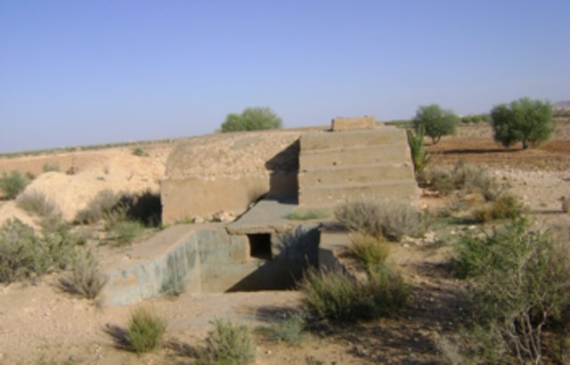
ข้อมูลจำเพาะด้านเทคนิค (แบบแปลนทางเทคนิคของเทคโนโลยี):
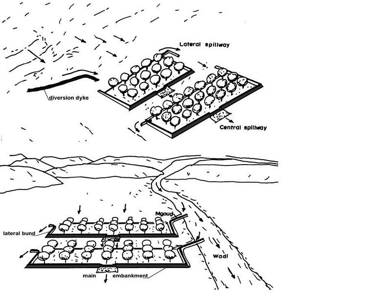
Tabia avec zone de collecte d'eau naturelle (supérieure) et tabia sur un système agrandi avec dérivation d'eau supplémentaire (inférieure). (Adapté d'Alaya et al., 1993)
Trouvé dans les zones plus plates, tabia peut accueillir plus d'arbres sur la terrasse en particulier quand il peut recevoir d'eau supplémentaire des inondations.
Localisation: Tunisie sud-est
Date: Janvier 2009
Connaissances techniques requises pour le personnel sur le terrain / conseillers: moyen
Connaissances techniques requises pour les utilisateurs des terres: moyen
Fonctions principales techniques: contrôle du ruissellement en ravines: rétention/capture
Fonctions techniques secondaire: augmentation de l'infiltration, récupération de l’eau / augmentation des réserves d’eau, épandage des eaux
Détournement de dérivation / drainage
Hauteur des bunds/barrages/autres (m): 2
Largeur des bunds/barrages/autres (m): 2-5
Longueur des bunds/barrages/autres (m): 10-30
Déversoir
Hauteur des bunds/barrages/autres (m): 1
Largeur des bunds/barrages/autres (m): 5
Length of bunds/banks/others (m): 2-4
Mur de protection/ rive: rectifié
Intervalle verticales entres les structures (m): 3
Espacement entre les structures (m): 100
Hauteur des bunds/barragues/autres (m): 2
Largeur des bunds/barrages/autres (m): 2-5
Longueur des bunds/barrages/autres (m): 50-150
Materiel de construction (terre): Digue principale
Materiel de construction (Pierres): Déversoir
Materiel de construction (béton): Déversoir
Materiel de construction (autres): Gabion: digue de dérivation
Gradient latéral le long de la structure: 1%
Pour la récolte de l'eau: Ratio entre la zone où l'eau récoltée est appliquée et la superficie totale d'où provient l'eau est 1:4
ผู้เขียน:
Adapted from Alaya et al. 1993
4.2 ข้อมูลทั่วไปเกี่ยวกับการคำนวณปัจจัยนำเข้าและค่าใช้จ่าย
อื่นๆ หรือสกุลเงินประจำชาติ (ระบุ):
TND
If relevant, indicate exchange rate from USD to local currency (e.g. 1 USD = 79.9 Brazilian Real): 1 USD =:
1.3
ระบุค่าเฉลี่ยของค่าจ้างในการจ้างแรงงานต่อวัน:
10.00
4.3 กิจกรรมเพื่อการจัดตั้ง
| กิจกรรม | Timing (season) | |
|---|---|---|
| 1. | Diversion channel | in the case of tabia on spreading system |
| 2. | Plantation | |
| 3. | Spillway construction | |
| 4. | Terracing |
4.4 ค่าใช้จ่ายของปัจจัยนำเข้าที่จำเป็นสำหรับการจัดตั้ง
| ปัจจัยนำเข้า | หน่วย | ปริมาณ | ค่าใช้จ่ายต่อหน่วย | ค่าใช้จ่ายทั้งหมดต่อปัจจัยนำเข้า | %ของค่าใช้จ่ายที่ก่อให้เกิดขึ้นโดยผู้ใช้ที่ดิน | |
|---|---|---|---|---|---|---|
| แรงงาน | Labour | ha | 1.0 | 500.0 | 500.0 | 100.0 |
| วัสดุสำหรับก่อสร้าง | ha | 1.0 | 170.0 | 170.0 | 100.0 | |
| ค่าใช้จ่ายทั้งหมดของการจัดตั้งเทคโนโลยี | 670.0 | |||||
| Total costs for establishment of the Technology in USD | 515.38 | |||||
แสดงความคิดเห็น:
Duration of establishment phase: 1 month(s)
4.5 การบำรุงรักษาสภาพหรือกิจกรรมที่เกิดขึ้นเป็นประจำ
| กิจกรรม | ช่วงระยะเวลา/ความถี่ | |
|---|---|---|
| 1. | Dyke and spillway maintenance | Annually |
| 2. | Reconstruction |
4.6 ค่าใช้จ่ายของปัจจัยนำเข้าและกิจกรรมที่เกิดขึ้นเป็นประจำที่ต้องการการบำรุงรักษา (ต่อปี)
| ปัจจัยนำเข้า | หน่วย | ปริมาณ | ค่าใช้จ่ายต่อหน่วย | ค่าใช้จ่ายทั้งหมดต่อปัจจัยนำเข้า | %ของค่าใช้จ่ายที่ก่อให้เกิดขึ้นโดยผู้ใช้ที่ดิน | |
|---|---|---|---|---|---|---|
| แรงงาน | Labour | ha | 1.0 | 150.0 | 150.0 | 100.0 |
| วัสดุสำหรับก่อสร้าง | ha | 1.0 | 50.0 | 50.0 | 100.0 | |
| ค่าใช้จ่ายทั้งหมดของการบำรุงรักษาสภาพเทคโนโลยี | 200.0 | |||||
| Total costs for maintenance of the Technology in USD | 153.85 | |||||
แสดงความคิดเห็น:
The technology establishment and maintenance costs met by the land users are 100% if executed on a private basis, but it can range from 10 to 50% when the site is part of a publicly-funded programme.
4.7 ปัจจัยสำคัญที่สุดที่มีผลกระทบต่อค่าใช้จ่าย
ปัจจัยสำคัญที่สุดที่มีผลกระทบต่อค่าใช้จ่ายต่างๆ:
Labour is the most determining factor affecting the costs.
5. สิ่งแวดล้อมทางธรรมชาติและของมนุษย์
5.1 ภูมิอากาศ
ฝนประจำปี
- < 250 ม.ม.
- 251-500 ม.ม.
- 501-750 ม.ม.
- 751-1,000 ม.ม.
- 1,001-1,500 ม.ม.
- 1,501-2,000 ม.ม.
- 2,001-3,000 ม.ม.
- 3,001-4,000 ม.ม.
- > 4,000 ม.ม.
เขตภูมิอากาศเกษตร
- แห้งแล้ง
Thermal climate class: subtropics
5.2 สภาพภูมิประเทศ
ค่าเฉลี่ยความลาดชัน:
- ราบเรียบ (0-2%)
- ลาดที่ไม่ชัน (3-5%)
- ปานกลาง (6-10%)
- เป็นลูกคลื่น (11-15%)
- เป็นเนิน (16-30%)
- ชัน (31-60%)
- ชันมาก (>60%)
ธรณีสัณฐาน:
- ที่ราบสูง/ที่ราบ
- สันเขา
- ไหล่เขา
- ไหล่เนินเขา
- ตีนเนิน
- หุบเขา
ระดับความสูง:
- 0-100 เมตร
- 101-500 เมตร
- 501-1,000 เมตร
- 1,001-1,500 เมตร
- 1,501-2,000 เมตร
- 2,001-2,500 เมตร
- 2,501-3,000 เมตร
- 3,001-4,000 เมตร
- > 4,000 เมตร
5.3 ดิน
ค่าเฉลี่ยความลึกของดิน:
- ตื้นมาก (0-20 ซ.ม.)
- ตื้น (21-50 ซ.ม.)
- ลึกปานกลาง (51-80 ซ.ม.)
- ลึก (81-120 ซ.ม.)
- ลึกมาก (>120 ซ.ม.)
เนื้อดิน (ดินชั้นบน):
- ปานกลาง (ดินร่วน ทรายแป้ง)
อินทรียวัตถุในดิน:
- ต่ำ (<1%)
(ถ้ามี) ให้แนบคำอธิบายเรื่องดินแบบเต็มหรือระบุข้อมูลที่มีอยู่ เช่น ชนิดของดิน ค่า pH ของดินหรือความเป็นกรดของดิน ความสามารถในการแลกเปลี่ยนประจุบวก ไนโตรเจน ความเค็ม เป็นต้น:
Soil fertility is: very low
Soil drainage/infiltration is: medium
Soil water storage is: medium
5.4 ความเป็นประโยชน์และคุณภาพของน้ำ
ระดับน้ำใต้ดิน:
5-50 เมตร
น้ำไหลบ่าที่ผิวดิน:
ปานกลาง
คุณภาพน้ำ (ที่ยังไม่ได้บำบัด):
เป็นน้ำเพื่อการดื่มที่ไม่ดี (จำเป็นต้องได้รับการบำบัด)
ความคิดเห็นและข้อมูลจำเพาะเพิ่มเติมเรื่องคุณภาพและปริมาณน้ำ:
Water quality (untreated): Poor drinking water (treatement required/medium quality)
5.5 ความหลากหลายทางชีวภาพ
ความหลากหลายทางชนิดพันธุ์:
- ปานกลาง
5.6 ลักษณะของผู้ใช้ที่ดินที่นำเทคโนโลยีไปปฏิบัติใช้
แนวทางการตลาดของระบบการผลิต:
- mixed (subsistence/ commercial)
รายได้ที่มาจากนอกฟาร์ม:
- > 50% ของรายได้ทั้งหมด
ระดับของความมั่งคั่งโดยเปรียบเทียบ:
- จน
- พอมีพอกิน
เป็นรายบุคคล/ครัวเรือน:
- เป็นรายบุคคล/ครัวเรือน
เพศ:
- ชาย
ระบุลักษณะอื่นๆที่เกี่ยวข้องของผู้ใช้ที่ดิน:
Land users applying the Technology are mainly common / average land users
Difference in the involvement of women and men: Outdoor hard works are generally performed by men.
Population density: 10-50 persons/km2
Annual population growth: 0.5% - 1%
10% of the land users are rich and own 10% of the land.
70% of the land users are average wealthy and own 75% of the land.
20% of the land users are poor and own 15% of the land.
5.7 Average area of land used by land users applying the Technology
- < 0.5 เฮกตาร์
- 0.5-1 เฮกตาร์
- 1-2 เฮกตาร์
- 2-5 เฮกตาร์
- 5-15 เฮกตาร์
- 15-50 เฮกตาร์
- 50-100 เฮกตาร์
- 100-500 เฮกตาร์
- 500-1,000 เฮกตาร์
- 1,000-10,000 เฮกตาร์
- >10,000 เฮกตาร์
พิจารณาว่าเป็นขนาดเล็ก กลาง หรือขนาดใหญ่ (ซึ่งอ้างอิงถึงบริบทระดับท้องถิ่น):
- ขนาดเล็ก
5.8 กรรมสิทธิ์ในที่ดิน สิทธิในการใช้ที่ดินและสิทธิในการใช้น้ำ
กรรมสิทธิ์ในที่ดิน:
- รายบุคคล ไม่ได้รับสิทธิครอบครอง
- รายบุคคล ได้รับสิทธิครอบครอง
สิทธิในการใช้ที่ดิน:
- รายบุคคล
สิทธิในการใช้น้ำ:
- รายบุคคล
5.9 การเข้าถึงบริการและโครงสร้างพื้นฐาน
สุขภาพ:
- จน
- ปานกลาง
- ดี
การศึกษา:
- จน
- ปานกลาง
- ดี
ความช่วยเหลือทางด้านเทคนิค:
- จน
- ปานกลาง
- ดี
การจ้างงาน (เช่น ภายนอกฟาร์ม):
- จน
- ปานกลาง
- ดี
ตลาด:
- จน
- ปานกลาง
- ดี
พลังงาน:
- จน
- ปานกลาง
- ดี
ถนนและการขนส่ง:
- จน
- ปานกลาง
- ดี
น้ำดื่มและการสุขาภิบาล:
- จน
- ปานกลาง
- ดี
บริการด้านการเงิน:
- จน
- ปานกลาง
- ดี
6. ผลกระทบและสรุปคำบอกกล่าว
6.1 ผลกระทบในพื้นที่ดำเนินการ (On-site) จากการใช้เทคโนโลยี
ผลกระทบทางด้านเศรษฐกิจและสังคม
การผลิต
การผลิตพืชผล
การเสี่ยงต่อความล้มเหลวในการผลิต
รายได้และค่าใช้จ่าย
รายได้จากฟาร์ม
ผลกระทบทางด้านเศรษฐกิจและสังคมอื่น ๆ
Grazing land
ผลกระทบด้านสังคมวัฒนธรรมอื่น ๆ
ความมั่นคงด้านอาหาร / พึ่งตนเองได้
SLM หรือความรู้เรื่องความเสื่อมโทรมของที่ดิน
การบรรเทาความขัดแย้ง
Improved livelihoods and human well-being
ผลกระทบด้านนิเวศวิทยา
วัฐจักรน้ำหรือน้ำบ่า
การเก็บเกี่ยวหรือการกักเก็บน้ำ
น้ำไหลบ่าที่ผิวดิน
น้ำบาดาลหรือระดับน้ำในแอ่งน้ำบาดาล
การระเหย
ดิน
การสูญเสียดิน
6.2 ผลกระทบนอกพื้นที่ดำเนินการ (Off-site) จากการใช้เทคโนโลยี
น้ำที่ใช้ประโยชน์ได้
การไหลของน้ำคงที่และสม่ำเสมอในช่วงฤดูแล้ง
น้ำท่วมพื้นที่ท้ายน้ำ
การทับถมของดินตะกอนพื้นที่ท้ายน้ำ
ความเสียหายต่อโครงสร้างพื้นฐานของรัฐหรือของเอกชน
6.3 การเผชิญและความตอบสนองของเทคโนโลยีต่อการเปลี่ยนแปลงสภาพภูมิอากาศที่ค่อยเป็นค่อยไป และสภาพรุนแรงของภูมิอากาศ / ภัยพิบัติ (ที่รับรู้ได้โดยผู้ใช้ที่ดิน)
การเปลี่ยนแปลงสภาพภูมิอากาศที่ค่อยเป็นค่อยไป
การเปลี่ยนแปลงสภาพภูมิอากาศที่ค่อยเป็นค่อยไป
| ฤดู | increase or decrease | เทคโนโลยีมีวิธีการรับมืออย่างไร | |
|---|---|---|---|
| อุณหภูมิประจำปี | เพิ่มขึ้น | ดี |
สภาพรุนแรงของภูมิอากาศ (ภัยพิบัติ)
ภัยพิบัติทางอุตุนิยมวิทยา
| เทคโนโลยีมีวิธีการรับมืออย่างไร | |
|---|---|
| พายุฝนประจำท้องถิ่น | ดี |
| พายุลมประจำท้องถิ่น | ดี |
ภัยพิบัติจากสภาพภูมิอากาศ
| เทคโนโลยีมีวิธีการรับมืออย่างไร | |
|---|---|
| ภัยจากฝนแล้ง | ไม่ค่อยดี |
ภัยพิบัติจากน้ำ
| เทคโนโลยีมีวิธีการรับมืออย่างไร | |
|---|---|
| น้ำท่วมตามปกติ (แม่น้ำ) | ไม่ค่อยดี |
ผลลัพธ์ตามมาที่เกี่ยวข้องกับภูมิอากาศอื่น ๆ
ผลลัพธ์ตามมาที่เกี่ยวข้องกับภูมิอากาศอื่น ๆ
| เทคโนโลยีมีวิธีการรับมืออย่างไร | |
|---|---|
| ช่วงการปลูกพืชที่ลดลงมา | ดี |
6.4 การวิเคราะห์ค่าใช้จ่ายและผลประโยชน์ที่ได้รับ
ผลประโยชน์ที่ได้รับเปรียบเทียบกับค่าใช้จ่ายในการจัดตั้งเป็นอย่างไร (จากมุมมองของผู้ใช้ที่ดิน)
ผลตอบแทนระยะสั้น:
ด้านลบ
ผลตอบแทนระยะยาว:
ด้านบวกอย่างมาก
ผลประโยชน์ที่ได้รับเปรียบเทียบกับค่าใช้จ่ายในการบำรุงรักษาหรือต้นทุนที่เกิดขึ้นซ้ำอีก เป็นอย่างไร (จากมุมมองของผู้ใช้ที่ดิน)
ผลตอบแทนระยะสั้น:
ด้านบวก
ผลตอบแทนระยะยาว:
ด้านบวกอย่างมาก
6.5 การปรับตัวของเทคโนโลยี
Of all those who have adopted the Technology, how many did so spontaneously, i.e. without receiving any material incentives/ payments?
- 51-90%
แสดงความคิดเห็น:
35% of land user families have adopted the Technology with external material support
65% of land user families have adopted the Technology without any external material support
There is a strong trend towards spontaneous adoption of the Technology
6.7 จุดแข็ง / ข้อได้เปรียบ / โอกาสของเทคโนโลยี
| จุดแข็ง / ข้อได้เปรียบ / โอกาสในทัศนคติของผู้ใช้ที่ดิน |
|---|
| Improved production and expansion of cropping land. |
| จุดแข็ง / ข้อได้เปรียบ / โอกาสในทัศนคติของผู้รวบรวมหรือวิทยากรหลัก |
|---|
|
This technique allows a rapid expansion of cropping lands in the piedmont and flat areas How can they be sustained / enhanced? encourage maintenance of existing structure. |
|
Allows crop production in very dry environments (with less than 200 mm of rainfall) How can they be sustained / enhanced? encourage maintenance of existing structure. |
|
Collects and accumulates water, soil and nutrients behind the tabia and makes it available to crops How can they be sustained / enhanced? encourage maintenance of existing structure. |
|
Reduced damage by flooding How can they be sustained / enhanced? encourage maintenance of existing structure. |
6.8 จุดอ่อน / ข้อเสียเปรียบ / ความเสี่ยงของเทคโนโลยีและวิธีการแก้ไข
| จุดอ่อน / ข้อเสียเปรียบ / ความเสี่ยงในทัศนคติของผู้ใช้ที่ดิน | มีวิธีการแก้ไขได้อย่างไร |
|---|---|
| Expansion is done at the expense of natural grazing land. |
| จุดอ่อน / ข้อเสียเปรียบ / ความเสี่ยงในทัศนคติของผู้รวบรวมหรือวิทยากรหลัก | มีวิธีการแก้ไขได้อย่างไร |
|---|---|
| Risks related to the climatic changes | it needs to be combined with supplementary irrigation. |
| Drought spells | Supplemental irrigation. |
| Land ownership fragmentation | new land access / agrarian reform. |
| Productivity of the land is very low | development of alternative income generation activities. |
| Risk of local know-how disappearance | training of new generations. |
7. การอ้างอิงและการเชื่อมต่อ
7.1 วิธีการและแหล่งข้อมูล
7.2 การอ้างอิงถึงสิ่งตีพิมพ์
หัวข้อ, ผู้เขียน, ปี, หมายเลข ISBN:
Alaya, K., Viertmann, W., Waibel, Th. 1993. Les tabias. Imprimerie Arabe de Tunisie, Tunis, Tunisia. 192 pp.
ชื่อเรื่อง ผู้เขียน ปี ISBN:
IRA
หัวข้อ, ผู้เขียน, ปี, หมายเลข ISBN:
Ben Mechlia, N., Ouessar, M. 2004. Water harvesting systems in Tunisia. In: Oweis, T., Hachum, A., Bruggeman, A. (eds). Indigenous water harvesting in West Asia and North Africa, , ICARDA, Aleppo, Syria, pp: 21-41
ชื่อเรื่อง ผู้เขียน ปี ISBN:
IRA, ICARDA
หัวข้อ, ผู้เขียน, ปี, หมายเลข ISBN:
Ennabli, N. 1993. Les aménagements hydrauliques et hydro-agricoles en Tunisie. Imprimerie Officielle de la République Tunisienne, Tunis, 255 pp.
ชื่อเรื่อง ผู้เขียน ปี ISBN:
IRA, INAT
หัวข้อ, ผู้เขียน, ปี, หมายเลข ISBN:
Genin, D., Guillaume, H., Ouessar, M., Ouled Belgacem, A., Romagny, B., Sghaier, M., Taamallah, H. (eds) 2006. Entre la désertification et le développement : la Jeffara tunisienne. CERES, Tunis, 351 pp.
ชื่อเรื่อง ผู้เขียน ปี ISBN:
IRA, IRD
หัวข้อ, ผู้เขียน, ปี, หมายเลข ISBN:
Nasri, S. 2002. Hydrological effects of water harvesting techniques. Ph.D. thesis, Lund University, Sweden, 104 pp.
ชื่อเรื่อง ผู้เขียน ปี ISBN:
IRA, INRGREF
หัวข้อ, ผู้เขียน, ปี, หมายเลข ISBN:
Sghaier, M., Mahdhi, N., De Graaff, J., Ouessar, M. 2002. Economic assessment of soil and water conservation works: case of the wadi Oum Zessar watershed in south-eastern Tunisia.TRMP paper n° 40, Wageningen University, The Netherlands, pp: 101-113.
ชื่อเรื่อง ผู้เขียน ปี ISBN:
IRA
หัวข้อ, ผู้เขียน, ปี, หมายเลข ISBN:
Ouessar M. 2007. Hydrological impacts of rainwater harvesting in wadi Oum Zessar watershed (Southern Tunisia). Ph.D. thesis, Faculty of Bioscience Engineering, Ghent University, Ghent, Belgium, 154 pp.
ชื่อเรื่อง ผู้เขียน ปี ISBN:
IRA
ลิงก์และโมดูล
ขยายทั้งหมด ย่อทั้งหมดลิงก์
Observatoire Territorial de Gestion des Ressources Naturelles [ตูนิเซีย]
L’observatoire territorial de gestion des ressources naturelles est un dispositif scientifique, technique et institutionnel mis en place sur un territoire, pour assurer une fonction d’observation, de suivi, et d’amélioration de la connaissance.
- ผู้รวบรวม: Wafa Saidi
Projet d'Aménagement et de Développement Intégré du Territoire … [ตูนิเซีย]
Le Projet d'Aménagement et de Développement Intégré du Territoire (PADIT) est basé sur la sollicitation des populations locales et la collaboration avec tous les acteurs impliqués dans la gestion des ressources naturelles et du développement rural afin de valoriser les atouts d'un territoire donné et élaborer un plan d'action intégré …
- ผู้รวบรวม: Wafa Saidi
Collecte des eaux pluviales dans des citernes [ตูนิเซีย]
Les citernes sont construites soit par l’état dans les zones enclavées où l’approvisionnement en eaux potables et difficile voire impossible par le réseau de la Société Nationale d’Exploitation et de Distribution des Eaux (SONEDE) soit par des particuliers pour collecter les eaux de pluies. Ces ouvrages sont destinés à l’abreuvement …
- ผู้รวบรวม: Donia Mühlematter
Conservation des eaux et des sols suivant la … [ตูนิเซีย]
Les tabias sont développés dans les piedmonts des Djebels et les plaines à pente légère (n’excédant pas les 3 %) du centre et du sud tunisien où la pluviométrie annuelle est relativement faible. Les zones aménagées en tabias reçoivent annuellement un supplément d’eau de ruissellement permettant une agriculture pluviale très …
- ผู้รวบรวม: Donia Mühlematter
Dryland watershed management approach [ตูนิเซีย]
Integrated land and water management approach, including vegetative, management, and agronomic measure
- ผู้รวบรวม: Naceur Mahdi
โมดูล
ไม่มีโมดูล