MAPPING, MONITORING, AND MITIGATION OF LAND DEGRADATION IN THE SULTANATE OF OMAN [Oman]
- Création :
- Mise à jour :
- Compilateur : Laila AlShmali
- Rédacteur : –
- Examinateurs : William Critchley, Rima Mekdaschi Studer
MAPPING, MONITORING, AND MITIGATION OF LAND DEGRADATION IN THE SULTANATE OF OMAN
approaches_5972 - Oman
Voir les sections
Développer tout Réduire tout1. Informations générales
1.2 Coordonnées des personnes-ressources et des institutions impliquées dans l'évaluation et la documentation de l'Approche
Personne(s) ressource(s) clé(s)
Spécialiste GDT:
Al-Sareeria Thuraya
00968 24404762
thuraya.alsareeri@meca.gov.om
Environment Authority
Muscat, Oman
Oman
Spécialiste GDT:
Al-Saadi Saleh Naghmush
00968 24404750
saleh.alsaadi@meca.gov.om
Environment Authority
Muscat, Oman
Oman
researcher:
Al-Wardy Malik
00968 24141224
mwardy@squ.edu.om
Sultan Qaboos University
Muscat, Oman
Oman
Nom du ou des institutions qui ont facilité la documentation/ l'évaluation de l'Approche (si pertinent)
Sultan Qaboos University (SQU) - Oman1.3 Conditions relatives à l'utilisation par WOCAT des données documentées
Quand les données ont-elles été compilées (sur le terrain)?
15/09/2013
Le compilateur et la(les) personne(s) ressource(s) acceptent les conditions relatives à l'utilisation par WOCAT des données documentées:
Oui
2. Description de l'Approche de GDT
2.1 Courte description de l'Approche
Mapping of land degradation in the Sultanate of Oman to identify areas with various degrees of degradation, and factors and processes causing degradation.
2.2 Description détaillée de l'Approche
Description détaillée de l'Approche:
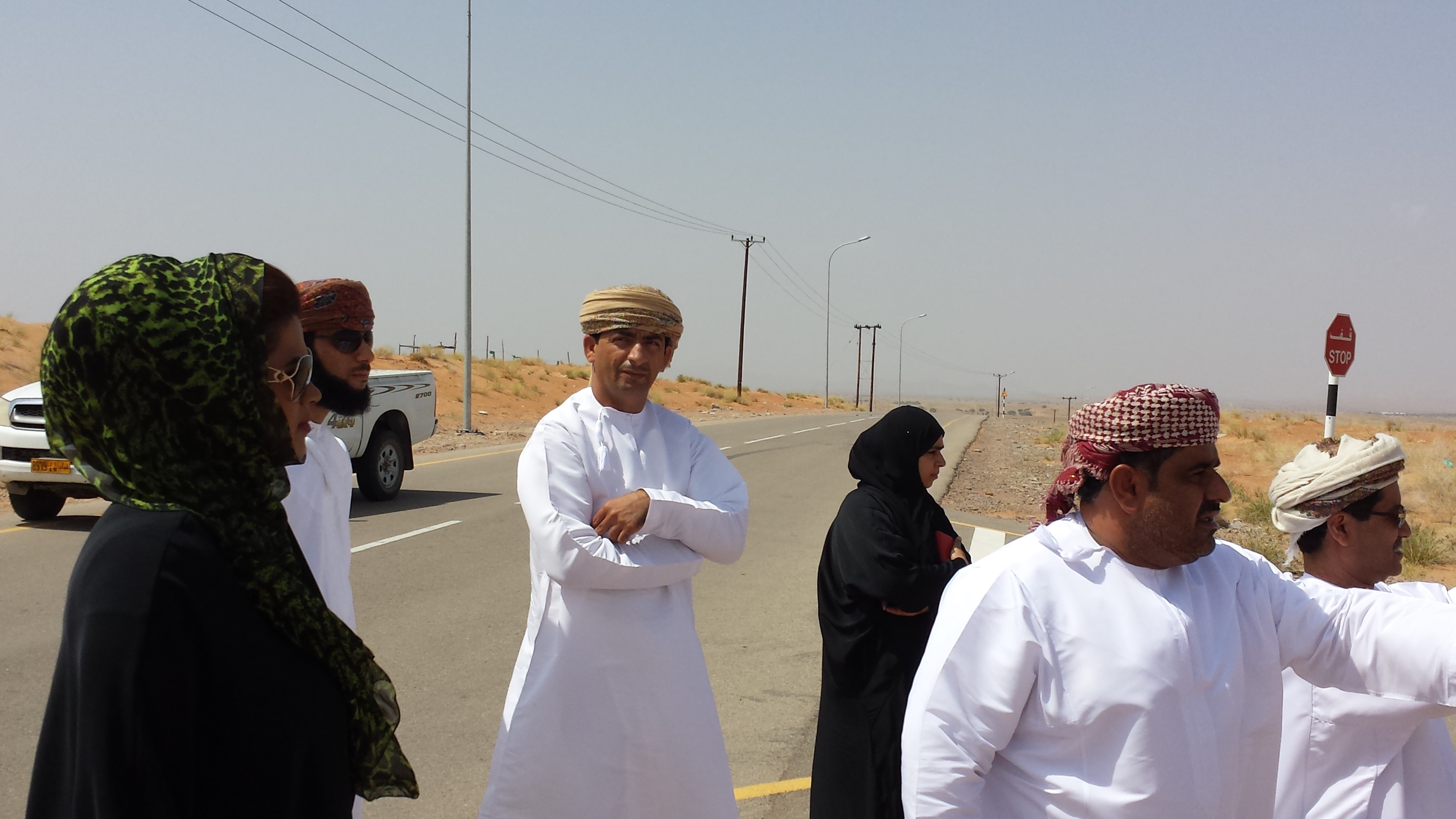
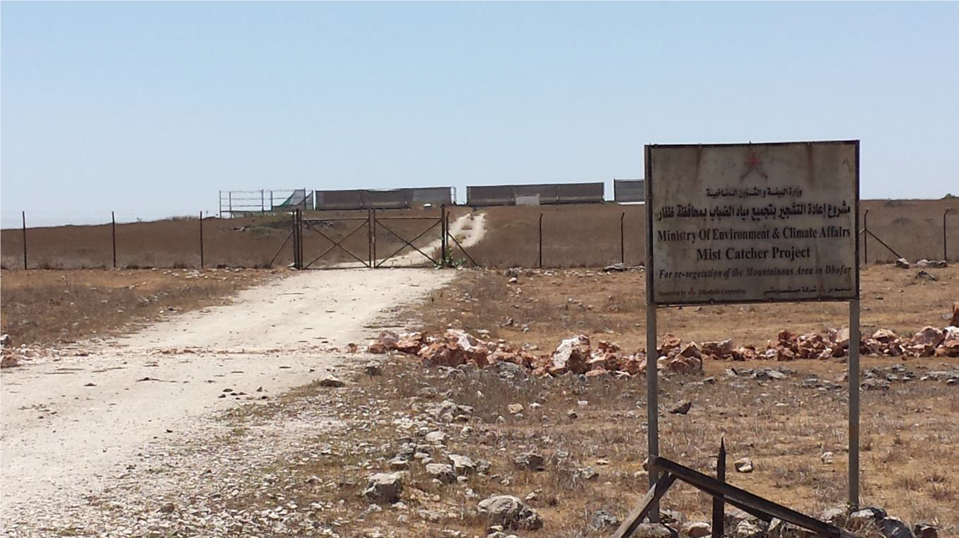
The Environment Authority has implemented land degradation mapping in the Sultanate of Oman in the Governorate of Dhofar, South and North Al Sharqiyah Governorates, and the Governorate of Al Dakhiliyah, in cooperation with Sultan Qaboos University, with the aim of identifying areas with various degrees of degradation and identifying the factors and processes causing degradation.
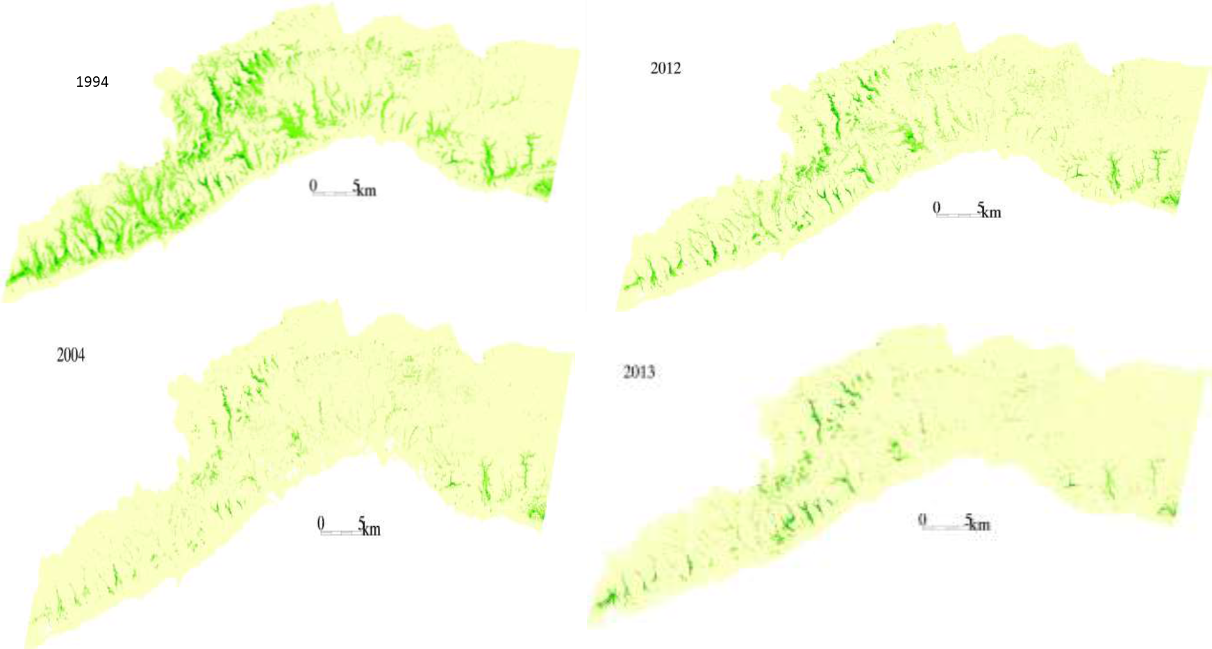
This investigation was based on high-resolution satellite imagery using NDVI as an Index of land degradation in the Dhofar Mountains and the invasion of mesquite (Prosopis juliflora.) in the plain of Salalah, as well as very high resolution aerial and satellite images of Jebal Al-Akhder derived from National Survey Authority. Precipitation data from two WMO stations were also utilized to test the link between precipitation and vegetation health. Vegetation was mapped to monitor changes and its health over time. In addition, a socio-economic survey in the Governorate of Dhofar was conducted, based on random sampling. The survey covered 6 different locations (Taqa, Taaqa farm, Zaik, Qiroon, Marbath, Al-Haqq and Taitam). The preliminary results clearly show that the study area has witnessed significant land use change between 1985 and 2013, marked by the emerging of a significant built-up area and water conservation infrastructure.
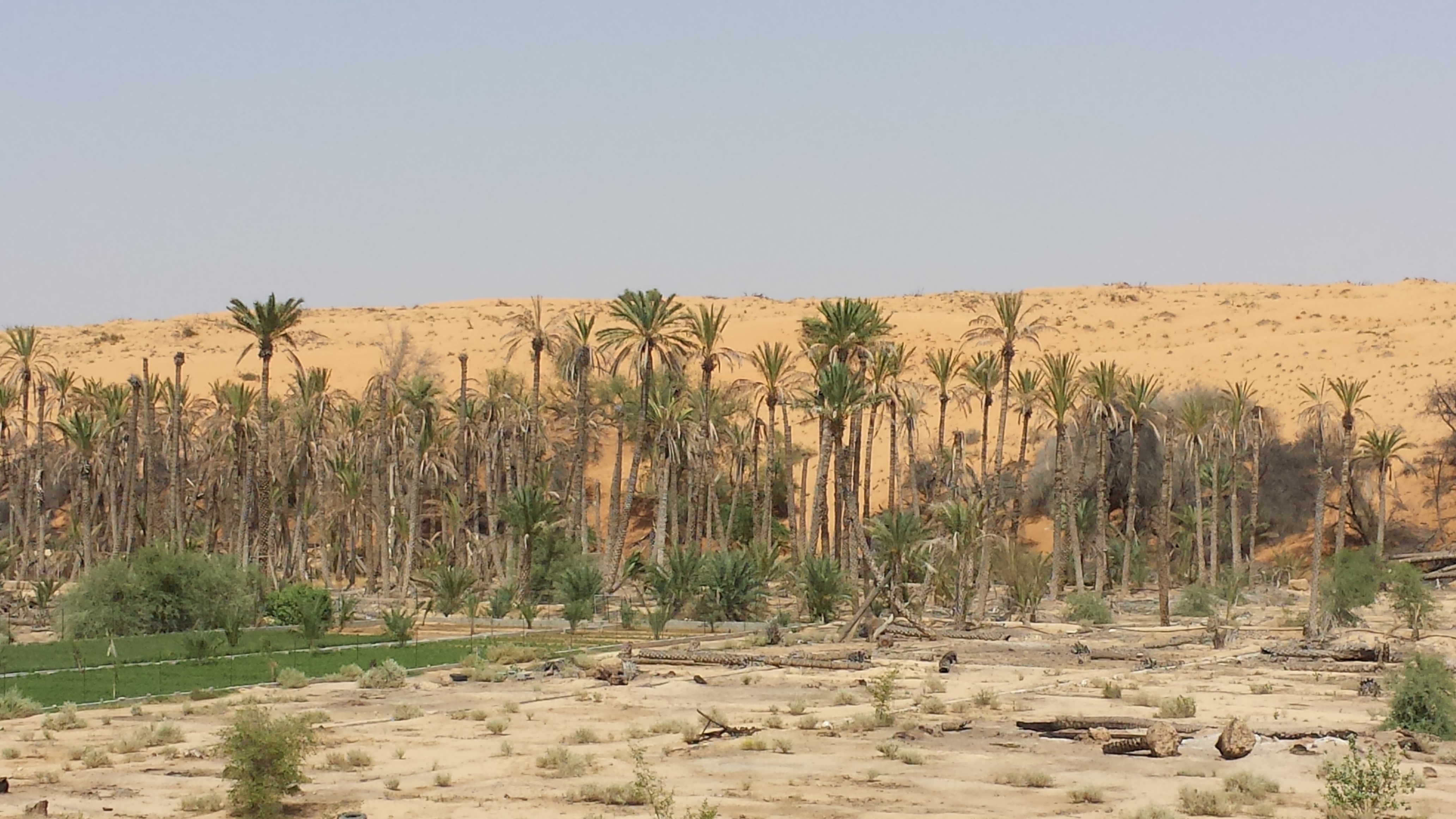
Spot images clearly show sharp changes in vegetation health through the years from 1994 to 2013. Vegetative vigour is lower in all years compared to 1994. Besides, the investigation shows a statistical relationship between rainfall and the status of the health of vegetation. Monsoon rainfall has an impact on the growth of vegetation. Around 2002-2003, the region suffered a major drought. Between 2012 and 2013, vegetative activity shows a decreasing trend. The analysis identified an area affected by the worst degree of land degradation. This area is situated in the southeastern of the Dhofar Mountains. In this area the process of land degradation is very active, with significant decrease in vegetation in 2013 compared to 2004. The mequite invasion in the Salalah Plain contributed to the degradation of natural vegetative cover in Dhofar Governorate. In nearly 30 years, the infested area almost quadrupled, indicating an average rate of expansion of 122,555m2 per year. The mesquite stands seem to have survived through the drought of 2002-2003.
The preliminary results of the survey clearly show that the mountains of Dhofar are under heavy anthropic pressure. The number of livestock is increasing and the native plant species are in great demand for cooking and heating.
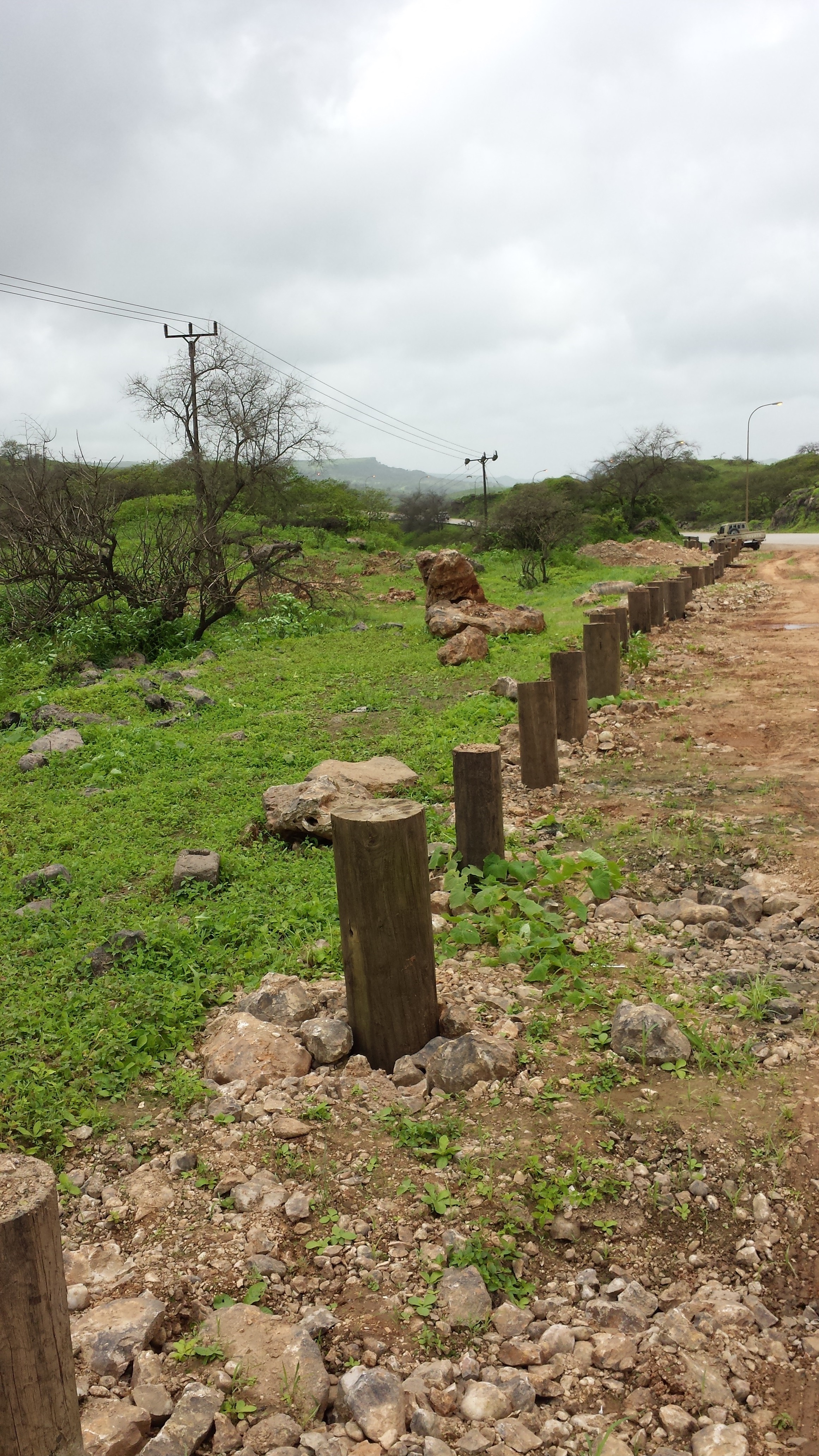
Fortunately, the analysis identifies two areas, situated in the south-west of the study area, where vegetation has increased in vigor and density. The areas preserved from this process are usually inaccessible and far from human activities.
Vegetation cover change in Al-Jabal Al-Akhdar from 1985 to 2014 was analysed using very high resolution aerial and satellite images. Vegetation cover is also studied near settlements, dams, in wadis, and in agricultural areas. The change in total vegetation cover in the study area of Al-Jabal Al-Akhdar from 1985 to 2014 is very evident from the analysis of the data and maps produced.
Vegetation cover increased from 7.38 km2 during 1985 to 13.65 km2 in 2014. This change of vegetation cover was most noticeable in wadis and gullies where vegetation increased from 4.56 km2 during to 9.38 km2. One main factor that might be contributing to this increase of vegetation in wadis is the increase in the number of dams for storing surface water, as the number of dams increased from 7 in 1985 in the study area to 27 in 2014. Vegetation within and around 1 km of settlements in the study area increased from 2.09 km2 during 1985 to 5.45 km2 in 2014. In all other areas, that are distant from human activities, there is a considerable change in green vegetation cover between 1985 and 2014 where vegetation cover increased from 2.49 km2 in 1985 to 3.91 km2 in 2014. It is important to note here that vegetation cover density has a strong correlation with the amount of rainfall in Al-Jabal Al-Akhdar and there was a large difference in the annual rainfall between the two years, i.e. 1985 and 2014. The annual rainfall in 1985 was about 150mm for that particular year. The year 1984 was not much better where annual rainfall was lower than 200mm according to available records. The annual rainfall in 2013, the year preceding date of image in 2014, was 466mm, which is three times higher that that of 1985. Given the results of this study, there is a clear indication that the amount of rainfall plays a major role in defining the density of vegetation cover even if land degradation is taking place in very localized areas where there is pressure from grazing, urbanization, and tourism.
2.3 Photos de l'approche
Galerie Médias

2.5 Pays/ région/ lieux où l'Approche a été appliquée
Pays:
Oman
Région/ Etat/ Province:
Governorate of Dhofar, North and South Al Sharqiyah Governorates and Governorate of Al Dakhiliyah
Autres spécifications du lieu :
Governorate of Dhofar: Taqa, Taaqa farm, Zaik, Qiroon, Marbath, Al-Haqq and Taitam Governorate of Al Dakhiliyah: Al-Jabal Al-Akhdar
2.6 Dates de début et de fin de l'Approche
Indiquez l'année de démarrage:
2013
2.7 Type d'Approche
- fondé sur un projet/ programme
2.8 Principaux objectifs de l'Approche
1.Monitoring and survey of land degradation and areas vulnerable to degradation
2.Enhancing human abilities in land degradation issues
3.Identifying various degrees of degraded areas, and factors and processes causing degradation
4.Regular monitoring of degraded areas
2.9 Conditions favorisant ou entravant la mise en œuvre de la(des) Technologie(s) appliquée(s) sous l'Approche
normes et valeurs sociales/ culturelles/ religieuses
- favorise
Cultural and religious values encourage the protection of land and planting of trees
collaboration/ coordination des acteurs
- favorise
There is always a good collaboration between the government and academic/research institutions to determine the right approaches and technologies for better management practices
cadre juridique (régime foncier, droits d'utilisation des terres et de l'eau)
- entrave
In some regions land tenure is not defined which affects grazing activities in these regions making it difficult to implement any replanting or reforestation projects
3. Participation et rôles des parties prenantes impliquées dans l'Approche
3.1 Parties prenantes impliquées dans l'Approche et rôles
- chercheurs
Researchers from Sultan Qaboos University
Approach development, analysis, and survey
- gouvernement local
Municipalities, Authority departments, and Governor's offices
Field visits and survey, meeting community
- gouvernement national (planificateurs, décideurs)
Environment Authority
Funding, planning approach
3.2 Participation des exploitants locaux des terres/ communautés locales aux différentes phases de l'Approche
| Participation des exploitants locaux des terres/ communautés locales | Spécifiez qui était impliqué et décrivez les activités | |
|---|---|---|
| initiation/ motivation | soutien extérieur | Governor's offices in respective regions played a major role in motivating community leaders to participate in the project |
| mise en œuvre | soutien extérieur | Regional directorates and Governor offices helped in organizing meetings with local communities to collect information about land use activities, including farming and grazing, in their respective villages |
3.3 Diagramme/ organigramme (si disponible)
3.4 Prises de décision pour la sélection de la Technologie/ des Technologies
Indiquez qui a décidé de la sélection de la Technologie/ des Technologies à mettre en œuvre:
- les responsables politiques/ dirigeants
Spécifiez sur quelle base ont été prises les décisions:
- les résultats de recherches?
4. Soutien technique, renforcement des capacités et gestion des connaissances
4.1 Renforcement des capacités/ formation
Une formation a-t-elle été dispensée aux exploitants des terres/ autres parties prenantes?
Oui
Spécifiez qui a été formé:
- personnels/ conseillers de terrain
Formats de la formation:
- cours
Thèmes abordés:
1.Understanding GIS and geographical approach to land degradation
2. Use of remote sensing techniques for data collection
3. Land degradation assessment in drylands
4.2 Service de conseils
Les exploitants des terres ont-ils accès à un service de conseils?
Non
4.3 Renforcement des institutions (développement organisationnel)
Des institutions ont elles été mises en place ou renforcées par le biais de l'Approche?
- oui, modérément
Spécifiez à quel(s) niveau(x), ces institutions ont été renforcées ou mises en place:
- national
Précisez le type de soutien:
- renforcement des capacités/ formation
4.4 Suivi et évaluation
Le suivi et l'évaluation font ils partie de l'Approche? :
Oui
Si oui, ce document est-il destiné à être utilisé pour le suivi et l'évaluation?
Non
4.5 Recherche
La recherche a-t-elle fait partie intégrante de l’Approche?
Oui
Spécifiez les thèmes:
- sociologie
- écologie
5. Financement et soutien matériel externe
5.1 Budget annuel de la composante GDT de l'Approche
Si le budget annuel précis n'est pas connu, indiquez une fourchette:
- 100 000-1 000 000
5.2 Soutiens financiers/ matériels fournis aux exploitants des terres
Les exploitants des terres ont-ils reçu un soutien financier/ matériel pour la mise en œuvre de la Technologie/ des Technologies?
Non
5.4 Crédits
Des crédits ont-ils été alloués à travers l'Approche pour les activités de GDT?
Non
5.5 Autres incitations ou instruments
D'autres incitations ou instruments ont-ils été utilisés pour promouvoir la mise en œuvre des Technologies de GDT?
Non
6. Analyses d'impact et conclusions
6.1 Impacts de l'Approche
Est-ce que l'Approche a autonomisé les exploitants locaux des terres, amélioré la participation des parties prenantes?
- Non
- Oui, un peu
- Oui, modérément
- Oui, beaucoup
Stakeholders participated in collecting social data by visiting different towns and sitting with the community to explain the approach, define the problems, and evaluate solutions
Est-ce que l'Approche a permis la prise de décisions fondées sur des données probantes?
- Non
- Oui, un peu
- Oui, modérément
- Oui, beaucoup
Solutions and practices suggested resulted from extensive field work and image analysis
Est-ce que l'Approche a mobilisé/ amélioré l'accès aux ressources financières pour la mise en œuvre de la GDT?
- Non
- Oui, un peu
- Oui, modérément
- Oui, beaucoup
Financial resources were mobilized and directed towards plantation of trees in degraded lands
Est-ce que l'Approche a amélioré les connaissances et les capacités des autres parties prenantes?
- Non
- Oui, un peu
- Oui, modérément
- Oui, beaucoup
Training courses were developed for government staff to collect field and social data
Est-ce que l'Approche a construit/ renforcé les institutions, la collaboration entre parties prenantes?
- Non
- Oui, un peu
- Oui, modérément
- Oui, beaucoup
6.2 Principale motivation des exploitants des terres pour mettre en œuvre la GDT
- réduire la dégradation des terres
- conscience environnementale
- améliorer les connaissances et compétences en GDT
6.3 Durabilité des activités de l'Approche
Les exploitants des terres peuvent-ils poursuivre ce qui a été mis en œuvre par le biais de l'Approche (sans soutien extérieur)?
- incertain
6.4 Points forts/ avantages de l'Approche
| Points forts/ avantages/ possibilités du point de vue du compilateur ou d'une autre personne ressource clé |
|---|
| 1-As the results show that the amount of rainfall plays a major role in defining the density of vegetation, water catchment techniques can be deployed during rainfall periods – especially during Dhofar monsoon characterized with white fog and light rains- such as fog harvesting, increasing recharge dams, using new irrigation techniques from dams for affected areas |
| 2-By mapping land degradation in the Sultanate, areas that need protective strategies and policies can be defined, to avoid the degradation of areas of similar features through the coordination with respective sectors including urban planning, tourism, and agriculture. |
| 3- As the analysis identifies areas where vegetation has increased in vigor and density, factors leading to that may be explored and studied in order to apply same factors in similar environments. |
6.5 Faiblesses/ inconvénients de l'Approche et moyens de les surmonter
| Faiblesses/ inconvénients/ risques du point de vue du compilateur ou d'une autre personne ressource clé | Comment peuvent-ils être surmontés? |
|---|---|
| 1-As the spread and type of vegetation and climatic conditions differs greatly from area to area in the Sultanate of Oman, different procedures and techniques need to be employed. | studying the general conditions and features of each area and applying different procedures and techniques based on specific characteristics. |
| 2-Analysis of vegetation change using satellite images in terrain characterized by deep slopes and deep valleys in some areas in the Sultanate is very difficult. | using very high resolution remotely sensed images |
| 3-High resolution remotely sensed images are sometimes unavailable for past periods, which hinder studying vegetation change in this region where using satellite is difficult as well. |
7. Références et liens
7.1 Méthodes/ sources d'information
- visites de terrain, enquêtes sur le terrain
- interviews/entretiens avec les exploitants des terres
More than 500 questionnaires
Liens et modules
Développer tout Réduire toutLiens
Aucun lien
Modules
Aucun module trouvé