MAPPING, MONITORING, AND MITIGATION OF LAND DEGRADATION IN THE SULTANATE OF OMAN [โอมาน]
- ผู้สร้างสรรค์:
- การอัพเดท:
- ผู้รวบรวม: Laila AlShmali
- ผู้เรียบเรียง: –
- ผู้ตรวจสอบ: William Critchley, Rima Mekdaschi Studer
MAPPING, MONITORING, AND MITIGATION OF LAND DEGRADATION IN THE SULTANATE OF OMAN
approaches_5972 - โอมาน
ดูส่วนย่อย
ขยายทั้งหมด ย่อทั้งหมด1. ข้อมูลทั่วไป
1.2 รายละเอียดที่ติดต่อได้ของผู้รวบรวมและองค์กรที่เกี่ยวข้องในการประเมินและการจัดเตรียมทำเอกสารของแนวทาง
วิทยากรหลัก
ผู้เชี่ยวชาญ SLM:
Al-Sareeria Thuraya
00968 24404762
thuraya.alsareeri@meca.gov.om
Environment Authority
Muscat, Oman
โอมาน
ผู้เชี่ยวชาญ SLM:
Al-Saadi Saleh Naghmush
00968 24404750
saleh.alsaadi@meca.gov.om
Environment Authority
Muscat, Oman
โอมาน
researcher:
Al-Wardy Malik
00968 24141224
mwardy@squ.edu.om
Sultan Qaboos University
Muscat, Oman
โอมาน
ชื่อของโครงการซึ่งอำนวยความสะดวกในการทำเอกสารหรือการประเมินแนวทาง (ถ้าเกี่ยวข้อง)
Sultan Qaboos University (SQU) - โอมาน1.3 เงื่อนไขที่เกี่ยวข้องกับการใช้ข้อมูลที่ได้บันทึกไว้ผ่านทาง WOCAT
วันที่เก็บรวบรวมข้อมูล (ภาคสนาม):
15/09/2013
ผู้รวบรวมและวิทยากรหลักยอมรับเงื่อนไขเกี่ยวกับการใช้ข้อมูลที่ถูกบันทึกผ่านทาง WOCAT:
ใช่
2. คำอธิบายของแนวทาง SLM
2.1 การอธิบายแบบสั้น ๆ ของแนวทาง
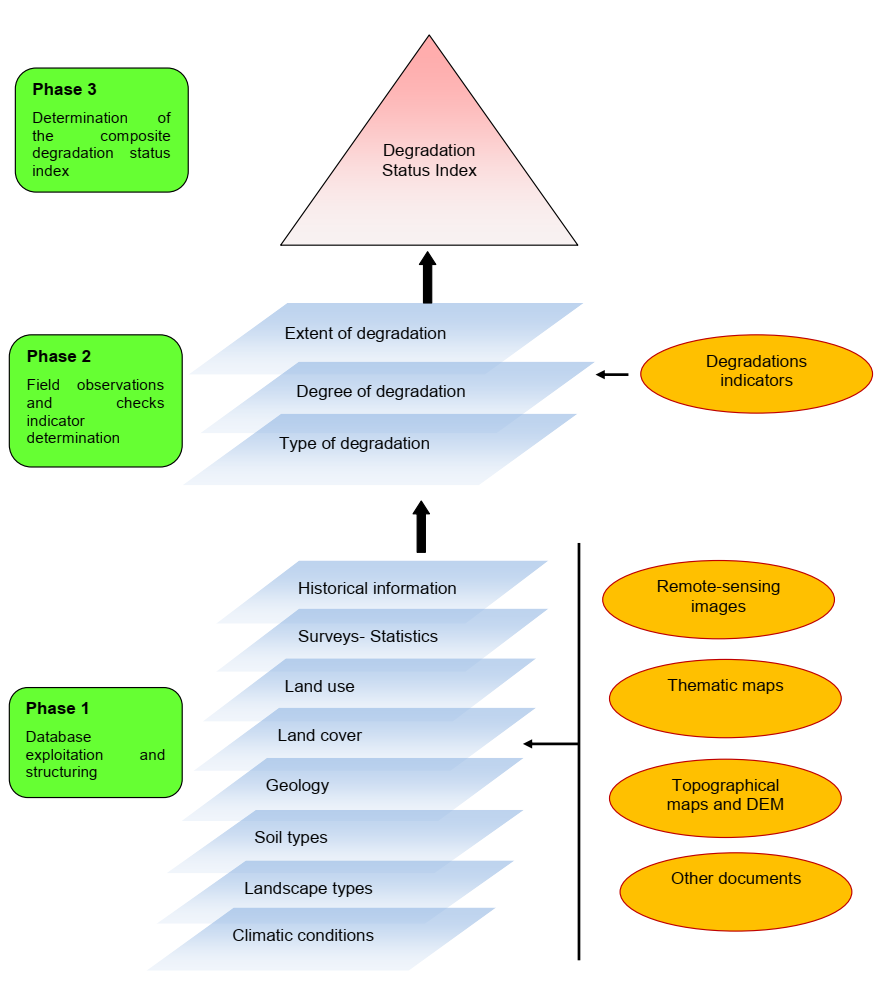
Mapping of land degradation in the Sultanate of Oman to identify areas with various degrees of degradation, and factors and processes causing degradation.
2.2 การอธิบายอย่างละเอียดของแนวทาง
การอธิบายอย่างละเอียดของแนวทาง:
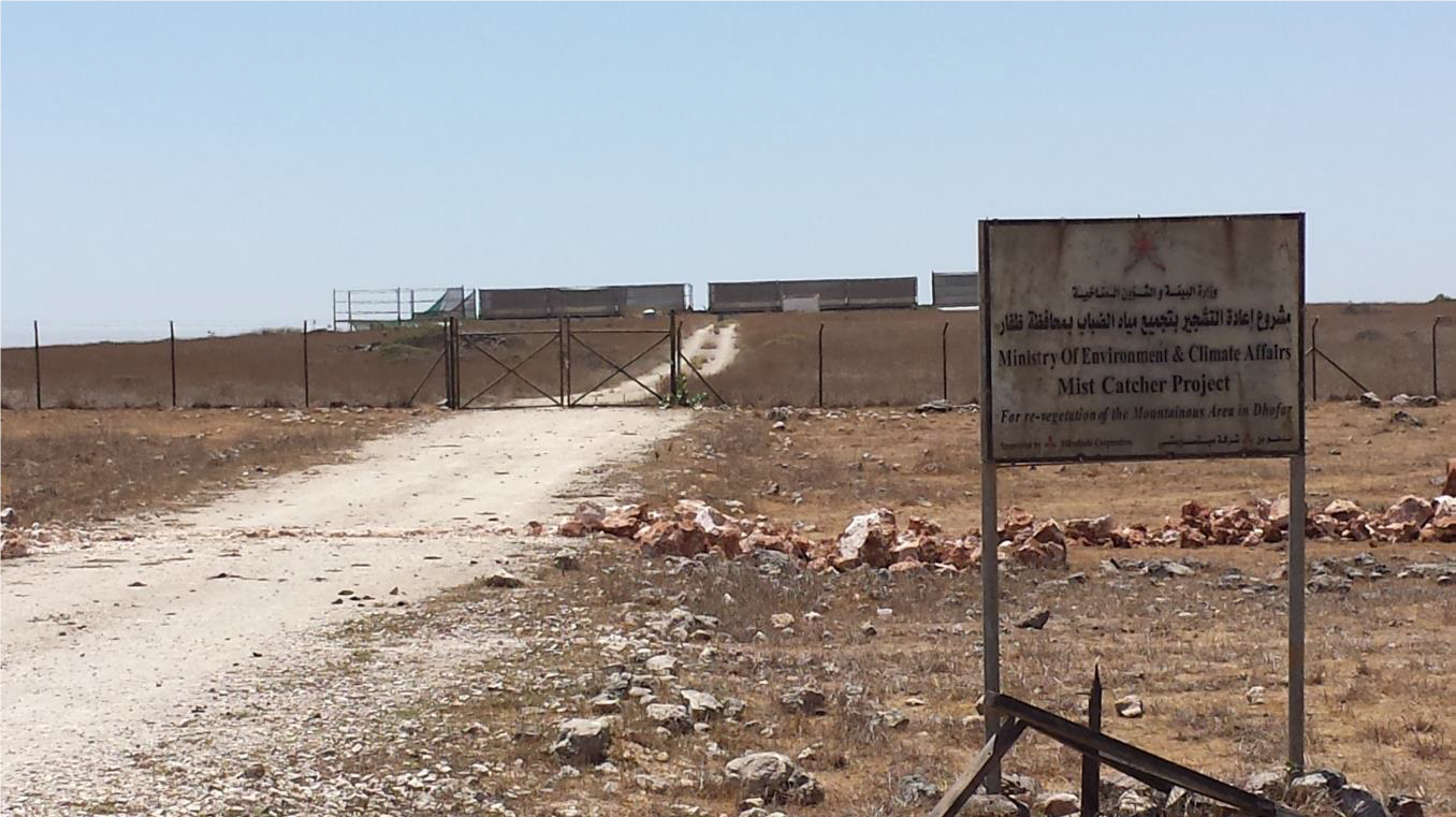
The Environment Authority has implemented land degradation mapping in the Sultanate of Oman in the Governorate of Dhofar, South and North Al Sharqiyah Governorates, and the Governorate of Al Dakhiliyah, in cooperation with Sultan Qaboos University, with the aim of identifying areas with various degrees of degradation and identifying the factors and processes causing degradation.
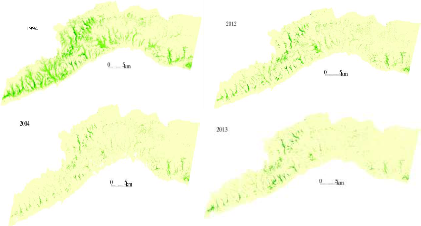
This investigation was based on high-resolution satellite imagery using NDVI as an Index of land degradation in the Dhofar Mountains and the invasion of mesquite (Prosopis juliflora.) in the plain of Salalah, as well as very high resolution aerial and satellite images of Jebal Al-Akhder derived from National Survey Authority. Precipitation data from two WMO stations were also utilized to test the link between precipitation and vegetation health. Vegetation was mapped to monitor changes and its health over time. In addition, a socio-economic survey in the Governorate of Dhofar was conducted, based on random sampling. The survey covered 6 different locations (Taqa, Taaqa farm, Zaik, Qiroon, Marbath, Al-Haqq and Taitam). The preliminary results clearly show that the study area has witnessed significant land use change between 1985 and 2013, marked by the emerging of a significant built-up area and water conservation infrastructure.
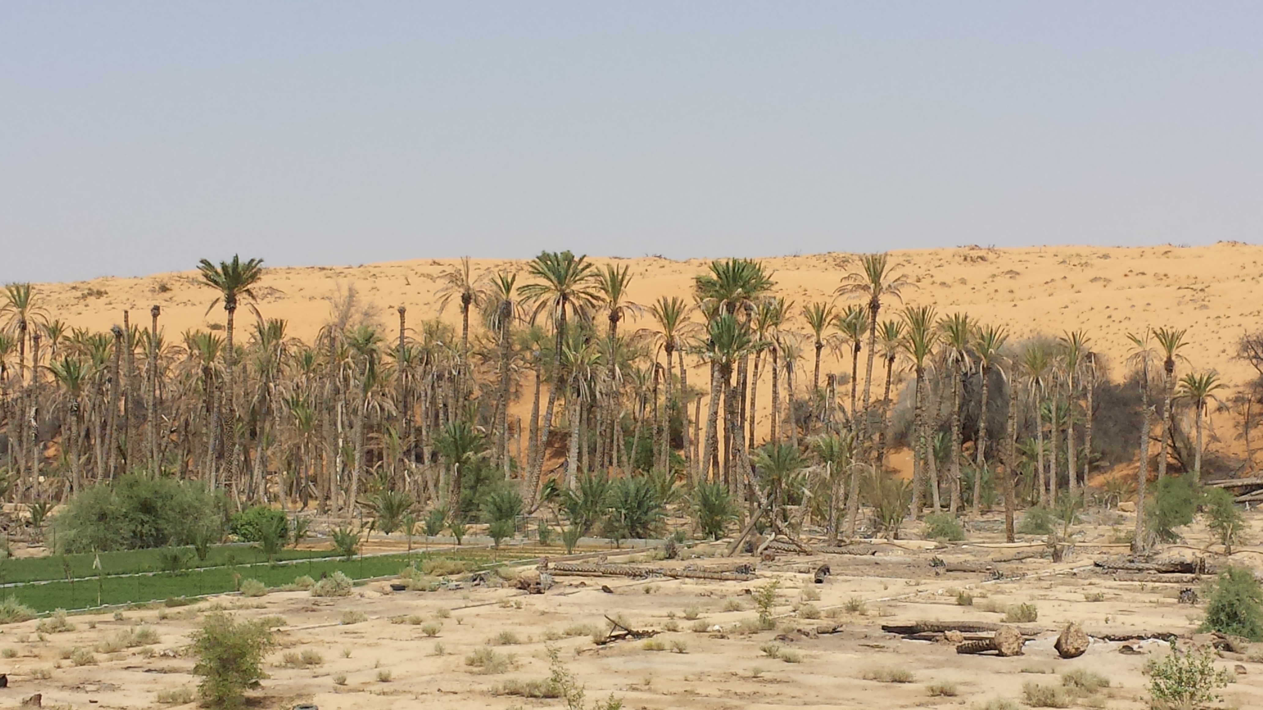
Spot images clearly show sharp changes in vegetation health through the years from 1994 to 2013. Vegetative vigour is lower in all years compared to 1994. Besides, the investigation shows a statistical relationship between rainfall and the status of the health of vegetation. Monsoon rainfall has an impact on the growth of vegetation. Around 2002-2003, the region suffered a major drought. Between 2012 and 2013, vegetative activity shows a decreasing trend. The analysis identified an area affected by the worst degree of land degradation. This area is situated in the southeastern of the Dhofar Mountains. In this area the process of land degradation is very active, with significant decrease in vegetation in 2013 compared to 2004. The mequite invasion in the Salalah Plain contributed to the degradation of natural vegetative cover in Dhofar Governorate. In nearly 30 years, the infested area almost quadrupled, indicating an average rate of expansion of 122,555m2 per year. The mesquite stands seem to have survived through the drought of 2002-2003.
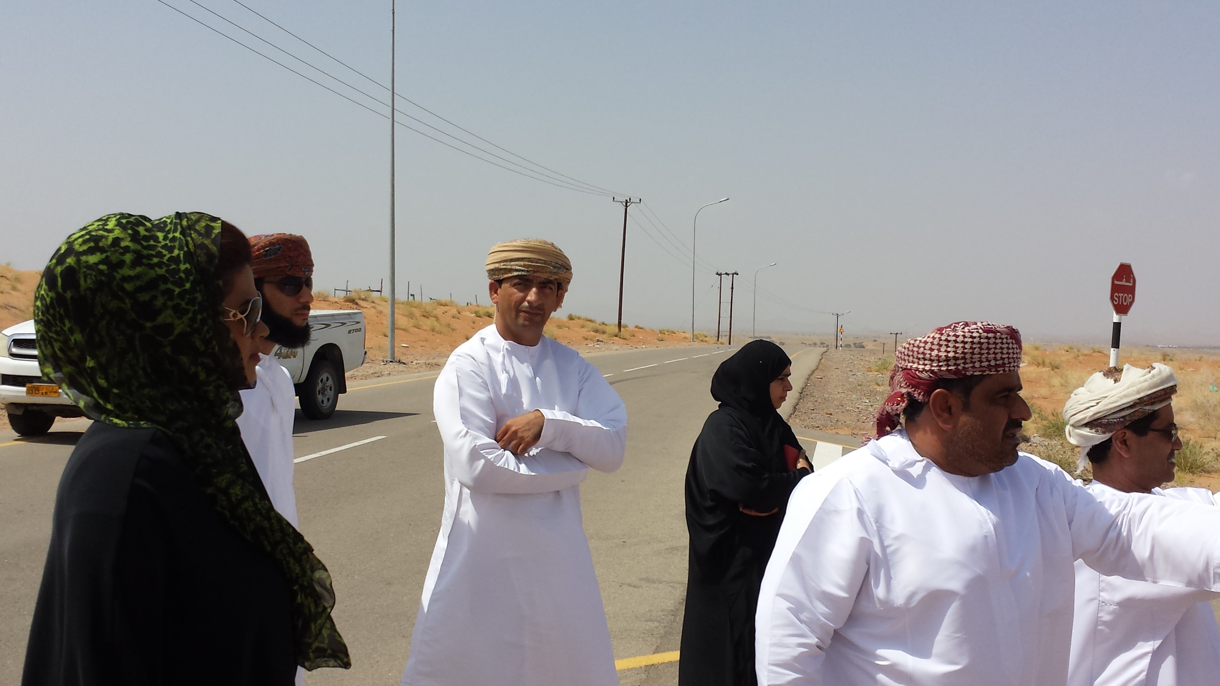
The preliminary results of the survey clearly show that the mountains of Dhofar are under heavy anthropic pressure. The number of livestock is increasing and the native plant species are in great demand for cooking and heating.
Fortunately, the analysis identifies two areas, situated in the south-west of the study area, where vegetation has increased in vigor and density. The areas preserved from this process are usually inaccessible and far from human activities.
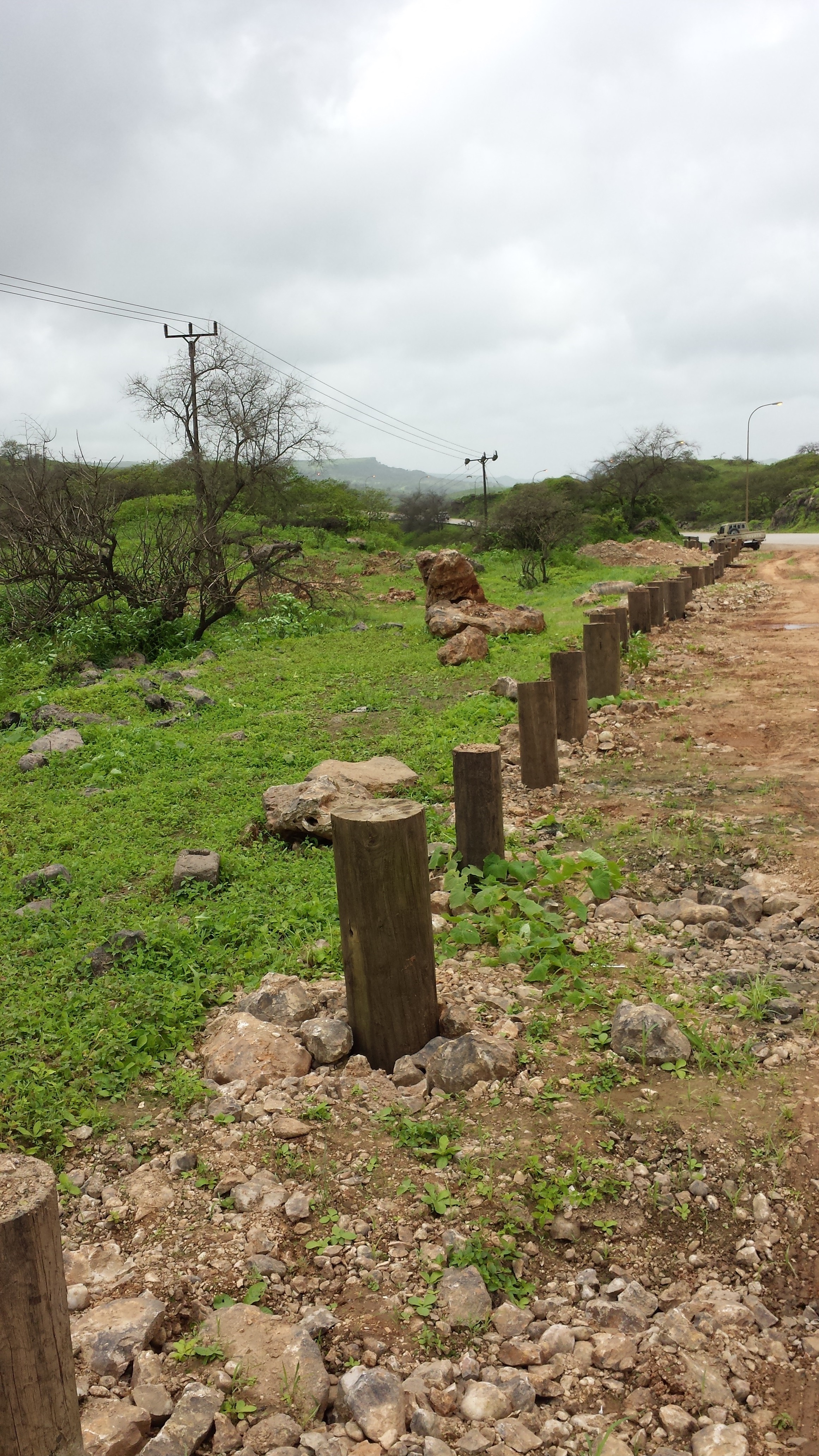
Vegetation cover change in Al-Jabal Al-Akhdar from 1985 to 2014 was analysed using very high resolution aerial and satellite images. Vegetation cover is also studied near settlements, dams, in wadis, and in agricultural areas. The change in total vegetation cover in the study area of Al-Jabal Al-Akhdar from 1985 to 2014 is very evident from the analysis of the data and maps produced.
Vegetation cover increased from 7.38 km2 during 1985 to 13.65 km2 in 2014. This change of vegetation cover was most noticeable in wadis and gullies where vegetation increased from 4.56 km2 during to 9.38 km2. One main factor that might be contributing to this increase of vegetation in wadis is the increase in the number of dams for storing surface water, as the number of dams increased from 7 in 1985 in the study area to 27 in 2014. Vegetation within and around 1 km of settlements in the study area increased from 2.09 km2 during 1985 to 5.45 km2 in 2014. In all other areas, that are distant from human activities, there is a considerable change in green vegetation cover between 1985 and 2014 where vegetation cover increased from 2.49 km2 in 1985 to 3.91 km2 in 2014. It is important to note here that vegetation cover density has a strong correlation with the amount of rainfall in Al-Jabal Al-Akhdar and there was a large difference in the annual rainfall between the two years, i.e. 1985 and 2014. The annual rainfall in 1985 was about 150mm for that particular year. The year 1984 was not much better where annual rainfall was lower than 200mm according to available records. The annual rainfall in 2013, the year preceding date of image in 2014, was 466mm, which is three times higher that that of 1985. Given the results of this study, there is a clear indication that the amount of rainfall plays a major role in defining the density of vegetation cover even if land degradation is taking place in very localized areas where there is pressure from grazing, urbanization, and tourism.
2.3 รูปภาพของแนวทาง
อัลบั้มสื่อบันทึก

2.5 ประเทศ ภูมิภาค หรือสถานที่ตั้งที่ได้นำแนวทางไปใช้
ประเทศ:
โอมาน
ภูมิภาค/รัฐ/จังหวัด: :
Governorate of Dhofar, North and South Al Sharqiyah Governorates and Governorate of Al Dakhiliyah
ข้อมูลเฉพาะเพิ่มเติมของสถานที่ตั้ง:
Governorate of Dhofar: Taqa, Taaqa farm, Zaik, Qiroon, Marbath, Al-Haqq and Taitam Governorate of Al Dakhiliyah: Al-Jabal Al-Akhdar
2.6 วันที่เริ่มต้นและสิ้นสุดของแนวทาง
ระบุปีที่เริ่ม:
2013
2.7 ประเภทของแนวทาง
- ใช้โครงงานหรือแผนงานเป็นฐาน
2.8 เป้าหมายหรือวัตถุประสงค์หลักของแนวทาง
1.Monitoring and survey of land degradation and areas vulnerable to degradation
2.Enhancing human abilities in land degradation issues
3.Identifying various degrees of degraded areas, and factors and processes causing degradation
4.Regular monitoring of degraded areas
2.9 เงื่อนไขที่เอื้ออำนวยหรือเป็นอุปสรรคต่อการนำเทคโนโลยีภายใต้แนวทางนี้ไปปฏิบัติใช้
บรรทัดฐานและค่านิยมทางสังคม วัฒนธรรม ศาสนา
- เอื้ออำนวย
Cultural and religious values encourage the protection of land and planting of trees
การร่วมมือหรือการทำงานประสานกันของผู้ลงมือปฏิบัติ
- เอื้ออำนวย
There is always a good collaboration between the government and academic/research institutions to determine the right approaches and technologies for better management practices
กรอบแนวทางในการดำเนินการด้านกฎหมาย (การถือครองที่ดิน สิทธิในการใช้ที่ดินและน้ำ)
- เป็นอุปสรรค
In some regions land tenure is not defined which affects grazing activities in these regions making it difficult to implement any replanting or reforestation projects
3. การมีส่วนร่วมและบทบาทของผู้มีส่วนได้ส่วนเสียที่เกี่ยวข้อง
3.1 ผู้มีส่วนได้ส่วนเสียที่เกี่ยวข้องในแนวทางนี้และบทบาท
- นักวิจัย
Researchers from Sultan Qaboos University
Approach development, analysis, and survey
- รัฐบาลระดับท้องถิ่น
Municipalities, Authority departments, and Governor's offices
Field visits and survey, meeting community
- รัฐบาลแห่งชาติ (ผู้วางแผน ผู้ทำการตัดสินใจ)
Environment Authority
Funding, planning approach
3.2 การเกี่ยวข้องของผู้ใช้ที่ดินระดับท้องถิ่นหรือชุมชนระดับท้องถิ่นในช่วงต่างๆของแนวทาง
| ความเกี่ยวข้องของผู้ใช้ที่ดินระดับท้องถิ่นหรือชุมชนระดับท้องถิ่น | ระบุผู้ที่มีส่วนเกี่ยวข้องและอธิบายกิจกรรม | |
|---|---|---|
| การริเริ่มหรือการจูงใจ | จ่ายเงินหรือสนับสนุนจากภายนอก | Governor's offices in respective regions played a major role in motivating community leaders to participate in the project |
| การดำเนินการ | จ่ายเงินหรือสนับสนุนจากภายนอก | Regional directorates and Governor offices helped in organizing meetings with local communities to collect information about land use activities, including farming and grazing, in their respective villages |
3.3 แผนผังแสดงขั้นตอนการทำงาน (ถ้ามี)
3.4 การตัดสินใจเลือกใช้เทคโนโลยี SLM
ระบุผู้ที่ทำการตัดสินใจเลือกเทคโนโลยีมากกว่าหนึ่งวิธีไปปฏิบัติใช้:
- นักการเมืองหรือผู้นำ
ระบุว่าการตัดสินใจตั้งอยู่บนพื้นฐานของ:
- สิ่งที่ค้นพบจากงานวิจัย
4. การสนับสนุนด้านเทคนิค การสร้างขีดความสามารถ และการจัดการด้านความรู้
4.1 การสร้างขีดความสามารถ / การอบรม
ได้มีการจัดอบรมให้แก่ผู้ใช้ที่ดินหรือผู้มีส่วนได้ส่วนเสียคนอื่น ๆ หรือไม่:
ใช่
ให้ระบุว่าใครเป็นผู้ได้รับการอบรม:
- เจ้าหน้าที่ภาคสนาม / ที่ปรึกษา
รูปแบบการอบรม:
- จัดคอร์ส
หัวข้อที่พูด:
1.Understanding GIS and geographical approach to land degradation
2. Use of remote sensing techniques for data collection
3. Land degradation assessment in drylands
4.2 การบริการให้คำแนะนำ
ผู้ใช้ที่ดินมีการเข้าถึงการรับบริการให้คำปรึกษาหรือไม่:
ไม่ใช่
4.3 การเสริมความแข็งแกร่งให้กับสถาบัน (การพัฒนาองค์กร)
สถาบันได้รับการจัดตั้งขึ้นมาหรือเสริมความแข็งแกร่งโดยแนวทางนี้หรือไม่:
- ใช่ ปานกลาง
ระบุระดับของสถาบันที่ได้รับการเสริมความแข็งแกร่งหรือจัดตั้งขึ้นมา:
- ประเทศ
ระบุประเภทของการให้ความช่วยเหลือสนับสนุน:
- การสร้างขีดความสามารถ / การอบรม
4.4 การติดตามตรวจสอบและประเมินผล
การติดตามตรวจสอบและประเมินผลเป็นส่วนหนึ่งของแนวทางหรือไม่:
ใช่
ถ้าตอบว่าใช่ แสดงว่าการจัดเตรียมเอกสารนี้มุ่งหวังที่จะเอาไปใช้สำหรับการติดตามตรวจสอบและประเมินผลใช่หรือไม่:
ไม่ใช่
4.5 การวิจัย
การวิจัยเป็นส่วนหนึ่งของแนวทางหรือไม่:
ใช่
ระบุหัวข้อเรื่อง:
- สังคมวิทยา
- นิเวศวิทยา
5. การสนับสนุนด้านการเงินและวัสดุอุปกรณ์
5.1 ระบุงบประมาณประจำปีสำหรับแนวทาง SLM นี้
ถ้าหากว่างบประมาณประจำปีไม่เป็นที่ทราบแน่นอน ให้ระบุช่วงลงไป:
- 10,000-100,000
5.2 การสนับสนุนด้านการเงิน / วัสดุอุปกรณ์ให้แก่ผู้ใช้ที่ดิน
ผู้ใช้ที่ดินได้รับการสนับสนุนด้านการเงิน / วัสดุอุปกรณ์ไปปฏิบัติใช้เทคโนโลยีหรือไม่:
ไม่ใช่
5.4 เครดิต
มีการจัดหาเครดิตมาให้ภายใต้แนวทาง SLM หรือไม่:
ไม่ใช่
5.5 แรงจูงใจหรือเครื่องมืออื่น ๆ
แรงจูงใจหรือเครื่องมืออื่น ๆ ได้ถูกนำไปใช้ส่งเสริมการใช้เทคโนโลยี SLM หรือไม่:
ไม่ใช่
6. การวิเคราะห์ผลกระทบและการสรุป
6.1 ผลกระทบของแนวทาง
ทำให้ผู้ใช้ที่ดินระดับท้องถิ่นมีอำนาจขึ้น ปรับปรุงการเข้าร่วมของผู้มีส่วนได้ส่วนเสียให้ดีขึ้นหรือไม่:
- ไม่ใช่
- ใช่ เล็กน้อย
- ใช่ ปานกลาง
- ใช่ อย่างมาก
Stakeholders participated in collecting social data by visiting different towns and sitting with the community to explain the approach, define the problems, and evaluate solutions
ช่วยในการตัดสินใจโดยดูจากหลักฐาน ได้หรือไม่:
- ไม่ใช่
- ใช่ เล็กน้อย
- ใช่ ปานกลาง
- ใช่ อย่างมาก
Solutions and practices suggested resulted from extensive field work and image analysis
ระดมกำลังหรือปรับปรุงการเข้าถึงแหล่ง เงินทุนสำหรับการดำเนินการ SLM หรือไม่:
- ไม่ใช่
- ใช่ เล็กน้อย
- ใช่ ปานกลาง
- ใช่ อย่างมาก
Financial resources were mobilized and directed towards plantation of trees in degraded lands
ปรับปรุงความรู้และความสามารถของผู้มีส่วนได้ส่วนเสียคนอื่น ๆ ให้ดีขึ้นหรือไม่:
- ไม่ใช่
- ใช่ เล็กน้อย
- ใช่ ปานกลาง
- ใช่ อย่างมาก
Training courses were developed for government staff to collect field and social data
ทำให้ผู้ใช้ที่ดินระดับท้องถิ่นมีอำนาจขึ้น ปรับปรุงการเข้าร่วมของผู้มีส่วนได้ส่วนเสียให้ดีขึ้นหรือไม่:
- ไม่ใช่
- ใช่ เล็กน้อย
- ใช่ ปานกลาง
- ใช่ อย่างมาก
6.2 แรงจูงใจหลักของผู้ใช้ที่ดินเพื่อที่จะนำ SLM ไปปฏิบัติใช้
- การเสื่อมของที่ดินลดลง
- จิตสำนึกด้านสิ่งแวดล้อม
- ความรู้และทักษะ SLM ที่เพิ่มพูนขึ้น
6.3 ความยั่งยืนของกิจกรรมของแนวทาง
ผู้ใช้ที่ดินสามารถทำให้สิ่งต่างๆ ที่ได้ปฏิบัติใช้โดยแนวทางนี้ยั่งยืนได้หรือไม่ (โดยไม่มีการสนับสนุนจากภายนอก):
- ไม่แน่ใจ
6.4 จุดแข็งและข้อได้เปรียบของแนวทาง
| จุดแข็ง / ข้อได้เปรียบของแนวทางในทัศนคติของผู้รวบรวมหรือวิทยากรหลัก |
|---|
| 1-As the results show that the amount of rainfall plays a major role in defining the density of vegetation, water catchment techniques can be deployed during rainfall periods – especially during Dhofar monsoon characterized with white fog and light rains- such as fog harvesting, increasing recharge dams, using new irrigation techniques from dams for affected areas |
| 2-By mapping land degradation in the Sultanate, areas that need protective strategies and policies can be defined, to avoid the degradation of areas of similar features through the coordination with respective sectors including urban planning, tourism, and agriculture. |
| 3- As the analysis identifies areas where vegetation has increased in vigor and density, factors leading to that may be explored and studied in order to apply same factors in similar environments. |
6.5 จุดอ่อน / ข้อเสียเปรียบของแนวทางและวิธีในการแก้ไข
| จุดอ่อน / ข้อเสียเปรียบในทัศนคติของผู้รวบรวมหรือวิทยากรหลัก | สามารถแก้ไขปัญหาได้อย่างไร |
|---|---|
| 1-As the spread and type of vegetation and climatic conditions differs greatly from area to area in the Sultanate of Oman, different procedures and techniques need to be employed. | studying the general conditions and features of each area and applying different procedures and techniques based on specific characteristics. |
| 2-Analysis of vegetation change using satellite images in terrain characterized by deep slopes and deep valleys in some areas in the Sultanate is very difficult. | using very high resolution remotely sensed images |
| 3-High resolution remotely sensed images are sometimes unavailable for past periods, which hinder studying vegetation change in this region where using satellite is difficult as well. |
7. การอ้างอิงและการเชื่อมต่อ
7.1 วิธีการหรือแหล่งข้อมูล
- ไปเยี่ยมชมภาคสนาม การสำรวจพื้นที่ภาคสนาม
- การสัมภาษณ์กับผู้ใช้ที่ดิน
More than 500 questionnaires
ลิงก์และโมดูล
ขยายทั้งหมด ย่อทั้งหมดลิงก์
ไม่มีลิงก์
โมดูล
ไม่มีโมดูล