MAPPING, MONITORING, AND MITIGATION OF LAND DEGRADATION IN THE SULTANATE OF OMAN [Оман]
- Шинийг нээх:
- Шинэчлэх:
- Мэдээлэл цуглуулсан: Laila AlShmali
- Редактор: –
- Хянагчид: William Critchley, Rima Mekdaschi Studer
MAPPING, MONITORING, AND MITIGATION OF LAND DEGRADATION IN THE SULTANATE OF OMAN
approaches_5972 - Оман
Бүлгүүдийг үзэх
Бүгдийг харуулах Бүгдийг хаах1. Ерөнхий мэдээлэл
1.2 Арга барилыг баримтжуулах болон үнэлгээ хийхэд оролцсон хүн эсвэл байгууллагын холбоо барих хаяг
Мэдээлэл өгсөн хүн(с)
ГТМ мэргэжилтэн :
Al-Sareeria Thuraya
00968 24404762
thuraya.alsareeri@meca.gov.om
Environment Authority
Muscat, Oman
Оман
ГТМ мэргэжилтэн :
Al-Saadi Saleh Naghmush
00968 24404750
saleh.alsaadi@meca.gov.om
Environment Authority
Muscat, Oman
Оман
researcher:
Al-Wardy Malik
00968 24141224
mwardy@squ.edu.om
Sultan Qaboos University
Muscat, Oman
Оман
Арга барилыг баримтжуулах/үнэлэх ажилд дэмжлэг үзүүлсэн байгууллага(ууд)-ын нэр (шаардлагатай бол)
Sultan Qaboos University (SQU) - Оман1.3 WOCAT-аар баримтжуулсан өгөгдлийг ашиглахтай холбоотой нөхцөл
Мэдээллийг хэзээ (газар дээр нь) цуглуулсан бэ?
15/09/2013
Эмхэтгэгч болон гол мэдээлэгч хүн(хүмүүс) WOCAT аргачлалаар баримтжуулсан мэдээллийг ашиглахтай холбоотой нөхцлийг хүлээн зөвшөөрсөн.
Тийм
2. ГТМ Арга барилын тодорхойлолт
2.1 Арга барилын товч тодорхойлолт
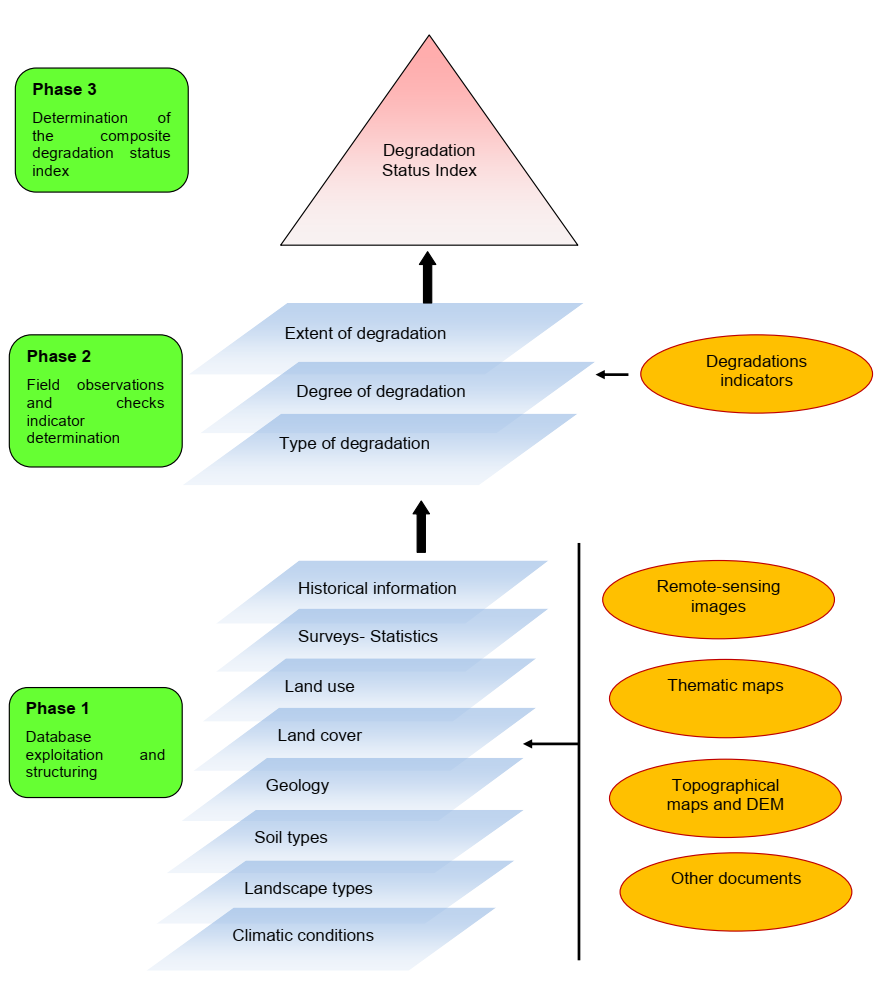
Mapping of land degradation in the Sultanate of Oman to identify areas with various degrees of degradation, and factors and processes causing degradation.
2.2 Арга барилын дэлгэрэнгүй тодорхойлолт
Арга барилын дэлгэрэнгүй тодорхойлолт :
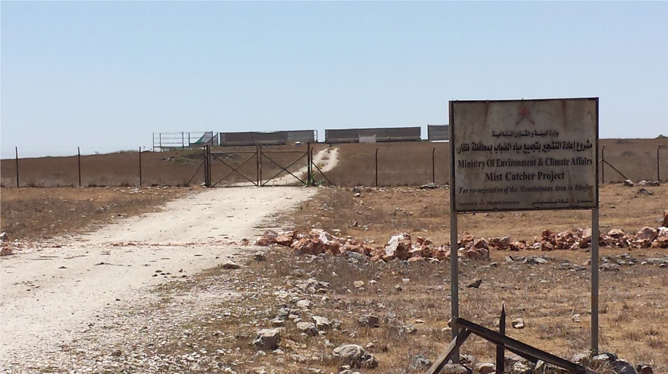
The Environment Authority has implemented land degradation mapping in the Sultanate of Oman in the Governorate of Dhofar, South and North Al Sharqiyah Governorates, and the Governorate of Al Dakhiliyah, in cooperation with Sultan Qaboos University, with the aim of identifying areas with various degrees of degradation and identifying the factors and processes causing degradation.
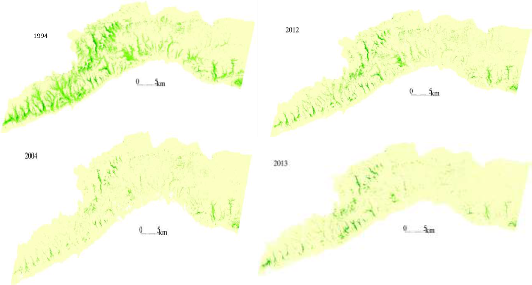
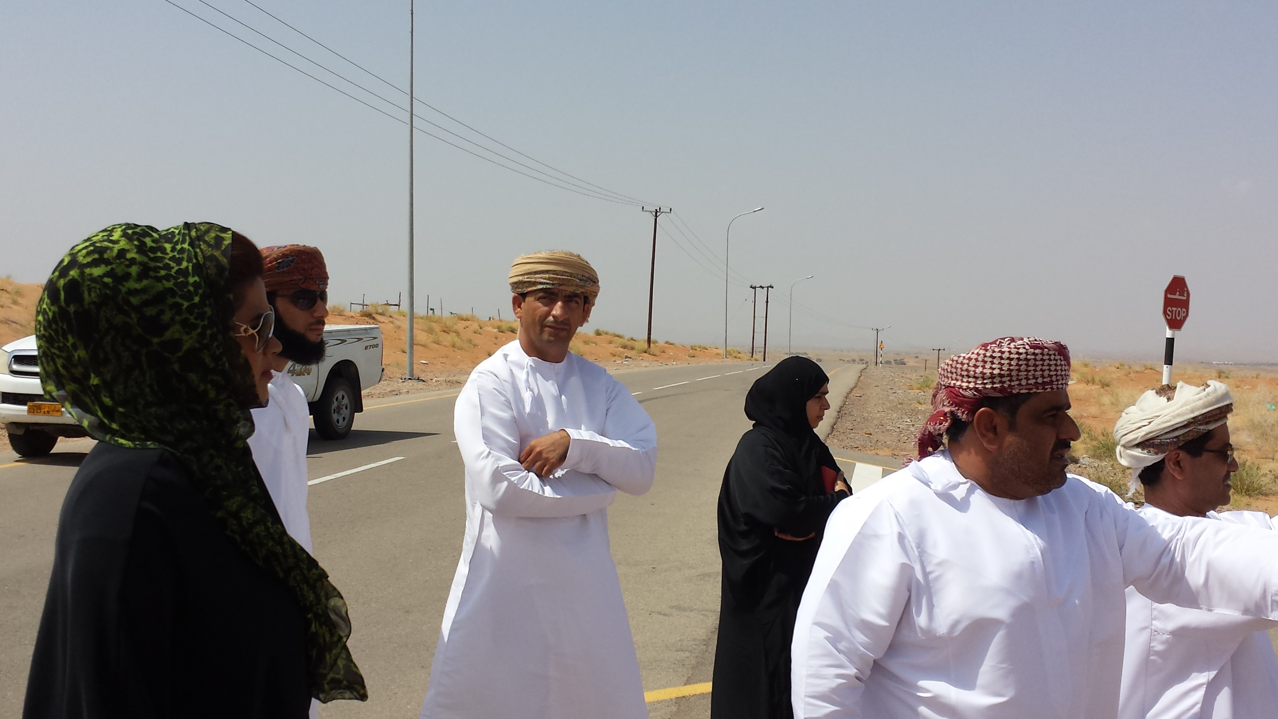
This investigation was based on high-resolution satellite imagery using NDVI as an Index of land degradation in the Dhofar Mountains and the invasion of mesquite (Prosopis juliflora.) in the plain of Salalah, as well as very high resolution aerial and satellite images of Jebal Al-Akhder derived from National Survey Authority. Precipitation data from two WMO stations were also utilized to test the link between precipitation and vegetation health. Vegetation was mapped to monitor changes and its health over time. In addition, a socio-economic survey in the Governorate of Dhofar was conducted, based on random sampling. The survey covered 6 different locations (Taqa, Taaqa farm, Zaik, Qiroon, Marbath, Al-Haqq and Taitam). The preliminary results clearly show that the study area has witnessed significant land use change between 1985 and 2013, marked by the emerging of a significant built-up area and water conservation infrastructure.
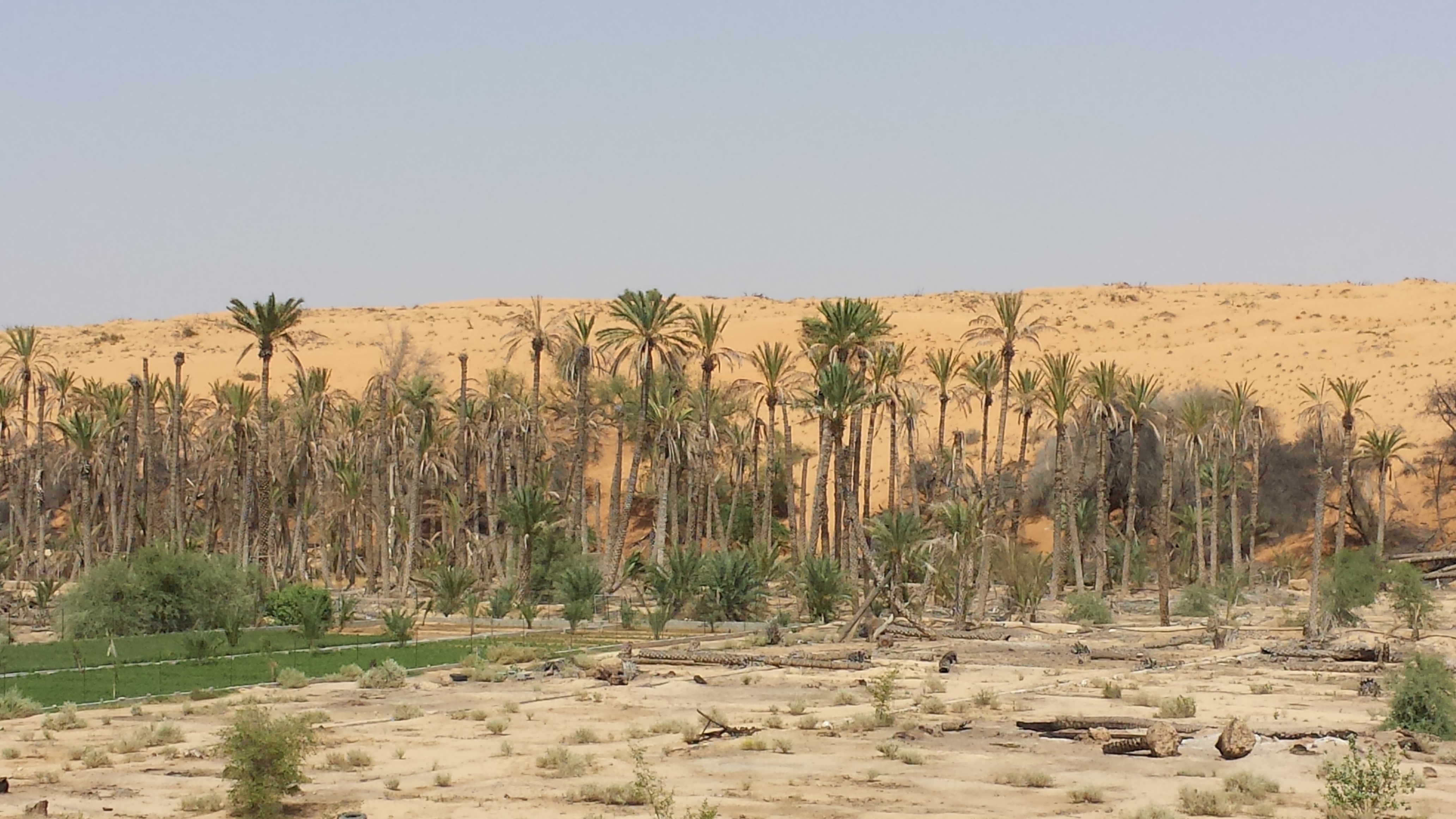
Spot images clearly show sharp changes in vegetation health through the years from 1994 to 2013. Vegetative vigour is lower in all years compared to 1994. Besides, the investigation shows a statistical relationship between rainfall and the status of the health of vegetation. Monsoon rainfall has an impact on the growth of vegetation. Around 2002-2003, the region suffered a major drought. Between 2012 and 2013, vegetative activity shows a decreasing trend. The analysis identified an area affected by the worst degree of land degradation. This area is situated in the southeastern of the Dhofar Mountains. In this area the process of land degradation is very active, with significant decrease in vegetation in 2013 compared to 2004. The mequite invasion in the Salalah Plain contributed to the degradation of natural vegetative cover in Dhofar Governorate. In nearly 30 years, the infested area almost quadrupled, indicating an average rate of expansion of 122,555m2 per year. The mesquite stands seem to have survived through the drought of 2002-2003.
The preliminary results of the survey clearly show that the mountains of Dhofar are under heavy anthropic pressure. The number of livestock is increasing and the native plant species are in great demand for cooking and heating.
Fortunately, the analysis identifies two areas, situated in the south-west of the study area, where vegetation has increased in vigor and density. The areas preserved from this process are usually inaccessible and far from human activities.
Vegetation cover change in Al-Jabal Al-Akhdar from 1985 to 2014 was analysed using very high resolution aerial and satellite images. Vegetation cover is also studied near settlements, dams, in wadis, and in agricultural areas. The change in total vegetation cover in the study area of Al-Jabal Al-Akhdar from 1985 to 2014 is very evident from the analysis of the data and maps produced.
Vegetation cover increased from 7.38 km2 during 1985 to 13.65 km2 in 2014. This change of vegetation cover was most noticeable in wadis and gullies where vegetation increased from 4.56 km2 during to 9.38 km2. One main factor that might be contributing to this increase of vegetation in wadis is the increase in the number of dams for storing surface water, as the number of dams increased from 7 in 1985 in the study area to 27 in 2014. Vegetation within and around 1 km of settlements in the study area increased from 2.09 km2 during 1985 to 5.45 km2 in 2014. In all other areas, that are distant from human activities, there is a considerable change in green vegetation cover between 1985 and 2014 where vegetation cover increased from 2.49 km2 in 1985 to 3.91 km2 in 2014. It is important to note here that vegetation cover density has a strong correlation with the amount of rainfall in Al-Jabal Al-Akhdar and there was a large difference in the annual rainfall between the two years, i.e. 1985 and 2014. The annual rainfall in 1985 was about 150mm for that particular year. The year 1984 was not much better where annual rainfall was lower than 200mm according to available records. The annual rainfall in 2013, the year preceding date of image in 2014, was 466mm, which is three times higher that that of 1985. Given the results of this study, there is a clear indication that the amount of rainfall plays a major role in defining the density of vegetation cover even if land degradation is taking place in very localized areas where there is pressure from grazing, urbanization, and tourism.
2.3 Арга барилын зурагууд
Медиа галерей
2.5 Арга барил нэвтрүүлсэн улс орон / бүс нутаг / байршил
Улс :
Оман
Улс/аймаг/сум:
Governorate of Dhofar, North and South Al Sharqiyah Governorates and Governorate of Al Dakhiliyah
Байршлын дэлгэрэнгүй тодорхойлолт:
Governorate of Dhofar: Taqa, Taaqa farm, Zaik, Qiroon, Marbath, Al-Haqq and Taitam Governorate of Al Dakhiliyah: Al-Jabal Al-Akhdar
2.6 Арга барилыг эхлэх, дуусах огноо
Эхлэх жилийг тэмдэглэ:
2013
2.7 Арга барилын төрөл
- төсөл / хөтөлбөр дээр үндэслэсэн
2.8 Арга барилын үндсэн зорилго, зорилтууд
1.Monitoring and survey of land degradation and areas vulnerable to degradation
2.Enhancing human abilities in land degradation issues
3.Identifying various degrees of degraded areas, and factors and processes causing degradation
4.Regular monitoring of degraded areas
2.9 Арга барилын хүрээнд хэрэгжсэн Технологи/Технологиудад дэмжсэн эсвэл саад учруулсан нөхцлүүд
нийгэм / соёл / шашны хэм хэмжээ, үнэт зүйлс
- Идэвхижүүлэх
Cultural and religious values encourage the protection of land and planting of trees
талуудыг хамтын ажиллагаа/зохицуулалт
- Идэвхижүүлэх
There is always a good collaboration between the government and academic/research institutions to determine the right approaches and technologies for better management practices
Хууль, эрхзүйн хүрээ (газар эзэмшил, газар, ус ашиглах эрх)
- Хазаарлалт
In some regions land tenure is not defined which affects grazing activities in these regions making it difficult to implement any replanting or reforestation projects
3. Оролцогч талуудын оролцоо ба үүргүүд
3.1 Арга барилд оролцогч талууд болон тэдгээрийн үүргүүд
- Судлаачид
Researchers from Sultan Qaboos University
Approach development, analysis, and survey
- Орон нутгийн захиргаа
Municipalities, Authority departments, and Governor's offices
Field visits and survey, meeting community
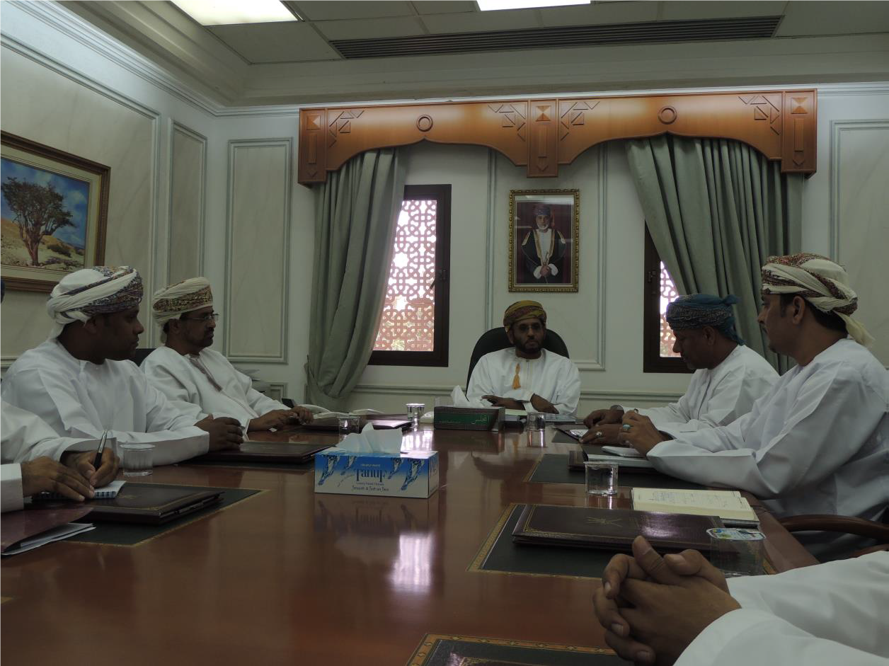
- Засгийн газар (шийдвэр гаргагч, төлөвлөгч)
Environment Authority
Funding, planning approach
3.2 Арга барилын янз бүрийн үе шатанд орон нутгийн газар ашиглагчид / бүлэглэлүүдийг татан оролцуулах
| Орон нутгийн газар ашиглагч / орон нутгийн иргэдийн оролцоо | Хэн оролцсоныг тодорхойлж, үйл ажиллагааг тайлбарлана уу | |
|---|---|---|
| санаачлага/идэвхжүүлэлт | Гадаад дэмжлэг | Governor's offices in respective regions played a major role in motivating community leaders to participate in the project |
| Хэрэгжилт | Гадаад дэмжлэг | Regional directorates and Governor offices helped in organizing meetings with local communities to collect information about land use activities, including farming and grazing, in their respective villages |
3.3 Диаграм (хэрэв боломжтой бол)
3.4 ГТМ-ийн технологи/технологиуд сонгох шийдвэр
Хэрэгжүүлэх Технологи/Технологиудын сонголтыг хийж шийдвэр гаргасан хүнийг тодорхойлно уу:
- улс төрчид / удирдагчид
Шийдвэрийг юунд үндэслэн гаргасан:
- Судалгааны үр дүн, ололтууд
4. Техникийн дэмжлэг, чадавхи бүрдүүлэх, мэдлэгийн менежмент
4.1 Чадавхи бэхжүүлэх/сургалт
Газар эзэмшигчид / бусад оролцогч талуудад сургалт явуулсан уу?
Тийм
Хэн сургалтанд хамрагдсан бэ:
- хээрийн ажилтан / зөвлөх
Сургалтын хэлбэр :
- курс дамжаа
Хамрагдсан сэвдүүд:
1.Understanding GIS and geographical approach to land degradation
2. Use of remote sensing techniques for data collection
3. Land degradation assessment in drylands
4.2 Зөвлөх үйлчилгээ
Газар ашиглагчдад зөвлөх үйлчилгээ авах боломжтой байдаг уу?
Үгүй
4.3 Институцийг бэхжүүлэх (байгууллагын хөгжил)
Арга барилаар дамжуулан институц байгуулагдаж эсвэл бэхжсэн үү?
- Тийм, дунд зэрэг
Байгууллагууд бэхжиж, үүсэн бий болсон түвшин(үүд)-г тодорхойлно уу:
- Үндэсний
Дэмжлэгийн төрлийг ялга:
- чадавхи бэхжүүлэх / сургалт
4.4 Мониторинг ба үнэлгээ
Мониторинг болон үнэлгээ нь арга барилын хэсэг үү?
Тийм
Хэрэв тийм бол энэ баримт бичиг нь мониторинг, үнэлгээнд ашиглагдахаар зориулагдсан уу?
Үгүй
4.5 Судалгаа
Судалгаа арга барилын хэсэг нь байсан уу?
Тийм
Сэдвийг тодруулна уу:
- Социологи
- Экологи
5. Санхүүгийн болон гадаад материаллаг дэмжлэг
5.1 ГТМ-ийн Арга барилын бүрэлдэхүүн хэсгийн жилийн төсөв
Хэрэв жилийн төсөв тодорхойгүй бол хягаарыг тодруулна уу:
- 100,000-1,000,000
5.2 Газар ашиглагчдад санхүүгийн / материаллаг дэмжлэг үзүүлсэн
Технологи / технологийг хэрэгжүүлэхэд газар ашиглагчид санхүүгийн / материаллаг дэмжлэг авсан уу?
Үгүй
5.4 Кредит
Арга барилын хүрээнд ГТМ-ийн үйл ажиллагаанд зориулж зээлд хамрагдсан уу?
Үгүй
5.5 Бусад урамшуулал, хэрэгсэл
ГТМ-ийн технологийг хэрэгжилтийг дэмжихэд ашигласан бусад урамшуулал, хэрэгсэл байсан уу?
Үгүй
6. Нөлөөллийн дүн шинжилгээ ба дүгнэлт
6.1 Арга барилын нөлөөллүүд
Арга барил нь орон нутгийн газар ашиглагчдыг чадваржуулах, оролцогч талуудын оролцоог сайжруулсан уу?
- Үгүй
- Тийм, бага зэрэг
- Тийм, зарим
- Тийм, их
Stakeholders participated in collecting social data by visiting different towns and sitting with the community to explain the approach, define the problems, and evaluate solutions
Арга барил нь нотолгоонд суурилсан шийдвэр гаргах боломж олгосон уу?
- Үгүй
- Тийм, бага зэрэг
- Тийм, зарим
- Тийм, их
Solutions and practices suggested resulted from extensive field work and image analysis
Арга барил нь ГТМ-ийн хэрэгжилтийн санхүүгийн эх үүсвэрийн хүртээмжийг сайжруулах / эргэлтэнд оруулахад чиглэсэн үү?
- Үгүй
- Тийм, бага зэрэг
- Тийм, зарим
- Тийм, их
Financial resources were mobilized and directed towards plantation of trees in degraded lands
Энэ арга барил бусад сонирхогч талуудын мэдлэг, чадавхийг сайжруулсан уу?
- Үгүй
- Тийм, бага зэрэг
- Тийм, зарим
- Тийм, их
Training courses were developed for government staff to collect field and social data
Арга барил нь оролцогч талуудын хооронд институци, хамтын ажиллагааг бий болгож, бэхжүүлсэн үү?
- Үгүй
- Тийм, бага зэрэг
- Тийм, зарим
- Тийм, их
6.2 ГТМ-ийг хэрэгжүүлэх газар ашиглагчидын гол санаачилга
- Газрын доройтол буурсан
- Байгаль орчны ухамсар
- ГТМ-ийн мэдлэг, туршлага дээшилсэн
6.3 Арга барилын үйл ажиллагааны тогтвортой байдал
Газар ашиглагчид арга барилаар дамжуулан хэрэгжүүлсэн арга хэмжээг тогтвортой хадгалж чадах уу (гадны дэмжлэггүйгээр)?
- Тодорхойгүй
6.4 Арга барилын тогтвортой/давуу тал/боломжууд
| Эмхэтгэгч, бусад мэдээлэл өгсөн хүмүүсийн өнцгөөс тодорхойлсон давуу тал/боломжууд |
|---|
| 1-As the results show that the amount of rainfall plays a major role in defining the density of vegetation, water catchment techniques can be deployed during rainfall periods – especially during Dhofar monsoon characterized with white fog and light rains- such as fog harvesting, increasing recharge dams, using new irrigation techniques from dams for affected areas |
| 2-By mapping land degradation in the Sultanate, areas that need protective strategies and policies can be defined, to avoid the degradation of areas of similar features through the coordination with respective sectors including urban planning, tourism, and agriculture. |
| 3- As the analysis identifies areas where vegetation has increased in vigor and density, factors leading to that may be explored and studied in order to apply same factors in similar environments. |
6.5 Арга барилын дутагдалтай/сул тал/аюул болон тэдгээрийн хэрхэн даван туулах арга замууд
| Эмхэтгэгч, бусад мэдээлэл өгсөн хүмүүсийн өнцгөөс тодорхойлсон сул тал/ дутагдал/ эрсдэл | Тэдгээрийг хэрхэн даван туулах вэ? |
|---|---|
| 1-As the spread and type of vegetation and climatic conditions differs greatly from area to area in the Sultanate of Oman, different procedures and techniques need to be employed. | studying the general conditions and features of each area and applying different procedures and techniques based on specific characteristics. |
| 2-Analysis of vegetation change using satellite images in terrain characterized by deep slopes and deep valleys in some areas in the Sultanate is very difficult. | using very high resolution remotely sensed images |
| 3-High resolution remotely sensed images are sometimes unavailable for past periods, which hinder studying vegetation change in this region where using satellite is difficult as well. |
7. Суурь мэдээлэл болон холбоосууд
7.1 Мэдээллийн эх үүсвэр/аргууд
- Хээрийн уулзалт, судалгаа
- Газар ашиглагчтай хийсэн ярилцлага
More than 500 questionnaires
Холбоос ба модулууд
Бүгдийг харуулах Бүгдийг хаахХолбоосууд
Холбоос байхгүй байна
Модулууд
Модуль байхгүй байна