Integrated Pasture Management Planning in Mountainous Regions [乔治亚]
- 创建:
- 更新:
- 编制者: Hanns Kirchmeir
- 编辑者: Natia Kobakhidze, Christian Goenner, Jonathan Etzold
- 审查者: Rima Mekdaschi Studer
approaches_5490 - 乔治亚
查看章节
全部展开 全部收起1. 一般信息
1.2 参与方法评估和文件编制的资源人员和机构的联系方式
SLM专业人员:
co-compiler:
SLM专业人员:
有助于对方法进行记录/评估的项目名称(如相关)
Integrated Biodiversity Management, South Caucasus (IBiS)有助于对方法进行记录/评估的机构名称(如相关)
Deutsche Gesellschaft für Internationale Zusammenarbeit (GIZ)1.3 关于使用通过WOCAT记录的数据的条件
(现场)数据是什么时候汇编的?:
01/02/2016
编制者和关键资源人员接受有关使用通过WOCAT记录数据的条件。:
是
1.4 SLM技术问卷的参考

Permanent grass cover in vineyards [匈牙利]
Permanent grass cover under grape vines protects the soil surface against erosion and compaction - and provides better conditions for traffic within the rows during mechanised field operations
- 编制者: Brigitta Szabó
Remote Sensing as a Tool for Land Degradation … [乔治亚]
Land degradation contributes to biodiversity loss and the impoverishment of rural livelihoods in Tusheti. Above all, however, land degradation are triggered by climate change as traditional land use practise might not be adapted to new climate conditions which can cause or speed up degradation processes significantly. On the other hand, …
- 编制者: Hanns Kirchmeir
2. SLM方法的描述
2.1 该方法的简要说明
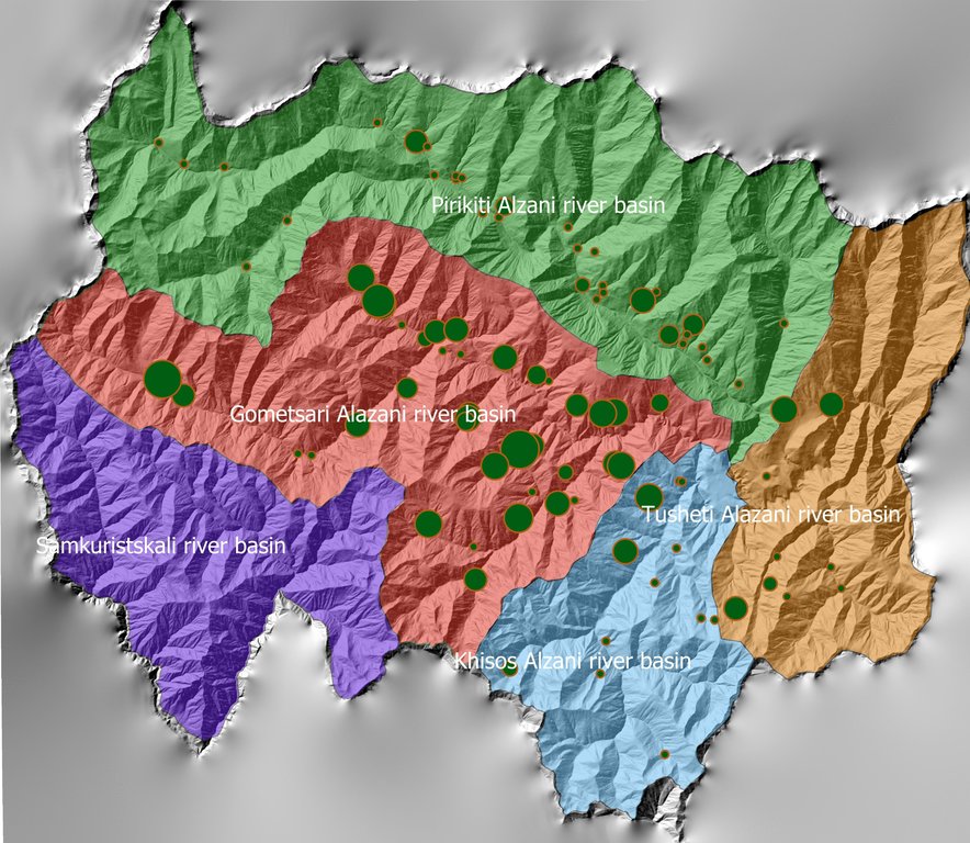
The unsustainable use of pastures and forest areas has led to soil erosion, degradation, desertification and loss of biodiversity in the high mountain areas of the South Caucasus. The development of pasture passports is part of a broader approach to a strategic pasture management plan for Tusheti. This showcase includes results from the spatial planning process applied in a pilot programme for Akhmeta municipality.
2.2 该方法的详细说明
该方法的详细说明:
Project area and purpose
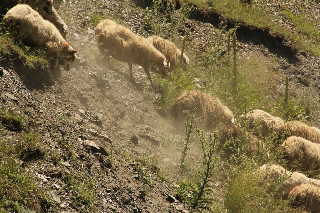
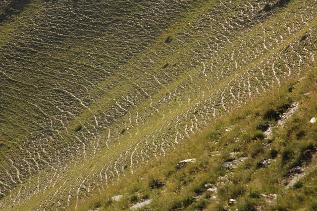
The project area comprises the Tusheti Protected Areas (PAs) on the northern slopes of the Greater Caucasus Mountains in Georgia. This group of protected areas consists of a strict nature reserve, a national park and a protected landscape with about 40 villages and settlements. Together they form a total protected area of approx. 114,000 ha. In Tusheti, overgrazing has led, especially in the eastern part with a higher number of villages and roads, to soil erosion and biodiversity loss. Especially the intensive use of summer pastures during the Soviet period resulted in a severe deterioration of the mountain slopes. So far, there are no standards or guidelines for the elaboration of sustainable pasture management plans in Georgia. Pasture passports, as a first step towards sustainable pasture management, document the actual grazing capacity for each pasture unit and serve as a guiding document for shepherds and local stakeholders and as a basis to prepare lease contracts.
Data gathering
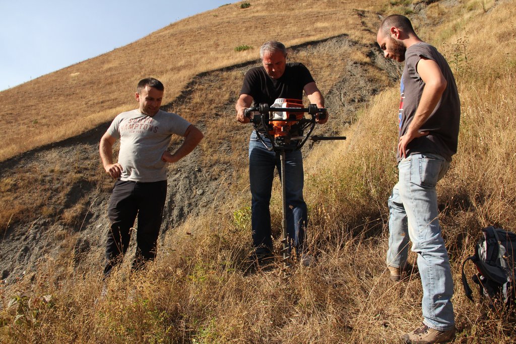
As a prerequisite for the development of pasture passports and the calculation of grazing capacity, the type of land cover, the erosion risk and the biomass of the pastureland had to be assessed for each pasture unit. This was done using remote sensing tools in combination with data collected in the field for calibration.
The details on the methodology of the Land Cover & Biomass as well as the Erosion Risk Assessment can be found in the WOCAT technology on "Remote Sensing as a Tool for Land Degradation Neutrality Monitoring" (see link).
Evaluation and Ground Truthing
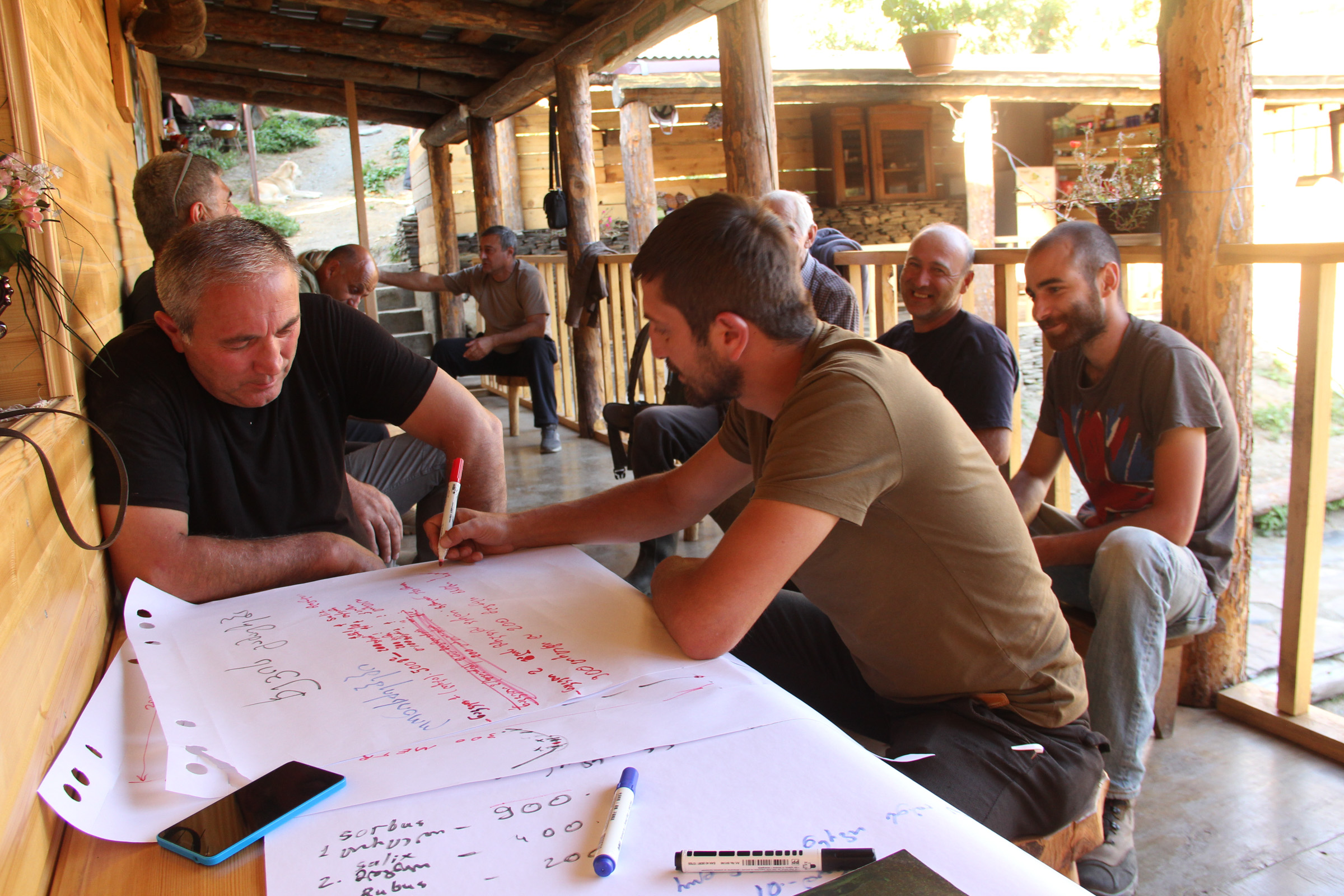
All interim results have been checked and evaluated by local stakeholders, national experts and experts from local administrations. It was important not only to conduct workshops in seminar rooms but to meet the local stakeholders in the field and to discuss the problems and challenges of pasture management on place in the field. At this workshops all levels of decision makers were included (Ministries, Donor organisations, international and national experts, local administrations and land users). This was important to create a common understanding of the current situation from different perspectives (nature conservation, administration, shepherds ...). The combination of remote sensing with calibration data from the field can be summarised as a very effective method to assess the erosion state in large areas. Neither of the two instruments would be able to provide results in this spatial dimension and quality alone.
Pasture Passports
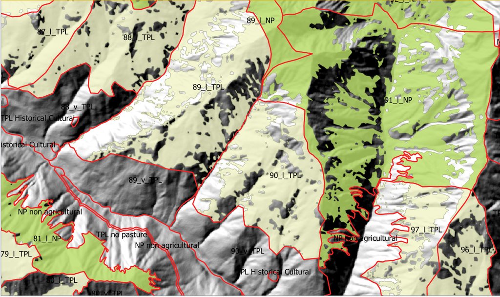
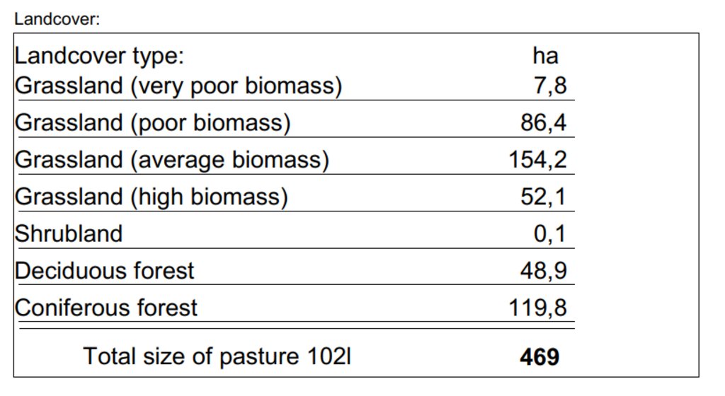
As part of the spatial planning of Akhmeta municipality, pastureland that can be leased to shepherds was separated from land used as hay meadows, farmland or pastures belonging to the villagers. The resulting map shows land available to the village and land available for lease. To understand the current use of pastureland, farms, livestock numbers and pasture units were assessed. In workshops with the local stakeholders and potential users of the results (shepherds, Tusheti Protected Landscape Administration, Tusheti NP Administration, APA), the design of the pasture passports was developed. Each pasture unit is described on four pages in the pasture passport.
Each pasture unit is described on four pages in the pasture passport: Header: the number (code), total area; content: map of the land cover types, the area of each land cover type, map of available biomass and carrying capacity, name of farmers/shepherds and their livestock numbers using the pasture unit
Spatial Planning Department and Construction Policy (within the Ministry of Regional Development and Infrastructure MRDI), and the Agency of Protected Areas APA (within the Ministry of Environmental Protection and Agriculture MEPA), are key stakeholders to use the pasture passports and to further develop and upscale this approach to other protected areas in Georgia. Beside APA, the Tusheti Protected Landscape Administration (TPLA), located within the Akhmeta municipality administration, is the second important user of pasture passports.
The pasture passports are showing not only the boundaries of each pasture unit, but also those areas that must not be grazed because this lands are part of strict protected areas or areas of high erosion risk. This helps shepherds to guide their flocks to the right places and the park rangers to check, if the regulations are respected correctly.
2.3 该方法的照片
2.5 采用该方法的国家/地区/地点
国家:
乔治亚
区域/州/省:
Tusheti
有关地点的进一步说明:
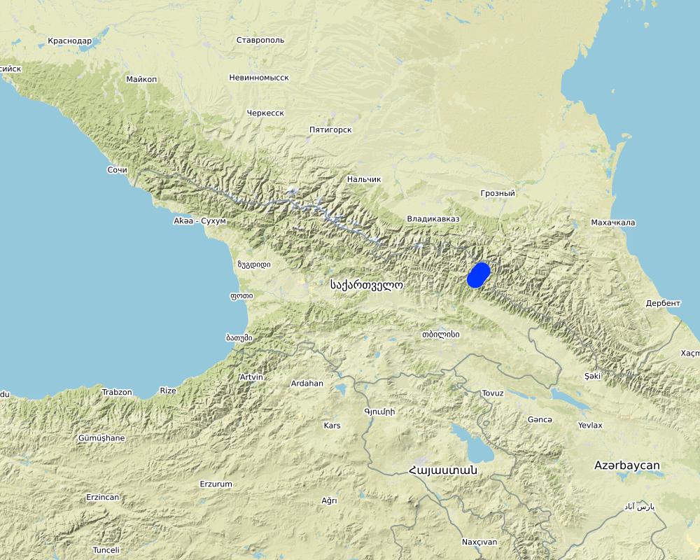
Entire territory of Tusheti Protected Areas (1100 km²)
注释:
Tusheti is located in the north-eastern of Georgia in the Higher Caucasus bordering Dagestan, Russia. The territory consists of the Tusheti Strict Nature Reserve (12,627 ha), Tusheti National Park (69,515 ha), and Tusheti Protected Landscape (31,517 ha), which includes around 40 villages and settlements.
Full territory of Tusheti Protected Areas (1100 km²)
Map
×2.6 该方法的开始和终止日期
注明开始年份:
2016
2.7 方法的类型
- 基于项目/方案
2.8 该方法的主要目的/目标
Support land use planning and decision-making processes for better management of natural resources, especially pastures.
2.9 推动或妨碍实施本办法所适用的技术的条件
社会/文化/宗教规范和价值观
- 启动
There is a strong identification of the local communities with the traditional pasture land use and the communities are willing to establish a long-term sustainable land management.
财务资源和服务的可用性/可得性
- 阻碍
Missing financial resources is hindering the implementation of the approach.
机构设置
- 启动
Good cooperation between the relevant institutions on the national and municipal level enabled a successful implementation. The Agency of Protected Areas (APA) located at the Ministry of Environmental Protection and Agriculture (MEPA) and the Tusheti Protected Landscape Administration (TPLA), located within the Akhmeta municipality administration are responsible for contracting lease agreements with shepherds and should not only be able to understand the technology behind the passports but should also have the capacity to handle the technology to be able to adapt the passports if needed (e.g., by changing boundaries of pasture units). For this issue, training workshops with decision-makers and technicians from the MoEPA, APA with TNP Administration and Administration of Akhmeta Munucuaplity with TPLA have been implemented.
Collaboration/ coordination of actors: All relevant national and local authorities that are dealing with spatial or environmental data participated in the workshop to discuss the approach and institutional suitability to host the sensitivity modelSoil Erosion Risk Model.
参与者的的协作/协调
- 启动
All relevant national and local authorities that are dealing with spatial or environmental data participated in the workshop to discuss the approach and institutional suitability to host the Soil Erosion Risk Model.
了解SLM,获得技术支持
- 阻碍
There is a high need for technical infrastructure and strong human capacity development.
3. 相关利益相关者的参与和角色
3.1 该方法涉及的利益相关者及其职责
- 当地土地使用者/当地社区
Shephards, local communities
Participation at the workshop/meeting and
making contributions through comments,
suggestions and sharing their analytical point
of view.
- SLM专家/农业顾问
GIS-LAB (Georgian scientific GIS service provider)
National experts on remote sensing and modelling of erosion risk.
- 研究人员
National ecologists from universities
- NGO
Centre for Biodiversity Research & Conservation (NACRES);
staff and experts from FATPA (Friends Association of Tusheti Protected Areas);
local NGO's
Interviews with local stakeholders, field experts
- 地方政府
Municipality of Akhmeta and Tusheti Protected Landscape Management
Participation at the workshop where they have given input and made contributions to the topic of technical aspects of the approach.
- 国家政府(规划者、决策者)
National Park management and APA (Agency for Protected Areas)
Long term aplication and upscaling on national level.
- 国际组织
Deutsche Gesellschaft fuer Zusammenarbeit (GIZ)
Funding and supervision of the implementation process.
3.2 当地土地使用者/当地社区参与该方法的不同阶段
| 当地土地使用者/当地社区的参与 | 指定参与人员并描述活动 | |
|---|---|---|
| 启动/动机 | 被动 | |
| 计划 | 被动 | |
| 实施 | 互动 | Organized meetings, workshop where stakeholders, local communities discussed different technical methodologies, visited the project communities and evaluated the preliminary result maps of erosion risk in the field. |
| 监测/评估 | 被动 |
3.3 流程图(如可用)
具体说明:
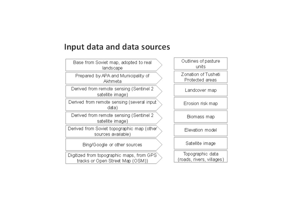
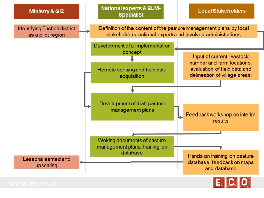
The process of generating pasture passports consists of several phases. The needs and expected content of the pasture management plans was defined in the early stage of the project by the local stakeholders, national experts and involved administrations. The preparation of the pasture management plans was an iterative process between the remotsensing and field sampling results and feedback and input from local stakeholders.
•
作者:
Hanns Kirchmeir
3.4 有关SLM技术选择的决策
具体说明谁有权决定选择要实施的技术:
- 主要是SLM专家,咨询土地使用者之后
明确做出决策的依据:
- 对充分记录的SLM知识进行评估(基于证据的决策)
4. 技术支持、能力建设和知识管理
4.1 能力建设/培训
是否为土地使用者/其他利益相关者提供培训?:
是
明确受训人员:
- 现场工作人员/顾问
培训形式:
- 示范区域
培训形式:
- workshop with field mission
涵盖的主题:
Evaluation of model results, preliminary result maps of erosion risk in the field, technical implementation of the sensitivity model in Georgia.
注释:
The workshops were combined with field missions to evaluate model results directly in the field. The expert teams went into the project communities and evaluated the preliminary result maps of erosion risk in the field together with local stakeholders.
4.2 咨询服务
土地使用者有权使用咨询服务吗?:
是
指明是否提供了咨询服务:
- 在固定中心
说明/注释:
Located on district level in Telavi
4.3 机构强化(组织发展)
是否通过这种方法建立或加强了机构?:
- 是,适度
具体说明机构的强化或建立程度:
- 本地
- 区域
- 国家
说明机构、角色和职责、成员等。:
The results of the approach implementation in Georgia has been summarized by the Programme ”Integrated Biodiversity Management, South Caucasus” and distributed to the experts in Azerbaijan for the further implementation.
Approach and results have been handed over to the local municipality responsible for the lease contracts in the Protected Landscape and to APA, which is responsible for the land use in the national park to integrate them into their pasture management plans.
具体说明支持类型:
- 财务
- 能力建设/培训
- sharing the concept, approach
提供进一步细节:
The concept and approach has been shared with local municipalities and other related experts.
Pilot study financed by GIZ.
4.4 监测和评估
监测和评估是该方法的一部分吗?:
是
注释:
Within the project a basline was drawn with the current livestock numbers, the current available fodder biomass and the current state of erosion.
若是,该文件是否用于监测和评估?:
是
注释:
The remote sensing technology enables a sound methodology to compare the state of erosion and the biomass volume based on satelite data after some years with the baseline values from 2017.
4.5 研究
研究是该方法的一部分吗?
是
明确话题:
- 技术
提供进一步的细节,并指出是谁做的研究:
National and international ecologists did research on vegetation details and biomass as well as on the remote sensing technology.
5. 融资和外部物质支持
5.1 该方法中SLM组成部分的年度预算
如果不知道准确的年度预算,请给出一个范围:
- 10,000-100,000
注释(例如主要的资助来源/主要捐助者):
The funds came from the Integrated Erosion Control project which aas launched as part of the Integrated Biodiversity Management, South Caucasus (IBiS) Programme of the Deutsche Gesellschaft für Internationale Zusammenarbeit (GIZ)
5.2 为土地使用者提供财政/物质支援
土地使用者是否获得实施该技术的财政/物质支持?:
否
5.3 对特定投入的补贴(包括劳动力)
- 无
如果土地使用者的劳动力是一项重要的投入,那么是不是:
- 自愿
注释:
There was a questionnaire and land-users shared their information on land-use practice.
5.4 信用
是否根据SLM活动的方法给予信用值?:
否
5.5 其它激励或手段
是否有其他激励措施或工具用于促进SLM技术的实施?:
是
如果是,请具体说明:
The Agency of Protected Areas (APA) thinks about upscaling the pasture passport method on a national level and establish the approach also in other protected areas of Georgia.
6. 影响分析和结论性陈述
6.1 方法的影响
该方法是否有助于当地土地使用者,提高利益相关者的参与度?:
- 否
- 是,很少
- 是,中等
- 是,支持力度很大
Through the field visits and workshops, it has involved both experts and authorities, where they have assessed, analysed and given input.
这种方法是否有助于基于证据的决策?:
- 否
- 是,很少
- 是,中等
- 是,支持力度很大
By the assessment of biomass, the carrying capacity of each pasture unit was calculated.
该方法是否提高了土地使用者实施土地管理的知识和能力?:
- 否
- 是,很少
- 是,中等
- 是,支持力度很大
The perception of the key stakeholders and management towards the importance of biodiversity and ecosystem services has become more positive.
该方法是否提高了其他利益相关者的知识和能力?:
- 否
- 是,很少
- 是,中等
- 是,支持力度很大
The implementation capacity of line ministries, their subordinate bodies and of training institutions regarding the management of biodiversity and ecosystem services is improved at the national level.
该方法是否建立/加强了机构、利益相关者之间的合作?:
- 否
- 是,很少
- 是,中等
- 是,支持力度很大
A cooperation between the local Administration of the Protected Landscape (managed by municipality) and the Administration of National Park (managed by national Agency of Protected Areas) was strengthened.
Promoted better coordination of biodiversity and ecosystem services management across sectors based on solid data.
6.2 土地使用者实施SLM的主要动机
- 增加生产
- 减少土地退化
6.3 方法活动的可持续性
土地使用者能否维持通过该方法实施的措施(无外部支持的情况下)?:
- 是
若是,请说明如何维持:
The remote sensing technology is not available to the land users, but the results (pasture passports) can be used by shepherds and local authorities to adjust the grazing intensity to the maximum carrying capacity of each pasture unit.
6.4 该方法的长处/优点
| 土地使用者眼中的长处/优势/机会 |
|---|
| The pasture passports are describing each pasture unit available for lease not only by size but also by the amount of available fodder biomass. This is representing the productivity and the maps are showing the accessibility of the fodder biomass to the livestock. This is essential for a more accurate prize estimation on the value of each pasture compared to old data just giving the size of the pasture unit. |
| The pasture passports are improving the legal basis for the lease contract. Areas that should not be grazed (strict protected areas, forests, areas of high erosion risk) are clearly shown on the map. |
| During the preparation process the village related areas and the pastures for lease have been defined and mapped. This leads to clear responsibilities for the different pasture lands. |
| 编制者或其他关键资源人员认为的长处/优势/机会 |
|---|
| Contribution to the work by local municipalities - the overall results have been handed over to the municipality, responsible for the lease contracts in the Protected Landscape and to APA, responsible for the land use in the National Park. |
| The remote sensing technology is an objective method to assess the state of the pasture land and can be reproduced at any future time or in other areas of the Caucasus. |
| The GIS data and databases can support the administrative process of preparing lease contracts and can additionally be used for further research activities. |
6.5 该方法的弱点/缺点以及克服它们的方法
| 土地使用者认为的弱点/缺点/风险 | 如何克服它们? |
|---|---|
| Informal land use practises are now documented and fixed in lease contracts. That might lead to higher costs (lease) and reduce the profit of the shepherd/livestock owner. | It needs to be communicated that long term lease contracts guarantee the shepherds/livestock owner grazing rights for several years. Investments into pasture quality and infrastructure become more meaningful. |
| 编制者或其他关键资源人员认为的弱点/缺点/风险 | 如何克服它们? |
|---|---|
| The preparation process includes high investment of resources in the first setup of the remote sensing data, field evaluation and database development. It needs special experts and know how. | Remote sensing becomes cheaper when applied on large areas. A distribution of field samples across the whole Caucasus range would enable to upscale from the pilot area to a much wider range with less costs per hectare pasture land. |
7. 参考和链接
7.1 方法/信息来源
- 实地考察、实地调查
- 与SLM专业人员/专家的访谈
34 experts have participated at the workshop on remote-sensing tools for erosion control and pasture management in Tusheti.
7.2 参考可用出版物
标题、作者、年份、ISBN:
Kirchmeir H. 12/2018: Implementation of an Erosion Risk Assessment tool on pilot regions in the Southern Caucasus. The Programme „Integrated Biodiversity Management, South Caucasus”
7.3 链接到网络上可用的相关信息
标题/说明:
The European GeoNode system
URL:
http://pegasosdi.uab.es/geoportal/
标题/说明:
Monitoring Manual for Highland Pastures in the Caucasus
URL:
https://biodivers-southcaucasus.org/uploads/files/Monitoring%20Manual%20Draft%20ENG_new%20%20amendments%20for%20Georgia_v9_acc.amend.pdf
链接和模块
全部展开 全部收起链接

Permanent grass cover in vineyards [匈牙利]
Permanent grass cover under grape vines protects the soil surface against erosion and compaction - and provides better conditions for traffic within the rows during mechanised field operations
- 编制者: Brigitta Szabó

Remote Sensing as a Tool for Land Degradation … [乔治亚]
Land degradation contributes to biodiversity loss and the impoverishment of rural livelihoods in Tusheti. Above all, however, land degradation are triggered by climate change as traditional land use practise might not be adapted to new climate conditions which can cause or speed up degradation processes significantly. On the other hand, …
- 编制者: Hanns Kirchmeir
模块
无模块


