Jessour [ប្រទេសទុយនីស៊ី]
- ការបង្កើត៖
- បច្ចុប្បន្នភាព
- អ្នកចងក្រង៖ Mongi Ben Zaied
- អ្នកកែសម្រួល៖ –
- អ្នកត្រួតពិនិត្យច្រើនទៀត៖ Deborah Niggli, Alexandra Gavilano
Jesser, Katra, Tabias (Arabic)
technologies_1013 - ប្រទេសទុយនីស៊ី
ពិនិត្យមើលគ្រប់ផ្នែក
ពង្រីកមើលទាំងអស់ បង្រួមទាំងអស់1. ព័ត៌មានទូទៅ
1.2 ព័ត៌មានលម្អិតពីបុគ្គលសំខាន់ៗ និងស្ថាប័នដែលចូលរួមក្នុងការវាយតម្លៃ និងចងក្រងឯកសារនៃបច្ចេកទេស
បុគ្គលសំខាន់ម្នាក់ (ច្រើននាក់)
អ្នកជំនាញឯកទេស SLM:
Mongi Sghaier
Institut des Régions Arides IRA
ប្រទេសទុយនីស៊ី
អ្នកជំនាញឯកទេស SLM:
Mongi Chniter
Commissariats Régionaux au Développement Agricole CRDA
ប្រទេសទុយនីស៊ី
អ្នកជំនាញឯកទេស SLM:
Ouessar Mohammed
Institut des Régions Arides IRA
ប្រទេសទុយនីស៊ី
ឈ្មោះគម្រោងដែលបានចងក្រងឯកសារ/ វាយតម្លៃលើបច្ចេកទេស (បើទាក់ទង)
DESIRE (EU-DES!RE)ឈ្មោះគម្រោងដែលបានចងក្រងឯកសារ/ វាយតម្លៃលើបច្ចេកទេស (បើទាក់ទង)
Book project: Water Harvesting – Guidelines to Good Practice (Water Harvesting)ឈ្មោះអង្គភាពមួយ (ច្រើន) ដែលបានចងក្រងឯកសារ/ វាយតម្លៃបច្ចេកទេស (បើទាក់ទង)
Institut des Régions Arides de Médenine (Institut des Régions Arides de Médenine) - ប្រទេសទុយនីស៊ីឈ្មោះអង្គភាពមួយ (ច្រើន) ដែលបានចងក្រងឯកសារ/ វាយតម្លៃបច្ចេកទេស (បើទាក់ទង)
Commissariats Régionaux au Développement Agricole (CRDA) - ប្រទេសទុយនីស៊ី1.3 លក្ខខណ្ឌទាក់ទងទៅនឹងការប្រើប្រាស់ទិន្នន័យដែលបានចងក្រងតាមរយៈ វ៉ូខេត
អ្នកចងក្រង និង(បុគ្គលសំខាន់ៗ)យល់ព្រមទទួលយកនូវលក្ខខណ្ឌនានាទាក់ទងទៅនឹងការប្រើប្រាស់ទិន្នន័យដែលបានចងក្រងតាមរយៈវ៉ូខេត:
បាទ/ចា៎
1.5 ការយោងទៅលើកម្រងបញ្ជីសំណួរ (មួយ ឬច្រើន) នៃវិធីសាស្ត្រផ្សព្វផ្សាយ SLM (ដែលបានចងក្រងដោយទស្សនៈពិភពលោកស្តីពីវិធីសាស្ត្រ និងបច្ចេកទេសងអភិរក្ស WOCAT)
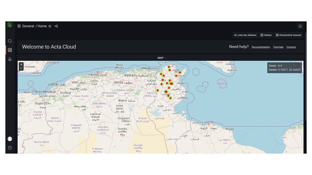
Observatoire Territorial de Gestion des Ressources Naturelles [ប្រទេសទុយនីស៊ី]
L’observatoire territorial de gestion des ressources naturelles est un dispositif scientifique, technique et institutionnel mis en place sur un territoire, pour assurer une fonction d’observation, de suivi, et d’amélioration de la connaissance.
- អ្នកចងក្រង៖ Wafa Saidi
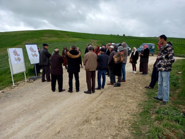
Projet d'Aménagement et de Développement Intégré du Territoire … [ប្រទេសទុយនីស៊ី]
Le Projet d'Aménagement et de Développement Intégré du Territoire (PADIT) est basé sur la sollicitation des populations locales et la collaboration avec tous les acteurs impliqués dans la gestion des ressources naturelles et du développement rural afin de valoriser les atouts d'un territoire donné et élaborer un plan d'action intégré …
- អ្នកចងក្រង៖ Wafa Saidi
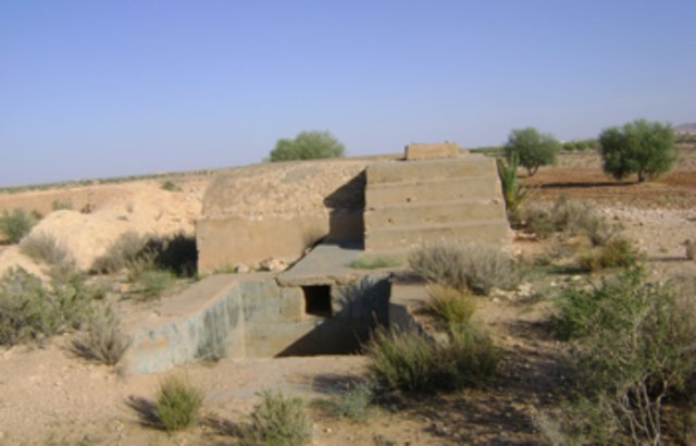
Collecte des eaux pluviales dans des citernes [ប្រទេសទុយនីស៊ី]
Les citernes sont construites soit par l’état dans les zones enclavées où l’approvisionnement en eaux potables et difficile voire impossible par le réseau de la Société Nationale d’Exploitation et de Distribution des Eaux (SONEDE) soit par des particuliers pour collecter les eaux de pluies. Ces ouvrages sont destinés à l’abreuvement …
- អ្នកចងក្រង៖ Donia Mühlematter
Conservation des eaux et des sols suivant la … [ប្រទេសទុយនីស៊ី]
Les « jessour » sont développés dans les zones montagneuses de Gabès, Mede-nine et Tataouine où l’altitude varie entre 400 et 600 m et une pluviométrie an-nuelle variant entre 100 et 150 mm. Dans cette zone, on compte aux alentours de 35 000 jisr qui reçoit chacun annuellement un supplément …
- អ្នកចងក្រង៖ Donia Mühlematter
Dryland watershed management approach [ប្រទេសទុយនីស៊ី]
Integrated land and water management approach, including vegetative, management, and agronomic measure
- អ្នកចងក្រង៖ Naceur Mahdi
2. ការពណ៌នាពីបច្ចេកទេស SLM
2.1 ការពណ៌នាដោយសង្ខេបពីបច្ចេកទេស
និយមន័យបច្ចេកទេស:
Jessour is an ancient runoff water harvesting technique widely practiced in the arid highlands
2.2 ការពណ៌នាលម្អិតពីបច្ចេកទេស
ការពណ៌នា:
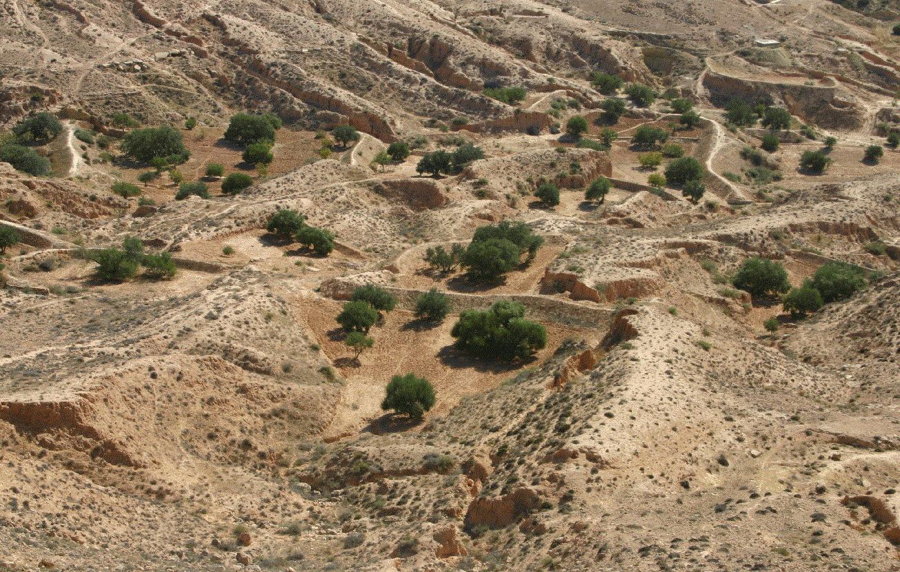
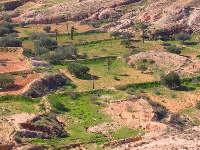
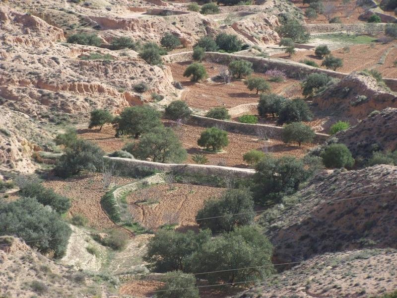
Jessour technology is generally practised in mountain dry regions (less than 200 mm annually) with medium to high slopes. This technology was behind the installation of very old olive orchards based on rainfed agriculture in rugged landscapes which allowed the local population not only to ensure self-sufficiency but also to provide neighbouring areas many agricultural produces (olive oil, dried figs, palm dates, etc.).
Jessour is the plural of jessr, which is a hydraulic unit made of three components: the impluvium, the terrace and the dyke. The impluvium or the catchment is the area which collects and conveys runoff water. It is bordered by a natural water divide line (a line that demarcates the boundary of a natural area or catchment, so that all the rain that falls on this area is concentrated and drained towards the same outlet). Each unit has its own impluvium, but can also receive excess water from upstream units. The terrace or cropping zone is the area in which farming is practised. It is formed progressively by the deposition of sediment. An artificial soil will then be created, which can be up to 5 m deep close to the dyke. Generally, fruit trees (e.g. olive, fig, almond, and date palm), legumes (e.g. pea, chickpeas, lentil, and faba bean) and barley and wheat are cultivated on these terraces.
Purpose of the Technology: Although the jessour technique was developed for the production of various agricultural crops, it now also plays three additional roles: (1) aquifer recharge, via runoff water infiltration into the terraces, (2) flood control and therefore the protection of infrastructure and towns built downstream, and (3) wind erosion control, by preventing sediment from reaching the downstream plains, where windspeeds can be particularly high.
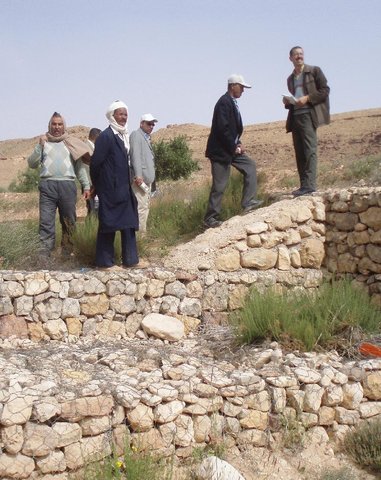
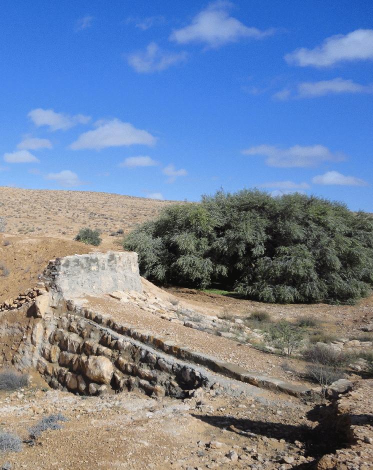
Establishment / maintenance activities and inputs: In the Jessour, a dyke (tabia, sed, katra) acts as a barrier used to hold back sediment and runoff water. Such dykes are made of earth, and are equipped with a central and/or lateral spillway (masref and/or manfes) and one or two abutments (ktef), assuring the evacuation of excess water. They are trapezoidal and measure 15-50 m in length, 1-4 m in width and 2-5 m in height. In old units, the dyke is stabilised with a covering of dry stones to overcome the erosive effects of water wave action on the front and back of the dyke. The spillway is made of stones arranged in the form of stairs, in order to dissipate the kinetic energy of the overflow.
This technology is currently encountered in the mountain ranges of Matmata of South Eastern Tunisia where the local agricultural activities are based mainly on rainfed agriculture and livestock breeding. However, high rates of migration to cities may threaten the long-term maintenance of those structures.
2.3 រូបភាពនៃបច្ចេកទេស
វិចិត្រសាលប្រព័ន្ធផ្សព្វផ្សាយ

2.5 ប្រទេស/តំបន់/ទីតាំងកន្លែង ដែលបច្ចេកទេសត្រូវបានអនុវត្ត និងបានគ្រប់ដណ្តប់ដោយការវាយតម្លៃនេះ
ប្រទេស:
ប្រទេសទុយនីស៊ី
តំបន់/រដ្ឋ/ខេត្ត:
Medenine
បញ្ជាក់បន្ថែមពីលក្ខណៈនៃទីតាំង:
Beni Khedache
បញ្ជាក់ពីការសាយភាយនៃបច្ចេកទេស:
- ត្រូវបានផ្សព្វផ្សាយត្រឹមតំបន់មួយ
ប្រសិនបើមិនច្បាស់ពីទំហំផ្ទៃដី សូមធ្វើការប៉ាន់ប្រម៉ាណ:
- 100-1,000 គម2
មតិយោបល់:
This technology is developed mainly in the upstream areas of the study watershed (mountainous zone of Béni Khédache). This system is based on runoff water harvesting for fruit trees cropping (mainly olives). The cropping areas are relatively small and rarely exceed 0.25 ha.
Map
×2.6 កាលបរិច្ឆេទនៃការអនុវត្ត
ប្រសិនបើមិនច្បាស់ឆ្នាំ សូមបញ្ជាក់កាលបរិច្ឆេទដែលប្រហាក់ប្រហែល:
- ច្រើនជាង 50 ឆ្នាំមុន (ប្រពៃណី)
2.7 ការណែនាំពីបច្ចេកទេស
សូមបញ្ជាក់តើបច្ចេកទេសត្រូវបានណែនាំឱ្យអនុវត្តដោយរបៀបណា:
- ជាផ្នែកនៃប្រព័ន្ធប្រពៃណី (> 50 ឆ្នាំ)
មតិយោបល់ (ប្រភេទនៃគម្រោង ។ល។):
Jessour is an ancient runoff water harvesting technique widely practiced in the arid highlands, which are dominated by outcroppings of calcareous formations and depositions of quaternary calcareous silt.
3. ចំណាត់ថ្នាក់នៃបច្ចេកទេស SLM
3.2 ប្រភេទដីប្រើប្រាស់មួយប្រភេទ (ច្រើនប្រភេទ) ដែលបានអនុវត្តបច្ចេកទេស

ដីដាំដំណាំ
- ដំណាំប្រចាំឆ្នាំ
- ប្រភេទដើមឈើធំៗ និងដើមឈើតូចៗ
ដំណាំប្រចាំឆ្នាំ - បញ្ជាក់ប្រភេទដំណាំ:
- ធញ្ញជាតិ - ផ្សេងៗ
- ធញ្ញជាតិ - ស្រូវសាលី (និទាឃរដូវ)
- ធញ្ញជាតិ - ស្រូវ
- បន្លែ - ផ្សេងៗ
- ពពួកសណ្តែក - គ្រាប់ហោឡាំងតាវ
ប្រភេទដើមឈើធំៗ និងដើមឈើតូចៗ - បញ្ជាក់ប្រភេទ:
- កាលបរិច្ឆេទ
- figs
- ដើមឈើយកគ្រាប់ (brazil nuts, pistachio, walnuts, almonds, etc.)
- អូលីវ
ចំនួនសារដែលដាំដំណាំក្នុងមួយឆ្នាំ:
- 1
សូមបញ្ជាក់:
Longest growing period in days: 180Longest growing period from month to month: Oct - Mar
មតិយោបល់:
Major land use problems (compiler’s opinion): Loss of surface water (runoff), problems of flooding, water erosion, soil degradation, drought
Future (final) land use (after implementation of SLM Technology): Cropland: Ct: Tree and shrub cropping
Livestock is grazing on crop residues
3.3 បន្ទាប់ពីអនុវត្តបច្ចេកទេស តើដីប្រើប្រាស់មានការប្រែប្រួលដែររឺទេ?
បន្ទាប់ពីអនុវត្តបច្ចេកទេស តើដីប្រើប្រាស់មានការប្រែប្រួលដែររឺទេ?
- បាទ/ច៎ា (សូមបំពេញសំណួរខាងក្រោមពីស្ថានភាពដីប្រើប្រាស់មុនពេលអនុវត្តបច្ចេកទេស)
ដីប្រើប្រាស់ចម្រុះនៅលើដីតែមួយ:
បាទ/ចា៎
បញ្ជាក់ពីប្រភេទដីច្រើនប្រភេទ (ដីដាំដំណាំ/ដីចិញ្ចឹមសត្វ/ដីព្រៃឈើ):
- Agro-pastoralism ( រួមបញ្ចូលទាំងដំណាំ និងចិញ្ចឹមសត្វ)
ដីដាំដំណាំ
- ប្រភេទដើមឈើធំៗ និងដើមឈើតូចៗ

ដីសម្រាប់ចិញ្ចឹមសត្វ
3.4 ការផ្គត់ផ្គង់ទឹក
ការផ្គត់ផ្គង់ទឹកនៅកន្លែងអនុវត្តបច្ចេកទេស:
- ទឹកភ្លៀង
មតិយោបល់:
Water supply: rainfed, mixed rainfed - irrigated
3.5 ក្រុម SLM ដែលបច្ចេកទេសស្ថិតនៅក្នុង
- របាំងខ្យល់
- ការស្តុកទុកទឹក
- ការគ្រប់គ្រងប្រព័ន្ធស្រោចស្រព (រួមទាំងការផ្គត់ផ្គង់ទឹក ប្រព័ន្ធបង្ហូរ)
3.6 វិធានការ SLM ដែលបញ្ចូលនូវបច្ចេកទេស

វិធានការរចនាស័ម្ពន្ធ
- S2: ភ្លឺ ច្រាំង
មតិយោបល់:
Main measures: structural measures
3.7 កំណត់ប្រភេទនៃការធ្លាក់ចុះគុណភាពដីសំខាន់ៗដែលបច្ចេកទេសនេះបានដោះស្រាយ

ការហូរច្រោះដីដោយសារទឹក
- Wt: ការបាត់ដីស្រទាប់លើដោយការហូរច្រោះ
- Wg: ការកកើតឡើងនូវកំទេចកំទីដីស្រទាប់ក្រោម
មតិយោបល់:
Main type of degradation addressed: Wt: loss of topsoil / surface erosion
Secondary types of degradation addressed: Wg: gully erosion / gullying
Main causes of degradation: crop management (annual, perennial, tree/shrub), change of seasonal rainfall, Heavy / extreme rainfall (intensity/amounts), poverty / wealth
Secondary causes of degradation: soil management, overgrazing, land tenure
3.8 ការពារ កាត់បន្ថយ ឬស្តារឡើងវិញនៃការធ្លាក់ចុះគុណភាពដី
បញ្ជាក់ពីគោលដៅរបស់បច្ចេកទេស ដែលផ្តោតទៅការធ្លាក់ចុះគុណភាពដី:
- ការការពារការធ្លាក់ចុះគុណភាពដី
- ការកាត់បន្ថយការធ្លាក់ចុះគុណភាពដី
មតិយោបល់:
Main goals: mitigation / reduction of land degradation
Secondary goals: prevention of land degradation
4. បច្ចេកទេសជាក់លាក់ សកម្មភាពអនុវត្ត ធាតុចូល និងថ្លៃដើម
4.1 គំនូសបច្ចេកទេសនៃបច្ចេកទេសនេះ
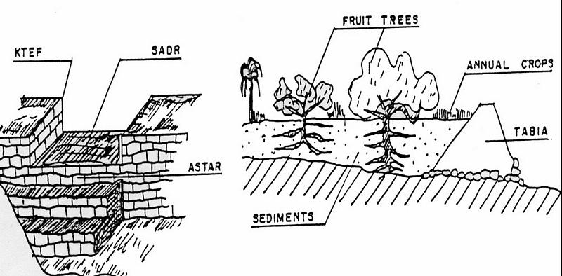
លក្ខណៈពិសេសនៃបច្ចេកទេស (ទាក់ទងនឺងគំនូរបច្ចេកទេស):
Left: Cross-section of dyke (locally called tabia) and terrace (cropping area).
The Jessour ensure the collection of both runoff water and sediments allowing creating very deep ‘artificial’ soils (terrace) which form a very good reservoir for water and nutrients to be used by fruit trees and annual crops.
Right: The spillway allows the overflow to the other Jessour downstream. It also represents the symbol of water sharing equity between different farmers in the same watershed. (Drawing adapted from El Amami (1984))
Location: Mountainous zone near Beni Khedache. Medenine
Date: 1984
Technical knowledge required for field staff / advisors: moderate
Technical knowledge required for land users: moderate
Main technical functions: increase of infiltration, sediment retention / trapping, sediment harvesting, harvesting of runoff water / water trapping
Secondary technical functions: control of concentrated runoff: retain / trap, improvement of ground cover, increase / maintain water stored in soil, increase of groundwater level / recharge of groundwater, increase of biomass (quantity)
Spillway
Height of bunds/banks/others (m): 2-5
Width of bunds/banks/others (m): 0.4-0.6
Length of bunds/banks/others (m): 2-6
Dam/ pan/ pond
Vertical interval between structures (m): 2-3
Spacing between structures (m): 30-70
Height of bunds/banks/others (m): 2-6
Width of bunds/banks/others (m): 1-5
Length of bunds/banks/others (m): 10-40
Construction material (earth): Main dyke
Construction material (stone): Spillway and in some cases the dyke (external coating)
Construction material (concrete): Occasionally for consolidation of the spillway.
Lateral gradient along the structure: <1%
Specification of dams/ pans/ ponds: Capacity 300-1000m3
Catchment area: 1-10ham2
Beneficial area: 0.01-1ham2
For water harvesting: the ratio between the area where the harvested water is applied and the total area from which water is collected is: 1:5
ឈ្មោះអ្នកនិពន្ធ:
Ouessar M., IRA, Medenine, Tunisia
4.2 ព័ត៌មានទូទៅដែលពាក់ព័ន្ធនឹងការគណនាធាតុចូល និងថ្លៃដើម
ផ្សេងៗ/ រូបិយប័ណ្ណជាតិ (បញ្ជាក់):
TD
បើពាក់ព័ន្ធសូមកំណត់អត្រាប្តូរប្រាក់ពីដុល្លាទៅរូបិយប័ណ្ណតំបន់ (ឧ. 1 ដុល្លារ = 79.9 រៀលនៃរូបិយប័ណ្ណប្រេស៊ីល) ៖ 1 ដុល្លារ =:
1,3
កំណត់ថ្លៃឈ្នួលជាមធ្យមនៃការជួលកម្លាំងពលកម្មក្នុងមួយថ្ងៃ:
10.00
4.3 សកម្មភាពបង្កើត
| សកម្មភាព | រយៈពេល (រដូវកាល) | |
|---|---|---|
| 1. | Dyke construction | |
| 2. | Plantations | |
| 3. | Spillway construction |
4.4 ថ្លៃដើម និងធាតុចូលដែលត្រូវការសម្រាប់ការបង្កើតបច្ចេកទេស
| បញ្ជាក់ពីធាតុចូល | ឯកតា | បរិមាណ | ថ្លៃដើមក្នុងមួយឯកតា | ថ្លៃធាតុចូលសរុប | % នៃថ្លៃដើមដែលចំណាយដោយអ្នកប្រើប្រាស់ដី | |
|---|---|---|---|---|---|---|
| កម្លាំងពលកម្ម | Labour | ha | 1,0 | 1200,0 | 1200,0 | 100,0 |
| សម្ភារៈដាំដុះ | ha | 1,0 | 800,0 | 800,0 | 100,0 | |
| សម្ភារៈសាងសង់ | ha | 1,0 | 1000,0 | 1000,0 | 100,0 | |
| ថ្លៃដើមសរុបក្នុងការបង្កើតបច្ចេកទេស | 3000,0 | |||||
| ថ្លៃដើមសរុបក្នុងការបង្កើតបច្ចេកទេសគិតជាដុល្លារ | 2307,69 | |||||
មតិយោបល់:
Duration of establishment phase: 6 month(s)
4.5 សកម្មភាពថែទាំ
| សកម្មភាព | ពេលវេលា/ ភាពញឹកញាប់ | |
|---|---|---|
| 1. | Crop and trees maintenance | Annually |
| 2. | Dyke and spillway maintenance | |
| 3. | Repairs | |
| 4. | Tillage (against soil sealing) | |
| 5. | Tillage (against soil sealing) | Annually and after rainy events |
4.6 កំណត់ថ្លៃដើមសម្រាប់ការថែទាំ/ សកម្មភាពរបស់បច្ចេកទេស (ក្នុងរយៈពេលមួយឆ្នាំ)
| បញ្ជាក់ពីធាតុចូល | ឯកតា | បរិមាណ | ថ្លៃដើមក្នុងមួយឯកតា | ថ្លៃធាតុចូលសរុប | % នៃថ្លៃដើមដែលចំណាយដោយអ្នកប្រើប្រាស់ដី | |
|---|---|---|---|---|---|---|
| កម្លាំងពលកម្ម | Labour | ha | 1,0 | 400,0 | 400,0 | 100,0 |
| សម្ភារៈដាំដុះ | ha | 1,0 | 200,0 | 200,0 | 100,0 | |
| សម្ភារៈសាងសង់ | ha | 1,0 | 300,0 | 300,0 | 100,0 | |
| ថ្លៃដើមសរុបសម្រាប់ការថែទាំដំណាំតាមបច្ចេកទេស | 900,0 | |||||
| ថ្លៃដើមសរុបសម្រាប់ការថែទាំដំណាំតាមបច្ចេកទេសគិតជាដុល្លារ | 692,31 | |||||
មតិយោបល់:
Machinery/ tools: Tractor, animals and manual works.
The technology establishment and maintenance costs met by the land users are 100% if executed on a private basis, but it can range from 10 to 50% when the site is subject to a publicly-funded programme.
4.7 កត្តាសំខាន់បំផុតដែលមានឥទ្ធិពលដល់ការចំណាយ
ពណ៌នាពីកត្តាប៉ះពាល់ចម្បងៗទៅលើថ្លៃដើម:
Found in inaccessible and even remote areas, labour is the most determining factors affecting the costs of this system.
5. លក្ខណៈបរិស្ថានធម្មជាតិ និងមនុស្ស
5.1 អាកាសធាតុ
បរិមាណទឹកភ្លៀងប្រចាំឆ្នាំ
- < 250 មម
- 251-500 មម
- 501-750 មម
- 751-1,000 មម
- 1,001-1,500 មម
- 1,501-2,000 មម
- 2,001-3,000 មម
- 3,001-4,000 មម
- > 4,000 មម
តំបន់កសិអាកាសធាតុ
- ស្ងួត
Thermal climate class: subtropics
5.2 សណ្ឋានដី
ជម្រាលជាមធ្យម:
- រាបស្មើ (0-2%)
- ជម្រាលតិចតួច (3-5%)
- មធ្យម (6-10%)
- ជម្រាលខ្ពស់បន្តិច (11-15%)
- ទីទួល (16-30%)
- ទីទួលចោត (31-60%)
- ទីទួលចោតខ្លាំង (>60%)
ទម្រង់ដី:
- ខ្ពង់រាប
- កំពូលភ្នំ
- ជម្រាលភ្នំ
- ជម្រាលទួល
- ជម្រាលជើងភ្នំ
- បាតជ្រលងភ្នំ
តំបន់តាមរយៈកម្ពស់ :
- 0-100 ម
- 101-500 ម
- 501-1,000 ម
- 1,001-1,500 ម
- 1,501-2,000 ម
- 2,001-2,500 ម
- 2,501-3,000 ម
- 3,001-4,000 ម
- > 4,000 ម
មតិយោបល់ និងបញ្ចាក់បន្ថែមអំពីសណ្ឋានដី :
Altitudinal zone: 101-500 m a.s.l. (This is the most appropriate location)
Landforms: Mountain slopes (This is the most appropriate location)
5.3 ដី
ជម្រៅដីជាមធ្យម:
- រាក់ខ្លាំង (0-20 សម)
- រាក់ (21-50 សម)
- មធ្យម (51-80 សម)
- ជ្រៅ (81-120 សម)
- ជ្រៅខ្លាំង (> 120 សម)
វាយនភាពដី (ស្រទាប់លើ):
- គ្រើម/ មានពន្លឺ (ខ្សាច់)
- មធ្យម (ល្បាយ, ល្បាប់)
សារធាតុសរីរាង្គនៅស្រទាប់ដីខាងលើ:
- ទាប (<1%)
បើអាចសូមភ្ជាប់ការពណ៌នាពីដីឱ្យបានច្បាស់ ឬព័ត៌មានដែលអាចទទួលបាន ឧ. ប្រភេទដី, pH ដី/ ជាតិអាស៊ីត, សមត្ថភាពផ្លាស់ប្តូរកាចុង, វត្តមាននីត្រូសែន, ភាពប្រៃ ។ល។:
Soil depth: Very shallow-shallow. Very deep in particular case of loess deposits.
Soil fertility is: Very low
Soil drainage/infiltration is: Medium
Soil water storage: Medium
5.4 ទឹកដែលអាចទាញមកប្រើប្រាស់បាន និងគុណភាពទឹក
នីវ៉ូទឹកក្រោមដី:
5-50 ម
ទឹកលើដីដែលអាចទាញយកប្រើប្រាស់បាន:
កម្រិតមធ្យម
គុណភាពទឹក (មិនបានធ្វើប្រត្តិកម្ម):
ទឹកពិសារដែលគ្មានគុណភាព (តម្រូវឱ្យមានការសំអាត)
មតិយោបល់ និងលក្ខណៈពិសេសផ្សេងៗទៀតលើគុណភាព និងបរិមាណទឹក :
Water quality untreated: Poor drinking water (treatement required) (ground water better than surface water (cisterns))
5.5 ជីវៈចម្រុះ
ភាពសម្បូរបែបនៃប្រភេទ:
- កម្រិតមធ្យម
5.6 លក្ខណៈនៃអ្នកប្រើប្រាស់ដីដែលអនុវត្តបច្ចេកទេស
ទីផ្សារនៃប្រព័ន្ធផលិតកម្ម:
- សម្រាប់ហូបក្នុងគ្រួសារ (ផ្គត់ផ្គង់ខ្លួនឯង)
- ពាក់កណ្តាលពាណិជ្ជកម្ម (ផ្គត់ផ្គង់ខ្លួនឯង/ ពាណិជ្ជកម្ម)
ចំណូលក្រៅកសិកម្ម:
- ច្រើនជាង 50% នៃចំណូល
កម្រិតជីវភាព:
- មិនល្អ
- មធ្យម
ឯកជន ឬក្រុម:
- ធ្វើខ្លួនឯង/ គ្រួសារ
កម្រិតប្រើប្រាស់គ្រឿងយន្ត:
- ប្រើកម្លាំងពលកម្ម
- ប្រើកម្លាំងសត្វ
យេនឌ័រ:
- បុរស
សូមបញ្ជាក់ពីលក្ខណៈពាក់ព័ន្ធផ្សេងទៀតអំពីអ្នកប្រើប្រាស់ដី:
Land users applying the Technology are mainly common / average land users
Difference in the involvement of women and men: Historically, the hard work is done by men.
Population density: 10-50 persons/km2
Annual population growth: < 0.5%
10% of the land users are rich and own 20% of the land.
80% of the land users are average wealthy and own 75% of the land.
10% of the land users are poor and own 5% of the land.
Off-farm income specification: The technique is very ancient and, therefore, ALL the farmers apply this technology. The only difference is the number of the owned units.
Off-farm incomes come from migration, construction works, commerce, tourism sector, administration or informal activities.
Level of mechanization: Manual work and animal traction (Especially in remote areas with difficult access)
5.7 ទំហំផ្ទៃដីជាមធ្យមនៃដីប្រើប្រាស់ដោយអ្នកប្រើប្រាស់ដី ក្នុងការអនុវត្តបច្ចេកទេស
- < 0.5 ហិកតា
- 0.5-1 ហិកតា
- 1-2 ហិកតា
- 2-5 ហិកតា
- 5-15 ហិកតា
- 15-50 ហិកតា
- 50-100 ហិកតា
- 100-500 ហិកតា
- 500-1,000 ហិកតា
- 1,000-10,000 ហិកតា
- > 10,000 ហិកតា
តើផ្ទៃដីនេះចាត់ទុកជាទំហំកម្រិតណាដែរ ខ្នាតតូច មធ្យម ឬខ្នាតធំ (ធៀបនឹងបរិបទតំបន់)?
- ខ្នាតតូច
5.8 ភាពជាម្ចាស់ដី កម្មសិទ្ធប្រើប្រាស់ដី និងកម្មសិទ្ធប្រើប្រាស់ទឹក
ភាពជាម្ចាស់ដី:
- ឯកជន មិនមានកម្មសិទ្ធ
កម្មសិទ្ធិប្រើប្រាស់ដី:
- ឯកជន
កម្មសិទ្ធប្រើប្រាស់ទឹក:
- ឯកជន
មតិយោបល់:
The communal rule applies in this region: the farmer owns the terrace (the cropping area) and its impluvium from which the runoff is harvested.
5.9 ការប្រើប្រាស់សេវាកម្ម និងហេដ្ឋារចនាសម្ព័ន្ធ
សុខភាព:
- មិនល្អ
- មធ្យម
- ល្អ
ការអប់រំ:
- មិនល្អ
- មធ្យម
- ល្អ
ជំនួយបច្ចេកទេស:
- មិនល្អ
- មធ្យម
- ល្អ
ការងារ (ឧ. ការងារក្រៅកសិដ្ឋាន):
- មិនល្អ
- មធ្យម
- ល្អ
ទីផ្សារ:
- មិនល្អ
- មធ្យម
- ល្អ
ថាមពល:
- មិនល្អ
- មធ្យម
- ល្អ
ផ្លូវ និងការដឹកជញ្ជូន:
- មិនល្អ
- មធ្យម
- ល្អ
ទឹកផឹក និងអនាម័យ:
- មិនល្អ
- មធ្យម
- ល្អ
សេវាកម្មហិរញ្ញវត្ថុ:
- មិនល្អ
- មធ្យម
- ល្អ
6. ផលប៉ះពាល់ និងការសន្និដ្ឋាន
6.1 ផលប៉ះពាល់ក្នុងបរិវេណអនុវត្តបច្ចេកទេសដែលកើតមាន
ផលប៉ះពាល់លើសេដ្ឋកិច្ចសង្គម
ផលិតផល
ផលិតកម្មដំណាំ
ហានិភ័យនៃភាពបរាជ័យរបស់ផលិតកម្ម
ភាពសម្បូរបែបនៃផលិតផល
ផ្ទៃដីផលិតកម្ម
មតិយោបល់/ ការបញ្ជាក់:
Reduced grazing lands
ចំណូល និងថ្លៃដើម
ចំណូលក្នុងកសិដ្ឋាន
ភាពសម្បូរបែបប្រភពប្រាក់ចំណូល
ផលប៉ះពាល់ទៅលើវប្បធម៌សង្គម
សន្តិសុខស្បៀង/ ភាពគ្រប់គ្រាន់ខ្លួនឯង
ចំណេះដឹង SLM / ការធ្លាក់ចុះគុណភាពដី
ការកាត់បន្ថយជម្លោះ
ស្ថានភាពក្រុមដែលមានបញ្ហាក្នុងសង្គម និងសេដ្ឋកិច្ច
ផលប៉ះពាល់ទៅលើអេកូឡូស៊ី
វដ្តទឹក/លំហូរ
ការប្រមូលស្តុកទុកទឹក
លំហូរទឹកលើផ្ទៃដី
នីវ៉ូទឹកក្រោមដី/ ដង្ហើមទឹក
ដី
ការបាត់បង់ដី
6.2 ផលប៉ះពាល់ក្រៅបរិវេណអនុវត្តបច្ចេកទេសដែលកើតមាន
ទឹកដែលអាចទាញមកប្រើប្រាស់បាន
លំហូរទឹកដែលអាចប្រើប្រាស់បាននៅរដូវប្រាំង
ទឹកជំនន់ខ្សែទឹកខាងក្រោម
កំណកល្បាប់ខ្សែទឹកខាងក្រោម
ខូចខាតដល់ហេដ្ឋារចនាសម្ព័ន្ធសាធារណៈ/ឯកជន
Runoff
មតិយោបល់/ ការបញ្ជាក់:
Reduced available runoff for downstream users
6.3 ភាពប្រឈម និងភាពរួសនៃបច្ចេកទេសទៅនឹងការប្រែប្រួលអាកាសធាតុ និងគ្រោះអាកាសធាតុ/ គ្រោះមហន្តរាយ (ដែលដឹងដោយអ្នកប្រើប្រាស់ដី)
ការប្រែប្រួលអាកាសធាតុ
ការប្រែប្រួលអាកាសធាតុ
| រដូវកាល | កើនឡើង ឬថយចុះ | លក្ខណៈឆ្លើយតបនៃបច្ចេកទេសទៅនឹងការប្រែប្រួលអាកាសធាតុ | |
|---|---|---|---|
| សីតុណ្ហភាពប្រចាំឆ្នាំ | កើនឡើង | ល្អ |
គ្រោះអាកាសធាតុ (មហន្តរាយ)
គ្រោះមហន្តរាយធម្មជាតិ
| លក្ខណៈឆ្លើយតបនៃបច្ចេកទេសទៅនឹងការប្រែប្រួលអាកាសធាតុ | |
|---|---|
| ព្យុះភ្លៀងតាមតំបន់ | ល្អ |
| ព្យុះកំបុតត្បូងតាមតំបន់ | ល្អ |
គ្រោះមហន្តរាយអាកាសធាតុ
| លក្ខណៈឆ្លើយតបនៃបច្ចេកទេសទៅនឹងការប្រែប្រួលអាកាសធាតុ | |
|---|---|
| រាំងស្ងួត | ល្អ |
គ្រោះមហន្តរាយទឹក
| លក្ខណៈឆ្លើយតបនៃបច្ចេកទេសទៅនឹងការប្រែប្រួលអាកាសធាតុ | |
|---|---|
| ទឹកជំនន់ទូទៅ (ទន្លេ) | មិនល្អ |
ផលវិបាកដែលទាក់ទងនឹងបរិយាកាសផ្សេងៗទៀត
ផលវិបាកដែលទាក់ទងនឹងបរិយាកាសផ្សេងៗទៀត
| លក្ខណៈឆ្លើយតបនៃបច្ចេកទេសទៅនឹងការប្រែប្រួលអាកាសធាតុ | |
|---|---|
| កាត់បន្ថយពេលដាំដុះ | ល្អ |
6.4 ការវិភាគថ្លៃដើម និងអត្ថប្រយោជន៍
តើផលចំណេញ និងថ្លៃដើមត្រូវបានប្រៀបធៀបគ្នាយ៉ាងដូចម្តេច (ទស្សនៈរបស់អ្នកប្រើប្រាស់ដី)?
រយៈពេលខ្លី:
អវិជ្ជមានខ្លាំង
រយៈពេលវែង:
វិជ្ជមានខ្លាំង
តើផលចំណេញ និងការថែទាំ/ ជួសជុលត្រូវបានប្រៀបធៀបគ្នាយ៉ាងដូចម្តេច (ទស្សនៈរបស់អ្នកប្រើប្រាស់ដី)?
រយៈពេលខ្លី:
ប៉ះពាល់តិចតួចបំផុត
រយៈពេលវែង:
វិជ្ជមាន
6.5 ការទទួលយកបច្ចេកទេស
ក្នុងចំណោមគ្រួសារទាំងអស់ដែលបានអនុវត្តបច្ចេកទេស តើមានប៉ុន្មានគ្រួសារដែលចង់ធ្វើដោយខ្លួនឯង ដោយមិនទទួលបានសម្ភារៈលើកទឹកចិត្ត/ប្រាក់ឧបត្ថម្ភ?:
- 91-100%
មតិយោបល់:
10% of land user families have adopted the Technology with external material support
90% of land user families have adopted the Technology without any external material support
Comments on spontaneous adoption: This technique is very ancient and it is therefore already fully adopted/used in the region.
There is a moderate trend towards spontaneous adoption of the Technology
6.7 ភាពខ្លាំង/ គុណសម្បត្តិ/ ឱកាសនៃបច្ចេកទេស
| ភាពខ្លាំង/ គុណសម្បត្តិ/ ឱកាសនៅកន្លែងរបស់អ្នកប្រើប្រាស់ដី |
|---|
|
Well known technique by the local population How can they be sustained / enhanced? training of new generations |
| ភាពខ្លាំង/ គុណសម្បត្តិ/ ឱកាស ទស្សនៈរបស់បុគ្គលសំខាន់ៗ |
|---|
|
This technique allowed a expansion of cropping lands in the mountain area How can they be sustained / enhanced? encourage maintenance of existing structure |
|
Allows crop production in very dry environments (with less than 200 mm of rainfall) How can they be sustained / enhanced? encourage maintenance of existing structure |
|
Collects and accumulates water, soil and nutrients behind the tabia and makes it available to crops How can they be sustained / enhanced? encourage maintenance of existing structure |
|
Reduced damage by flooding How can they be sustained / enhanced? encourage maintenance of existing structure |
|
Well adapted technology for the ecological environment How can they be sustained / enhanced? ensure maintenance works |
6.8 ភាពខ្សោយ/ គុណវិបត្តិ/ ហានិភ័យនៃបច្ចេកទេស និងវិធីសាស្ត្រដោះស្រាយ
| ភាពខ្សោយ/ គុណវិបត្តិ/ ហានិភ័យ ទស្សនៈរបស់អ្នកប្រើប្រាស់ដី | តើបច្ចេកទេសទាំងនោះបានដោះស្រាយបញ្ហាដូចម្តេច? |
|---|---|
| Productivity of the land is very low | Development of alternative income generation activities. |
| Land ownership fragmentation | New land access |
| ភាពខ្សោយ/ គុណវិបត្តិ/ ហានិភ័យ ទស្សនៈរបស់អ្នកចងក្រងឬបុគ្គលសំខាន់ៗ | តើបច្ចេកទេសទាំងនោះបានដោះស្រាយបញ្ហាដូចម្តេច? |
|---|---|
| Risks related to the climatic changes | It needs to be combined with supplemental irrigation |
| Risk of local know how disappearence | Trainig of new generations |
| Land ownership fragmentation | Agrarian reform |
7. ឯកសារយោង និងវេបសាយ
7.1 វិធីសាស្ត្រ/ ប្រភពនៃព័ត៌មាន
7.2 ឯកសារយោងដែលបានចេញផ្សាយ
ចំណងជើង អ្នកនិពន្ធ ឆ្នាំ ISBN:
El Amami, S. 1984. Les aménagements hydrauliques traditionnels en Tunisie. Centre de Recherche en Génie Rural (CRGR), Tunis, Tunisia. 69 pp.
មានប្រភពមកពីណា? ថ្លៃដើមប៉ុន្មាន?
ENGREF - Tunis
ចំណងជើង អ្នកនិពន្ធ ឆ្នាំ ISBN:
Ennabli, N. 1993. Les aménagements hydrauliques et hydro-agricoles en Tunisie. Imprimerie Officielle de la République Tunisienne, Tunis, 255 pp.
មានប្រភពមកពីណា? ថ្លៃដើមប៉ុន្មាន?
INAT - Tunis
ចំណងជើង អ្នកនិពន្ធ ឆ្នាំ ISBN:
Ben Mechlia, N., Ouessar, M. 2004. Water harvesting systems in Tunisia. In: Oweis, T., Hachum, A., Bruggeman, A. (eds). Indigenous water harvesting in West Asia and North Africa, , ICARDA, Aleppo, Syria, pp: 21-41.
មានប្រភពមកពីណា? ថ្លៃដើមប៉ុន្មាន?
ICARDA
ចំណងជើង អ្នកនិពន្ធ ឆ្នាំ ISBN:
Genin, D., Guillaume, H., Ouessar, M., Ouled Belgacem, A., Romagny, B., Sghaier, M., Taamallah, H. (eds) 2006. Entre la désertification et le développement : la Jeffara tunisienne. CERES, Tunis, 351 pp.
មានប្រភពមកពីណា? ថ្លៃដើមប៉ុន្មាន?
IRA; IRD
ចំណងជើង អ្នកនិពន្ធ ឆ្នាំ ISBN:
Ouessar M. 2007. Hydrological impacts of rainwater harvesting in wadi Oum Zessar watershed (Southern Tunisia). Ph.D. thesis, Faculty of Bioscience Engineering, Ghent University, Ghent, Belgium, 154 pp.
មានប្រភពមកពីណា? ថ្លៃដើមប៉ុន្មាន?
IRA
ចំណងជើង អ្នកនិពន្ធ ឆ្នាំ ISBN:
Sghaier, M., Mahdhi, N., De Graaff, J., Ouessar, M. 2002. Economic assessment of soil and water conservation works: case of the wadi Oum Zessar watershed in south-eastern Tunisia.TRMP paper n° 40, Wageningen University, The Netherlands, pp: 101-113.
មានប្រភពមកពីណា? ថ្លៃដើមប៉ុន្មាន?
IRA
ការតភ្ជាប់ និងម៉ូឌុល
ពង្រីកមើលទាំងអស់ បង្រួមទាំងអស់ការតភ្ជាប់
Observatoire Territorial de Gestion des Ressources Naturelles [ប្រទេសទុយនីស៊ី]
L’observatoire territorial de gestion des ressources naturelles est un dispositif scientifique, technique et institutionnel mis en place sur un territoire, pour assurer une fonction d’observation, de suivi, et d’amélioration de la connaissance.
- អ្នកចងក្រង៖ Wafa Saidi
Projet d'Aménagement et de Développement Intégré du Territoire … [ប្រទេសទុយនីស៊ី]
Le Projet d'Aménagement et de Développement Intégré du Territoire (PADIT) est basé sur la sollicitation des populations locales et la collaboration avec tous les acteurs impliqués dans la gestion des ressources naturelles et du développement rural afin de valoriser les atouts d'un territoire donné et élaborer un plan d'action intégré …
- អ្នកចងក្រង៖ Wafa Saidi
Collecte des eaux pluviales dans des citernes [ប្រទេសទុយនីស៊ី]
Les citernes sont construites soit par l’état dans les zones enclavées où l’approvisionnement en eaux potables et difficile voire impossible par le réseau de la Société Nationale d’Exploitation et de Distribution des Eaux (SONEDE) soit par des particuliers pour collecter les eaux de pluies. Ces ouvrages sont destinés à l’abreuvement …
- អ្នកចងក្រង៖ Donia Mühlematter
Conservation des eaux et des sols suivant la … [ប្រទេសទុយនីស៊ី]
Les « jessour » sont développés dans les zones montagneuses de Gabès, Mede-nine et Tataouine où l’altitude varie entre 400 et 600 m et une pluviométrie an-nuelle variant entre 100 et 150 mm. Dans cette zone, on compte aux alentours de 35 000 jisr qui reçoit chacun annuellement un supplément …
- អ្នកចងក្រង៖ Donia Mühlematter
Dryland watershed management approach [ប្រទេសទុយនីស៊ី]
Integrated land and water management approach, including vegetative, management, and agronomic measure
- អ្នកចងក្រង៖ Naceur Mahdi
ម៉ូឌុល
គ្មានម៉ូឌុល