Integrated Pasture Management Planning in Mountainous Regions [ຈີອໍເຈຍ]
- ການສ້າງ:
- ປັບປູງ:
- ຜູ້ສັງລວມຂໍ້ມູນ: Hanns Kirchmeir
- ບັນນາທິການ: Natia Kobakhidze, Christian Goenner, Jonathan Etzold
- ຜູ້ທົບທວນຄືນ: Rima Mekdaschi Studer
approaches_5490 - ຈີອໍເຈຍ
ເບິ່ງພາກສ່ວນ
ຂະຫຍາຍທັງໝົດ ຍຸບທັງໝົດ1. ຂໍ້ມູນທົ່ວໄປ
1.2 ລາຍລະອຽດ ການຕິດຕໍ່ ຂອງບຸກຄົນທີ່ຊັບພະຍາກອນ ແລະ ສະຖາບັນ ການມີສ່ວນຮ່ວມ ໃນການປະເມີນຜົນ ແລະ ເອກະສານ ຂອງວິທີທາງ
ຜູ້ຊ່ຽວຊານ ດ້ານການຄຸ້ມຄອງ ທີ່ດິນແບບຍືນຍົງ:
co-compiler:
ຜູ້ຊ່ຽວຊານ ດ້ານການຄຸ້ມຄອງ ທີ່ດິນແບບຍືນຍົງ:
ຊື່ຂອງໂຄງການ ທີ່ອໍານວຍຄວາມສະດວກ ໃນການສ້າງເອກກະສານ ຫຼື ປະເມີນດ້ານແນວທາງ (ຖ້າກ່ຽວຂ້ອງ)
Integrated Biodiversity Management, South Caucasus (IBiS)ຊື່ຂອງ ສະຖາບັນການຈັດຕັ້ງ ທີ່ອໍານວຍຄວາມສະດວກ ໃນການສ້າງເອກກະສານ ຫຼື ປະເມີນແນວທາງ (ຖ້າກ່ຽວຂ້ອງ)
Deutsche Gesellschaft für Internationale Zusammenarbeit (GIZ)1.3 ເງື່ອນໄຂ ຂອງການນໍາໃຊ້ເອກກະສານຂໍ້ມູນ ຂອງ WOCAT
ເມື່ອໃດທີ່ໄດ້ສັງລວມຂໍ້ມູນ (ຢູ່ພາກສະໜາມ)?
01/02/2016
ຜູ້ສັງລວມ ແລະ ບັນດາຜູ້ຕອບແບບສອບຖາມ ຍອມຮັບໃນເງື່ອນໄຂ ການນໍາໃຊ້ຂໍ້ມູນເອກະສານ ທີ່ສ້າງຂື້ນ ໂດຍຜ່ານ ອົງການ WOCAT:
ແມ່ນ
1.4 ເອກະສານອ້າງອີງ (ຫຼາຍ) ກັບແບບສອບຖາມ (ຫຼາຍ) ເຕັກໂນໂລຢີ ຂອງດ້ານການຄຸ້ມຄອງ ດິນແບບຍືນຍົງ

Permanent grass cover in vineyards [ຮັນກາຣີ]
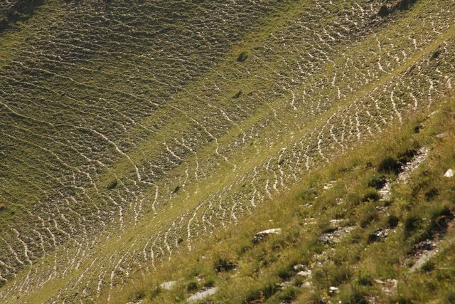
Permanent grass cover under grape vines protects the soil surface against erosion and compaction - and provides better conditions for traffic within the rows during mechanised field operations
- ຜູ້ສັງລວມຂໍ້ມູນ: Brigitta Szabó
Remote Sensing as a Tool for Land Degradation … [ຈີອໍເຈຍ]
Land degradation contributes to biodiversity loss and the impoverishment of rural livelihoods in Tusheti. Above all, however, land degradation are triggered by climate change as traditional land use practise might not be adapted to new climate conditions which can cause or speed up degradation processes significantly. On the other hand, …
- ຜູ້ສັງລວມຂໍ້ມູນ: Hanns Kirchmeir
2. ພັນລະນາ ແນວທາງການຄຸ້ມຄອງນໍາໃຊ້ດິນແບບຍືນຍົງ
2.1 ການອະທິບາຍ ໂດຍຫຍໍ້ ຂອງວິທີທາງ
The unsustainable use of pastures and forest areas has led to soil erosion, degradation, desertification and loss of biodiversity in the high mountain areas of the South Caucasus. The development of pasture passports is part of a broader approach to a strategic pasture management plan for Tusheti. This showcase includes results from the spatial planning process applied in a pilot programme for Akhmeta municipality.
2.2 ການອະທິບາຍ ລາຍລະອຽດ ຂອງວິທີທາງ
ການອະທິບາຍ ລາຍລະອຽດ ຂອງວິທີທາງ:
Project area and purpose
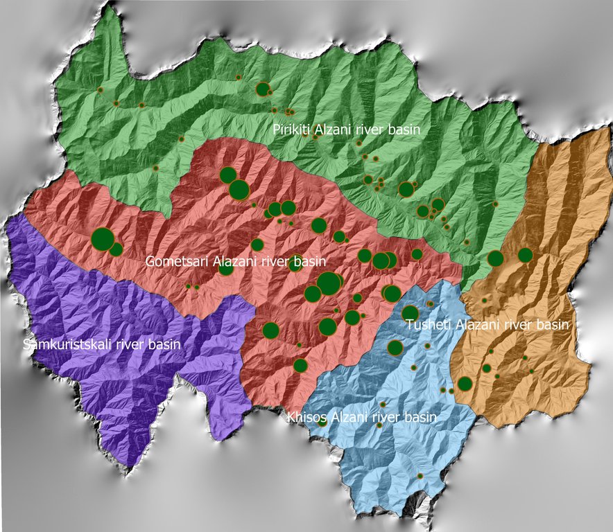
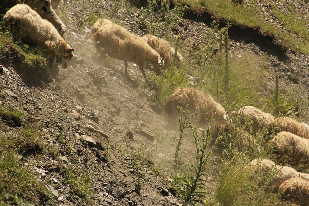
The project area comprises the Tusheti Protected Areas (PAs) on the northern slopes of the Greater Caucasus Mountains in Georgia. This group of protected areas consists of a strict nature reserve, a national park and a protected landscape with about 40 villages and settlements. Together they form a total protected area of approx. 114,000 ha. In Tusheti, overgrazing has led, especially in the eastern part with a higher number of villages and roads, to soil erosion and biodiversity loss. Especially the intensive use of summer pastures during the Soviet period resulted in a severe deterioration of the mountain slopes. So far, there are no standards or guidelines for the elaboration of sustainable pasture management plans in Georgia. Pasture passports, as a first step towards sustainable pasture management, document the actual grazing capacity for each pasture unit and serve as a guiding document for shepherds and local stakeholders and as a basis to prepare lease contracts.
Data gathering
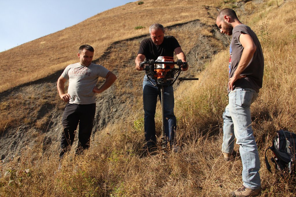
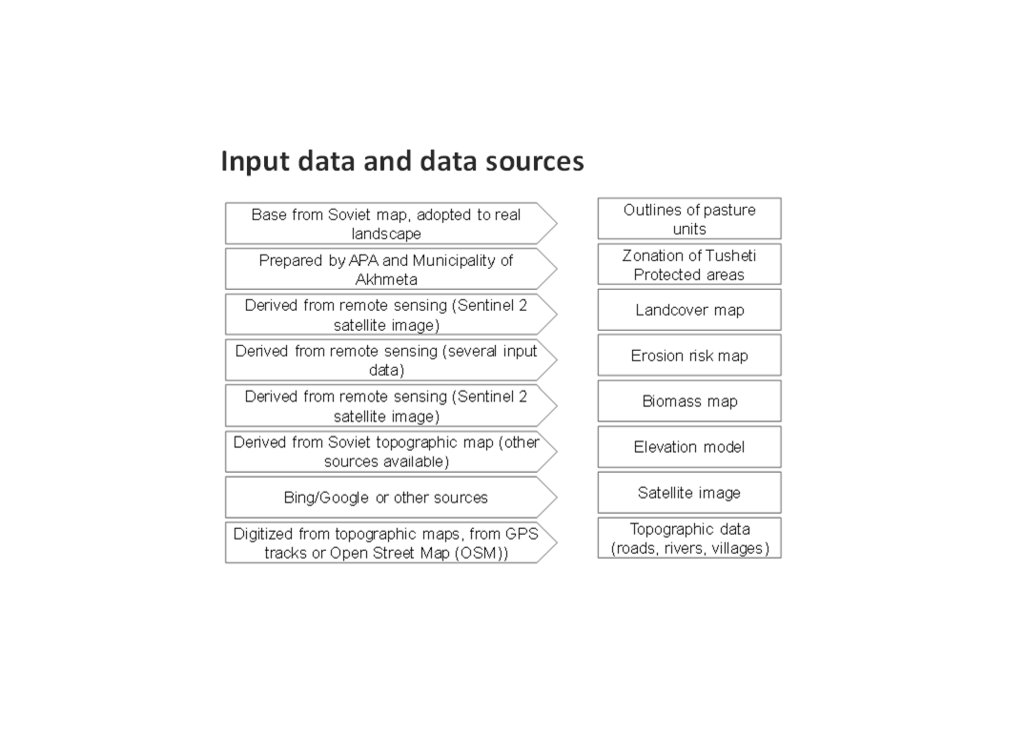
As a prerequisite for the development of pasture passports and the calculation of grazing capacity, the type of land cover, the erosion risk and the biomass of the pastureland had to be assessed for each pasture unit. This was done using remote sensing tools in combination with data collected in the field for calibration.
The details on the methodology of the Land Cover & Biomass as well as the Erosion Risk Assessment can be found in the WOCAT technology on "Remote Sensing as a Tool for Land Degradation Neutrality Monitoring" (see link).
Evaluation and Ground Truthing
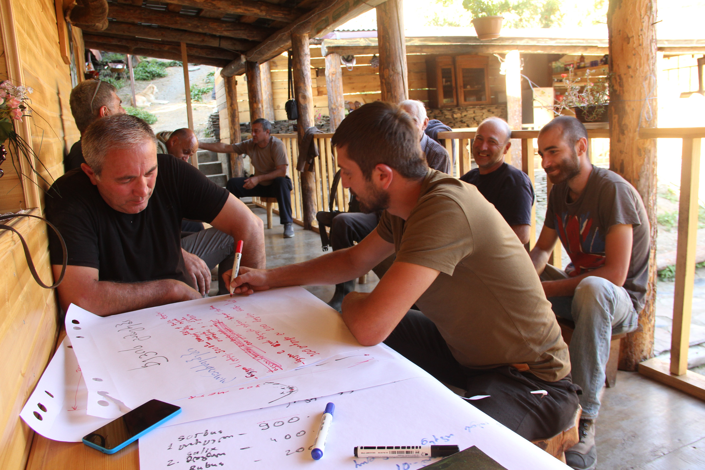
All interim results have been checked and evaluated by local stakeholders, national experts and experts from local administrations. It was important not only to conduct workshops in seminar rooms but to meet the local stakeholders in the field and to discuss the problems and challenges of pasture management on place in the field. At this workshops all levels of decision makers were included (Ministries, Donor organisations, international and national experts, local administrations and land users). This was important to create a common understanding of the current situation from different perspectives (nature conservation, administration, shepherds ...). The combination of remote sensing with calibration data from the field can be summarised as a very effective method to assess the erosion state in large areas. Neither of the two instruments would be able to provide results in this spatial dimension and quality alone.
Pasture Passports
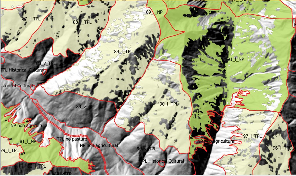
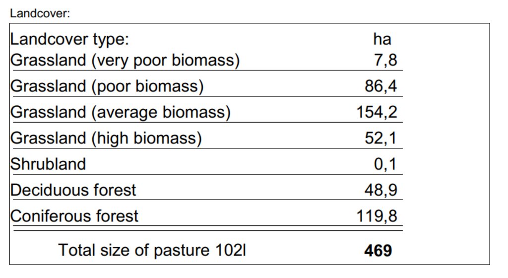
As part of the spatial planning of Akhmeta municipality, pastureland that can be leased to shepherds was separated from land used as hay meadows, farmland or pastures belonging to the villagers. The resulting map shows land available to the village and land available for lease. To understand the current use of pastureland, farms, livestock numbers and pasture units were assessed. In workshops with the local stakeholders and potential users of the results (shepherds, Tusheti Protected Landscape Administration, Tusheti NP Administration, APA), the design of the pasture passports was developed. Each pasture unit is described on four pages in the pasture passport.
Each pasture unit is described on four pages in the pasture passport: Header: the number (code), total area; content: map of the land cover types, the area of each land cover type, map of available biomass and carrying capacity, name of farmers/shepherds and their livestock numbers using the pasture unit
Spatial Planning Department and Construction Policy (within the Ministry of Regional Development and Infrastructure MRDI), and the Agency of Protected Areas APA (within the Ministry of Environmental Protection and Agriculture MEPA), are key stakeholders to use the pasture passports and to further develop and upscale this approach to other protected areas in Georgia. Beside APA, the Tusheti Protected Landscape Administration (TPLA), located within the Akhmeta municipality administration, is the second important user of pasture passports.
The pasture passports are showing not only the boundaries of each pasture unit, but also those areas that must not be grazed because this lands are part of strict protected areas or areas of high erosion risk. This helps shepherds to guide their flocks to the right places and the park rangers to check, if the regulations are respected correctly.
2.3 ຮູບພາບຂອງແນວທາງ
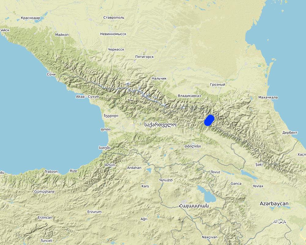
2.5 ປະເທດ / ເຂດ / ສະຖານທີ່ບ່ອນທີ່ແນວທາງໄດ້ຖືກນໍາໃຊ້
ປະເທດ:
ຈີອໍເຈຍ
ພາກພື້ນ / ລັດ / ແຂວງ:
Tusheti
ຂໍ້ມູນເພີ່ມເຕີມຂອງສະຖານທີ່:
Entire territory of Tusheti Protected Areas (1100 km²)
ຄວາມຄິດເຫັນ:
Tusheti is located in the north-eastern of Georgia in the Higher Caucasus bordering Dagestan, Russia. The territory consists of the Tusheti Strict Nature Reserve (12,627 ha), Tusheti National Park (69,515 ha), and Tusheti Protected Landscape (31,517 ha), which includes around 40 villages and settlements.
Full territory of Tusheti Protected Areas (1100 km²)
Map
×2.6 ວັນທີເລີ່ມຕົ້ນ ແລະ ສິ້ນສຸດ ການຈັດຕັ້ງປະຕີບັດ ວິທີທາງ
ສະແດງປີຂອງການເລີ່ມຕົ້ນ:
2016
2.7 ປະເພດຂອງແນວທາງ
- ພາຍໃຕ້ໂຄງການ / ແຜນງານ
2.8 ເປົ້າໝາຍ / ຈຸດປະສົງຫຼັກ ຂອງການຈັດຕັ້ງປະຕິບັດ ວິທີທາງ
Support land use planning and decision-making processes for better management of natural resources, especially pastures.
2.9 ເງື່ອນໄຂອໍານວຍ ຫຼື ຂັດຂວາງການປະຕິບັດຂອງເຕັກໂນໂລຢີ / ເຕັກໂນໂລຢີການນໍາໃຊ້ຕາມແນວທາງ
ສັງຄົມ / ວັດທະນະທໍາ / ມາດຕະຖານ ແລະ ຄຸນຄ່າທາງສາສະໜາ
- ອໍານວຍ
There is a strong identification of the local communities with the traditional pasture land use and the communities are willing to establish a long-term sustainable land management.
ມີຄວາມສາມາດ / ເຂັ້າເຖິງຊັບພະຍາກອນດ້ານການເງິນ ແລະ ການບໍລິການ
- ເຊື່ອງຊ້ອນ
Missing financial resources is hindering the implementation of the approach.
ການກໍ່ຕັ້ງສະຖາບັນ
- ອໍານວຍ
Good cooperation between the relevant institutions on the national and municipal level enabled a successful implementation. The Agency of Protected Areas (APA) located at the Ministry of Environmental Protection and Agriculture (MEPA) and the Tusheti Protected Landscape Administration (TPLA), located within the Akhmeta municipality administration are responsible for contracting lease agreements with shepherds and should not only be able to understand the technology behind the passports but should also have the capacity to handle the technology to be able to adapt the passports if needed (e.g., by changing boundaries of pasture units). For this issue, training workshops with decision-makers and technicians from the MoEPA, APA with TNP Administration and Administration of Akhmeta Munucuaplity with TPLA have been implemented.
Collaboration/ coordination of actors: All relevant national and local authorities that are dealing with spatial or environmental data participated in the workshop to discuss the approach and institutional suitability to host the sensitivity modelSoil Erosion Risk Model.
ການຮ່ວມມື / ການປະສານງານຂອງຜູ້ກ່ຽວຂ້ອງ
- ອໍານວຍ
All relevant national and local authorities that are dealing with spatial or environmental data participated in the workshop to discuss the approach and institutional suitability to host the Soil Erosion Risk Model.
ຄວາມຮູ້ກ່ຽວກັບການຄຸ້ມຄອງ ທີ່ດິນແບບຍືນຍົງ, ການເຂົ້າເຖິງການສະໜັບສະໜູນ ທາງດ້ານວິຊາການ
- ເຊື່ອງຊ້ອນ
There is a high need for technical infrastructure and strong human capacity development.
3. ການມີສ່ວນຮ່ວມ ແລະ ບົດບາດຂອງພາກສ່ວນທີ່ກ່ຽວຂ້ອງທີ່ໄດ້ມີສ່ວນຮ່ວມ
3.1 ຜູ້ມີສ່ວນຮ່ວມ ໃນວິທີທາງ ແລະ ພາລະບົດບາດ ຂອງເຂົາເຈົ້າ
- ຜູ້ນໍາໃຊ້ດິນໃນທ້ອງຖິ່ນ / ຊຸມຊົນທ້ອງຖິ່ນ
Shephards, local communities
Participation at the workshop/meeting and
making contributions through comments,
suggestions and sharing their analytical point
of view.
- ຜູ້ຊ່ຽວຊານ ການນຄຸ້ມຄອງ ທີ່ດິນແບບຍືນຍົງ / ທີ່ປຶກສາດ້ານກະສິກໍາ
GIS-LAB (Georgian scientific GIS service provider)
National experts on remote sensing and modelling of erosion risk.
- ນັກຄົ້ນຄວ້າ
National ecologists from universities
- ອົງການຈັດຕັ້ງ ທີ່ບໍ່ຂື້ນກັບລັດຖະບານ
Centre for Biodiversity Research & Conservation (NACRES);
staff and experts from FATPA (Friends Association of Tusheti Protected Areas);
local NGO's
Interviews with local stakeholders, field experts
- ອໍານາດ ການປົກຄອງທ້ອງຖິ່ນ
Municipality of Akhmeta and Tusheti Protected Landscape Management
Participation at the workshop where they have given input and made contributions to the topic of technical aspects of the approach.
- ພະນັກງານຂັ້ນສູນກາງ (ຜູ້ວາງແຜນ, ຜູ້ສ້າງນະໂຍບາຍ)
National Park management and APA (Agency for Protected Areas)
Long term aplication and upscaling on national level.
- ອົງການຈັດຕັ້ງ ສາກົນ
Deutsche Gesellschaft fuer Zusammenarbeit (GIZ)
Funding and supervision of the implementation process.
3.2 ການມີສ່ວນຮ່ວມຂອງຜູ້ນໍາໃຊ້ທີ່ດິນໃນທ້ອງຖິ່ນ / ຊຸມຊົນທ້ອງຖິ່ນໃນໄລຍະທີ່ແຕກຕ່າງກັນຂອງແນວທາງ
| ການລວບລວມ ເອົາຜູ້ນໍາໃຊ້ດິນ ໃນທ້ອງຖິ່ນ / ຊຸມຊົນທ້ອງຖິ່ນ | ໃຫ້ລະບຸ ຜູ້ໃດທີ່ມີສ່ວນຮ່ວມ ໃນແຕ່ລະກິດຈະກໍາ? | |
|---|---|---|
| ການເລີ່ມຕົ້ນ / ແຮງຈູງໃຈ | ການບໍ່ປະຕິບັດ | |
| ການວາງແຜນ | ການບໍ່ປະຕິບັດ | |
| ການປະຕິບັດ | ການຮ່ວມມື | Organized meetings, workshop where stakeholders, local communities discussed different technical methodologies, visited the project communities and evaluated the preliminary result maps of erosion risk in the field. |
| ຕິດຕາມກວດກາ / ການປະເມີນຜົນ | ການບໍ່ປະຕິບັດ |
3.3 ແຜນວາດ (ຖ້າມີ)
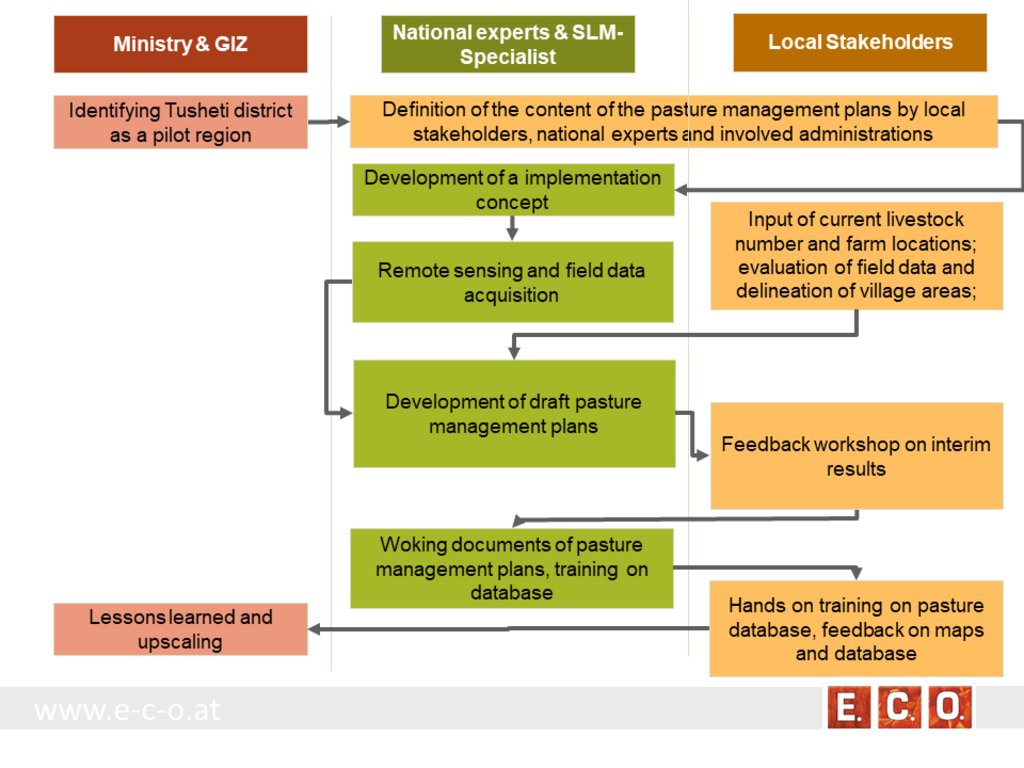
ການອະທິບາຍ:
The process of generating pasture passports consists of several phases. The needs and expected content of the pasture management plans was defined in the early stage of the project by the local stakeholders, national experts and involved administrations. The preparation of the pasture management plans was an iterative process between the remotsensing and field sampling results and feedback and input from local stakeholders.
•
ຜູ້ຂຽນ:
Hanns Kirchmeir
3.4 ການຕັດສິນໃຈກ່ຽວກັບການຄັດເລືອກເຕັກໂນໂລຢີຂອງການຄຸ້ມຄອງທີ່ດິນແບບຍືນຍົງ / ເຕັກໂນໂລຢີ
ລະບຸ ຄົນທີ່ຕັດສິນໃຈ ກ່ຽວກັບການຄັດເລືອກຂອງ ເຕັກໂນໂລຢີ / ເຕັກໂນໂລຢີ ຈະໄດ້ຮັບການປະຕິບັດ:
- ຜູ້ຊ່ຽວຊານ ຫຼັກດ້ານການຄຸ້ມຄອງ ທີ່ດິນແບບຍືນຍົງ, ມີການຕິດຕາມປຶກສາຫາລືກັບຜູ້ນໍາໃຊ້ທີ່ດິນ
Specify on what basis decisions were made:
- ປະເມີນເອກກະສານ ຄວາມຮູ້ກ່ຽວກັບ ການຄຸ້ມຄອງ ທີ່ດິນແບບຍືນຍົງ (ຫຼັກຖານທີ່ຊ່ວຍໃນການຕັດສິນໃຈ)
4. ການສະໜັບສະໜູນທາງດ້ານວິຊາການ, ການສ້າງຄວາມສາມາດ, ແລະ ການຈັດການຄວາມຮູ້.
4.1 ການສ້າງຄວາມສາມາດ / ການຝຶກອົບຮົມ
ຜູ້ນໍາໃຊ້ທີ່ດິນ ຫຼື ພາກສ່ວນກ່ຽວຂ້ອງອື່ນໆ ໄດ້ຮັບການຝຶກອົບຮົມບໍ່?
ແມ່ນ
ໃຫ້ລະບຸ ຜູ້ໃດທີ່ໄດ້ຮັບການຝຶກອົບຮົມ:
- ພະນັກງານພາກສະໜາມ / ທີ່ປຶກສາ
ຮູບແບບຂອງການຝຶກອົບຮົມ:
- ເນື້ອທີ່ສວນທົດລອງ
ຮູບແບບຂອງການຝຶກອົບຮົມ:
- workshop with field mission
ໃນຫົວຂໍ້:
Evaluation of model results, preliminary result maps of erosion risk in the field, technical implementation of the sensitivity model in Georgia.
ຄວາມຄິດເຫັນ:
The workshops were combined with field missions to evaluate model results directly in the field. The expert teams went into the project communities and evaluated the preliminary result maps of erosion risk in the field together with local stakeholders.
4.2 ການບໍລິການໃຫ້ຄໍາປຶກສາ
ເຮັດຜູ້ໃຊ້ທີ່ດິນມີການເຂົ້າເຖິງການບໍລິການໃຫ້ຄໍາປຶກສາ?
ແມ່ນ
ລະບຸວ່າການສະໜອງ ການບໍລິການ ໃຫ້ຄໍາປຶກສາ:
- ສູນຄົ້ນຄວ້າ
ອະທິບາຍ / ຄວາມຄິດເຫັນ:
Located on district level in Telavi
4.3 ສະຖາບັນການສ້າງຄວາມເຂັ້ມແຂງ (ການພັດທະນາອົງການຈັດຕັ້ງ)
ສະຖາບັນ ໄດ້ຮັບການສ້າງຕັ້ງຂື້ນ ຫຼື ໄດ້ຮັບການສ້າງຄວາມເຂັ້ມແຂງ ໂດຍການຈັດຕັ້ງປະຕິບັດ ວິທີທາງບໍ່?
- ມີ, ພໍສົມຄວນ
ລະບຸ ທາງສະຖາບັນ ໄດ້ສ້າງຄວາມເຂັ້ມແຂງ ໃນລະດັບໃດ (ຫຼາຍ):
- ທ້ອງຖິ່ນ
- ລະດັບພາກພື້ນ
- ແຫ່ງຊາດ
ອະທິບາຍ ສະຖາບັນການຈັດຕັ້ງ, ພາລະບົດບາດ ແລະ ໜ້າທີ່ຮັບຜິດຊອບ, ສະມາຊິກ ແລະ ອື່ນໆ.
The results of the approach implementation in Georgia has been summarized by the Programme ”Integrated Biodiversity Management, South Caucasus” and distributed to the experts in Azerbaijan for the further implementation.
Approach and results have been handed over to the local municipality responsible for the lease contracts in the Protected Landscape and to APA, which is responsible for the land use in the national park to integrate them into their pasture management plans.
ລະບຸ ປະເພດ ຂອງສະໜັບສະໜູນ:
- ທາງດ້ານການເງິນ
- ການສ້າງຄວາມອາດສາມາດ / ການຝຶກອົບຮົມ
- sharing the concept, approach
ໃຫ້ລາຍລະອຽດເພີ່ມເຕີມ:
The concept and approach has been shared with local municipalities and other related experts.
Pilot study financed by GIZ.
4.4 ຕິດຕາມກວດກາ ແລະ ປະເມີນຜົນ
ການຈັດຕັ້ງປະຕິບັດ ວິທີທາງ ໄດ້ມີການປະເມີນຜົນ ແລະ ຕິດຕາມບໍ?
ແມ່ນ
ຄວາມຄິດເຫັນ:
Within the project a basline was drawn with the current livestock numbers, the current available fodder biomass and the current state of erosion.
ຖ້າແມ່ນ, ເອກກະສານສະບັບນີ້ ແມ່ນໄດ້ນໍາໃຊ້ເຂົ້າໃນການຕິດຕາມ ແລະ ປະເມີນຜົນບໍ່?
ແມ່ນ
ຄວາມຄິດເຫັນ:
The remote sensing technology enables a sound methodology to compare the state of erosion and the biomass volume based on satelite data after some years with the baseline values from 2017.
4.5 ການຄົ້ນຄວ້າ
ນີ້້ແມ່ນສ່ວນໜຶ່ງ ການຄົ້ນຄວ້າ ຂອງວິທີທາງບໍ່?
ແມ່ນ
ລະບຸ ຫົວຂໍ້:
- ເຕັກໂນໂລຢີ
ໃຫ້ຂໍ້ມູນ ເພີ່ມເຕີມ ແລະ ກໍານົດ ຜູ້ໃດເຮັດການຄົ້ນຄວ້າ:
National and international ecologists did research on vegetation details and biomass as well as on the remote sensing technology.
5. ການສະໜັບສະໜູນທາງດ້ານການເງິນ ແລະ ອຸປະກອນຈາກພາຍນອກ
5.1 ງົບປະມານປະຈໍາປີ ສໍາລັບວິທີທາງ ຂອງການຄຸ້ມຄອງ ທີ່ດິນແບບຍືນຍົງ
ຖ້າຫາກບໍ່ຮູ້ຈັດງົບປະມານທີ່ແນ່ນອນ ແມ່ນໃຫ້ປະມານເອົາ:
- 10,000-100,000
ຄໍາເຫັນ (ຕົວຢ່າງ: ແຫຼ່ງຂໍ້ມູນຫຼັກ ຂອງການສະໜອງທຶນ / ຜູ້ໃຫ້ທຶນທີ່ສໍາຄັນ):
The funds came from the Integrated Erosion Control project which aas launched as part of the Integrated Biodiversity Management, South Caucasus (IBiS) Programme of the Deutsche Gesellschaft für Internationale Zusammenarbeit (GIZ)
5.2 ການສະໜັບສະໜູນ ທາງດ້ານການເງິນ / ອຸປະກອນ ສະໜອງໃຫ້ແກ່ຜູ້ນໍາທີ່ດິນ
ຜູ້ນໍາໃຊ້ດິນ ໄດ້ຮັບການສະໜັບສະໜູນ ທາງດ້ານ ການເງິນ / ອຸປະກອນ ໃນການຈັດຕັ້ງປະຕິບັດ ເຕັກໂນໂລຢີບໍ?
ບໍ່ແມ່ນ
5.3 ເງິນສົມທົບສໍາລັບການນໍາໃຊ້ສະເພາະປັດໃຈຂາເຂົ້າໃນການຜະລີດກະສິກໍາ (ລວມທັງແຮງງານ)
- ບໍ່ມີ
ຖ້າແຮງງານ ຂອງຜູ້ນໍາໃຊ້ດິນ ໄດ້ຮັບການສະໜັບສະໜູນ ປັດໃຈຂາເຂົ້າ, ແມ່ນບໍ່:
- ການອາສາ
ຄວາມຄິດເຫັນ:
There was a questionnaire and land-users shared their information on land-use practice.
5.4 ສິນເຊື່ອ
ໄດ້ປ່ອຍສິນເຊື່ອ ສະໜອງໃຫ້ພາຍໃຕ້ ວິທີການສໍາລັບກິດຈະກໍາ ການຄຸ້ມຄອງ ທີ່ດິນແບບຍືນນຍົງບໍ່?
ບໍ່ແມ່ນ
5.5 ສິ່ງຈູງໃຈ ຫຼື ເຄື່ອງມືອື່ນໆ
ການສົ່ງເສີມ ຈັດຕັ້ງປະຕິບັດ ເຕັກໂນໂລຢີ ໃນການຄຸ້ມຄອງ ດິນແບບຍືນຍົງ ໄດ້ສະໜອງສິ່ງກະຕຸກຊຸກຍູ້ບໍ່?
ແມ່ນ
ຖ້າແມ່ນ, ໃຫ້ລະບຸ:
The Agency of Protected Areas (APA) thinks about upscaling the pasture passport method on a national level and establish the approach also in other protected areas of Georgia.
6. ວິເຄາະຜົນກະທົບ ແລະ ສັງລວມບັນຫາ
6.1 ຜົນກະທົບຂອງແນວທາງ
ວິທີທາງ ຊ່ວຍຊຸກຍູ້ ຜູ້ນຳໃຊ້ທີ່ດິນທ້ອງຖີ່ນ, ໃນການປັບປຸງ ການມີສ່ວນຮ່ວມ ຂອງຜູ້ທີ່ກ່ຽວຂ້ອງ ບໍ່?
- ບໍ່
- ມີ, ໜ້ອຍໜຶ່ງ
- ມີ, ພໍສົມຄວນ
- ມີ, ຫຼາຍ
Through the field visits and workshops, it has involved both experts and authorities, where they have assessed, analysed and given input.
ການນໍາໃຊ້ ວິທີທາງ ດັ່ງກ່າວນີ້ ສາມາດເປັນຫຼັກຖານ ທີ່ສະໜັບສະໜູນ ໃຫ້ການຕັດສິນໃຈໄດ້ບໍ່?
- ບໍ່
- ມີ, ໜ້ອຍໜຶ່ງ
- ມີ, ພໍສົມຄວນ
- ມີ, ຫຼາຍ
By the assessment of biomass, the carrying capacity of each pasture unit was calculated.
ການນໍາໃຊ້ ວິທີທາງ ສາມາດປັບປຸງຄວາມຮູ້ ແລະ ຄວາມສາມາດຂອງຜູ້ນໍາໃຊ້ທີ່ດິນ ໃນການປະຕິບັດ ການຄຸ້ມຄອງ ທີ່ດິນແບບຍືດຍົງໄດ້ບໍ່?
- ບໍ່
- ມີ, ໜ້ອຍໜຶ່ງ
- ມີ, ພໍສົມຄວນ
- ມີ, ຫຼາຍ
The perception of the key stakeholders and management towards the importance of biodiversity and ecosystem services has become more positive.
ການນໍາໃຊ້ ວິທີທາງ ສາມາດປັບປຸງຄວາມຮູ້ ແລະ ຄວາມສາມາດ ຂອງພາກສ່ວນທີ່ກ່ຽວຂ້ອງໄດ້ບໍ່?
- ບໍ່
- ມີ, ໜ້ອຍໜຶ່ງ
- ມີ, ພໍສົມຄວນ
- ມີ, ຫຼາຍ
The implementation capacity of line ministries, their subordinate bodies and of training institutions regarding the management of biodiversity and ecosystem services is improved at the national level.
ການນໍາໃຊ້ ວິທີທາງ ສາມາດສ້າງຄວາມເຂັ້ມແຂງ ໃຫ້ສະຖາບັນການຈັດຕັ້ງ, ການຮ່ວມມື ລະຫວ່າງພາກສ່ວນທີ່ກ່ຽວຂ້ອງບໍ່?
- ບໍ່
- ມີ, ໜ້ອຍໜຶ່ງ
- ມີ, ພໍສົມຄວນ
- ມີ, ຫຼາຍ
A cooperation between the local Administration of the Protected Landscape (managed by municipality) and the Administration of National Park (managed by national Agency of Protected Areas) was strengthened.
Promoted better coordination of biodiversity and ecosystem services management across sectors based on solid data.
6.2 ແຮງຈູງໃຈຫຼັກຂອງຜູ້ນໍາໃຊ້ທີ່ດິນໃນການປະຕິບັດການຄຸ້ມຄອງທີ່ດິນແບບຍືນຍົງ
- ການຜະລິດເພີ່ມຂຶ້ນ
- ຫຼຸດຜ່ອນດິນເຊື່ອມໂຊມ
6.3 ຄວາມຍືນຍົງຂອງກິດຈະກໍາວິທີທາງ
ຜູ້ນໍາໃຊ້ ທີ່ດິນ ສາມາດສືບຕໍ່ ການຈັດຕັ້ງປະຕິບັດ ຜ່ານວິທີທາງໄດ້ບໍ່ (ໂດຍປາດສະຈາກ ການຊ່ວຍເຫຼືອ ຈາກພາກສ່ວນພາຍນອກ)?
- ແມ່ນ
ຖ້າ ໄດ້, ອະທິບາຍເຫດຜົນ:
The remote sensing technology is not available to the land users, but the results (pasture passports) can be used by shepherds and local authorities to adjust the grazing intensity to the maximum carrying capacity of each pasture unit.
6.4 ຈຸດແຂງ / ຂໍ້ດີ ຂອງວິທີທາງ
| ຈຸດແຂງ / ຂໍ້ດີ / ໂອກາດໃນການນໍາໃຊ້ທີ່ດິນ |
|---|
| The pasture passports are describing each pasture unit available for lease not only by size but also by the amount of available fodder biomass. This is representing the productivity and the maps are showing the accessibility of the fodder biomass to the livestock. This is essential for a more accurate prize estimation on the value of each pasture compared to old data just giving the size of the pasture unit. |
| The pasture passports are improving the legal basis for the lease contract. Areas that should not be grazed (strict protected areas, forests, areas of high erosion risk) are clearly shown on the map. |
| During the preparation process the village related areas and the pastures for lease have been defined and mapped. This leads to clear responsibilities for the different pasture lands. |
| ຈຸດແຂງ / ຈຸດດີ / ໂອກາດ ຈາກທັດສະນະຂອງຜູ້ປ້ອນຂໍ້ມູນ ຫຼື ບຸກຄົນສຳຄັນ |
|---|
| Contribution to the work by local municipalities - the overall results have been handed over to the municipality, responsible for the lease contracts in the Protected Landscape and to APA, responsible for the land use in the National Park. |
| The remote sensing technology is an objective method to assess the state of the pasture land and can be reproduced at any future time or in other areas of the Caucasus. |
| The GIS data and databases can support the administrative process of preparing lease contracts and can additionally be used for further research activities. |
6.5 ຈຸດອ່ອນ / ຂໍ້ເສຍຂອງແນວທາງ ແລະ ວິທີການແກ້ໄຂໃຫ້ເຂົາເຈົ້າ
| ຈຸດອ່ອນ / ຂໍ້ເສຍ / ຄວາມສ່ຽງໃນມູມມອງຂອງຜູ້ນໍາໃຊ້ທີ່ດິນ | ມີວິທີການແກ້ໄຂຄືແນວໃດ? |
|---|---|
| Informal land use practises are now documented and fixed in lease contracts. That might lead to higher costs (lease) and reduce the profit of the shepherd/livestock owner. | It needs to be communicated that long term lease contracts guarantee the shepherds/livestock owner grazing rights for several years. Investments into pasture quality and infrastructure become more meaningful. |
| ຈຸດອ່ອນ ຫຼື ຂໍ້ເສຍ ຫຼື ຄວາມສ່ຽງ ໃນມຸມມອງຂອງ ຜູ້ສັງລວມຂໍ້ມູນ ຫຼື ບັນດາຜູ້ຕອບແບບສອບຖາມ | ມີວິທີການແກ້ໄຂຄືແນວໃດ? |
|---|---|
| The preparation process includes high investment of resources in the first setup of the remote sensing data, field evaluation and database development. It needs special experts and know how. | Remote sensing becomes cheaper when applied on large areas. A distribution of field samples across the whole Caucasus range would enable to upscale from the pilot area to a much wider range with less costs per hectare pasture land. |
7. ເອກກະສານອ້າງອີງ ແລະ ຂໍ້ມູນການເຊື່ອມໂຍງ
7.1 ວິທີການ / ແຫຼ່ງຂໍ້ມູນ
- ການໄປຢ້ຽມຢາມພາກສະໜາມ, ການສໍາຫຼວດພາກສະໜາມ
- ສໍາພາດ ຊ່ຽວຊານ ການຄຸ້ມຄອງ ດິນແບບຍືນຍົງ
34 experts have participated at the workshop on remote-sensing tools for erosion control and pasture management in Tusheti.
7.2 ເອກະສານທົ່ວໄປທີ່ສາມາດໃຊ້ໄດ້
ຫົວຂໍ້, ຜູ້ຂຽນ, ປີ, ISBN:
Kirchmeir H. 12/2018: Implementation of an Erosion Risk Assessment tool on pilot regions in the Southern Caucasus. The Programme „Integrated Biodiversity Management, South Caucasus”
7.3 ການເຊື່ອມຕໍ່ກັບຂໍ້ມູນທີ່ກ່ຽວຂ້ອງທີ່ສາມາດໃຊ້ອອນໄລນ໌
ຫົວຂໍ້ / ພັນລະນາ:
The European GeoNode system
URL:
http://pegasosdi.uab.es/geoportal/
ຫົວຂໍ້ / ພັນລະນາ:
Monitoring Manual for Highland Pastures in the Caucasus
URL:
https://biodivers-southcaucasus.org/uploads/files/Monitoring%20Manual%20Draft%20ENG_new%20%20amendments%20for%20Georgia_v9_acc.amend.pdf
ຂໍ້ມູນການເຊື່ອມຕໍ່ ແລະ ເນື້ອໃນ
ຂະຫຍາຍທັງໝົດ ຍຸບທັງໝົດການເຊື່ອມຕໍ່

Permanent grass cover in vineyards [ຮັນກາຣີ]
Permanent grass cover under grape vines protects the soil surface against erosion and compaction - and provides better conditions for traffic within the rows during mechanised field operations
- ຜູ້ສັງລວມຂໍ້ມູນ: Brigitta Szabó

Remote Sensing as a Tool for Land Degradation … [ຈີອໍເຈຍ]
Land degradation contributes to biodiversity loss and the impoverishment of rural livelihoods in Tusheti. Above all, however, land degradation are triggered by climate change as traditional land use practise might not be adapted to new climate conditions which can cause or speed up degradation processes significantly. On the other hand, …
- ຜູ້ສັງລວມຂໍ້ມູນ: Hanns Kirchmeir
ເນື້ອໃນ
ບໍ່ມີເນື້ອໃນ


