Project of check-dam for land [ຈີນ]
- ການສ້າງ:
- ປັບປູງ:
- ຜູ້ສັງລວມຂໍ້ມູນ: Fei WANG
- ບັນນາທິການ: –
- ຜູ້ທົບທວນຄືນ: David Streiff
淤地坝工程
approaches_2450 - ຈີນ
ເບິ່ງພາກສ່ວນ
ຂະຫຍາຍທັງໝົດ ຍຸບທັງໝົດ1. ຂໍ້ມູນທົ່ວໄປ
1.2 ລາຍລະອຽດ ການຕິດຕໍ່ ຂອງບຸກຄົນທີ່ຊັບພະຍາກອນ ແລະ ສະຖາບັນ ການມີສ່ວນຮ່ວມ ໃນການປະເມີນຜົນ ແລະ ເອກະສານ ຂອງວິທີທາງ
ຊື່ຂອງ ສະຖາບັນການຈັດຕັ້ງ ທີ່ອໍານວຍຄວາມສະດວກ ໃນການສ້າງເອກກະສານ ຫຼື ປະເມີນແນວທາງ (ຖ້າກ່ຽວຂ້ອງ)
Northwest A&F University (NWAFU) - ຈີນ1.3 ເງື່ອນໄຂ ຂອງການນໍາໃຊ້ເອກກະສານຂໍ້ມູນ ຂອງ WOCAT
ຜູ້ສັງລວມ ແລະ ບັນດາຜູ້ຕອບແບບສອບຖາມ ຍອມຮັບໃນເງື່ອນໄຂ ການນໍາໃຊ້ຂໍ້ມູນເອກະສານ ທີ່ສ້າງຂື້ນ ໂດຍຜ່ານ ອົງການ WOCAT:
ແມ່ນ
1.4 ເອກະສານອ້າງອີງ (ຫຼາຍ) ກັບແບບສອບຖາມ (ຫຼາຍ) ເຕັກໂນໂລຢີ ຂອງດ້ານການຄຸ້ມຄອງ ດິນແບບຍືນຍົງ
Check dam for land [ຈີນ]
Check dam for land is a structural SLM practice that is constructed in the valley of a watershed in order to slow down the runoff and increase sedimentation. After this, the land quality of the controlling area will increase because soil and water conditions in this place are improved.
- ຜູ້ສັງລວມຂໍ້ມູນ: Fei WANG
2. ພັນລະນາ ແນວທາງການຄຸ້ມຄອງນໍາໃຊ້ດິນແບບຍືນຍົງ
2.1 ການອະທິບາຍ ໂດຍຫຍໍ້ ຂອງວິທີທາງ
Approach of check dam for land is a kind of soil and water conservation activity to reduce the sediment discharge and improve the agricultural condition through building a dam across the valley in order to silt the sediment from upstream untill it convert to land with few soil erosion and flash floods.
2.2 ການອະທິບາຍ ລາຍລະອຽດ ຂອງວິທີທາງ
ການອະທິບາຍ ລາຍລະອຽດ ຂອງວິທີທາງ:
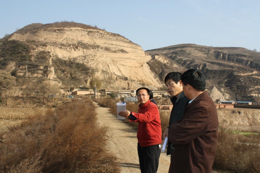
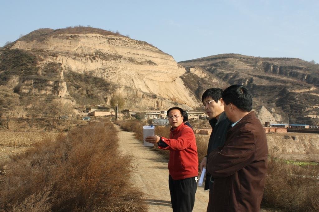
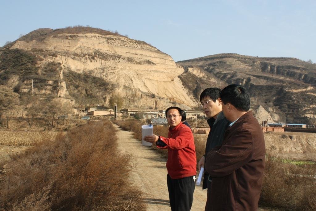
Aims / objectives: The aims of this approach are to reduce sediment discharge of the rivers and to create cropland in the valley. A wall across the valley is built to hold up the muddy flash flood and to slow down the runoff and to silt the sediment. The water in the check dam could be used as waterbody or discharge as clear water. The local farmers and governments want to improve the agricultural condition in the valley near to village and select the check dam for land.
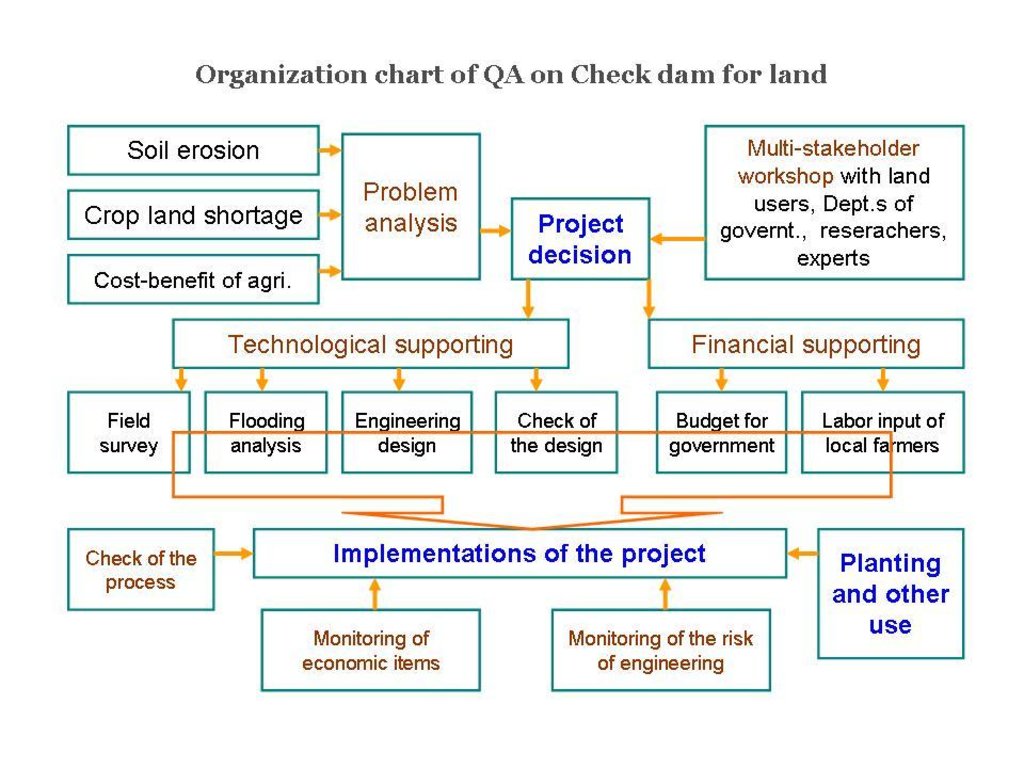
Methods: Normally the farmers and the local experts judge the feasibility of the technology firstly and then apply the support of local government. The construction should be finished by group (village) with labour input combining with finicial support outside.
Stages of implementation: The first stage to implenment this technology is to call on the local farmers with benefits show of such technologies. Then, an application should be submitted to local gevernment. After getting the support, the construction begin.
Role of stakeholders: The local farmers, experts and local government are main participants in this approach.
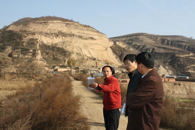
2.3 ຮູບພາບຂອງແນວທາງ
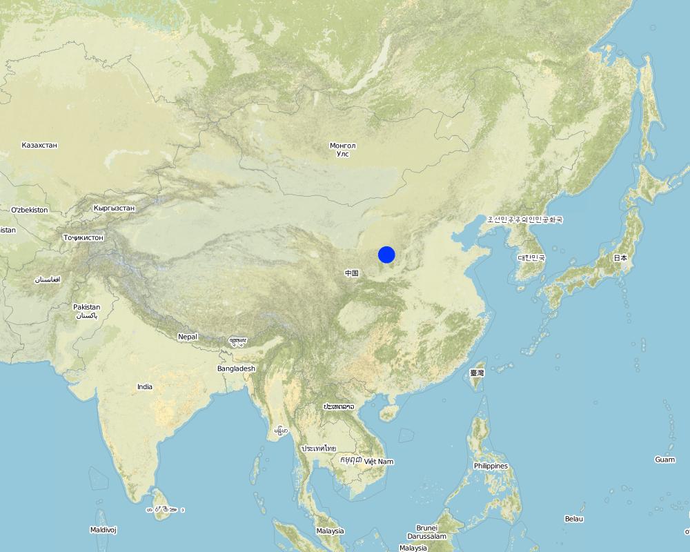
2.5 ປະເທດ / ເຂດ / ສະຖານທີ່ບ່ອນທີ່ແນວທາງໄດ້ຖືກນໍາໃຊ້
ປະເທດ:
ຈີນ
ພາກພື້ນ / ລັດ / ແຂວງ:
Shaanxi Province
ຂໍ້ມູນເພີ່ມເຕີມຂອງສະຖານທີ່:
Baota County, Yan'an City
ຄວາມຄິດເຫັນ:
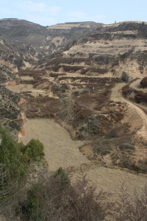
The total area with different measures is almost 2000 km2 . Yanhe River is a first class branch of Yellow River, China. The average channel slope is 3.26‰, and the area of whole basin is 7,687 km2. It is situated in the semi-arid North Temperate Zone with an average annual precipitation varying from 500 to 550 mm, and an average annual air temperature ranging from 8.5 to 11.4℃. It is in hilly gull
Map
×2.6 ວັນທີເລີ່ມຕົ້ນ ແລະ ສິ້ນສຸດ ການຈັດຕັ້ງປະຕີບັດ ວິທີທາງ
ສະແດງປີຂອງການເລີ່ມຕົ້ນ:
18
ປີທີ່ສີ້ນສູດ (ຖ້າຢຸດບໍ່ໄດ້ນໍາໃຊ້ ວິທີທາງ):
16
2.7 ປະເພດຂອງແນວທາງ
- ພາຍໃຕ້ໂຄງການ / ແຜນງານ
2.8 ເປົ້າໝາຍ / ຈຸດປະສົງຫຼັກ ຂອງການຈັດຕັ້ງປະຕິບັດ ວິທີທາງ
The Approach focused mainly on SLM with other activities (Structural practices; crop land; reduction of sediment load downstream)
1. it reduces the sediment load of the downstream or main river. 2. it improves the agricultural condition through the gain of new cropland in the valleys; 3. it reduces the soil erosion of gullies by down-cutting erosion; 4. it to reduces the gravity erosion or collapse of slopes because the land would increase the stability of slopes. 5. it designs the check dam well and search funds in order to construct the check dam.
The SLM Approach addressed the following problems: The problems include: lack of flat areas for crop production, high soil erosion on the slopes, poverty induced by low production, requirement of sediment control , lack of cash, and so on.
2.9 ເງື່ອນໄຂອໍານວຍ ຫຼື ຂັດຂວາງການປະຕິບັດຂອງເຕັກໂນໂລຢີ / ເຕັກໂນໂລຢີການນໍາໃຊ້ຕາມແນວທາງ
ມີຄວາມສາມາດ / ເຂັ້າເຖິງຊັບພະຍາກອນດ້ານການເງິນ ແລະ ການບໍລິການ
- ເຊື່ອງຊ້ອນ
the input for a check dam is high for small households and villages
Treatment through the SLM Approach: financial support from outside such as local or central governemnt, or the management organization of water basin.
ກ່ຽວກັບກົດໝາຍ (ສິດນໍາໃຊ້ດິນ, ສິດນໍາໃຊ້ນໍ້າ)
- ອໍານວຍ
The existing land ownership, land use rights / water rights greatly helped the approach implementation: The approach has many advantages for the different stakeholders. The existing land ownship, land user rights and water rights could help the approach implementation.
ຄວາມຮູ້ກ່ຽວກັບການຄຸ້ມຄອງ ທີ່ດິນແບບຍືນຍົງ, ການເຂົ້າເຖິງການສະໜັບສະໜູນ ທາງດ້ານວິຊາການ
- ເຊື່ອງຊ້ອນ
A huge flood would destroy the dam
Treatment through the SLM Approach: To improve the quality which is depending on calculation of the possibility of flood and during extrem storms the control area of the dam.
3. ການມີສ່ວນຮ່ວມ ແລະ ບົດບາດຂອງພາກສ່ວນທີ່ກ່ຽວຂ້ອງທີ່ໄດ້ມີສ່ວນຮ່ວມ
3.1 ຜູ້ມີສ່ວນຮ່ວມ ໃນວິທີທາງ ແລະ ພາລະບົດບາດ ຂອງເຂົາເຈົ້າ
- ຜູ້ນໍາໃຊ້ດິນໃນທ້ອງຖິ່ນ / ຊຸມຊົນທ້ອງຖິ່ນ
Some check dams were implemented by villagers, before
The land area of local farmers is very small, and the decision at the village level should be decided by the group.
- ຜູ້ຊ່ຽວຊານ ການນຄຸ້ມຄອງ ທີ່ດິນແບບຍືນຍົງ / ທີ່ປຶກສາດ້ານກະສິກໍາ
The geologist designs the site of engineering, the hydyologist designs the ability of dam according the strom records and landform of the basin; the civil engineers design the number of engineers.
They can evaluate the properity of check dam for land and design it
- ອໍານາດ ການປົກຄອງທ້ອງຖິ່ນ
The departments with certification to implement
They decide the planning of soil and water conservation.
- ພະນັກງານຂັ້ນສູນກາງ (ຜູ້ວາງແຜນ, ຜູ້ສ້າງນະໂຍບາຍ)
By politicians / leaders
3.2 ການມີສ່ວນຮ່ວມຂອງຜູ້ນໍາໃຊ້ທີ່ດິນໃນທ້ອງຖິ່ນ / ຊຸມຊົນທ້ອງຖິ່ນໃນໄລຍະທີ່ແຕກຕ່າງກັນຂອງແນວທາງ
| ການລວບລວມ ເອົາຜູ້ນໍາໃຊ້ດິນ ໃນທ້ອງຖິ່ນ / ຊຸມຊົນທ້ອງຖິ່ນ | ໃຫ້ລະບຸ ຜູ້ໃດທີ່ມີສ່ວນຮ່ວມ ໃນແຕ່ລະກິດຈະກໍາ? | |
|---|---|---|
| ການເລີ່ມຕົ້ນ / ແຮງຈູງໃຈ | ການນໍາໃໍຊ້ເອງ | the local farmers and village head involved normally. They could build the check dam before but they submit the proposal for the building now. |
| ການວາງແຜນ | ການຊ່ວຍເຫຼືອຈາກພາຍນອກ | the experts in hydrology, soil erosion, landform involved. They survey, calculate and design the check dam. |
| ການປະຕິບັດ | ການຮ່ວມມື | |
| ຕິດຕາມກວດກາ / ການປະເມີນຜົນ | ບໍ່ມີ | |
| Research | ບໍ່ມີ |
3.3 ແຜນວາດ (ຖ້າມີ)
3.4 ການຕັດສິນໃຈກ່ຽວກັບການຄັດເລືອກເຕັກໂນໂລຢີຂອງການຄຸ້ມຄອງທີ່ດິນແບບຍືນຍົງ / ເຕັກໂນໂລຢີ
ລະບຸ ຄົນທີ່ຕັດສິນໃຈ ກ່ຽວກັບການຄັດເລືອກຂອງ ເຕັກໂນໂລຢີ / ເຕັກໂນໂລຢີ ຈະໄດ້ຮັບການປະຕິບັດ:
- ນັກການເມືອງ / ຜູ້ນໍາ
ອະທິບາຍ:
the high input is mainly from the government. Specialist also play a very important role in decision making.
Decisions on the method of implementing the SLM Technology were made by mainly by SLM specialists with consultation of land users. the specialists are the conductor according the natural condition and the requirement of the land users.
4. ການສະໜັບສະໜູນທາງດ້ານວິຊາການ, ການສ້າງຄວາມສາມາດ, ແລະ ການຈັດການຄວາມຮູ້.
4.1 ການສ້າງຄວາມສາມາດ / ການຝຶກອົບຮົມ
ຜູ້ນໍາໃຊ້ທີ່ດິນ ຫຼື ພາກສ່ວນກ່ຽວຂ້ອງອື່ນໆ ໄດ້ຮັບການຝຶກອົບຮົມບໍ່?
ແມ່ນ
ໃຫ້ລະບຸ ຜູ້ໃດທີ່ໄດ້ຮັບການຝຶກອົບຮົມ:
- ຜູ້ນໍາໃຊ້ດິນ
- ພະນັກງານພາກສະໜາມ / ທີ່ປຶກສາ
ຮູບແບບຂອງການຝຶກອົບຮົມ:
- ເນື້ອທີ່ສວນທົດລອງ
- ກອງປະຊຸມ
4.2 ການບໍລິການໃຫ້ຄໍາປຶກສາ
ເຮັດຜູ້ໃຊ້ທີ່ດິນມີການເຂົ້າເຖິງການບໍລິການໃຫ້ຄໍາປຶກສາ?
ແມ່ນ
ລະບຸວ່າການສະໜອງ ການບໍລິການ ໃຫ້ຄໍາປຶກສາ:
- ໃນພື້ນທີ່ຂອງຜູ້ນໍາໃຊ້ດິນ
- ສູນຄົ້ນຄວ້າ
ອະທິບາຍ / ຄວາມຄິດເຫັນ:
Consultation and Discussion; Key elements: Determine and classify the questions and problems of the project, Analysis the problems and discussion it wth the relative experts, Explain the whole condition of the project to the participants; it is not so difficult in the Loess Plateau because the local farmers are familiar with the check dam for land more or less.
Advisory service is quite adequate to ensure the continuation of land conservation activities; the technology is not new in the Yan River Basin
4.3 ສະຖາບັນການສ້າງຄວາມເຂັ້ມແຂງ (ການພັດທະນາອົງການຈັດຕັ້ງ)
ສະຖາບັນ ໄດ້ຮັບການສ້າງຕັ້ງຂື້ນ ຫຼື ໄດ້ຮັບການສ້າງຄວາມເຂັ້ມແຂງ ໂດຍການຈັດຕັ້ງປະຕິບັດ ວິທີທາງບໍ່?
- ມີ, ໜ້ອຍໜຶ່ງ
ລະບຸ ທາງສະຖາບັນ ໄດ້ສ້າງຄວາມເຂັ້ມແຂງ ໃນລະດັບໃດ (ຫຼາຍ):
- ທ້ອງຖິ່ນ
ລະບຸ ປະເພດ ຂອງສະໜັບສະໜູນ:
- ການສ້າງຄວາມອາດສາມາດ / ການຝຶກອົບຮົມ
ໃຫ້ລາຍລະອຽດເພີ່ມເຕີມ:
To show the benefits and process of construction for local farmers.
4.4 ຕິດຕາມກວດກາ ແລະ ປະເມີນຜົນ
ການຈັດຕັ້ງປະຕິບັດ ວິທີທາງ ໄດ້ມີການປະເມີນຜົນ ແລະ ຕິດຕາມບໍ?
ແມ່ນ
ຄວາມຄິດເຫັນ:
technical aspects were regular monitored by project staff through measurements; indicators: Professional is necessary in measure and design.
economic / production aspects were regular monitored by project staff, land users through observations; indicators: To know the benefit of project
economic / production aspects were regular monitored by project staff through measurements; indicators: To monitor sometime.
no. of land users involved aspects were regular monitored by government through measurements; indicators: To know how many people participating
management of Approach aspects were regular monitored by government through measurements; indicators: To manage the whole project
There were few changes in the Approach as a result of monitoring and evaluation: the safety of the dam should be checked after flood season in order that the check dam management can be adapted to changing risks.
There were several changes in the Technology as a result of monitoring and evaluation: the sediment from slopes decreased recently, the drainage channel changed to lower level since the stage of designing.
4.5 ການຄົ້ນຄວ້າ
ນີ້້ແມ່ນສ່ວນໜຶ່ງ ການຄົ້ນຄວ້າ ຂອງວິທີທາງບໍ່?
ແມ່ນ
ລະບຸ ຫົວຂໍ້:
- ເສດຖະສາດ / ການຕະຫຼາດ
- ລະບົບນິເວດ
- ເຕັກໂນໂລຢີ
ໃຫ້ຂໍ້ມູນ ເພີ່ມເຕີມ ແລະ ກໍານົດ ຜູ້ໃດເຮັດການຄົ້ນຄວ້າ:
The experts should know the important parameters of the technology for improved designing. The researchers also need to judge and evaluate the permission and support of the project based on the econonic and ecological impacts.
Research was carried out both on station and on-farm
5. ການສະໜັບສະໜູນທາງດ້ານການເງິນ ແລະ ອຸປະກອນຈາກພາຍນອກ
5.1 ງົບປະມານປະຈໍາປີ ສໍາລັບວິທີທາງ ຂອງການຄຸ້ມຄອງ ທີ່ດິນແບບຍືນຍົງ
ຖ້າຫາກບໍ່ຮູ້ຈັດງົບປະມານທີ່ແນ່ນອນ ແມ່ນໃຫ້ປະມານເອົາ:
- < 2,000
ຄໍາເຫັນ (ຕົວຢ່າງ: ແຫຼ່ງຂໍ້ມູນຫຼັກ ຂອງການສະໜອງທຶນ / ຜູ້ໃຫ້ທຶນທີ່ສໍາຄັນ):
Approach costs were met by the following donors: government (the input is mainly from government): 90.0%; local community / land user(s) (labour work input): 10.0%
5.2 ການສະໜັບສະໜູນ ທາງດ້ານການເງິນ / ອຸປະກອນ ສະໜອງໃຫ້ແກ່ຜູ້ນໍາທີ່ດິນ
ຜູ້ນໍາໃຊ້ດິນ ໄດ້ຮັບການສະໜັບສະໜູນ ທາງດ້ານ ການເງິນ / ອຸປະກອນ ໃນການຈັດຕັ້ງປະຕິບັດ ເຕັກໂນໂລຢີບໍ?
ແມ່ນ
ຖ້າແມ່ນ, ໃຫ້ລະບຸປະເພດ (ຫຼາຍ) ຂອງການສະໜັບສະໜູນ, ເງື່ອນໄຂ ແລະ ຜູູ້ສະໜອງ (ຫຼາຍ):
by state
5.3 ເງິນສົມທົບສໍາລັບການນໍາໃຊ້ສະເພາະປັດໃຈຂາເຂົ້າໃນການຜະລີດກະສິກໍາ (ລວມທັງແຮງງານ)
- ອຸປະກອນ
| ໃຫ້ລະບຸໄດ້ຮັບການສະໜັບສະໜູນປັດໃຈຂາເຂົ້າຫຍັງແດ່ | ທີ່ຂອບເຂດ | ລະບຸ ການອຸດໜູນ |
|---|---|---|
| ເຄື່ອງກົນຈັກ | ງົບປະມານເຕັມສ່ວນ | by government |
- ການກໍ່ສ້າງ
| ໃຫ້ລະບຸໄດ້ຮັບການສະໜັບສະໜູນປັດໃຈຂາເຂົ້າຫຍັງແດ່ | ທີ່ຂອບເຂດ | ລະບຸ ການອຸດໜູນ |
|---|---|---|
| ຫີນ | ງົບປະມານເຕັມສ່ວນ | loess around the site of the dam |
ຄວາມຄິດເຫັນ:
The labor input is necessary and some time they can get money from government or other families have no time to participate the construction.
The tools of farmers is very simple.
5.4 ສິນເຊື່ອ
ໄດ້ປ່ອຍສິນເຊື່ອ ສະໜອງໃຫ້ພາຍໃຕ້ ວິທີການສໍາລັບກິດຈະກໍາ ການຄຸ້ມຄອງ ທີ່ດິນແບບຍືນນຍົງບໍ່?
ບໍ່ແມ່ນ
6. ວິເຄາະຜົນກະທົບ ແລະ ສັງລວມບັນຫາ
6.1 ຜົນກະທົບຂອງແນວທາງ
ການຈັດຕັ້ງປະຕິບັດ ວິທີທາງ ສາມາດຊ່ວຍຜູ້ນໍາໃຊ້ທີ່ດິນ ໃນການຈັດຕັ້ງປະຕິບັດ ແລະ ບໍາລຸງຮັກສາ ເຕັກໂນໂລຢີ ການຄຸ້ມຄອງ ທີ່ດິນແບບຍືນຍົງໄດ້ບໍ?
- ບໍ່
- ມີ, ໜ້ອຍໜຶ່ງ
- ມີ, ພໍສົມຄວນ
- ມີ, ຫຼາຍ
1. the land in the valley is prone to incision by flash flood, the check dam could prevent the erosion; 2. crop land is very useful for the local farmers because of its good condition of soil properities, the local farmers paid more attention to protect this land;3. the ability of production is hig
ການຈັດຕັ້ງປະຕິບັດ ວິທີທາງ ສາມາດສ້າງຄວາມເຂັ້ມແຂງ ທາງສັງຄົມ ແລະ ເສດຖະກິດບໍ່?
- ບໍ່
- ມີ, ໜ້ອຍໜຶ່ງ
- ມີ, ພໍສົມຄວນ
- ມີ, ຫຼາຍ
agricultural condition improved so that the yield, income and spare time increases. There are no special changes on gender, age and ethnicity induced by this approach.
ການຈັດຕັ້ງປະຕິບັດ ວິທີທາງ ສາມາດປັບປຸງ ປະເດັນການຖືຄອງທີ່ດິນ / ສິດທິໃນການນໍາໃຊ້ທີ່ດິນ ທີ່ເຊື່ອງຊ້ອນໃນການຈັດຕັ້ງປະຕິບັດ ເຕັກໂນໂລຢີ ການຄຸ້ມຄອງ ທີ່ດິນແບບຍືນຍົງໄດ້ບໍ?
- ບໍ່
- ມີ, ໜ້ອຍໜຶ່ງ
- ມີ, ພໍສົມຄວນ
- ມີ, ຫຼາຍ
The problem is unlikely to be overcome in the near future. The approach has been approved that the ability of anti-flooding is high. The possible extream storm is out of the consideration till now.
Did other land users / projects adopt the Approach?
- ບໍ່
- ມີ, ໜ້ອຍໜຶ່ງ
- ມີ, ພໍສົມຄວນ
- ມີ, ຫຼາຍ
the Ministry of Water Resources of China developed a project for check dam engineering land based on its the integrated functions. The local government and land users (local farmers) also try to find financial support for this project.
Did the Approach lead to improved livelihoods / human well-being?
- ບໍ່
- ມີ, ໜ້ອຍໜຶ່ງ
- ມີ, ພໍສົມຄວນ
- ມີ, ຫຼາຍ
Stable and high yield, and the relative labor input, of check-dam land could improve livihoods and human well-being; 2. In general cropland land is limited in such an area
Did the Approach help to alleviate poverty?
- ບໍ່
- ມີ, ໜ້ອຍໜຶ່ງ
- ມີ, ພໍສົມຄວນ
- ມີ, ຫຼາຍ
Stable and high yield, and the relative labor input, of check-dam land could improve livihoods and human well-being; 2. In general cropland land is limited in such an area
6.2 ແຮງຈູງໃຈຫຼັກຂອງຜູ້ນໍາໃຊ້ທີ່ດິນໃນການປະຕິບັດການຄຸ້ມຄອງທີ່ດິນແບບຍືນຍົງ
- ການຜະລິດເພີ່ມຂຶ້ນ
the yield of the check dam land is stable and high
- ການຫຼຸດຜ່ອນພາລະວຽກ
the labour work less when getting the same food
- well-being and livelihoods improvement
the output of labour is higher
6.3 ຄວາມຍືນຍົງຂອງກິດຈະກໍາວິທີທາງ
ຜູ້ນໍາໃຊ້ ທີ່ດິນ ສາມາດສືບຕໍ່ ການຈັດຕັ້ງປະຕິບັດ ຜ່ານວິທີທາງໄດ້ບໍ່ (ໂດຍປາດສະຈາກ ການຊ່ວຍເຫຼືອ ຈາກພາກສ່ວນພາຍນອກ)?
- ບໍ່ແນ່ນອນ
ຖ້າ ບໍ່ ຫຼື ບໍ່ແນ່ໃຈ, ໃຫ້ອະທິບາຍ ແລະ ຄໍາເຫັນ:
the finicial support of local farmers is limited that makes it impossible to continue, but if the economic condition improved, they might build the check dam for cropland reclamation by themselves.
6.4 ຈຸດແຂງ / ຂໍ້ດີ ຂອງວິທີທາງ
| ຈຸດແຂງ / ຂໍ້ດີ / ໂອກາດໃນການນໍາໃຊ້ທີ່ດິນ |
|---|
| Could get the finicial from government (How to sustain/ enhance this strength: Continue to support the construction at the suitable place) |
| To create 'good' land for themselves (How to sustain/ enhance this strength: Share the land fairly) |
| ຈຸດແຂງ / ຈຸດດີ / ໂອກາດ ຈາກທັດສະນະຂອງຜູ້ປ້ອນຂໍ້ມູນ ຫຼື ບຸກຄົນສຳຄັນ |
|---|
| Make more people know its benefits (How to sustain/ enhance this strength: Show the integrated impacts of project ) |
| Professional design (How to sustain/ enhance this strength: To improve the quanlity of project through field survey and calculation. ) |
| to organize the local farmers working together (How to sustain/ enhance this strength: Plan and make the local farmers to know they can share fairly within the local farmers. ) |
6.5 ຈຸດອ່ອນ / ຂໍ້ເສຍຂອງແນວທາງ ແລະ ວິທີການແກ້ໄຂໃຫ້ເຂົາເຈົ້າ
| ຈຸດອ່ອນ / ຂໍ້ເສຍ / ຄວາມສ່ຽງໃນມູມມອງຂອງຜູ້ນໍາໃຊ້ທີ່ດິນ | ມີວິທີການແກ້ໄຂຄືແນວໃດ? |
|---|---|
| very few, sometimes the are is temporary flooded | drainage of the flash water on time |
| ຈຸດອ່ອນ ຫຼື ຂໍ້ເສຍ ຫຼື ຄວາມສ່ຽງ ໃນມຸມມອງຂອງ ຜູ້ສັງລວມຂໍ້ມູນ ຫຼື ບັນດາຜູ້ຕອບແບບສອບຖາມ | ມີວິທີການແກ້ໄຂຄືແນວໃດ? |
|---|---|
| change of landform | can not be overcome |
| The farmer does not plan to build check dam for land with their own invest | New approach is necessary for some farmers or small farmer group to implenment project themselves |
7. ເອກກະສານອ້າງອີງ ແລະ ຂໍ້ມູນການເຊື່ອມໂຍງ
7.1 ວິທີການ / ແຫຼ່ງຂໍ້ມູນ
- ການໄປຢ້ຽມຢາມພາກສະໜາມ, ການສໍາຫຼວດພາກສະໜາມ
7.2 ເອກະສານທົ່ວໄປທີ່ສາມາດໃຊ້ໄດ້
ຫົວຂໍ້, ຜູ້ຂຽນ, ປີ, ISBN:
Experiment and Practice of Check Dam Land, Zheng Baoming, Wang Xiao, Tianyonghong, Shangguomei, Mu Zhenlian. 2004
ມີຢູ່ໃສ?ມູນຄ່າເທົ່າໃດ?
Yellow River Conservancy Press【YRCP】
ຫົວຂໍ້, ຜູ້ຂຽນ, ປີ, ISBN:
Effect of soil-retaining dams on flood and sediment reduction in middle reaches of Yellow River. Ran Dachuan, Luo Quanhua, Liu Bin, Wang Hong. 2004
ມີຢູ່ໃສ?ມູນຄ່າເທົ່າໃດ?
JOURNAL OF HYDRAULIC ENGINEERING ,2004, (5)
7.3 ການເຊື່ອມຕໍ່ກັບຂໍ້ມູນທີ່ກ່ຽວຂ້ອງທີ່ສາມາດໃຊ້ອອນໄລນ໌
ຫົວຂໍ້ / ພັນລະນາ:
Regional Impact of Human Activities on Soil and Water Losses. Wang Fei. PhD thesis, 2004
URL:
http://epub.cnki.net/grid2008/detail.aspx?DBName=CDFD2004&FileName=2004124106.nh
ຂໍ້ມູນການເຊື່ອມຕໍ່ ແລະ ເນື້ອໃນ
ຂະຫຍາຍທັງໝົດ ຍຸບທັງໝົດການເຊື່ອມຕໍ່

Check dam for land [ຈີນ]
Check dam for land is a structural SLM practice that is constructed in the valley of a watershed in order to slow down the runoff and increase sedimentation. After this, the land quality of the controlling area will increase because soil and water conditions in this place are improved.
- ຜູ້ສັງລວມຂໍ້ມູນ: Fei WANG
ເນື້ອໃນ
ບໍ່ມີເນື້ອໃນ


